Category: High Frequency Posts

  • Regeneration Highway Design In 2026: How To Plan Streets That Unlock Development And Win Approval

    Regeneration Highway Design In 2026: How To Plan Streets That Unlock Development And Win Approval

    Urban regeneration rarely succeeds on architecture alone. A scheme can look excellent on the drawing board, promise new homes, jobs and public realm, and still stall because the street network doesn’t work for the place it is meant to serve. That is where regeneration highway design becomes critical.

    In planning terms, we’re not simply arranging kerbs, lanes and signs. We’re shaping how a development connects to its surroundings, how people arrive, move and linger, and whether a highway authority is persuaded that the proposal is safe, deliverable and aligned with policy. For architects, planners, developers, surveyors and councils, that means streets have to do more than carry traffic. They have to support growth, improve accessibility, respect existing constraints and stand up to technical scrutiny.

    In 2026, the expectation is clearer than ever: highway design must contribute to place-making as well as movement. That applies whether we’re dealing with a town-centre redevelopment, a mixed-use urban block, estate renewal, or a commercial site needing reconfigured access and servicing.

    In this guide, we set out what regeneration highway design means in a planning context, when it becomes a formal requirement, which standards matter, and how to move from early concept to planning consent with fewer surprises. The aim is practical: help project teams design streets that unlock development, satisfy local authority expectations and remain deliverable on the ground.

    What Regeneration Highway Design Means In A Planning Context
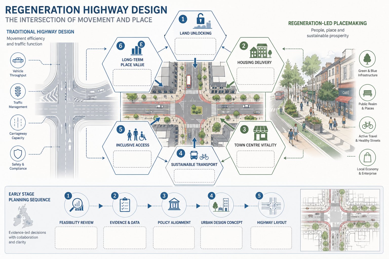
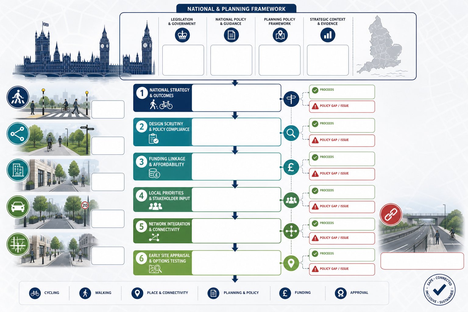
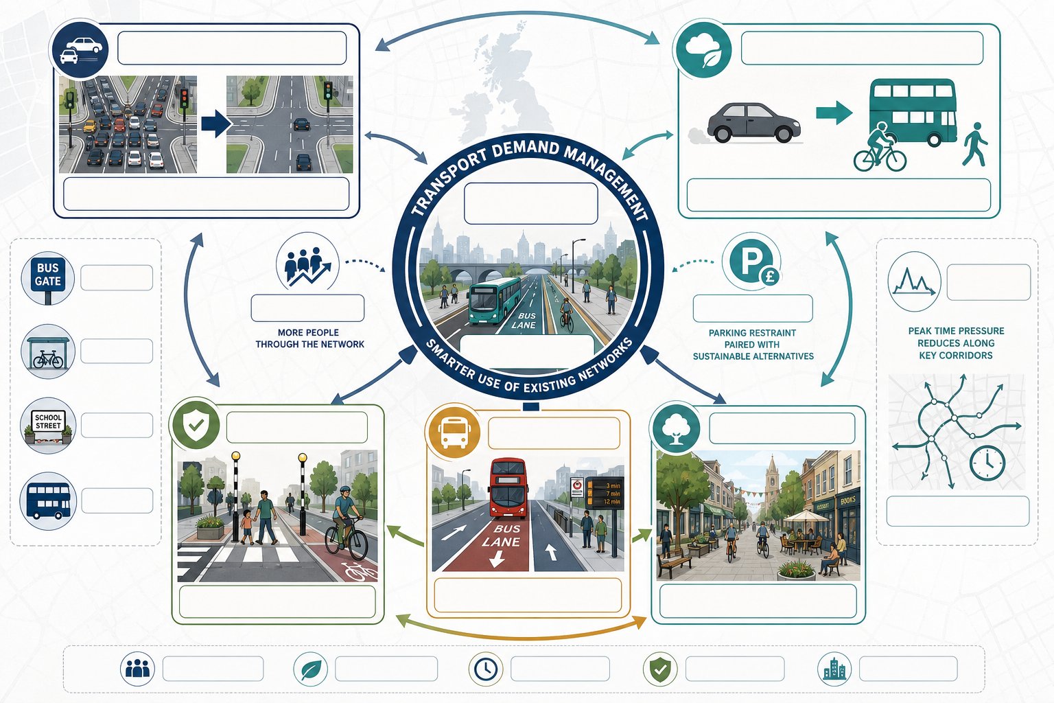
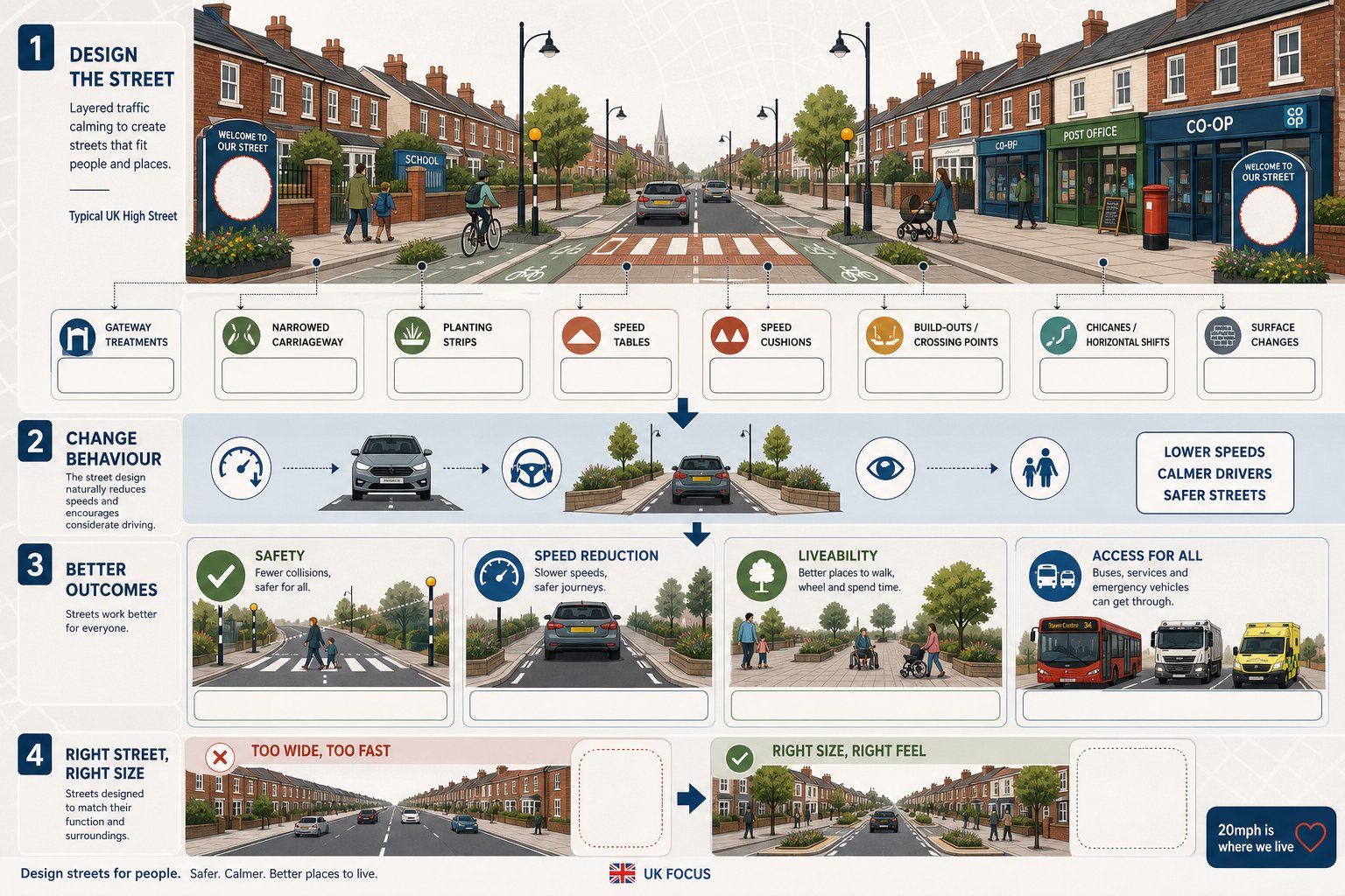
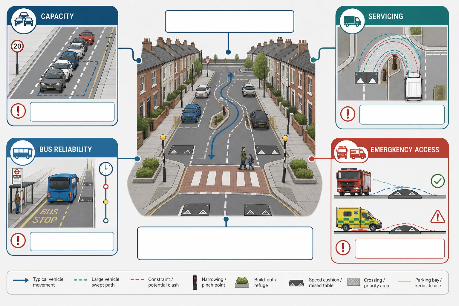
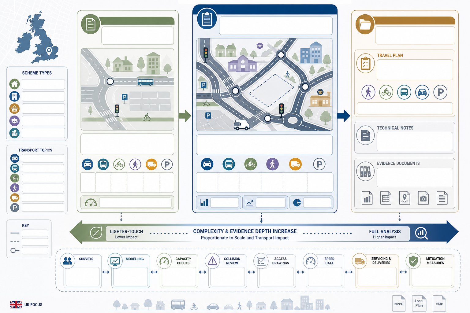
    infographic of highway design balancing traffic movement, place, and regeneration goals in the UK

    Regeneration highway design is the planning and design of streets, junctions and access arrangements so they actively support renewal, not merely traffic flow. In other words, the highway becomes part of the development strategy. It helps unlock land, improve movement, support economic activity and create a better urban environment.

    That distinction matters in planning. Traditional highway thinking often focused heavily on vehicle capacity and standards compliance. Regeneration schemes still need safe and efficient operation, of course, but they are usually judged against a wider set of objectives: housing delivery, town centre vitality, public realm quality, sustainable transport, inclusive access and long-term place value.

    So when we talk about regeneration highway design, we’re usually talking about a context-sensitive approach. The right answer in a constrained town centre will not look the same as the right answer on an edge-of-settlement allocation. Highway geometry, crossing points, servicing strategy, parking layout and frontage treatment all need to respond to the physical, economic and social setting.

    This is also why early technical input matters. A highway proposal that is technically compliant but tone-deaf to the place often struggles in planning. A better route is to align transport strategy with urban design from the outset, using evidence and policy to show how movement and place can work together. On complex schemes, that often starts with a robust feasibility study highway review before fixed layouts harden into assumptions.

    How Highway Design Supports Regeneration Objectives
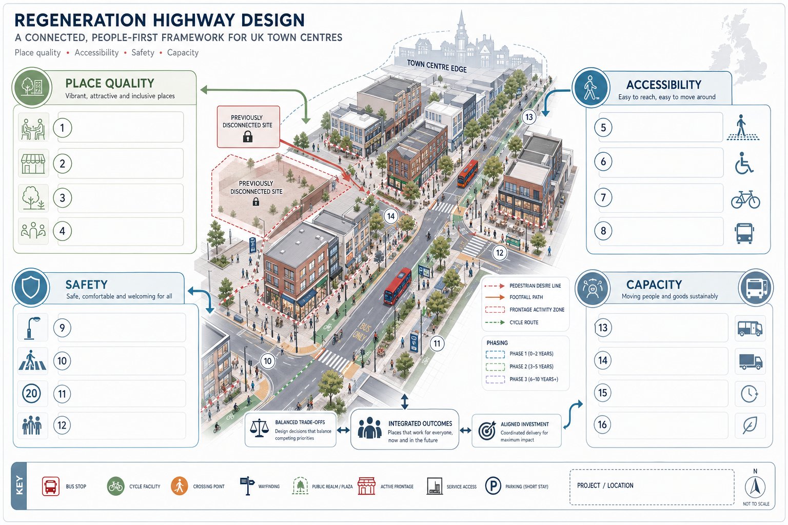
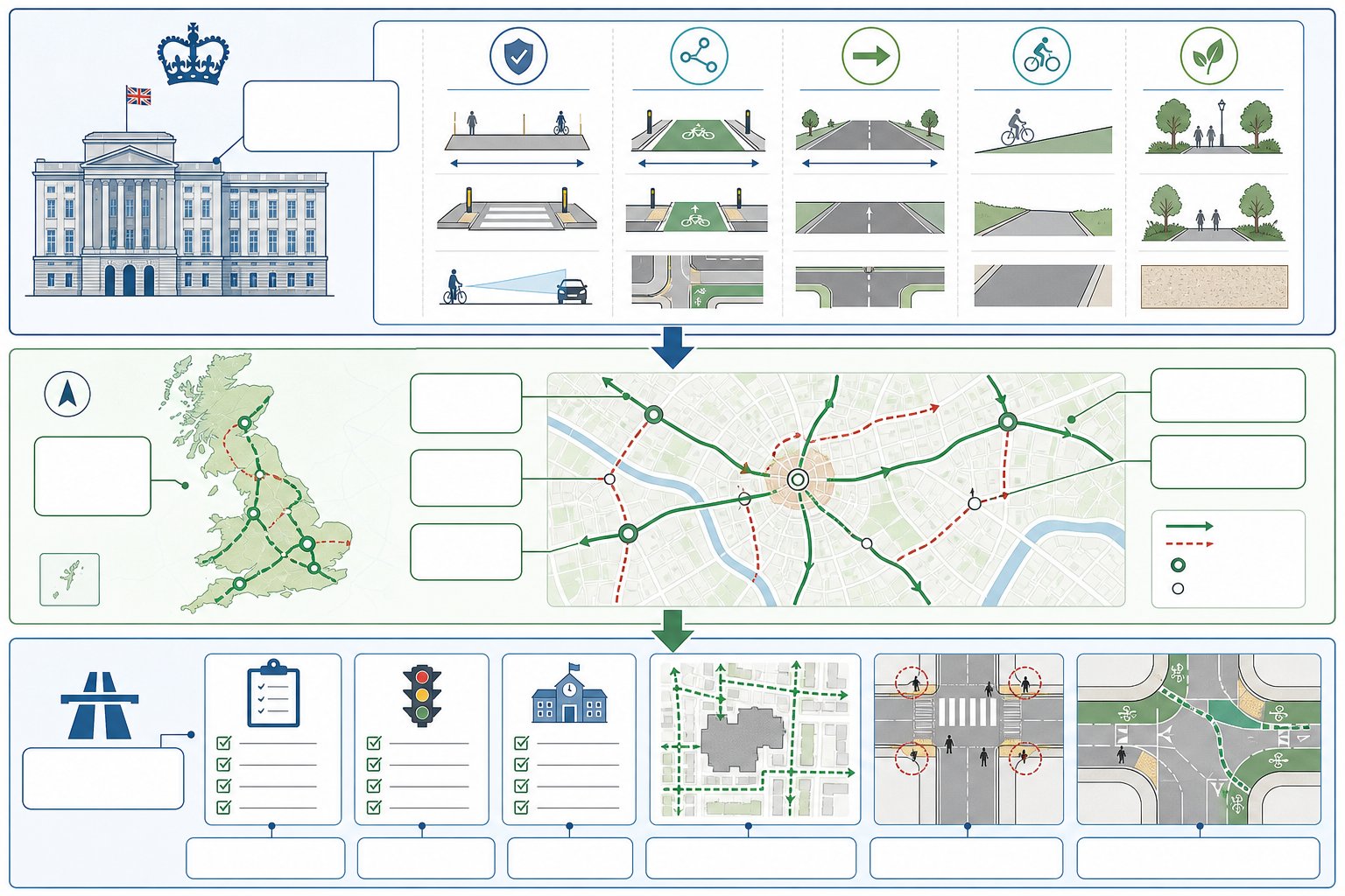
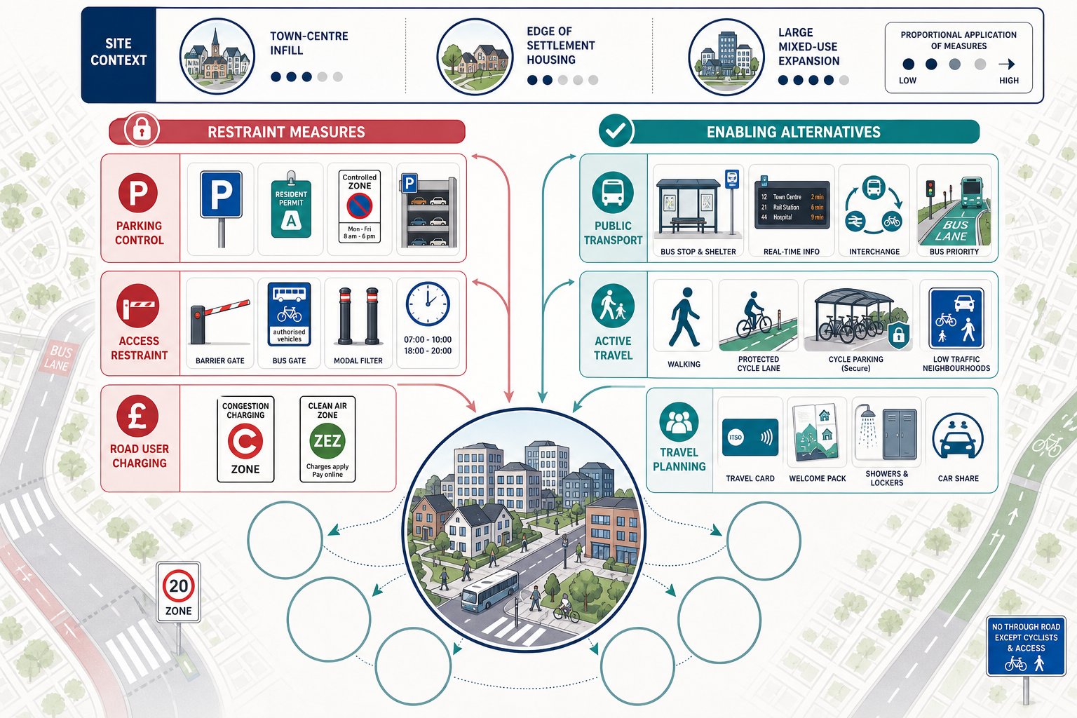
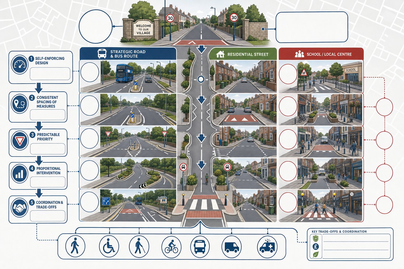
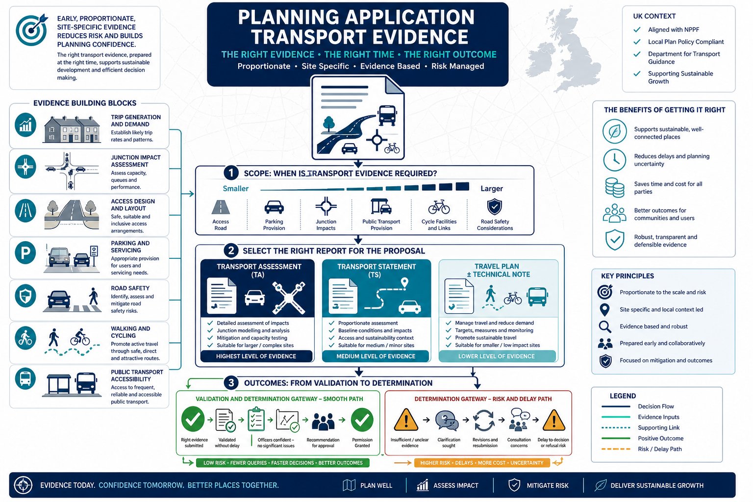
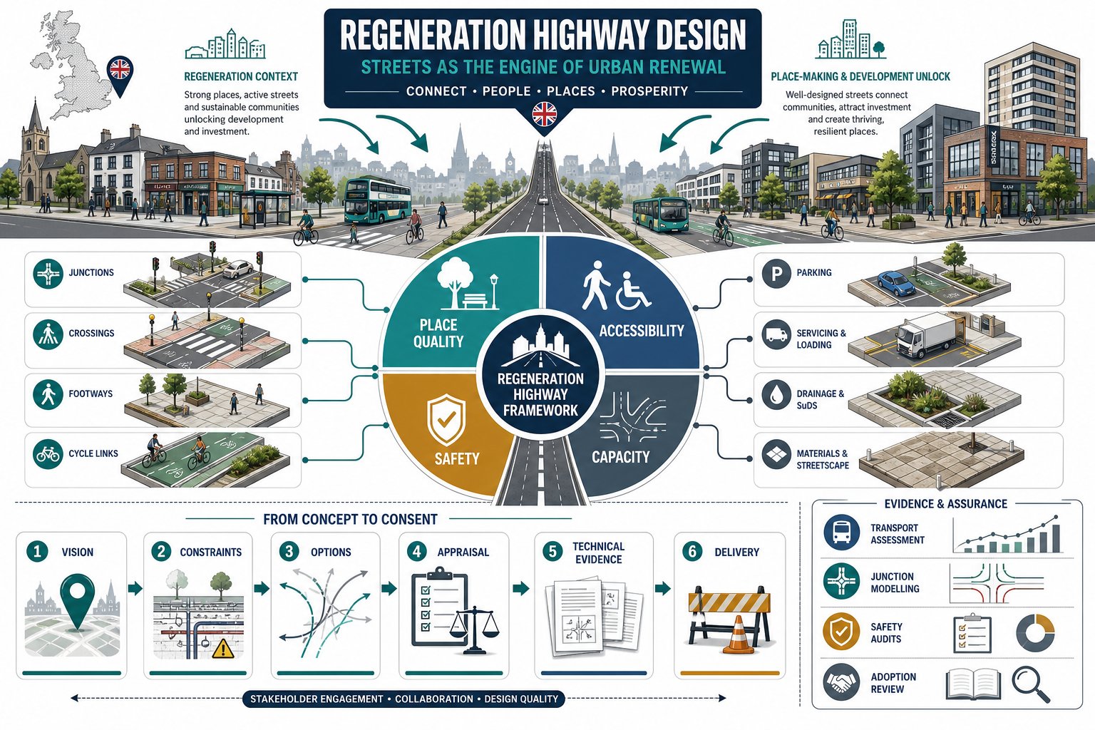
    Infographic of a redesigned UK street balancing access, safety, place and capacity.

    Good highway design can make the difference between a scheme that technically functions and one that genuinely changes an area for the better. In regeneration projects, streets are often the framework that ties land uses together. They influence development value, occupier confidence, pedestrian activity and the quality of everyday experience.

    At a practical level, highway design supports regeneration by improving connectivity to and through a site. That might mean opening up a previously isolated parcel, reducing severance around a town centre edge, rationalising awkward servicing movements, or making public transport access more attractive. In many cases, it also means rebalancing road space so walking and cycling are realistic, not token gestures.

    Highway interventions can also support viability. Better access can increase developable area, improve frontage quality, and make phased delivery easier. Where schemes include retail, leisure or mixed-use components, the design of the street often affects dwell time, visibility and footfall just as much as the building layout does.

    For planning purposes, the strongest regeneration highway design schemes are the ones that clearly link technical decisions to policy outcomes. If a crossing is moved, there should be a reason tied to desire lines and inclusivity. If carriageway space is reallocated, there should be a reason tied to place quality, safety or modal shift. That clear chain of logic is what helps authorities, design teams and stakeholders stay aligned.

    Place Quality, Accessibility, Safety, And Capacity

    These four themes sit at the centre of almost every regeneration highway discussion, and they need balancing rather than treating in isolation.

    Place quality is about more than appearance. It includes frontage activity, comfort, enclosure, tree planting, materials, crossing simplicity and whether the street feels like part of the neighbourhood rather than a transport corridor cutting through it.

    Accessibility means access for everyone: pedestrians, wheelchair users, cyclists, bus passengers, delivery vehicles and drivers. Inclusive design is not optional. Crossing gradients, tactile paving, footway widths, turning requirements and dropped kerbs all matter, especially in older urban areas where existing conditions are awkward.

    Safety remains fundamental. That includes collision risk, visibility, speed environment, pedestrian conflict points, cycle safety and the legibility of layouts. Regeneration sites often attract more varied users than conventional highway schemes, so the design must be forgiving and intuitive.

    Capacity still matters, but it should be considered in context. The objective is rarely maximum vehicle throughput at any cost. More often, we need an acceptable level of network performance that does not undermine the place-making aims of the development. That is why our highway infrastructure design approach on urban schemes tends to test movement and placemaking together rather than as separate workstreams.

    When A Regeneration Scheme Triggers Highway Design Requirements
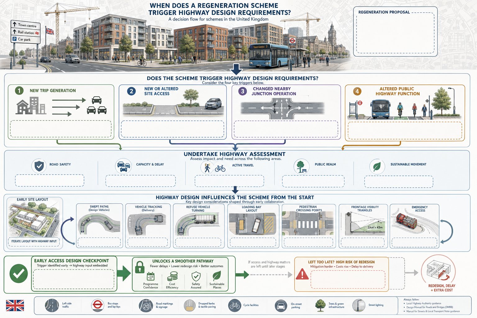
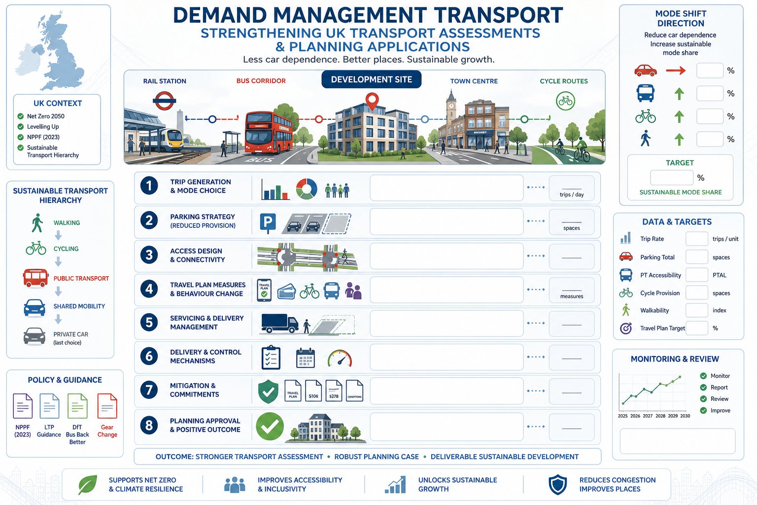
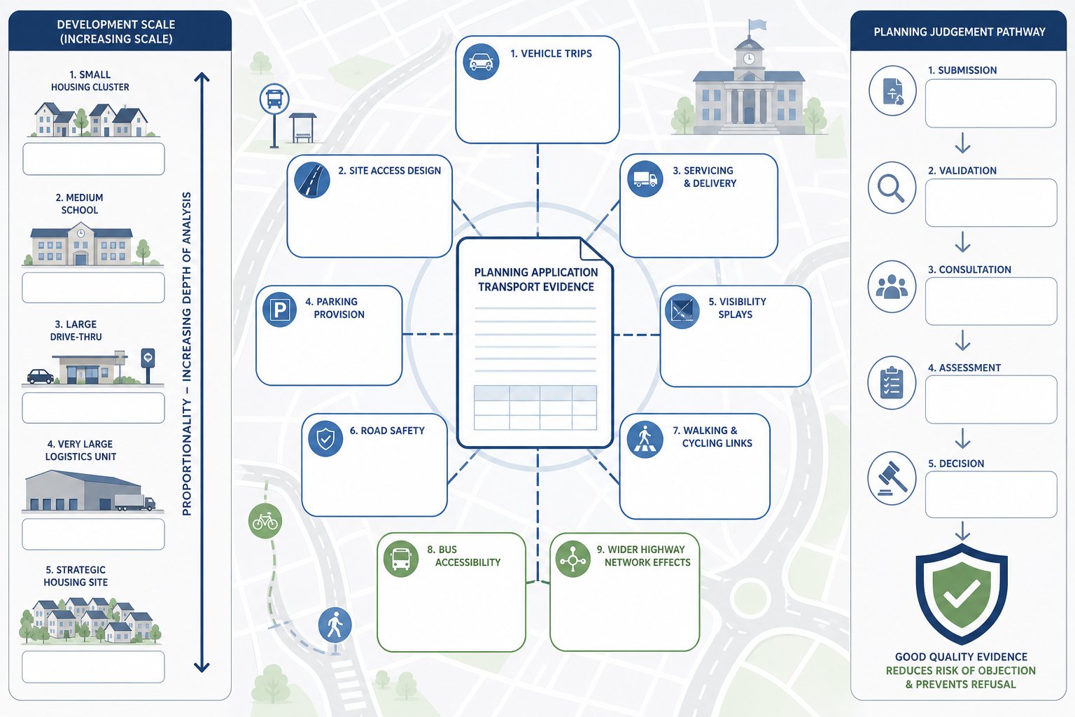
    Flowchart of regeneration schemes triggering highway design checks in the UK.

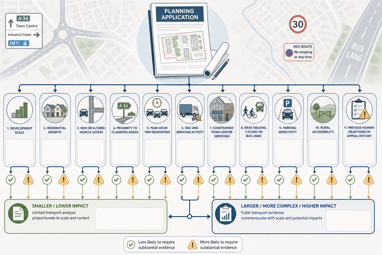
    Not every regeneration proposal requires major off-site works, but many do trigger formal highway design requirements. The trigger is usually one of four things: the scheme generates material new trips, requires a new or altered access, changes the operation of nearby junctions, or affects the way public highway space functions.

    In planning terms, that can arise on relatively modest schemes as well as large masterplans. A town-centre conversion may trigger servicing, parking and pedestrian access issues. A mixed-use redevelopment may require junction upgrades, bus stop changes and cycle connections. Estate renewal can involve reconfigured streets, stopping-up, emergency access checks and changes to adoption responsibilities.

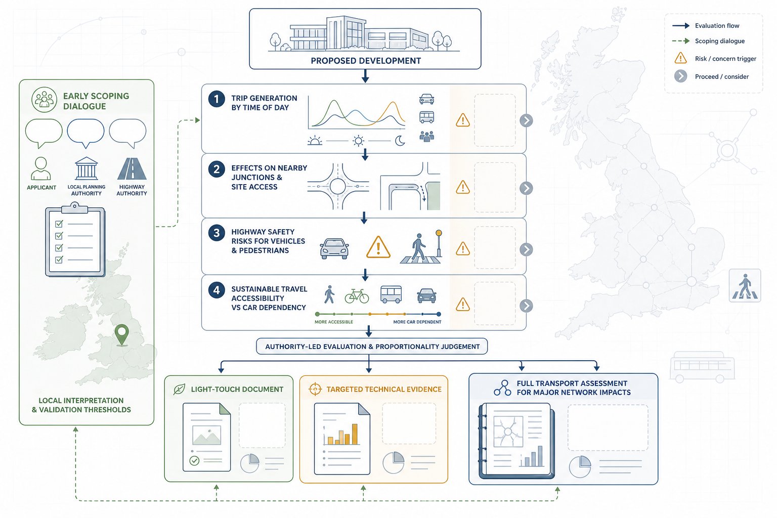
    The highway authority will typically want to know whether the development can be accessed safely, whether surrounding roads can accommodate additional demand, and whether the scheme aligns with local policy on active travel, public realm and sustainable movement. If the answer is uncertain, further design and technical evidence quickly become necessary.

    A common mistake is assuming highway work begins only once the architectural layout is settled. In reality, access, swept paths, vehicle tracking, refuse strategy, loading arrangements and crossing locations often influence the layout from day one. That is especially true where constrained frontages, visibility limitations or competing land uses are in play.

    Where development depends on a new or amended access arrangement, early access design highway input can save a lot of redesign later. It helps establish whether the principle is workable before the scheme becomes politically or financially committed to a layout that the authority may not support.

    Key Planning, Design, And Adoption Standards To Consider
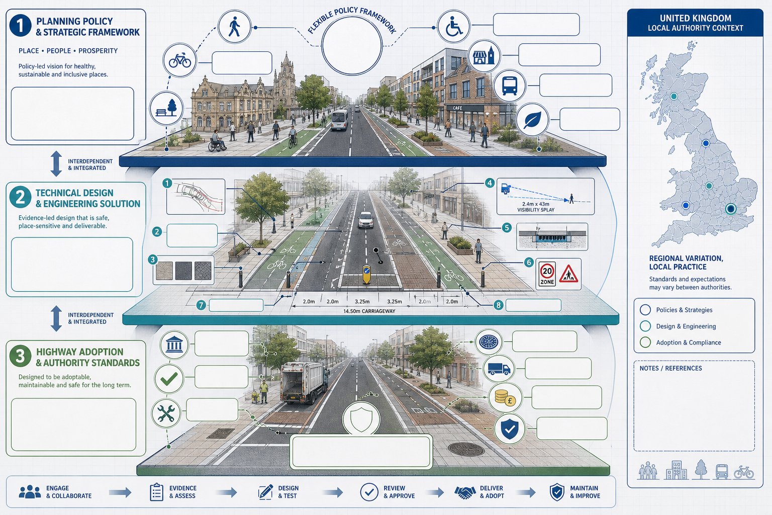
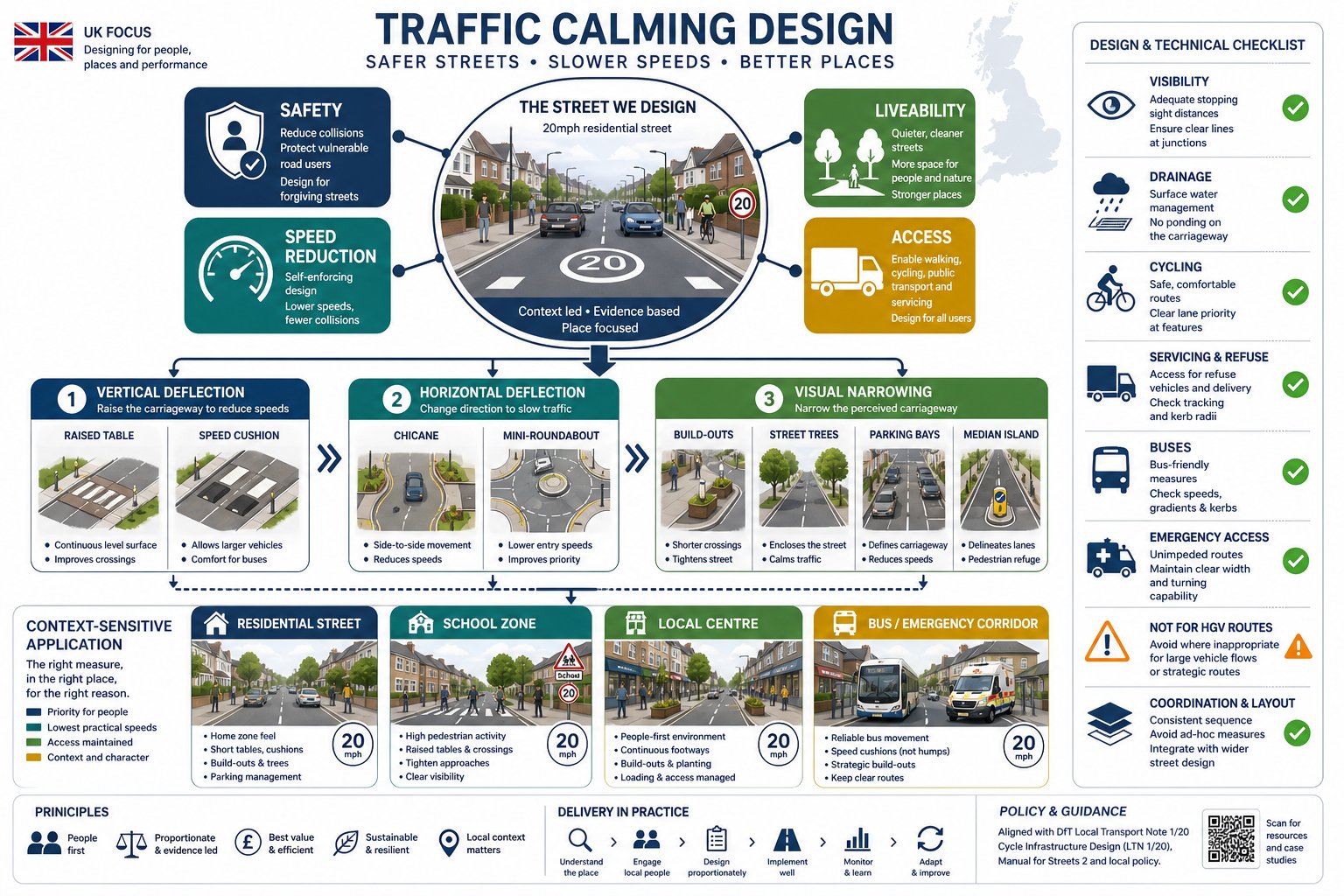
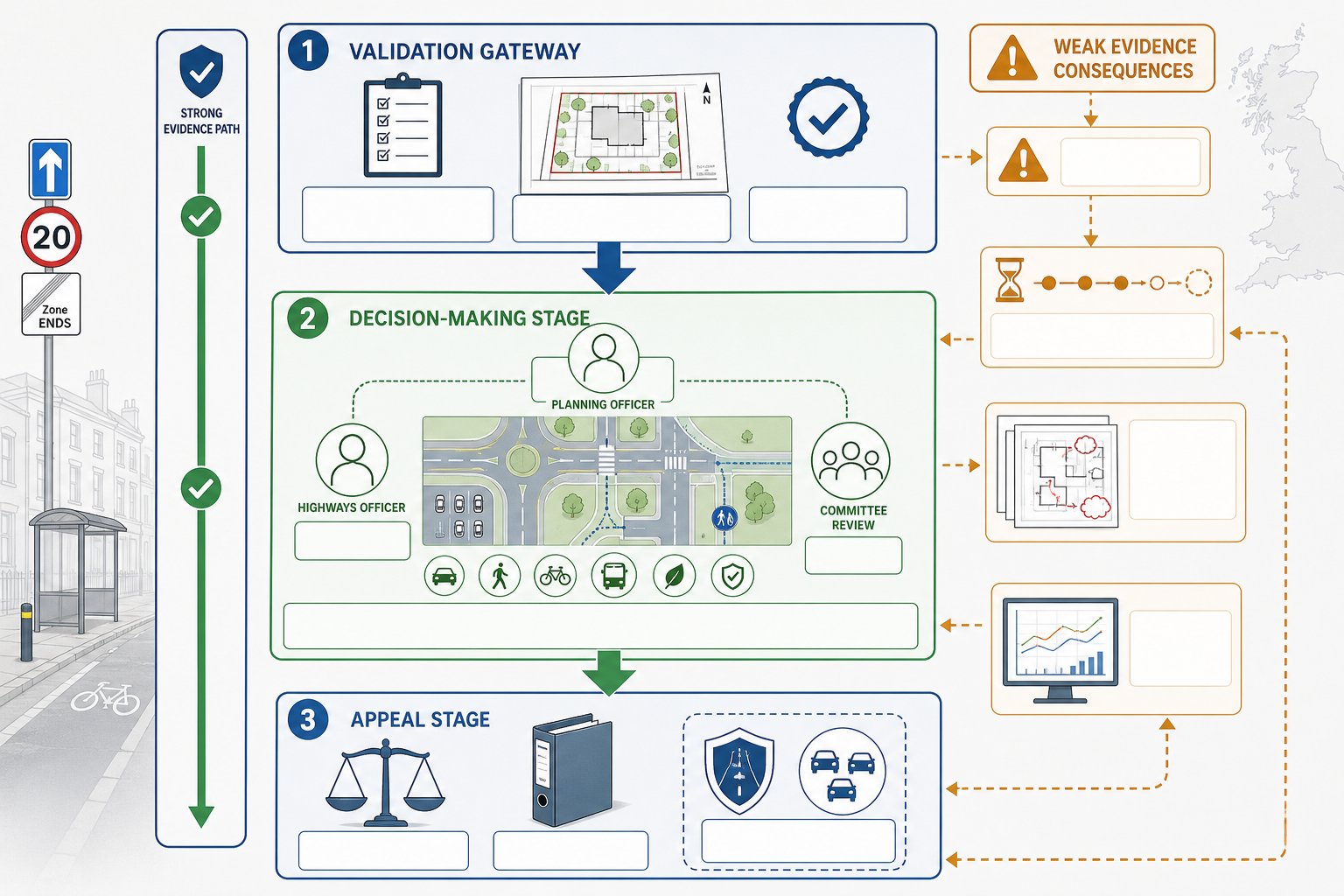
    UK infographic showing planning, design, and highway adoption layers for regeneration schemes.

    Regeneration highway schemes sit at the junction of planning policy, technical design guidance and highway authority practice. That sounds obvious, but many delays happen because teams focus on only one of those layers.

    The planning layer asks whether the proposal supports policy objectives: sustainable transport, good design, healthy streets, town centre renewal, accessibility and deliverability. The technical layer deals with geometry, visibility, tracking, drainage, structures, signs, materials, road safety and operational performance. The adoption layer asks a different question again: if works are to become maintainable public highway, are the authority’s standards and processes actually being met?

    On urban regeneration projects, flexibility is often available, but it has to be justified. Authorities may accept departures from standard dimensions or layouts where context demands it, particularly in historic or constrained areas. But they will still expect a defensible rationale, evidence that risks are understood, and confidence that maintenance and safety issues are addressed.

    This is where project teams benefit from bringing planning and technical reporting together rather than treating them as separate silos. We’ve found that concise, authority-aware reporting tends to work best, especially where local thresholds, committee sensitivities and adoption concerns differ from one borough or county to another.

    National Policy, Local Standards, And Highway Authority Expectations

    National policy increasingly encourages transport design that supports sustainable development and responds to local character rather than imposing a one-size-fits-all highway template. That gives room for intelligent design, but not for vague design.

    Local plans, area action plans and supplementary guidance often add another layer, setting expectations around street hierarchy, public realm, parking restraint, servicing hours, cycle provision and town centre movement priorities. In regeneration areas, these local documents can be more influential than generic standards because they reflect the political and spatial priorities of the place.

    Then there is the highway authority itself. Its development management, adoption and technical approval teams will usually have specific expectations on swept paths, refuse access, tracking, construction details, drainage strategy, visibility, commuted sums and future maintenance liability. If a scheme ignores those expectations until late in the process, approval can drift.

    On larger or more commercially sensitive sites, specialist input from Highway Design Consultants: helps bridge those layers. And where proposals hinge on node performance or signal changes, engaging Junction Design Consultants: early can make the difference between a concept that looks plausible and one that stands up under review.

    Core Design Elements In Regeneration Highway Schemes
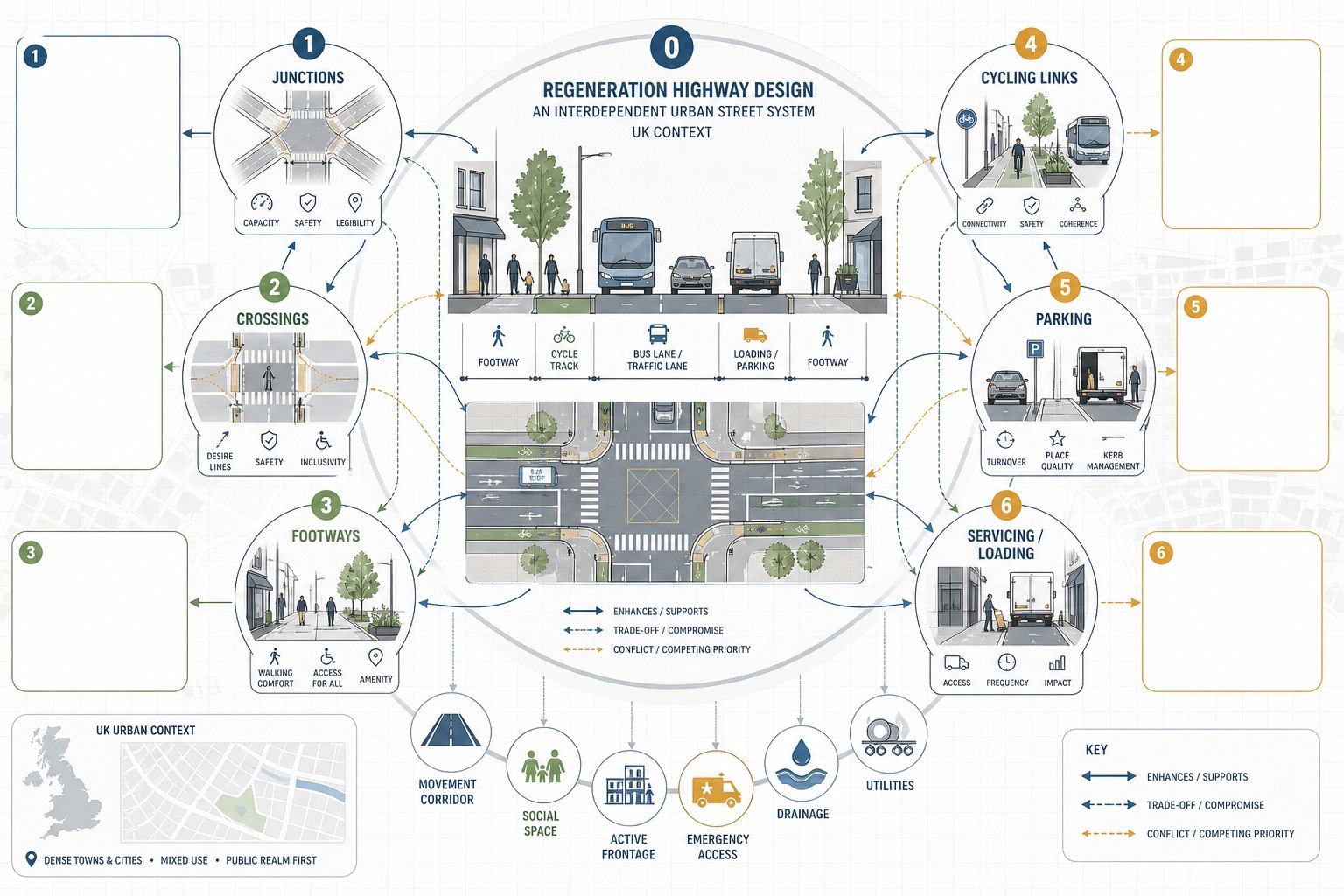
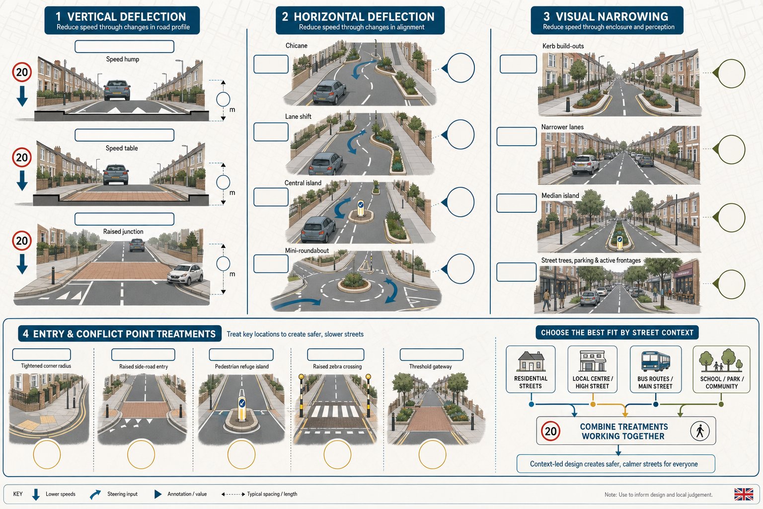
    Infographic of interconnected street design elements in a UK regeneration scheme.

    The physical components of regeneration highway design are familiar enough: junctions, crossings, footways, cycle facilities, parking, loading, servicing, drainage and street materials. What changes on regeneration projects is the level of interdependence between them.

    A widened footway may reduce loading space. A new tree line may affect visibility or utility corridors. A relocated bus stop may alter crossing desire lines. A compact junction might improve urban character but introduce tracking constraints for servicing vehicles. Good design works through these interactions rather than treating each item as a separate drawing package.

    In most regeneration schemes, the street also has to perform several roles at once. It may be a movement corridor, a social space, a frontage for active ground-floor uses, an emergency route, a servicing zone and a route for drainage and utilities. That complexity is exactly why early option testing matters.

    There is rarely a single textbook solution. The right arrangement depends on land use intensity, frontage activity, traffic composition, local policy, adoption intentions and the existing urban grain. On employment-led projects, Commercial Development Highway issues often dominate, while residential-led schemes may focus more heavily on frontage, crossings and liveability.

    Junctions, Crossings, Footways, Cycling Links, Parking, And Servicing

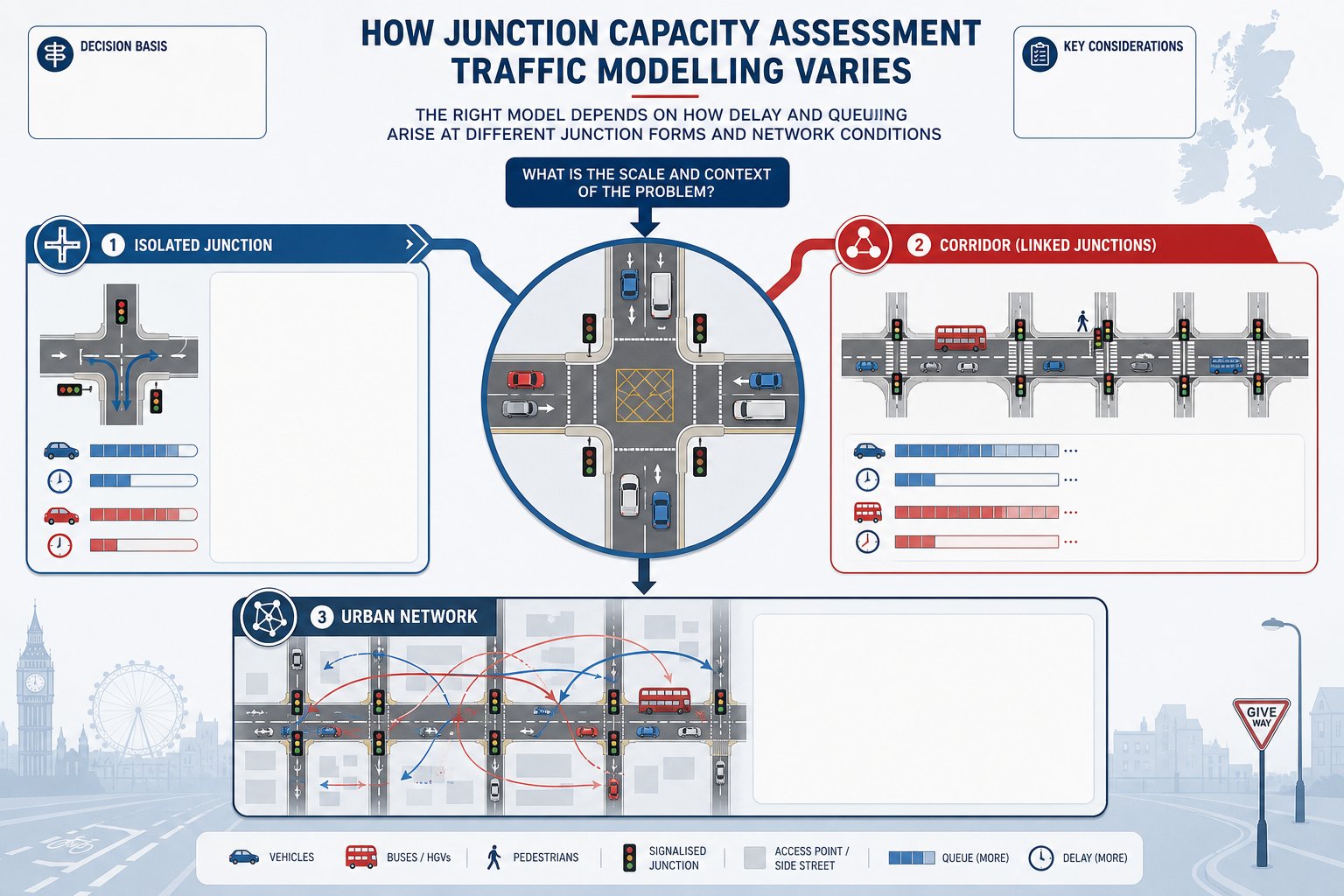
    Junctions are often the most scrutinised feature because they affect capacity, safety and first impressions of the scheme. In regeneration areas, compact forms, signal optimisation or revised priorities can be preferable to highway-heavy layouts that consume valuable frontage.

    Crossings should follow desire lines, not just leftover space. Signal-controlled crossings, zebras and side-road entry treatments all have a role, but the best option depends on speeds, flows, user profiles and surrounding land uses.

    Footways need continuity, comfort and width. In practice, that means dealing carefully with dropped crossings, private accesses, street furniture and loading pinch points.

    Cycling links should be coherent and direct. A short painted fragment that disappears at the difficult bit is not a regeneration strategy. Authorities increasingly expect legible, safe connections to surrounding routes.

    Parking should support the land use without overwhelming the public realm. That includes disabled provision, short-stay demand, cycle parking and the management of kerbside space.

    Servicing can make or break urban schemes. If loading happens in the wrong place or at the wrong time, pedestrian comfort and cycle safety quickly suffer. These details often look minor in planning packs but they are exactly the details officers and authorities probe.

    The Role Of Transport Assessments And Supporting Technical Evidence

    A well-designed street concept is not enough on its own. Planning decisions on regeneration projects usually depend on the supporting evidence that explains what the scheme will do to the network, how people will travel, and what mitigation is needed.

    For larger schemes, that normally means a Transport Assessment, often accompanied by a Travel Plan. The TA should quantify trip generation, mode split assumptions, distribution and assignment, junction effects, parking demand and mitigation. But on regeneration sites, the better TAs do something more useful than that: they explain how transport impacts and place outcomes have been weighed together.

    Supporting evidence may include junction modelling, road safety audits, walking and cycling audits, delivery and servicing plans, construction logistics information, parking surveys and tracking analysis. The exact package depends on scale and local thresholds, but the principle is consistent: the authority needs confidence that the proposal is evidence-led rather than aspirational.

    This is where speed and accuracy matter. Authorities can usually spot generic reporting very quickly. They respond better to concise technical work that reflects their local policy framework, network sensitivities and validation expectations. That is one reason firms with long experience in authority-specific planning submissions, including teams like ours at ML Traffic, tend to focus on proportionate evidence rather than inflated reporting.

    Where the highway strategy is still evolving, a staged approach can work well: initial scoping, concept testing, then fuller assessment once the preferred scheme has matured. That avoids overcommitting to assumptions too early while still giving planners and designers a solid technical base.

    Designing For Existing Constraints In Urban Regeneration Areas

    Urban regeneration rarely starts on a clean slate. More often, we inherit narrow corridors, irregular plots, legacy accesses, buried services, retaining structures, level differences, listed frontages, awkward bus movements and local political sensitivities. The challenge is not removing all constraints. It is designing intelligently through them.

    In these settings, the temptation is to force a standard layout into a non-standard context. That usually produces strained geometry, poor public realm and difficult conversations with the authority. A better approach is to understand which standards are essential, which are flexible, and where the real operational risks sit.

    Existing constraints also affect deliverability. A layout that looks neat in plan may fail once utility diversion costs, access rights, retaining requirements or frontage servicing realities are properly understood. So the design process needs to test buildability as well as planning acceptability.

    This is especially important in dense urban centres, where one small geometric change can affect basement access, disabled parking, refuse collection, café spill-out space and drainage strategy all at once. Teams that treat highway design as part of the wider regeneration system tend to handle these trade-offs better than teams working in sequence.

    Utilities, Frontage Access, Public Realm, Levels, And Construction Phasing

    Utilities are a classic programme risk. Existing apparatus can limit tree pits, signal equipment, drainage runs, kerb lines and crossing foundations. Early C2 enquiries help, but real coordination often needs deeper investigation.

    Frontage access has to work for occupiers and residents, not just on a tracking drawing. Short-stay drop-off, servicing windows, emergency access and threshold protection all matter in lived operation.

    Public realm should not be the leftover strip after vehicle design is done. Materials, clutter reduction, seating, planting and lighting all influence whether regeneration feels genuine or cosmetic.

    Levels can be surprisingly tricky. Thresholds to existing buildings, basement ramps, drainage falls and accessible gradients often compete. In retrofit streets, they need very careful resolution.

    Construction phasing is the final test of realism. If the scheme cannot maintain safe access, servicing and reasonable network function during works, delay is almost built in. On complex sites, input from highway design consultants Birmingham: or similarly local teams can be particularly valuable where authority practice and town-centre conditions are very place-specific.

    Common Risks That Delay Approval Or Delivery

    Most delayed regeneration schemes are not undone by one dramatic flaw. They drift because several smaller issues were left unresolved until they became planning objections, technical queries or procurement problems.

    One common risk is over-prioritising vehicle capacity at the expense of place quality and active travel. A layout may model adequately and still face resistance because it undermines the wider regeneration case. Another is the reverse: a very attractive concept with weak evidence on operation, servicing or safety.

    Late engagement with the highway authority is another regular problem. If adoption, visibility, junction form, drainage or commuted sums are only discussed once the application is ready to submit, programme pressure rises immediately. The same applies where local design guidance has been skimmed rather than properly absorbed.

    Technical evidence can also cause delay when it is incomplete, generic or inconsistent across documents. We often see planning statements, transport assessments, delivery plans and engineering drawings describing slightly different schemes. Authorities notice that.

    Then there are physical constraints: utility diversions that are more extensive than expected, third-party land needs, visibility splays crossing land outside control, and maintenance burdens that no authority wants to inherit.

    The practical answer is not endless reporting. It is disciplined coordination: one coherent highway strategy, tested early, explained clearly and updated consistently as the scheme evolves. That usually saves far more time than trying to repair contradictions after submission.

    A Practical Process For Taking A Scheme From Concept To Consent

    The cleanest way to approach regeneration highway design is through a staged process that reflects both planning risk and engineering reality.

    First, define the problem and the vision. We need to be clear what the scheme is trying to achieve: unlock housing, improve a town centre edge, support employment floorspace, remove severance, upgrade public realm, or all of the above. That vision should be tied to local policy from the start.

    Second, establish the baseline and constraints. This means traffic conditions, user movements, collision history, nearby developments, utilities, levels, frontage activity, servicing patterns, land ownership and heritage or townscape sensitivities. If this step is rushed, later design choices become guesswork.

    Third, develop options. Different street typologies, access points, junction forms, crossing arrangements and parking strategies should be explored before the team settles on a preferred layout. Optioneering is where context-sensitive flexibility earns its keep.

    Fourth, appraise and select. The chosen option should be defensible against movement, place, safety, environmental and viability criteria. Not perfect in every respect, but clearly the best-balanced solution.

    Fifth, prepare detailed technical material. That may include a TA, Travel Plan, modelling, tracking, road safety audit input, drainage coordination and adoption discussions. This is where regeneration highway design moves from concept language to consent-ready evidence.

    Sixth, agree the route to delivery. Conditions, Section 278 or 38 mechanisms, commuted sums, phasing, temporary traffic management and construction logistics all need clarity before consent turns into implementation.

    Get that sequence right and approval becomes far more predictable. Not effortless, never that, but grounded in a scheme that makes sense on paper and on site.

    The strongest regeneration projects are the ones where highways are treated neither as an afterthought nor as a purely technical hurdle. They are designed as part of the place itself. When we do that well, streets stop being the thing that delays regeneration and start becoming one of the main reasons it succeeds.

    Frequently Asked Questions about Regeneration Highway Design

    What is regeneration highway design in a planning context?

    Regeneration highway design involves planning streets and highways to actively support urban renewal by enhancing place quality, accessibility, safety, and economic vitality, rather than solely focusing on vehicle movement.

    How does regeneration highway design support urban regeneration objectives?

    It improves connectivity and access for all transport modes, balances road capacity with liveability and safety, enhances streetscapes and public realm, and facilitates development viability and economic activity.

    When does a regeneration scheme require formal highway design input?

    Formal highway design is needed when a scheme generates new trips, alters access points, affects junction operations, or changes public highway functions such as parking or servicing arrangements.

    Which core elements are involved in regeneration highway schemes?

    Key elements include junctions designed for safety and capacity, pedestrian crossings aligned with desire lines, continuous footways, coherent cycling links, managed parking, and integrated servicing to support mixed-use activity.

    Why is early engagement with highway authorities important in regeneration highway design?

    Early engagement helps align designs with local policies and technical standards, identifies constraints, reduces redesign risks, and ensures deliverability and approval for planning consent.

    What common challenges can delay regeneration highway design approval?

    Delays often stem from ignoring local place-making policies, overemphasising vehicle capacity, incomplete or inconsistent technical evidence, late authority engagement, unresolved utilities, or maintenance liabilities.
  • Cycling And Walking Infrastructure In 2026: What Good Design Looks Like For Planning And Development

    Cycling And Walking Infrastructure In 2026: What Good Design Looks Like For Planning And Development

    Planning applications in 2026 are being judged far more closely on how people will walk and cycle to, from and through a site. That shift isn’t cosmetic. Cycling and walking infrastructure now sits at the centre of transport strategy, placemaking, public health and carbon reduction across the UK. For architects, planners, developers and local authorities, it can influence everything from trip generation assumptions to scheme viability, committee risk and planning conditions.

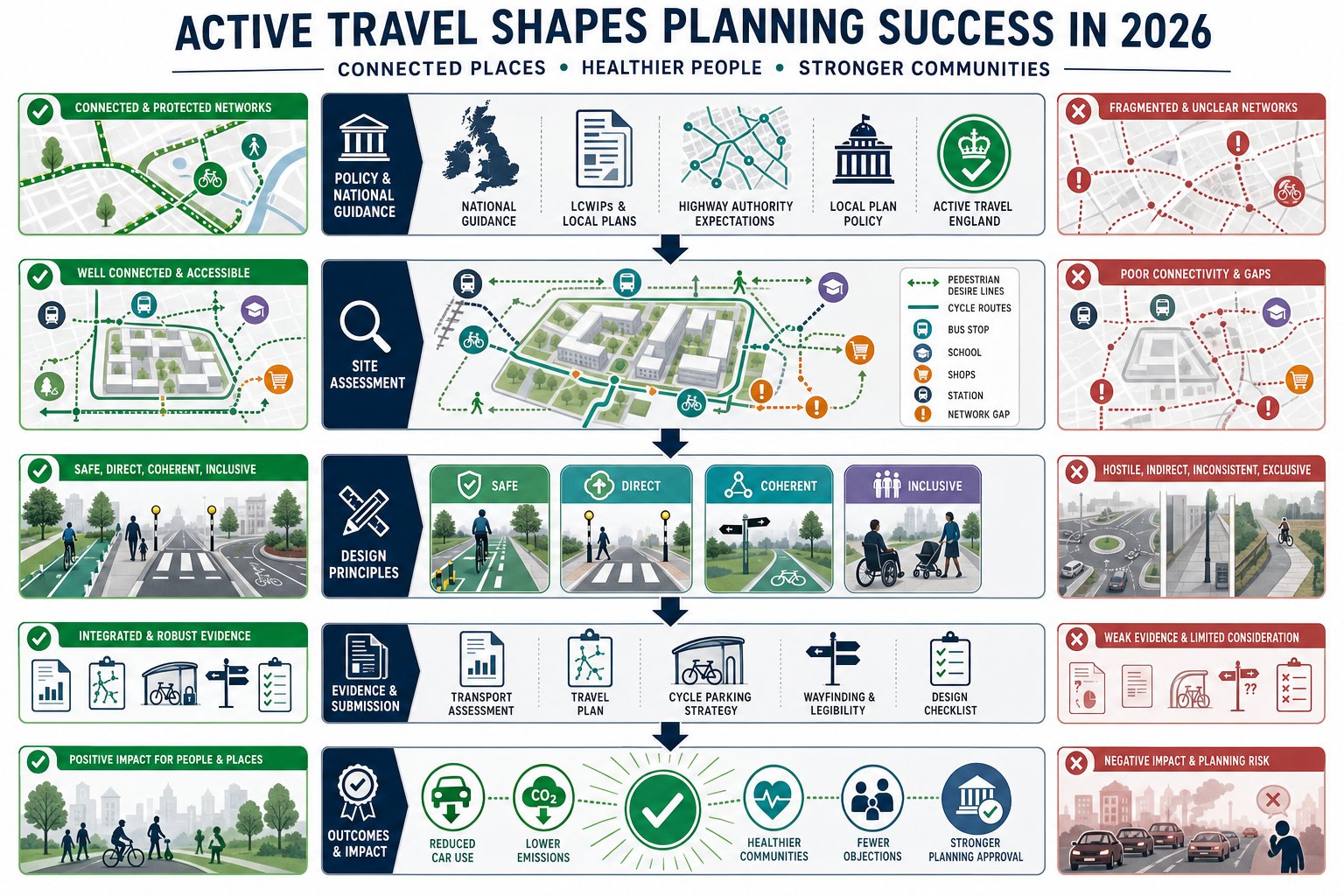
    We’re seeing the same pattern across applications of very different sizes: proposals that treat active travel as a bolt-on tend to run into trouble, while schemes that design it in from the start are easier to justify and often easier to move through the planning process. National policy wants walking and cycling to become the natural choice for shorter journeys. Local plans, LCWIPs, highway authority expectations and Active Travel England’s growing influence are all pushing in the same direction.

    That means the old approach, a narrow footway here, a shared path there, maybe a token cycle store in the corner, usually isn’t enough. Decision-makers increasingly want evidence that routes are safe, direct, coherent and inclusive, and that they actually connect to where people need to go.

    In this guide, we’ll look at what good cycling and walking infrastructure really means in planning and development terms, how to assess a site properly, and where applications most often go wrong.

    Why Cycling And Walking Infrastructure Matters In Planning Applications

    Infographic showing how walking and cycling links improve planning and access.

    In planning terms, active travel is no longer a nice extra. It is a core test of whether a development is accessible, sustainable and aligned with policy. If a site can only work comfortably by car, that weakness tends to surface quickly in transport reviews, consultee responses and committee discussions.

    Good cycling and walking infrastructure matters because it helps reduce car dependency from day one. That has a knock-on effect on congestion, emissions, parking pressure and even the scale of highway mitigation a scheme may need. It also affects how trip generation is understood. Where a development has safe, legible and attractive walking and cycling connections to schools, shops, bus stops, employment areas and local centres, a stronger case can usually be made for lower car mode share.

    There is also a social and economic dimension. Safe active travel routes improve access for people who do not drive, cannot drive, or simply do not want to drive for every short trip. That includes children, older people, disabled people, lower-income households and commuters making linked journeys by foot, cycle and public transport. In other words, the quality of access is often a question of inclusion, not just transport.

    From a planning application perspective, this all translates into risk. Weak proposals attract objections because they can appear contrary to national guidance, local policy and adopted network strategies. Strong proposals, by contrast, show that the site has been planned around realistic movement patterns. That is exactly the sort of evidence we aim to set out in concise transport reports at ML Traffic, especially where local authority thresholds and expectations need careful handling.

    The Policy And Regulatory Context Shaping Active Travel Schemes

    Infographic showing UK active travel policy shaping connected walking and cycling schemes.

    The policy backdrop has become much more demanding and much clearer. Across England, transport and planning policy increasingly expects walking and cycling to be integral to scheme design rather than treated as residual uses of leftover highway space.

    At national level, the direction of travel is straightforward: make walking and cycling the natural choice for short journeys, support healthier communities, and reduce the environmental impact of transport. The Cycling and Walking Investment Strategy continues to shape funding priorities and local delivery expectations. At the same time, Active Travel England has changed the practical planning landscape by scrutinising certain schemes and linking design quality to both support and funding.

    For applicants, that means the policy case cannot stop at broad statements about sustainability. We need to show how a proposal responds to actual standards, local priorities and likely authority concerns. A development may have excellent internal routes, but if those routes do not tie into the surrounding network or fail to address a known severance issue, officers may still see a policy gap.

    This is why active travel should be tested early, at site appraisal and concept design stage, not patched in later once layouts are fixed. By then, the most important opportunities, direct connections, generous frontages, safer crossings, reduced vehicle dominance at key points, are often harder and more expensive to deliver.

    National Guidance, Local Plan Policies, And Highway Authority Expectations

    Three-layer UK infographic on walking and cycling policy, plans, and authority review.

    National guidance sets the broad design direction, but planning decisions are usually won or lost in the detail of local application. That means we have to read three layers together: national standards and guidance, development plan policy, and the practical expectations of the relevant highway authority.

    Nationally, UK guidance increasingly emphasises routes that are safe, coherent, direct, comfortable and attractive for people of different ages and abilities. In practical terms, that affects width, segregation, crossing design, gradients, visibility, junction geometry and surface quality. It also pushes designers away from poor compromises such as awkward shared use beside fast traffic or indirect crossings that make walking and cycling the slowest option.
    Locally, plans and supplementary guidance often go further. Many authorities now rely on Local Cycling and Walking Infrastructure Plans (LCWIPs) to identify priority corridors, strategic links, town centre improvements and future network gaps. If a site sits close to one of those corridors, the application should respond directly to it. Ignoring an LCWIP can look like ignoring adopted evidence.

    Then there is the highway authority’s own review culture. Some authorities focus heavily on crossing safety, some on permeability through large sites, some on school access, and others on junction performance for cycles. We find that successful applications anticipate those priorities rather than waiting for consultation comments to reveal them.

    What Counts As Effective Cycling And Walking Infrastructure

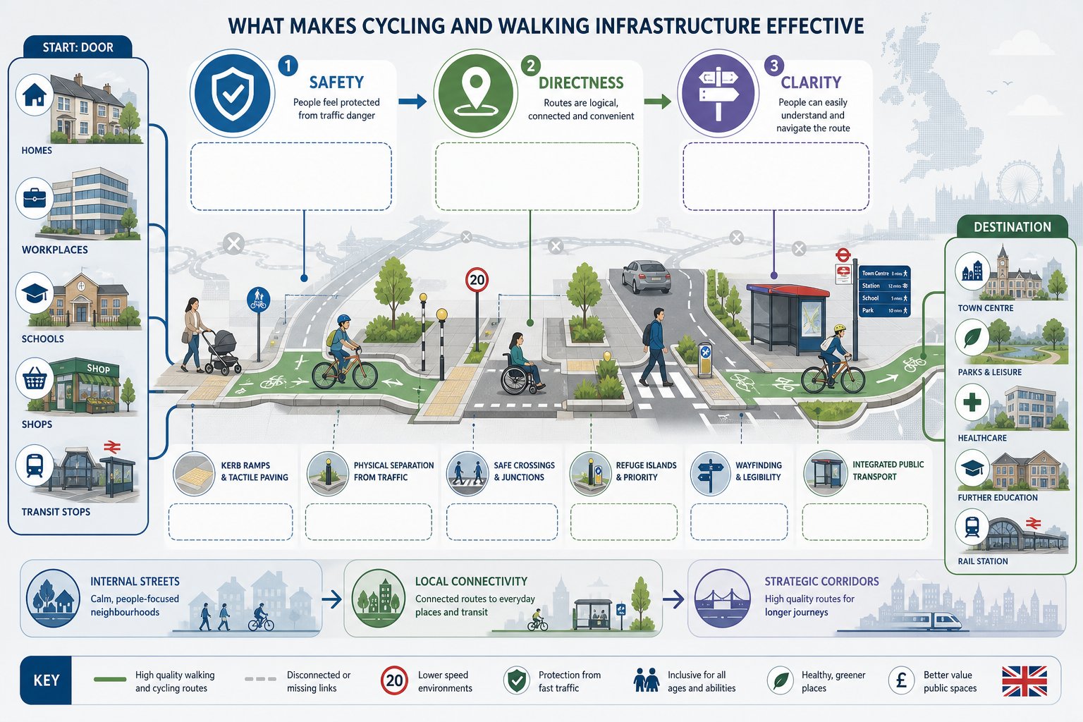
    Infographic of safe, direct, connected cycling and walking routes in the UK.

    Effective cycling and walking infrastructure is not just infrastructure that exists. It is infrastructure that people will actually use because it feels safe, obvious and worthwhile.

    That sounds simple, but poor schemes usually fail on one of those three tests. A route may be technically provided yet feel unsafe because it runs too close to fast traffic. It may be safe enough but so indirect that most people ignore it and walk along carriageways desire-line style. Or it may be direct but confusing, with inconsistent materials, missing signs, ambiguous priority and awkward crossing points.

    In planning and development, effectiveness depends on how the whole journey works. Can someone leave a front door, employment building or retail unit and reach nearby destinations without needless detours? Can a parent walk with a pushchair comfortably? Can an older child cycle to school without mixing with heavy traffic at the worst junction? Can a wheelchair user pass without dropped kerbs that pool water or force repeated level changes? Those are the real-world questions officers, inspectors and consultees increasingly expect us to answer.

    A strong scheme hence connects internal streets and paths to external routes, public transport stops, local facilities and wider strategic networks. It avoids isolated fragments. And it treats walking and cycling as normal everyday modes, not recreational afterthoughts. That distinction matters more than ever.

    Core Design Principles For Safe, Direct, And Inclusive Routes

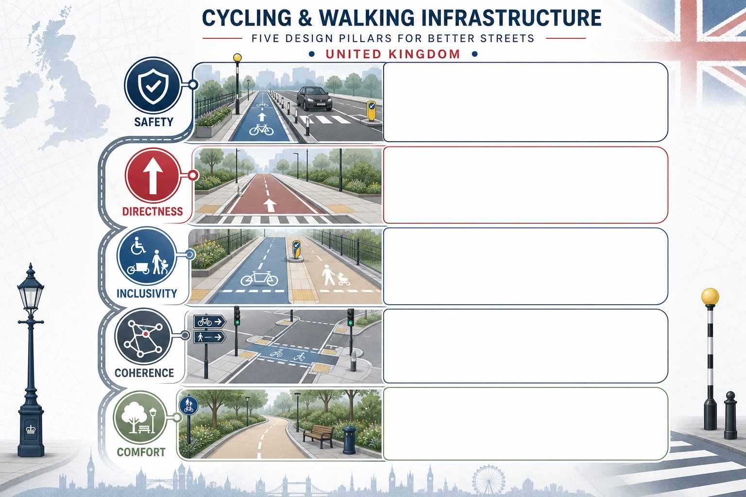
    Infographic showing five principles for safe and inclusive cycling and walking routes.

    Good design principles are well established, but they need disciplined application.

    Safety comes first. Where traffic speeds or volumes are high, separation is often necessary. That may mean protected cycle tracks, better side-road treatments, tighter junction geometry or lower-speed street design. Simply painting a lane beside fast-moving traffic rarely creates a comfortable environment for most users.

    Directness is equally important. People usually choose the route that is quickest and easiest to understand. If cars get a straight line while pedestrians and cyclists are sent through dog-legs, staggered barriers or multi-stage crossings, the design is already telling us whose journey matters. Planning officers notice that.

    Inclusivity means more than meeting a minimum width. Routes should account for mobility aids, non-standard cycles, child trailers, pushchairs, rest points, surfacing quality and manageable gradients. Crossing times and refuge widths matter too. So does lighting where routes are expected to serve regular daily trips.

    Coherence and legibility tie the network together. Users should be able to follow a route naturally, with clear priority and consistent treatment. Sudden disappearances of cycle provision at junctions are a classic weak point.

    And then there’s comfort. Smooth surfaces, reduced conflict, low delay and pleasant surroundings all influence whether active travel feels practical. Infrastructure does not need to be flashy, but it does need to work in ordinary weather, at ordinary times, for ordinary people.

    Key Infrastructure Types Used In New Developments And Street Improvements

    Most schemes use a mix of infrastructure types, and the right combination depends on context rather than fashion. Residential extensions, town centre upgrades, roadside redevelopment and employment sites all have different movement patterns and constraints.

    The central point is that each element should support a complete route. A high-quality cycle track that ends at a hostile roundabout is only half a solution. A new footway that stops at the site boundary without a safe onward crossing leaves a gap exactly where objections tend to land.

    For developments, internal street design is often just as important as off-site works. Low-speed, permeable layouts can enable walking and cycling naturally, reducing the need for more formal segregation in some areas. But on busier frontages and distributor roads, stronger protection and more deliberate crossing design are usually needed.

    Specification also matters. Widths, kerb details, tactile paving, drainage, visibility, signing, turning radii, servicing arrangements and maintenance access can all affect whether infrastructure performs as intended. In our experience, planning submissions are stronger when drawings and transport evidence tell the same story: the proposed infrastructure is not only policy-compliant in principle, but workable in technical detail.

    Footways, Shared Routes, Cycle Tracks, Crossings, And Junction Treatments

    Footways remain fundamental. They should be continuous, appropriately wide, accessible and protected from obstruction. Narrow pavements squeezed beside carriageways or interrupted by excessive vehicle crossovers create exactly the sort of hostile environment that undermines a sustainability narrative.

    Shared routes can work, but only in the right conditions: lower pedestrian and cycle flows, lower conflict potential, good visibility and clear space. They are often overused where separate provision would be better. If a shared path is proposed simply because there is not enough room for proper segregation, that usually deserves closer scrutiny.

    Cycle tracks are increasingly expected on streets with higher traffic volumes or speeds. One-way or two-way arrangements can both be suitable, provided they connect logically and resolve priority clearly at side roads and access points. Kerb protection often improves comfort and uptake.

    Crossings are where many schemes succeed or fail. Zebra, parallel and signal-controlled crossings all have a role, but the choice should follow route function and user need. Side-road entry treatments and continuous footway or cycleway treatments can dramatically improve priority and legibility if designed properly.

    At junctions, protection matters. Protected junction layouts, cycle-friendly roundabouts, reduced corner radii and priority crossings can make the difference between theoretical access and realistic access. A route is only as good as its most stressful point.

    How To Assess Existing Conditions Around A Site

    A robust active travel assessment starts with honest observation. We need to understand how the area works today, where it fails, and what opportunities a development can realistically unlock.

    That means going beyond desktop mapping. Site visits matter. So do audits at the times people actually travel: school drop-off, commuter peaks, evening periods, wet weather if possible. A route that looks adequate on a plan can feel entirely different when bins narrow the footway, parking overruns dropped kerbs or traffic speeds make an on-carriageway cycle connection feel unrealistic.

    For pedestrians, we should review continuity, effective width, surfacing, lighting, gradients, crossing availability and personal security. For cycling, the key questions include traffic speed and volume, lane widths, existing cycle provision, pinch points, junction stress, parking conflict and whether less confident riders would reasonably use the route.

    We also need to identify attractors: schools, local centres, healthcare, bus stops, rail stations, employment areas, parks and community facilities. If those destinations sit within realistic walking and cycling distance, the application should show how they can be reached safely and directly.

    This assessment work often shapes the entire transport strategy. It informs trip assumptions, mitigation, off-site works, travel plan measures and the credibility of any claim that the development supports sustainable travel.

    Connectivity, Accessibility, Desire Lines, And Network Gaps

    Connectivity is about more than whether a line exists on a map. A connected network allows people to travel continuously between real origins and destinations without awkward breaks, unsafe crossings or confusing transitions.

    We normally begin by mapping likely desire lines. Where will residents walk to buy milk? Which route will staff use to reach the nearest bus stop? Where are pupils likely to cycle? People do not move according to neat red lines on planning diagrams: they follow the simplest sensible route. Good design responds to that human instinct rather than trying to fight it.

    Accessibility then tests whether those routes are usable by a broad range of people. Are gradients reasonable? Are dropped kerbs aligned? Is there enough width for side-by-side movement or passing? Can a non-standard cycle navigate barriers and corners? The answer must be practical, not theoretical.

    Finally, we identify network gaps. These may be short but critical: a missing dropped kerb, no crossing near a desire line, a narrow bridge, an intimidating roundabout, a severed footway, a dead-end path. LCWIPs and local plans are useful here because they often highlight strategic deficiencies already recognised by the authority. If a development can help plug one of those gaps, the planning case becomes much stronger.

    Sometimes the most valuable intervention is not inside the red line at all, but just beyond it.

    Integrating Active Travel Into Transport Assessments And Travel Plans

    If active travel is important to the design, it should also be visible throughout the evidence base. Too many transport assessments mention walking and cycling positively in the opening chapters, then quietly revert to a car-focused analysis everywhere else.

    A better approach is to thread active travel through the whole submission. Existing conditions should include route audits and network mapping. Accessibility should be demonstrated to key destinations by walking and cycling time, not just by drive-time. Trip generation and mode share assumptions should reflect local and national policy aspirations where justified by site context and infrastructure quality. Proposed mitigation should explain how internal layout and off-site works support safer, more attractive active trips.

    Travel plans are equally important. Secure and convenient cycle parking, changing facilities where relevant, wayfinding, welcome packs, personalised travel information, cycle training links, public transport integration, monitoring and review mechanisms all help turn infrastructure into actual behaviour change. But they only work if the underlying routes are credible.

    For planning teams, this joined-up approach is often what gives an application resilience. It shows that active travel has been considered from first principles rather than inserted to satisfy a checklist. That is a big difference. And in practice, concise, locally tuned reporting can make that difference clearer for officers and consultees reviewing multiple complex documents under time pressure.

    Common Design And Planning Mistakes That Lead To Objections

    Some objections are highly site-specific. Others are painfully predictable.

    One common mistake is providing short, disconnected pieces of infrastructure that look positive on a plan but fail as a usable route. Another is forcing pedestrians and cyclists into indirect, delayed movements while preserving vehicle priority at every key junction. If walking and cycling are supposedly encouraged, the geometry should show it.

    Sub-standard widths also cause problems, particularly where designers rely on nominal dimensions without considering walls, columns, overhang, street furniture, drainage features or passing space. The same goes for poor surfacing, steep ramps, awkward tactile layouts and routes vulnerable to obstruction from parking, loading or refuse storage.

    Shared use is another regular weak point. It is often proposed as an easy compromise, yet in constrained or busy settings it can simply transfer conflict from vehicles to vulnerable users. Authorities are increasingly alert to that.

    Perhaps the biggest strategic error is ignoring the wider network. Applications that fail to engage with LCWIPs, local plan priorities or known severance issues can appear detached from adopted policy evidence. That is avoidable.

    In our experience, objections are less likely when the submission explains not only what is proposed, but why it is the right response to the site, the surrounding network and the authority’s policy framework. That extra layer of reasoning matters.

    Conclusion

    In 2026, good cycling and walking infrastructure is not a fringe design issue. It is a planning issue, a transport issue and, increasingly, a viability issue. The strongest schemes are the ones that start with movement patterns people will actually follow and then design safe, direct and inclusive routes around them.

    For developers, consultants and local authorities, the message is fairly plain: active travel needs to be embedded early, tested honestly and evidenced clearly. That means understanding local policy, LCWIPs and highway authority expectations: auditing existing conditions properly: and making sure transport assessments and travel plans support the same story as the drawings.

    Done well, this is not just about avoiding objections. It helps create places that are easier to access, healthier to live in and more resilient in policy terms. And when applications need concise, technically robust transport input shaped around those realities, that is exactly the kind of work we focus on at ML Traffic.

    Cycling and Walking Infrastructure FAQs

    Why is cycling and walking infrastructure crucial in planning applications?

    Cycling and walking infrastructure reduces car dependency, lowers congestion and emissions, and supports inclusive access to jobs, education, and services. It is a core planning test ensuring developments are accessible, sustainable, and aligned with national and local policies.

    How do national policy and local plans influence active travel infrastructure requirements?

    National policies aim to make walking and cycling the natural choice for short journeys, guided by the Cycling and Walking Investment Strategy and Active Travel England standards. Local plans and LCWIPs identify priority routes and expect developments to provide safe, direct, and connected active travel infrastructure.

    What are the key design principles for effective cycling and walking infrastructure?

    Effective infrastructure prioritises safety through separation from fast traffic, direct and legible routes following desire lines, inclusivity with accessible gradients and widths, minimal junction delay, coherence, and comfort with smooth surfaces and pleasant surroundings suitable for all ages and abilities.
    What types of infrastructure are typically used to support active travel in new developments?

    Common infrastructure includes continuous footways separated from roads, shared routes where appropriate, protected cycle tracks (one-way or two-way), safe crossings (zebra, signal-controlled), and junction treatments like cycle-friendly roundabouts and protected side-road crossings, all integrated into connected networks.

    How can planning applicants ensure their transport assessments and travel plans support active travel goals?

    Applicants should demonstrate walking and cycling connectivity to key destinations, align trip generation and mode share with policy aspirations, include infrastructure details, and complement with travel plans offering secure cycle parking, wayfinding, personalised travel info, and monitoring to encourage mode shift to active travel.

    What are common mistakes in cycling and walking infrastructure design that lead to planning objections?

    Frequent issues include disconnected or short routes, indirect crossings favouring cars, sub-standard widths, poor surface quality, routes blocked by parking or servicing, overuse of shared paths in unsuitable locations, and failure to connect with adopted local networks or LCWIPs, all weakening policy compliance and user safety.

  • Cycling And Walking Infrastructure In 2026: What Good Design Looks Like For Planning And Development

    Cycling And Walking Infrastructure In 2026: What Good Design Looks Like For Planning And Development

    Planning applications in 2026 are being judged far more closely on how people will walk and cycle to, from and through a site. That shift isn’t cosmetic. Cycling and walking infrastructure now sits at the centre of transport strategy, placemaking, public health and carbon reduction across the UK. For architects, planners, developers and local authorities, it can influence everything from trip generation assumptions to scheme viability, committee risk and planning conditions.

    We’re seeing the same pattern across applications of very different sizes: proposals that treat active travel as a bolt-on tend to run into trouble, while schemes that design it in from the start are easier to justify and often easier to move through the planning process. National policy wants walking and cycling to become the natural choice for shorter journeys. Local plans, LCWIPs, highway authority expectations and Active Travel England’s growing influence are all pushing in the same direction.

    That means the old approach, a narrow footway here, a shared path there, maybe a token cycle store in the corner, usually isn’t enough. Decision-makers increasingly want evidence that routes are safe, direct, coherent and inclusive, and that they actually connect to where people need to go.

    In this guide, we’ll look at what good cycling and walking infrastructure really means in planning and development terms, how to assess a site properly, and where applications most often go wrong.

    Why Cycling And Walking Infrastructure Matters In Planning Applications

    Infographic showing how walking and cycling links improve planning and access.

    In planning terms, active travel is no longer a nice extra. It is a core test of whether a development is accessible, sustainable and aligned with policy. If a site can only work comfortably by car, that weakness tends to surface quickly in transport reviews, consultee responses and committee discussions.

    Good cycling and walking infrastructure matters because it helps reduce car dependency from day one. That has a knock-on effect on congestion, emissions, parking pressure and even the scale of highway mitigation a scheme may need. It also affects how trip generation is understood. Where a development has safe, legible and attractive walking and cycling connections to schools, shops, bus stops, employment areas and local centres, a stronger case can usually be made for lower car mode share.

    There is also a social and economic dimension. Safe active travel routes improve access for people who do not drive, cannot drive, or simply do not want to drive for every short trip. That includes children, older people, disabled people, lower-income households and commuters making linked journeys by foot, cycle and public transport. In other words, the quality of access is often a question of inclusion, not just transport.

    From a planning application perspective, this all translates into risk. Weak proposals attract objections because they can appear contrary to national guidance, local policy and adopted network strategies. Strong proposals, by contrast, show that the site has been planned around realistic movement patterns. That is exactly the sort of evidence we aim to set out in concise transport reports at ML Traffic, especially where local authority thresholds and expectations need careful handling.

    The Policy And Regulatory Context Shaping Active Travel Schemes

    Infographic showing UK active travel policy shaping connected walking and cycling schemes.

    The policy backdrop has become much more demanding and much clearer. Across England, transport and planning policy increasingly expects walking and cycling to be integral to scheme design rather than treated as residual uses of leftover highway space.

    At national level, the direction of travel is straightforward: make walking and cycling the natural choice for short journeys, support healthier communities, and reduce the environmental impact of transport. The Cycling and Walking Investment Strategy continues to shape funding priorities and local delivery expectations. At the same time, Active Travel England has changed the practical planning landscape by scrutinising certain schemes and linking design quality to both support and funding.

    For applicants, that means the policy case cannot stop at broad statements about sustainability. We need to show how a proposal responds to actual standards, local priorities and likely authority concerns. A development may have excellent internal routes, but if those routes do not tie into the surrounding network or fail to address a known severance issue, officers may still see a policy gap.

    This is why active travel should be tested early, at site appraisal and concept design stage, not patched in later once layouts are fixed. By then, the most important opportunities, direct connections, generous frontages, safer crossings, reduced vehicle dominance at key points, are often harder and more expensive to deliver.

    National Guidance, Local Plan Policies, And Highway Authority Expectations

    Three-layer UK infographic on walking and cycling policy, plans, and authority review.

    National guidance sets the broad design direction, but planning decisions are usually won or lost in the detail of local application. That means we have to read three layers together: national standards and guidance, development plan policy, and the practical expectations of the relevant highway authority.

    Nationally, UK guidance increasingly emphasises routes that are safe, coherent, direct, comfortable and attractive for people of different ages and abilities. In practical terms, that affects width, segregation, crossing design, gradients, visibility, junction geometry and surface quality. It also pushes designers away from poor compromises such as awkward shared use beside fast traffic or indirect crossings that make walking and cycling the slowest option.
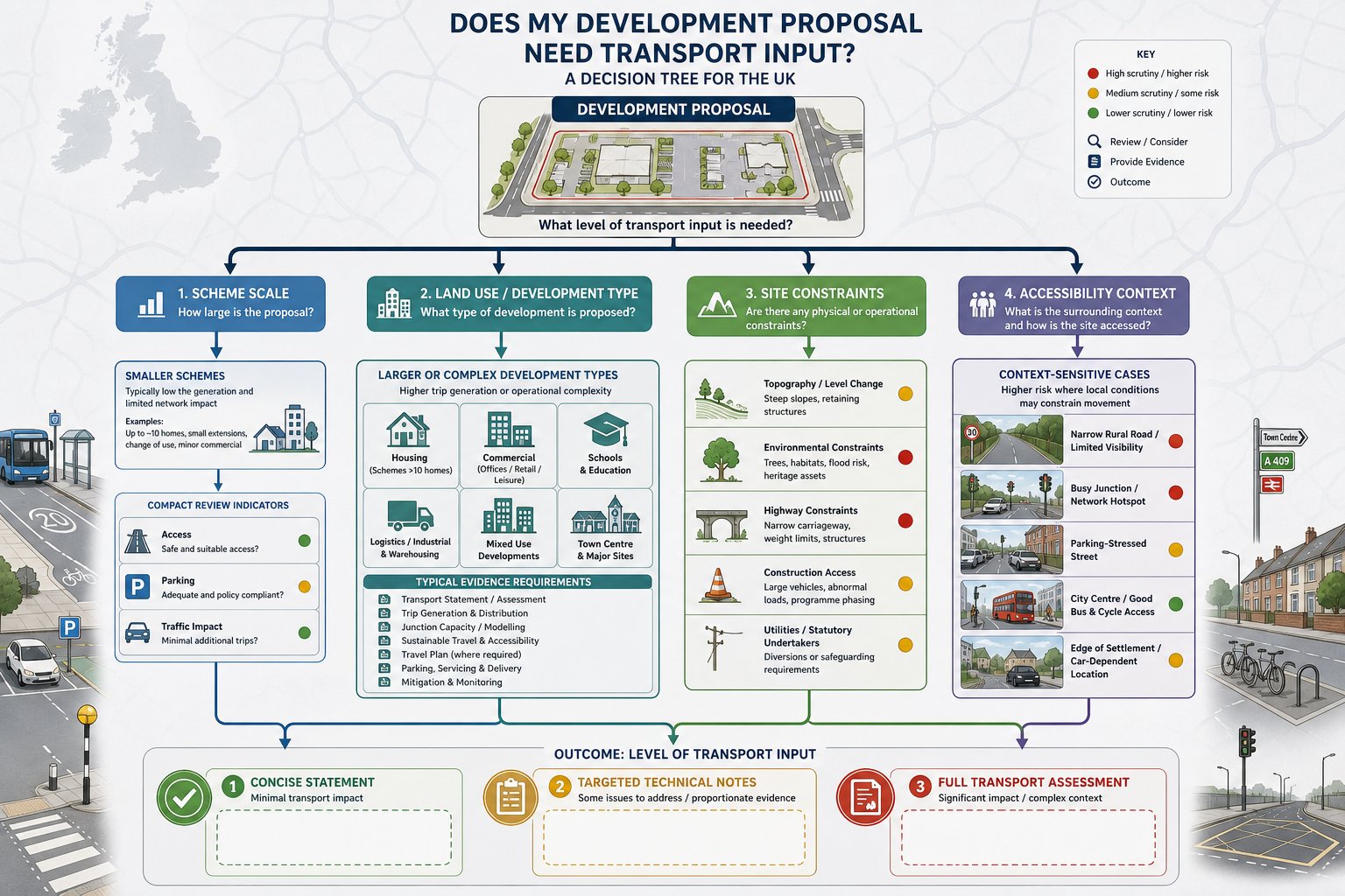
    Locally, plans and supplementary guidance often go further. Many authorities now rely on Local Cycling and Walking Infrastructure Plans (LCWIPs) to identify priority corridors, strategic links, town centre improvements and future network gaps. If a site sits close to one of those corridors, the application should respond directly to it. Ignoring an LCWIP can look like ignoring adopted evidence.

    Then there is the highway authority’s own review culture. Some authorities focus heavily on crossing safety, some on permeability through large sites, some on school access, and others on junction performance for cycles. We find that successful applications anticipate those priorities rather than waiting for consultation comments to reveal them.

    What Counts As Effective Cycling And Walking Infrastructure

    Infographic of safe, direct, connected cycling and walking routes in the UK.

    Effective cycling and walking infrastructure is not just infrastructure that exists. It is infrastructure that people will actually use because it feels safe, obvious and worthwhile.

    That sounds simple, but poor schemes usually fail on one of those three tests. A route may be technically provided yet feel unsafe because it runs too close to fast traffic. It may be safe enough but so indirect that most people ignore it and walk along carriageways desire-line style. Or it may be direct but confusing, with inconsistent materials, missing signs, ambiguous priority and awkward crossing points.

    In planning and development, effectiveness depends on how the whole journey works. Can someone leave a front door, employment building or retail unit and reach nearby destinations without needless detours? Can a parent walk with a pushchair comfortably? Can an older child cycle to school without mixing with heavy traffic at the worst junction? Can a wheelchair user pass without dropped kerbs that pool water or force repeated level changes? Those are the real-world questions officers, inspectors and consultees increasingly expect us to answer.

    A strong scheme hence connects internal streets and paths to external routes, public transport stops, local facilities and wider strategic networks. It avoids isolated fragments. And it treats walking and cycling as normal everyday modes, not recreational afterthoughts. That distinction matters more than ever.

    Core Design Principles For Safe, Direct, And Inclusive Routes

    Infographic showing five principles for safe and inclusive cycling and walking routes.

    Good design principles are well established, but they need disciplined application.

    Safety comes first. Where traffic speeds or volumes are high, separation is often necessary. That may mean protected cycle tracks, better side-road treatments, tighter junction geometry or lower-speed street design. Simply painting a lane beside fast-moving traffic rarely creates a comfortable environment for most users.

    Directness is equally important. People usually choose the route that is quickest and easiest to understand. If cars get a straight line while pedestrians and cyclists are sent through dog-legs, staggered barriers or multi-stage crossings, the design is already telling us whose journey matters. Planning officers notice that.

    Inclusivity means more than meeting a minimum width. Routes should account for mobility aids, non-standard cycles, child trailers, pushchairs, rest points, surfacing quality and manageable gradients. Crossing times and refuge widths matter too. So does lighting where routes are expected to serve regular daily trips.

    Coherence and legibility tie the network together. Users should be able to follow a route naturally, with clear priority and consistent treatment. Sudden disappearances of cycle provision at junctions are a classic weak point.

    And then there’s comfort. Smooth surfaces, reduced conflict, low delay and pleasant surroundings all influence whether active travel feels practical. Infrastructure does not need to be flashy, but it does need to work in ordinary weather, at ordinary times, for ordinary people.

    Key Infrastructure Types Used In New Developments And Street Improvements

    Most schemes use a mix of infrastructure types, and the right combination depends on context rather than fashion. Residential extensions, town centre upgrades, roadside redevelopment and employment sites all have different movement patterns and constraints.

    The central point is that each element should support a complete route. A high-quality cycle track that ends at a hostile roundabout is only half a solution. A new footway that stops at the site boundary without a safe onward crossing leaves a gap exactly where objections tend to land.

    For developments, internal street design is often just as important as off-site works. Low-speed, permeable layouts can enable walking and cycling naturally, reducing the need for more formal segregation in some areas. But on busier frontages and distributor roads, stronger protection and more deliberate crossing design are usually needed.

    Specification also matters. Widths, kerb details, tactile paving, drainage, visibility, signing, turning radii, servicing arrangements and maintenance access can all affect whether infrastructure performs as intended. In our experience, planning submissions are stronger when drawings and transport evidence tell the same story: the proposed infrastructure is not only policy-compliant in principle, but workable in technical detail.

    Footways, Shared Routes, Cycle Tracks, Crossings, And Junction Treatments

    Footways remain fundamental. They should be continuous, appropriately wide, accessible and protected from obstruction. Narrow pavements squeezed beside carriageways or interrupted by excessive vehicle crossovers create exactly the sort of hostile environment that undermines a sustainability narrative.

    Shared routes can work, but only in the right conditions: lower pedestrian and cycle flows, lower conflict potential, good visibility and clear space. They are often overused where separate provision would be better. If a shared path is proposed simply because there is not enough room for proper segregation, that usually deserves closer scrutiny.

    Cycle tracks are increasingly expected on streets with higher traffic volumes or speeds. One-way or two-way arrangements can both be suitable, provided they connect logically and resolve priority clearly at side roads and access points. Kerb protection often improves comfort and uptake.

    Crossings are where many schemes succeed or fail. Zebra, parallel and signal-controlled crossings all have a role, but the choice should follow route function and user need. Side-road entry treatments and continuous footway or cycleway treatments can dramatically improve priority and legibility if designed properly.

    At junctions, protection matters. Protected junction layouts, cycle-friendly roundabouts, reduced corner radii and priority crossings can make the difference between theoretical access and realistic access. A route is only as good as its most stressful point.

    How To Assess Existing Conditions Around A Site

    A robust active travel assessment starts with honest observation. We need to understand how the area works today, where it fails, and what opportunities a development can realistically unlock.

    That means going beyond desktop mapping. Site visits matter. So do audits at the times people actually travel: school drop-off, commuter peaks, evening periods, wet weather if possible. A route that looks adequate on a plan can feel entirely different when bins narrow the footway, parking overruns dropped kerbs or traffic speeds make an on-carriageway cycle connection feel unrealistic.

    For pedestrians, we should review continuity, effective width, surfacing, lighting, gradients, crossing availability and personal security. For cycling, the key questions include traffic speed and volume, lane widths, existing cycle provision, pinch points, junction stress, parking conflict and whether less confident riders would reasonably use the route.

    We also need to identify attractors: schools, local centres, healthcare, bus stops, rail stations, employment areas, parks and community facilities. If those destinations sit within realistic walking and cycling distance, the application should show how they can be reached safely and directly.
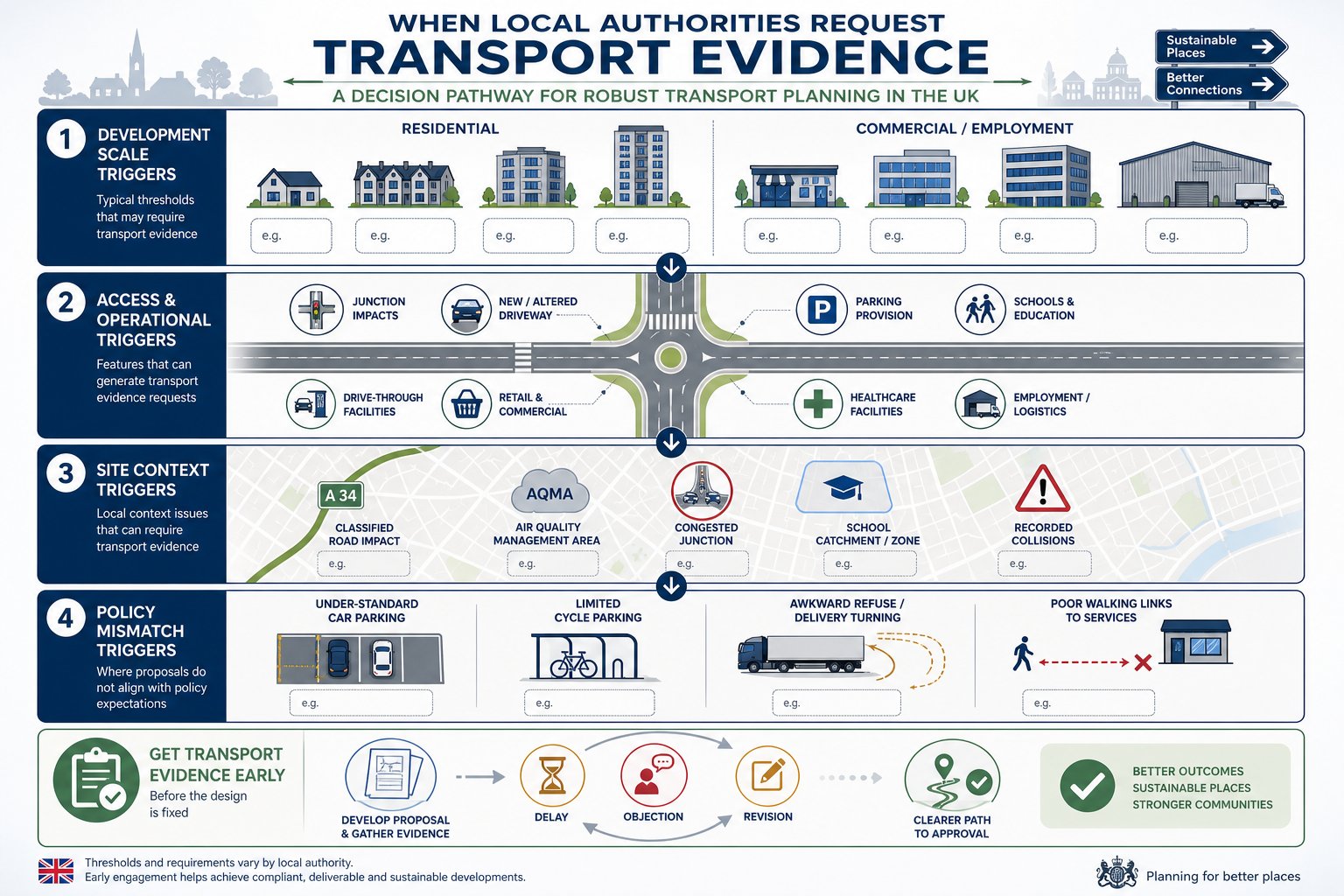
    This assessment work often shapes the entire transport strategy. It informs trip assumptions, mitigation, off-site works, travel plan measures and the credibility of any claim that the development supports sustainable travel.

    Connectivity, Accessibility, Desire Lines, And Network Gaps

    Connectivity is about more than whether a line exists on a map. A connected network allows people to travel continuously between real origins and destinations without awkward breaks, unsafe crossings or confusing transitions.

    We normally begin by mapping likely desire lines. Where will residents walk to buy milk? Which route will staff use to reach the nearest bus stop? Where are pupils likely to cycle? People do not move according to neat red lines on planning diagrams: they follow the simplest sensible route. Good design responds to that human instinct rather than trying to fight it.

    Accessibility then tests whether those routes are usable by a broad range of people. Are gradients reasonable? Are dropped kerbs aligned? Is there enough width for side-by-side movement or passing? Can a non-standard cycle navigate barriers and corners? The answer must be practical, not theoretical.

    Finally, we identify network gaps. These may be short but critical: a missing dropped kerb, no crossing near a desire line, a narrow bridge, an intimidating roundabout, a severed footway, a dead-end path. LCWIPs and local plans are useful here because they often highlight strategic deficiencies already recognised by the authority. If a development can help plug one of those gaps, the planning case becomes much stronger.

    Sometimes the most valuable intervention is not inside the red line at all, but just beyond it.

    Integrating Active Travel Into Transport Assessments And Travel Plans

    If active travel is important to the design, it should also be visible throughout the evidence base. Too many transport assessments mention walking and cycling positively in the opening chapters, then quietly revert to a car-focused analysis everywhere else.

    A better approach is to thread active travel through the whole submission. Existing conditions should include route audits and network mapping. Accessibility should be demonstrated to key destinations by walking and cycling time, not just by drive-time. Trip generation and mode share assumptions should reflect local and national policy aspirations where justified by site context and infrastructure quality. Proposed mitigation should explain how internal layout and off-site works support safer, more attractive active trips.

    Travel plans are equally important. Secure and convenient cycle parking, changing facilities where relevant, wayfinding, welcome packs, personalised travel information, cycle training links, public transport integration, monitoring and review mechanisms all help turn infrastructure into actual behaviour change. But they only work if the underlying routes are credible.

    For planning teams, this joined-up approach is often what gives an application resilience. It shows that active travel has been considered from first principles rather than inserted to satisfy a checklist. That is a big difference. And in practice, concise, locally tuned reporting can make that difference clearer for officers and consultees reviewing multiple complex documents under time pressure.

    Common Design And Planning Mistakes That Lead To Objections

    Some objections are highly site-specific. Others are painfully predictable.

    One common mistake is providing short, disconnected pieces of infrastructure that look positive on a plan but fail as a usable route. Another is forcing pedestrians and cyclists into indirect, delayed movements while preserving vehicle priority at every key junction. If walking and cycling are supposedly encouraged, the geometry should show it.

    Sub-standard widths also cause problems, particularly where designers rely on nominal dimensions without considering walls, columns, overhang, street furniture, drainage features or passing space. The same goes for poor surfacing, steep ramps, awkward tactile layouts and routes vulnerable to obstruction from parking, loading or refuse storage.

    Shared use is another regular weak point. It is often proposed as an easy compromise, yet in constrained or busy settings it can simply transfer conflict from vehicles to vulnerable users. Authorities are increasingly alert to that.

    Perhaps the biggest strategic error is ignoring the wider network. Applications that fail to engage with LCWIPs, local plan priorities or known severance issues can appear detached from adopted policy evidence. That is avoidable.

    In our experience, objections are less likely when the submission explains not only what is proposed, but why it is the right response to the site, the surrounding network and the authority’s policy framework. That extra layer of reasoning matters.

    Conclusion

    In 2026, good cycling and walking infrastructure is not a fringe design issue. It is a planning issue, a transport issue and, increasingly, a viability issue. The strongest schemes are the ones that start with movement patterns people will actually follow and then design safe, direct and inclusive routes around them.

    For developers, consultants and local authorities, the message is fairly plain: active travel needs to be embedded early, tested honestly and evidenced clearly. That means understanding local policy, LCWIPs and highway authority expectations: auditing existing conditions properly: and making sure transport assessments and travel plans support the same story as the drawings.

    Done well, this is not just about avoiding objections. It helps create places that are easier to access, healthier to live in and more resilient in policy terms. And when applications need concise, technically robust transport input shaped around those realities, that is exactly the kind of work we focus on at ML Traffic.

    Cycling and Walking Infrastructure FAQs

    Why is cycling and walking infrastructure crucial in planning applications?

    Cycling and walking infrastructure reduces car dependency, lowers congestion and emissions, and supports inclusive access to jobs, education, and services. It is a core planning test ensuring developments are accessible, sustainable, and aligned with national and local policies.

    How do national policy and local plans influence active travel infrastructure requirements?

    National policies aim to make walking and cycling the natural choice for short journeys, guided by the Cycling and Walking Investment Strategy and Active Travel England standards. Local plans and LCWIPs identify priority routes and expect developments to provide safe, direct, and connected active travel infrastructure.

    What are the key design principles for effective cycling and walking infrastructure?

    Effective infrastructure prioritises safety through separation from fast traffic, direct and legible routes following desire lines, inclusivity with accessible gradients and widths, minimal junction delay, coherence, and comfort with smooth surfaces and pleasant surroundings suitable for all ages and abilities.
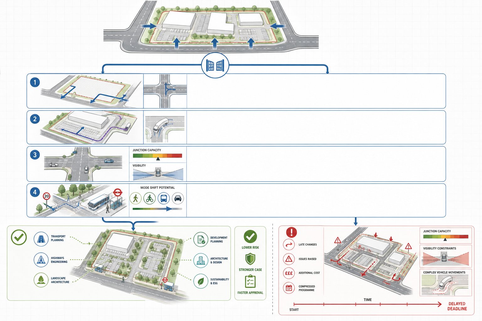
    What types of infrastructure are typically used to support active travel in new developments?

    Common infrastructure includes continuous footways separated from roads, shared routes where appropriate, protected cycle tracks (one-way or two-way), safe crossings (zebra, signal-controlled), and junction treatments like cycle-friendly roundabouts and protected side-road crossings, all integrated into connected networks.

    How can planning applicants ensure their transport assessments and travel plans support active travel goals?

    Applicants should demonstrate walking and cycling connectivity to key destinations, align trip generation and mode share with policy aspirations, include infrastructure details, and complement with travel plans offering secure cycle parking, wayfinding, personalised travel info, and monitoring to encourage mode shift to active travel.

    What are common mistakes in cycling and walking infrastructure design that lead to planning objections?

    Frequent issues include disconnected or short routes, indirect crossings favouring cars, sub-standard widths, poor surface quality, routes blocked by parking or servicing, overuse of shared paths in unsuitable locations, and failure to connect with adopted local networks or LCWIPs, all weakening policy compliance and user safety.

  • Public Transport Strategy Consultants: How Expert Advice Strengthens Planning Applications In 2026

    Public Transport Strategy Consultants: How Expert Advice Strengthens Planning Applications In 2026

    Planning applications rarely fail because a drawing set looked untidy. More often, they stall because a scheme can’t clearly show how people will reach it without leaning too heavily on the private car. That’s where public transport strategy consultants come in.

    For architects, planners, developers, solicitors and local authorities, the issue is no longer simply whether a bus stop exists somewhere nearby. In 2026, the real test is more demanding: Is the site genuinely accessible? Are services frequent enough at the right times? Can the network absorb demand? And, if not, what realistic mitigation can be secured through design, funding or operation?

    We’ve seen time and again that strong public transport input at the right moment can change the trajectory of an application. It helps teams spot weaknesses before an objection letter does, frame evidence in a way local authorities can work with, and connect transport strategy to the wider planning story around sustainability, accessibility and deliverability.

    In this text, we’ll look at what public transport strategy consultants actually do, when their advice is needed, how their work supports planning applications, and what to look for when appointing a consultant. The focus is practical: how to get from policy expectation to an application package that stands up under scrutiny.

    What Public Transport Strategy Consultants Do And When Their Input Is Needed

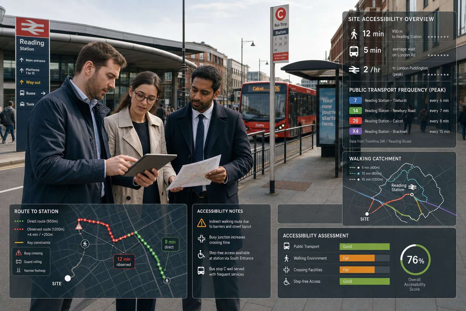
    Consultants reviewing UK public transport plans for a development site.

    Public transport strategy consultants assess how well a site is served by bus, rail, tram, metro and interchange networks, then translate that evidence into planning-ready advice. In practice, that means reviewing routes, frequencies, hours of operation, network directness, interchange quality, peak crowding risks, walk access, barriers to movement, and the likely travel patterns generated by the proposed development.

    Their role sits somewhere between technical transport assessment and planning strategy. They are not just counting services: they are asking whether the public transport offer is good enough for the land use proposed, the policy tests that apply, and the travel behaviours the development is expected to support. On a residential site, that may mean proving realistic commuter access to nearby employment centres. On a school or healthcare scheme, it may mean testing whether timed arrivals can be accommodated safely and reliably.

    Input is usually most valuable at pre-application stage or during early design development. That’s when layout, access points, trip assumptions and mitigation options are still flexible. If consultants are brought in only after objections arise, the team is often forced into reactive work, redesign, or awkward negotiations over contributions.

    For schemes moving through broader end to end transport workstreams, public transport strategy also helps align transport evidence from the outset rather than patching it together later. And that usually saves time, not to mention stress.

    How Public Transport Strategy Supports Planning Applications And Local Authority Requirements

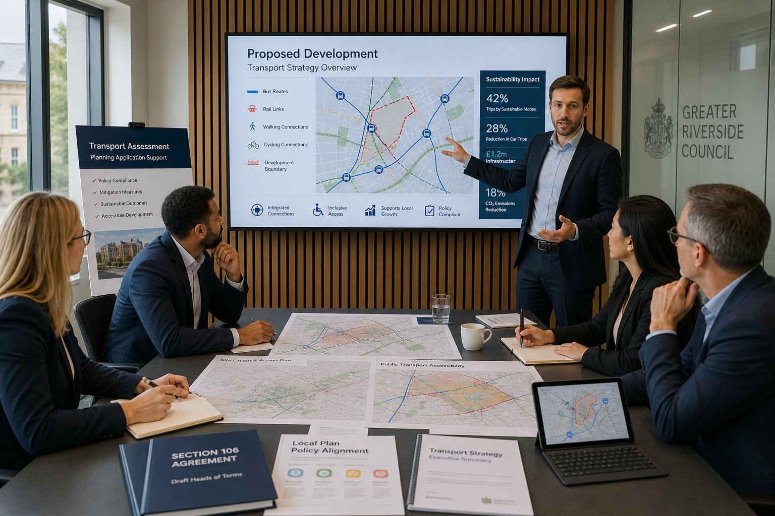
    Consultants presenting a public transport planning strategy in a modern UK meeting room.

    A robust public transport strategy gives decision-makers something they can test, rather than something they have to assume. Local planning authorities want to understand how a development will function in the real world: who will use it, how they will arrive, whether existing networks are adequate, and what commitments are needed if they are not.

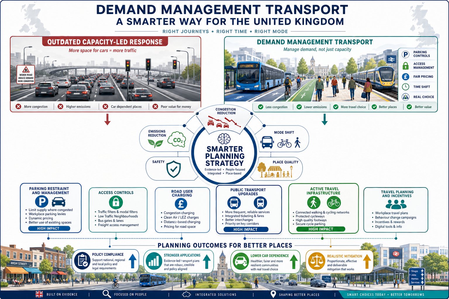
    This matters because policy is increasingly framed around sustainable transport outcomes, not just highway impact. National and local policy typically expects developments to promote walking, cycling and public transport, reduce unnecessary car dependence, and place major trip-generating uses where sustainable modes are credible. A site may be technically developable and still face resistance if the transport narrative is weak.

    Public transport strategy supports applications by documenting baseline conditions, identifying gaps, and proposing proportionate responses. It can feed directly into site selection, parameter plans, access strategy, section 106 discussions and committee reporting. It also helps planning officers and consultees understand whether mitigation is operationally realistic or merely aspirational.

    In many cases, this work sits alongside broader Transport Planning Consultants: input and can be closely linked to a Transport Policy Review where local plan wording, parking standards, accessibility thresholds and sustainable travel policies need to be interpreted carefully.

    For councils, a well-prepared strategy also reduces uncertainty. It shows that the applicant has tested the site properly, understands the local network, and is willing to commit to measures that can actually be delivered.

    Core Elements Of A Robust Public Transport Strategy

    Transport consultants reviewing UK public transport maps and service analysis in office.

    A convincing strategy is not a glossy statement saying a bus route exists within walking distance. It needs to explain existing conditions, likely demand, constraints, opportunities and delivery mechanisms in a form that planners, highway authorities and operators can interrogate.

    At a minimum, we would expect the strategy to cover baseline provision, accessibility, service quality, likely user demand by land use, constraints on the surrounding network, required mitigation, phasing, responsibilities and how all of this links back to policy. The best documents are specific. They identify which stops matter, which services matter, what time periods matter, and why.

    Accessibility And Catchment Analysis

    Accessibility analysis tests whether people can realistically walk to stops and stations, not whether a point on a map falls inside a neat radius. That means measuring actual routes, gradients, crossing points, lighting, wayfinding and barriers such as severance from major roads, gated edges or poor footway continuity.

    Catchment analysis usually considers standard walk thresholds, but the smarter approach is contextual. A five-minute walk along a direct, overlooked route feels very different from the same distance via a hostile road crossing and an unlit path. For older users, school pupils, disabled passengers or patients, those differences are critical.

    Good analysis also looks outward. It asks what destinations can be reached from the site within reasonable journey times, with how many interchanges, and at what times of day. That is why public transport strategy often overlaps with vision led transport thinking: accessibility is about lived experience, not just geometry.

    Service Frequency, Capacity And Connectivity Review

    Once access to the network is understood, the next question is whether the network itself is good enough. Frequency matters because infrequent services sharply reduce convenience and resilience. A route running twice an hour may satisfy a basic policy claim, yet still perform poorly for shift workers, college arrivals, hospital appointments or linked trips.

    Capacity matters too. If buses are already heavily loaded in the peak, adding new demand without evidence or mitigation invites objection. Rail stations may be nearby but offer poor step-free access, constrained platforms or weak onward interchange. Connectivity is equally important: direct services to local centres, employment areas and education hubs usually carry more planning weight than an impressive timetable to places residents rarely need.

    A thorough review tests weekdays, Saturdays and evenings, and distinguishes between headline frequency and genuinely usable service patterns. On larger schemes, this assessment may sit within wider regional transport planning considerations where strategic corridors, growth allocations and neighbouring developments influence future demand.

    Mitigation, Enhancement And Delivery Measures

    If existing provision is marginal or insufficient, the strategy needs to move from diagnosis to delivery. Mitigation can include new or upgraded stops, shelters, raised kerbs, real-time information, improved crossings, footway links, travel information packs, demand management, operator engagement, service pump-priming or financial contributions secured through planning obligations.

    The key word is deliverable. Authorities are rightly sceptical of vague promises to “encourage bus use” without a budget, trigger, responsible party or implementation mechanism. Strong strategies set out what will be done, when, by whom, and under what legal or commercial arrangement.

    This is where work often aligns with broader Sustainable Transport Initiatives and with site-specific design changes that make public transport the easy choice rather than the worthy choice. If the route to the stop feels awkward, people won’t use it, regardless of how polished the strategy document looks.

    How Consultants Assess Existing Public Transport Conditions Around A Site

    Consultants assessing bus and rail access near a UK development site.

    The assessment usually starts with a desk-based review, but it should not end there. Timetables, route maps, operator data, station facilities information and policy documents provide the baseline, yet site reality often tells a different story. We regularly find that mapped provision looks acceptable until on-site work reveals indirect walking routes, poor crossing opportunities, cluttered stops, or interchanges that are technically present but practically unattractive.

    A sound assessment hence combines mapping, timetable review and field observation. Consultants will normally identify the nearest stops and stations, measure actual walking distances, review service span and frequency, check key destination links, and note barriers such as severance, steep topography or gaps in pedestrian infrastructure. On more sensitive schemes, they may also consider crowding patterns, school peak conflicts, interchange delays and network reliability.

    The output should explain not just what exists, but how useful it is for the proposed land use. A residential development may need strong morning and evening commuter links. A logistics or industrial site may depend on early and late services for shift changeovers. A clinic, civic building or community hub may require all-day access for users who cannot drive.

    This diagnostic stage also feeds neatly into related work by Sustainable Transport Consultants, especially where mode choice, active travel and public transport need to be considered as one joined-up accessibility picture. That joined-up view is often what makes the planning case feel credible.

    Developing A Strategy For Different Types Of Development

    Consultants reviewing UK public transport plans for different development types.

    Not all developments place the same demands on the public transport network, so the strategy has to reflect the use class, user profile, operational hours and likely trip patterns. A generic statement copied from another scheme is usually easy to spot and rarely persuasive.

    Residential, Mixed-Use And Commercial Schemes

    Residential schemes tend to focus on day-to-day accessibility: commuting, education, shopping, healthcare and leisure. The central question is whether future residents can live reasonably without high car dependence. That means looking at service quality across the day, not simply whether one bus route exists at the edge of the site.

    Mixed-use schemes are more complex because they generate layered trip patterns. Residents, staff, visitors and deliveries may all place different demands on the network at different times. Public transport strategy hence needs to test multi-directional movement and consider whether a development can support local centres while reducing pressure on parking and highway capacity.

    Commercial developments often bring a sharper focus on workforce access, peak spreading and staff travel behaviour. Office sites may align well with rail and frequent bus corridors, while industrial and warehouse uses can be much harder because shift times often fall outside strong service windows. In those cases, Modal Shift Consultants: style thinking becomes important, combining operational measures with realistic changes to access and travel behaviour.

    Education, Healthcare And Community Developments

    Education, healthcare and community uses raise distinct planning issues because arrivals can be concentrated, vulnerable users may be involved, and accessibility is often a core public interest issue rather than a secondary benefit.

    Schools and colleges may need analysis of start and finish peaks, school bus interaction, crossing safety and the management of parent trips. Hospitals, clinics and care settings require a more inclusive approach, accounting for patients, visitors, staff, mobility-impaired users and appointments spread through the day. Community buildings often serve varied age groups and can generate unpredictable demand around events.

    For these schemes, the strategy should test whether public transport is understandable, legible and manageable for people who may be unfamiliar with the area or unable to tolerate difficult walking conditions. Timing matters enormously. A half-hourly service that misses a clinic’s appointment rhythms can be less useful than a simpler but well-aligned route.

    We’ve found that the strongest strategies avoid overclaiming. They acknowledge genuine shortcomings and then set out proportionate, fundable measures to improve access, often as part of a wider public transport strategy consultants approach to planning evidence.

    The Link Between Public Transport Strategy, Travel Plans And Transport Assessments

    These documents are closely related, but they do different jobs. The public transport strategy explains the accessibility context, tests network quality, and sets out required improvements or commitments. The Transport Assessment examines the wider transport effects of the development, including trip generation, distribution, junction performance and multi-modal access. The Travel Plan then focuses on how sustainable travel will be encouraged, managed and monitored once the site is occupied.

    Problems arise when teams treat them as separate silos. If the Transport Assessment assumes low car mode share, but the public transport strategy shows weak service provision and no mitigation, the application looks inconsistent. Likewise, a Travel Plan that promises bus use growth without evidence on routes, frequencies, fare arrangements or information measures will feel generic.

    The better approach is integration. Public transport findings should inform trip assumptions, parking strategy, accessibility statements and Travel Plan measures from the start. That can include discounted tickets, resident welcome packs, staff travel coordinators, stop upgrades, wayfinding, mobility hubs or monitoring triggers linked to occupation.

    On policy-led schemes, this integrated method also strengthens the argument that the development has been designed around sustainable access rather than retrofitted with token measures. That is one reason many applicants now combine public transport strategy with public transport strategy consultants input from policy and planning specialists so the evidence stack remains coherent from pre-app to determination.

    Common Risks, Objections And How To Avoid Delays In The Planning Process

    The most common risk is overstatement. Applicants sometimes present a site as highly sustainable because a bus stop is nearby, only for consultees to point out that services are infrequent, indirect, overcrowded or absent in the evening. That kind of mismatch can undermine confidence in the whole submission.

    Other familiar problems include weak walking links to stops, poor interchange quality, inaccessible station facilities, lack of evidence on peak capacity, and mitigation measures that are mentioned but not secured. For some developments, especially edge-of-settlement or employment schemes, the biggest issue is timing: public transport simply does not align with the operating day.

    To reduce delay, we need to identify these issues early and address them honestly. Site audits matter. So does speaking the language of the authority and understanding what its policies, thresholds and committee concerns are likely to be. Generic text borrowed from another borough rarely survives scrutiny.

    It also helps to define mitigation with precision. If a stop upgrade is required, where is it, who delivers it, when is it triggered, and is there land control? If service support is proposed, how long will funding last and what happens afterward? Those details are where applications either gain credibility or lose it.

    For firms handling planning evidence at pace, such as MLTraffic, the advantage is often the ability to produce concise, authority-aware technical material quickly while still grounding recommendations in practical delivery. In difficult cases, that blend of clarity and realism can be the difference between a manageable planning dialogue and months of drift.

    How To Choose Public Transport Strategy Consultants For Your Project

    Not every transport consultant is equally strong on public transport strategy. Some are excellent at highway modelling but less comfortable with accessibility analysis, operator engagement or the planning nuances around sustainable location and mitigation. So selection should be based on relevant evidence, not just a familiar name.

    First, look for planning experience on comparable schemes. A consultant should be able to show how they have supported residential, mixed-use, commercial or community applications facing similar policy tests. Second, check local knowledge. Understanding authority expectations, local plan wording, committee sensitivities and regional network issues is hugely valuable. Third, ask how they assess deliverability. Good consultants do not simply list possible improvements: they test whether those improvements can actually be funded, secured and implemented.

    It is also worth asking about analytical capability. Can they map catchments properly, review service patterns in detail, coordinate with Transport Assessments and Travel Plans, and explain findings clearly to both technical officers and non-technical decision-makers? Bigger firms such as WSP, Arup, Deloitte, Bain and Kittelson all operate in adjacent transport or transit consulting space, but the right choice depends on project scale, geography and planning context.

    For many applicants, the best fit is a consultant with strong planning instincts, local authority awareness and a reputation for concise, decision-useful reporting. That matters because the aim is not to produce a longer document. It is to produce one that gets read, trusted and acted on.

    And in 2026, that is exactly why public transport strategy consultants remain such a valuable part of the planning team.

    Public Transport Strategy Consultants: Frequently Asked Questions

    What is the role of public transport strategy consultants in planning applications?

    Public transport strategy consultants assess a site’s accessibility via bus, rail, tram, and other networks, evaluating service frequency, connectivity, and capacity. They advise on realistic mitigation measures, helping applicants demonstrate sustainable transport access aligned with policy expectations to support planning consent.

    When should developers seek input from public transport strategy consultants?

    Consultants should be involved early at the pre-application or design development stages. Early input allows flexible layout and access planning, helping avoid later objections by identifying transport weaknesses and proposing deliverable mitigation aligned with local policies.

    How do public transport strategies support planning applications and local authority requirements?

    A robust strategy provides evidence on baseline conditions, accessibility, likely demand, and needed improvements. It enables planning officers to test operational realism, informs Transport Assessments and Travel Plans, and aligns with broader transport policy reviews and sustainable transport initiatives.

    What core elements are included in a robust public transport strategy?

    Key elements include detailed accessibility and catchment analysis considering walk routes and barriers, service frequency and capacity reviews, connectivity to key destinations, demand forecasts by land use, and clearly defined mitigation, enhancement, and delivery responsibilities to ensure measures are practical and fundable.

    How do public transport strategy consultants tailor strategies for different development types?

    Strategies reflect the development use class and trip patterns: residential schemes focus on commuter and local access; mixed-use developments address varied trips; commercial sites consider workforce peak access; education and healthcare require timed, accessible services for vulnerable users. This ensures transport solutions are user-appropriate and policy-compliant.

    What should be considered when choosing a public transport strategy consultant?

    Choose consultants with proven planning experience on similar schemes, deep local policy knowledge, strong analytical and modelling capabilities, and a track record of delivering viable, policy-aligned strategies. Their ability to integrate with Transport Planning Consultants and align public transport with planning evidence is vital.

  • Demand Management In Transport: Practical Strategies For Smarter Planning Decisions In 2026

    Demand Management In Transport: Practical Strategies For Smarter Planning Decisions In 2026

    In UK planning, one of the most persistent mistakes is treating congestion as a pure capacity problem. If queues form, the instinct is often to widen, add, or signalise. But that approach only takes us so far. In many locations, especially town centres, growth areas and constrained urban networks, we simply cannot build our way out of traffic pressure.

    That is where demand management transport thinking becomes essential. Rather than assuming every forecast car trip must be accommodated, demand management in transport asks a sharper question: how can we reduce, redistribute or shift travel demand so the network works better overall? For architects, planners, developers, local authorities and legal teams, that question now sits at the heart of credible planning strategy.

    In practice, transport demand management is not a single policy. It is a package of measures that influences when people travel, how they travel, where they park, and whether some trips can be avoided or shortened altogether. It supports lower-carbon development, stronger planning applications and more realistic mitigation strategies.

    From our perspective, this matters because planning decisions are increasingly judged against mode shift, place quality, safety, emissions and policy alignment, not just junction capacity. A robust approach to demand management can hence make the difference between a scheme that merely adds traffic and one that demonstrates genuine transport sustainability. The sections below set out what demand management means, the objectives behind it, the measures most commonly used, and how it supports transport assessments in 2026.

    What Demand Management In Transport Means And Why It Matters

    UK transport infographic showing how travel demand is shifted from cars to sustainable modes.

    Demand management in transport, often shortened to TDM, is the deliberate use of policies, design choices and operational measures to influence travel behaviour. The aim is not simply to move more vehicles. It is to make better use of the network by reducing unnecessary car trips, shifting journeys to more sustainable modes, and spreading demand away from the busiest times and locations.

    For planning teams, that distinction is critical. A road network may be constrained physically, environmentally or politically. In those cases, the old predict-and-provide model tends to fail because added capacity is expensive, slow to deliver and often self-defeating. New road space can attract new traffic. Demand management offers a more practical route: shape travel choices before impacts materialise.

    That is why TDM now sits alongside wider planning concepts such as healthy streets, net zero, place-making and decide-and-provide. It supports development that functions within a realistic transport envelope rather than relying on ever-larger highway interventions. In our work, that often means combining parking restraint, active travel access, public transport connectivity and travel planning into one coherent mitigation package.

    For applicants and councils alike, the point is simple: demand management is no longer an optional extra. It is increasingly part of what makes a transport strategy policy-compliant, defensible and deliverable.

    How Travel Demand Differs From Traffic Capacity

    Travel demand and traffic capacity are related, but they are not the same thing. Travel demand is about the number of trips people want to make, their origins and destinations, the time they choose to travel, and the mode they use. Capacity, by contrast, is the amount of movement a road, junction, corridor or public transport route can accommodate while still operating acceptably.

    That difference matters because congestion occurs when demand exceeds capacity at a specific place and time. Morning peak delays on a town-centre arm, for example, may reflect concentrated school, commuter and servicing trips rather than a permanent all-day shortage of carriageway. If so, widening the road may be disproportionate, while targeted demand management could remove or reschedule enough trips to stabilise operation.

    This is especially relevant in development planning. A site may generate a manageable number of person trips overall, yet still create pressure if most of them arrive by single-occupancy car in the same peak hour. Equally, the same site can perform very differently where demand is shifted towards bus, rail, walking and cycling. That is why a good transport assessment for development does more than count vehicles: it tests whether demand can be influenced before impacts hit the network.

    Why Demand Management Is Central To Modern Planning Policy

    Modern planning policy has moved well beyond the idea that every forecast vehicle movement should be accommodated on demand. In the UK, national and local policy increasingly prioritises sustainable transport, climate resilience, healthier places and development that reduces reliance on private car use.

    That shift is visible in parking standards, low-car housing models, active travel investment, bus-priority measures, clean air policy and the growing influence of vision-led design. It is also reflected in the move from predict-and-provide to decide-and-provide: first establish the place and transport outcomes we want, then shape the network and travel behaviour to support them.

    For developers and consultants, this means demand management is central not only in principle but in evidence. Authorities increasingly expect applicants to show how mode share targets will be achieved, how parking demand will be managed, and how peak-hour vehicle trips will be minimised. In complex schemes, that logic often sits within broader vision led transport work, where movement strategy is aligned with the desired character and function of the place.

    In short, TDM matters because policy now expects transport planning to shape demand, not merely react to it.

    The Main Objectives Of Transport Demand Management

    Infographic showing transport demand management goals in UK streets and networks.

    Transport demand management has several objectives, but they all come back to one core principle: use existing networks more intelligently while achieving better planning outcomes. That means less congestion where it is most damaging, fewer emissions, safer streets, stronger public transport viability and places that function for people rather than just vehicle flow.

    For our audience, the practical value is obvious. A scheme that relies solely on highway capacity improvements can be costly, uncertain and vulnerable in policy terms. A scheme supported by targeted demand management often has a broader and more defensible mitigation strategy. It can show not only that impacts are acceptable, but that the development actively supports local transport policy.

    The objectives also work together. Reducing peak car trips helps congestion, but it also improves bus reliability. Better walking and cycling access may reduce parking demand, improve health outcomes and support more attractive streets. Reallocating road space can sometimes appear restrictive in vehicle terms, yet increase person-throughput and make a centre function better commercially.

    In that sense, demand management is not about suppressing movement for its own sake. It is about managing movement in a way that better serves economic activity, environmental limits and place quality.

    Reducing Congestion, Emissions And Car Dependence

    One of the clearest objectives of demand management is reducing traffic pressure in the places and periods where the network is most sensitive. Peak spreading, mode shift and shorter trip lengths can all remove stress from junctions and corridors without major new road construction.

    This matters because congestion is not just inconvenient. It affects delivery reliability, bus punctuality, emergency access, fuel consumption and local air quality. Vehicle stop-start conditions also increase emissions per trip. So when demand management reduces single-occupancy car use or shifts trips out of the busiest hour, the benefits are wider than journey time alone.

    The same is true for car dependence. In many developments, especially those in accessible urban locations, a design that bakes in high parking provision and weak sustainable links almost guarantees car-led trip patterns. By contrast, a package of restraint and alternatives can change travel behaviour materially. Parking pricing, car club spaces, cycle storage, direct pedestrian routes, bus information and travel plan incentives all play a role.

    For larger schemes, this sits naturally within end to end transport strategy, where access, servicing, parking and mitigation are planned as one system rather than as isolated fixes. Done properly, demand management reduces both immediate traffic impacts and longer-term car reliance.

    Improving Network Efficiency, Safety And Place Quality

    A useful way to think about TDM is that it improves not just flow, but function. Roads and streets serve many purposes at once: movement, access, social interaction, servicing, commerce and public life. If we judge success only by vehicle throughput, we can miss the bigger planning picture.

    Demand management helps by improving network efficiency in person terms rather than vehicle terms alone. A bus lane, for example, may reduce road space for general traffic, yet move far more people per hour. School streets can create short-term access restraint but cut conflict at the school gate. Bus gates and filtered permeability can remove through traffic from streets that were never meant to operate as distributor roads in the first place.

    Safety is another major objective. Lower traffic volumes and lower speeds generally reduce collision risk and severity. Better conditions for walking and cycling also widen travel choice for children, older people and less confident users. That has obvious social value, but it also supports more realistic mode shift.

    And then there is place quality. Cleaner air, quieter streets, safer crossings and reduced parking dominance make centres and neighbourhoods more attractive. In a mixed use masterplan, these outcomes are often as important as raw capacity because they influence viability, footfall and long-term urban character.

    Common Demand Management Measures Used In Development And Local Transport Planning

    UK transport demand management infographic comparing restrictions and sustainable travel measures.

    Demand management measures are rarely effective in isolation. The strongest results usually come from a package that combines restraint, incentives and better alternatives. In planning terms, that package must also be proportionate to the scale and context of the proposal. A town-centre infill site, an edge-of-settlement housing scheme and a large mixed-use expansion area will not need the same tools.

    Still, there are common themes. Parking management is often the most immediate lever because it directly shapes car ownership and use. Access management can protect sensitive streets or prioritise certain users. Charging mechanisms can tackle congestion or emissions where network pressure is acute. Alongside these, public transport improvements, active travel infrastructure and travel plans give people workable alternatives.

    The best packages are grounded in evidence. They respond to local policy, accessibility, existing mode shares and observed constraints. And crucially, they are deliverable. There is little value in promising ambitious mode shift if the walking route is indirect, the cycle parking is tokenistic or the bus service is too infrequent to be credible.

    Parking Control, Access Restraint And Road User Charging

    Parking is one of the most powerful demand management tools because it influences travel choices before the trip even starts. High parking provision tends to support higher car ownership and greater car use. Limited supply, pricing and allocation controls can produce the opposite effect, especially where sustainable alternatives are reasonably good.

    In development planning, that may mean maximum parking standards rather than minimum ones, unbundled parking for residential schemes, managed permit systems, shared spaces for mixed-use sites, and EV provision that supports policy without encouraging unnecessary car trips. Workplace parking restraint is equally important on employment-led schemes.

    Access restraint works slightly differently. Instead of targeting parking, it controls where and when vehicles can move. Examples include bus gates, modal filters, school streets, freight time windows, loading restrictions and low-traffic neighbourhood treatments. These measures can protect town centres and residential streets from rat-running or reduce conflict in sensitive locations.

    Road user charging adds another layer. Congestion charging, clean air zones and more sophisticated time-distance-place charging all aim to reflect the real external cost of driving in constrained networks. Not every development is directly subject to these tools, but many must account for them. In some cases, the analysis may need support from Traffic Flow Management evidence to understand how restrictions, rerouting and local network conditions interact.

    Public Transport, Active Travel And Travel Planning Measures

    If parking and access restraint are the stick, then public transport, active travel and travel planning are the means of making lower-car travel realistic. Without them, demand management quickly becomes punitive rather than effective.

    Public transport measures can include new or diverted services, stop upgrades, real-time information, improved waiting environments, better interchange and ticketing initiatives. The value is not merely capacity. Reliability, legibility and directness often matter more to mode choice than raw timetable frequency. A modest service improvement paired with better walking access to stops can outperform a more expensive intervention that leaves the first and last leg awkward.

    Active travel measures are just as important. Continuous footways, high-quality crossings, direct cycle routes, secure cycle parking, showers, lockers and well-designed public realm all affect whether walking and cycling feel normal rather than aspirational. For many shorter trips, especially in urban areas, these details decide mode share.

    Travel plans tie the package together. They turn physical infrastructure into behavioural change through welcome packs, personalised travel advice, cycle vouchers, monitoring, car-share databases, season ticket support and targeted communication. In a planning application, those measures help quantify how demand will be managed over time rather than assumed away in principle. That is a key part of effective demand management transport strategy in 2026.

    How Demand Management Supports Transport Assessments And Planning Applications

    Infographic of demand management shaping UK transport planning and development approval.

    Demand management supports transport assessments by making them more realistic, policy-aligned and solution-focused. A conventional assessment that forecasts high car trip rates and then searches for junction mitigation can feel disconnected from modern planning policy, especially in locations where sustainable travel is expected. By contrast, a TDM-led assessment shows how trip generation, parking demand and network effects can be shaped from the outset.

    That matters because planning authorities increasingly test not only whether residual cumulative impacts are severe, but whether applicants have genuinely prioritised sustainable modes. If the proposal sits in a town centre, near rail, on a strategic bus corridor or within a growth area with clear mode shift policy, a car-dominant evidence base is unlikely to land well.

    In practice, demand management may influence several parts of the submission: trip generation assumptions, parking strategy, access design, travel plan commitments, delivery and servicing controls, and mitigation packages secured by condition or obligation. It can also strengthen the planning narrative. Instead of simply defending traffic impacts, the application demonstrates that it actively supports local transport objectives.

    For us, this is often where concise technical reporting matters most. Local authorities want evidence that is proportionate, robust and tailored to threshold requirements. A well-structured demand management case can do a great deal of work in relatively few pages if the assumptions are credible and the commitments are clear.

    When Demand Management Evidence Is Needed For Development Proposals

    Demand management evidence is usually needed when a scheme is likely to generate significant trips, parking demand or pressure on a constrained network. That includes obvious cases such as major residential, commercial, education, healthcare and mixed-use proposals. But smaller schemes can trigger the same need if they are in sensitive locations or raise policy concerns around congestion, air quality or car dependency.

    Town centres are a common example. So are edge-of-centre sites with good public transport access, corridors with existing peak-hour stress, and authorities pursuing low-car or car-lite growth strategies. In these contexts, decision-makers often expect quantified evidence showing how vehicle trip rates, parking accumulation and mode share will be influenced by the proposed measures.

    That evidence may sit across the transport assessment, travel plan and design response. We would normally expect it to address parking supply and control, accessibility by non-car modes, site layout, servicing strategy, delivery timing, incentives, monitoring and fallback arrangements if targets are not met. The stronger submissions are specific. They do not just say cycling will be encouraged: they explain how many spaces are provided, where they are located, what facilities support them, and how uptake will be reviewed.

    For planning teams operating to tight programmes, this is where experience helps. The key is to provide enough detail to satisfy the authority without drowning the application in generic text. In 2026, demand management evidence is increasingly not supplementary material but part of the core case for why a development is acceptable.

    Conclusion

    Demand management in transport has become a core part of credible planning, not a side note added after the traffic modelling is finished. For developers, planners, architects, surveyors, lawyers and councils, the message is fairly clear: successful schemes are increasingly the ones that manage demand intelligently rather than assuming every car trip can or should be accommodated.

    The practical implication is that transport strategy now needs to do more than measure impact. It needs to shape behaviour, support policy, and show how a development will function within a constrained and increasingly sustainability-led network. Parking restraint, active travel, public transport support, access controls and travel planning are no longer isolated measures: together, they form a planning toolset.

    When applied proportionately and evidenced properly, demand management can reduce risk, strengthen applications and produce better places. And in 2026, that is exactly what smarter planning decisions require.

    Frequently Asked Questions about Demand Management in Transport

    What is demand management in transport and why is it important?

    Demand management in transport (TDM) involves policies and measures to reduce or reshape travel demand rather than just increasing road capacity. It improves network efficiency, reduces congestion, cuts emissions, and supports sustainable planning and healthier places in constrained urban areas.

    How does travel demand differ from traffic capacity?

    Travel demand refers to the number, timing, mode, and origins of trips people want to make, while traffic capacity is the amount of movement a road or transport route can accommodate effectively. Congestion arises when demand exceeds capacity at specific times or places.

    Why is demand management central to modern UK planning policy?

    Modern UK planning policy prioritises sustainable transport, net zero goals, and healthy streets, recognising that unfettered car demand cannot be met. Demand management transport aligns with these by shaping travel behaviour and supporting mode shift, making transport strategies policy-compliant and sustainable.

    What are common measures used in demand management transport?

    Common measures include parking control (maximum standards, pricing), access restraint (bus gates, school streets), road user charging (congestion charges, clean air zones), public transport improvements, active travel infrastructure, and travel plans encouraging behavioural change.

    How does demand management support transport assessments for developments?

    Demand management makes transport assessments more realistic and policy-aligned by showing how trip generation and car impacts will be managed. It helps demonstrate mode share targets, parking demand control, and mitigation strategies, strengthening planning applications and compliance with policy.

    When is demand management evidence needed for a development proposal?

    Evidence is typically required for schemes generating significant trips, parking demand, or impacting congested locations. This includes major residential, commercial or mixed-use developments in town centres or areas with policies favouring mode shift and low-car lifestyles, supported by detailed transport assessments and travel plans.

  • Traffic Calming Design In 2026: Principles, Measures And Planning Considerations That Work

    Traffic Calming Design In 2026: Principles, Measures And Planning Considerations That Work

    A traffic calming scheme can look deceptively simple. A raised table here, a build-out there, a couple of signs at the entrance to a residential street, and on paper it all seems straightforward. In practice, though, traffic calming design sits right at the junction of safety, place-making, highway engineering and planning risk. Get it right and speeds fall, crossings feel shorter, streets become more usable, and planning officers are far more comfortable that a scheme will work in the real world. Get it wrong and the result is often patchy compliance, drainage complaints, objections from bus operators, and features drivers simply ignore.

    For architects, planning consultants, developers, surveyors and local authorities, that distinction matters. We’re rarely designing in a vacuum. We’re working within adopted standards, constrained corridors, forecast traffic growth, emergency access requirements, active travel expectations and local political realities. And in 2026, expectations are higher: schemes need to be self-enforcing, proportionate and defensible in planning terms.
    In this guide, we set out what traffic calming design actually involves, the principles behind effective schemes, the measures that tend to work best in different contexts, and the design checks that are too often left until late in the process. We’ll also look at how traffic calming should be handled within transport assessments and planning applications, where poorly justified proposals can easily stall otherwise viable development.

    What Traffic Calming Design Is And Why It Matters

    Infographic showing UK traffic calming features and their safety and street benefits.

    Traffic calming design is the use of physical and perceptual street features to reduce vehicle speeds, influence driver behaviour, manage traffic volumes and improve conditions for people using the street. That can include vertical features such as speed tables and cushions, horizontal changes such as chicanes or build-outs, and visual cues such as planting, narrower carriageways, surfacing changes, markings and gateway treatments.

    The point is not simply to slow vehicles for its own sake. Good traffic calming aligns traffic speed with street purpose. A street serving homes, schools, local shops or walking routes should not feel or operate like a distributor road. That sounds obvious, but many planning disputes begin because the geometry sends one message while the land use sends another.

    The evidence base is one reason the subject matters so much. Lower speeds generally mean fewer collisions and, crucially, less severe outcomes where collisions still occur. That is particularly important in mixed-use environments and on residential streets where people walking, cycling, wheeling or crossing informally are part of normal daily movement.

    It also matters because traffic calming increasingly supports broader planning objectives. In many schemes, it is not just a highways add-on: it helps deliver public realm quality, safer active travel connections, and a more credible 20 mph environment. In that sense, traffic calming sits within wider Traffic Engineering: Your decisions about how movement and place should coexist.

    Core Objectives: Safety, Speed Reduction, Liveability And Access

    At scheme level, four objectives usually sit at the centre.

    Safety comes first. We want fewer collisions, and where conflicts do occur, we want lower impact speeds and better visibility. Geometry that naturally reduces turning speeds or shortens crossing distances is often more valuable than signage alone.

    Speed reduction is the most obvious aim, but it needs to be tied to a realistic target speed consistent with the road’s function. On many UK residential streets that means creating a genuinely self-enforcing 20 mph character, not just applying a limit and hoping compliance follows.

    Liveability is where traffic calming moves beyond engineering. Quieter streets, easier crossings, more pleasant frontages and better conditions for walking and cycling all feed into placemaking. Parents judge streets this way. So do planning committees.

    Access keeps the design grounded. Residents, refuse vehicles, servicing, buses and emergency services still need to get through. Effective traffic calming design is hence about balance: slowing what should slow down, while preserving the level of access the street genuinely needs.

    Key Principles Of Effective Traffic Calming Design

    Infographic of UK traffic calming design principles across different street types.

    The best schemes are self-enforcing. That principle is worth dwelling on because it separates effective design from cosmetic intervention. If a driver can comfortably accelerate between isolated features, or if the geometry feels overly generous even though the signs, the scheme will underperform.

    Self-enforcing design relies on consistency. Measures need to be spaced and composed so that drivers read the street as a low-speed environment from entry to exit. One speed table outside a school gate can be helpful, but if the rest of the corridor remains wide, straight and forgiving, average speeds often rebound quickly.

    Predictability matters too. Drivers should understand where they are expected to yield, slow, turn or align. Pedestrians and cyclists should be able to read crossings and priority with equal clarity. Confusing layouts do not create calm: they create hesitation and occasional conflict.

    Another principle is proportionality. We should match the degree of intervention to the street’s role. A residential loop road can usually accommodate stronger vertical features than a bus corridor or emergency response route. Likewise, a village gateway or local centre may benefit more from surface character, tighter geometry and visual friction than from repeated humps.

    Good schemes also account for all users, including people with mobility impairments, visually impaired pedestrians, cyclists using standard carriageways, bus passengers and delivery drivers. That means traffic calming is not just about reducing speed, it is about shaping a street that still functions well.

    Where developments need a broader package of intervention, traffic calming often sits alongside wider mitigation measures traffic: proposals, especially when local authorities want evidence that impacts are being managed in a coherent way.

    How Street Function, Context And User Needs Shape The Design

    Street context should decide the toolkit.

    On strategic roads, bus routes and streets carrying regular servicing movements, harsh vertical deflection is often the wrong first answer. In these locations, we typically look harder at horizontal alignment, lane discipline, gateway treatment, reduced effective width, signal coordination or selective road diet measures. The aim is to moderate speed without undermining route resilience.

    On local residential streets, the palette is wider. Speed humps, cushions, raised tables, modal filters, tighter junction radii and narrowed entries can all be appropriate where through-traffic should feel secondary to neighbourhood function.

    Near schools, local centres and places with heavy pedestrian activity, crossing quality becomes central. Raised crossings, side-road tables, build-outs and strong entry treatments often do more than a standard hump sequence because they directly reinforce pedestrian priority.

    User needs can alter apparently sensible proposals. A cushion layout that suits cars may create discomfort for cyclists if bypass width is poor. A chicane can reduce speed but create pinch conflict unless cycle movement is designed in. And a landscaped narrowing may look excellent at concept stage yet fail if refuse tracking or disabled parking demand has not been tested. This is why early coordination with access design highway work is so important on live planning projects.

    Common Traffic Calming Measures And Where They Fit Best

    UK infographic comparing traffic calming measures for streets, junctions, crossings and gateways.

    There is no universal best measure. The right choice depends on target speed, traffic composition, frontage activity, route function, maintenance implications and what behaviour we are trying to change.

    Vertical deflection remains one of the strongest tools where clear speed reduction is required on local streets. Speed humps, sinusoidal profiles, speed tables and raised junctions can all produce meaningful reductions when properly spaced. They tend to work best where low to moderate traffic volumes, residential character and limited bus sensitivity align.

    Horizontal deflection is often better suited to routes where speed needs to come down but ride quality and operational continuity still matter. Chicanes, lane shifts, central islands and mini-roundabouts encourage slower approach speeds without the same level of vertical discomfort.

    Visual narrowing sits somewhere between geometry and psychology. Build-outs, narrower lanes, tree planting, median islands, strong frontage enclosure, on-street parking and changes in material can all make a street feel less like a through-route and more like a place. These are particularly useful where we want lower speeds with less harsh intervention.

    There are also volume-management measures such as modal filters, turn restrictions and closures. Strictly speaking, these can go beyond classic speed control, but they are often part of the same strategy where rat-running or inappropriate through-movement is the underlying problem.

    In planning-led schemes, the measure should also fit the delivery route. Some features are straightforward within on-site highway layouts: others may depend on off-site works, land take, drainage alterations or adoption negotiations. That is where highway infrastructure design thinking has to join the conversation early.

    Vertical Deflection, Horizontal Deflection And Visual Narrowing

    Vertical deflection includes humps, cushions, tables and raised intersections. These are effective because they physically force lower speeds. But they come with trade-offs. Buses, ambulances, fire appliances and some delivery fleets may object to repeated severe profiles. Poorly detailed features can also create noise, discomfort and drainage problems. Cushions can soften impacts for larger vehicles able to straddle them, though their effect depends heavily on lane positioning and actual vehicle mix.

    Horizontal deflection includes chicanes, lane shifts, mini-roundabouts and junction realignment. Done well, these lower speed through steering input rather than impact. They are often useful on busier streets, but they need enough visual clarity and deflection angle to work. Token offsets rarely change behaviour.

    Visual narrowing is subtler but often powerful. Narrowed lanes, kerb build-outs, medians, street trees, frontage activity and parking bays can all reduce the perceived operating envelope of the carriageway. Drivers tend to moderate speed when a street feels enclosed and socially active. In many modern schemes, the strongest results come from combining light physical measures with visual friction rather than relying on one dramatic feature.

    For development-led streets, we often test these options alongside Speed Reduction Measures decisions so the eventual geometry supports both policy compliance and day-to-day usability.

    Junction Treatments, Crossings And Gateway Features

    Junctions are often where traffic calming produces the greatest return because they are already points of conflict, decision and speed change. Tightened corner radii, raised side-road entries, compact junction tables and mini-roundabouts can all reduce turning speed while making pedestrian movement more legible.

    Crossings deserve more attention than they sometimes get in transport reports. A refuge island, raised zebra, parallel crossing or simple build-out can materially shorten crossing distance and improve intervisibility. Near schools or neighbourhood centres, these interventions often shape public perception of safety more than a mid-link hump ever will.

    Gateway features are also crucial, especially where drivers are entering a lower-speed environment from a faster road. Effective gateways usually combine more than one cue: signing, carriageway narrowing, surfacing change, planting, village-style edge treatment, lighting character or a raised feature at the threshold. The goal is to create a transition that feels unmistakable.

    What tends not to work is the weak gateway, a pair of signs on a wide, forgiving road with no accompanying geometric message. Drivers read shape faster than words. So when a 20 mph zone or residential street begins, the carriageway should say so immediately.

    Design Standards, Visibility And Drainage Considerations

    UK traffic calming design infographic showing visibility, drainage, and road feature checks.

    Traffic calming design needs more than a good concept sketch. It must also stand up technically. In England, Local Transport Note 1/07 remains a key reference point for traffic calming design and installation, and local highway authorities will often supplement it with their own standards, standard details and adoption preferences. In 2026, Active Travel England expectations also matter more than they once did, particularly where measures affect walking and cycling quality.

    Visibility is one of the first checks we make. Forward visibility has to remain adequate on approaches to humps, cushions, chicanes, crossings and priority narrowings. Features that depend on opposing traffic behaviour must be readable in enough time for drivers to react smoothly. At junctions, reduced corner radii and raised entries should calm speeds without compromising intervisibility or creating blind conflict with cyclists.

    Drainage is another area where weak detailing can quietly undermine an otherwise sound design. Build-outs can interrupt gutter flow. Raised tables can trap water if tie-ins are poor. Narrowings and islands can create ponding where crossfall and gully placement are not coordinated. And once standing water appears, user complaints follow quickly, especially if crossings are involved.

    We also need to think about constructability and maintenance. Surface treatments that look persuasive on a visualisation may weather badly. Planting can improve enclosure but only if maintenance responsibilities are realistic. Kerb lines, tactile paving, ironwork adjustments and utility covers all need to be coordinated in detail design, not left to chance.

    On planning projects, these checks often sit naturally beside a traffic impact assessment because authorities want confidence that proposed calming measures are both effective and buildable, rather than simply illustrative.

    How Traffic Calming Affects Capacity, Servicing And Emergency Access

    Infographic of traffic calming impacts on capacity, deliveries, buses, and emergency access.

    Traffic calming almost always changes operational performance. Sometimes that is the point. Lower speeds can discourage unsuitable through-traffic and reinforce use of more appropriate routes. But those benefits need to be weighed against effects on capacity, servicing efficiency, bus reliability and emergency response.

    On lightly trafficked residential streets, reduced capacity may be acceptable or even desirable. On streets with frequent servicing, bus penetration or strategic diversion roles, the same intervention may create unintended friction. Repeated vertical features can add delay, increase vehicle wear complaints and reduce passenger comfort. That does not mean such measures are never appropriate, only that they should be selected and spaced with route function in mind.

    Emergency access deserves direct consultation, not assumptions. Fire and ambulance services may accept some features, object to others, or request modified profiles and alignments. Cushions are often proposed as a compromise because wider-track emergency vehicles may straddle them, but that benefit depends on exact dimensions and approach position.

    Servicing is similar. Swept path analysis should test whether delivery vehicles can pass narrowings, negotiate deflections and still operate safely near crossing points or parking bays. If the street also relies on kerbside activity, there may be interaction with a wider parking strategy traffic approach.

    The practical lesson is simple: traffic calming should not be assessed as an isolated safety feature. It affects how the street works day to day, and local authorities will usually expect evidence that these operational impacts have been understood rather than discovered after implementation.

    Traffic Calming Design In Planning Applications And Transport Assessments

    In planning work, traffic calming is often proposed for one of three reasons: to make an internal site layout self-enforcing, to mitigate the effects of development traffic on nearby streets, or to support a policy case around safety, active travel and placemaking. Sometimes it does all three.

    Within a Transport Assessment or Transport Statement, the design case should be clear. We need to explain the existing problem or future need, identify the target operating environment, show why the selected measures are appropriate to the road function, and demonstrate that the proposal remains workable in terms of visibility, swept paths, drainage, accessibility and safety. A vague promise of “traffic calming if required” rarely carries much weight.

    This is particularly true where off-site works are involved. If a development relies on speed reduction measures, crossing improvements or junction tables beyond the red line boundary, the likely delivery route should be acknowledged early, often through Section 278 works, and sometimes with linked Section 106 obligations where wider mitigation is necessary.

    Planning officers and highway authorities also tend to respond better when traffic calming is framed as part of a coherent network strategy, not a bolt-on. If pedestrian desire lines point one way, cycle connections another, and the carriageway geometry another, objections are more likely.

    For housing-led schemes, this often overlaps with a residential traffic impact review of forecast flows, junction effects and local street suitability. And where rapid reporting is needed, a concise evidence-led approach, something we prioritise in our own transport work at ML Traffic, can make a real difference to keeping planning programmes on track.

    The best submissions show not just that a measure can be drawn, but that it has been thought through in the context of local authority thresholds, design codes and real user behaviour.

    Mistakes To Avoid When Specifying Traffic Calming Measures

    The most common mistake is relying on isolated features. A single hump, one refuge island or a token gateway on its own often produces a localised dip in speed followed by quick acceleration. Drivers respond to a sequence and a street character, not to a one-off interruption.

    Another frequent error is over-reliance on signs and markings without enough geometric support. Markings can reinforce a low-speed environment, but they rarely create one by themselves. If the carriageway still feels wide, straight and forgiving, compliance will often be weak.

    We also see schemes that overlook cyclists, disabled users or pedestrian comfort. A pinchpoint without cycling provision, tactile paving that does not align with desire lines, or vertical features that create unnecessary discomfort can turn a nominal safety intervention into a source of friction.

    Drainage is regularly underestimated. Minor level differences around tables, build-outs and side-road entries can lead to ponding, splash and maintenance problems that erode confidence in the whole scheme. So can poor materials selection or details that are difficult to construct accurately.

    Finally, there is the route hierarchy mistake: applying severe vertical measures on important bus or emergency corridors without proper consultation and then being surprised by objections. Context should always drive choice.

    A good rule of thumb is this: if a proposed measure solves one problem but creates two more, capacity, servicing, accessibility, drainage or political acceptability, it probably needs redesign, not better wording in the report.

    Conclusion

    Traffic calming design works best when we treat it as part engineering, part behavioural design, and part placemaking. The strongest schemes do not simply tell drivers to slow down: they make lower speeds feel natural, expected and appropriate to the street.

    For planning teams, that means choosing measures that suit the road’s function, testing them properly against visibility, drainage and operational needs, and presenting them clearly in transport evidence. It also means resisting the temptation to specify features in isolation or too late in the design process.

    In 2026, local authorities are looking for schemes that are safer, self-enforcing and policy-aligned, while still practical for residents, buses, servicing and emergency access. When those strands come together, traffic calming stops being a checkbox and becomes a credible part of delivering streets that actually work.

    Frequently Asked Questions about Traffic Calming Design

    What is traffic calming design and why is it important?

    Traffic calming design uses physical and visual features like humps, narrowings and crossings to reduce vehicle speeds, manage traffic flow and improve safety and liveability for all street users. It lowers collision rates, supports walking and cycling, and enhances the public realm.

    How do the core objectives of traffic calming design balance safety and access?

    The core aims are to reduce collision frequency and speed, improve street liveability, and maintain reasonable access for residents, buses, servicing and emergency vehicles. Effective design slows traffic where appropriate while ensuring essential movement is not compromised.

    Which traffic calming measures are best suited for residential streets versus busier routes?

    Local residential streets benefit from vertical deflection measures like speed humps, cushions and narrowed junctions. Busier or strategic routes often require horizontal deflection such as chicanes, lane shifts, or visual narrowing to moderate speeds without disrupting buses and emergency vehicles.

    Why is self-enforcing design crucial in traffic calming schemes?

    Self-enforcing design means the street geometry manages speeds naturally without relying on signage or enforcement. Consistent spacing and predictable layouts ensure drivers perceive and maintain lower speeds throughout the zone, improving compliance and safety.

    How do traffic calming schemes affect emergency vehicle access and local servicing?

    While calming measures reduce speeds, designs like cushions can allow wide-track emergency vehicles to straddle them, mitigating delays. Swept path analysis ensures delivery vehicles and buses can navigate safely, balancing traffic calming with operational needs.

    What should be included in planning applications regarding traffic calming to ensure successful approval?

    Applications must clearly justify the need, demonstrate appropriate measure selection aligned to road function, and show the scheme’s impact on safety, visibility, drainage, accessibility and capacity. Early inclusion in transport assessments and alignment with design codes increases approval likelihood.

  • Planning Application Transport Evidence: What You Need, When You Need It, And How To Avoid Costly Delays In 2026

    Planning Application Transport Evidence: What You Need, When You Need It, And How To Avoid Costly Delays In 2026

    A planning application can be well designed, commercially sound, and policy-led, and still stall because the transport evidence is thin, late, or simply the wrong type. We see that more often than many teams expect. A scheme may look modest on paper, but if it changes access, affects parking stress, adds turning movements, or raises questions about sustainable travel, the local planning authority and highway authority will want clear answers.

    That is where planning application transport evidence comes in. In practical terms, it is the body of transport information submitted to show how a proposal will function on the network, how people will reach it, whether it will be safe, and what mitigation may be needed. Sometimes that means a full Transport Assessment. Sometimes a shorter Transport Statement is enough. In other cases, the decisive document is a Travel Plan, a junction note, swept path analysis, or targeted technical evidence supporting the application.

    For architects, planners, surveyors, developers, legal teams, and councils, getting this right early can save weeks of rework and avoid frustrating validation queries. In this guide, we set out what planning application transport evidence means, when it is likely to be required, how authorities judge the right level of detail, and what a robust package should include if you want a smoother route to determination in 2026.
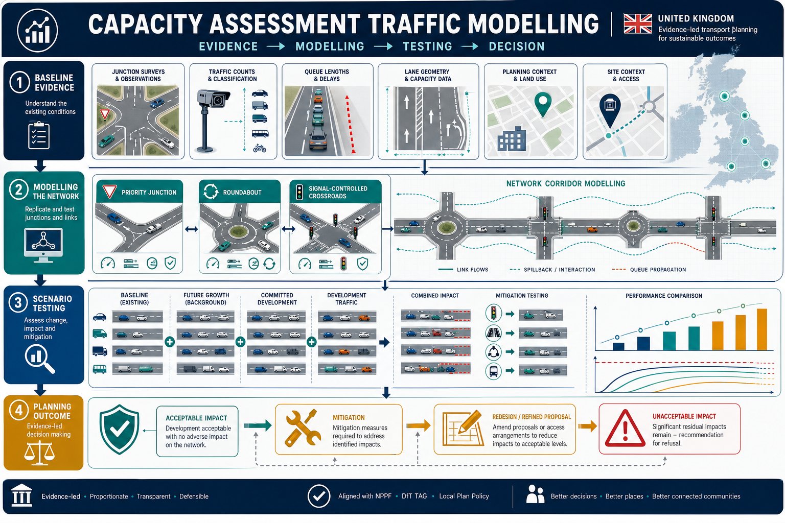
    What Planning Application Transport Evidence Means

    UK planning transport evidence infographic showing key topics, proportionality, and decision process.

    Planning application transport evidence is the transport-related material submitted with an application to explain the likely effects of a development on movement and the wider highway network. That sounds straightforward, but in practice it covers a fairly wide range of issues: vehicle trips, access design, servicing, parking provision, visibility, road safety, walking and cycling links, bus accessibility, and the overall suitability of the site in transport terms.

    The key point is that it is not just “traffic data”. It is evidence used to support planning judgement. A local planning authority is asking: will this development work here, safely and acceptably, and if not, what needs to change? The answer may sit in a detailed transport assessment for larger schemes, or in a shorter statement for lower-impact proposals. Either way, the role is the same: give decision-makers enough confidence to validate, consult on, and determine the application.

    In UK planning practice, proportionality matters. A ten-dwelling scheme on a constrained access road does not need the same level of analysis as a logistics unit, roadside drive-thru, school expansion, or strategic housing site. But even smaller proposals can trigger transport questions if they alter access, intensify use, or sit in sensitive locations.

    We generally advise clients to think of transport evidence as part technical document, part risk-management tool. Done well, it anticipates objections before they harden into refusal reasons.

    Why Transport Evidence Matters To Validation And Decision-Making

    UK planning transport evidence infographic showing validation, decision-making, delays, and appeal stages.
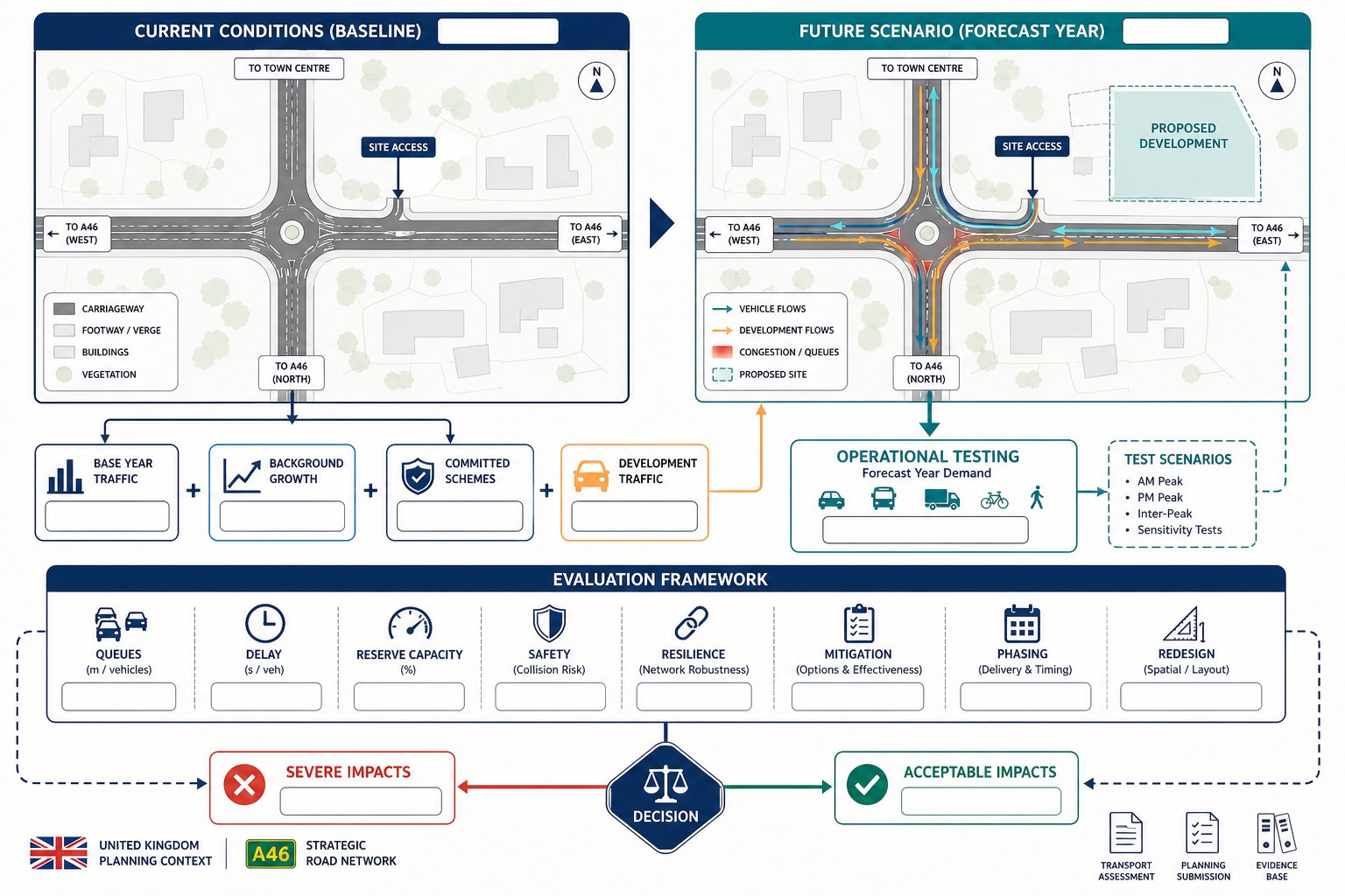
    Transport evidence matters at two distinct stages: validation and determination. At validation, the authority checks whether the application includes the documents required by its local list and by the specific characteristics of the site and proposal. If transport evidence is expected and missing, the application may not be registered at all. That alone can throw a programme off course.

    Once validated, the same evidence becomes central to decision-making. Planning officers, highways officers, and sometimes committee members rely on it to judge whether impacts are acceptable, whether residual cumulative impacts would be severe, and whether mitigation can make the scheme policy-compliant. Weak evidence tends to create the same pattern: requests for clarification, delayed consultations, revised drawings, and fresh modelling late in the process.
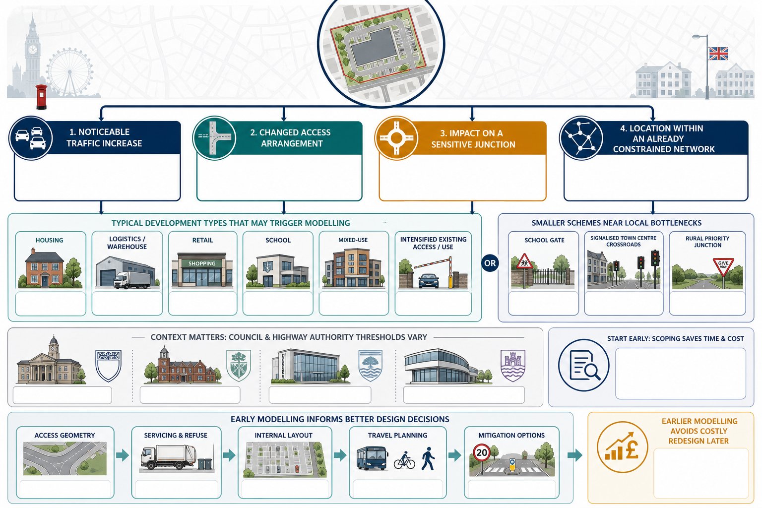
    It also matters at appeal. If a refusal turns on highway safety, parking stress, accessibility, or network impact, the quality of the transport case becomes critical. A thin report rarely improves with age.
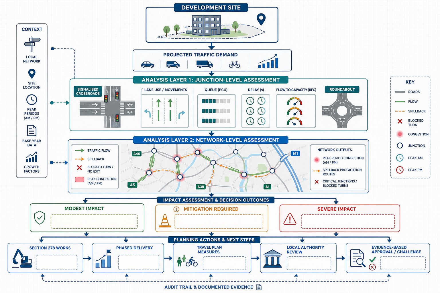
    For that reason, transport work should not be treated as a box-ticking exercise. A credible evidence base can help unlock agreement on scope, frame the narrative of the application, and support negotiations on conditions or obligations. In more complex schemes, an end to end transport approach is often what prevents fragmented advice and conflicting assumptions.

    And, frankly, highway concerns have a habit of becoming the “easy” reason to delay a scheme if the supporting material is vague.

    The Main Types Of Transport Reports Used In Planning

    Comparison of UK planning transport report types and supporting evidence.

    Not every development needs the same report. The right document depends on scale, context, and likely effect. The common categories are outlined below.

    Transport Assessment

    A Transport Assessment is the most detailed of the standard planning transport documents. It is generally prepared where a development is expected to generate significant movement or where the site raises material transport questions that need structured analysis. That may include larger residential schemes, schools, employment sites, mixed-use projects, retail, roadside uses, and sites with complex access or junction issues.

    A full assessment usually covers baseline conditions, relevant policy, trip generation, trip distribution, assignment, junction impact, sustainable travel opportunities, parking, servicing, road safety, and mitigation. It may include survey data, modelling, capacity testing, and appendices such as visibility splays or swept path drawings.

    The objective is not just to present numbers. It is to show that the proposal has been tested properly and that any impacts are understood and manageable. For many major applications, a detailed Development Transport Assessment: can shape the whole planning strategy because access and movement assumptions influence layout, density, and viability.

    Transport Statement

    A Transport Statement is a lighter-touch, proportionate document used where impacts are likely to be limited. It still needs to be evidence-led, but it is usually shorter and more focused than a full assessment.

    Typical uses include smaller residential schemes, changes of use, local extensions, infill development, or proposals where the main issue is simply demonstrating that existing access, parking, and local accessibility are acceptable. A statement may summarise forecast trips rather than undertake extensive modelling, particularly where generation is low and no junction capacity concern is expected.

    That said, “statement” should never mean superficial. We have seen modest schemes delayed because a short report ignored delivery arrangements, disabled parking, or the way vehicles would actually enter and leave the site. Where a proportionate report is suitable, the analysis still needs to answer the authority’s likely questions. Advice from experienced Transport Statement Consultants can be useful when the line between statement and assessment is not obvious.

    Travel Plan, Technical Note, And Supporting Evidence

    Some applications stand or fall on supporting documents rather than the main report title. A Travel Plan, for example, sets out practical measures to reduce car dependency and encourage walking, cycling, public transport, car sharing, and smarter travel behaviour. It is often requested for schools, offices, larger residential schemes, healthcare, student accommodation, and mixed-use developments.

    Technical notes are narrower but often decisive. They may deal with a specific junction, compare parking demand, review collision data, respond to consultee comments, or justify assumptions used in the main report. Supporting evidence can also include speed surveys, vehicle tracking, access drawings, construction routing information, and location-specific accessibility analysis.

    Where transport effects overlap with wider environmental topics, linked work on environmental impact assessment may also be relevant. The strongest submissions are usually the ones where every transport document tells the same story, rather than behaving like separate pieces written in isolation.

    When A Development Is Likely To Need Transport Evidence

    Decision-tree infographic showing UK development triggers for needing transport evidence.

    The short answer is: whenever a proposal could materially affect movement, access, or highway safety. In practice, transport evidence is commonly needed for major development, but that is not the whole picture. Smaller schemes can also trigger the requirement if local roads are constrained, the access is substandard, parking is sensitive, or the use itself generates atypical movements.

    Residential development is an obvious example. A handful of new dwellings on a quiet estate may need only limited analysis, while a scheme of 30, 50, or 100 homes is likely to require a more developed case. Specialist guidance on Residential Development Transport issues often becomes important where parking standards, school-run traffic, or rural accessibility are under scrutiny.

    Other common triggers include:

    • creation or alteration of a vehicular access:
    • development on or near a classified road:
    • uses with concentrated peak-hour demand:
    • proposals involving HGVs, servicing yards, or frequent deliveries:
    • sites in town centres with constrained servicing and limited parking:
    • locations where walking, cycling, or bus access is weak and must be justified:
    • schemes with previous appeal history or known local highway objections.

    The safest assumption is not “is this major?” but “what transport questions will the authority ask?” If the honest answer is more than one or two, some form of structured evidence is probably needed.

    Pre-application discussion can save a lot of guesswork here. So can reviewing local validation lists and highway guidance before design work becomes fixed.

    How Local Planning Authorities Decide What Level Of Evidence Is Required

    Flowchart showing how UK authorities decide transport evidence for planning applications.

    Authorities do not usually choose between no report, a statement, or a full assessment at random. They look at a mix of scale, use, location, sensitivity, and likely impact. National guidance supports a proportionate approach, but each local planning authority and highway authority may also have local thresholds or validation expectations.

    In broad terms, they ask four questions. First, how many trips is the proposal likely to generate, and at what times? Second, will those trips create material effects on nearby junctions, roads, or site access? Third, are there highway safety concerns, including visibility, conflict with pedestrians, or manoeuvring problems? Fourth, does the site offer credible sustainable travel options, or will the scheme depend heavily on private car use?

    The answers shape the level of detail required. A low-trip proposal in a highly accessible area may need only a concise statement. A moderate scheme with a difficult access may need targeted technical work. A major site with network implications will typically require a full assessment, often agreed through scoping.

    This is why early dialogue matters. If scope is not agreed, teams can end up producing the wrong report, too little, and the authority asks for more: too much, and time and budget are wasted. Working with experienced Transport Assessment Consultants: helps because thresholds are only part of the story: local interpretation matters just as much.

    At ML Traffic, that local-authority-led judgement is usually where the real planning value sits: knowing what will satisfy the case officer and highways officer before the formal submission lands.

    What A Strong Transport Evidence Package Should Cover

    A strong package is clear, proportionate, and specific to the site. It should explain the development proposal accurately, describe existing conditions honestly, test impacts using defensible assumptions, and present mitigation in a way that is practical rather than aspirational. Too many reports fail because they are technically competent but disconnected from the drawings, design code, or actual operation of the site.

    At minimum, we would expect a good transport evidence package to address baseline transport conditions, policy context, forecast travel demand, access design, parking and servicing arrangements, active travel links, public transport, and any required mitigation or monitoring. The level of detail changes from scheme to scheme, but the logic should always be easy to follow.

    Importantly, consistency matters. The red line boundary, unit mix, floor areas, access width, parking numbers, and delivery assumptions must align across all submitted documents. If the transport report says one thing and the site plan another, the authority notices.

    For sites with delivery courts, refuse collection constraints, or tight internal geometry, practical design support such as Onsite Delivery Transport input can make the difference between a smooth consultation and a drawn-out request for revisions.

    Below are the core technical themes most authorities expect to see covered properly.

    Trip Generation, Distribution, And Junction Impact

    This is usually the heart of the technical case. The report should explain how many trips the development is expected to generate, what evidence base has been used, and why the assumptions are reasonable. Depending on the proposal, that might involve TRICS-informed forecasting, comparable sites, committed development review, census and travel survey context, or observed local conditions.

    Distribution matters just as much as generation. Even a modest number of trips can become contentious if they are expected to route through a constrained junction, a village centre, or a school frontage. The evidence should hence show where trips are likely to come from and go to, and why.

    Where capacity is in issue, the package should include proportionate junction assessment. That may range from simple priority-junction review to more detailed modelling. But the aim is always the same: demonstrate whether the residual impact is acceptable and whether mitigation is needed.

    The strongest reports also explain uncertainty. Peak spreading, linked trips, pass-by trips, and existing lawful fallback positions can all be relevant, but they need to be argued carefully, not used as convenient optimism.

    Access, Parking, Servicing, And Road Safety

    Many applications run into trouble here because these are the issues people can picture immediately. If a councillor can imagine cars queuing into the road, a refuse vehicle reversing awkwardly, or overspill parking on neighbouring streets, the transport case needs to deal with that head-on.

    A robust package should show that site access is suitable in geometry and visibility terms, that internal circulation works for expected vehicles, and that parking is policy-compliant or justified if there is a departure. That includes disabled spaces, cycle parking, electric vehicle provision where relevant, turning areas, and realistic servicing arrangements.

    Road safety analysis should not be tokenistic. Collision records, local observations, and site-specific risks all matter. If there is a history of recorded incidents, the report should interpret that evidence carefully rather than pretending it does not exist.

    Quite often, these practical points are the reason a lighter report becomes a longer one. A “small” scheme with a poor access can require more technical explanation than a larger site with an excellent frontage.

    Walking, Cycling, Public Transport, And Accessibility

    Transport evidence now needs to do more than prove cars can get in and out. Authorities increasingly expect a clear account of how the development supports sustainable travel and whether day-to-day journeys can be made without over-reliance on the private car.

    That means assessing footway continuity, crossing opportunities, cycle routes, bus stop access, service frequency, rail links where relevant, and the real usability of those options for likely occupants or users. A bus stop within 400 metres on paper is not much help if the walking route is unlit, indirect, or lacks dropped kerbs.

    A good report should connect accessibility analysis to the nature of the development. Office workers, warehouse staff, school pupils, care home visitors, and suburban family households do not all travel in the same way. The resulting measures in a Travel Plan should reflect that reality.

    When this part of the package is done properly, it strengthens the planning balance. It shows not only that impacts are manageable, but that the proposal is aligned with wider policy objectives around mode shift, health, and place quality.

    Common Problems That Delay Planning Applications

    Most transport-related delays are avoidable. They tend to come from the same recurring issues, and nearly all of them start earlier in the process than teams think.

    The first is missing or mis-scoped evidence. A report is commissioned too late, based on an outdated layout, or prepared without checking local validation requirements. The authority then asks for a fuller assessment, a revised Travel Plan, or additional junction work after submission.

    The second is weak technical justification. Trip rates are asserted but not defended. Parking demand is guessed. Servicing is mentioned but not tracked. Sustainable travel is described in generic language with no link to the site. In those cases, consultees naturally push back.

    The third is inconsistency across the application set. Floor areas change, access drawings evolve, unit numbers shift, yet the transport report is not updated to match. That undermines confidence fast.

    A fourth problem is failing to engage with local concerns. If neighbours are likely to worry about rat-running, school gate congestion, rural lane safety, or overspill parking, the evidence should address those topics directly. Silence tends to be read as weakness.

    Finally, there is timing. Surveys, speed data, swept path testing, and authority discussions all take time. When teams try to compress transport work into the final days before submission, quality drops and risk rises.

    The practical lesson is simple enough: agree scope early, align the report with the evolving design, and make sure the evidence answers the real transport questions the site raises. That is how we avoid the kind of delays that feel sudden but, in truth, were building from the start.

    A well-prepared planning application rarely succeeds because of one document alone. But poor transport evidence can derail an otherwise strong scheme remarkably quickly. In 2026, with authorities still under pressure and validation standards closely watched, the safest route is proportionate, site-specific, and early transport input. If the likely issues are understood at concept stage, the right report can be scoped, the right surveys can be commissioned, and the planning narrative can be built around evidence rather than assumption.

    For architects, planners, developers, lawyers, surveyors, and councils, that means treating planning application transport evidence as a strategic part of the submission, not a late attachment. When it is aligned with the drawings, responsive to local thresholds, and clear about mitigation, it gives decision-makers what they need: confidence. And confidence, more than most teams care to admit, is often what moves an application from delay to determination.

    Planning Application Transport Evidence FAQs

    What is planning application transport evidence and why is it important?

    Planning application transport evidence is the transport-related information submitted with a planning application to demonstrate how a development will affect movement, access, safety, parking, servicing, and the wider network. It helps local authorities assess whether the scheme is acceptable and what mitigation may be necessary.

    When is a Transport Assessment required over a Transport Statement in planning applications?

    A Transport Assessment is needed for developments expected to generate significant traffic or raise complex transport issues, such as larger housing schemes or employment sites. Smaller or lower-impact proposals usually require a lighter Transport Statement, but it must still be evidence-led and proportionate.

    How do local planning authorities decide the level of transport evidence needed?

    Authorities consider factors like development size, expected trip generation, location sensitivity, and highway safety concerns. They then decide whether no report, a Transport Statement, or a full Transport Assessment is appropriate, ensuring the evidence matches the site’s transport impact and local thresholds.

    What key topics should a strong planning application transport evidence package cover?

    A robust package should address baseline transport conditions, trip generation and distribution, junction impacts, access design, parking and servicing, road safety, walking, cycling, public transport links, and mitigation measures. Consistency with site plans and clear practical solutions are essential.

    How can poor planning application transport evidence delay a development?

    Delays often arise from missing or mis-scoped reports, weak technical justification, inconsistencies in submitted data, failure to address local concerns, and last-minute surveys or revisions. Early engagement and clear, accurate evidence help avoid validation issues and prolonged consultations.

    What role do Travel Plans play in planning application transport evidence?

    Travel Plans outline strategies to reduce car dependency by encouraging walking, cycling, public transport, and car sharing. They are often required for developments like schools, offices, and large residential sites to support sustainable travel and complement other transport evidence.

  • Robust Transport Planning Advice: How To Strengthen Planning Applications And Reduce Delays In 2026

    Robust Transport Planning Advice: How To Strengthen Planning Applications And Reduce Delays In 2026

    A planning application can be well designed, policy-aware and commercially sensible, yet still run into trouble for one stubborn reason: transport hasn’t been dealt with properly. We see it often. A scheme reaches validation or consultation stage, and suddenly questions appear about access geometry, trip impact, parking stress, servicing, walking links, visibility splays, or whether the wrong report has been submitted altogether.

    That’s why robust transport planning advice matters. In practical UK planning terms, it means proportionate, evidence-led work that shows a development is safe, acceptable on the network, aligned with policy, and realistically deliverable. Not padded reporting. Not over-engineering for the sake of it. Just the right level of transport evidence, prepared early enough to influence the scheme rather than defend mistakes after the fact.

    For architects, planners, developers, surveyors, solicitors, builders and local authorities, the real value is risk reduction. Strong transport input can support validation, narrow highways concerns, improve negotiation with officers, and avoid late redesign that burns time and budget. It also helps create a planning narrative that stands up when a proposal is scrutinised.

    In this guide, we set out what robust transport planning advice looks like in 2026, when transport input is usually required, which reports do the heavy lifting, and how to build a defensible case that reduces delay rather than inviting it.

    What Robust Transport Planning Advice Means In The Planning Process

    UK transport planning infographic showing access, network impact, sustainable travel, and mitigation.

    Robust transport planning advice is not simply a report attached to an application because a validation list says so. It is the disciplined process of testing whether a proposal works in movement terms and then presenting that case in a form decision-makers can rely on. In UK planning practice, that usually means combining local and national policy, site-specific evidence, highways review, and realistic mitigation into one coherent position.

    At its best, transport advice helps answer four planning questions. Is the site safely accessible? Will the development create material harm on the surrounding network? Does it support sustainable travel in a credible way? And can any residual effects be managed through design, conditions, or proportionate mitigation?

    That is why robust advice sits inside the planning balance rather than outside it. Officers, members and appeal inspectors are rarely persuaded by vague assurances. They want defensible numbers, clear drawings, and a straightforward explanation of why the proposal is acceptable. Good transport work does exactly that.

    In practice, the strongest applications treat transport as part of the development strategy from the start. That is the difference between a document produced to fill a gap and a genuine piece of robust transport planning advice that supports the whole scheme.

    When A Development Needs Transport Input

    Decision infographic showing when a development needs transport planning input in the UK.

    Most non-householder development needs some degree of transport input, even where the transport effects appear modest at first glance. The key test is usually whether the proposal could materially alter access, parking, trip generation, servicing, road safety, or sustainable travel patterns around the site.

    For smaller schemes, that may only require a concise review confirming that existing access works, parking is policy-compliant, and traffic effects are limited. For larger or more complex proposals, the expected evidence increases quickly. Residential development, commercial space, schools, roadside uses, logistics premises, mixed-use schemes and town-centre sites often trigger more detailed analysis because their travel characteristics can be sensitive to peak-hour network conditions.

    We also need to look beyond scale alone. A relatively small proposal on a constrained rural road, near a busy junction, or in an area with local parking stress can attract transport scrutiny out of all proportion to its floorspace. Equally, a city-centre development with excellent active travel and bus access may justify a more proportionate evidence base than a car-dependent edge-of-settlement site.

    This is where early scoping helps. A short review against local thresholds, site conditions and planning policy usually reveals whether the right route is a Transport Statement, a full assessment, or targeted technical notes supported by Transport Assessment Consultants: focused on planning risk rather than paperwork.

    Typical Triggers From Local Authority Validation Requirements

    UK transport planning triggers infographic showing thresholds, site context, access, and policy issues.

    Validation requirements vary by authority, but the recurring triggers are familiar. Housing numbers and commercial floorspace thresholds are the obvious starting point. So are proposals involving a new access, a materially altered access, changes to parking provision, or uses with sharp peak-hour demand such as schools, drive-throughs, food retail, healthcare, and distribution.

    Authorities also pay close attention to context. Sites on classified roads, within Air Quality Management Areas, near congested junctions, close to schools, or in locations with known collision history may need transport evidence even where a scheme sits below generic thresholds. Some councils are explicit about this in local validation checklists: others rely on judgement during validation or consultation. Either way, assuming that a small scheme will avoid transport scrutiny is a gamble.

    Another trigger is a mismatch between the proposal and the local policy framework. If parking is below standards, if cycle provision is limited, if refuse or delivery vehicles appear awkward to accommodate, or if walking links to nearby services are weak, transport questions arrive quickly.

    A useful discipline is to test the proposal against local validation guidance before design is fixed. That kind of end to end transport thinking can prevent a frustrating cycle of validation delays, consultee objections and drawing revisions.

    How Early Transport Advice Reduces Planning Risk

    Infographic showing how early transport advice reduces planning risk in development.

    The earlier transport advice enters the project, the more valuable it becomes. Once a layout is fixed and an application deadline is looming, transport work often turns defensive. We are no longer shaping the proposal: we are trying to explain away weaknesses that could have been designed out in week one.

    Early input reduces planning risk in several ways. First, it tests site access options before teams become attached to a poor arrangement. Second, it helps calibrate parking, servicing and internal circulation to the likely expectations of the local highway authority. Third, it identifies whether the proposed scale of development is realistic against junction capacity, visibility constraints, sustainable connectivity and local policy. Those are big issues. Catching them late is expensive.

    It also sharpens strategy. If a development is likely to be judged on walkability, public transport access or mode shift, we can gather evidence early and make design choices that support that case. If highway capacity is sensitive, we can agree survey scope, modelling assumptions and mitigation principles before positions harden.

    For development teams, this usually means fewer surprises and better coordination between disciplines. It is one reason clients increasingly favour Private Sector Transport Planning that is embedded at concept stage rather than commissioned as a late validation exercise.

    Core Reports That Support A Planning Application

    Infographic showing core transport reports and supporting planning evidence in the UK.

    Transport evidence should match the likely effect of the development. That sounds obvious, but plenty of applications still fail because the report package is either too thin to answer basic concerns or so overblown that it obscures the real issues.

    The core suite usually starts with a Transport Statement or Transport Assessment, sometimes accompanied by a Travel Plan. Depending on the site, that may be supported by access drawings, visibility plans, swept-path analysis, parking accumulation evidence, servicing strategy, road safety review, and junction modelling. On more constrained schemes, we may also need delivery management measures, construction access commentary, public transport assessment, or active travel audit work.

    The point is not to throw every technical appendix at an application. It is to provide enough reliable evidence for officers and highway consultees to conclude that the scheme is acceptable, and to understand any mitigation required.

    Clear report structure matters too. A well-prepared application shows how the transport evidence relates to the plans, the design and access statement, and the planning case. Where those threads line up, consultees tend to spend less time trying to work out what the development is actually proposing. That alone can save weeks.

    Transport Statements, Transport Assessments, And Travel Plans

    These are the documents most planning teams talk about first, and with good reason. They are the standard framework used across the UK to explain transport effects.

    A Transport Statement is generally suited to lower-impact development. It describes the site, existing conditions, access arrangements, parking, sustainable travel opportunities and expected trip effects in a concise format. It still needs evidence, but the emphasis is proportionate explanation rather than extensive modelling.

    A Transport Assessment is the heavier-duty document for schemes with material transport implications. It usually covers baseline conditions, trip generation, trip distribution, assignment, junction capacity, road safety, accessibility, servicing, parking, and mitigation in much greater depth. If a proposal is likely to prompt serious scrutiny from the highway authority, the TA is often where the argument is won or lost.

    A Travel Plan focuses on behaviour and management. It sets out measures to reduce reliance on the private car and increase walking, cycling, car sharing and public transport use. For many employment, education and larger residential schemes, it is a practical part of the planning package rather than a box-ticking appendix.

    Teams needing a sharper read on scope often benefit from comparing the demands of a formal TA with a narrower transport assessment for schemes where impacts are present but still manageable through proportionate evidence.

    Junction Reviews, Access Appraisals, And Parking Evidence

    This is the material that often decides whether a consultee is comfortable with the proposal. A planning statement may say the scheme is sustainable: a junction review or access appraisal shows whether that claim survives technical scrutiny.

    Junction reviews test the effect of development traffic on surrounding nodes, usually with observed operation, queue review and, where needed, capacity modelling. The key is realism. Over-optimistic assumptions or opaque distribution patterns are quickly challenged.

    Access appraisals examine the practical safety and functionality of getting in and out of the site. That includes geometry, visibility splays, speed environment, pedestrian crossing routes, cycle access, gradients and interaction with nearby frontages or junctions. On awkward sites, a small design adjustment can make a remarkable difference.

    Parking evidence should do more than count bays. It needs to show that provision is policy-aware and workable for the land use, location and user profile. For many schemes, that means demonstrating how parking demand, disabled provision, cycle parking, electric vehicle charging and servicing arrangements have been considered together.

    Where public transport or active travel is central to the strategy, adjoining evidence from Public Transport Strategy or local sustainable movement work can strengthen the overall case, provided it is tied back to the actual site and occupier pattern.

    The Key Evidence Needed To Build A Defensible Case

    A defensible case is one that can withstand normal planning scrutiny without collapsing into assertion. In transport terms, that usually rests on five pillars.

    First, credible trip generation. The data source must fit the proposed land use, location and likely mode share. Weak comparator selection is a common point of attack.

    Second, transparent trip distribution and assignment. Officers and highway authorities need to understand where traffic is expected to travel and why. If the logic is unclear, confidence falls quickly.

    Third, capacity and operational analysis where material impacts are possible. This does not always mean complex modelling, but it does mean using the right tool for the right issue and explaining assumptions clearly.

    Fourth, road safety and access evidence. Collision records, visibility, turning paths, pedestrian movement and servicing all matter because safety concerns remain among the fastest ways for objections to gain traction.

    Fifth, policy compliance and sustainable access. A strong application shows not only that impacts are acceptable, but that the site provides genuine opportunities for walking, cycling and public transport use, or that mitigation can improve them.

    In our experience, the strongest submissions combine those elements with clear drawings and concise reporting. Increasingly, teams also pair conventional analysis with Sustainable Transport Consultants input where mode shift and future-proofing are central to the planning narrative.

    Common Reasons Transport Objections Arise

    Transport objections rarely appear out of nowhere. Most can be traced to a predictable gap in evidence, design or strategy.

    One common problem is using the wrong level of assessment. If a scheme with genuine peak-hour implications is supported by a lightweight statement, consultees often conclude that impacts have been understated. The opposite can also create trouble: an overcomplicated report full of unnecessary technical material can distract from the actual planning issues and invite challenge on minor points.

    Another frequent cause is inconsistency. Drawings, parking schedules, swept paths, red-line boundaries and report assumptions must align. If they do not, the authority may question the reliability of the whole package.

    Timing is another issue. Late transport input tends to preserve flawed layouts rather than improve them. By then, the design team may be defending a suboptimal access point, awkward servicing route or unsupported parking ratio simply because the programme has moved on.

    And then there is presentation. Dense, jargon-heavy reports can make a reasonable scheme look uncertain. Clear evidence, explained plainly, is usually far more persuasive.

    For many developer-led schemes, that is why Private Sector Transport advice works best when it is integrated with planning and design decisions rather than left to tidy up at the end.

    Highways Safety, Capacity, Sustainability, And Servicing Issues

    If we strip transport objections down to their essentials, four themes recur.

    Highways safety concerns usually relate to access visibility, vehicle conflict, unsuitable geometry, pedestrian risk, or a poor response to the surrounding speed environment. Even where traffic growth is modest, authorities may resist a proposal if the site access feels awkward or unsafe.

    Capacity objections focus on whether development traffic would cause severe impact at nearby junctions or worsen existing congestion in a material way. This is where realistic baseline review and proportionate modelling matter. A bad forecast can haunt an application.

    Sustainability concerns arise where the location or design appears overly car-dependent. Weak walking links, poor cycle parking, limited bus access, or the absence of practical mode-shift measures can undermine a scheme even if highway capacity is technically manageable.

    Servicing is often underestimated. Refuse collection, deliveries, emergency access and larger vehicle manoeuvring all need to work cleanly. If a servicing plan relies on heroic assumptions, consultees notice.

    The good news is that these issues are usually identifiable early. Once recognised, they can often be addressed through layout changes, revised management measures, or targeted evidence rather than wholesale redesign.

    How To Align Transport Advice With Design Teams And Planning Strategy

    Transport planning works best as a live conversation, not a final-stage commission. Architects, planners, highways specialists, landscape teams and clients are often solving the same problem from different angles: how to make the scheme both attractive and approvable. If transport advice is isolated, conflicts emerge quickly.

    We find alignment usually depends on three habits. First, agree the transport strategy early: access principles, likely report scope, parking philosophy, servicing approach and sustainability goals. Second, test those principles against evolving layouts rather than waiting for a supposedly final plan. Third, keep the planning narrative consistent across all documents.

    That consistency matters more than many teams realise. If the planning statement argues that a scheme is sustainably located, the transport evidence should demonstrate walkable catchments, bus accessibility and cycle provision. If the design and access statement celebrates placemaking, the transport work should not quietly rely on vehicle movements that compromise it.

    It also helps to define what success looks like with the highway authority. Is the aim to demonstrate negligible impact, acceptable residual impact with mitigation, or policy compliance through a balanced package of measures? Different schemes need different answers.

    Done well, transport input supports design quality instead of limiting it. Done badly, it becomes an expensive argument over problems that could have been coordinated away.

    Choosing Practical, Proportionate Advice For Different Development Types

    Not every site needs a full technical arsenal. The right approach depends on risk, context and likely policy sensitivity.

    For small infill residential schemes, a concise Transport Statement, access review, parking assessment and perhaps a simple swept-path check may be enough. The objective is to demonstrate limited impact and workable site operation without creating unnecessary technical bulk.

    For larger residential development, the emphasis often expands to trip generation, distribution, junction analysis, travel planning, internal street function and sometimes school-run sensitivity. Mixed-tenure or phased schemes may also need a more careful management narrative.

    For commercial and employment sites, servicing, staff travel patterns, parking accumulation and peak-hour traffic interaction are usually central. Warehouse and logistics uses can require particularly careful review of HGV routing and yard operation.

    For town-centre, education, healthcare and mixed-use schemes, sustainable transport, footfall patterns, public transport accessibility and operational timing often carry significant weight alongside traffic impacts.

    The principle is simple: scale the evidence to the real planning issues. Too little invites objection. Too much can waste budget and muddy the message. Proportionate scoping, grounded in local thresholds and site realities, is what turns transport advice from a compliance exercise into a practical tool for securing permission.

    Conclusion

    Robust transport planning advice is really about judgement. The best work is proportionate, evidence-led and closely tied to the design and planning strategy behind the application. It anticipates the questions a highway authority will ask, answers them clearly, and avoids dressing uncertainty up as certainty.

    In 2026, that matters more than ever. Validation requirements remain detailed, highway authorities are under pressure, and development teams cannot afford preventable redesign or avoidable refusals. Whether a project needs a concise Transport Statement or a fuller package of assessment, travel planning, access and parking evidence, the aim is the same: build a credible transport case early enough to influence outcomes.

    For architects, planners, developers, solicitors and councils, the practical takeaway is straightforward. Treat transport as a core planning discipline from the outset. When the evidence is aligned with policy, design and delivery, applications tend to move more smoothly, objections narrow, and decisions become easier to justify.

    Frequently Asked Questions About Robust Transport Planning Advice

    What does robust transport planning advice involve in the UK planning process?

    Robust transport planning advice involves proportionate, evidence-led analysis demonstrating a development is safe, policy-compliant, and deliverable. It supports decision-makers by addressing access, movement, safety, and sustainability within the planning balance, ensuring clear and defensible transport evidence early on.

    When is transport input typically required for a development project?

    Transport input is generally required for most non-householder developments and larger householder schemes where changes in trip generation, parking, access, or safety could materially affect local conditions. Smaller schemes still need review if they alter access or parking or affect sensitive sites.

    How can early transport advice reduce planning risks for developers?

    Early transport advice helps shape access, parking, and trip strategies from concept stage, avoiding costly redesign and supporting viability against local policy and network constraints. It allows for clear alignment with highway authorities, reducing surprises, objections, and delays.

    What are the core reports used to support a planning application?

    Core reports include a Transport Statement (TS) for lower-impact schemes, a Transport Assessment (TA) for larger developments with material impacts, and a Travel Plan to manage travel behaviour. These may be complemented by access appraisals, swept-path analysis, and parking and servicing strategies.

    Why do transport objections commonly arise in planning applications?

    Objections often stem from insufficient or inconsistent evidence, safety concerns such as poor access visibility, severe traffic capacity impacts, inadequate parking or servicing provisions, and lack of sustainable travel options. Timing and clarity of reporting also influence objections.

    How should transport planning advice be coordinated with design teams and planning strategies?

    Transport planners should work collaboratively with architects and planners from the start, agreeing on access, parking, servicing, and sustainability goals. Iterative testing of transport principles against evolving designs ensures a consistent planning narrative aligning transport evidence with policy and strategy.

  • Capacity Assessment Traffic Modelling: A Practical Guide For Planning Applications In 2026

    Capacity Assessment Traffic Modelling: A Practical Guide For Planning Applications In 2026

    Planning applications rarely fail on traffic grounds because someone forgot a buzzword. They fail because the evidence is thin, the assumptions don’t stand up, or the local highway authority simply isn’t persuaded that the network can cope. That is where capacity assessment traffic modelling matters.

    In practical terms, it gives us a structured way to test whether a proposed development will overload a junction, worsen queuing, or create knock-on operational problems elsewhere on the network. For architects, planners, developers, solicitors, surveyors and council officers, that evidence often sits at the heart of a transport assessment and can heavily influence whether an application moves smoothly or gets pushed into revision, mitigation, or refusal.

    In 2026, expectations are sharper than ever. Local authorities want robust survey data, transparent growth assumptions, realistic future-year forecasts and modelling that reflects how roads actually operate, not just how a spreadsheet says they should. And when the right level of analysis is done early, it can save months of redesign and negotiation later.

    In this guide, we set out what capacity assessment traffic modelling means in the UK planning process, when it is usually required, the methods commonly used, the data that matters most, and the issues that tend to attract challenge from reviewing authorities.

    What Capacity Assessment Traffic Modelling Means In The Planning Process

    Infographic comparing baseline and development traffic capacity at a UK junction.

    Capacity assessment traffic modelling is the process of testing whether an existing highway asset, typically a junction, road link, access arrangement or local network, can accommodate current and forecast traffic demand safely and efficiently. Within planning, its role is not abstract. It is there to answer a straightforward question: will the development create a severe or unacceptable transport effect?

    Usually, we are examining the difference between a baseline scenario and one or more development scenarios. That means comparing existing traffic conditions with future-year flows that include background growth, committed schemes and the proposed site traffic. The outputs help us understand whether the extra demand materially changes operational performance.

    For planning teams, this matters because policy and decision-making turn on evidence. A transport statement might be enough for smaller proposals, but once traffic effects become more material, more detailed testing is expected. In many cases, that sits alongside a wider transport assessment for an application needs to demonstrate acceptability.

    Good modelling also does something less obvious but equally important: it narrows argument. Instead of vague claims that a junction is “already busy”, we can test likely queue lengths, reserve capacity, delay and operational resilience. That gives applicants, consultants and local authorities a common technical basis for discussing mitigation, phasing or redesign. In our experience, the planning value is not just in producing numbers: it is in producing numbers that are credible, proportionate and specific to the site context.

    When A Capacity Assessment Is Needed For A Development Proposal

    Infographic showing when development proposals need traffic capacity assessment in the UK.

    Not every application needs detailed capacity modelling. But where a proposal is likely to generate a noticeable increase in traffic, alter access arrangements, affect a sensitive junction or sit within an already constrained network, the requirement becomes much more likely.

    As a rule, local planning authorities and highway authorities ask for capacity assessment where they need clear evidence on operational impact. That often includes residential schemes of meaningful scale, employment and logistics sites, retail development, schools, mixed-use masterplans and changes that intensify vehicle movements at an existing access. A smaller scheme can still trigger modelling if it is located near a known bottleneck, a school gate, a signalised town centre junction or a constrained rural priority junction.

    Thresholds vary between authorities, which is why local context matters. Some councils publish guidance on when a transport statement is sufficient and when a full assessment is expected. Others decide case by case. That is one reason early scoping with the authority is useful, particularly where a traffic impact assessment may overlap with broader modelling requirements.

    We should also remember timing. Capacity assessment is most valuable before design has hardened too much. If we wait until the application is nearly fixed, the modelling may simply reveal a problem that could have been designed out earlier. Done at the right stage, it helps shape access geometry, servicing, internal layout, travel planning measures and mitigation strategy before those points become expensive to revisit.

    How Traffic Modelling Supports Transport Assessments And Planning Decisions

    Traffic modelling infographic showing junction capacity, network impacts, and planning decisions.

    Transport assessments are meant to do more than describe a site and list trip rates. They need to show, with evidence, how movement demand is expected to change and whether the surrounding network can accommodate it. Capacity assessment traffic modelling provides the quantitative backbone for that argument.

    At junction level, modelling tells us whether forecast traffic demand approaches or exceeds practical capacity. At network level, it helps us understand whether localised delay spills into wider operational issues, blocking back across adjacent junctions, obstructing turning movements, or creating unstable peak conditions. Those findings directly inform the planning judgement on impact.

    The modelling also helps distinguish between impacts that are theoretically measurable and impacts that are actually material. A development might add traffic, but the crucial question is whether the resulting effect is modest, manageable with mitigation, or severe enough to warrant objection. That is where outputs such as queue length, delay and ratio of flow to capacity become useful.

    For applicants, the benefit is strategic as well as technical. Robust modelling can support discussions around mitigation scope, section 278 works, phasing triggers and travel plan commitments. For local authorities, it offers an auditable basis for accepting or challenging an application. And for multi-disciplinary teams, including architects and planning solicitors, it creates a clearer line of evidence than broad narrative alone.

    That is why detailed work in this area often sits alongside wider Traffic Impact Assessments and development transport reporting. The stronger the modelling logic, the easier it is to defend the planning position.

    The Main Types Of Junction Capacity Assessment Used In The UK

    UK infographic showing junction assessment types for isolated junctions, corridors and networks.

    In the UK, the type of capacity assessment used depends on the form of junction being tested and the nature of the question being asked. We do not use one model for everything because roads do not all fail in the same way.

    For isolated junctions, the analysis is often relatively focused: can this node process the forecast volume of turning movements within an acceptable level of delay and queuing? For more complex corridors or tightly spaced urban networks, the answer may require more than a single-junction model, especially where interaction between signals, crossings and adjacent accesses affects real-world performance.

    The choice of model matters because local authorities will usually expect the method to match the operating characteristics of the highway feature being assessed. A model can be technically sophisticated and still be wrong for the problem if it misses the key mechanism of delay.

    Below are the main categories used in practice.

    Priority Junctions, Roundabouts, And Signal-Controlled Junctions

    comparison infographic of priority, roundabout, and signal junction capacity assessment.

    Priority junctions are commonly assessed using industry-standard methods that estimate capacity based on the geometry of the junction, the major road flow and the turning demands from the minor arm. The typical issue here is whether side-road traffic can find enough acceptable gaps to enter or cross the mainline without excessive delay or queue growth.

    Roundabouts are different because multiple entry arms interact, circulating flow affects available gaps, and lane use can materially change performance. A compact four-arm roundabout on paper may behave very differently once uneven turning patterns are applied. Small geometry assumptions, flare length, entry width, lane discipline, can shift results more than some teams expect.

    Signal-controlled junctions add another layer. Capacity depends on staging, intergreen times, pedestrian phases, lane allocation, saturation flow and coordination with nearby signals. If a crossing is called frequently or a bus priority stage operates, the model needs to reflect it. Otherwise, the forecast can look cleaner than reality.

    This is why selecting the right analyst matters as much as selecting the right software. Experienced Traffic Modelling Consultants: tend to spot where a nominally simple junction is actually being influenced by downstream blockage, atypical peak spreading or site-specific driver behaviour that deserves explicit treatment.

    Link Capacity, Network Effects, And Wider Highway Performance

    Junctions are only part of the story. A development can pass an isolated junction test and still create a highway problem if the links between those nodes are near practical capacity or if queuing on one arm blocks another. That is where link capacity and network analysis come in.

    Link capacity assessment looks at whether a stretch of road can carry forecast flows without unacceptable congestion or instability. On strategic or distributor routes, this can be critical, especially where turning pockets are short, lane drops occur, or frontage activity disrupts flow. The link may be the real constraint, not the junction heads themselves.

    Wider network effects become especially important in urban centres, around retail parks, near schools, and on corridors with several junctions in close proximity. Static junction models can be useful, but they may understate queue spillback, platooning effects and the way delay propagates through a corridor. In those circumstances, a broader movement strategy, sometimes informed by a Masterplan Traffic Strategy: How growth is distributed across phases, can be just as important as the detailed node testing.

    The key point is simple: if the operational issue is network interaction, the assessment method has to capture network interaction. Otherwise, the application can look compliant on paper while leaving obvious concerns unresolved for the reviewing authority.

    Core Data Needed To Build A Robust Capacity Assessment

    Most disagreements over traffic modelling are not really about mathematics. They are about inputs. If the survey data is weak, the geometry is wrong, committed development has been omitted or growth assumptions are unclear, even elegant modelling will not carry much planning weight.

    A robust capacity assessment starts with a defensible evidence base. That usually includes observed turning count surveys, queue surveys where relevant, site access observations, speed data if the access design is sensitive, and a reliable record of junction geometry and lane usage. Then we add development traffic, future-year growth and scenario testing.

    What local authorities want is not perfection: they want traceability. They need to see where the data came from, why the assumptions are reasonable, and whether the test reflects likely operating conditions. If those points are handled well, discussions become more constructive. If they are handled poorly, the review often gets stuck in avoidable technical challenge.

    Survey Data, Development Trip Generation, And Future Year Forecasts

    Survey quality is the foundation. Turning counts should reflect representative conditions, avoid abnormal dates, and cover the peaks that matter for the proposed land use and the surrounding network. In some cases, that means weekday commuter peaks. In others, food retail, leisure, stadia, schools, it may mean a very different survey profile. If the survey day is distorted by roadworks, poor weather, rail strikes or school holidays, the authority may reject the baseline before it even reaches the modelling stage.

    Geometry data matters just as much. The number of lanes, flare lengths, storage space, stop line positions and lane markings all affect performance. A surprisingly common problem is relying on outdated mapping rather than a current site check.

    Trip generation then converts the proposed development into forecast traffic demand. That should be evidence-led, typically using suitable survey databases, local comparators or agreed benchmarks. Arrival and departure profiles need to match the actual use, not a generic average that flatters the result.

    Future-year forecasts combine baseline traffic with growth and development traffic to test operational performance at an assessment year, often opening year and a later design year. For larger schemes, this process may sit within wider Commercial Traffic Engineering work where access, servicing and highway interface all need to align.

    Committed Development, Background Growth, And Sensitivity Testing

    One of the fastest ways to weaken a planning submission is to underplay future demand. Local authorities will usually expect committed development to be included where it is relevant and likely to influence the study network. That means approved schemes, allocations or developments with a realistic prospect of delivery, depending on the authority’s scoping position.

    Background growth is also important, but it needs judgement. Blindly applying a generic factor without considering local network changes can be just as problematic as ignoring growth altogether. Sometimes strategic forecasts are appropriate: sometimes local evidence and known constraints justify a more tailored approach.

    Sensitivity testing is where robust assessments separate themselves from optimistic ones. We should ask what happens if trip rates are slightly higher, if traffic growth outpaces central assumptions, if a key mitigation scheme is delayed, or if a different distribution pattern emerges. The purpose is not to invent worst-case fiction. It is to show that the conclusions are resilient.

    This becomes especially relevant on housing-led schemes, where a residential traffic impact review may need to consider school-run peaks, multi-phase occupation and cumulative development across a settlement edge. Authorities are often reassured when they can see that uncertainty has been tested openly rather than buried in the appendix.

    How Capacity Assessment Traffic Modelling Is Typically Carried Out

    The process usually begins with scoping. We identify the site context, likely trip impacts, the study area, relevant junctions, peak periods and the assessment years. Ideally, that scope is discussed with the local highway authority early, because disagreement about study area or methodology can waste weeks later on.

    Next, we establish the baseline using surveyed traffic flows and verified geometry. We then estimate development trips, distribute and assign them across the network, and combine them with background growth and committed development to build future-year scenarios. Common scenarios include a do-minimum case and a do-something case with mitigation.

    Those flows are then tested using the appropriate junction or network models. At this stage, the work is rarely just mechanical. We sense-check lane allocations, compare outputs with observed conditions, examine whether queues would physically fit within available storage, and check whether one constrained arm could distort neighbouring junction performance.

    If issues emerge, mitigation options are tested. That might include ghost island right-turn lanes, signal optimisation, revised lane marking, access relocation, mini-roundabout conversion, pedestrian crossing amendments, or internal site changes that reduce conflict at the boundary. For larger sites, phasing and trigger points may also be modelled.

    At ML Traffic, that sort of exercise usually sits within a wider package of concise reporting and local-authority-focused evidence, often linked to Traffic Flow Management considerations where network operation matters beyond a single junction.

    Common Outputs, Performance Indicators, And What They Mean

    Capacity modelling produces numbers, but planning teams need interpretation. The most common outputs are ratio of flow to capacity, reserve capacity, delay, queue length and, in some frameworks, level of service or practical operational grade.

    Ratio of flow to capacity tells us how close demand is to the theoretical or practical limit of the junction or movement. Values approaching or exceeding capacity suggest a stressed condition, though the interpretation depends on the model type and local context.

    Delay indicates how long vehicles are expected to wait. High delay can be material even where theoretical capacity has not yet fully failed, especially if the junction serves sensitive turning movements, school access or emergency routes.

    Queue length is often the output that matters most on the ground. A queue that blocks an upstream access, pedestrian crossing, bus stop or adjacent junction can create consequences well beyond the modelled node. That is why average queue alone is not always enough: maximum or percentile queue can matter in review.

    Level of service is a broader descriptor of operational quality. Some authorities find it useful, others focus more directly on delay and queue metrics.

    What matters in planning is not one absolute threshold applied blindly. It is whether the outputs, taken together, indicate a development impact that is acceptable, severe, or manageable through mitigation and design refinement.

    Frequent Issues That Lead To Challenge From Local Authorities

    Most local authority challenges are predictable. They tend to arise where the modelling appears selective, opaque or disconnected from observed reality.

    A common issue is poor baseline data: old traffic counts, surveys undertaken during abnormal conditions, missing queue observations, or geometry that does not match the actual layout. Another is weak forecasting logic, trip rates without justification, unrealistic modal assumptions, or committed development left out because it complicates the result.

    Authorities also push back where modelling isolates one junction even though everyone involved knows the operational issue is corridor-wide. If queues routinely spill back from one node into another, an isolated assessment can look evasive. The same applies where internal site operation, servicing or nearby accesses materially influence the network but have been treated as someone else’s problem.

    Presentation matters too. Reviewers are more likely to challenge work when assumptions are buried, diagrams are unclear, or the narrative does not explain why a result should be accepted as reasonable. Strong technical analysis can still stumble if the reporting is hard to audit.

    This is one reason a joined-up submission helps. Capacity evidence tends to be stronger when it aligns with the broader transport assessment for developments: narrative, access design, mitigation schedule and planning strategy. In practice, authorities are not looking for perfection: they are looking for evidence they can trust.

    Conclusion

    Capacity assessment traffic modelling remains one of the most useful tools we have for testing whether development traffic can be accommodated on the UK highway network. Done properly, it gives planning teams clear evidence on operational effects, helps identify realistic mitigation, and reduces avoidable argument during application review.

    The strongest submissions are rarely the ones with the flashiest software. They are the ones built on sound surveys, transparent assumptions, proportionate methodology and a clear explanation of what the outputs actually mean. That applies whether we are assessing a single priority junction for a small scheme or testing wider network interaction for a phased masterplan.

    For developers, architects, planners and councils alike, the practical lesson is simple: start early, scope properly, and make sure the modelling matches the real transport question being asked. When those basics are right, planning decisions tend to become faster, clearer and more defensible.

    Frequently Asked Questions About Capacity Assessment Traffic Modelling

    What is capacity assessment traffic modelling in the UK planning process?

    Capacity assessment traffic modelling tests whether a junction, road link, or network can accommodate current and future traffic safely and efficiently, helping determine if a proposed development causes unacceptable transport effects.

    When is capacity assessment traffic modelling typically required for a development?

    It is usually needed when a development will significantly increase traffic, affect sensitive junctions, or is near constrained networks, such as large residential schemes, retail sites, or near school gates.

    How does capacity assessment traffic modelling support transport assessments for planning decisions?

    The modelling provides quantitative evidence on capacity, delay, and queue lengths, informing planning authorities whether traffic impacts are manageable or require mitigation in transport assessments.

    What are the main types of junction capacity assessments used in the UK?

    Priority junctions, roundabouts, and signal-controlled junctions are assessed using tailored models that consider geometry, traffic flows, and operational characteristics specific to each junction type.

    What core data is essential for a robust capacity assessment traffic model?

    Robust models rely on accurate turning count surveys, site geometry verification, realistic trip generation estimates, future-year traffic forecasts including committed development, and sensitivity testing for uncertainties.

    Why is addressing network effects important beyond isolated junction modelling?

    Because congestion at one junction can spill back and affect others, a wider network analysis captures these interactions to avoid underestimating delays and operational problems across the corridor or area.

  • Highway And Traffic Engineering Consultants: What They Do And Why They Matter For Planning Success In 2026

    Highway And Traffic Engineering Consultants: What They Do And Why They Matter For Planning Success In 2026

    Planning applications rarely fail because the architecture is weak on paper. More often, they stall because one practical question hasn’t been answered convincingly enough: how will people, vehicles, deliveries, refuse trucks, cyclists and emergency services actually get in, out and around the site safely?

    That is where highway and traffic engineering consultants become central to planning success. We’re not just talking about traffic counts and neat drawings. We’re talking about the technical evidence that shows a proposal can operate in the real world, fit local policy, and avoid creating unacceptable impacts on the surrounding highway network. For architects, planners, surveyors, developers, lawyers and local authorities, that evidence can make the difference between a straightforward approval and months of avoidable back-and-forth.

    In 2026, expectations are only getting sharper. Local validation checklists are more specific, transport policy is more sustainability-led, and highway authorities want robust, proportionate assessments rather than vague assurances. Whether a scheme needs a concise Transport Statement or a full Transport Assessment with modelling, the role of the consultant is to turn a site’s transport constraints into a workable planning strategy.

    Below, we break down what highway and traffic engineering consultants do, when their input is needed, and how to choose the right team for your project.

    What Highway And Traffic Engineering Consultants Do

    Consultants reviewing traffic plans and road access designs in a modern office.

    Highway and traffic engineering consultants assess how development interacts with the transport network, then translate that into evidence, design and strategy that planning officers and highway authorities can actually rely on.

    At the broadest level, the job covers four linked tasks: understanding existing conditions, forecasting likely impacts, designing safe and workable access arrangements, and justifying the proposal against policy and technical standards. That sounds tidy. In practice, it can involve site visits, traffic surveys, collision review, junction modelling, visibility checks, parking analysis, internal layout review and negotiation with the local highway authority.

    We typically start by asking a few simple questions. What kind of trips will the development generate? At what times? Can the local network absorb them? Is the proposed access safe? Will larger vehicles turn properly? Does the layout support walking, cycling and servicing as well as private cars? Those answers shape everything that follows.

    For smaller schemes, the output may be a concise note or statement showing that impacts are limited and acceptable. For larger or more sensitive sites, it may involve detailed modelling, mitigation proposals and a package of drawings. Either way, the aim is the same: to prove that the scheme is not just desirable in planning terms, but deliverable on the ground.

    That overlap between transport evidence and development design is why experienced highway and traffic engineering consultants are usually involved well before submission, not after objections land.

    How Their Work Supports Planning Applications

    Consultants reviewing traffic plans and transport data for a UK planning application.

    Planning is evidence-led, and transport is one of the clearest areas where unsupported assumptions get challenged fast. Highway and traffic engineering consultants support planning applications by providing that evidence in a form local authorities can test.

    A good transport submission does more than say a scheme will be fine. It demonstrates, with data and method, that the development is safe, practical and policy-compliant. That might include traffic survey information, trip generation based on recognised databases, future year traffic growth, queue or capacity analysis, access geometry, visibility splays, parking provision and sustainable travel measures.

    The value here is partly technical and partly strategic. Technically, we show whether a junction operates within acceptable limits, whether a visibility splay can be achieved, or whether a refuse vehicle can turn on site. Strategically, we help frame the planning case so the right amount of information is submitted at the right stage. Too little detail invites objections. Too much irrelevant analysis can waste time and budget.

    This is especially important when schemes sit on constrained urban sites, near busy A-roads, or in areas where councils are sensitive to school-run peaks, town-centre servicing or existing parking stress. In those cases, a robust transport narrative can de-risk the application before it reaches committee.

    Used properly, transport evidence doesn’t sit in isolation. It strengthens layout decisions, supports design revisions and helps the wider consultant team present a coherent proposal. That broader relationship is reflected in practical guidance on Traffic Engineering and Transportation, where transport planning is treated as part of development strategy rather than a late technical add-on.

    Transport Statements, Transport Assessments, And Travel Plans Explained

    Consultants comparing transport statement, transport assessment, and travel plan in a UK office.

    These three documents are often mentioned together, but they do different jobs.

    A Transport Statement (TS) is usually prepared for smaller developments with limited transport impact. It sets out the existing highway context, describes the proposal, reviews access and parking, and explains why the scheme is unlikely to create severe transport effects. It is proportionate by design. The point is not to over-engineer the submission, but to provide enough evidence for a highway authority to be comfortable.

    A Transport Assessment (TA) goes further. It is typically required for larger schemes, sensitive locations, or uses likely to generate meaningful peak-time demand. A TA may include traffic surveys, trip generation and distribution, assignment, future year scenarios, junction modelling, accident analysis, mitigation testing and detailed active travel review. If a TS says “the effects are modest”, a TA shows exactly how and why that conclusion is reached.

    A Travel Plan (TP) is different again. It focuses less on highway capacity and more on behaviour. It sets out measures to encourage walking, cycling, public transport use, car-sharing and sometimes phased monitoring or targets after occupation. Councils often expect Travel Plans for schools, offices, larger residential schemes and mixed-use sites because mode share matters just as much as junction performance.

    The skill lies in choosing the right tool. A proportionate TS can be stronger than an unfocused TA, and a practical Travel Plan often helps address policy concerns around sustainability. For projects where scope is uncertain, early advice from Traffic Engineering Consultants: What can stop teams from either under-submitting or producing far more than the authority will realistically need.

    When A Development Needs Highway And Traffic Input

    UK traffic consultants reviewing development access and transport plans in an office.

    Not every application needs a long technical report, but many more sites need transport input than clients first assume. The trigger is rarely just project size. Often, it is the combination of scale, access arrangement, location and local authority expectation.

    If a scheme proposes a new access onto the public highway, alters an existing junction, increases trip generation materially, or relies on a constrained site layout, highway input is usually sensible from the start. The same applies where parking is tight, servicing is awkward, pedestrian connections are poor, or there is a history of local concern about traffic conditions.

    And timing matters. We often see the most expensive transport problems emerge not because they were technically complex, but because they were left too late. A seemingly minor change in building position can affect visibility: a revised parking court can compromise refuse tracking: an access width that works architecturally may fail on adoptability or emergency access grounds.

    For that reason, bringing transport advice into feasibility and pre-app stages tends to save more than it costs. It can protect site capacity, reduce redesign, and give planning consultants and lawyers a clearer evidential base when negotiating conditions or obligations.

    Typical Triggers From Local Authorities

    Most local authorities set out transport thresholds in validation checklists, supplementary guidance or standing advice. These vary, but the pattern is familiar. Certain numbers of dwellings, floorspace thresholds, parking provision levels or trip-intensive land uses often trigger a TS, TA or Travel Plan.

    Authorities may also ask for transport evidence where a site is on or close to a classified road, near a congested junction, within a town centre, beside a school, or in an area with known road safety issues. Even a relatively modest proposal can attract scrutiny if local circumstances are sensitive.

    Peak timing matters too. Schools, supermarkets, drive-thrus, logistics uses and healthcare sites can raise concerns that go beyond raw daily trip numbers because their demand is concentrated at the busiest times of day. In those cases, transport evidence needs to be precise rather than generic.

    Common Project Types That Require Advice

    Residential development is the obvious category, ranging from small infill schemes to strategic housing sites. But it is far from the only one. Retail parks, foodstores, roadside uses, employment schemes, industrial units, offices, schools, universities, hospitals, leisure venues and stadia all commonly need highway and traffic input.

    Mixed-use sites are often the trickiest because they combine different trip profiles, servicing needs and parking patterns. A residential-led scheme with ground-floor commercial space, for example, may look simple until delivery activity, disabled access, cycle storage and refuse strategy are tested together.

    The same is true for urban brownfield sites. They may benefit from sustainable locations, but constrained frontages, nearby junctions and existing kerbside pressure can make transport justification more involved than on a larger edge-of-settlement plot. In those cases, input from Traffic Flow Management specialists can complement wider planning work where network operation is a key concern.

    Core Services Provided During The Planning Process

    Consultants reviewing UK road access and traffic planning documents in an office.

    The planning process is rarely linear, and transport support usually needs to adapt as a scheme evolves. Good consultants do not just write a report at the end: they provide staged input that helps shape a scheme from first appraisal through to determination and, in some cases, implementation.

    Typical services include pre-purchase constraint reviews, access feasibility testing, pre-application submissions, scoping discussions with highway authorities, traffic surveys, trip forecasting, transport report preparation, junction modelling, parking and servicing review, and support during negotiation of planning conditions or obligations. On schemes in England and Wales, that may also extend to technical input on Section 106 or Section 278 matters where off-site highway works are proposed.

    What matters most is proportionate sequencing. Early on, the key question may be whether a site is developable in principle. Later, the focus may shift to the specific geometry of an access, the wording of a Travel Plan monitoring clause, or whether a mitigation package is sufficiently evidenced.

    At ML Traffic, that practical sequencing is part of the value: concise reporting, fast turnaround, and advice tailored to local authority thresholds can prevent teams from spending weeks pursuing the wrong level of detail. It’s one reason clients often draw on Highway Design Consultants: How when access design and planning evidence need to move together rather than in separate silos.

    Junction Capacity, Access Design, And Visibility Reviews

    This is where transport planning becomes very tangible. We assess whether the proposed access can physically and safely connect to the surrounding network, and whether the nearby junctions can accommodate development traffic without unacceptable delay or risk.

    Capacity analysis is typically carried out using recognised software suitable for the junction type, whether priority, signalised or roundabout control. The purpose is not simply to generate numbers, but to understand how the network behaves in peak conditions and whether mitigation is required.

    Access design then deals with geometry: widths, radii, gradients, tie-ins, pedestrian crossing points and relationships to existing features such as trees, walls, street lighting or bus stops. Visibility reviews sit alongside this, checking whether drivers can see and be seen over the required distances. Many applications run into difficulty here, especially on constrained frontage sites or roads with higher approach speeds.

    A well-evidenced visibility review can resolve objections early. A weak one tends to prolong them.

    Swept Path Analysis, Parking Layouts, And Servicing Strategy

    These services answer a very practical question: can the site work day to day, not just in theory?

    Swept path analysis uses vehicle tracking software to test how cars, refuse vehicles, fire appliances, delivery vans and HGVs move through the layout. It shows whether they can enter, turn, load and exit without overrunning kerbs, conflicting with parked vehicles or relying on unrealistic manoeuvres. On tight urban sites, this can be the difference between a defendable layout and one that falls apart under scrutiny.

    Parking layout review goes beyond counting spaces. We assess bay sizes, aisle widths, disabled provision, EV charging, cycle parking, visitor demand and the relationship between parking and building entrances. Poor parking design creates knock-on problems quickly: blocked aisles, unsafe reversing, inaccessible bays and pressure on surrounding streets.

    Servicing strategy covers deliveries, refuse collection and operational movements. Councils want confidence that these can happen safely and efficiently, particularly where loading may affect pedestrians, neighbours or the public highway. On more technical schemes, support from Traffic Modelling Consultants: can sit alongside swept path and servicing work where internal operation and external network impacts need to be tested together.

    How Consultants Work With Architects, Planners, And Developers

    The best transport outcomes usually come from collaboration, not handovers. Highway and traffic engineering consultants work most effectively when they are part of the design conversation early enough to influence layout, frontage treatment, parking strategy and site operation before plans harden.

    With architects, we often review access geometry, tracking constraints, level relationships, bin collection strategy, active travel links and how parking sits within the overall place-making concept. That can mean nudging a building line, widening a turning head, protecting visibility splays or improving pedestrian priority without undermining design quality.

    With planning consultants and town planners, the focus is slightly different. We help align transport evidence with local policy, validation requirements and likely authority concerns. A scheme may be technically workable but still need a more convincing planning narrative around sustainability, accessibility or town-centre impact. That narrative matters.

    For developers, the priorities are often programme, cost and risk. They need to know whether a site is likely to attract highway objections, what level of reporting is required, whether off-site works are probable, and how transport issues might affect yield or phasing. Honest advice is essential here. Sometimes the right answer is that the current layout is pushing too hard.

    Where projects involve region-specific expectations or local authority nuance, area familiarity can help too. For example, teams working in the West Midlands may value input from highway design consultants who understand how local review standards and officer expectations play out in practice.

    What Makes A Good Highway And Traffic Engineering Consultant

    A good consultant does more than produce technically correct documents. They combine engineering judgement, planning awareness and commercial realism.

    First, they need a strong grasp of the standards and guidance that underpin decisions: DMRB where relevant, Manual for Streets, TSRGD, local parking standards, local validation requirements and authority-specific design preferences. But knowledge of standards alone is not enough. The real skill is understanding when a site-specific departure can be justified and when it cannot.

    Second, experience matters. Consultants who have worked on similar development types tend to spot issues earlier: a school site’s peak accumulation problem, a drive-thru’s stacking risk, a residential courtyard’s servicing pinch point, a logistics site’s gate set-back requirement. Those lessons do not always appear neatly in guidance notes: they come from seeing what highway authorities actually challenge.

    Third, they need to communicate clearly. Planning teams, clients and officers do not want opaque reporting padded with jargon. They want auditable evidence, clear assumptions and conclusions that can survive scrutiny.

    And finally, they should be pragmatic. Development is a balancing exercise between safety, capacity, sustainability, design quality and viability. The strongest consultants know how to defend what is workable, revise what is weak, and keep the process moving. Broader technical literacy across Traffic Engineering: Your field is often a good sign that advice will be grounded rather than narrowly procedural.

    How To Choose The Right Consultant For Your Project

    Start with fit, not just price. A consultant who understands your type of scheme, your authority area and your likely planning pathway will usually save far more time than they cost.

    Look first at relevant project experience. Have they worked on comparable residential, retail, education, employment or mixed-use developments? Can they show examples of Transport Statements, Transport Assessments or Travel Plans that reflect the level of complexity you need? Better still, can they explain how they handled objections, design revisions or mitigation discussions?

    Then test capability. Not every consultant offers the same range of services in-house. If your project may require junction modelling, access design, swept path tracking, Road Safety Audit liaison or Travel Plan monitoring, make sure the team can cover that scope competently and on programme.

    Communication style matters more than many clients expect. You want concise reporting, prompt responses, and advice that is direct about both opportunity and risk. If the early conversation is vague, the report often will be too.

    Professional standing is worth checking as well. Chartered status, relevant CIHT or ICE affiliations, and familiarity with local authority process all point in the right direction, though they should support judgement rather than substitute for it.

    Finally, ask how they scope work. Good consultants tailor inputs to local thresholds and project context. They do not default to the largest report possible, and they do not gamble on under-submitting either. That balance is usually the clearest marker of a team that knows what planning success actually looks like.

    Conclusion

    Highway and traffic engineering consultants sit at the point where design ambition meets operational reality. They test whether a development can be accessed safely, serviced properly, accommodated on the surrounding network and supported in policy terms. In planning, that is rarely a side issue.

    For architects, planners, developers, surveyors, lawyers and local councils, the practical value is straightforward: robust transport input reduces uncertainty. It helps teams identify constraints early, shape better layouts, answer highway authority concerns with evidence, and avoid preventable delays.

    In 2026, that role is only becoming more important. Expectations around safety, sustainability, active travel and proportionate evidence are rising, while planning timetables remain tight. The right consultant does not just produce a report: they help make the scheme more deliverable.

    And that, eventually, is why transport advice matters so much. A well-prepared planning application is not simply persuasive on paper. It works when the drawings, the evidence and the real-world operation all line up.

    Frequently Asked Questions about Highway and Traffic Engineering Consultants

    What is the role of highway and traffic engineering consultants in planning applications?

    Highway and traffic engineering consultants provide technical evidence to show a development can be accessed and operated safely and efficiently, supporting planning applications by aligning proposals with local transport policy and technical standards.

    When is it necessary to involve highway and traffic engineering consultants in a development project?

    Consultants are typically needed when a project creates new or altered highway access, materially increases trip generation, involves constrained site layouts, or lies near sensitive locations such as busy junctions or accident-prone areas.

    What are the differences between a Transport Statement, Transport Assessment, and Travel Plan?

    A Transport Statement summarises transport impacts for smaller schemes, a Transport Assessment provides a detailed analysis including modelling for larger or sensitive sites, and a Travel Plan focuses on encouraging sustainable travel behaviours with measures and monitoring.

    How do highway and traffic engineering consultants collaborate with architects and planners?

    They work early with architects to influence site layout and access design, and coordinate with planning consultants to ensure transport evidence aligns with policy and authority expectations, helping produce coherent, deliverable proposals.

    What services do highway and traffic engineering consultants provide during the planning process?

    Services include pre-application advice, transport surveys, trip forecasting, junction modelling, access design, parking and servicing reviews, report preparation, and support for planning conditions and legal agreements like Section 106 or 278.

    How can I choose the right highway and traffic engineering consultant for my project?

    Choose a consultant with experience in your project type and local area, verified capabilities in required services such as modelling and access design, clear communication, relevant professional qualifications, and a balanced approach to scoping work proportionate to planning requirements.