Author: adminmltuk

  • What is a Transport Planner? A Guide for Developers

    What is a Transport Planner? A Guide for Developers

    What if the difference between your project breaking ground and getting stuck in a multi-month regulatory deadlock was a single technical report? You already know that securing planning permission is becoming more expensive and complex, particularly following the 3.8% increase in planning application fees across England on April 1, 2026. It’s common to feel the pressure when local councils suddenly demand intricate data or when you’re forced to navigate the confusion between consumer journey apps and a professional transport planner who understands the law.

    You deserve a clear path to approval without the friction of unexpected technical hurdles. This guide shows you how a transport planner acts as a strategic risk-mitigator to secure your approvals and protect your bottom line. We will examine how specialized services like Swept Path Analysis and Transport Statements ensure your site access is safe and compliant with the latest 2026 standards. By the end of this guide, you’ll understand how to leverage technical expertise to avoid costly design revisions and keep your project moving forward at pace.

    Key Takeaways

    • Identify the specific role of a professional transport planner in translating complex regulatory requirements into technical reports that secure planning approval.
    • Differentiate between Transport Statements and comprehensive Transport Assessments to ensure your application meets the exact evidentiary standards of the local authority.
    • Utilize digital tools like Swept Path Analysis to provide definitive proof of safe site access and avoid expensive design revisions late in the project lifecycle.
    • Navigate the technical complexities of Section 278 and Section 106 agreements with precision to mitigate development risks and manage infrastructure impacts.
    • Leverage data-driven Parking Surveys and Traffic Surveys to address council objections regarding local network capacity and site viability.

    Table of Contents

    What is a Transport Planner? (And Why Developers Need One)

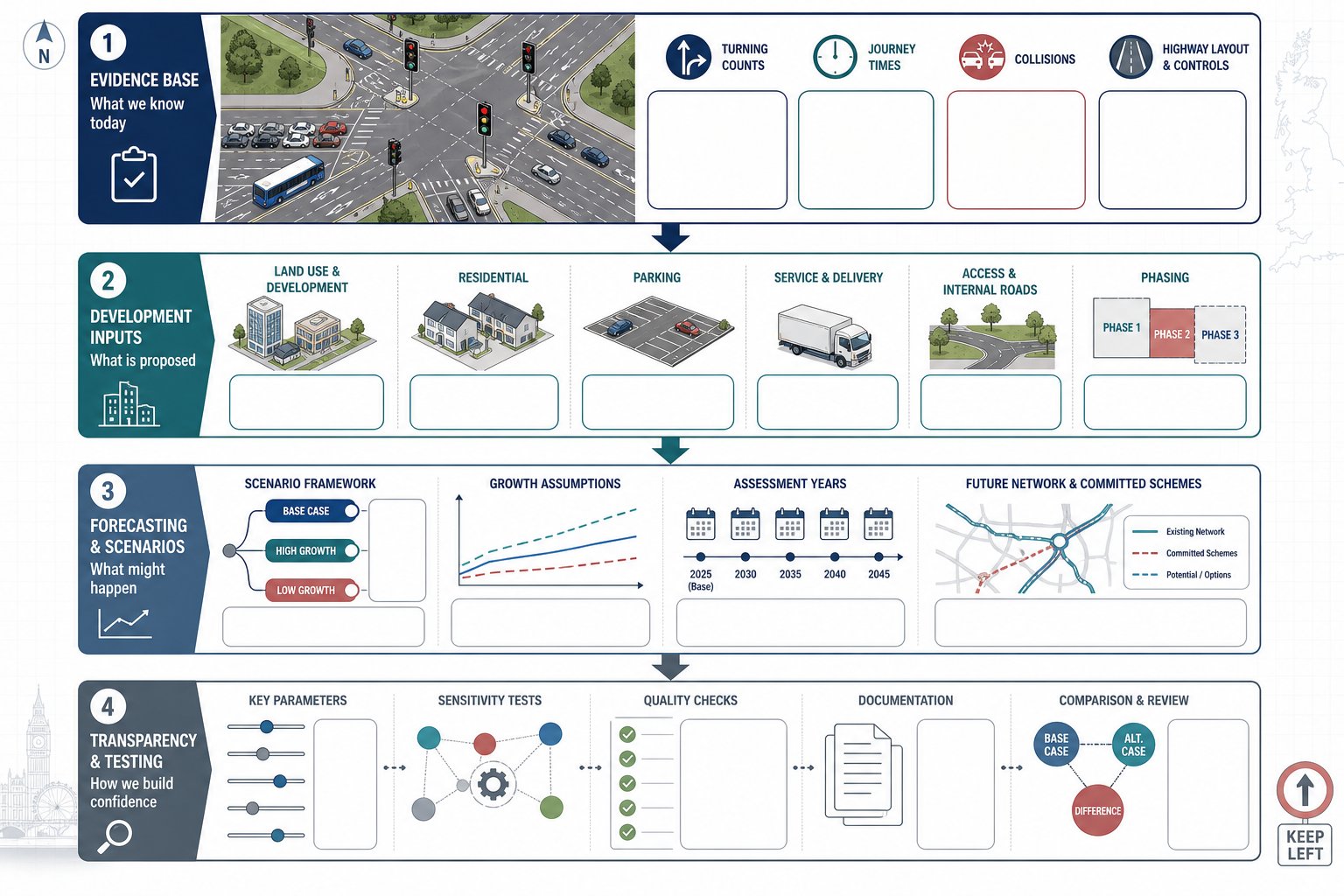
    A transport planner acts as a technical bridge between your architectural vision and the regulatory requirements of the local highway authority. This role isn’t about deciding where a new train line should go. Instead, it focuses on providing the robust technical evidence needed to prove that your specific development won’t negatively impact road safety or local congestion. They assess how a project integrates with the existing network, ensuring that site access is safe and the infrastructure can handle the increased demand.

    To better understand this concept, watch this helpful video:

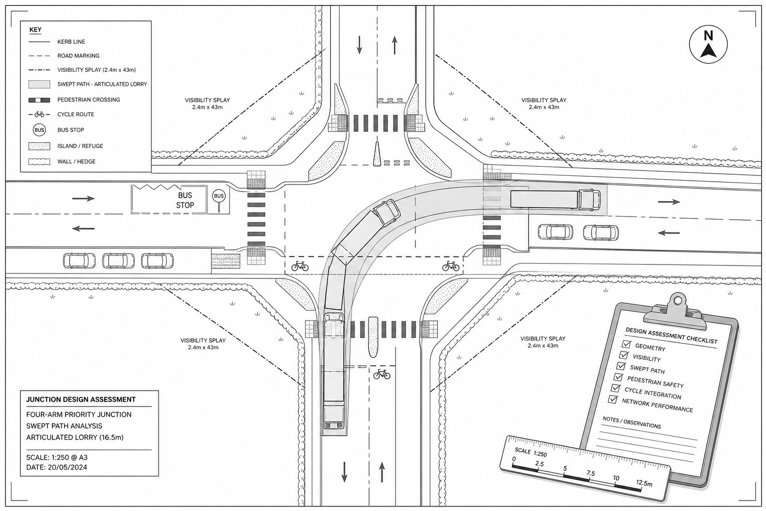
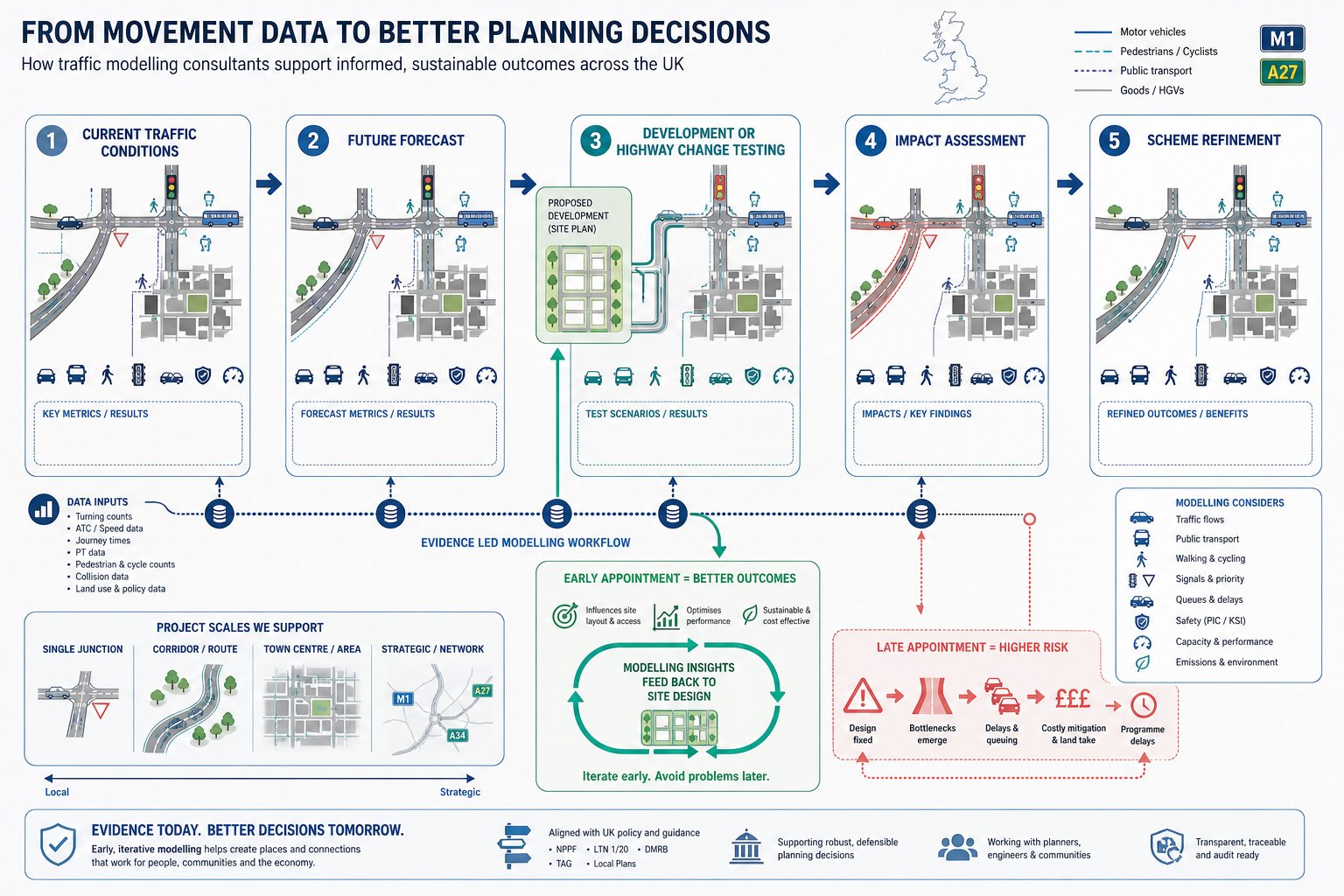
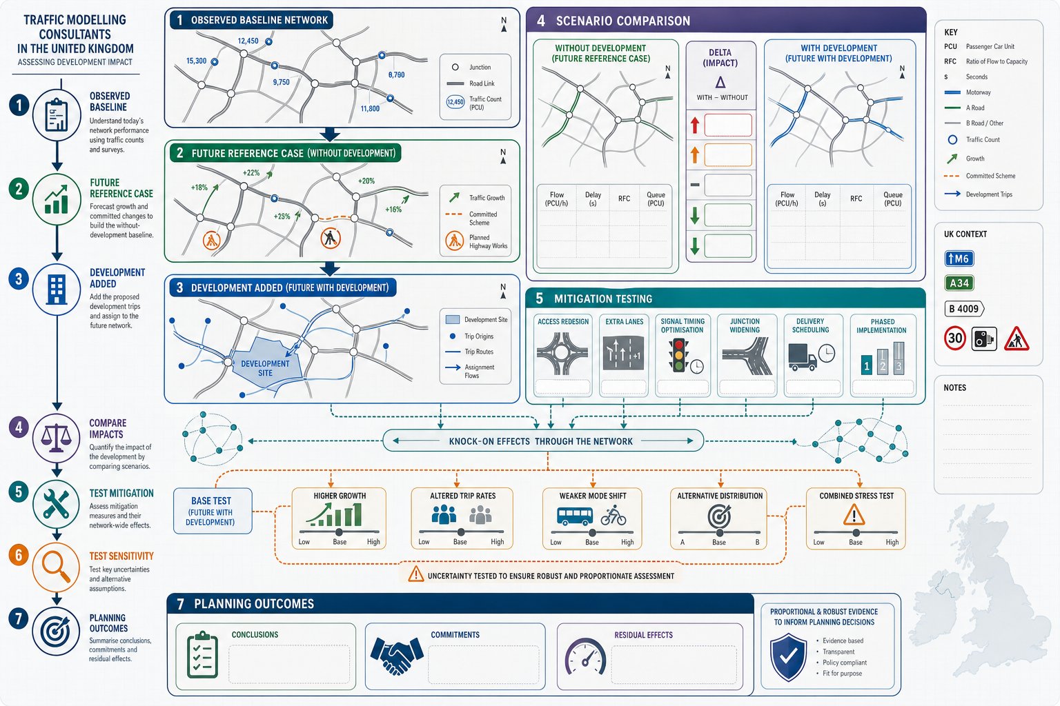
    Professional transportation planning involves a rigorous cycle of data collection, traffic modelling, and the preparation of statutory reports. This work is entirely distinct from consumer-facing tools like TfL’s journey planners. While a journey app helps a commuter find the quickest route, a professional consultant uses specialized CAD software and TRICS data to prove that a refuse vehicle can safely maneuver within your site boundaries. They translate raw data into the technical language that council planning officers require for approval.

    The Role in the Planning Application Process

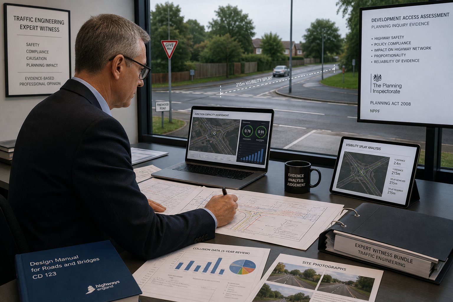
    In the context of a planning application, your transport planner serves as an expert witness. They handle technical scrutiny from council officers and provide the data required by the National Planning Policy Framework (NPPF). This involves liaising directly with Highway Authorities to agree on mitigation measures, ensuring that transport-related queries don’t stall your project. By providing this technical evidence early, you reduce the risk of late-stage objections that could derail your construction timeline or lead to expensive design changes.

    Consultancy vs. Public Sector Planning

    It’s vital to distinguish between public sector planners and private consultants. Public sector planners work for the local authority to set regional transport policy and manage the wider network. Private consultants, however, focus exclusively on the developer’s needs. They help you navigate specific council standards and use independent data to challenge unreasonable or outdated demands from local authorities. A transport planning consultant is a strategic partner who ensures your development remains viable, safe, and fully compliant with current legislation.

    Key Deliverables: Transport Statements and Assessments

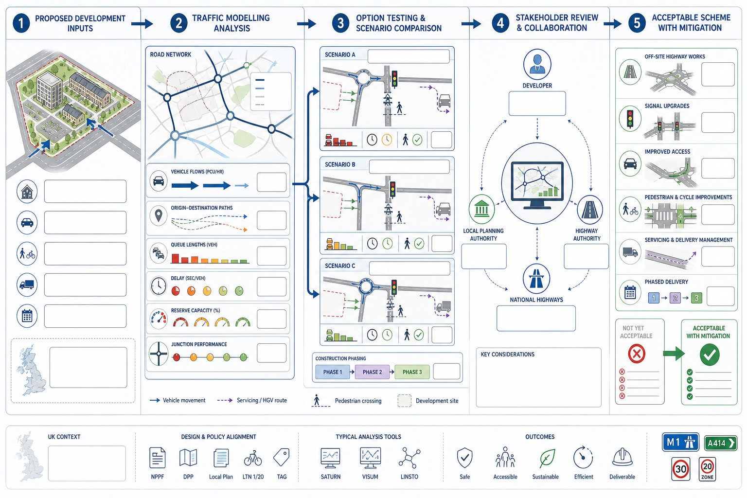
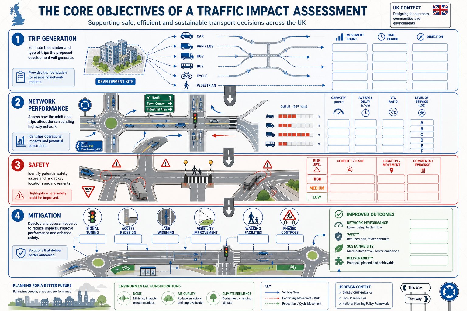
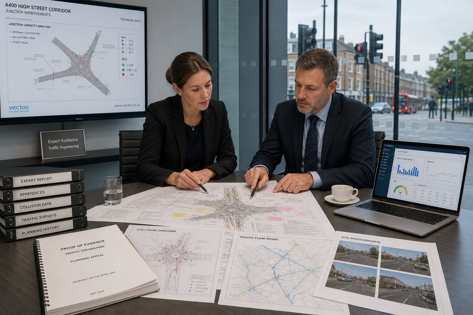
    A transport planner produces the specific technical documentation required for every stage of a planning application. The scale of your development determines the depth of reporting needed. Smaller projects with limited traffic implications typically require a Transport Statement. Larger developments that could significantly impact the local network necessitate a full Transport Assessment. Both types of documents rely on the TRICS database. This national system allows consultants to predict trip generation by comparing your project to similar land uses across the UK. By using this data, your consultant provides a realistic forecast of the volume of vehicles, cyclists, and pedestrians your site will attract.

    Choosing the Right Report for Your Project

    Selecting the correct report depends on specific thresholds set by individual local authorities. While official government guidance provides a general framework, councils often apply stricter requirements in dense urban environments. For residential developments, a Transport Statement is often the standard for 10 to 49 units, but these figures can change based on local policy. Engaging a professional early for a scoping study can prevent you from over-investing in a full assessment when a simpler statement would suffice. You can review our resources to understand how these technical requirements apply to your specific project type.

    Sustainable Travel and Travel Plans

    Modern planning success in 2026 relies heavily on sustainable transport strategies. A Travel Plan is no longer an optional extra; it is a vital tool to encourage active travel and reduce reliance on private cars. Since the electric vehicle exemption for the London Congestion Charge ended in late 2025, the focus has shifted toward infrastructure readiness. Your reports must now detail active EV charging points and high-quality cycle parking to meet the 100% provision mandate for new residential spaces. A robust plan can effectively offset concerns about traffic volume by demonstrating a clear commitment to reduced vehicle usage.

    Securing your planning approval requires precision in these technical reports. If you’re unsure which document your project needs, reviewing our technical services can help clarify the requirements for your next submission. A transport planner ensures your data is accurate and compliant from the first draft.

    What is a Transport Planner? A Guide for Developers

    Technical Analysis: Proving Site Viability

    Technical analysis transforms a conceptual design into a viable, functional site. While previous sections focused on the strategic reports required for submission, this stage involves the raw data that proves those reports are accurate. A transport planner utilizes advanced modelling software and on-site observations to ensure every vehicle, from a standard car to a 12-meter refuse truck, can navigate the proposed layout. This precision reduces the risk of the council rejecting a scheme based on perceived safety or access issues. It moves the conversation from abstract policy to physical reality.

    The Power of Swept Path Analysis

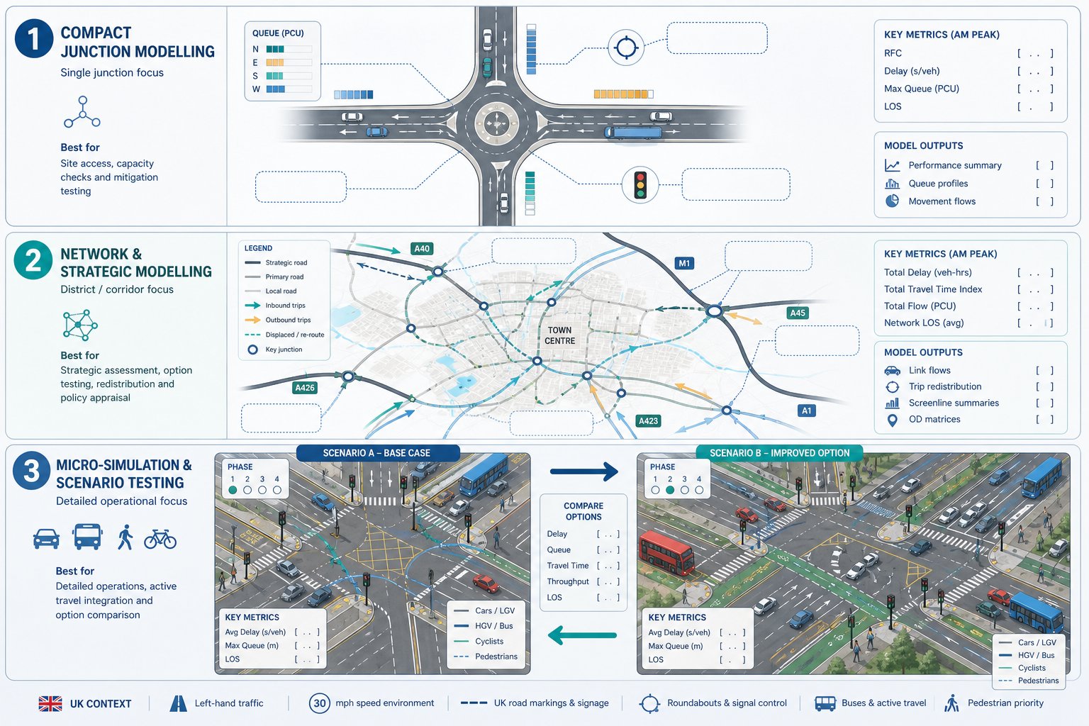
    Swept Path Analysis (SPA) is the cornerstone of modern site design. By simulating the movement of specific vehicles on your digital site plans, we identify potential pinch points before they become physical obstacles. This is particularly critical for emergency services access. If a fire tender cannot reach the furthest point of your development, the scheme will fail its safety assessment. Utilizing professional Swept Path Analysis services provides the definitive evidence needed to satisfy these safety requirements. This proactive approach prevents the need for expensive structural changes or road widening once construction has already begun.

    Parking Surveys and the Lambeth Methodology

    High-density urban developments often face intense scrutiny regarding parking capacity. To justify a specific parking ratio, we conduct comprehensive Parking Surveys. Following the Lambeth Methodology, these overnight surveys establish the exact level of parking stress on surrounding streets. This data is essential when proposing car-free developments in areas with high Public Transport Accessibility Levels (PTAL). It demonstrates that the development won’t cause overspill parking that inconveniences existing residents or compromises road safety. Accurate surveys are the only way to challenge council assumptions about local parking availability.

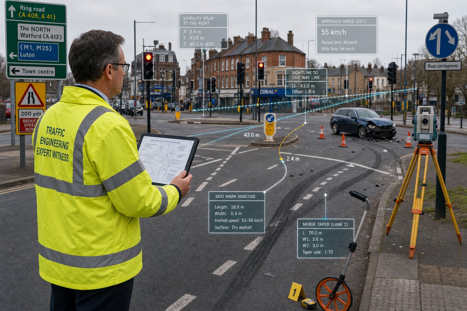
    Establishing the baseline environment also requires real-world Traffic Surveys. We measure vehicle speeds and volumes to determine the precise dimensions of visibility splays at new junctions. A visibility splay is the unobstructed view a driver needs to see oncoming traffic before pulling out. These sightlines must adhere to strict safety standards to prevent collisions. This level of technical rigor is a core responsibility within the Transport planner job profile, ensuring that every project contributes to a safer and more efficient highway network.

    Securing planning approval is only half the battle. Once technical viability is proven through analysis and surveys, a transport planner must navigate the legal frameworks that govern physical changes to the road network. Most developers encounter Section 278 (S278) agreements when their project requires modifications to the existing public highway. These agreements ensure that any changes, such as a new junction or pavement widening, meet the strict safety and construction standards of the local authority. Without this technical oversight, projects risk significant delays or refusal during the later stages of the planning process.

    Section 106 contributions also play a major role in the financial feasibility of a development. These are legally binding obligations used to mitigate the impact of a project on the wider transport infrastructure. A planner acts as your advocate, ensuring that requested contributions are proportionate and directly related to the development’s actual impact. They facilitate direct liaison with National Highways and local authorities to reach a technical consensus that protects your project’s timeline and budget.

    Understanding Highway Design Agreements

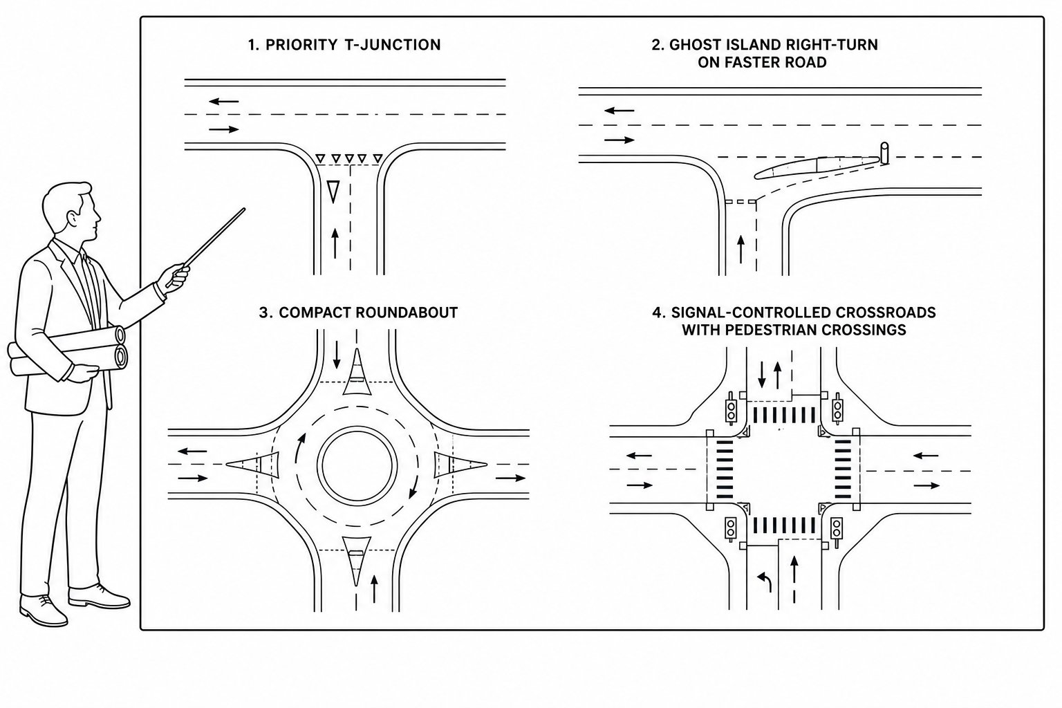
    It’s essential to distinguish between S278 and Section 38 (S38) agreements. While S278 covers works on the existing public highway, S38 relates to the adoption of entirely new roads built within the development site. A planner ensures that the technical design of these roads meets the council’s specific adoption standards from the outset. For a detailed breakdown of these requirements, read our Highway Design S278 & S38 Guide. This early alignment prevents the council from refusing to adopt the roads later, which would leave the developer with long-term maintenance liabilities.

    Pre-application Advice and Negotiation

    Risk mitigation starts long before the formal submission. Engaging a transport planner for pre-application discussions allows for early negotiation with council officers to find a technical middle ground on complex issues like site access or parking ratios. These early meetings provide an opportunity to address potential concerns in a collaborative environment rather than a confrontational one. Early engagement prevents “objection” letters from statutory consultees that can otherwise stall an application for months. This proactive liaison ensures that the final submission is already aligned with the highway authority’s expectations.

    If you’re preparing a new submission and need to navigate these regulatory requirements, view our project types to see how ML Traffic Engineers UK manages these legal agreements for developers.

    Why Choose ML Traffic Engineers UK for Your Transport Planning?

    Choosing the right transport planner is a critical decision for any developer. At ML Traffic Engineers UK, we provide specialized expertise in the English planning system, with a deep understanding of the evolving London-specific requirements. As of May 2026, motor vehicle traffic volumes have reached 105% of pre-COVID levels. This increase makes accurate data more essential than ever for securing approvals. We utilize a data-driven approach, leveraging the latest TRICS data and CAD-based Swept Path Analysis to deliver reports that withstand the highest levels of scrutiny. Our proven track record spans residential, commercial, and mixed-use developments, ensuring that your project benefits from our extensive industry knowledge.

    You gain direct access to senior consultants who prioritize rapid response and professional reassurance. In a high-stakes regulatory environment, precision is a functional necessity. We don’t just provide reports; we act as a reliable partner throughout the entire project lifecycle. Our team understands intricate regional regulations, such as the 2026 mandates for 100% EV charging access in residential developments. We handle these complexities so you don’t have to navigate them alone.

    Comprehensive Project Lifecycle Support

    Our support begins at the initial site feasibility stage and continues through to final planning sign-off. We produce tailored reporting that speaks the technical language of local authority planning officers, reducing the risk of friction during the application process. Whether we are conducting complex Parking Surveys or detailed Traffic Surveys, our focus remains on precision. This commitment ensures public safety and full regulatory compliance, protecting your project from costly delays. We manage the technical lexicon and industry benchmarks so you can focus on the broader architectural vision.

    Get Started with Your Transport Statement

    Initiating your technical assessment is a straightforward process. To provide an accurate quote for your specific development type, we typically require a site location plan and a clear description of the project scale. This information allows us to determine whether a Transport Statement or a more comprehensive Transport Assessment is the most appropriate deliverable. We value your time and understand the fast-moving nature of the infrastructure industry. By providing an all-encompassing, fully-managed service, we ensure your submission is robust from day one.

    Contact ML Traffic Engineers UK for your Transport Planning needs to discuss your next project and secure professional technical support today.

    Secure Your Development’s Future with Technical Precision

    Securing planning approval requires more than just a vision; it demands technical accuracy and a deep understanding of highway regulations. By integrating robust data from the outset, you protect your project from the high-stakes risks of regulatory delays and late-stage design changes. A professional transport planner acts as your primary advocate, translating complex traffic modelling and site constraints into the technical reporting that local authorities demand.

    Since our foundation in 2014, ML Traffic Engineers UK has delivered over a decade of planning success for developers navigating London Borough and National Highway requirements. Our comprehensive toolkit, including advanced Swept Path Analysis and TRICS trip generation data, ensures your submission is compliant and safe. We provide the technical authority needed to satisfy strict 2026 standards, from EV charging mandates to active travel targets.

    Don’t let technical transport data requests stall your project’s progress. Secure your planning approval with expert Transport Planning from ML Traffic Engineers UK. Our team is ready to provide the precision and reliability your development needs to move forward with confidence.

    Frequently Asked Questions

    What is the difference between a transport planner and a traffic engineer?

    A transport planner focuses on the strategic assessment, modeling, and reporting required to secure planning permission. They analyze how a development impacts the wider network and ensure compliance with transport policy. A traffic engineer typically handles the detailed design and technical engineering of physical infrastructure, such as junction geometry or traffic signal timings. While their roles overlap, the planner’s work is centered on the impact analysis phase of the project lifecycle.

    When is a Transport Statement required for a planning application in England?

    A Transport Statement is typically required for residential developments consisting of 10 to 49 units. However, local highway authorities in dense urban areas often set lower thresholds based on local network capacity. You should check the specific validation requirements of your local council, as they may demand a statement for smaller projects if the site is in a sensitive location or has complex access requirements.

    How much does a professional transport planner cost?

    Fees for a professional transport planner are determined by the complexity of the project and the specific deliverables required, such as Traffic Surveys or Swept Path Analysis. A comprehensive Transport Assessment involves more extensive modeling and data analysis than a Transport Statement, which impacts the overall project budget. We recommend requesting a tailored quote based on your site’s specific constraints and the local authority’s requirements.

    Can a transport planner help with a refused planning application?

    Yes, a planner is vital when a project is refused on highway or transport grounds. They analyze the council’s reasons for refusal and provide the technical evidence, such as revised Parking Surveys or improved access designs, to address those specific concerns. This evidence is essential for a successful resubmission or to support a formal planning appeal by proving the development is safe and viable.

    What is the TRICS database and why do planners use it?

    TRICS stands for the Trip Rate Information Computer System. It is the national standard database used to predict the number of trips a new development will generate. Planners use this data to provide a realistic forecast of vehicle, pedestrian, and cyclist movements by comparing your project to similar land uses across the UK. This ensures the local network can accommodate the additional demand without compromising safety.

    Do I need a transport planner for a small residential conversion?

    Small residential conversions don’t always require a full assessment, but they often trigger requests for a Parking Survey or a short Transport Statement. If your conversion is located in a high-density area with existing parking stress, the council will likely need technical proof that the new residents won’t negatively impact local street capacity. Providing this data early prevents the council from stalling your application with last-minute requests.

    What is Swept Path Analysis and is it mandatory?

    Swept Path Analysis is a digital simulation that proves specific vehicles can safely enter, maneuver within, and exit a site. While not mandatory for every single application, it’s almost always required when a development involves new access points or internal roads. Councils use it to verify that refuse trucks and fire tenders can operate without hitting curbs or buildings, ensuring the site meets essential safety standards.

    How long does it take to produce a Transport Assessment?

    Producing a full Transport Assessment typically takes several weeks, though this timeline depends on the scale of the project and the availability of data. If new Traffic Surveys or complex modeling are required, the process may take longer to ensure all information is accurate and compliant. Early engagement ensures that these technical reports are ready well before your submission deadline, reducing the risk of project delays.

    Which areas in London do you cover?

    We service Acton, Balham, Barking, Barnes, Barnet, Battersea, Beckenham, Bexleyheath, Brentford, Brixton, Bromley, Camberwell, Carshalton, Charlton, Chelsea, Chiswick, Clapham, Coulsdon, Croydon, Crystal Palace, Dagenham, Dulwich, Ealing, Edgware, Eltham, Enfield, Finchley, Forest Gate, Fulham, Golders Green, Greenwich, Hackney, Hammersmith, Hampstead, Harrow, Hayes, Highgate, Hounslow, Ilford, Islington, Kensington, Kentish Town, Kingston upon Thames, Lewisham, Mitcham, Muswell Hill, New Malden, Notting Hill, Orpington, Peckham, Pinner, Purley, Putney, Richmond, Romford, Ruislip, Sidcup, Southall, Southgate, Streatham, Surbiton, Sutton, Tooting, Tottenham, Twickenham, Uxbridge, Walthamstow, Wembley, West Norwood, Wimbledon, Wood Green, Woolwich, Bethnal Green, Shoreditch, Canary Wharf, Deptford, Leyton, Palmers Green, Stanmore, Upminster, Chislehurst, Erith, Feltham.

    Which cities in England do you cover?

    We service London, Birmingham, Manchester, Liverpool, Sheffield, Leeds.

    Michael Lee

    Article by

    Michael Lee

    Transport planner with over 35 years’ experience.

    Disclaimer

    The content on mltraffic.co.uk, including all technical articles, guides, and resources, is provided for general informational and educational purposes only. It is not intended to constitute professional advice in traffic engineering, transportation planning, development approvals, or any other technical or legal field.
    While ML Traffic Engineers makes every reasonable effort to ensure the accuracy, completeness, and timeliness of the information published, we do not provide any warranties or representations (express or implied) regarding its reliability, suitability, or availability for any particular purpose. Any reliance you place on the content is strictly at your own risk.
    In no event shall ML Traffic Engineers, its directors, employees, authors, or affiliates be liable for any direct, indirect, incidental, special, consequential, or punitive damages (including, without limitation, loss of profits, data, or business opportunities) arising out of or in connection with the use of, or inability to use, any information provided on this website.
    The articles and guides on this site are not a substitute for engaging a qualified, professional traffic engineer to assess your specific project requirements. For tailored advice, compliance assessments, or traffic engineering services, please contact a competent professional.
    This disclaimer may be updated from time to time without notice. By accessing or using this website, you agree to be bound by the most current version of this disclaimer.

  • Transport Statement Birmingham: A Developer’s Guide for 2026 approvals

    Transport Statement Birmingham: A Developer’s Guide for 2026 approvals

    Expanding our specialized infrastructure support from our established hubs in London, High Wycombe, and Slough, we are now assisting developers with the rigorous 2026 requirements in the West Midlands. With Birmingham’s population forecast to reach 1.25 million by 2031, the city council has implemented a £308 million Transport and Highways Delivery Programme that demands absolute technical precision. For developers, a transport statement Birmingham is now a vital strategic document rather than a simple administrative task; this is especially true following the 4.99% fee increase for highways-related charges in April 2026.

    We understand you need a robust report that passes council scrutiny on the first attempt to avoid the high costs of planning delays. This guide provides the clear guidance on site access and parking feasibility needed to secure your planning approval while minimizing potential Section 106 and 278 contribution costs. We will preview the essential data requirements for 2026, from navigating the Clean Air Zone to meeting new active travel benchmarks. Our goal is to reduce your regulatory pressure through precision-led reporting and unwavering reliability.

    Key Takeaways

    • Learn how to determine if your project needs a concise transport statement Birmingham or a full Transport Assessment based on your development’s scale.
    • Understand the technical integration of TRICS database modeling and baseline infrastructure analysis to predict traffic movements.
    • Identify how to address Birmingham’s Clean Air Zone (CAZ) mandates by incorporating sustainable pedestrian and cycling infrastructure.
    • Master the submission workflow, from initial site feasibility mapping to strategic scoping with Birmingham City Council highway officers.
    • Discover how precision-led Swept Path Analysis and Parking Surveys reduce regulatory friction and minimize Section 106 financial obligations.

    Table of Contents

    What is a Transport Statement for Birmingham Planning Applications?

    While our technical teams operate extensively across London, High Wycombe, and Slough, we apply the same rigorous standards to every transport statement Birmingham submission. Within the local planning framework, a Transport Statement is a technical report required for developments that don’t meet the high traffic thresholds of a full Transport Assessment (TA). It serves as a concise evaluation of a project’s impact on the highway network. This requirement is anchored in the National Planning Policy Framework (NPPF), which dictates that local decisions must account for sustainable movement and safety. By applying universal transportation planning principles, we ensure your project aligns with both national standards and the specific expectations of Birmingham City Council highway officers.

    To understand the existing infrastructure and network connectivity that your report must analyze, watch this helpful video:

    When is a Transport Statement Required in Birmingham?

    Thresholds for a Statement typically involve residential schemes between 50 and 80 units or commercial floor space of a moderate scale. However, the unique environmental requirements of the West Midlands often trigger the need for a report on much smaller sites. If your development is situated within the Birmingham Clean Air Zone (CAZ), the council may require a TS regardless of unit count to monitor emission impacts. We recommend checking the Birmingham Local Plan for site-specific requirements. Local policies often prioritize air quality and congestion management, making early technical scoping essential for sites that might otherwise fall below national thresholds.

    The Core Objectives of Your Statement

    Your transport statement Birmingham must achieve three primary goals to secure planning approval. First, it must demonstrate safe and suitable access for all road users, including pedestrians and cyclists. Second, we evaluate the residual cumulative impact on the surrounding road network to ensure junctions remain within capacity. Finally, the document must align with the Birmingham Transport Plan 2031. This strategic document emphasizes a transition toward a carbon-neutral network. If your scheme doesn’t actively support the city’s shift toward public transport and active travel, it faces a high risk of highway authority objection during the technical review phase.

    Technical Requirements: What Your Birmingham Statement Must Include

    Applying the same technical precision we utilize for developments in London, High Wycombe, and Slough, our reports for the West Midlands adhere strictly to UK government guidance on Transport Assessments. A professional transport statement Birmingham begins with a detailed baseline analysis of existing infrastructure. We document all pedestrian footways, cycle networks, and public transport nodes within a specified catchment area. To predict traffic movements, we utilize the TRICS database. This ensures your trip generation figures are based on validated data from comparable urban schemes, providing a defensible foundation for your planning application.

    Safety and sustainability are core components of the 2026 technical requirements. Your statement must include a review of Personal Injury Accident (PIA) data covering the most recent five-year period. This identifies any safety clusters near your site that could impact proposed access points. Furthermore, we conduct a sustainability audit to map proximity to Birmingham New Street, Snow Hill, and the expanding Sprint bus network. This audit aligns your project with the Birmingham Transport Plan 2031 objectives of reducing car dependency. Demonstrating high levels of connectivity is essential for securing approval in a city focused on carbon-neutral growth.

    Swept Path Analysis for Tight Urban Sites

    Many redevelopment sites feature narrow street patterns and restricted access points similar to those we manage in congested London boroughs. We use Swept Path Analysis to simulate the movement of refuse vehicles and emergency tenders. This technical proof is vital for proving that your site layout is functional and safe. Without this simulation, highway officers may object based on perceived maneuvering difficulties. Our analysis ensures your design works on paper before you commit to construction, preventing the need for expensive post-submission revisions.

    Parking Provision and Birmingham Standards

    Navigating Birmingham City Council’s maximum parking standards requires a strategic approach. For sites with high public transport accessibility, we often justify reduced parking provision to meet sustainability goals. By 2026, all new developments must also integrate EV charging infrastructure to comply with local network requirements. If your project faces parking constraints, we can conduct detailed Parking Surveys to establish current levels of street stress. This data-driven approach allows us to justify your parking strategy and reduce regulatory friction during the planning process.

    Addressing Birmingham’s Specific Transport Challenges

    Developers in 2026 must align their transport statement Birmingham with the city’s aggressive decarbonisation targets. The Birmingham Clean Air Zone (CAZ) remains a central pillar of this strategy. Revenue from the CAZ is continuously reinvested into the city’s transport network, meaning the council expects developers to prove their schemes won’t degrade air quality. For commercial sites, this requires robust delivery strategies that account for vehicle compliance within the zone. It’s not just about the vehicles; it’s about reducing the total number of trips through smarter logistics and site management.

    Major infrastructure projects like HS2 and the Curzon Street redevelopment are radically altering the city’s transport topography. These changes create a ripple effect across the inner ring road and the A38. A professional report must evaluate how your site integrates with these massive shifts. If your project sits near these major hubs, your statement needs to address long-term network capacity and connectivity. We focus on mitigating traffic impact on the A38 by promoting public transport expansion, such as the Midland Metro network and the new Sprint rapid transit buses. This ensures your development remains viable as the city’s infrastructure evolves.

    The Shift Toward Low-Traffic Neighbourhoods (LTNs)

    Birmingham’s commitment to Low-Traffic Neighbourhoods significantly influences site access strategies. The council prioritises reallocating road space to pedestrians and cyclists over private motorists. When we draft your transport statement Birmingham, we develop strong "modal shift" arguments. These arguments demonstrate how your development supports high-density urban living without increasing local congestion. We do this by integrating high-quality cycle storage and direct pedestrian links to local transit stations. Prioritising these non-car modes is often the only way to secure council support in restricted zones where car access is intentionally limited.

    Section 106 and 278 Negotiations

    A precise technical report is your strongest tool in financial negotiations. Birmingham City Council uses Section 106 and 278 agreements to fund infrastructure improvements. However, a well-drafted statement can prevent you from paying for network issues your development didn’t cause. We specialise in negotiating S278 agreements for off-site highway improvements. By providing granular data on trip generation and impact, we ensure that your required contributions remain proportional to your project’s actual footprint. Avoiding common pitfalls in S106 transport clauses can save your project significant capital during the technical approval phase.

    The Workflow: Preparing Your Statement for Submission

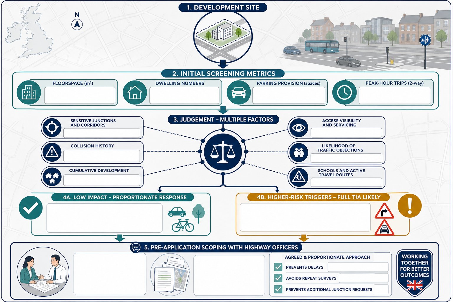
    A successful transport statement Birmingham follows a strict chronological path. Skipping steps or failing to agree on parameters with highway officers often leads to expensive revisions. The process begins with initial site feasibility and transport constraints mapping. We look for physical barriers, visibility issues, or existing traffic orders that might restrict access. Once the site’s potential is clear, we move to scoping the assessment with Birmingham City Council highway officers. This ensures the study area and methodology meet their specific expectations before you commit to full reporting.

    Following the scoping agreement, we initiate data collection. This includes parking surveys and traffic counts designed to capture current network behavior. Our technical team then performs the analysis, drafting the Transport Statement to address safety, sustainability, and capacity. The final step is a rigorous review before submission as part of your planning portal package. This sequential workflow ensures every claim in your report is backed by defensible data.

    The Scoping Process with Birmingham Highway Officers

    Scoping is the most critical phase for risk mitigation. In 2026, Birmingham City Council charges £1,732 for pre-application reviews for schemes up to 25 units. We recommend including a detailed scoping note that outlines your proposed trip generation methodology and the specific junctions you intend to analyze. Agreeing on the study area early prevents the council from requesting additional junction modeling midway through the planning process. Having experienced transport planning consultants lead these talks ensures technical terms align with local policy, reducing the likelihood of highway authority objections.

    Data Collection and Surveys

    Accuracy in data collection is paramount. Birmingham requires data to be current, typically collected within the last three years, to reflect the post-CAZ traffic environment. We use a mix of Automated Traffic Counts (ATCs) for long-term flow data and manual turning counts for specific junction behavior. Parking surveys must follow the council’s approved methodology, often requiring overnight observations to establish a true baseline of local parking stress. This precision prevents the council from dismissing your findings as outdated or unrepresentative.

    If you are ready to begin your project’s technical assessment, you can secure our professional transport planning services to ensure your data meets Birmingham’s 2026 standards.

    Transport Statement Birmingham: A Developer’s Guide for 2026 approvals

    Why ML Traffic Engineers for Your Birmingham Project?

    Choosing the right technical partner is the difference between immediate planning approval and costly, time-consuming resubmissions. At ML Traffic Engineers, we provide a precision-led approach that ensures every transport statement Birmingham we produce meets 2026 statutory standards. We understand that the 4.99% increase in highways-related charges and the £15,348 minimum fee for Section 278 technical approvals leave no room for error. Our reports are built on defensible data and rigorous analysis, designed specifically to satisfy the scrutiny of Birmingham City Council highway officers.

    We deploy a client-focused strategy that reduces regulatory pressure on developers and architects. By managing the technical complexities of your application, we allow you to focus on the broader aspects of your development. Our team is equipped to handle the full range of required services, including:

    • Detailed Transport Statements and full Transport Assessments.

    • Technical Swept Path Analysis to verify site accessibility for emergency and service vehicles.

    • Comprehensive Parking Surveys that align with local maximum standards.

    • Robust Travel Plans and Traffic Surveys to support sustainable urban integration.

    We recognize the fast-moving nature of the West Midlands construction sector. Our readiness and commitment to rapid response ensure we meet tight planning deadlines with unwavering reliability. We don’t just provide data; we provide a fully-managed service that moves your project from initial inception to final council negotiations.

    A Dependable Partner for West Midlands Infrastructure

    Our experience in navigating the intricate regional regulations of the West Midlands makes us a vital partner for your project. We understand how the Birmingham Transport Plan 2031 impacts private site access and how to frame modal shift arguments that win council support. We take immense pride in our professional integrity and adherence to industry benchmarks. As your technical consultant, we act as a guardian of project safety and compliance, ensuring your site design is functional and safe for all road users. You can explore our previous project types to see how we manage full lifecycles for various residential and commercial schemes.

    Get Your Birmingham Transport Statement Quote

    We provide direct, active support for all residential and commercial planning applications across the city. Whether you are navigating the complexities of the Clean Air Zone or need to justify reduced parking provision in a high PTAL area, our team is ready to discuss your site’s specific transport needs today. We focus on providing clarity and rapid information delivery to keep your project on track. Accuracy in your initial submission prevents the need for expensive post-submission revisions.

    Request a professional Transport Statement quote for your Birmingham project and secure the technical expertise required for 2026 planning success.

    Secure Your 2026 Planning Approval with Technical Precision

    Birmingham’s evolving infrastructure requires a proactive approach to technical planning. Successfully securing your 2026 approval depends on aligning your site with the city’s sustainable network goals and navigating specific Clean Air Zone requirements. A professional transport statement Birmingham must translate complex traffic data into a strategic argument for urban integration while minimizing your Section 106 and 278 contribution costs. Precision in the early stages prevents highway authority objections that can derail your project timeline.

    ML Traffic Engineers has been delivering planning success since 2014. Our specialized expertise in Swept Path Analysis and TRICS data ensures your report stands up to rigorous council scrutiny. As professional members of the Chartered Institution of Highways and Transportation (CIHT) and the Institute of Highway Engineers (IHE), we maintain the highest standards of technical excellence. We manage the full project lifecycle from initial feasibility to final submission so you don’t have to navigate these logistical pressures alone.

    Ready to move your development forward? Contact ML Traffic Engineers for a Birmingham Transport Statement Quote today. We are prepared to help you navigate the city’s complex regulatory landscape with confidence.

    Frequently Asked Questions

    How much does a Transport Statement cost in Birmingham for 2026?

    The cost of a technical report varies depending on the scale of the development and the complexity of the required data. Developers must also budget for Birmingham City Council’s statutory fees, such as the £1,732 charge for pre-application advice on minor schemes. For a precise quote tailored to your site’s specific constraints, you should consult with our technical team directly.

    What is the difference between a Transport Statement and a Transport Assessment?

    A Transport Statement is a concise report for smaller developments with limited traffic impact. In contrast, a Transport Assessment (TA) is a comprehensive document required for major projects that generate significant movement. While a Statement focuses on immediate site access and local infrastructure, a TA involves extensive junction modeling and a wider analysis of the regional road network.

    Can I write my own Transport Statement for a Birmingham application?

    While you can technically draft your own document, it’s not recommended for professional planning applications. Birmingham highway officers require technical data, such as TRICS trip generation and accident analysis, that must meet industry benchmarks. Reports that lack professional precision or fail to use recognized methodologies often face immediate objections, leading to expensive delays and potential planning refusal.

    How long does it take to produce a professional Transport Statement?

    The production timeline typically spans several weeks, depending on the speed of data collection and council scoping responses. This period allows for site visits, traffic counts, and the technical drafting of the report. Starting the process early ensures your transport statement Birmingham is fully verified and ready for submission alongside your main planning portal application package.

    Does a Transport Statement guarantee planning permission?

    A technical report doesn’t guarantee approval, but it provides the defensible evidence needed to overcome highway authority objections. It proves that your development won’t compromise public safety or road efficiency. By demonstrating that the residual cumulative impact is acceptable under the NPPF, you provide the council with the technical justification required to support your scheme’s transport strategy.

    Will I need a Travel Plan in addition to my Transport Statement?

    The requirement for a Travel Plan depends on the scale and use class of your development. Birmingham City Council often requests these for projects that exceed specific trip generation thresholds to encourage sustainable commuting. We identify these requirements during the initial scoping phase to ensure all necessary documents are prepared to satisfy the council’s local planning conditions.

    What happens if Birmingham City Council highway officers object to the Statement?

    If an objection is raised, we immediately review the technical grounds provided by the highway authority. This process often involves gathering additional data or performing a more detailed Parking Survey to address specific concerns. We act as your technical representative, negotiating with the council to find a viable design solution that maintains safety while securing your planning approval.

    Do I need a Swept Path Analysis for a small driveway access in Birmingham?

    A Swept Path Analysis is frequently required if the access serves larger vehicles or is located on a narrow street. In dense urban areas like Digbeth, the council may request this proof to ensure vehicles can enter and exit the site in a single movement. It provides the visual certainty that your transport statement Birmingham needs to prove the access is functional.

    Which areas do we cover?

    We service Acocks Green, Alum Rock, Ashted, Aston, Aston Cross, Austin Village, Balsall Heath, Balti Triangle, Bartley Green, Beech Lanes, Billesley, Birches Green, Birchfield, Birmingham Chinatown, Boldmere, Bordesley, Bordesley Green, Bournbrook, Bournville, Brandwood End, Brindleyplace, Bromford, Browns Green, Buckland End, California, Camp Hill, Castle Vale, Chad Valley, Churchfield, Cofton Common, Cotteridge, Deritend, Digbeth, Doe Bank, Driffold, Druids Heath, Duddeston, Eastside, Edgbaston, Erdington, Falcon Lodge, Five Ways, Four Oaks, Fox Hollies, Frankley, Garretts Green, Gib Heath, Gilbertstone, Glebe Farm, Gosta Green, Gravelly Hill, Great Barr, Greet, Grimstock Hill, Gun Quarter, Hall Green, Hamstead, Handsworth, Handsworth Wood, Harborne, Harts Green, Haslucks Green, Hawkesley, Hay Mills, High Heath, Highgate, Highter’s Heath, Hill Hook, Hill Wood, Hockley, Hodge Hill, Jewellery Quarter, Kents Moat, Kings Heath, Kings Norton, Kingstanding, Kitts Green, Ladywood, Lea Hall, Lee Bank, Ley Hill, Lifford, Little Bromwich, Lodge Hill, Longbridge, Lozells, Lyndon Green, Maney, Maypole, Minworth, Mere Green, Moor Green, Moseley, Nechells, New Frankley, New Oscott, Newtown, Northfield, Old Oscott, Over Green, Peddimore, Park Hall, Pelham, Perry Barr, Perry Beeches, Perry Common, Pheasey, Pype Hayes, Queslett, Quinton, Reddicap Heath, Rednal, Ridgacre, Rotton Park, Roughley, Rubery, Saltley, Sarehole, Selly Oak, Selly Park, Shard End, Sheldon, Shenley Fields, Shenley Green, Short Heath, Showell Green, Small Heath, Smithfield, Soho, Southside, South Yardley, South Woodgate, Sparkbrook, Sparkhill, Springfield, Spring Vale, Stechford, Stirchley, Stockfield, Stockland Green, Streetly, Sutton Coldfield, The Leverrets, Theatreland, Thimble End, Tile Cross, Tower Hill, Tudor Hill, Turves Green, Tyburn, Tyseley, Vauxhall, Wake Green, Walker’s Heath, Walmley, Ward End, Warstock, Washwood Heath, Wells Green, Weoley Hill, Weoley Castle, West Heath, Westside, Wiggins Hill, Whitehouse Common, Winson Green, Witton, Woodcock Hill, Woodgate, Wylde Green, Yardley, Yardley Wood.

    Michael Lee

    Article by

    Michael Lee

    Transport planner with over 35 years' experience.

    Disclaimer

    The content on mltraffic.co.uk, including all technical articles, guides, and resources, is provided for general informational and educational purposes only. It is not intended to constitute professional advice in traffic engineering, transportation planning, development approvals, or any other technical or legal field.
    While ML Traffic Engineers makes every reasonable effort to ensure the accuracy, completeness, and timeliness of the information published, we do not provide any warranties or representations (express or implied) regarding its reliability, suitability, or availability for any particular purpose. Any reliance you place on the content is strictly at your own risk.
    In no event shall ML Traffic Engineers, its directors, employees, authors, or affiliates be liable for any direct, indirect, incidental, special, consequential, or punitive damages (including, without limitation, loss of profits, data, or business opportunities) arising out of or in connection with the use of, or inability to use, any information provided on this website.
    The articles and guides on this site are not a substitute for engaging a qualified, professional traffic engineer to assess your specific project requirements. For tailored advice, compliance assessments, or traffic engineering services, please contact a competent professional.
    This disclaimer may be updated from time to time without notice. By accessing or using this website, you agree to be bound by the most current version of this disclaimer.

  • transport statement cost for small development England Best Practices and Expert Advice

    transport statement cost for small development England Best Practices and Expert Advice

    Did you know that robust transport documentation reduced planning appeal rates by 22% for residential schemes in 2023? Many developers assume the transport statement cost for small development England projects is fixed by site size, but it’s actually driven by technical risk and specific local data requirements. You’ve likely experienced the frustration of opaque consultancy fees or the fear that a local highway authority will reject your application based on NPPF threshold confusion. Precision is a functional necessity in this high-stakes environment where regulatory delays can stall your momentum for months.

    We understand that planning pressures are increasing, particularly with the 3.8% rise in England planning fees effective from 1 April 2026. This guide provides the technical authority you need to secure planning approval efficiently while maintaining full compliance with local standards. We’ll explain the primary factors influencing your report costs, from parking surveys to swept path analysis requirements. You’ll learn how to navigate current EV charging mandates and produce a submission that passes council scrutiny the first time. Our goal is to reduce your regulatory burden and provide a clear, logical path to project execution.

    Key Takeaways

    • Differentiate between a Transport Statement and a full Assessment to ensure you only commission the technical detail required for your site’s specific scale.
    • Identify how factors like projected trip generation and highway complexity determine the transport statement cost for small development England to avoid unexpected consultancy fees.
    • Minimise project delays by engaging a transport consultant at the feasibility stage to identify and resolve site accessibility issues before submitting your application.
    • Streamline the approval process with high-quality site plans that reduce drafting time and ensure compliance with strict local highway authority standards.
    • Gain a competitive advantage by applying expert technical advice tailored to the specific planning policies of councils in London, Slough, and High Wycombe.

    Table of Contents

    What Is a Transport Statement for Small Developments?

    A Transport Statement is a concise technical report required for development proposals that generate some traffic but don’t reach the threshold for a full Transport Assessment. This document forms a critical part of the broader transportation planning process by assessing site accessibility, safety, and the potential impact on the local highway network. While a full Assessment involves complex junction modeling across a wide geographical area, a Statement focuses on immediate site constraints and sustainable travel options. It provides the technical evidence needed to prove that a proposal aligns with the National Planning Policy Framework (NPPF).

    For developers, this report serves as a vital negotiation tool with the Local Highway Authority (LHA). Understanding the transport statement cost for small development England is often the first step in budgeting for a successful planning application. By addressing potential highway objections early, you reduce the risk of costly delays or application refusal. We focus on delivering precision so that the regulatory pressures on your project are minimised from the outset.

    Small Development Thresholds in England (2026)

    As of 2026, national guidelines typically require a Transport Statement for residential developments consisting of 10 to 49 units. However, thresholds for commercial sites vary significantly based on use classes, such as retail, industrial, or office space. Local councils in high-density areas like Slough or London frequently lower these thresholds. They do this because even a small increase in vehicle movements can have a disproportionate effect on already congested urban networks or sensitive local infrastructure. We track these regional variations to ensure your project remains compliant with local standards.

    The Purpose of the Statement in the Planning Process

    The primary objective is to demonstrate that the residual cumulative impact of the development is not severe. This is a specific legal test set by the NPPF that determines whether a project can be refused on transport grounds. We focus on ensuring safe access for all users, including pedestrians, cyclists, and motorists. A well-prepared report ensures that your site layout promotes sustainable transport and meets modern safety standards. For more technical guidance and support in achieving these benchmarks, you can access ML Traffic Engineers resources. We provide the technical authority required to navigate these intricate regional regulations efficiently.

    Key Factors Influencing Transport Statement Cost

    Determining the transport statement cost for small development England requires an analysis of technical risk rather than a flat fee based solely on unit numbers. Site location is a primary driver of these costs. A greenfield site with clear sightlines involves different technical challenges than a brownfield site with existing highway constraints. We prioritize precision in these assessments to ensure your submission meets UK government guidance regarding safety and accessibility. The level of consultation required with the Local Highway Authority (LHA) also dictates the workload, as complex sites often necessitate multiple rounds of pre-application feedback.

    Data acquisition forms a significant portion of the technical fee. We utilize the TRICS database to project trip generation, which requires professional subscription access to ensure the data is current and defensible. The scale of your proposed development directly dictates the volume of these projected movements. Larger small-scale sites, such as those approaching the 50-unit threshold, require more rigorous data sets to satisfy the LHA. If existing data is deemed insufficient by the council, physical Traffic Surveys may be necessary to establish baseline movements. These surveys provide the empirical evidence required to justify your development’s impact on the local network.

    Swept Path Analysis and Technical Modeling

    Swept Path Analysis (SPA) is a critical component that often influences the final fee. This technical modeling uses specialized software to simulate vehicle maneuvers, such as fire tenders or refuse trucks, within your site layout. Local authorities require this to guarantee that emergency and service vehicles can enter and exit in forward gear. While adding to the initial report cost, SPA prevents expensive design revisions during the construction phase by identifying tight turns or inadequate radii early. Precision here is non-negotiable for public safety and long-term site functionality.

    Local Authority Requirements (London vs. Home Counties)

    Regional variations significantly impact the scope of work. London boroughs often demand higher levels of scrutiny compared to councils in Slough or High Wycombe. In London, your Public Transport Accessibility Level (PTAL) rating dictates the depth of the Statement. A low PTAL score might necessitate more robust mitigation strategies or detailed Parking Surveys to address overspill concerns. If your site is near a strategic road network managed by National Highways, expect additional coordination requirements. We manage these intricate regional regulations so you don’t have to, maintaining a focus on rapid delivery and regulatory compliance.

    transport statement cost for small development England Best Practices and Expert Advice

    Transport Statement vs. Transport Assessment: Cost Comparison

    Choosing between these two documents isn’t just a matter of site size; it’s about the technical intensity required by the Local Highway Authority (LHA). While a Transport Statement focuses on the site’s immediate vicinity and access, a Transport Assessment demands a much wider geographical study area. This increased scope significantly inflates the project’s budget because it requires extensive junction capacity modeling using specialized software. According to official government guidance on Transport Statements, the report must be proportionate to the development’s impact. For most small sites, the transport statement cost for small development England remains manageable because it avoids the multi-junction analysis required for larger schemes.

    Statements are typically delivered on a fixed-fee basis, providing developers with cost certainty from the outset. In contrast, Assessments are often quoted in stages or as time-charge projects due to their unpredictable nature. If the LHA demands additional modeling for distant junctions after the initial submission, the fees can escalate rapidly. Selecting the wrong report type is a common pitfall that leads to immediate planning refusal. It’s vital to agree on the technical scope before commissioning work to ensure your investment leads to a successful planning outcome.

    When a Statement Isn’t Enough

    Specific triggers might necessitate a full Assessment even if your unit count is low. If your site is located near a junction with a high accident record or existing capacity issues, the council will likely demand a more rigorous study. Pre-application advice is the most reliable way to confirm which report is necessary for your specific location. For those managing larger or more sensitive projects in the capital, our Transport Assessment London guide provides deeper insight into these complex requirements. We manage the full project lifecycle to ensure your submission meets these heightened standards without unnecessary delays.

    Fee Structures for Small Developments

    Most professional quotes for a Transport Statement utilize a “lump sum” model that covers the site visit, data analysis, and report drafting. However, you should watch for hidden costs that aren’t always included in a basic proposal. These might include site visit travel expenses, LHA meeting fees, or the cost of purchasing specific traffic count data from third parties. We prioritize transparency by providing comprehensive support that identifies these variables early. This approach reduces the regulatory pressures on your team and ensures that your budget remains intact from inception to completion.

    How to Minimise Your Transport Planning Costs

    Reducing the transport statement cost for small development England projects requires technical foresight rather than just administrative filing. Precision saves money. By identifying potential highway objections during the initial design phase, you avoid the expensive cycle of re-submitting plans after a council refusal. We recommend engaging a consultant at the feasibility stage to identify red flags like inadequate visibility splays or restricted access points. Correcting these issues on paper is far cheaper than attempting to mitigate them once a formal application is already in progress.

    Efficiency in data management also drives down fees. You can lower your costs by providing clear, high-quality CAD site plans from the outset. This reduces the time our engineers spend cleaning up drafting errors. Consolidating your requirements into a single technical package is another effective strategy. For example, commissioning a Swept Path Analysis alongside your Transport Statement ensures that vehicle tracking and policy compliance are handled simultaneously. This integrated approach eliminates redundant work and streamlines the submission process.

    Leveraging existing data is a vital cost-saving measure. We always check for recent traffic surveys or council-held data before recommending new on-site counts. If the local network has already been modelled for a nearby development, we can often use that information to support your case. This prevents the need for expensive new survey equipment and manual data entry, keeping your project on track and within budget.

    The Value of Pre-Application Engagement

    Clear scoping with the Local Highway Authority (LHA) prevents scope creep. Without an agreed scope, councils may demand excessive junction analysis that isn’t proportionate to your site’s scale. We use our technical authority to negotiate a reduced study area, focusing only on the junctions that truly matter. This proactive engagement protects you from the 3.8% increase in planning fees effective from April 2026 by ensuring your first submission is robust enough to pass without costly revisions.

    Avoiding Common Mistakes

    Simple omissions often lead to the highest costs. Failing to include a required Travel Plan can stall an application for weeks. Similarly, using inaccurate vehicle templates for tracking can result in a site layout that refuse trucks cannot navigate, leading to immediate rejection. Ignoring local parking standards in high-pressure areas like Slough or London is another frequent error. We ensure every detail matches local council benchmarks so your application moves forward with urgency and reliability. To streamline your project lifecycle, secure a fixed-fee quote for your transport documentation today.

    Choosing ML Traffic Engineers for Your Transport Statement

    Securing a competitive transport statement cost for small development England projects depends on choosing a partner who understands the local landscape. We specialize in small to medium developments, providing the technical authority needed to navigate intricate regional regulations. Our engineers focus on producing planning-ready reports that anticipate and resolve potential highway objections before they stall your application. By integrating our services, we ensure that your submission is robust, compliant, and delivered with the urgency your project demands.

    Our team understands the high-stakes nature of planning applications. Precision is a functional necessity in this environment. We manage the full project lifecycle from initial data collection to final submission; this comprehensive approach reduces the logistical and regulatory pressures on your team. We don’t just provide data; we act as a vital guardian of your project’s timeline and budget. Whether you’re developing a small residential site or a commercial unit, our reports provide the clarity required to move forward with confidence.

    Our Approach to Cost-Effective Reporting

    We utilize direct communication with Highway Officers to streamline the approval process. This proactive engagement clarifies the technical scope early and prevents the “scope creep” that often inflates consultancy fees. Our engineers use the latest TRICS data and industry-standard modeling software to ensure every projection is defensible and accurate. To keep your project costs centralized and manageable, we offer integrated packages that include Swept Path Analysis and Parking Surveys. This all-encompassing service model eliminates the need for multiple consultants and ensures technical consistency across your entire submission. You can get a quote for your project to see how our transparent pricing supports your development goals.

    Proven Track Record in the South East

    Our deep expertise in London, High Wycombe, and Slough allows us to navigate the specific local planning policies that often catch developers off guard. We’ve successfully secured planning approvals for numerous small residential sites by addressing complex access and safety issues with technical precision. Our experience extends beyond the initial report; we also provide expert guidance on Section 278 and Section 38 agreements. This technical authority builds trust with planning committees and highway authorities alike. We position ourselves as a reliable partner that understands the fast-moving nature of infrastructure maintenance and emergency works, ensuring your transport statement cost for small development England remains a sound investment in your project’s success.

    Secure Your Planning Success with Expert Technical Advice

    Navigating the technical and regulatory landscape of English planning requires more than just a standard report. You now understand how factors like site location and vehicle tracking influence the total transport statement cost for small development England, and why early pre-application engagement is the most effective way to protect your budget. By prioritizing precision in your data collection and site modeling, you remove the guesswork from the local highway authority’s decision-making process. This approach ensures your project moves forward without the delays associated with technical objections or application rejections.

    Founded in 2014, ML Traffic Engineers brings over a decade of planning success to your development team. We are specialists in London and South East highway regulations, utilizing current TRICS data and industry-standard SPA software to deliver reports that stand up to rigorous council scrutiny. Our engineers are ready to manage the full technical lifecycle of your project, providing the unwavering reliability you need to succeed in a high-stakes environment. Request a Professional Transport Statement Quote to secure your project’s future today. We look forward to helping you achieve a first-time planning approval.

    Frequently Asked Questions

    Do I need a Transport Statement for a 5-house development in England?

    Requirement for a report depends entirely on your local planning authority’s specific thresholds and site sensitivity. While many councils set a baseline at 10 or more dwellings, authorities in high-density areas like London or Slough often require documentation for smaller schemes if there are existing safety concerns or restricted access points. Determining the transport statement cost for small development England early helps you budget for these local variations and ensures your application remains compliant with National Planning Policy Framework standards.

    How long does it take to produce a Transport Statement for a small site?

    Production typically takes between two and three weeks from the initial site visit to the final report delivery. This timeline depends on the availability of current traffic data and the complexity of the site’s access arrangements. If your project requires bespoke Traffic Surveys to establish baseline movements, you should allow additional time for data collection and analysis. We prioritize rapid delivery to ensure your planning submission remains on schedule.

    Is a site visit always required for a Transport Statement quote?

    A physical site visit is a non-negotiable requirement for producing an accurate and defensible technical report. Our engineers must personally assess visibility splays, local highway geometry, and existing parking pressures to ensure the report reflects real-world conditions. This precision is a functional necessity that prevents the local highway authority from questioning the validity of our findings. We include the site visit as a standard component of our professional service lifecycle.

    Can I use a Transport Statement from a previous planning application?

    You can only reuse a previous report if the traffic data remains current and the development’s scale hasn’t changed. Local authorities generally consider data older than three years to be outdated, especially in areas with significant recent infrastructure changes. Using obsolete TRICS data or failing to account for new local developments will likely lead to an immediate technical objection. We recommend a data refresh to maintain technical authority during the planning process.

    What is the difference between a Transport Statement and a Travel Plan?

    A Transport Statement focuses on the physical impact and safety of a development on the highway network. In contrast, a Travel Plan is a management strategy designed to encourage sustainable travel modes like cycling, walking, and public transport. While they are separate documents, local councils often require both for a single application to meet environmental and accessibility targets. We manage both requirements to provide an all-encompassing service for our clients.

    How much does Swept Path Analysis add to the total cost?

    Including vehicle tracking increases the technical workload but remains a vital investment for securing planning approval. The transport statement cost for small development England often incorporates this analysis to prove that emergency and refuse vehicles can navigate the site safely. By simulating these maneuvers during the design phase, you avoid the high cost of layout revisions after your application has been submitted. This proactive modeling acts as a safeguard for your project’s viability.

    Will a Transport Statement guarantee planning permission?

    No document can guarantee permission, but a robust technical report significantly reduces the risk of refusal on highway grounds. It provides the empirical evidence needed to demonstrate that your development’s impact isn’t severe according to NPPF criteria. Our role is to act as a dependable expert who defends your proposal through rigorous data and adherence to industry benchmarks. This professional integrity builds the necessary trust with planning committees and highway officers.

    What happens if the Local Highway Authority objects to the Statement?

    You must address technical objections through targeted modeling, design adjustments, or additional data clarification. We manage this negotiation process directly with the highway officers to resolve concerns as quickly as possible. This might involve refining a Swept Path Analysis or conducting additional Parking Surveys to satisfy specific local requirements. Our constant availability ensures that we respond to authority feedback with the urgency required to keep your project moving forward.

    Which areas in London do you cover?

    We service Acton, Balham, Barking, Barnes, Barnet, Battersea, Beckenham, Bexleyheath, Brentford, Brixton, Bromley, Camberwell, Carshalton, Charlton, Chelsea, Chiswick, Clapham, Coulsdon, Croydon, Crystal Palace, Dagenham, Dulwich, Ealing, Edgware, Eltham, Enfield, Finchley, Forest Gate, Fulham, Golders Green, Greenwich, Hackney, Hammersmith, Hampstead, Harrow, Hayes, Highgate, Hounslow, Ilford, Islington, Kensington, Kentish Town, Kingston upon Thames, Lewisham, Mitcham, Muswell Hill, New Malden, Notting Hill, Orpington, Peckham, Pinner, Purley, Putney, Richmond, Romford, Ruislip, Sidcup, Southall, Southgate, Streatham, Surbiton, Sutton, Tooting, Tottenham, Twickenham, Uxbridge, Walthamstow, Wembley, West Norwood, Wimbledon, Wood Green, Woolwich, Bethnal Green, Shoreditch, Canary Wharf, Deptford, Leyton, Palmers Green, Stanmore, Upminster, Chislehurst, Erith, Feltham.

    Which cities in England do you cover?

    We service London, Birmingham, Manchester, Liverpool, Sheffield, Leeds.

    Michael Lee

    Article by

    Michael Lee

    Transport planner with over 35 years’ experience.

    Disclaimer

    The content on mltraffic.co.uk, including all technical articles, guides, and resources, is provided for general informational and educational purposes only. It is not intended to constitute professional advice in traffic engineering, transportation planning, development approvals, or any other technical or legal field.
    While ML Traffic Engineers makes every reasonable effort to ensure the accuracy, completeness, and timeliness of the information published, we do not provide any warranties or representations (express or implied) regarding its reliability, suitability, or availability for any particular purpose. Any reliance you place on the content is strictly at your own risk.
    In no event shall ML Traffic Engineers, its directors, employees, authors, or affiliates be liable for any direct, indirect, incidental, special, consequential, or punitive damages (including, without limitation, loss of profits, data, or business opportunities) arising out of or in connection with the use of, or inability to use, any information provided on this website.
    The articles and guides on this site are not a substitute for engaging a qualified, professional traffic engineer to assess your specific project requirements. For tailored advice, compliance assessments, or traffic engineering services, please contact a competent professional.
    This disclaimer may be updated from time to time without notice. By accessing or using this website, you agree to be bound by the most current version of this disclaimer.

  • Traffic Survey for Planning Applications

    Traffic Survey for Planning Applications

    A traffic survey is not just a simple count; it’s the critical legal evidence that proves your development is safe and sustainable for the UK highway network. You’re likely aware of the immense pressure to meet statutory deadlines, such as the 13-week limit for major applications, while fearing that "outdated" or "flawed" data could lead to an immediate planning refusal. It’s frustrating when technical acronyms like ATC or MCC cause confusion, especially when you must hit specific "neutral" survey windows to satisfy rigorous Highway Authority standards.

    This guide helps you identify exactly which traffic survey for planning application UK requirements your specific project must meet to succeed. We’ll show you how to secure accurate data that satisfies decision-makers the first time, reducing regulatory friction and avoiding costly delays. You’ll gain a clear understanding of essential survey types, the impact of the London Plan 2026, and the new PAS 2161 monitoring standards. We also preview how professional Transport Statements, Travel Plans, and Swept Path Analysis create a reliable, data-driven path toward your planning approval.

    Key Takeaways

    • Learn why precise traffic data serves as the legal foundation for development impact assessments and satisfies Local Highway Authority safety standards.
    • Determine which traffic survey for planning application UK your project requires, from 7-day ATC volume data to detailed Manual Classified Counts.
    • Compare methodology options like pneumatic tubes and side-detection radar to capture the accurate vehicle speeds and classifications your site demands.
    • Identify the critical “neutral periods” for data collection to ensure your survey isn’t rejected due to school holidays or bank holiday anomalies.
    • Discover how to integrate raw survey findings into professional Transport Statements and Travel Plans to secure a smooth route to planning consent.

    Table of Contents

    Why Traffic Surveys are Essential for UK Planning Applications

    A traffic survey serves as the evidentiary foundation for every development impact assessment in England. It transforms subjective claims about road capacity into objective, verifiable data. Without this technical precision, your project risks an immediate refusal on highways grounds from the Local Highway Authority (LHA). These authorities review every submission to ensure public safety and network efficiency remain uncompromised. Your survey data directly informs your Transport Statement, providing the baseline for all subsequent technical analysis.

    A professional Traffic count identifies existing vehicle movements, speeds, and queue lengths. This technical clarity is vital because decision-makers prioritize road safety above all else. When you submit a traffic survey for planning application UK approval, you’re providing the LHA with the tools they need to validate your access designs and visibility splays. Accurate data reduces the regulatory pressure on your team and builds a transparent case for your development.

    To better understand how your data fits into the wider planning process, watch this helpful video on finding current applications:

    Meeting Statutory Planning Requirements

    The National Planning Policy Framework (NPPF) mandates that all developments promote sustainable transport and safe site access. Local Plans further define these requirements, often setting specific thresholds based on the scale of your project. For major developments, where the 13-week determination period applies, the LHA expects high-resolution data. Relying on "estimated" figures or national averages is no longer sufficient; most departments now require site-specific counts to verify that the local network can handle the proposed trip generation.

    The Consequences of Poor Data Collection

    Inaccurate data is a primary driver of costly planning appeals. If a survey under-counts peak hour traffic, the resulting safety assessments will be fundamentally flawed, potentially leading to dangerous road conditions. Highway Authorities are also quick to reject surveys conducted outside of "neutral" windows. Data collected during school holidays or local disruptions fails to represent typical conditions. This leads to delays that can push your project past the government’s 26-week Planning Guarantee for major applications, resulting in significant financial loss.

    Key Types of Traffic Surveys Required by Highway Authorities

    The specific data required for a traffic survey for planning application UK depends on the scale and location of your project. Local Highway Authorities rarely accept a one size fits all approach. Instead, they require a tailored suite of data collection methods to validate your site access and impact. It’s essential to match the survey type to the specific highway concern, whether that involves junction capacity or pedestrian safety. Developers should consult the government guidance on transport assessments to understand the baseline expectations for their specific development tier.

    Automatic Traffic Counters (ATC) and Volume Data

    ATCs provide a continuous, 24/7 record of vehicle movements over a minimum seven-day period. We typically deploy pneumatic tubes across the carriageway or use side-detection radar sensors to capture volume, speed, and vehicle classification. This data is critical for establishing the 85th percentile speed, which is the standard metric used to design safe visibility splays at new access points. Without accurate ATC data, your junction modeling will lack the necessary baseline flows required for a successful audit. These automated systems are the most cost-effective way to gather long-term data for less complex road sections.

    Manual Classified Counts (MCC) for Complex Junctions

    While automated systems are efficient for volume, complex junctions require the nuance of human observation or advanced video analytics. MCCs allow us to differentiate between cyclists, HGVs, buses, and private cars. This granularity is essential for capturing specific turning movements at existing junctions near your site. If you don’t provide this level of detail, Highway Authorities may question your impact analysis. These detailed counts are a non-negotiable component of Transport Assessment London requirements, where active travel and heavy vehicle interactions are under intense scrutiny.

    Parking Surveys and the Lambeth Methodology

    Urban developments with limited on-site provision often face resistance due to potential overspill. In these cases, a parking "stress test" is necessary for a traffic survey for planning application UK in high-density areas. Using the Lambeth Methodology, we record all parked vehicles and legal spaces within a 200-meter radius on two separate weekday nights between 00:30 and 05:30. This evidence proves whether the local network can absorb additional demand, justifying "car-free" or low-parking schemes. This data also directly supports a robust Travel Plan by demonstrating the feasibility of sustainable transport choices.

    Our team manages the full lifecycle of these surveys, ensuring every data point meets the strict standards of UK Highway Authorities. You can view our full range of technical survey services to see which methodology fits your project constraints.

    Manual vs. Automated Traffic Counts: Choosing the Right Methodology

    Selecting the correct methodology for a traffic survey for planning application UK is a technical decision that directly impacts both data reliability and project costs. While some guidelines suggest a blanket preference for automated systems to reduce human error, the reality is more nuanced. The choice depends entirely on your specific Project Type and the physical characteristics of the highway network involved. For high-speed rural roads, we often prefer automated side-detection radar (SDR) over traditional pneumatic tubes. SDR systems are non-intrusive and help eliminate the "Surveyor Effect." This phenomenon occurs when visible human observers or bulky roadside equipment cause drivers to instinctively change their behavior, often by slowing down, which artificially skews the speed data required for your visibility splay calculations.

    Precision is a functional necessity in this high-stakes environment. Using covert data collection methods ensures that the captured vehicle movements reflect genuine, everyday conditions. This objective data is what Highway Authorities demand. It reduces the logistical pressure on your planning team by providing a "neutral" baseline that decision-makers can trust. Whether you’re managing a small residential access or a major infrastructure project, the methodology must align with the rigorous accuracy standards of PAS 2161 to ensure your data remains valid throughout the determination period.

    When to Use Automated Traffic Counters (ATC)

    ATCs are the most efficient tool for generating 7-day speed profiles and total volume counts on straight, free-flowing road sections. They offer significant cost benefits for long-term monitoring, as they don’t require manual shifts or constant supervision. However, ATCs have technical limitations in congested urban areas. Pneumatic tubes can fail or provide "noisy" data when slow-moving queues sit directly over the sensors for extended periods. In these environments, the risk of data dropouts is high. We evaluate the site conditions first to ensure the equipment can handle the expected traffic density without compromising the 85th percentile speed results.

    The Necessity of Manual Classified Counts (MCC)

    Manual Classified Counts remain the gold standard for complex multi-arm roundabout analysis and detailed junction modeling. While automated tubes are excellent for volume, they cannot reliably distinguish between a heavy goods vehicle (HGV) and a light van during complex turning movements. MCCs provide the granular "Classification" data essential for modern planning. This includes capturing pedestrian and cyclist data that automated tubes often miss entirely. If your development must satisfy "Healthy Streets" indicators or active travel policies, MCCs are a non-negotiable requirement. They provide the detailed evidence needed to prove your site is safe for all road users, not just motorists.

    Timing Your Survey: Neutral Periods and Local Authority Standards

    Timing is often the critical factor that determines whether your data is accepted or discarded by decision-makers. Local Highway Authorities require evidence of "normal" traffic conditions to assess the true impact of a development. If you conduct a traffic survey for planning application UK during a school holiday or near a bank holiday, the results will likely be rejected as unrepresentative. This leads to expensive re-surveys and missed planning committee dates. We ensure your data collection aligns with these strict regulatory windows to maintain your project’s momentum. Integrating these findings with Swept Path Analysis further proves site feasibility by showing how vehicles move within the actual, recorded traffic flow.

    A single-day "snapshot" is rarely sufficient for volume data. Authorities typically demand a 7-day profile to account for daily variations in road use. This longitudinal approach identifies the genuine morning and evening peaks, providing a robust baseline for your Transport Statement. Precision in timing reduces the risk of an "atypical" data set, which is a common reason for planning refusal. By capturing data when the network is at its most stable, you provide the LHA with the objective evidence they need to approve your site access designs.

    The Planning Calendar: Avoiding Invalid Data

    In the transport planning industry, May, June, September, and October are considered "planning gold." These months offer the most reliable "neutral" conditions. You must avoid specific dates that skew results, such as:

    • School half-terms and summer holidays.

    • The weeks immediately surrounding Christmas and Easter.

    • Local major events, festivals, or significant roadworks.

    • Periods of extreme weather, such as heavy snow or flooding, which alter driver behaviour.

    It’s also vital to verify that no temporary traffic management or diversions are active near your site. Atypical traffic from a nearby closed road can artificially inflate your counts, leading to over-engineered and unnecessarily expensive junction designs.

    Local Authority Specific Requirements

    Each Local Highway Authority maintains its own bespoke protocols for survey length and detail. While a 12-hour manual count might suffice for a small residential access, larger commercial schemes often require 24-hour automated monitoring over a full week. London boroughs are particularly rigorous, frequently demanding specific "peak hour" manual counts to assess pedestrian and cyclist interactions in high-density areas. You should always check for regional variations before deploying equipment. Secure your compliant Traffic Surveys today to ensure your data meets these local standards on the first attempt.

    The Ultimate Guide to transport planning consultants england

    From Raw Data to Planning Approval: The ML Traffic Approach

    Raw data provides the foundation, but professional interpretation is what secures a planning approval. We don’t just deliver spreadsheets; we translate every traffic survey for planning application UK into a cohesive technical argument. Our approach integrates these findings into our full suite of services, from initial assessments to detailed junction design. By applying 2026-standard modeling techniques, we predict future traffic growth with precision, ensuring your development remains viable throughout its operational lifecycle. This comprehensive oversight is part of what we do to reduce regulatory pressure on our clients and their design teams.

    Precision is a functional necessity in this high-stakes environment. We use the latest industry benchmarks to ensure your data is defensible during the rigorous LHA review process. Our team manages the full project lifecycle, moving from initial assessment to execution with a sense of readiness and urgency. This logical flow ensures that the data collected during neutral windows remains valid throughout the statutory determination period, whether your project faces an 8-week or 13-week deadline.

    Technical Analysis and Junction Modeling

    We feed your survey data directly into industry-standard modeling software like PICADY, ARCADY, and LinSig. These tools allow us to simulate how your development will interact with the existing network under peak conditions. Under the National Planning Policy Framework (NPPF), we must prove that the "residual cumulative impact" of your project is not severe. Precise visibility splay calculations, derived from our 85th percentile speed data, provide the safety evidence Highway Officers require. This technical rigour ensures that every access point is justified by objective data rather than estimation, meeting the requirements of PAS 2161 for road condition monitoring and data collection.

    Securing Your Planning Permission

    Professional data presentation reduces friction with Highway Officers and planning committees. Authorities are more likely to approve applications supported by clear, compliant datasets that follow a logical and sequential technical narrative. When authorities challenge survey findings or request additional clarification, we provide a robust "Response to Comments" service to defend the data integrity. This proactive communication prevents minor technical queries from turning into costly delays or unnecessary appeals. We understand the tight statutory deadlines and work with unwavering reliability to keep your project on track. If you need reliable data that satisfies UK Highway Authorities the first time, contact ML Traffic for a bespoke survey quote and secure the technical evidence your project demands.

    Secure Your Planning Success with Precise Data

    Securing planning approval requires more than just raw numbers; it demands a technically sound traffic survey for planning application UK that aligns with the latest 2026 regulatory standards. You’ve seen how strategic timing during neutral windows and the correct choice between automated or manual methodologies can prevent costly delays and planning refusals. By choosing a partner who understands intricate regional regulations, you ensure that your data satisfies Highway Authorities on the first submission. Precision is a functional necessity in this high-stakes environment, and we’re ready to provide the unwavering reliability your development requires.

    Our team provides expert interpretations of Local Authority requirements and ensures a fast turnaround for ATC and Speed surveys. We manage the full project lifecycle, delivering comprehensive reporting that includes professional Transport Statements and Assessments. We’ve built our reputation on technical authority and a client-focused approach that reduces regulatory pressure. Don’t let flawed data stall your progress. Get a Professional Traffic Survey Quote for Your Project today and move forward with the confidence that your technical evidence is robust, compliant, and ready for review.

    Frequently Asked Questions

    How long is a traffic survey valid for a planning application?

    Traffic surveys are typically valid for three years from the date of collection. Local Highway Authorities often consider data older than this obsolete because it fails to reflect current network conditions or recent infrastructure changes. If your data is approaching this limit, you should verify its acceptability with your planning officer before submission. Providing current evidence ensures your application remains compliant with the latest standards for road monitoring.

    What is a "neutral period" for traffic surveys in the UK?

    A neutral period refers to months where traffic flow is stable and representative of typical daily conditions. In the UK, these months are May, June, September, and October. You must avoid school half-terms, bank holidays, and major local events. Collecting data during these windows is essential for a traffic survey for planning application UK because it prevents skewed results that could lead to an immediate planning refusal.

    Do I need a 7-day traffic survey or just a one-day count?

    Most authorities require a 7-day survey for volume and speed data to establish a reliable 85th percentile speed. This duration accounts for daily fluctuations and provides a robust profile for technical analysis. A one-day count, typically a 12-hour Manual Classified Count, is usually reserved for analyzing specific turning movements at complex junctions. You should always check your local authority’s bespoke protocols to ensure your survey duration meets their requirements.

    How much does a professional traffic survey cost in 2026?

    Costs for professional surveys vary based on the project’s scale, the equipment used, and the survey’s duration. Factors such as the number of monitoring locations and the complexity of the data required, like HGV classification, will influence the final quote. While some local authorities provide historical data sets for a fee, this rarely replaces the need for a fresh, site-specific study that reflects the most recent network conditions.
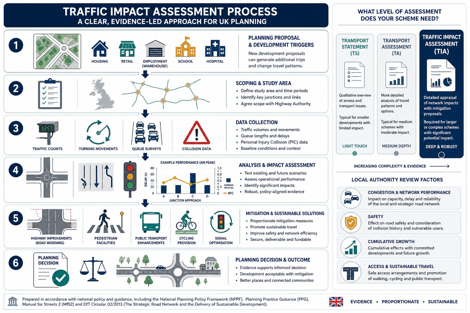
    Can I conduct my own traffic survey for a small development?

    You cannot conduct your own survey for a formal planning submission because it lacks technical authority. Local Highway Authorities require independent, professional data to ensure accuracy and unbiased reporting. Professional surveys utilize calibrated equipment and follow standardized methodologies that satisfy legal and safety requirements. Submitting DIY counts often leads to rejection because the data isn’t considered a reliable baseline for a Transport Statement or Assessment.
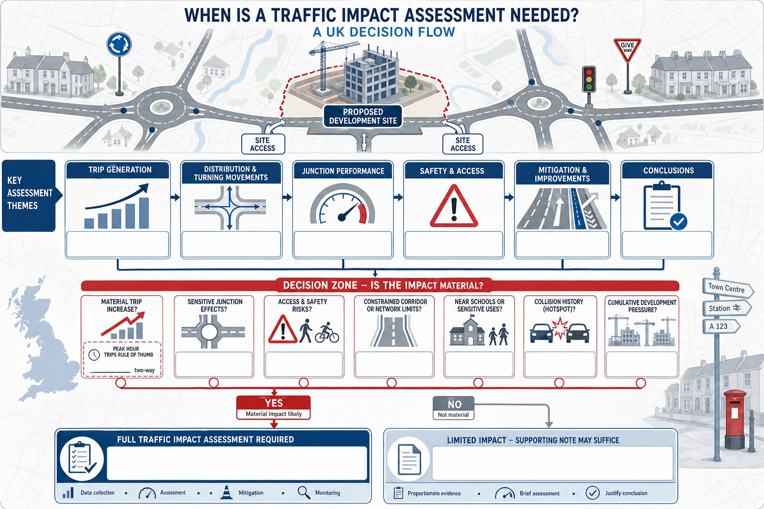
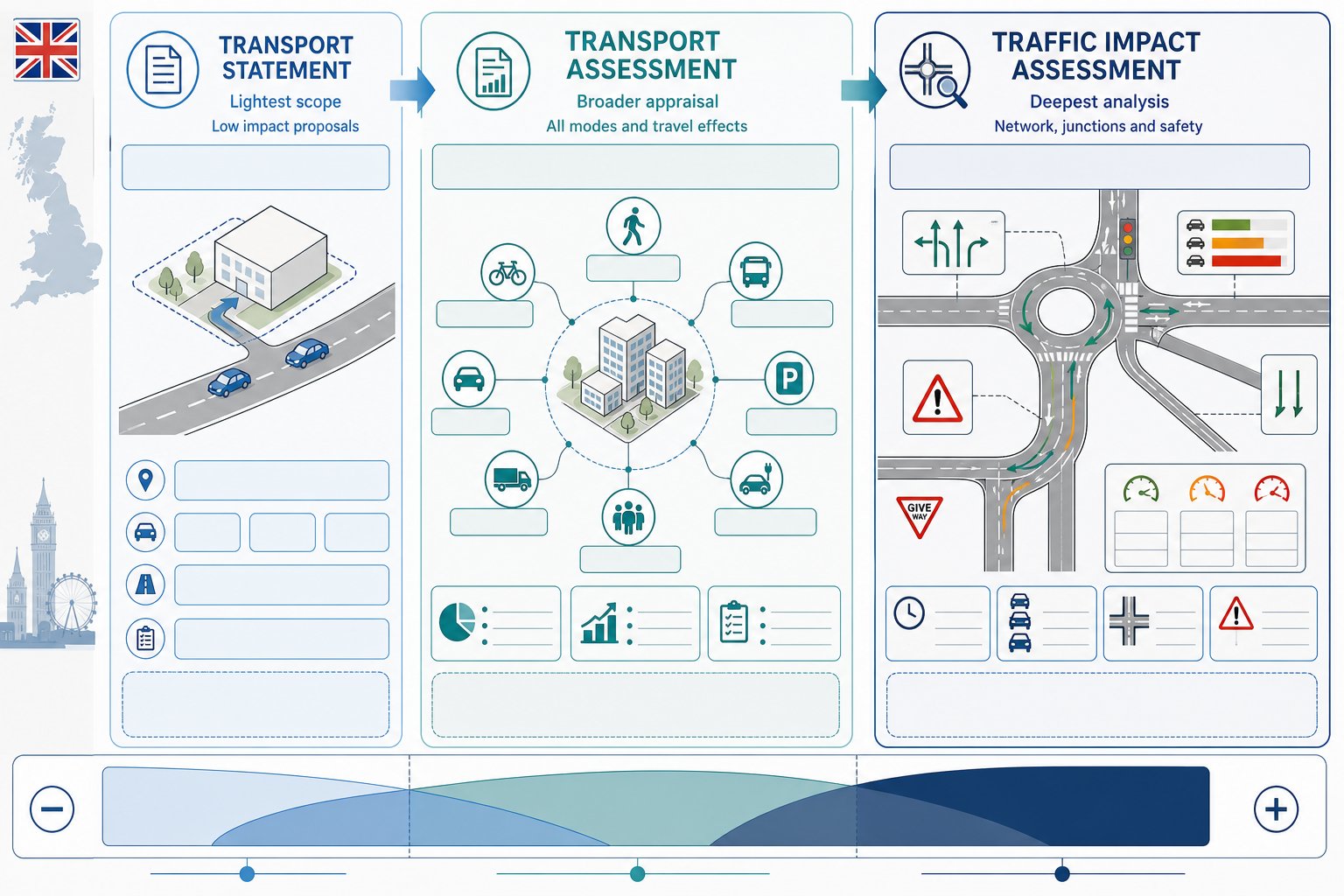
    What happens if the traffic survey shows the road is too busy?

    If a survey indicates high congestion, the data serves as a baseline for mitigation strategies. We use this information to optimize your site access design or to develop a robust Travel Plan that encourages sustainable transport. Precise data allows you to prove that the residual cumulative impact of your development is not severe under NPPF guidelines. Professional interpretation helps you find technical solutions that satisfy the Highway Authority’s safety standards.

    Does the Highway Authority provide the traffic data for me?

    Highway Authorities may hold historical records, but they don’t provide current, site-specific surveys for your development. While you can sometimes purchase existing data sets, this information is often outdated or lacks the granular detail required for visibility splay design. You will almost always need a new traffic survey for planning application UK to provide the objective evidence necessary for a successful determination and to meet modern regulatory expectations.

    What is the difference between an ATC and an MCC survey?

    An Automatic Traffic Counter (ATC) uses sensors or radar to collect volume and speed data 24/7, usually over a full week. A Manual Classified Count (MCC) involves human observers or video analytics to categorize specific vehicle types and record turning movements at junctions. ATCs are best for long-term speed profiles, while MCCs are the gold standard for understanding complex junction capacity and interactions between different road users like cyclists and HGVs.

    Which areas in London do you cover?

    We service Acton, Balham, Barking, Barnes, Barnet, Battersea, Beckenham, Bexleyheath, Brentford, Brixton, Bromley, Camberwell, Carshalton, Charlton, Chelsea, Chiswick, Clapham, Coulsdon, Croydon, Crystal Palace, Dagenham, Dulwich, Ealing, Edgware, Eltham, Enfield, Finchley, Forest Gate, Fulham, Golders Green, Greenwich, Hackney, Hammersmith, Hampstead, Harrow, Hayes, Highgate, Hounslow, Ilford, Islington, Kensington, Kentish Town, Kingston upon Thames, Lewisham, Mitcham, Muswell Hill, New Malden, Notting Hill, Orpington, Peckham, Pinner, Purley, Putney, Richmond, Romford, Ruislip, Sidcup, Southall, Southgate, Streatham, Surbiton, Sutton, Tooting, Tottenham, Twickenham, Uxbridge, Walthamstow, Wembley, West Norwood, Wimbledon, Wood Green, Woolwich, Bethnal Green, Shoreditch, Canary Wharf, Deptford, Leyton, Palmers Green, Stanmore, Upminster, Chislehurst, Erith, Feltham.

    Which cities in England do you cover?

    We service London, Birmingham, Manchester, Liverpool, Sheffield, Leeds.

    Michael Lee

    Article by

    Michael Lee

    Transport planner with over 35 years' experience.

    Disclaimer

    The content on mltraffic.co.uk, including all technical articles, guides, and resources, is provided for general informational and educational purposes only. It is not intended to constitute professional advice in traffic engineering, transportation planning, development approvals, or any other technical or legal field.
    While ML Traffic Engineers makes every reasonable effort to ensure the accuracy, completeness, and timeliness of the information published, we do not provide any warranties or representations (express or implied) regarding its reliability, suitability, or availability for any particular purpose. Any reliance you place on the content is strictly at your own risk.
    In no event shall ML Traffic Engineers, its directors, employees, authors, or affiliates be liable for any direct, indirect, incidental, special, consequential, or punitive damages (including, without limitation, loss of profits, data, or business opportunities) arising out of or in connection with the use of, or inability to use, any information provided on this website.
    The articles and guides on this site are not a substitute for engaging a qualified, professional traffic engineer to assess your specific project requirements. For tailored advice, compliance assessments, or traffic engineering services, please contact a competent professional.
    This disclaimer may be updated from time to time without notice. By accessing or using this website, you agree to be bound by the most current version of this disclaimer.

  • Transport Engineering Consultants London: Navigating Planning Approvals in 2026

    Transport Engineering Consultants London: Navigating Planning Approvals in 2026

    In 2026, London ranks as the sixth most congested city in the world, with drivers losing an average of 109 hours a year in rush-hour traffic. You likely feel the weight of these statistics every time you submit a planning application. Between the London Plan’s strict car-free mandates for areas with a PTAL of 4 or higher and the varying parking standards across individual boroughs, securing consent often feels like a moving target. Insufficient transport data or a poorly timed submission can lead to expensive delays that stall your project’s momentum.

    This guide demonstrates how expert transport engineering consultants london provide the technical precision required to navigate these regulatory hurdles and unlock your site’s maximum potential. We’ll show you how to transform logistical constraints into approved developments through accurate data and strategic planning. We’ll examine the role of professional Transport Assessments, Swept Path Analysis, and tailored Travel Plans in securing successful outcomes while keeping your mitigation strategies cost-effective.

    Key Takeaways

    • Understand how technical justification bridges architectural vision and statutory requirements in London’s high-density environment.
    • Learn how transport engineering consultants london determine whether your project requires a Transport Statement or a full Assessment to satisfy borough-specific structures.
    • Discover how Swept Path Analysis and Parking Surveys prove site layout viability and justify parking provisions on constrained city streets.
    • Master the complexities of PTAL ratings and borough standards to maintain high-density residential goals even in areas with lower accessibility scores.
    • Identify how precision-led reporting and rapid response capabilities help developers meet urgent planning deadlines and reduce regulatory pressure.

    Table of Contents

    The Strategic Role of Transport Engineering Consultants in London Planning

    Transport engineering serves as the technical bridge between an architectural concept and its operational reality on the highway network. In London, where traffic volumes in May 2026 reached 105% of pre-2020 levels, every new development faces intense scrutiny from local authorities. Professional transport engineering consultants london provide the evidence-based justification required to prove that a project won’t negatively affect local traffic flow, safety, or public transport efficiency. This technical rigor is essential for both minor residential schemes and major commercial hubs that must coexist within the city’s limited road space.

    Unlocking a site’s value in a city ranked the sixth most congested globally requires more than just good design. It demands a deep understanding of transportation planning principles and the specific constraints of the capital’s infrastructure. With Islington’s Local Plan aiming for 87% of journeys to be sustainable by 2041, the pressure to deliver high-density, car-free schemes is immense. Consultants translate these policy targets into viable site layouts by providing accurate data on vehicle movements and access requirements. This helps developers maximize their site’s density while remaining compliant with statutory requirements.

    When Do You Need a Transport Consultant?

    Many developers wait until they receive an objection from a Highway Officer before seeking professional help. This reactive approach often leads to expensive delays and redesign costs. You should engage a consultant at the earliest feasibility stage for triggers such as a change of use, the addition of new residential units, or significant commercial expansions. Early involvement identifies fundamental design flaws, such as inadequate access for service vehicles or non-compliant parking layouts, before they become built-in problems that are difficult to fix.

    Expert guidance is particularly valuable during pre-application discussions with London Boroughs and Transport for London (TfL). These meetings set the scope for all required technical work. Establishing a clear, data-backed strategy during these early talks reduces the risk of being asked for additional, costly surveys later in the process. It ensures that the project team understands the specific expectations of the highway authority from day one.

    The Impact on Planning Success Rates

    Professional credibility is a decisive factor when an application reaches a planning committee. Data-driven reports, such as Transport Statements and Assessments, provide the objective evidence needed to neutralize objections from statutory consultees. When a Highway Officer reviews a submission backed by precise technical analysis and current traffic data, the path to approval becomes significantly clearer. The goal is to present a project that feels like a low-risk addition to the existing network.

    High-quality reporting demonstrates a commitment to safety and regulatory excellence. This proactive stance builds trust with planning authorities and helps streamline the decision-making process. For sector-specific examples of how this technical authority applies to different developments, you can explore various ML Traffic Engineers project types. Ultimately, the right consultant provides a seamless transition from the planning stage to execution, ensuring your development is both viable and safe.

    Core Technical Deliverables: Transport Statements and Assessments

    Distinguishing between a Transport Statement and a Transport Assessment is the first step in any successful planning application. The scale of your development dictates which report is necessary. Smaller schemes often only require a Statement, while larger developments exceeding 80 residential units or 2,500sqm of commercial space usually trigger a full Assessment. Professional transport engineering consultants london ensure these reports align with the London Plan and individual borough requirements to prevent costly delays during the review process.

    Every report must be compliant with 2026 policy standards. This includes calculating the Public Transport Accessibility Level (PTAL) of the site and demonstrating how the project supports the Mayor’s target for 80% of all journeys to be made by walking, cycling, or public transport. For a deeper dive into the technical requirements, consult our Transport Assessment London Guide.

    Transport Statements for Small to Medium Developments

    A Transport Statement focuses on site-specific logistics such as access points, parking provision, and basic trip generation. These reports satisfy local borough requirements for minor applications by proving that the development’s impact on the immediate highway is negligible. We use localized data to justify parking ratios, especially in boroughs like Islington where car-free developments are mandated for schemes with a PTAL rating of 4 or higher. These documents provide the technical reassurance Highway Officers need to recommend approval for smaller sites.

    Comprehensive Transport Assessments for Major Sites

    Major developments require a more rigorous approach. A full Transport Assessment includes complex junction modelling and a wider network impact analysis. We utilize the TRICS database for accurate trip rate forecasting, ensuring that the predicted traffic volume is based on comparable, real-world sites. This data-driven precision is vital when negotiating mitigation measures with planning authorities.

    A critical outcome of these assessments is the identification of necessary infrastructure improvements. These often lead to S106 contributions or S278 agreements. In 2026, for example, Islington Council’s drawing approval fee for major S278 works valued over £1m is £6,380. Identifying these requirements early allows you to factor these costs into your initial feasibility studies. If you need clarity on your site’s specific requirements, you can explore our full range of technical services to see how we manage these complex deliverables.

    Transport Engineering Consultants London: Navigating Planning Approvals in 2026

    Ensuring Site Feasibility through Swept Path Analysis and Parking Surveys

    Feasibility is fundamentally about risk mitigation. Redesigning a site layout after you have submitted a planning application is a costly error that stalls project timelines. Expert transport engineering consultants london use digital modeling to prove that a development’s internal geometry works for real-world vehicles before a single brick is laid. By simulating vehicle movements during the design phase, we identify potential pinch points that would otherwise trigger objections from highway officers. This technical foresight ensures that your site layout is both operationally efficient and compliant with the rigorous standards set by the Chartered Institution of Highways & Transportation (CIHT).

    We utilize the latest industry software, such as AutoTURN 2026.12.1.0, to conduct Swept Path Analysis (SPA). This tool allows us to map the precise path of various vehicles as they navigate site entrances, turning heads, and loading bays. Relying on generic dimensions isn’t enough in London’s constrained urban environment. Precision is a functional necessity to ensure that your architectural vision doesn’t conflict with the physical requirements of the highway network.

    Swept Path Analysis: Fire Tenders to Refuse Vehicles

    Fire tender access is a non-negotiable safety requirement. If a fire engine cannot reach every part of a building within statutory distances, the application will fail. We perform detailed tracking to confirm that emergency vehicles can enter, turn, and exit the site without obstruction. Similarly, we use SPA to satisfy council waste management teams by proving that refuse vehicles can service the development safely. Demonstrating this capability early in the process protects your project from fundamental design flaws. For more details on these technical requirements, see our Swept Path Analysis Services in London.

    Parking Surveys: Navigating the Lambeth Methodology

    Parking provision is often the most contested element of a London planning application. When a developer proposes a car-free or car-capped scheme, they must prove that the development won’t increase “parking stress” on surrounding streets. We conduct Parking Surveys using the Lambeth Methodology, which is the industry standard for London stress tests. This process involves precise data collection during the peak period of residential parking demand, typically between 00:30 and 05:30 on two separate weekday nights.

    The resulting data provides a clear picture of the available capacity within a 200-meter walking distance of the site. In areas with high Controlled Parking Zone (CPZ) pressure, this evidence is vital. It allows transport engineering consultants london to justify lower parking ratios by showing that the local network can absorb any residual demand. Accurate survey data turns a subjective debate about parking into an objective, technical discussion, significantly increasing your chances of a successful outcome.

    The Public Transport Accessibility Level (PTAL) is the primary metric used by Transport for London (TfL) to quantify how well a site connects to the public transport network. For developers, this score is a non-negotiable determinant of a project’s density and parking capacity. In a city where traffic volumes reached 105% of 2020 levels by May 2026, transport engineering consultants london use these ratings to establish the technical boundaries of what can be built. While a high PTAL rating of 4 or above typically mandates car-free development under the London Plan, sites with lower scores require a more nuanced technical strategy to justify high-density residential use.

    A common objection developers face is the assumption that a low PTAL rating automatically limits development density. You can often overcome this hurdle by implementing a comprehensive Travel Plan. We use these documents to propose sustainable travel alternatives, such as improved cycling infrastructure or car-club memberships, which satisfy the “Healthy Streets” approach favored by planning officers. This allows you to maintain higher density targets by proving the development won’t create additional pressure on the local highway network.

    Understanding PTAL Ratings for Developers

    TfL calculates PTAL on a scale of 0 to 6b. This score depends on the walking distance to transport nodes and the frequency of services. These numbers directly dictate the maximum allowable parking spaces. For example, the London Plan mandates car-free developments for any scheme with a PTAL of 4 or higher in Inner London. If your site sits on the boundary of two different zones, we conduct a detailed assessment to ensure the most favorable rating is applied. We don’t just accept automated outputs; we verify the data against current service levels to ensure your site’s accessibility is represented accurately.

    Borough-Specific Planning Nuances

    Every London borough interprets the London Plan through its own Local Plan, creating a complex web of varying standards. Requirements in high-density areas like Westminster or Tower Hamlets are vastly different from those in Outer London boroughs. For specific insights into these regional challenges, consult our guide for Transport Planning Consultants Tower Hamlets. In these central locations, the focus shifts almost entirely to pedestrian safety and the management of delivery movements within constrained spaces.

    Experienced transport engineering consultants london act as your technical mediator during discussions with the Borough Highway Officer. We provide the professional credibility needed to navigate these intricate regional regulations so you don’t have to. By presenting clear, data-driven justifications for your site’s transport strategy, we reduce the likelihood of costly delays or planning refusals. If you’re preparing a submission for a challenging London site, our technical team is ready to provide the specialized support required for planning success.

    Choosing ML Traffic Engineers: Precision-Led Transport Solutions

    Selecting the right technical partner is the final step in de-risking your development. ML Traffic Engineers operates with a focus on technical accuracy and safety-conscious reporting, ensuring that every document survives the most rigorous highway authority audits. As transport engineering consultants london, we provide the technical authority needed to reduce regulatory pressure on your team. We manage the full project lifecycle from initial data collection through to final report submission. This all-encompassing service ensures consistency across your Traffic Surveys, Transport Assessments, and Travel Plans.

    Precision is a functional necessity in London’s high-stakes planning environment. We understand that planning deadlines are often unforgiving. Our firm maintains a constant sense of readiness and urgency to meet these demands. We combine an intimate knowledge of regional London regulations with a client-focused approach, positioning ourselves as a dependable partner rather than a simple service provider. We take pride in our adherence to industry benchmarks, ensuring that your submission is compliant with the latest legislative requirements from the outset.

    From Planning Approval to Section 278 Implementation

    Our support doesn’t end when you receive planning consent. The transition from a successful application to physical implementation requires detailed technical design and further statutory approvals. We support the post-planning phase by managing the highway design requirements for S278 and S38 agreements. These agreements are essential for any development that involves modifications to the existing public highway or the adoption of new roads. We provide the technical drawings and justification needed to secure these legal agreements efficiently. For a comprehensive look at this process, read our Highway Design S278 & S38 Guide.

    Contact Our London Transport Experts

    Successful planning outcomes rely on the quality of the data and the credibility of the consultant. Whether you’re managing a minor residential scheme or a major commercial hub, our team provides the specialized support required for 2026 approvals. We offer extensive coverage across London, High Wycombe, and Slough, bringing localized expertise to every project. Our commitment to formal excellence and professional integrity ensures that your development is viewed as a safe, viable addition to the city’s infrastructure.

    Don’t let logistical or regulatory hurdles stall your project’s progress. You can access our full suite of technical documents and industry guidance by visiting the ML Traffic Engineers resources page. If you require a project-specific quote or an initial access review, contact our experts today. We’re ready to provide the precision-led solutions your site needs to achieve planning success.

    Securing Your Site’s Future in London’s 2026 Planning Landscape

    Navigating the technical requirements of the London Plan and borough-specific mandates requires more than just high-level strategy. It demands the precision of data-driven reporting to ensure your site layout is viable and compliant. By integrating detailed Swept Path Analysis and comprehensive Parking Surveys early in the process, you eliminate the risk of late-stage redesigns and highway authority objections. These technical justifications don’t just support your application; they protect your investment from avoidable delays and ensure your project aligns with the city’s evolving infrastructure goals.

    ML Traffic Engineers provides the technical authority and expert knowledge of London Borough highway requirements needed to streamline your application. Our proven track record in securing planning consents for complex sites ensures your development moves efficiently from inception to execution. When you partner with transport engineering consultants london, you gain a reliable ally that understands the intricate regional regulations so you don’t have to. We’re ready to help you unlock your site’s full potential and move your project forward with certainty.

    Contact ML Traffic Engineers for a Professional Transport Quote today and ensure your project meets every regulatory benchmark with confidence.

    Frequently Asked Questions

    What is the difference between a Transport Statement and a Transport Assessment in London?

    The scale and potential impact of your development determine which document is required. A Transport Statement is typically sufficient for minor applications with lower trip generation, while a Transport Assessment is mandatory for major developments that require detailed junction modeling and wider network analysis. Expert transport engineering consultants london ensure the correct report is prepared to meet specific borough thresholds and avoid processing delays.

    How much does a parking survey cost for a London planning application?

    The cost of a parking survey depends on the size of the survey area and the specific methodology required by the local council. Factors such as the number of nights surveyed and the complexity of the street network influence the final fee. Developers should request a project-specific quote to ensure the survey meets the exact technical standards of the relevant London borough and provides the necessary data for approval.

    When is Swept Path Analysis legally required for a new development?

    Swept Path Analysis is required whenever a development needs to prove that specific vehicles can safely enter, maneuver within, and exit the site. This is most common for fire tender access and refuse collection, where highway officers require technical proof that these vehicles won’t be obstructed. It’s a non-negotiable safety requirement for most new site layouts in London and protects the project from fundamental design flaws.

    Can a Transport Consultant help me get a car-free development approved?

    Yes, a consultant justifies car-free schemes by providing data-driven evidence that the local network can support the development without private vehicle parking. This often involves using high PTAL ratings and a robust Travel Plan to demonstrate that residents have viable sustainable travel alternatives. This technical justification is essential for aligning with the Mayor’s Transport Strategy and borough-level sustainability targets.

    How does a high PTAL rating affect my parking provision?

    A high Public Transport Accessibility Level (PTAL) rating of 4 or above significantly reduces the maximum number of parking spaces allowed. In many Inner London boroughs, a high rating mandates a car-free development, with the exception of disabled person parking. Professional transport engineering consultants london use these ratings to establish the technical boundaries for parking density during the initial design phase to ensure policy compliance.

    What is the Lambeth Methodology for parking surveys?

    The Lambeth Methodology is the industry standard for measuring parking stress in London. It involves counting parked vehicles within a 200-meter walking distance of the site during the early morning hours, typically between 00:30 and 05:30. This data proves whether there’s sufficient on-street capacity to absorb any parking demand generated by the new development, which is vital in areas with high parking pressure.

    How long does it take to prepare a Transport Statement?

    Preparation time varies based on the availability of survey data and the complexity of the site access. Once all required Traffic Surveys and data collection are complete, the technical reporting phase usually takes between two to four weeks. Engaging a consultant early in the project lifecycle ensures that these timelines align with your planned submission dates and prevents urgent planning deadlines from being missed.

    Do I need a Travel Plan for a small residential development?

    While smaller developments often only require a Transport Statement, some boroughs may request a Travel Plan as a condition of approval. This is particularly common if the development is in an area with low transport accessibility or if the developer is seeking to mitigate potential traffic impacts. A Travel Plan outlines the long-term management strategy for encouraging sustainable travel among residents and is often a requirement for securing planning consent.

    Which areas in London do you cover?

    We service Acton, Balham, Barking, Barnes, Barnet, Battersea, Beckenham, Bexleyheath, Brentford, Brixton, Bromley, Camberwell, Carshalton, Charlton, Chelsea, Chiswick, Clapham, Coulsdon, Croydon, Crystal Palace, Dagenham, Dulwich, Ealing, Edgware, Eltham, Enfield, Finchley, Forest Gate, Fulham, Golders Green, Greenwich, Hackney, Hammersmith, Hampstead, Harrow, Hayes, Highgate, Hounslow, Ilford, Islington, Kensington, Kentish Town, Kingston upon Thames, Lewisham, Mitcham, Muswell Hill, New Malden, Notting Hill, Orpington, Peckham, Pinner, Purley, Putney, Richmond, Romford, Ruislip, Sidcup, Southall, Southgate, Streatham, Surbiton, Sutton, Tooting, Tottenham, Twickenham, Uxbridge, Walthamstow, Wembley, West Norwood, Wimbledon, Wood Green, Woolwich, Bethnal Green, Shoreditch, Canary Wharf, Deptford, Leyton, Palmers Green, Stanmore, Upminster, Chislehurst, Erith, Feltham.

    Which cities in England do you cover?

    We service London, Birmingham, Manchester, Liverpool, Sheffield, Leeds.

    Michael Lee

    Article by

    Michael Lee

    Transport planner with over 35 years’ experience.

    Disclaimer

    The content on mltraffic.co.uk, including all technical articles, guides, and resources, is provided for general informational and educational purposes only. It is not intended to constitute professional advice in traffic engineering, transportation planning, development approvals, or any other technical or legal field.
    While ML Traffic Engineers makes every reasonable effort to ensure the accuracy, completeness, and timeliness of the information published, we do not provide any warranties or representations (express or implied) regarding its reliability, suitability, or availability for any particular purpose. Any reliance you place on the content is strictly at your own risk.
    In no event shall ML Traffic Engineers, its directors, employees, authors, or affiliates be liable for any direct, indirect, incidental, special, consequential, or punitive damages (including, without limitation, loss of profits, data, or business opportunities) arising out of or in connection with the use of, or inability to use, any information provided on this website.
    The articles and guides on this site are not a substitute for engaging a qualified, professional traffic engineer to assess your specific project requirements. For tailored advice, compliance assessments, or traffic engineering services, please contact a competent professional.
    This disclaimer may be updated from time to time without notice. By accessing or using this website, you agree to be bound by the most current version of this disclaimer.

  • Common Transport Issues in Planning Applications: A 2026 Developer’s Guide

    Common Transport Issues in Planning Applications: A 2026 Developer’s Guide

    Data collection costs for transport assessments have surged by 15% since 2024, yet many developers still face costly delays due to unpredictable highway officer demands. You’ve likely experienced the frustration of a project stalling because of borough-specific parking stress requirements or technical disputes over site access. In the high-stakes regulatory environment of London and the Home Counties, technical precision is a functional necessity rather than a luxury. This guide identifies the most frequent common transport issues in planning applications and provides the technical strategies needed to resolve them effectively.

    We’ll examine the critical 2026 mandates, including the requirement for 100% active EV charging and the strict car-free rules for areas with a PTAL of 4 or higher. You’ll learn how to use professional parking surveys, swept path analysis, and robust transport statements to provide the validated data authorities require. By aligning your technical documentation with the latest NPPF standards and local borough expectations, you can transform transport objections into a clear path toward swift planning approval and cost-effective delivery.

    Key Takeaways

    • Master the shift toward ‘Vision and Validate’ policies to resolve common transport issues in planning applications and avoid summary refusal.
    • Utilize Swept Path Analysis to validate site access designs and prove manoeuvrability for service vehicles on constrained urban sites.
    • Identify how PTAL ratings of 4 or higher dictate your development’s density and the necessity of car-free mandates.
    • Build a defensible evidence base using TRICS forecasting and traffic surveys to satisfy the demand for rigorous technical data.
    • It’s vital to understand how Section 278 and Section 38 agreements turn technical highway objections into viable planning conditions.

    Table of Contents

    Why Transport Issues Delay Planning Applications in 2026

    The UK planning system underwent a fundamental shift in 2026, moving decisively from the traditional “Predict and Provide” model to a “Vision and Validate” approach. This change means local authorities no longer simply look at how much traffic a development will create and ask for more road space. Instead, they require developers to set a sustainable vision for travel and prove how it will be achieved. Failure to adapt to this methodology is one of the most common transport issues in planning applications today. When a project doesn’t align with these modern expectations, highway officers often recommend summary refusal based on inadequate site access, safety concerns, or a lack of sustainable infrastructure.

    Securing consent requires a deep understanding of the transportation planning process and how it integrates with local policy. Developers must distinguish between a Transport Statement for smaller schemes and a full Transport Assessment for residential developments of 80 units or more. Engaging with these requirements during the early RIBA stages prevents the need for expensive structural redesigns later in the project lifecycle. Technical documentation must be precise, data-driven, and ready to withstand rigorous scrutiny from statutory consultees.

    The Statutory Role of the Local Highway Authority

    In London and the Home Counties, the Local Highway Authority (LHA) acts as a critical guardian of public safety and network capacity. Highway officers possess the power to stall an application if they believe the “safety and capacity” of the existing road network is compromised. We recommend seeking pre-application advice to identify site-specific constraints before submitting formal plans. This proactive step allows us to tailor our Transport Statements and Assessments to address the LHA’s specific concerns regarding local junctions or pedestrian safety zones.

    NPPF vs. Local Plan: The Hierarchy of Objections

    The National Planning Policy Framework (NPPF) remains the primary guide for development in England. It states that development should only be prevented on transport grounds if the residual cumulative impacts on the road network would be “severe.” However, local plans often impose stricter requirements. The 2026 London Plan, for instance, now mandates 100% active electric vehicle charging points for all permitted spaces and enforces car-free developments in areas with a Public Transport Access Level (PTAL) of 4 or higher. In the context of transport planning, sustainable development is defined as a project that prioritises active travel and public transport integration to meet current needs without increasing long-term car dependency. Adhering to these benchmarks is non-negotiable for securing planning approval in the current regulatory climate.

    Access and Manoeuvrability: The Swept Path Analysis Hurdle

    Urban infill developments face unique challenges, primarily regarding the physical constraints of existing streetscapes. Inadequate site access remains one of the most common transport issues in planning applications, often leading to technical objections that can stall a project indefinitely. To overcome these hurdles, developers must provide empirical evidence that vehicles can enter, turn, and exit the site safely. Swept Path Analysis (SPA) is the industry standard for providing this proof, using digital modelling to simulate the movement of specific vehicle templates within your site’s footprint.

    Precise SPA drawings prevent the risk of receiving an “undeliverable” planning consent. A permission that looks good on paper but fails to account for the turning circle of a refuse freighter will inevitably fail at the construction or operational stage. The UK government guidance emphasises the role of technical assessments in mitigating development impacts, but local authorities now demand high-resolution digital simulations over static, manual drawings. Our team provides the comprehensive technical reporting required to validate these designs before they reach the highway officer’s desk.

    Proving Fire Tender and Refuse Access

    By 2026, London Boroughs have largely phased out the acceptance of manual tracking diagrams. Emergency vehicle access is a non-negotiable safety requirement, specifically regarding the turning circles and weight tolerances for fire tenders. Refuse freighters also require significant space, and failure to prove their manoeuvrability often results in a recommendation for refusal. Utilising professional Swept Path Analysis Services in London ensures your site layout accounts for the 2026 standards for both emergency and service vehicle templates, including the increasingly common long-wheelbase delivery vans.

    Visibility Splays and Junction Design

    Visibility splays are the sightlines required for drivers to see and be seen when exiting a site. These are calculated based on safe stopping distances, which must be supported by local speed survey data. Street furniture, existing landscaping, and third-party land often obstruct these splays, creating significant planning friction. However, technical data can often justify narrower access points, particularly in heritage or sensitive areas. By using precise traffic surveys to document actual local speeds, we can often negotiate reduced visibility requirements that preserve the aesthetic character of a site without compromising safety standards. This data-led approach turns subjective objections into objective, manageable planning conditions.

    Common Transport Issues in Planning Applications: A 2026 Developer’s Guide

    The Public Transport Accessibility Level (PTAL) system serves as the primary metric for determining development density and allowable parking provision across London. Under the 2026 London Plan, sites with a PTAL rating of 4, 5, or 6 are strictly mandated as car-free developments. This policy aims to eliminate non-essential car trips, yet it creates significant friction during the planning process. Developers must still provide technical justification for essential vehicle access, specifically for Blue Badge holders and operational service requirements. Addressing these parking limitations is one of the most common transport issues in planning applications, as failing to provide a robust technical case can lead to immediate refusal.

    Baseline data for parking assessments has also shifted due to the expansion of the Ultra Low Emission Zone (ULEZ). Modern assessments must reflect updated car ownership patterns that have emerged since the ULEZ boundary was finalised. While a development may be car-free, the surrounding road network remains under pressure. We use precise Parking Surveys to document existing street capacity, ensuring that any residual parking demand from the development does not negatively impact local residents or highway safety.

    Parking Stress Surveys and the Lambeth Methodology

    London Boroughs frequently require a formal parking stress survey when a development proposes less parking than local residents might expect. We apply the Lambeth Methodology, which involves a detailed assessment of all available on-street parking within a 200-metre walking distance of the site. These assessments typically occur over two consecutive weekday nights to capture peak residential demand. Parking surveys must be conducted during neutral weeks to ensure the recorded data accurately represents typical local demand without the skewing effects of school holidays or major seasonal events.

    Active Travel and Cycle Storage Requirements

    To offset low parking provision, the 2026 standards require a significant commitment to active travel infrastructure. This includes meeting strict London Plan requirements for both long-stay and short-stay cycle parking, which must be secure, covered, and easily accessible. Since 2019, daily cycling stages in London have increased by 43%, making high-quality storage a functional necessity for site viability. We integrate ‘Healthy Streets’ indicators into our site access designs to prioritise pedestrian comfort and safety. Additionally, we provide comprehensive Travel Plans that outline clear strategies for reducing car dependency, turning potential transport objections into manageable planning conditions.

    Data-Driven Solutions: Surveys and Trip Generation

    Technical objections often stem from a lack of empirical evidence. Subjective concerns from local residents regarding congestion or safety can stall a project, but objective data provides a clear path forward. Establishing an accurate baseline through Manual and Automatic Traffic Counts (ATC) is essential for resolving common transport issues in planning applications. These surveys provide the raw data needed to prove that a development’s impact on the local highway network is manageable and within statutory limits. Precise data collection ensures that your submission is resilient against anecdotal complaints during the public consultation phase.

    Beyond baseline counts, we use speed surveys to determine the actual 85th percentile speeds of vehicles passing the site. This data is critical for calculating safe stopping distances and visibility splays accurately. When local objectors claim that a new development will “flood the streets with cars,” professional technical reporting disproves these perceptions with hard numbers. By presenting a data-backed case, we shift the conversation from emotional speculation to technical reality, ensuring the highway officer has the facts required to recommend approval.

    Trip Generation: Forecasting Development Impact

    We forecast the future impact of a site by using the TRICS database, the UK standard for trip generation analysis. This process involves comparing your proposed project against similar, existing developments to predict vehicle movements with high precision. In sustainable urban locations, we successfully argue for ‘multi-modal’ trip reductions by demonstrating how residents will use public transport and cycling instead of private cars. You can find technical templates for these assessments in the ML Traffic Engineers Resources section. This evidence-based forecasting is vital for justifying your development’s scale to the local authority.

    Traffic Surveys in Slough and High Wycombe

    Requirements for traffic data vary significantly once you move outside central London into the Home Counties. In areas like Slough and High Wycombe, local authorities such as Buckinghamshire or Berkshire often demand specific survey durations or locations to satisfy Section 278 (S278) highway works. These works involve permanent changes to the public highway, and the design must be supported by rigorous local speed and volume data. We ensure all Traffic Surveys meet these specific regional standards to prevent delays during the technical approval stage. This regional expertise ensures your project remains compliant with diverse local policy requirements.

    Secure the data you need for a successful application by booking a professional Traffic Survey today to validate your site’s impact.

    Overcoming Objections with ML Traffic Engineers

    Resolving common transport issues in planning applications requires more than raw data collection. It demands a strategic approach to negotiation that transforms technical objections into manageable planning conditions. We bridge the gap between your development goals and the strict requirements of the Local Highway Authority. By providing integrated data collection and technical reporting, we ensure your submission is resilient and capable of withstanding rigorous scrutiny. This professional oversight reduces regulatory pressure and provides a clear path toward project completion.

    Our team manages the technical complexities of Section 278 (S278) and Section 38 (S38) agreements. These legal frameworks are essential when a development requires permanent alterations to the public highway or the adoption of new roads. We provide the precise technical documentation and design validation needed to satisfy highway officers in London and the Home Counties. This expertise ensures that highway works are both compliant with industry benchmarks and aligned with your project’s commercial objectives.

    From Survey to Planning Consent: A Full Lifecycle Service

    We provide a comprehensive service that supports your project from initial inception through to final approval. Our engineers coordinate directly with architects and planners to optimize site layouts for vehicle manoeuvrability and pedestrian safety. This early-stage collaboration prevents the need for expensive redesigns during the later RIBA stages. We possess extensive experience in negotiating with Transport for London (TfL) and local borough highway officers, allowing us to resolve technical disputes before they lead to refusal. Explore our ML Traffic Engineers Project Types to see how this lifecycle support has secured consent for diverse developments.

    Securing Your Planning Approval in 2026

    The 2026 property market operates with a sense of urgency that leaves no room for technical errors or slow response times. We prioritize rapid technical delivery to ensure your application remains on schedule. Our bespoke Transport Statements and Assessments are specifically tailored to the unique regulatory landscapes of London and the surrounding counties. Whether you require a validated parking survey or a complex swept path analysis, we deliver high-accuracy reporting that highway officers trust.

    Precision is a functional necessity in the current planning environment. We offer tailored quotes for our full range of services, including traffic surveys and travel plans, to meet your specific site constraints. Contact ML Traffic Engineers for expert planning support and ensure your development meets the highest standards of safety and compliance.

    Success in the 2026 planning landscape depends on your ability to replace subjective objections with empirical data. We’ve explored how the shift toward ‘Vision and Validate’ policies and the enforcement of car-free mandates in high PTAL areas have redefined project viability. Using digital Swept Path Analysis and accurate TRICS forecasting ensures your site access and trip generation data remain beyond reproach. By addressing these common transport issues in planning applications early, you prevent costly redesigns and keep your project timeline on track.

    ML Traffic Engineers provides the technical authority needed to navigate these regulatory pressures. We possess expert knowledge of all 32 London Boroughs and specialise in delivering high-resolution SPA drawings and robust Transport Statements. Our team has maintained a proven track record of securing planning approvals for developers since 2014. Don’t let technical hurdles stall your progress. Request a quote for your Transport Statement or Swept Path Analysis today to benefit from our precision-focused approach. We’re ready to help you turn technical objections into valid planning consents.

    Frequently Asked Questions

    What is the most common transport reason for planning refusal in London?

    Inadequate site access and safety concerns are the leading reasons for transport-related refusals in London. Local authorities prioritise the safety of road users and the operational capacity of the existing network. If your submission fails to prove that a refuse vehicle or fire tender can turn safely within the site footprint, the highway officer will likely recommend refusal. Professional technical reporting is required to resolve these common transport issues in planning applications before they reach the committee stage.

    Do I need a Transport Statement for a small residential development?

    Small residential developments usually require a Transport Statement rather than a full assessment. This document provides a concise overview of transport impacts for schemes that don’t meet the 80-unit threshold for a full Transport Assessment. It’s a critical tool for addressing local parking and access constraints early in the process. Even for minor schemes, a Statement provides the technical justification needed to satisfy highway officers in the Home Counties and London Boroughs.

    How does a PTAL rating affect my development’s parking allowance?

    A high PTAL rating of 4, 5, or 6 typically triggers a mandate for car-free development across London. This means no on-site parking is permitted except for Blue Badge holders and essential service vehicles. Conversely, lower PTAL ratings allow for limited parking provision based on the specific standards of the local borough’s plan. We use precise data to help developers navigate these density constraints while ensuring essential access remains functional and compliant.

    Is a Swept Path Analysis mandatory for all new site accesses?

    Swept Path Analysis is a functional necessity for almost all new site accesses in urban environments. While not explicitly mandatory for every single driveway, London boroughs and many Home Counties authorities won’t approve a layout without digital proof of vehicle manoeuvrability. It ensures that service and emergency vehicles don’t over-run kerbs or block the public highway. Providing this digital simulation is the most effective way to disprove technical objections regarding site safety.

    What is the difference between a Transport Statement and a Transport Assessment?

    The primary difference lies in the scale of the development and the depth of the data required. A Transport Statement is a simplified report for smaller schemes, whereas a Transport Assessment is a comprehensive study required for residential developments of 80 units or more. Assessments involve more complex junction modelling and wider network impact analysis. Both documents serve to identify and resolve common transport issues in planning applications by providing a clear evidence base for the council.

    How long is a traffic survey valid for a planning application?

    Traffic survey data is generally considered valid for three years, though many local authorities prefer data collected within the last 12 to 24 months. If significant development or road layout changes have occurred nearby, the council may request a fresh survey to reflect the current baseline. We ensure our traffic surveys meet these contemporary standards to prevent technical objections. Accurate, recent data is the foundation of a resilient planning submission.

    Can a Travel Plan reduce the amount of parking I am required to provide?

    A robust Travel Plan can often justify a reduction in mandatory parking provision by promoting sustainable travel modes. By outlining clear strategies for cycling, walking, and public transport use, you demonstrate a reduced reliance on private cars. This mitigation strategy is essential for meeting the sustainability targets of the 2026 London Plan. It shows the local authority that the development will actively manage its transport impact through long-term behavioral change.

    What is a Section 278 agreement and when do I need one?

    A Section 278 agreement is a legal contract between a developer and the Local Highway Authority for works on the public highway. You’ll need one if your planning consent requires permanent changes to existing roads, such as a new junction or a modified access point. These agreements ensure all works meet strict safety and construction standards. We provide the technical reporting and design validation needed to secure these agreements and move your project into the execution phase.

    Which areas do you cover?

    We service Acton, Balham, Barking, Barnes, Barnet, Battersea, Beckenham, Bexleyheath, Brentford, Brixton, Bromley, Camberwell, Carshalton, Charlton, Chelsea, Chiswick, Clapham, Coulsdon, Croydon, Crystal Palace, Dagenham, Dulwich, Ealing, Edgware, Eltham, Enfield, Finchley, Forest Gate, Fulham, Golders Green, Greenwich, Hackney, Hammersmith, Hampstead, Harrow, Hayes, Highgate, Hounslow, Ilford, Islington, Kensington, Kentish Town, Kingston upon Thames, Lewisham, Mitcham, Muswell Hill, New Malden, Notting Hill, Orpington, Peckham, Pinner, Purley, Putney, Richmond, Romford, Ruislip, Sidcup, Southall, Southgate, Streatham, Surbiton, Sutton, Tooting, Tottenham, Twickenham, Uxbridge, Walthamstow, Wembley, West Norwood, Wimbledon, Wood Green, Woolwich, Bethnal Green, Shoreditch, Canary Wharf, Deptford, Leyton, Palmers Green, Stanmore, Upminster, Chislehurst, Erith, Feltham.

    Which cities in England do you cover?

    We service London, Birmingham, Manchester, Liverpool, Sheffield, Leeds.

    Michael Lee

    Article by

    Michael Lee

    Transport planner with over 35 years’ experience.

    Disclaimer

    The content on mltraffic.co.uk, including all technical articles, guides, and resources, is provided for general informational and educational purposes only. It is not intended to constitute professional advice in traffic engineering, transportation planning, development approvals, or any other technical or legal field.
    While ML Traffic Engineers makes every reasonable effort to ensure the accuracy, completeness, and timeliness of the information published, we do not provide any warranties or representations (express or implied) regarding its reliability, suitability, or availability for any particular purpose. Any reliance you place on the content is strictly at your own risk.
    In no event shall ML Traffic Engineers, its directors, employees, authors, or affiliates be liable for any direct, indirect, incidental, special, consequential, or punitive damages (including, without limitation, loss of profits, data, or business opportunities) arising out of or in connection with the use of, or inability to use, any information provided on this website.
    The articles and guides on this site are not a substitute for engaging a qualified, professional traffic engineer to assess your specific project requirements. For tailored advice, compliance assessments, or traffic engineering services, please contact a competent professional.
    This disclaimer may be updated from time to time without notice. By accessing or using this website, you agree to be bound by the most current version of this disclaimer.

  • Transport Statement: The Developer’s 2026 Guide to Planning Approval

    Transport Statement: The Developer’s 2026 Guide to Planning Approval

    A rejected transport statement in London can trigger project delays of up to 16 weeks and cost over £5,000 in avoidable consultancy revisions. This is a high price for a technicality, yet many developers find themselves stalled by highway objections because they’ve misjudged the threshold between a Statement and a full Assessment. With the 2026 London Plan mandating car-free developments in high PTAL areas and the government considering major NPPF revisions, the margin for error has narrowed. Precision data is no longer optional; it’s the foundation of site viability.

    We understand that navigating local authority thresholds feels like hitting a moving target while planning application fees continue to rise. This guide provides a clear roadmap to mastering the technical requirements of your transport statement to secure planning permission and mitigate development risk. You’ll learn how to leverage technical reporting, including Swept Path Analysis and Parking Surveys, to ensure your project moves from inception to approval without the burden of Section 278 complications. We’ll outline the exact steps to deliver a compliant, cost-effective submission that satisfies even the most rigorous highway authorities.

    Key Takeaways

    • Understand how a professional transport statement acts as the technical bridge between site design and mandatory highway safety requirements.
    • Identify how PTAL scores and borough-specific standards in London dictate your reporting requirements and parking strategies.
    • Learn the sequential process of gathering traffic surveys and baseline data to validate site accessibility during the pre-application stage.
    • Discover how precision technical reporting, including Swept Path Analysis, prevents costly infrastructure redesigns during the construction phase.
    • Master the transition from initial assessment to final submission to eliminate highway objections and streamline your project’s path to approval.

    Table of Contents

    The Role of a Transport Statement in Modern Planning Applications

    A transport statement serves as the technical bridge between your site design and public highway safety. It’s more than a regulatory hurdle; it’s a strategic tool that translates architectural intent into a functional reality that local authorities can approve. By documenting how a development integrates with the existing network, this report proves that your project won’t compromise traffic flow or pedestrian safety. We focus on delivering precise data that justifies your site’s viability from the first submission.

    The National Planning Policy Framework (NPPF), last updated in February 2025, mandates these reports to ensure all developments promote sustainable travel. Effective transportation planning requires developers to identify and mitigate potential impacts on the road network before they become physical liabilities. Without this technical foundation, even well-designed projects face immediate objections from highway officers who prioritize network capacity and safety over developer timelines.

    NPPF Compliance and Statutory Requirements

    As of May 2026, the February 2025 NPPF remains the officially adopted framework, despite a significant consultation on revisions that concluded in March 2026. These regulations utilize “significant movement” triggers to alert local planning authorities to potential traffic issues. Securing transport for planning permission requires a report that demonstrates alignment with these national standards for accessibility. We ensure your submission addresses current sustainable transport goals, reducing the risk of the council requesting additional, costly data during the determination phase.

    Transport Statement vs. Transport Assessment

    Choosing the correct report scale is a critical financial decision for any developer. A transport statement offers a “lighter touch” for smaller developments that don’t meet major impact thresholds, focusing on immediate site access and local safety. In contrast, if your project exceeds specific local triggers, such as generating over 30 two-way vehicle movements per hour, you’ll likely require a full Transport Assessment London. We recommend early pre-application liaison with highway officers to negotiate the scope of the report. This proactive approach prevents the highway authority from imposing restrictive pre-commencement conditions that could stall your construction schedule for months.

    Core Components of a Professional Technical Report

    A professional transport statement provides the empirical evidence required to validate a development’s feasibility. It moves beyond basic site descriptions to offer a rigorous audit of existing infrastructure, including pedestrian footways, cycle lanes, and public transport nodes. By following official UK government guidance, we ensure that every report addresses the specific safety and capacity concerns of the local highway authority. This technical precision is vital for moving a project from the design phase to planning approval without costly revisions.

    Modern reporting must now account for 2026 Net Zero targets and the latest London Plan mandates. For developments in the capital, this includes documenting how the site will support the 100% active electric vehicle charging point requirement for all permitted parking spaces. High-quality reporting ensures these technical benchmarks are integrated into the initial site design rather than being addressed as expensive retrofits. We prioritize accuracy in these early audits to protect your project from future regulatory friction.

    Baseline Traffic Data and Site Accessibility Audits

    Accurate measurement of existing traffic volume and pedestrian flow is the first step in any technical submission. We utilize advanced data collection techniques to evaluate how well a site connects to active travel networks and public transport hubs. This assessment determines the site’s inherent sustainability and identifies any gaps in the local infrastructure that your development might need to address. Baseline data establishes the definitive zero-impact threshold against which all new development traffic is measured. If you require precise data for your application, commissioning professional Traffic Surveys provides the necessary evidence to satisfy highway officers.

    Trip Generation and TRICS Database Analysis

    Predicting the volume of people traveling to and from a new site requires a specialized approach using the TRICS database. This industry-standard tool allows us to forecast vehicle movements based on comparable use classes across the UK. However, raw data is rarely enough for a successful application. We adjust trip rates for London-specific factors, including the impacts of the Ultra Low Emission Zone (ULEZ) and the Congestion Charge, which significantly alter travel behavior. Precision in trip generation prevents highway authority objections regarding junction capacity and ensures your transport statement remains robust under scrutiny.

    The final component of the report focuses on mitigation measures. If the data suggests a potential negative impact on the local network, we propose specific design changes or infrastructure improvements to offset these effects. This proactive problem-solving demonstrates to the planning committee that the development is both safe and sustainable. By addressing these technical requirements early, you reduce the risk of planning delays and secure a more predictable path to construction.

    Transport Statement: The Developer’s 2026 Guide to Planning Approval

    London’s planning environment demands a level of technical granularity that often exceeds standard national requirements. While the official government guidance on Transport Statements provides a baseline for development impact, London developers must navigate the specific mandates of the London Plan 2026. This includes aligning your submission with the Healthy Streets Approach and the Mayor’s Transport Strategy, which aims for 80% of all trips in the capital to be made by foot, cycle, or public transport by 2041. We ensure your report addresses these high-level policy goals to prevent friction with Transport for London (TfL) or local highway officers.

    The geographic location of your site significantly dictates the complexity of your technical reporting. For instance, Transport Planning Consultants Tower Hamlets face vastly different challenges than those operating in outer London boroughs like Havering or Hillingdon. In high-density areas, the focus shifts entirely from vehicle capacity to pedestrian comfort and “Vision Zero” safety standards. This initiative targets the elimination of all deaths and serious injuries from London’s transport network by 2041, meaning your transport statement must prove that new site access points don’t introduce fresh risks to vulnerable road users.

    The Role of PTAL Ratings in Transport Logic

    Public Transport Accessibility Level (PTAL) scores are the primary driver for parking policy in the capital. Under the 2026 London Plan, any development located in an area with a PTAL score of 4 or higher is mandated to be “car-free.” We use PTAL data to justify reduced parking provisions, which can significantly lower your construction costs and maximize developable floor space. However, a car-free designation isn’t a shortcut; it necessitates the inclusion of comprehensive Travel Plans that outline how residents or employees will access the site via sustainable modes. High PTAL ratings allow us to argue against outdated minimum parking requirements that might otherwise stall an application.

    Borough-Specific Requirements: Lambeth vs. Westminster

    Each London borough maintains its own interpretation of highway safety and parking stress. If your project is in a borough like Lambeth, you’ll likely need to conduct parking surveys using the “Lambeth Methodology.” This specific technical approach measures overnight parking stress within a 200-meter radius of the site to ensure that overspill parking doesn’t compromise local road safety. In contrast, Westminster may prioritize different metrics, such as servicing and delivery access in constrained urban cores. We recommend engaging in pre-application discussions with TfL for any project impacting the Strategic Road Network or involving more than 150 residential units. This proactive step ensures your technical reporting meets local expectations before the formal submission date.

    The Data-Driven Process: From Survey to Submission

    Securing planning approval requires a sequential, data-driven methodology that leaves no room for ambiguity. A professional transport statement isn’t just a descriptive document; it’s the technical output of a rigorous five-step process designed to eliminate highway objections. We manage full project lifecycles from initial inception through to post-submission negotiation, ensuring your development meets every regulatory benchmark. This structured approach protects your timeline and reduces the risk of expensive redesigns during the construction phase.

    The process begins with a comprehensive site assessment and pre-application liaison with the highway authority. We agree on the scope of work early to prevent “scope creep” or unexpected data requests later in the application. Once the scope is fixed, we commission technical data collection, including Traffic Surveys and parking data, to establish the baseline conditions of the local network. This evidence-based foundation is essential for justifying the site’s viability to the planning committee.

    Integrating Swept Path Analysis and Parking Surveys

    Modern urban developments face intense scrutiny regarding vehicle access and local parking stress. Utilizing professional Swept Path Analysis services is essential for proving that refuse and emergency vehicles can safely navigate your site. SPA software simulates vehicle manoeuvres to validate site layouts, ensuring that large vehicles don’t need to perform dangerous reversing movements onto the public highway. We pair this with technical parking survey data to satisfy council concerns about overspill on local streets, proving that your development won’t compromise the existing residents’ access.

    Mitigating Negative Impacts through Design

    When our analysis identifies potential network pressure, we propose design-led mitigation to offset these impacts. This involves integrating “soft” measures like high-capacity cycle storage and car club memberships to reduce private vehicle dependency. If your project requires physical modifications to the local road network, the report provides the technical justification for highway design S278 works. A strong “Summary and Conclusions” section is vital here; it acts as the final technical argument that sways the planning officer in your favor by demonstrating a safe, sustainable, and policy-compliant layout.

    Following the drafting and internal review against local policy, we handle the submission to the planning portal. Our role doesn’t end at submission; we actively manage post-submission negotiations with highway officers to resolve any final queries. If you need to secure your project’s future with a robust technical report, contact our expert team today to begin your initial site assessment.

    Why Expert Transport Consultancy is Vital for Project Success

    Relying on “in-house” reports or generic templates often leads to immediate highway objections. Professional traffic engineers carry significantly more weight with Local Planning Authorities (LPAs) because their technical conclusions are backed by rigorous data and professional indemnity. We ensure every transport statement we produce aligns with the specific regulatory expectations of the borough in question. This technical authority doesn’t just secure approval; it provides a defensive shield against unreasonable planning conditions that could inflate your project costs.

    Precision at the planning stage prevents catastrophic redesigns during construction. If a site layout is approved based on flawed access data, the subsequent discovery of maneuverability issues can halt a project entirely. We utilize advanced Swept Path Analysis and Traffic Surveys to ensure your design is functional from the outset. This foresight is especially valuable when negotiating Section 106 and S278 agreements, where we act as a proactive partner to ensure infrastructure contributions are fair and technically justified. We manage full project lifecycles from inception to completion, delivering the data-driven certainty London developers require.

    Preventing Planning Delays and Highway Objections

    Many developers face delays because they miss borough-specific quirks or fail to account for cumulative impact. Common mistakes in a transport statement include utilizing outdated TRICS data or ignoring local parking stress methodologies like the Lambeth or Hilson Moran standards. These errors lead to immediate refusal or costly requests for further information. We manage the full lifecycle of your technical submission, from initial Parking Surveys to the final report. Our team’s adherence to industry benchmarks ensures that every submission meets the highest standards of formal excellence, providing the reassurance you need in a high-stakes environment.

    Bespoke Solutions for Challenging Urban Sites

    London’s constrained geography requires more than just standard templates. Overcoming access issues on narrow streets in boroughs like Islington or Camden requires innovative design thinking and deep local knowledge. We leverage our understanding of London’s 32 boroughs and the City to deliver tailored solutions for even the most restricted sites. Whether you are managing a minor residential scheme or a major commercial development, our team provides the technical certainty required for success. We pride ourselves on precision and adherence to standards, acting as a vital partner in your development team.

    Don’t leave your planning approval to chance. Contact ML Traffic Engineers for a professional Transport Statement quote and secure the technical expertise your project deserves.

    Securing Your Project’s Approval Through Technical Precision

    A robust transport statement acts as the definitive safeguard against planning delays and highway objections. By integrating precision data from Swept Path Analysis and Lambeth Parking Surveys, you transform a regulatory requirement into a strategic asset for site viability. Our team has provided this technical certainty since 2014, leveraging over a decade of specialized London planning expertise to protect developer timelines. We manage the full project lifecycle, from initial traffic data collection to the final report submission, ensuring every detail meets the rigorous standards of your local highway authority.

    Technical accuracy in the early stages prevents expensive redesigns and Section 278 complications during construction. We understand the unique pressures of the London planning landscape and provide the bespoke reporting necessary to satisfy both TfL and borough-specific mandates. Don’t leave your site’s viability to chance. Get a Professional Transport Statement Quote for Your Project today and move forward with confidence. We are ready to deliver the data-driven results your development deserves.

    Frequently Asked Questions

    What is the difference between a Transport Statement and a Transport Assessment?

    A transport statement is a concise report designed for developments with limited traffic impact, whereas a Transport Assessment is a comprehensive study for major schemes. The choice depends on local authority thresholds, such as requirement for an Assessment when vehicle movements exceed 30 per hour or 100 per day. Statements focus on local safety and site access, while Assessments require detailed junction modeling and wider network analysis.

    How long does it take to produce a Transport Statement for a London project?

    Production typically takes between two and four weeks, largely dictated by the timeframe for technical data collection. Commissioning traffic surveys or parking stress tests requires several days of site observation during neutral periods. Once the raw data is secured, our engineers perform the technical analysis and drafting within seven to ten working days to ensure your submission meets the next available planning committee deadline.

    Do I need a parking survey to support my Transport Statement?

    You’ll require a parking survey if your development is located in a high-density area or if the local authority suspects existing parking stress. In London, boroughs often mandate the Lambeth Methodology to assess overnight street capacity within a 200-meter radius. These surveys provide the empirical evidence needed in your transport statement to prove that overspill parking won’t compromise local highway safety or residential amenity.

    Will a Transport Statement guarantee my planning permission?

    No technical report can guarantee permission, but a professional statement effectively removes highway-related objections, which are a primary cause of planning refusal. By demonstrating compliance with the NPPF and the London Plan 2026, the report proves your site is safe and accessible. This technical certainty allows planning officers to focus on other aspects of your application, significantly reducing the risk of a recommendation for refusal on transport grounds.

    How much does a professional Transport Statement cost in 2026?

    Costs for a professional report are determined by the complexity of the development and the specific surveys required by the local authority. Factors such as the need for Swept Path Analysis or multi-day traffic counts influence the final technical fee. We recommend requesting a bespoke quote to ensure your budget accounts for all necessary data collection without paying for redundant analysis that the council hasn’t requested during pre-application discussions.

    Can I write my own Transport Statement for a small development?

    While you can technically draft your own report, it’s a high-risk strategy that often leads to immediate rejection by the highway authority. Professional reports require specialized technical analysis and access to industry-standard databases like TRICS. Without professional indemnity and technical accreditation, your submission may lack the necessary weight to overturn officer concerns, potentially leading to project delays of 12 to 16 weeks and expensive revisions.

    What happens if the Highway Authority objects to my Transport Statement?

    If an objection is raised, we enter a formal negotiation phase with the highway officer to address their specific concerns. This often involves refining the site layout through Swept Path Analysis or proposing additional mitigation measures like cycle infrastructure. Our proactive approach aims to resolve these technical disputes quickly, preventing the council from imposing restrictive pre-commencement conditions that could stall your construction start date or increase your Section 278 costs.

    Is a Travel Plan always required alongside a Transport Statement?

    A Travel Plan isn’t always mandatory for every small scheme, but local authorities increasingly request them to support sustainable travel goals. In London, high PTAL areas almost always require a Travel Plan to justify car-free or car-lite development models. These plans outline the “soft” measures, such as car club memberships or cycle vouchers, that will be implemented to reduce the development’s overall vehicle dependency and long-term environmental impact.

    Which areas do you cover?

    We service Acton, Balham, Barking, Barnes, Barnet, Battersea, Beckenham, Bexleyheath, Brentford, Brixton, Bromley, Camberwell, Carshalton, Charlton, Chelsea, Chiswick, Clapham, Coulsdon, Croydon, Crystal Palace, Dagenham, Dulwich, Ealing, Edgware, Eltham, Enfield, Finchley, Forest Gate, Fulham, Golders Green, Greenwich, Hackney, Hammersmith, Hampstead, Harrow, Hayes, Highgate, Hounslow, Ilford, Islington, Kensington, Kentish Town, Kingston upon Thames, Lewisham, Mitcham, Muswell Hill, New Malden, Notting Hill, Orpington, Peckham, Pinner, Purley, Putney, Richmond, Romford, Ruislip, Sidcup, Southall, Southgate, Streatham, Surbiton, Sutton, Tooting, Tottenham, Twickenham, Uxbridge, Walthamstow, Wembley, West Norwood, Wimbledon, Wood Green, Woolwich, Bethnal Green, Shoreditch, Canary Wharf, Deptford, Leyton, Palmers Green, Stanmore, Upminster, Chislehurst, Erith, Feltham.

    Which cities in England do you cover?

    We service Birmingham, Leeds, Liverpool and Manchester.

    Michael Lee

    Article by

    Michael Lee

    Transport planner with over 35 years’ experience.

    Disclaimer

    The content on mltraffic.co.uk, including all technical articles, guides, and resources, is provided for general informational and educational purposes only. It is not intended to constitute professional advice in traffic engineering, transportation planning, development approvals, or any other technical or legal field.
    While ML Traffic Engineers makes every reasonable effort to ensure the accuracy, completeness, and timeliness of the information published, we do not provide any warranties or representations (express or implied) regarding its reliability, suitability, or availability for any particular purpose. Any reliance you place on the content is strictly at your own risk.
    In no event shall ML Traffic Engineers, its directors, employees, authors, or affiliates be liable for any direct, indirect, incidental, special, consequential, or punitive damages (including, without limitation, loss of profits, data, or business opportunities) arising out of or in connection with the use of, or inability to use, any information provided on this website.
    The articles and guides on this site are not a substitute for engaging a qualified, professional traffic engineer to assess your specific project requirements. For tailored advice, compliance assessments, or traffic engineering services, please contact a competent professional.
    This disclaimer may be updated from time to time without notice. By accessing or using this website, you agree to be bound by the most current version of this disclaimer.

  • Transport Planning Consultants Westminster: Navigating 2026 Planning Approvals

    Transport Planning Consultants Westminster: Navigating 2026 Planning Approvals

    Did you know that Westminster now targets a 27% reduction in total motor vehicle kilometers as part of its new Sustainable Transport Strategy 2026–2036? This aggressive shift toward active travel and zero-emission zones means that traditional site access plans are no longer sufficient to secure approval. Partnering with experienced Transport Planning Consultants Westminster is now a functional necessity for any developer facing the borough’s stringent PTAL-based parking limits and historic street constraints.

    We understand that technical objections from the council can stall your project for months, especially with the 2026 City Plan updates prioritizing freight reduction and Vision Zero safety targets. You need a partner who provides immediate, data-driven solutions rather than generic advice. This article provides the technical guidance you need to master Westminster City Council’s latest requirements, ensuring your application meets every regulatory benchmark. We’ll examine the impact of the 2026 transport strategy, explain how to justify site access in high-congestion zones, and outline the essential technical reports, such as Transport Statements and Swept Path Analysis, required for a successful submission.

    Key Takeaways

    • Identify whether your development requires a Transport Statement or a full Transport Assessment to meet Westminster’s rigorous 2026 submission standards.
    • Learn how Swept Path Analysis (SPA) acts as a critical tool for proving vehicle maneuverability and emergency access within the borough’s historic, narrow street networks.
    • Align your site proposals with the latest Westminster City Plan updates, specifically regarding PTAL ratings and mandatory cycle storage ratios.
    • Utilize high-precision Parking Surveys to provide the technical evidence necessary to overcome restrictive local parking standards and justify site access.
    • Understand why engaging specialized Transport Planning Consultants Westminster is essential for navigating technical objections and securing swift planning approval.

    The Role of Transport Planning Consultants in Westminster’s 2026 Development Landscape

    Transport Planning Consultants Westminster act as the essential technical bridge between complex development goals and the strict regulatory requirements of Westminster City Council (WCC). In a borough where spatial constraints are the norm rather than the exception, the council maintains a level of technical scrutiny that far exceeds most other London authorities. Precision in reporting is not just a preference; it’s a functional necessity for project viability. Professional consultants translate high-level council aspirations into actionable technical data that supports your planning application.

    The publication of the Sustainable Transport Strategy 2026–2036 in February 2026 has fundamentally shifted the development landscape. Developers must now navigate ambitious targets, such as the drive toward zero-emission zones and the reduction of freight vehicle movements. Achieving these benchmarks requires a sophisticated approach to transportation planning that prioritizes empirical data and technical authority over generic assumptions. Professional reporting ensures your project aligns with the council’s safety targets, which aim to eliminate road danger while improving air quality across the West End and beyond.

    To better understand how urban planning affects transport and life in this specific borough, watch this helpful video:

    Navigating the Westminster Planning Portal

    Success within the Westminster planning portal requires a clear understanding of the hierarchy between the London Plan and local Westminster policies. The January 2026 partial review of the City Plan has already strengthened policies regarding affordable housing and retrofitting, making the regulatory environment more complex. Early engagement with highways officers is a functional necessity to avoid technical objections. This proactive approach allows developers to address the council’s shift toward “Healthy Streets” and active travel early in the design phase. By demonstrating a commitment to the council’s long-term active travel goals, consultants can reduce the likelihood of costly delays during the formal consultation period.

    When to Appoint a Transport Consultant

    Identify transport risks during the site feasibility and due diligence stage to protect your investment. Waiting until the architectural masterplan is complete often leads to friction when parking or servicing requirements clash with spatial constraints. Integrating transport design early allows for the inclusion of technical justifications for site access and parking provision. ML Traffic Engineers ensures all statutory requirements, from Transport Statements to Travel Plans, are robust and ready for submission. You can view our full range of services on our what we do page. This readiness minimizes the risk of planning objections and ensures your project moves from inception to completion without unnecessary regulatory pressure.

    Essential Transport Documentation for Westminster City Council Applications

    Securing planning permission in the West End or surrounding wards requires a rigorous technical approach. Westminster City Council (WCC) distinguishes between reports based on the scale of the proposed development’s impact. Precision in these documents is vital because even minor technical errors can lead to immediate objections from highways officers. Expert Transport Planning Consultants Westminster ensure that every document, from a basic statement to a complex assessment, adheres strictly to Westminster’s planning policies and the 2026 Sustainable Transport Strategy.

    The council demands high-level evidence for any project that might influence local traffic flow or pedestrian safety. While smaller residential conversions might only require a concise Transport Statement, larger commercial or mixed-use developments necessitate a full Transport Assessment. These reports must address the borough’s unique challenges, such as restricted servicing windows and the need for consolidated deliveries. Data-driven reporting is the only reliable way to justify departures from standard parking policies, especially in areas with high PTAL ratings where the council enforces car-free development.

    Transport Statements for Westminster Projects

    A Transport Statement serves as a focused evaluation for smaller-scale projects. It includes a detailed site description, a thorough policy review, and a trip generation analysis. We utilize the TRICS database to provide accurate traffic impact forecasts that satisfy council scrutiny. This document proves that your development won’t negatively affect the local highway network. If your project exceeds specific size thresholds, you’ll likely need a more comprehensive report. You can find detailed technical requirements in our Transport Assessment London guide.

    Travel Plans and Sustainability

    Travel Plans are now a mandatory component for most Westminster applications. These documents must outline site-specific measures that actively encourage cycling and public transport use. With the council’s 2041 goal of 70% of residents achieving 20 minutes of active travel daily, your plan must be ambitious yet achievable. ML Traffic Engineers designs robust London Travel Plans that include long-term monitoring and management strategies to ensure compliance. If you’re preparing a submission, you can view our technical capabilities on our services overview page. Our reports provide the clarity needed to navigate the 2026 regulatory environment and secure a successful planning outcome.

    Transport Planning Consultants Westminster: Navigating 2026 Planning Approvals

    Overcoming Spatial Constraints: Swept Path Analysis and Parking Surveys in Westminster

    Westminster’s street network is one of the most constrained in the UK. In 2023, London’s roads were ranked the most congested in Europe, with drivers spending an average of 99 hours in traffic. This high level of congestion makes site access a primary concern for highways officers during the planning process. With over 2,000 people currently on the waiting list for secure cycle hangar spaces, the pressure on available street space is immense. Developers must prove that their sites can function effectively without obstructing the public highway. This is where Transport Planning Consultants Westminster provide technical authority. We use precise data to navigate the borough’s historic architecture and narrow mews, ensuring your site layout is both functional and compliant.

    Proving vehicle access is a mandatory requirement for any site entrance in Central London. In 2023, there were 1,374 casualties on Westminster’s streets, which was the highest number of any London borough. Consequently, the council requires clear evidence that emergency and service vehicles can enter and exit in a forward gear. This involves preparing Essential Transport Documentation that includes detailed computer simulations. Without this level of technical justification, applications often face immediate rejection due to safety concerns. Our reports provide the clarity needed to reduce regulatory pressure and move your project forward.

    Technical Precision in Swept Path Analysis

    We simulate vehicle movements using industry-standard software to create accurate Swept Path Analysis services. Our technical reports address specific “overhang” and “clearance” issues common in basement car park designs and tight site entrances. We model the exact dimensions of fire tenders and refuse vehicles to ensure compliance with London Fire Brigade and WCC waste collection standards. This precision is non-negotiable for Westminster’s narrow mews, where every centimeter of clearance determines project viability. We provide the technical evidence needed to finalize site layouts without fear of highways objections.

    Conducting Parking Surveys in Central London

    In high PTAL zones, such as those with ratings of 6a or 6b, the council often mandates car-free developments to reduce local congestion. However, you must still prove that your project won’t increase local parking stress on neighboring streets. We apply the Lambeth Methodology to Westminster’s unique parking zones to gather reliable data. Our Parking Surveys identify overnight parking stress and daytime commercial demand. This data allows us to mitigate council concerns regarding overspill parking by providing an empirical baseline of current street capacity. Our surveys ensure your application meets the council’s strict sustainability and safety benchmarks.

    Westminster-Specific Planning Requirements: PTAL, Servicing, and Sustainability

    The Westminster City Plan 2019-2040 remains the foundation for development, but the February 2026 Sustainable Transport Strategy has introduced more aggressive benchmarks for compliance. Developers must now account for the council’s target to reduce total motor vehicle kilometers by 27% by 2040. In areas with PTAL ratings of 6a and 6b, which cover much of the borough, Westminster City Council (WCC) effectively mandates car-free developments. These high accessibility levels dictate strict parking and cycle storage ratios. With over 2,000 residents on the waiting list for secure cycle hangar spaces as of 2024, providing high-quality, on-site cycle infrastructure is a functional necessity for planning success.

    Sustainability is no longer an optional add-on; it’s a core technical requirement. WCC aims for 98% of all powered vehicles on its roads to be zero-emission by 2040. This goal forces developers to incorporate Electric Vehicle (EV) charging infrastructure into even the most constrained site layouts. Transport Planning Consultants Westminster provide the technical authority needed to integrate these systems without compromising site efficiency. We ensure your proposals align with the council’s air quality goals, which target World Health Organization guideline levels by 2040. Our team prepares the data-driven reports required to prove your site supports a sustainable, low-carbon economy.

    Servicing and Waste Management in High-Density Areas

    In congested zones like Marylebone, designing on-site loading bays that don’t compromise the public highway is a major hurdle. You must meet Westminster’s strict requirements for refuse collection vehicle (RCV) access, ensuring these large vehicles can maneuver safely without reversing onto busy streets. Consolidated Delivery requirements for WCC commercial sites mandate that multiple suppliers use a single distribution point to minimize the number of individual vehicle trips entering the congestion charge zone. We use technical simulations to prove that your servicing strategy reduces road danger while maintaining operational efficiency. If you need assistance with site access logistics, you can view our full range of technical services.

    Highway Design and Section 278 Agreements

    Securing planning approval is only the first step; you must also navigate the transition to highway works via Section 278 (S278) agreements. These legal contracts ensure that any modifications to the public road meet Westminster’s high aesthetic and safety standards. Our expertise in Highway Design S278 & S38 ensures that your public realm improvements are technically sound and compliant with the latest 2026 standards. We manage the technical dialogue with highways officers to ensure that your project moves from planning to execution without unnecessary delays. This comprehensive approach reduces the regulatory pressure on your team and guarantees that all statutory technical requirements are met before construction begins.

    Expert Transport Consultancy for Westminster: How ML Traffic Engineers Secures Approvals

    Securing planning permission in the 2026 regulatory climate requires more than basic technical reports. It demands a partner with the technical authority to stand up to the most rigorous council scrutiny. Westminster City Council’s highways officers are known for their meticulous attention to detail, especially regarding safety and the latest urban mobility standards. We provide the precision needed to satisfy these requirements, acting as a dependable expert for developers who cannot afford delays. Our team manages full project lifecycles, ensuring that every submission is technically sound and aligned with the latest legislative benchmarks.

    We reduce the logistical and regulatory pressures on your team by handling the intricate technical details of your application. Whether you require a Transport Statement for a minor conversion or a full Transport Assessment for a large-scale commercial project, we deliver reports that prioritize clarity and rapid delivery. Our expertise extends to providing high-precision Traffic Surveys and Travel Plans that directly address the borough’s specific sustainability targets. We understand that in a high-stakes environment, precision is a functional necessity. By positioning ourselves as a vital guardian of professional standards, we ensure your site access and parking justifications are beyond reproach.

    Our Westminster Project Experience

    Our team has extensive experience navigating the complexities of Central London’s planning portals. We recently secured approval for a constrained residential site on the Tower Hamlets and Westminster borders, where narrow street access and high PTAL ratings presented significant hurdles. By using data-driven justifications and precise Swept Path Analysis, we overcame technical objections regarding refuse vehicle maneuvering. Our cross-borough expertise is a major advantage for developers working across different jurisdictions. You can learn more about our work in adjacent areas in our guide for Transport Planning Consultants Tower Hamlets. This broad experience allows us to anticipate council concerns before they lead to formal objections.

    Get Your Westminster Project Started

    Success in Westminster depends on early engagement and technical readiness. Don’t let your project stall due to avoidable technical objections or incomplete documentation. Contact ML Traffic Engineers today for a tailored quote on your Transport Statement, Swept Path Analysis, or Parking Survey. You can explore our full range of professional offerings on our what we do page. We provide professional, safety-conscious advice with constant accessibility for urgent planning needs, ensuring your application remains on track. Our commitment to unwavering reliability makes us the comprehensive partner you need to navigate the complexities of 2026 planning approvals.

    Secure Your Westminster Planning Approval with Technical Precision

    Navigating the 2026 planning landscape in Central London requires a balance of technical authority and local policy knowledge. You must ensure that every report, from a Transport Statement to a detailed Swept Path Analysis, meets the high-stakes requirements set by the council. Precision in data is the only reliable way to overcome technical objections and secure a successful outcome for your development project. Success depends on aligning your site’s functional needs with the borough’s evolving safety and sustainability benchmarks.

    ML Traffic has been a reliable partner for developers since 2014, providing over a decade of London planning expertise. We are specialists in TRICS data and Swept Path Analysis, ensuring your application is robust enough to withstand rigorous scrutiny. Our team also serves as expert witnesses for planning appeals and public inquiries, offering the technical support you need when the stakes are highest. We handle the intricate regulatory details so you don’t have to. Request a Technical Quote for Your Westminster Project today and partner with expert Transport Planning Consultants Westminster to move your project from inception to completion with confidence.

    Frequently Asked Questions

    Do I need a Transport Statement or a Transport Assessment for my Westminster project?

    Your project’s scale determines the report type. Small residential or commercial developments usually require a Transport Statement to evaluate local impact. Larger schemes with significant trip generation necessitate a full Transport Assessment. Transport Planning Consultants Westminster analyze your site against the 2026 Sustainable Transport Strategy to determine the appropriate level of technical scrutiny required by the council.

    What is a PTAL rating and how does it affect my planning application in Westminster?

    PTAL stands for Public Transport Accessibility Level and measures the density and proximity of the transport network. In Westminster, many sites achieve ratings of 6a or 6b, the highest possible scores. These ratings trigger strict car-free or low-car policies, forcing developers to prioritize cycle storage and active travel infrastructure over traditional parking bays to align with London Plan standards.

    Why is Swept Path Analysis required for my narrow site entrance?

    Swept Path Analysis is a mandatory requirement to prove that service and emergency vehicles can maneuver safely within constrained spaces. Using computer simulations, we demonstrate that fire tenders and refuse vehicles can enter and exit your site in a forward gear. This technical evidence is vital for Westminster’s narrow mews and historic streets, where clearance and overhang issues often lead to council objections.

    How long does it take to prepare a Transport Statement for a Westminster application?

    Preparation timelines vary based on site complexity and data availability, but most reports are completed within two to four weeks. This period allows for a thorough policy review, site visit, and trip generation analysis using the TRICS database. We prioritize rapid delivery to ensure your submission meets critical planning deadlines without compromising on technical precision or regulatory compliance.

    Can a Transport Planning Consultant help me with a car-free development?

    Yes, consultants provide the technical justification needed to satisfy council requirements for car-free schemes. We use Parking Surveys to demonstrate that the development won’t increase on-street parking stress in the surrounding neighborhood. By highlighting high PTAL ratings and designing robust Travel Plans, we help you align with the council’s motor vehicle reduction targets and sustainability goals.

    What are the current Westminster parking standards for 2026?

    Current standards prioritize car-free development in high PTAL areas to meet the council’s 27% motor vehicle reduction target by 2040. Residential parking is heavily restricted, while commercial parking is generally discouraged in favor of active travel. Any proposed parking must include Electric Vehicle (EV) charging infrastructure and comply with the latest 2026 City Plan updates regarding sustainable transport and air quality.

    What is a Section 278 agreement and when is it triggered?

    A Section 278 (S278) agreement is a legal contract between a developer and the local highway authority to allow works on the public road. It’s triggered when a planning permission requires modifications to the existing highway, such as new site access or junction improvements. These agreements ensure that all changes meet Westminster’s safety and aesthetic standards before construction begins on the public realm.

    How does a Travel Plan help in securing planning permission?

    A Travel Plan acts as a long-term strategy to encourage sustainable transport use among site occupants. By outlining specific measures for cycling and public transport, you demonstrate a commitment to the council’s active travel goals. Transport Planning Consultants Westminster design these plans to mitigate the environmental impact of your development, which is a key requirement for securing approval in the 2026 regulatory environment.

    Michael Lee

    Article by

    Michael Lee

    Transport planner with over 35 years’ experience.

    Disclaimer

    The content on mltraffic.co.uk, including all technical articles, guides, and resources, is provided for general informational and educational purposes only. It is not intended to constitute professional advice in traffic engineering, transportation planning, development approvals, or any other technical or legal field.
    While ML Traffic Engineers makes every reasonable effort to ensure the accuracy, completeness, and timeliness of the information published, we do not provide any warranties or representations (express or implied) regarding its reliability, suitability, or availability for any particular purpose. Any reliance you place on the content is strictly at your own risk.
    In no event shall ML Traffic Engineers, its directors, employees, authors, or affiliates be liable for any direct, indirect, incidental, special, consequential, or punitive damages (including, without limitation, loss of profits, data, or business opportunities) arising out of or in connection with the use of, or inability to use, any information provided on this website.
    The articles and guides on this site are not a substitute for engaging a qualified, professional traffic engineer to assess your specific project requirements. For tailored advice, compliance assessments, or traffic engineering services, please contact a competent professional.
    This disclaimer may be updated from time to time without notice. By accessing or using this website, you agree to be bound by the most current version of this disclaimer.

  • Transport Planning Consultants Wandsworth: The 2026 Developer’s Guide to Planning Approval

    Transport Planning Consultants Wandsworth: The 2026 Developer’s Guide to Planning Approval

    Your 2026 planning application in Wandsworth will fail if it relies on the 2023 Local Plan policies that were superseded on 4 March 2026. Partnering with expert Transport Planning Consultants Wandsworth ensures your project aligns with the six new planning policies that now dictate borough development. With the council’s aggressive target of 82% sustainable trips by 2041 and the new financial contribution requirements for small sites, the margin for technical error has disappeared.

    You’re likely already feeling the pressure of high parking stress areas and the difficulty of proving vehicle manoeuvres on increasingly tight urban plots. It’s a high-stakes environment where a single oversight in a technical report can lead to costly delays or outright refusal. This guide provides the technical roadmap you need to navigate these complexities, focusing on data-driven reports that satisfy highway officers and accelerate your approval timeline. We’ll break down the specific roles of Transport Statements, Swept Path Analysis, and Parking Surveys in securing a successful decision under the latest 2026 regulations.

    Key Takeaways

    • Understand how the 2026 Wandsworth Local Plan Partial Review and LIP3 policies dictate the technical evidence required for your planning application.
    • Identify whether your project triggers the need for a Transport Statement or a full Transport Assessment based on specific council-mandated thresholds.
    • Secure your site’s viability by using Transport Planning Consultants Wandsworth to conduct Lambeth-style Parking Surveys and Swept Path Analysis to mitigate local parking stress objections.
    • Learn how to navigate the pre-application process to align your technical reports with the council’s 82% sustainable transport target for 2041.
    • Avoid common regulatory pitfalls by ensuring all technical documentation meets the latest legislative benchmarks and industry standards for precision.

    Wandsworth Transport Planning: Navigating Local Policy in 2026

    Wandsworth’s planning environment underwent a significant shift on 4 March 2026 with the adoption of the Local Plan Partial Review. For developers, this means that generic transport strategies are no longer sufficient. Transport Planning Consultants Wandsworth provide the technical rigour required to navigate the Third Local Implementation Plan (LIP3), which is the primary document setting the framework for all borough infrastructure. This transportation planning process ensures that new developments don’t just exist in isolation but actively contribute to the borough’s vision for “Healthy Streets.”

    The council now demands exhaustive transport evidence for even minor developments. This isn’t just bureaucratic red tape; it’s a direct response to the borough’s ambitious target to have 82% of all trips made via public transport or active travel by 2041. Whether you’re proposing a single dwellinghouse or a multi-unit scheme, your application must demonstrate how it supports walking, cycling, and reduced car dependency. A consultant acts as the vital bridge, translating your commercial development goals into technical reports that satisfy strict council criteria.

    For developers who require professional property valuations or building surveys to complement their transport strategy, check out South Surveyors for expert assistance in the South London area.

    To better understand the technical distinctions in this field, watch this helpful video:

    The Role of the Local Implementation Plan (LIP)

    The LIP3 is the primary tool Wandsworth uses to deliver the Mayor of London’s Transport Strategy at a local level. Planning decisions are heavily influenced by how well a project addresses specific LIP objectives, such as air quality improvements on Putney High Street or congestion relief around Clapham Junction. If your project doesn’t explicitly align with the council’s walking and cycling strategies, you risk an immediate objection from highway officers. We ensure your submission highlights these alignments through robust data and clear policy mapping, moving your project from initial assessment to execution without unnecessary delays.

    Why Local Expertise Matters in Wandsworth

    Wandsworth’s requirements often differ significantly from neighbouring boroughs like Lambeth or Merton. For instance, the high-density constraints in Battersea require a specific understanding of local highway network pressures that a generalist might overlook. ML Traffic Engineers bring over a decade of experience to Wandsworth projects, ensuring that every Transport Statement or Parking Survey is tailored to these hyper-local nuances. Our team manages the full project lifecycle, providing the technical authority needed to reduce regulatory pressure on your team. We understand the intricate regional regulations so that you don’t have to, maintaining a standard of formal excellence that aligns with the borough’s strict regulatory environment.

    Essential Technical Reports: Transport Statements & Assessments

    Securing planning approval in 2026 requires precise technical documentation that leaves no room for ambiguity. Transport Planning Consultants Wandsworth ensure that your data withstands the rigorous scrutiny of highway officers. The foundation of a successful application lies in choosing the correct report type, whether it’s a Transport Statement (TS) or a full Transport Assessment (TA). These documents must align with Wandsworth’s Local Implementation Plan to prove your development won’t compromise the borough’s safety or efficiency standards.

    Accuracy in these reports is driven by the TRICS database, the industry standard for trip generation analysis. We use this data-driven approach to predict how many people will enter and leave your site by various modes of travel. By comparing your site against similar established developments, we provide a realistic forecast of transport demand. This level of technical authority is essential for justifying your project’s impact on the local network. If your data is flawed, your application will likely face immediate pushback from the council.

    When Do You Need a Transport Statement?

    A Transport Statement is a simplified report for developments with limited transport impact. In Wandsworth, this typically applies to non-major applications that could still influence local traffic or parking. While the council doesn’t set a universal unit threshold, any development that changes the use of a site or introduces new residents often triggers this requirement. We focus on clarity and speed, ensuring these reports address local highway concerns without unnecessary complexity. If you’re unsure which report your site needs, our technical reporting services can provide immediate clarity.

    Full Transport Assessments for Major Developments

    Major developments require a comprehensive Transport Assessment. These reports go beyond simple trip counts to include detailed junction capacity modelling and multi-modal impact analysis. In high-growth areas like the Nine Elms regeneration zone, the council demands a focus on the cumulative impact of multiple projects. A TA must demonstrate how your site integrates with existing infrastructure while supporting the borough’s active travel goals. For a deeper look at these requirements, see our Transport Assessment London Guide. We manage this entire technical process, from initial scoping with highway officers to final submission, ensuring your project remains on track for approval.

    Transport Planning Consultants Wandsworth: The 2026 Developer’s Guide to Planning Approval

    Data-Driven Solutions: Parking Surveys and Swept Path Analysis

    Parking provision remains the most frequent point of contention for planning applications in South West London. In many cases, it’s the primary reason for a project’s refusal. To overcome local objections, Transport Planning Consultants Wandsworth must provide robust, empirical evidence that proves a development won’t saturate the local highway network. By utilizing precise data collection methods, we help you navigate the borough’s strict requirements and secure the necessary approvals for your site.

    The foundation of a successful parking strategy involves a comprehensive understanding of Wandsworth Council’s transport policy. This policy prioritizes active travel and public transport, meaning any proposal for on-site parking must be rigorously justified. We use high-precision data to demonstrate that your development aligns with the council’s vision for reduced car dependency while still meeting the functional needs of future residents or commercial tenants.

    Justifying Parking with PTAL and Stress Surveys

    The Public Transport Accessibility Level (PTAL) system is the primary tool used to determine how much parking a site is allowed. Areas with high PTAL ratings, such as Putney or Battersea, often require “car-free” or “car-capped” developments. If your site is in a high-stress area, we conduct Lambeth-style parking surveys. This methodology involves counting parked cars within a 200-metre walking distance of the site over two consecutive weekday nights. This data is essential for residential conversions where you need to prove that any overspill parking can be safely absorbed by the existing streets without creating a hazard.

    Swept Path Analysis: Ensuring Vehicle Maneuverability

    Swept Path Analysis (SPA) is a technical simulation used to track the path of a vehicle as it manoeuvres through a site. It’s a non-negotiable requirement for proving that refuse freighters and fire tenders can access your development safely, especially on narrow Wandsworth streets. By using advanced software, we simulate these movements during the design phase to prevent costly redesigns of site entrances or basement car park layouts. This precision ensures your site is functional from day one. For more information on how we manage these technical requirements, explore our Swept Path Analysis Services. We focus on providing the technical authority needed to satisfy highway officers and move your project forward.

    Securing Approval: Dealing with Wandsworth Council and TfL

    Dealing with Wandsworth Council requires a proactive and highly technical approach. In 2026, the local planning landscape is more stringent than ever following the adoption of the Local Plan Partial Review. Engaging Transport Planning Consultants Wandsworth early in the project lifecycle allows you to address potential highway objections before they crystallize into a formal refusal. For major residential developments exceeding 25 units, the council’s pre-application advice fee for the 2026/2027 period is £5,240.00. While this is an upfront cost, it’s a vital investment to secure an agreement on your transport strategy before the final submission.

    Common pitfalls often involve insufficient data regarding trip generation or failing to align with the borough’s 82% sustainable travel target. If your site sits near the Strategic Road Network (SRN), such as the A3 or A205 South Circular, Transport for London (TfL) will also act as a statutory consultee. We manage these dual-layered negotiations, ensuring that both borough and regional requirements are met. This prevents conflicting demands from stalling your progress and ensures your technical reports satisfy all regulatory bodies simultaneously.

    The Pre-Application Process

    Early engagement with Wandsworth highway engineers is the most effective way to mitigate risk. By agreeing on the scope of your Transport Assessment or Parking Survey during the pre-app stage, you avoid the cost of re-running surveys if the council later disputes your methodology. This stage also provides a formal platform to address community concerns regarding traffic volume. We present clear, data-driven evidence to reassure both officers and local residents that your project is viable and safe. We take pride in our precision, ensuring every report adheres to the latest legislative benchmarks.

    Navigating Section 278 and Section 38 Agreements

    Planning approval is only the first hurdle in the infrastructure lifecycle. If your development requires changes to the public highway, such as a new site entrance or pavement widening, you must enter into a Section 278 agreement. This legal contract ensures that all works meet the borough’s safety and engineering standards. Our team manages the technical audit process, providing the detailed drawings and specifications required for council approval. For a comprehensive breakdown of these requirements, read our Highway Design S278 & S38 Guide. If you’re ready to move from planning to implementation, contact our technical team to discuss your project’s specific highway requirements.

    Expert Transport Planning Consultants in Wandsworth: The ML Traffic Advantage

    ML Traffic Engineers provides the technical precision required for developers to navigate the 2026 Wandsworth Local Plan Partial Review. With over 10 years of experience in London transport planning, we understand that accuracy is a functional necessity in this high-stakes environment. Our team balances technical authority with a client-focused approach to reduce the regulatory pressure on your development team. We position ourselves as a dependable, highly organized partner that understands intricate regional regulations so you don’t have to. This expertise is vital for ensuring your project aligns with the borough’s latest safety and sustainability benchmarks.

    We maintain a sense of readiness and urgency that aligns with the fast-moving nature of infrastructure development. This constant availability ensures that your planning deadlines are met with professional integrity. Our commitment to precision and adherence to standards acts as a primary hallmark of our brand promise. We view our role not just as a service provider, but as a vital guardian of professional standards in the borough, ensuring every report we produce is robust and defensible.

    Our Comprehensive Service Offering

    Our team manages the full project lifecycle, from inception to completion. We deliver a suite of technical reports tailored to the unique constraints of South West London sites. Whether your project requires initial Traffic Surveys to establish a baseline or complex Travel Plans to meet sustainability targets, we provide the data-driven analysis needed for approval. We also specialize in technical documentation for residential and commercial developments, including:

    • Detailed Transport Statements and Transport Assessments.
    • Lambeth-style Parking Surveys to address local parking stress.
    • High-precision Swept Path Analysis for tight urban sites.

    For a full breakdown of our technical capabilities, visit What We Do. We provide an all-encompassing, fully-managed service that ensures consistency across all your planning documents, reducing the risk of conflicting data that could trigger a council objection.

    Partnering for Planning Success

    We recognize that the 2026 planning environment in Wandsworth is more demanding than ever. The council’s shift toward social rent and sustainable transport targets means your technical evidence must be beyond reproach. Partnering with expert Transport Planning Consultants Wandsworth gives you the technical authority needed to satisfy highway officers and local stakeholders alike. We provide reliable data collection that stands up to the most rigorous council scrutiny, ensuring your project moves forward without delay.

    Our all-encompassing approach means we handle the logistical complexities of data collection and report writing so your team can focus on the broader development goals. We take pride in our rapid response capabilities and our ability to manage unpredictable infrastructure requirements. If you need a partner that values time and precision, get a transport planning quote for your Wandsworth project today. We’re ready to provide the professional support your development requires to secure planning approval in 2026.

    Maximise Your Development Potential in Wandsworth

    Success in the 2026 planning cycle depends on aligning your project with the borough’s updated Local Plan and LIP3 targets. We’ve explored how data-driven reports, from Lambeth-style parking surveys to rigorous transport assessments, provide the technical foundation needed to satisfy highway officers. Precision in these documents is not optional; it’s a functional requirement for any developer looking to mitigate risk and avoid costly redesigns.

    Since 2014, ML Traffic Engineers has provided over a decade of London expertise to help clients navigate these intricate regional regulations. As specialist Transport Planning Consultants Wandsworth, we offer a comprehensive service that manages everything from initial traffic surveys to complex swept path analysis and TRICS-based reporting. We take pride in our precision and readiness to meet urgent planning deadlines.

    Don’t let regulatory complexity stall your progress. Contact ML Traffic Engineers for expert Wandsworth transport planning advice and ensure your technical evidence stands up to the highest standards of scrutiny. Your project’s approval is within reach with the right technical partner by your side.

    Frequently Asked Questions

    Do I need a Transport Statement for a small development in Wandsworth?

    Yes, Wandsworth Council often requires a Transport Statement for non-major developments that could impact local highway safety or parking. Even a small residential conversion must demonstrate how it aligns with the borough’s latest sustainable travel targets and LIP3 policies. We provide these simplified reports to ensure your project meets the necessary technical criteria without unnecessary complexity.

    What is a Lambeth Methodology parking survey and why is it used in Wandsworth?

    A Lambeth Methodology survey is the industry standard for measuring parking stress in London boroughs. It involves counting parked vehicles within a 200-metre radius of a site over two separate weekday nights between 00:30 and 05:30. Wandsworth highway officers require this data to prove that any overspill parking from your development won’t saturate the existing street network.

    How much does a transport planning consultant cost in London?

    Fees for transport planning services depend entirely on the scale of the project and the specific reports required by the council. A complex Transport Assessment for a major development involves more technical modelling than a standard Parking Survey for a single unit. You should contact a specialist firm directly to receive a tailored quote based on your site’s specific requirements.

    Can you help with Swept Path Analysis for fire tender access?

    Yes, we provide high-precision Swept Path Analysis to simulate the movement of emergency vehicles. This technical data is a non-negotiable requirement for proving that fire tenders and refuse freighters can safely manoeuvre through your site. By simulating these paths during the design phase, we help you avoid the risk of a planning refusal based on poor site accessibility.

    What is a PTAL rating and how does it affect my planning application?

    PTAL stands for Public Transport Accessibility Level and measures a site’s proximity to public transport networks. Ratings range from 0 to 6b, with higher scores indicating better access. Your PTAL rating directly dictates how much on-site parking the council will allow, with high-scoring areas like Putney or Battersea often requiring car-free or car-capped developments.

    How long does it take to prepare a Transport Assessment for Wandsworth Council?

    The timeline for a full Transport Assessment varies based on the level of data collection required, such as multi-modal traffic surveys or junction modelling. While we maintain a sense of urgency to meet planning deadlines, the process usually takes several weeks to ensure all technical evidence is robust. Early engagement during the pre-application stage helps streamline this process significantly.

    Does Wandsworth Council allow car-free developments?

    Wandsworth actively encourages car-free developments in areas with high public transport accessibility. This approach aligns with the council’s target for 82% of all trips to be made by public transport or active travel by 2041. To secure approval for a car-free scheme, you must provide a solid technical justification through a Travel Plan and a detailed Transport Statement.

    What happens if my planning application is refused on transport grounds?

    If your application is refused, you have the option to appeal the decision or resubmit with revised technical evidence. Expert Transport Planning Consultants Wandsworth can review the council’s decision notice and identify the specific data gaps that led to the refusal. We then produce the necessary Parking Surveys or technical reports to address the highway officer’s objections and improve your chances of success upon resubmission.

    Michael Lee

    Article by

    Michael Lee

    Transport planner with over 35 years’ experience.

    Disclaimer

    The content on mltraffic.co.uk, including all technical articles, guides, and resources, is provided for general informational and educational purposes only. It is not intended to constitute professional advice in traffic engineering, transportation planning, development approvals, or any other technical or legal field.
    While ML Traffic Engineers makes every reasonable effort to ensure the accuracy, completeness, and timeliness of the information published, we do not provide any warranties or representations (express or implied) regarding its reliability, suitability, or availability for any particular purpose. Any reliance you place on the content is strictly at your own risk.
    In no event shall ML Traffic Engineers, its directors, employees, authors, or affiliates be liable for any direct, indirect, incidental, special, consequential, or punitive damages (including, without limitation, loss of profits, data, or business opportunities) arising out of or in connection with the use of, or inability to use, any information provided on this website.
    The articles and guides on this site are not a substitute for engaging a qualified, professional traffic engineer to assess your specific project requirements. For tailored advice, compliance assessments, or traffic engineering services, please contact a competent professional.
    This disclaimer may be updated from time to time without notice. By accessing or using this website, you agree to be bound by the most current version of this disclaimer.

  • Transport Planning Consultants Waltham Forest: The 2026 Developer’s Guide

    Transport Planning Consultants Waltham Forest: The 2026 Developer’s Guide

    Can a residential development in Waltham Forest actually survive the borough’s aggressive shift toward car-free living? With the Local Plan Part 1 firmly in effect and 2026/27 TfL funding focused heavily on active travel corridors, developers face some of the most stringent transport requirements in London. Engaging specialized Transport Planning Consultants Waltham Forest is no longer just a recommendation; it’s a technical necessity for any project aiming to bypass the gridlock of planning objections.

    You likely recognize that high PTAL ratings and narrow Victorian street layouts create a perfect storm for access refusals. We understand the pressure of meeting an annual housing requirement of 1,264 units while managing the recent 3.8% increase in national planning fees. This guide promises to show you how to use data-driven reporting to satisfy local authorities and optimize your site layout. We’ll preview the essential roles of Transport Statements, Swept Path Analysis, and Parking Surveys in securing a seamless approval in this complex regulatory environment.

    Key Takeaways

    • Identify whether your project requires a Transport Statement or a full Transport Assessment based on the specific thresholds defined in the 2026 Local Plan.
    • Discover how expert Transport Planning Consultants Waltham Forest utilize Swept Path Analysis to verify fire tender and refuse vehicle access for constrained urban sites.
    • Understand the application of the Lambeth Methodology within Parking Surveys to justify car-free developments and manage on-street capacity concerns.
    • Learn how mandatory Travel Plans for residential and commercial schemes support the borough’s target for 80% sustainable modal share by 2041.
    • Utilize technical Traffic Surveys and data-driven reporting to mitigate planning objections and streamline the path to site layout approval.

    Waltham Forest has fundamentally transformed its approach to urban movement. Under the adopted Local Plan Part 1 (2020-2035), transportation planning is no longer a secondary consideration but a core requirement for site viability. The borough’s aggressive modal share target of 80% sustainable travel by 2041 means every new application must prove it doesn’t compromise the safety or efficiency of the existing network. Even small-scale projects face scrutiny because the cumulative impact of development can quickly overwhelm local infrastructure.

    This shift is largely driven by the legacy of the “Mini-Holland” scheme and ongoing active travel initiatives. Whether you’re planning a small residential infill in Leytonstone or a major mixed-use development in Blackhorse Lane, the council expects robust technical data. Expert Transport Planning Consultants Waltham Forest provide the necessary evidence to show how a project aligns with these high-level environmental goals while maintaining practical functionality. We bridge the gap between your design aspirations and the council’s strict regulatory framework.

    To better understand how urban infrastructure choices shape city life, watch this helpful video:

    Waltham Forest’s Unique Transport Landscape

    The 15-minute city concept is the foundation of local policy. This means residents should have access to essential services within a short walk or cycle. In areas with high Public Transport Accessibility Level (PTAL) scores, such as Walthamstow Central or Leyton, the council often mandates car-free or car-capped developments. We see these standards applied strictly to reduce congestion and improve air quality. Developers must navigate these restrictive parking standards while ensuring the site remains functional for deliveries and emergency services. Precision in your initial transport strategy prevents the council from rejecting a proposal based on perceived parking overspill.

    When to Engage a Transport Planning Consultant

    You should identify transport triggers during the pre-application stage to avoid expensive redesigns. If your site is near a cycle superhighway or within a Controlled Parking Zone (CPZ), the planning department will scrutinize your access points. Early engagement allows for the integration of technical requirements into the initial site layout. We provide data-driven reports that address these specific local constraints, ensuring your submission stands up to the rigorous examination of Waltham Forest’s highways officers. You can learn more about how we support these projects on our what we do page. Proactive reporting is the most effective way to mitigate objections before they arise.

    Essential Transport Reports for Waltham Forest Planning Applications

    Planning success in E17 and E10 depends on submitting the correct technical documentation. The council uses Waltham Forest’s Local Implementation Plan (LIP) to benchmark every proposal against the Mayor’s Transport Strategy. We use TRICS (Trip Rate Information Computer System) data to provide an accurate forecast of how many vehicle, cycle, and pedestrian movements your development will generate. This data-driven approach is vital. It prevents officers from making assumptions that could lead to unnecessary parking restrictions or site access objections.

    Integrating sustainable transport measures is no longer optional. For any development where parking is permitted, the council requires a minimum of 20% of spaces to have active electric vehicle charging facilities. The remaining spaces must include passive provision to allow for future installation. Expert Transport Planning Consultants Waltham Forest help you integrate these technical requirements into your reporting to satisfy highways officers early in the process. We ensure your submission reflects the borough’s commitment to clean air and reduced congestion.

    Transport Statements vs. Assessments

    The scale of your project determines the depth of reporting required. Small residential developments, often found in the Victorian terraces of Walthamstow, typically require a Transport Statement. This document focuses on local impact, site access, and parking provision. For larger schemes exceeding 80 dwellings or significant commercial footprints, a full Transport Assessment is mandatory. This more detailed report analyzes the wider network impact, including junction capacity and public transport pressure. Aligning these documents with the Waltham Forest Local Plan ensures your technical evidence supports the borough’s growth targets without compromising safety.

    The Role of Travel Plans in 2026

    Travel Plans are now a standard requirement for most residential and workplace applications in the borough. These aren’t just static documents; they’re active strategies to reduce single-occupancy car use and promote the 80% modal share target. A successful plan includes measurable targets and identifies a Travel Plan Coordinator to oversee progress over a five-year period. In 2026, the council prioritizes plans that offer tangible incentives for cycling and car club memberships. You can find more details on these requirements in our London Travel Plans Guide. We ensure these plans are realistic and cost-effective for the developer while meeting strict environmental benchmarks.

    If you’re unsure which report your site needs, we can help you identify the correct technical reporting requirements during your pre-application phase to avoid delays.

    Transport Planning Consultants Waltham Forest: The 2026 Developer’s Guide

    Swept Path Analysis: Overcoming Access Constraints in E17 and E4

    Waltham Forest presents a unique set of physical challenges for modern developers. The borough’s characteristic Victorian terraces and narrow mews in areas like Walthamstow (E17) and Chingford (E4) weren’t designed for 11.4-meter refuse vehicles or modern fire appliances. Without technical proof of maneuverability, planning applications for infill sites often face immediate refusal. As Transport Planning Consultants Waltham Forest, we use computer-aided design to simulate vehicle movements through these tight corridors, ensuring your site layout is both functional and compliant.

    Every submission must align with TfL’s street design guidance. This ensures that new access points don’t compromise the safety of pedestrians or cyclists. We utilize standard vehicle templates to verify that emergency services can reach every part of a proposed site without obstruction. Precision during this stage is mandatory. If a vehicle can’t navigate your site safely, the Highways department won’t support your application.

    Solving Refuse and Emergency Access Issues

    Waltham Forest Council maintains strict requirements for refuse vehicle turning circles. They typically require evidence that an 11.4-meter refuse vehicle can enter and exit a site in forward gear. We provide detailed Swept Path Analysis to demonstrate safe ingress and egress. This analysis also covers standard fire appliances, proving that emergency teams can access the building within the statutory distances. By identifying these access hurdles early, we help you avoid the common pitfalls that lead to planning refusals. Our reports provide the technical reassurance that officers need to see before they sign off on a scheme.

    Optimising Tight Development Sites

    We use sophisticated software to maximize your developable area while maintaining necessary access. This is especially critical for former industrial sites in Blackhorse Lane where access routes are often shared or restricted. For a recent mews development in E11, we successfully utilized SPA to prove that a constrained site could accommodate necessary service vehicles without losing valuable residential units. By refining the internal site circulation, we ensure that every square meter of your development is optimized. Transport Planning Consultants Waltham Forest turn these spatial constraints into opportunities for smarter, more efficient urban design that satisfies both the developer and the local authority.

    Parking Surveys and PTAL: Meeting Waltham Forest Standards

    Waltham Forest’s push for car-free developments creates a specific technical hurdle for developers. Even when a project proposes zero on-site parking, the council remains concerned about “overspill” into the surrounding neighborhood. If your site isn’t within a Controlled Parking Zone (CPZ) that restricts new permits, you must prove that any potential parking demand won’t overwhelm local streets. Transport Planning Consultants Waltham Forest use precise data to address these concerns, ensuring that “parking stress” doesn’t become a reason for refusal.

    The council’s scrutiny focuses on the impact of your development on the existing community. We provide the technical evidence required to show that your scheme aligns with the borough’s goal of an 80% sustainable modal share. By combining Public Transport Accessibility Level (PTAL) analysis with empirical survey data, we build a robust case for your development’s viability. This proactive approach mitigates objections from both highways officers and local residents who may worry about increased competition for on-street spaces.

    The Lambeth Methodology Explained

    Waltham Forest Highways officers typically require parking data collected using the Lambeth Methodology. This standard involves conducting two separate overnight surveys, usually between 1:00 am and 5:00 am on weekday nights. These hours represent the period of peak residential parking demand. We analyze the available capacity within a 200-meter walking distance of the site, which is the industry-standard radius for assessing local impact. Presenting this data clearly is essential. We calculate the exact percentage of “parking stress” to demonstrate whether the local network can safely absorb the predicted demand from your site.

    PTAL and Sustainable Transport

    A site’s PTAL score is a primary driver for development density and parking allowances. In high-access areas like Leytonstone or Walthamstow, high PTAL ratings allow for significantly reduced parking provision or entirely car-free schemes. We calculate these scores based on the proximity and frequency of local bus, tube, and rail services. When PTAL scores are high, we strengthen your application by integrating sustainable measures such as car club memberships and high-quality cycle parking. These elements act as vital mitigation, reducing the perceived need for private vehicle ownership. If you need to verify your site’s capacity, you can book a technical Parking Survey to secure the necessary data for your submission.

    We ensure that every report addresses the specific nuances of Waltham Forest’s 2026 Local Plan. This precision reduces the risk of the council requesting additional data mid-cycle, which can lead to costly delays. By providing a clear, data-backed narrative, we help you navigate the borough’s restrictive parking standards with confidence.

    Securing Approval with ML Traffic Engineers in Waltham Forest

    Successfully navigating the planning process in Waltham Forest requires more than just filling out forms. It demands a technical understanding of how the borough’s “Shaping the Borough” Local Plan interacts with the daily realities of London’s transport network. As Transport Planning Consultants Waltham Forest, we manage the entire project lifecycle. We handle everything from the initial site visit and data collection to the final technical report submission. Our team ensures that every piece of evidence we provide is robust enough to withstand the scrutiny of highways officers and local stakeholders.

    Securing approval in this borough is about precision. We have a proven track record of clearing transport-related planning conditions that often stall other projects. Our Transport Planning Services provide developers with the technical clarity needed to move from concept to construction without regulatory friction. We don’t just provide data; we provide solutions that align with Waltham Forest’s 2026 infrastructure goals. Our involvement reduces the likelihood of costly delays caused by inadequate technical responses to council queries.

    Why Choose a Specialist Transport Consultancy?

    General planning advice often lacks the engineering depth required to solve complex access or parking issues. We provide technical engineering reports that use empirical data to justify your design choices. Our established relationship with London highway authorities and TfL allows us to anticipate potential objections before they are even raised. You gain direct access to technical experts who specialize in Transport Assessments and technical modeling. This expertise is vital for projects near sensitive locations, such as the Leyton Tube station upgrade area, where construction and operational transport impacts are heavily scrutinized.

    Next Steps for Your Waltham Forest Project

    Starting your technical assessment early is the best way to protect your project timeline. To provide a bespoke quote for your Transport Statement or Swept Path Analysis, we typically require your current site layout plans and a description of the proposed land use. This allows us to determine the necessary survey requirements and reporting scope immediately. We understand the high-stakes nature of London development and prioritize the rapid delivery of accurate, compliant information. To begin securing your planning approval, contact ML Traffic Engineers for a consultation. We’ll ensure your project meets every technical benchmark required by the London Borough of Waltham Forest.

    Our approach is sequential and logical. We move from initial assessment to execution, ensuring that your development’s transport strategy is a functional asset rather than a regulatory hurdle. We take pride in our role as a dependable partner, understanding the intricate regional regulations so you don’t have to. Let us handle the data while you focus on the build.

    Secure Your Waltham Forest Development’s Future

    Mastering the transport requirements in Waltham Forest requires a technical approach that balances the borough’s active travel goals with practical site access. You’ve seen how Swept Path Analysis and Lambeth-compliant Parking Surveys provide the necessary evidence to clear planning objections. By using data-driven TRICS analysis and high-quality Travel Plans, you can navigate the 2026 Local Plan with confidence.

    ML Traffic Engineers was founded in 2014 and brings over a decade of London expertise to your project. We specialize in providing the expert technical reports required for both Transport Statements and Assessments. Our team understands the nuances of local policy, ensuring your submission meets the highest standards of precision and safety. We’re specialists in Swept Path Analysis and Lambeth Parking Surveys, providing the technical reassurance that highways officers expect.

    It’s time to move your project toward a successful planning decision. Get a Technical Quote for Your Waltham Forest Project today. As your dedicated Transport Planning Consultants Waltham Forest, we’re ready to manage your full project lifecycle and mitigate regulatory pressures. We look forward to helping you achieve a seamless site layout and a successful submission.

    Frequently Asked Questions

    Do I need a Transport Statement for a small residential conversion in Waltham Forest?

    Yes, conversion projects typically require a Transport Statement to evaluate the change in highway impact. Even for small schemes, the council needs to confirm that refuse collection and cycle storage meet current standards. This report provides the technical evidence to prove that the conversion won’t negatively affect local traffic flow or safety. It’s a vital document for clearing initial planning hurdles.

    What is the Lambeth Methodology for parking surveys?

    This methodology is the statutory framework for conducting Parking Surveys in London. It involves measuring on-street capacity within a 200m radius of your site during two separate overnight windows. By surveying between 1am and 5am, we identify the peak residential parking demand. This data allows us to calculate the exact parking stress percentage for your planning submission.

    How does the Waltham Forest Mini-Holland scheme affect my planning application?

    The Mini-Holland initiatives place a heavy emphasis on pedestrian and cyclist safety. Your planning application must show that the development supports active travel and doesn’t interfere with dedicated cycle lanes. Council officers expect technical reporting that demonstrates how your site integrates with these low-traffic neighborhoods and promotes sustainable movement patterns. Proving your site doesn’t impede these corridors is essential for approval.

    Can I build a car-free development in a low PTAL area of Waltham Forest?

    Car-free schemes are standard in high PTAL areas, but low PTAL sites require significantly more justification. You’ll likely need a Parking Survey to demonstrate that residents won’t park on nearby streets. If the site is within a Controlled Parking Zone, the council may require a legal agreement to prevent new residents from applying for parking permits as a condition of approval.

    What vehicle dimensions are used for Swept Path Analysis in London?

    We use technical templates for an 11.4m refuse vehicle and a standard fire appliance. These represent the largest vehicles that must safely navigate your site. Expert Transport Planning Consultants Waltham Forest use these specific dimensions during Swept Path Analysis to ensure your site layout allows for safe turning circles and forward-gear exit. This precision prevents access-related refusals during the planning cycle.

    How long does it take to produce a Transport Assessment for Waltham Forest Council?

    Producing a comprehensive Transport Assessment typically requires 4 to 6 weeks. This window allows for accurate Traffic Surveys, TRICS trip generation modeling, and technical writing. We recommend starting this process during the pre-application stage. This ensures your data is ready for submission and accounts for any specific council feedback regarding local junction capacity or network pressure.

    What happens if my development fails a parking stress test?

    If surveys show local streets are over capacity, you’ll need to implement mitigation measures. This could include providing more on-site cycle parking or contributing to local sustainable transport improvements through Section 106 agreements. We help you refine the project’s transport strategy to ensure it remains viable while addressing the council’s concerns about on-street parking pressure and neighborhood congestion.

    Is a Travel Plan mandatory for all commercial sites in Waltham Forest?

    Yes, most commercial applications require a Travel Plan to support the borough’s environmental targets. While smaller sites may only need a basic statement, larger developments require a full strategy with measurable targets. Transport Planning Consultants Waltham Forest design these plans to reduce single-occupancy car trips and promote the use of the borough’s extensive cycle network and public transport links.

    Michael Lee

    Article by

    Michael Lee

    Transport planner with over 35 years’ experience.

    Disclaimer

    The content on mltraffic.co.uk, including all technical articles, guides, and resources, is provided for general informational and educational purposes only. It is not intended to constitute professional advice in traffic engineering, transportation planning, development approvals, or any other technical or legal field.
    While ML Traffic Engineers makes every reasonable effort to ensure the accuracy, completeness, and timeliness of the information published, we do not provide any warranties or representations (express or implied) regarding its reliability, suitability, or availability for any particular purpose. Any reliance you place on the content is strictly at your own risk.
    In no event shall ML Traffic Engineers, its directors, employees, authors, or affiliates be liable for any direct, indirect, incidental, special, consequential, or punitive damages (including, without limitation, loss of profits, data, or business opportunities) arising out of or in connection with the use of, or inability to use, any information provided on this website.
    The articles and guides on this site are not a substitute for engaging a qualified, professional traffic engineer to assess your specific project requirements. For tailored advice, compliance assessments, or traffic engineering services, please contact a competent professional.
    This disclaimer may be updated from time to time without notice. By accessing or using this website, you agree to be bound by the most current version of this disclaimer.