Southall is not the sort of place where transport can be treated as a planning afterthought. Between busy local roads, rail and bus connectivity, town-centre pressure, servicing demands, and the steady pace of redevelopment, even modest schemes can raise pointed questions from planners and highway officers. A small access change can affect visibility. A handful of extra trips can matter at the wrong junction, at the wrong hour. And parking, as anyone who works locally already knows, rarely stays a “minor detail” for long.
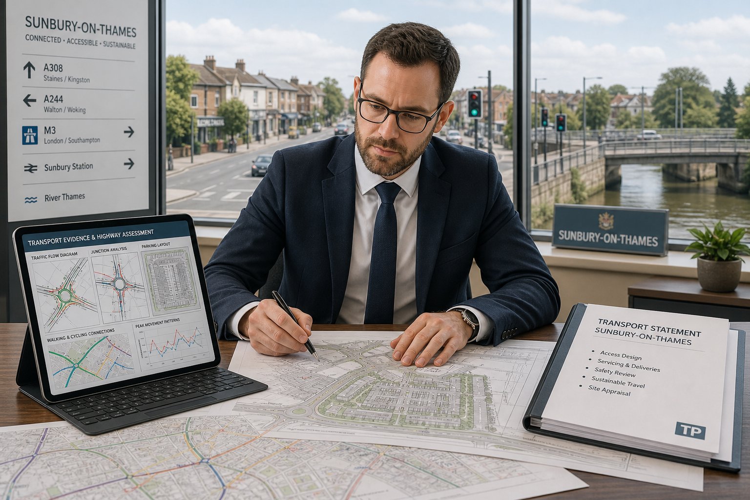
That is where a traffic engineer in Southall becomes central to the planning process. We help translate a proposal into transport evidence that local authorities can actually use: how many trips are likely, where they will go, whether the access works, how deliveries will operate, whether walking, cycling, and public transport are realistic alternatives, and what mitigation may be needed if pressure on the network increases.
For architects, planners, lawyers, surveyors, builders, developers, and local councils, the aim is usually the same: a scheme that is accessible, safe, policy-aligned, and defensible at application stage. In practice, getting there requires more than a generic report. It needs local judgement, proportionate assessment, and technical work that responds to Southall’s streets, constraints, and planning context in 2026. This guide explains where traffic engineering fits, when formal assessments are needed, and how the right evidence can strengthen an application rather than simply accompany it.
Key Takeaways
- A traffic engineer in Southall is essential for preparing transport evidence that ensures planning applications are accessible, safe, and aligned with local policies.
- Transport Statements and Transport Assessments are tailored based on the scheme’s scale and impact, requiring early professional judgement to determine the appropriate level of analysis.
- Local road network constraints, junction capacity, and parking demand are critical factors that a Southall traffic engineer must address through detailed technical surveys and modelling.
- Sustainable travel considerations, including public transport accessibility, walking, and cycling routes, must be pragmatically evaluated and incorporated into transport assessments.
- Effective traffic engineering involves proactive collaboration with local planning and highway authorities to address concerns promptly and adapt designs to avoid delays or objections.
- Choosing the right traffic engineer involves assessing their relevant experience, technical competence, local knowledge, clear reporting skills, and responsiveness to strict planning timelines.
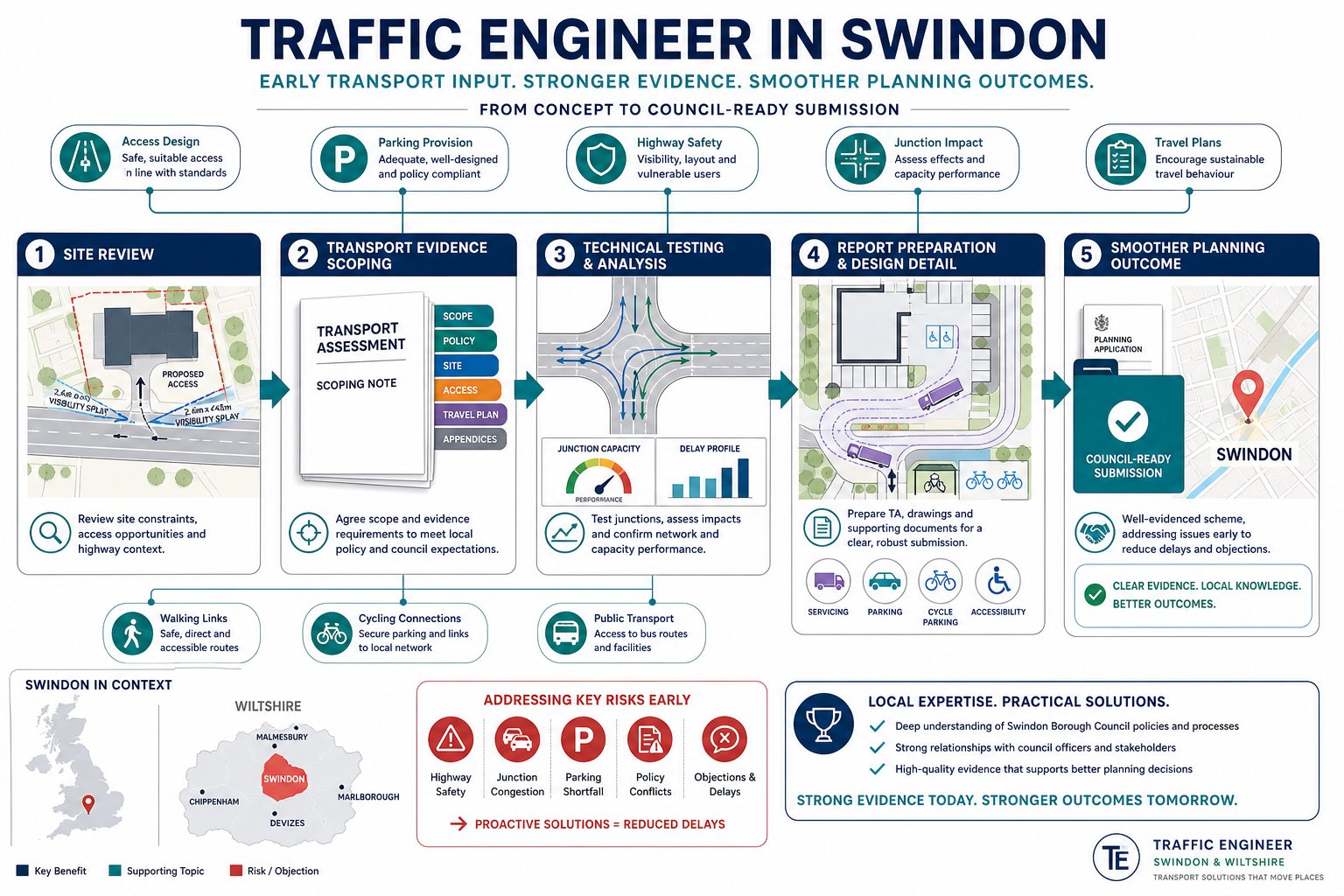
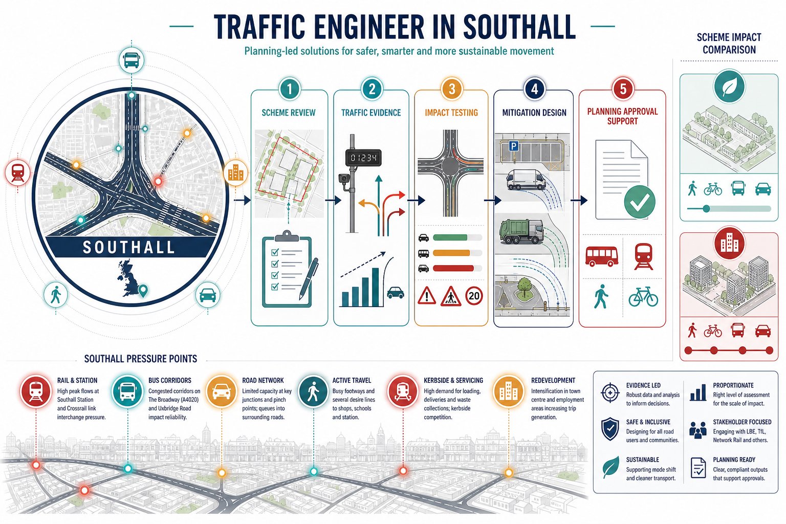
What A Traffic Engineer In Southall Does For Planning Applications
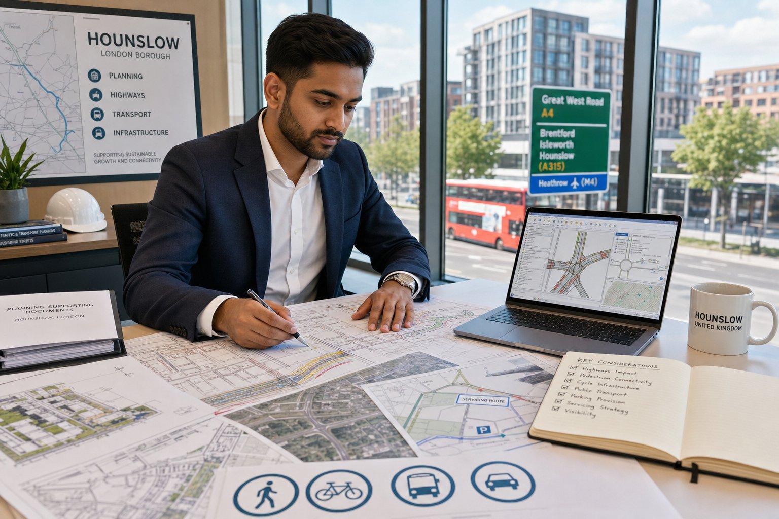
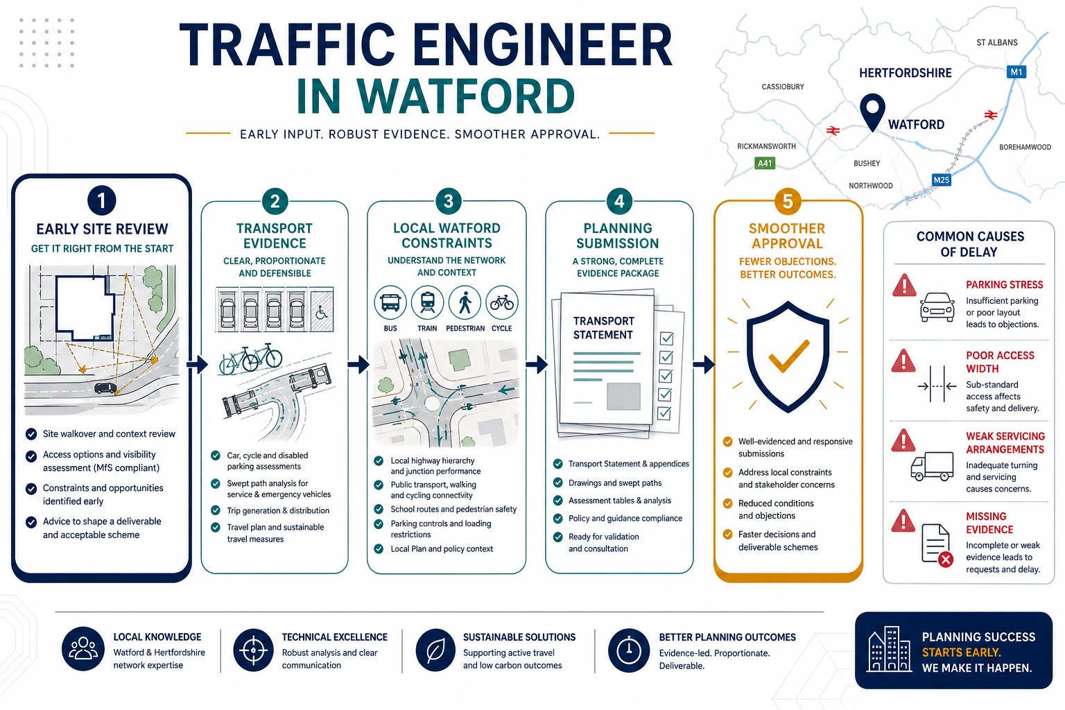
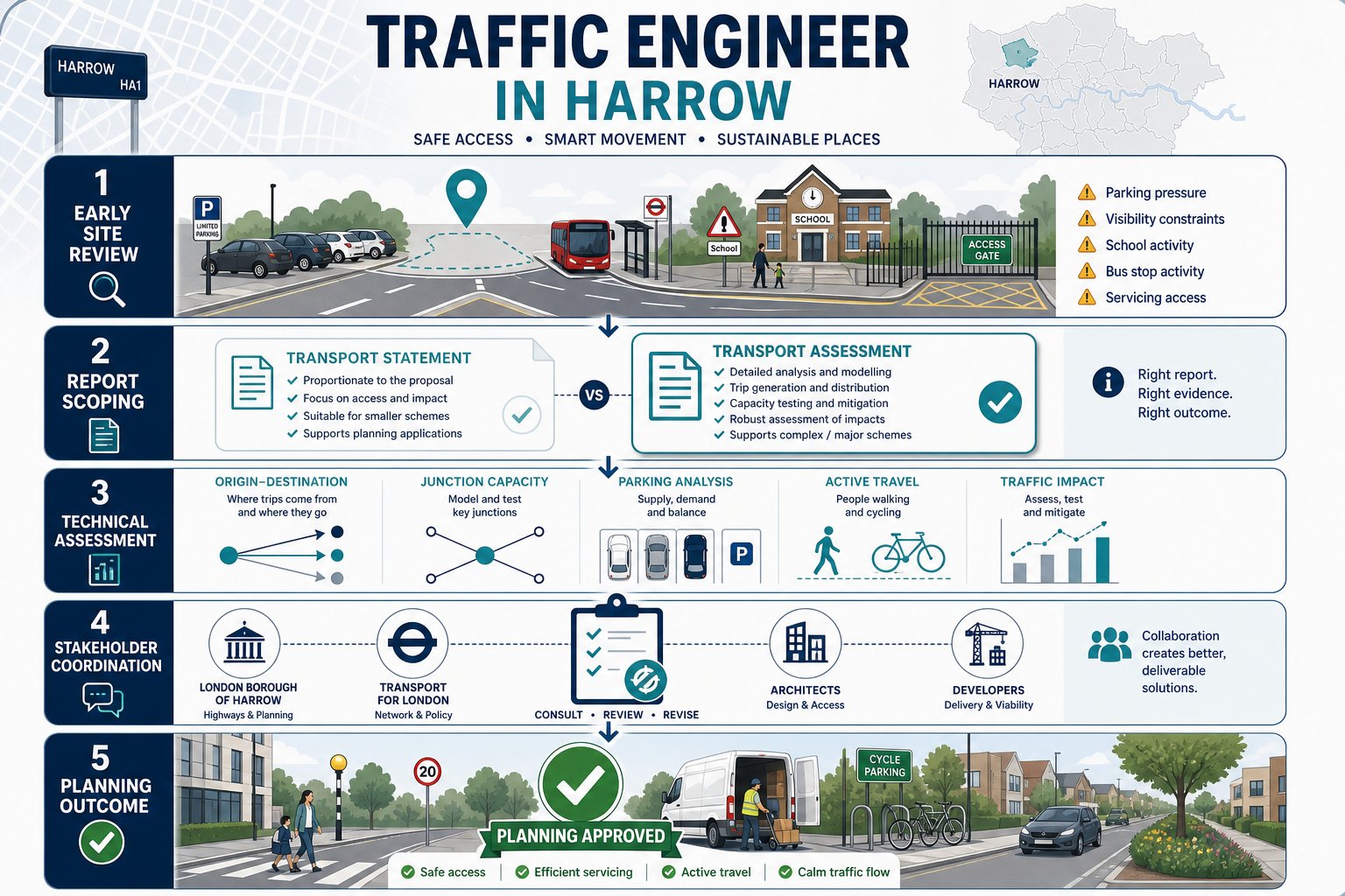
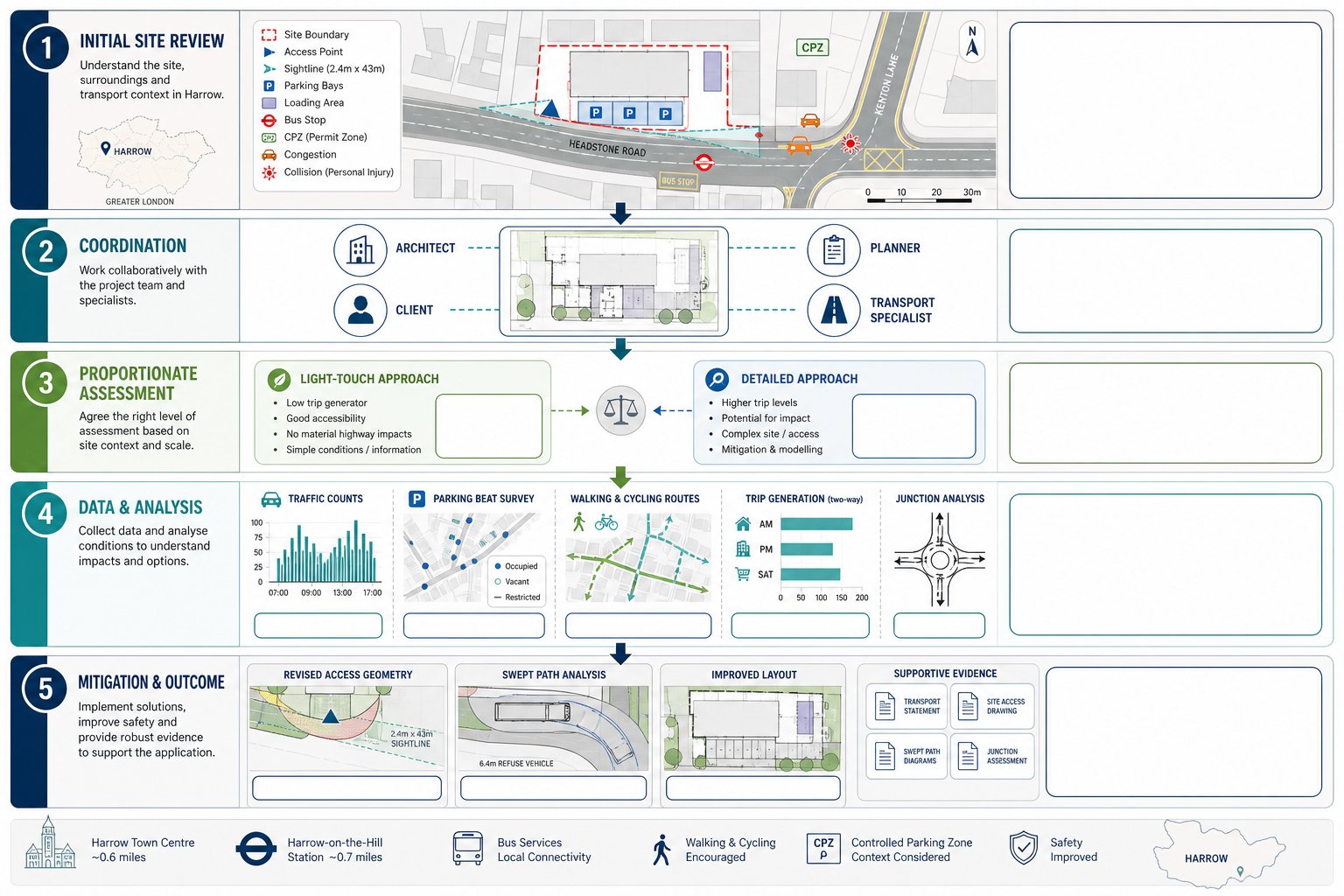
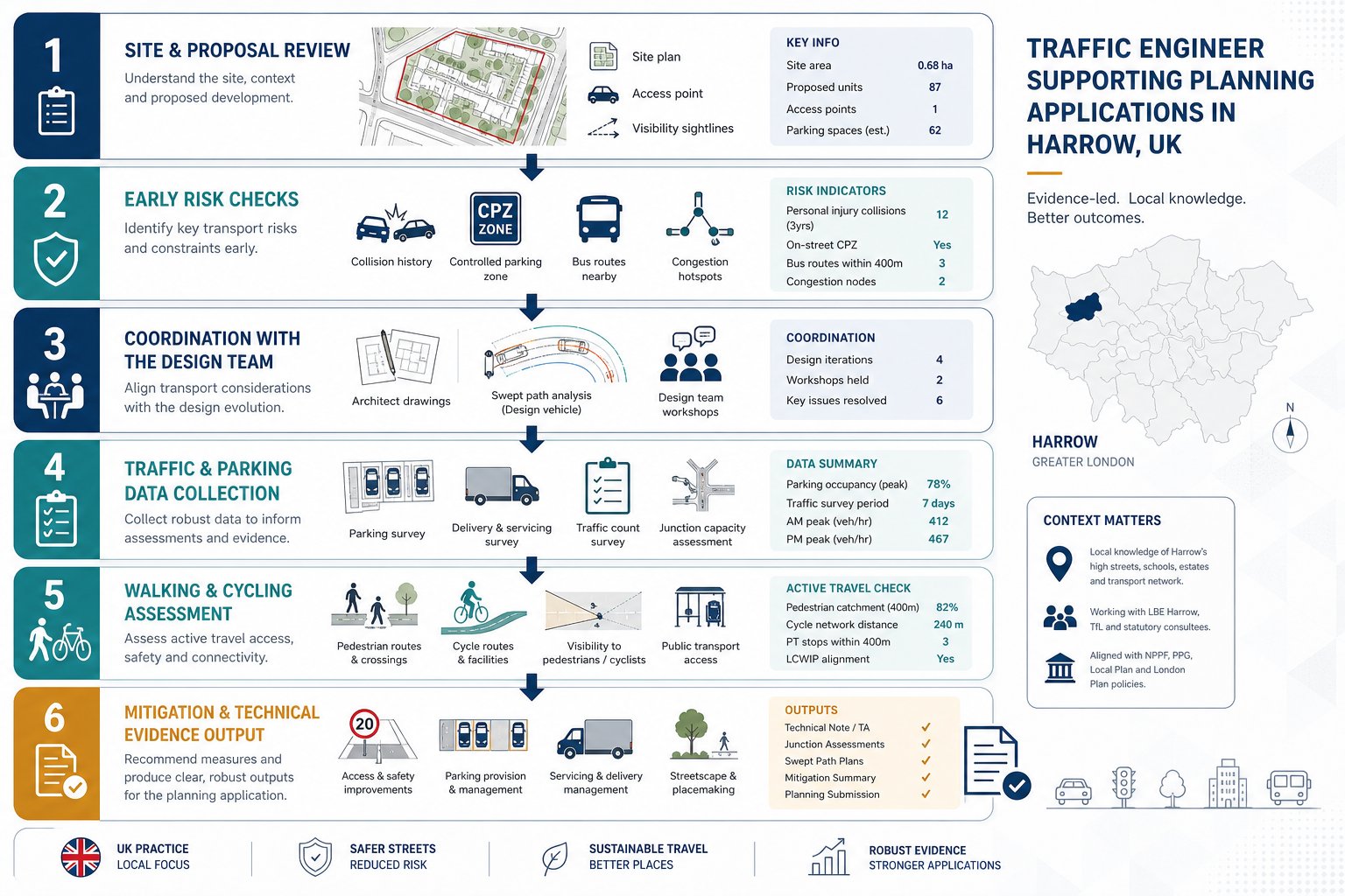
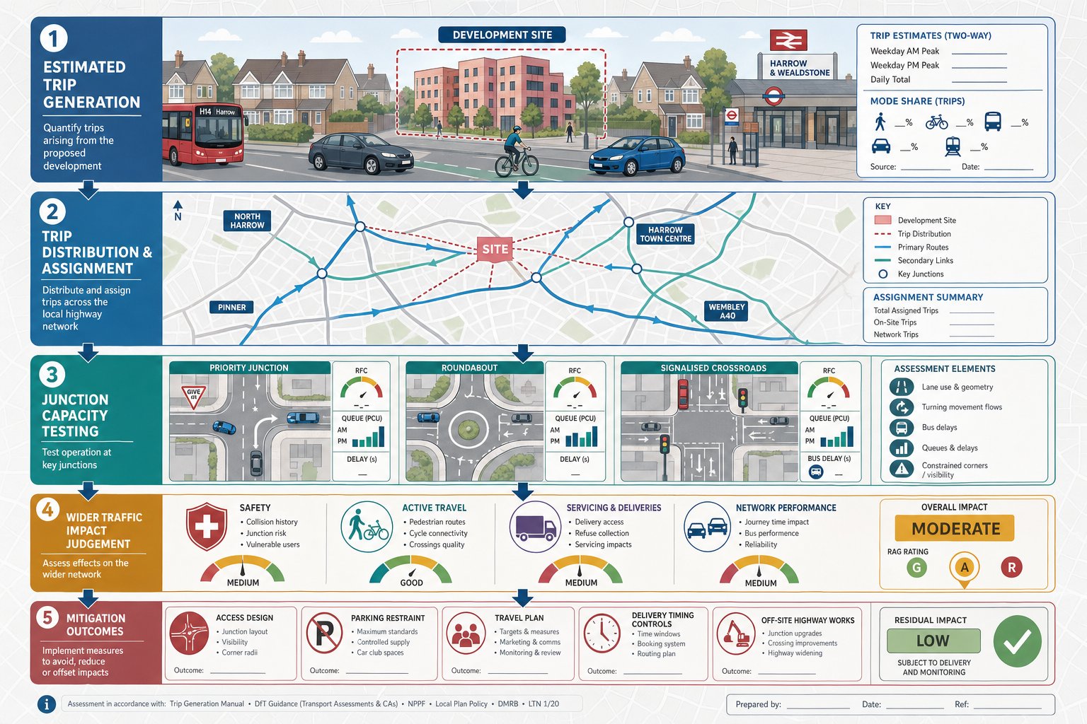
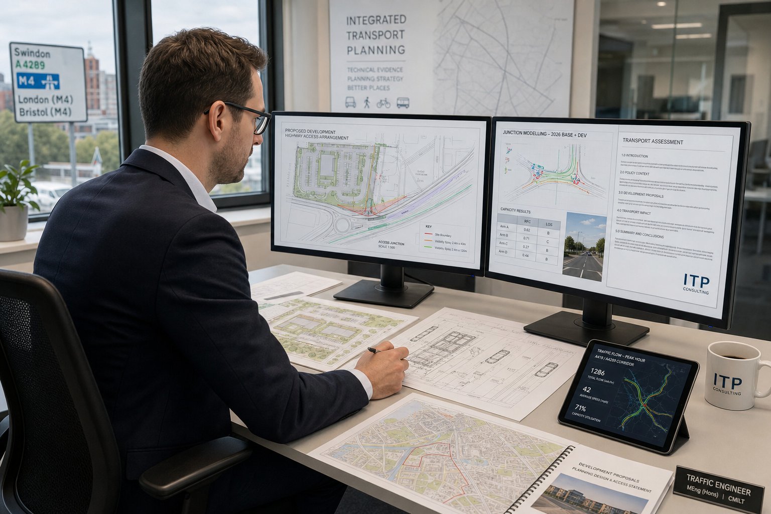
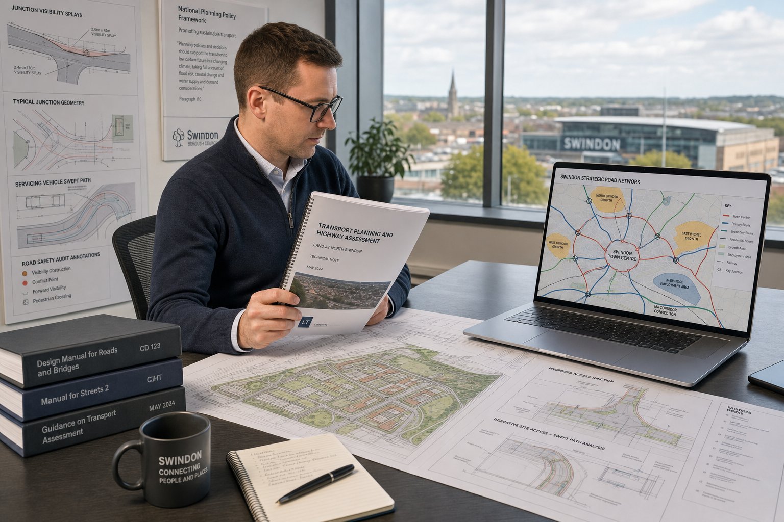
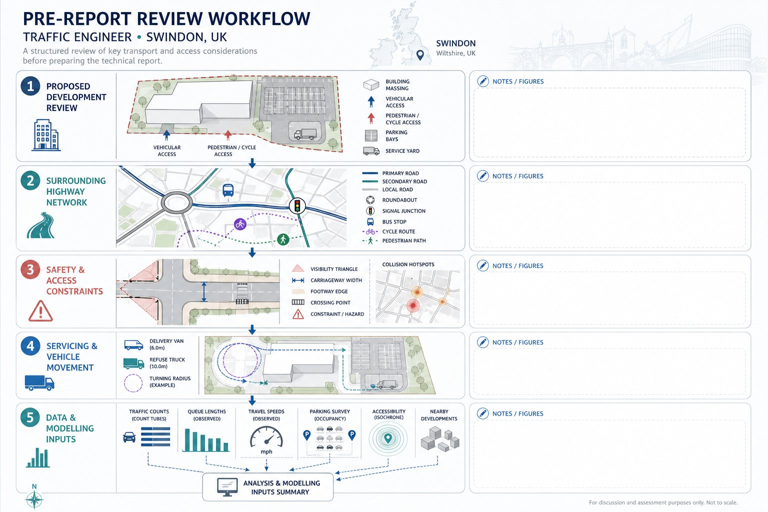
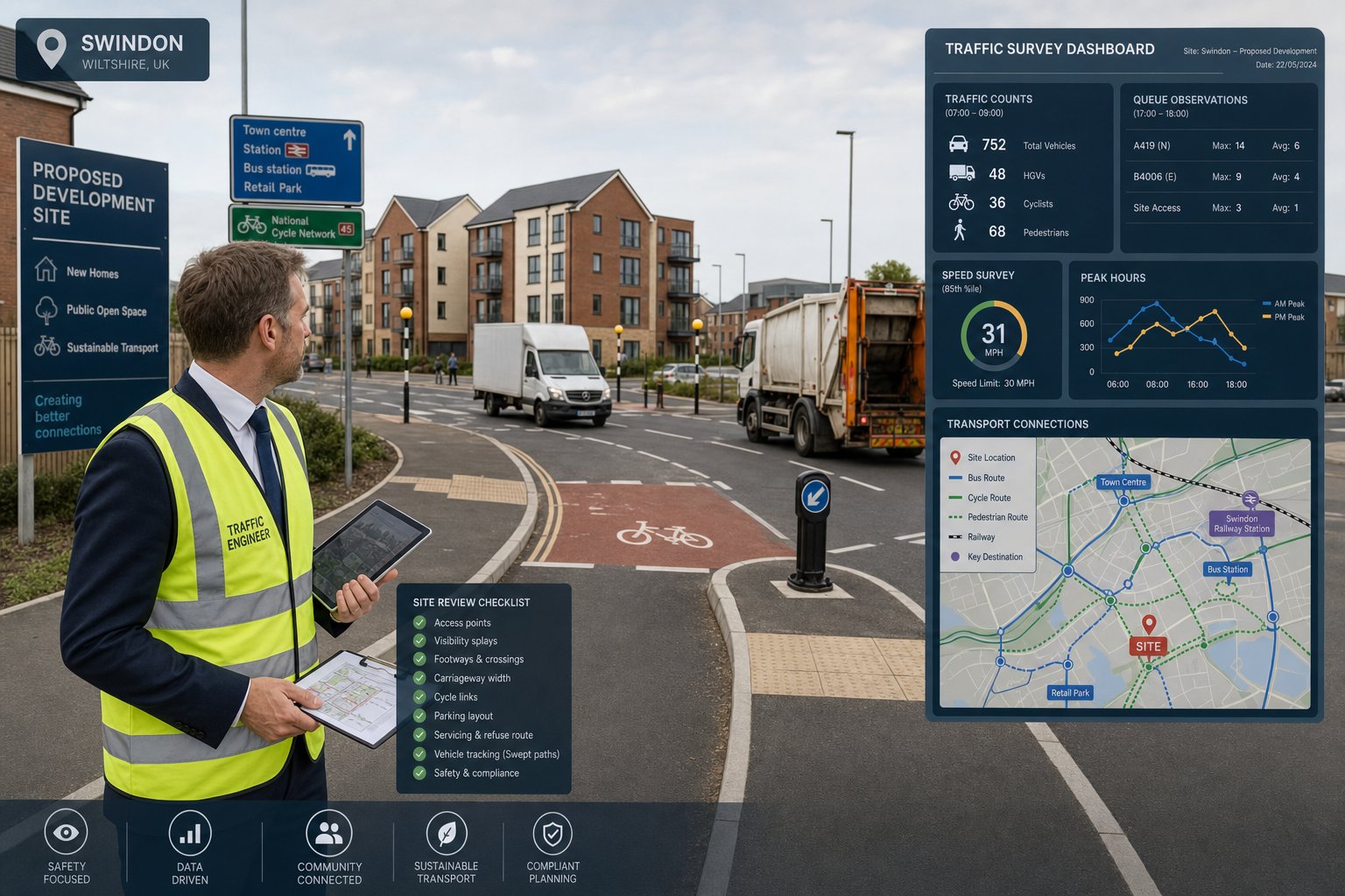
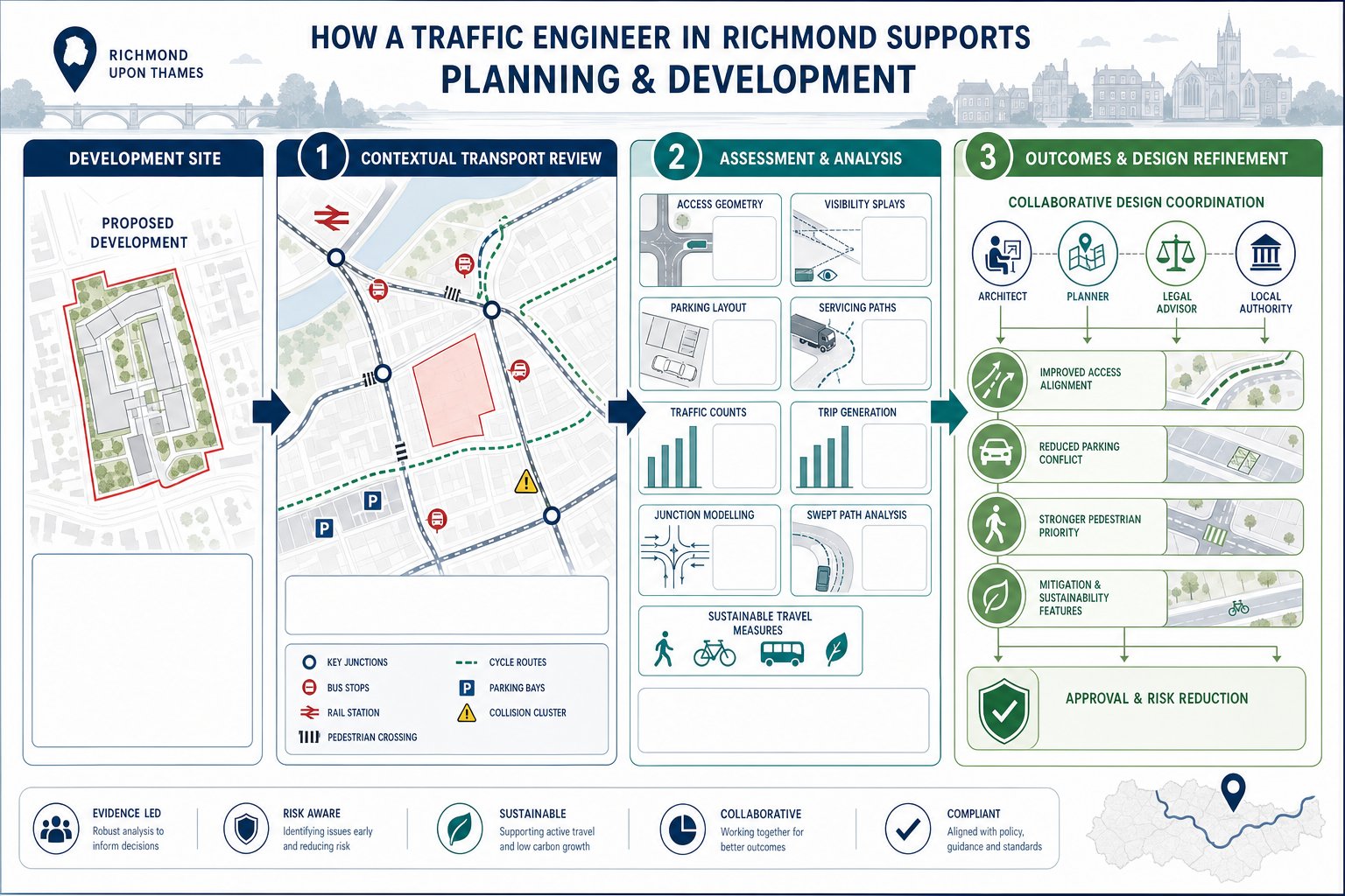
A traffic engineer in Southall supports planning applications by testing whether a development will function acceptably on the transport network and by preparing the evidence needed to show that to decision-makers. That sounds simple. It rarely is.
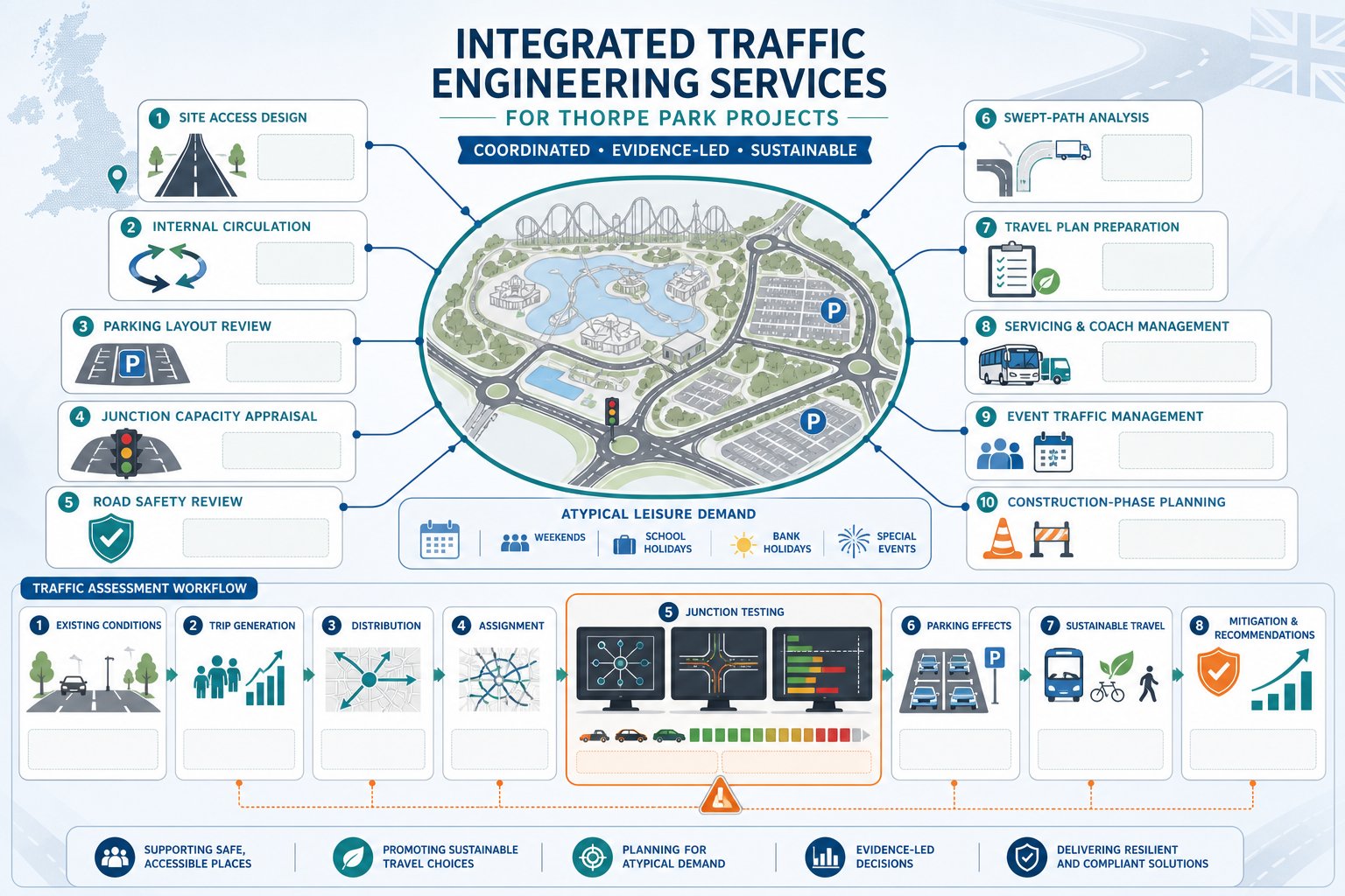
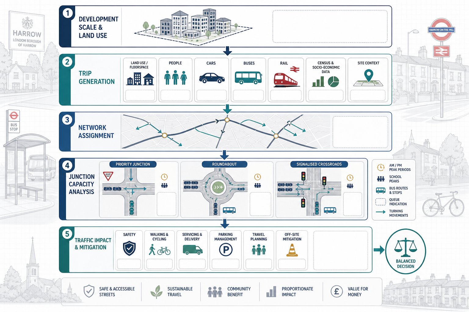
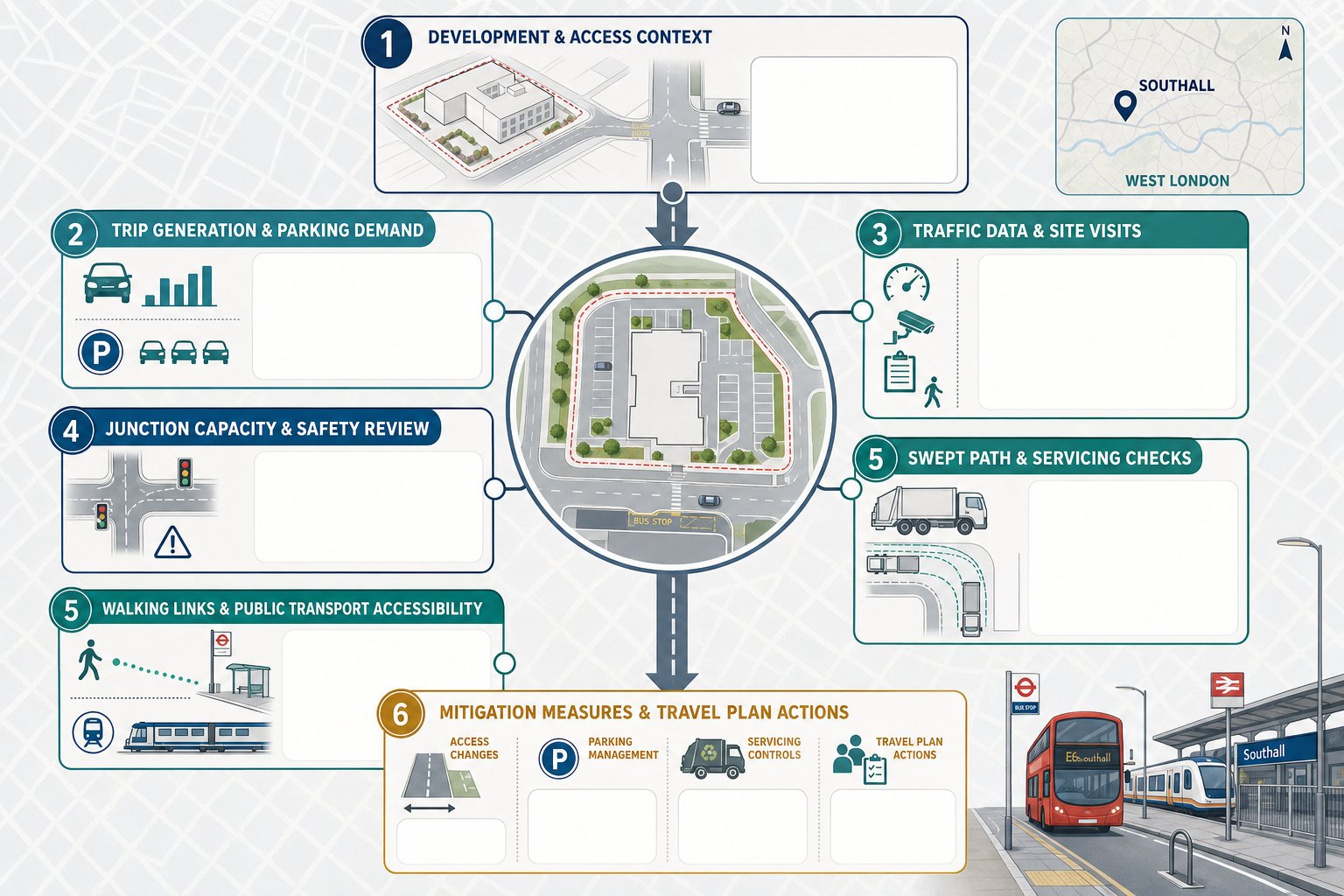
In practical terms, we start by understanding the scheme: land use, scale, access arrangements, likely trip generation, parking demand, servicing needs, and how people are expected to arrive and leave. From there, we assess the proposal against local and national policy, site conditions, and the authority’s likely concerns. On one project, the key issue may be junction capacity. On another, it may be refuse vehicle access, blue-badge parking, or whether walking links to bus stops are credible.
The work often includes traffic data review, site visits, swept path analysis, accident record review, accessibility assessment, and trip-rate forecasting. If needed, we also prepare mitigation strategies, whether that means access amendments, servicing controls, parking management, or travel plan measures. Broader strategic context can matter too, which is why teams often draw on approaches used by Traffic Engineering Consultants: working across comparable planning environments.
Good transport input is not just about “getting a report done”. It is about anticipating objections early, shaping a workable layout, and helping the planning statement stand up to scrutiny. That is especially important in areas such as Southall, where local roads, bus routes, rail access, and kerbside pressure interact very quickly with development proposals.
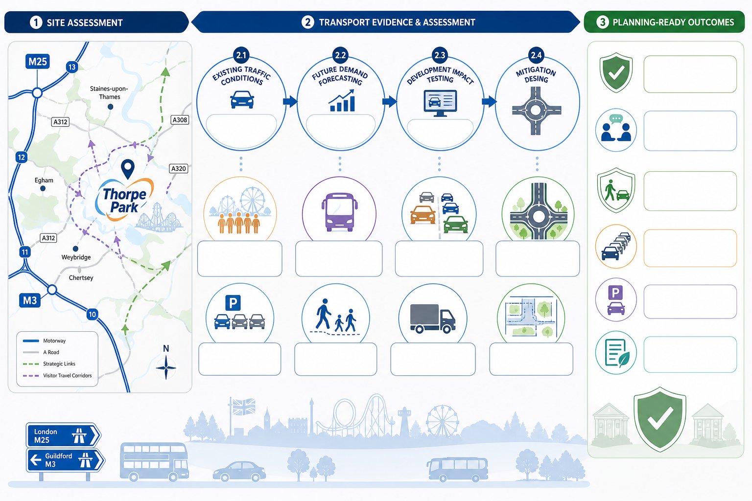
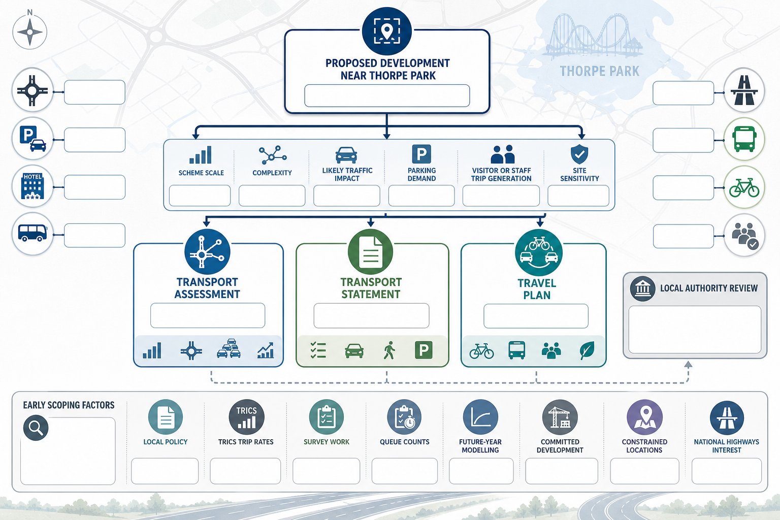
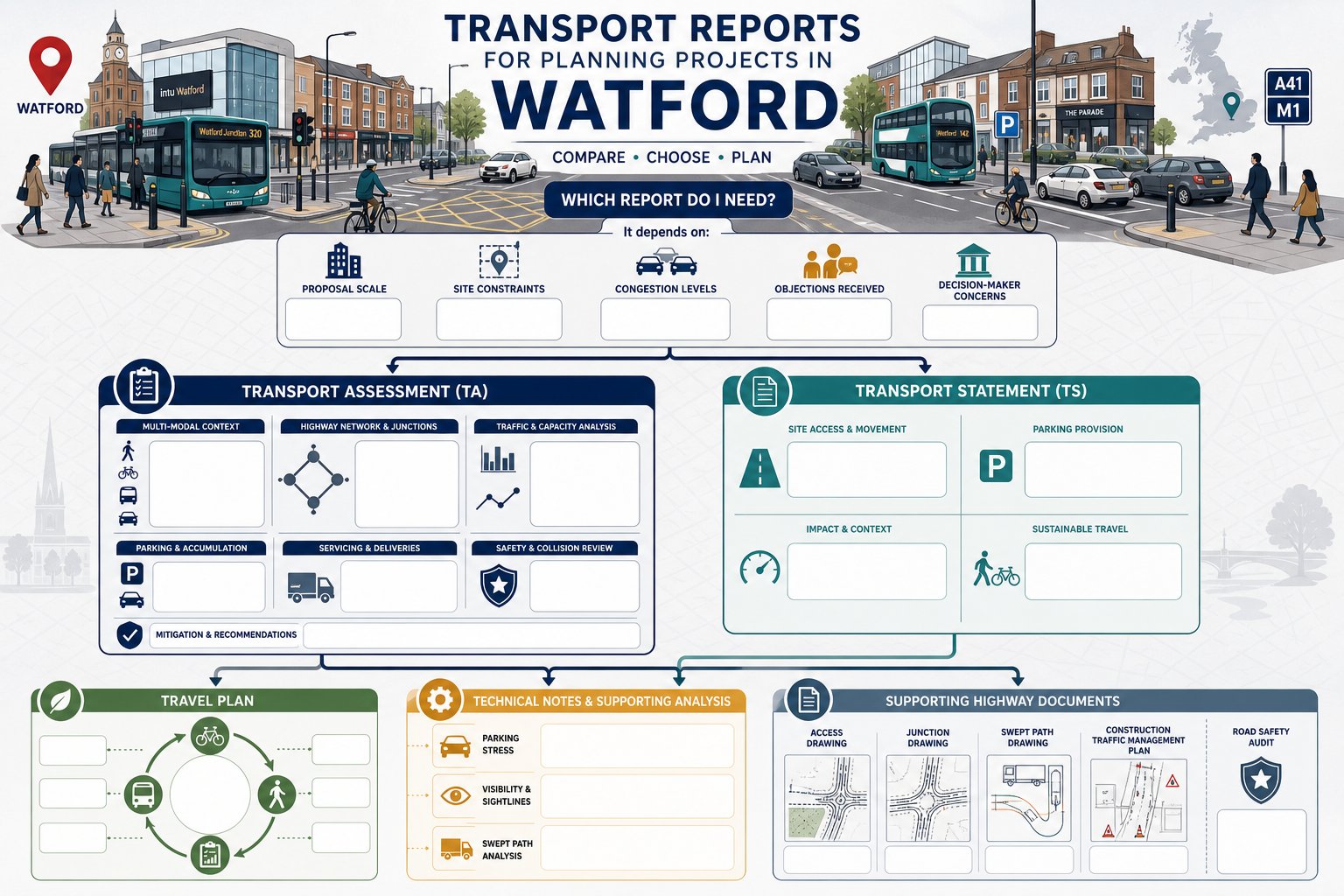
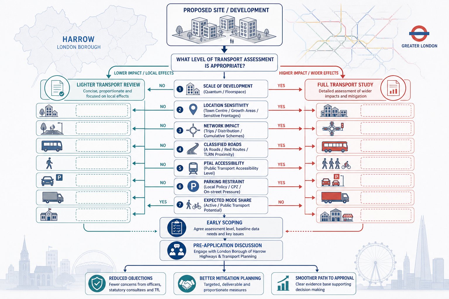
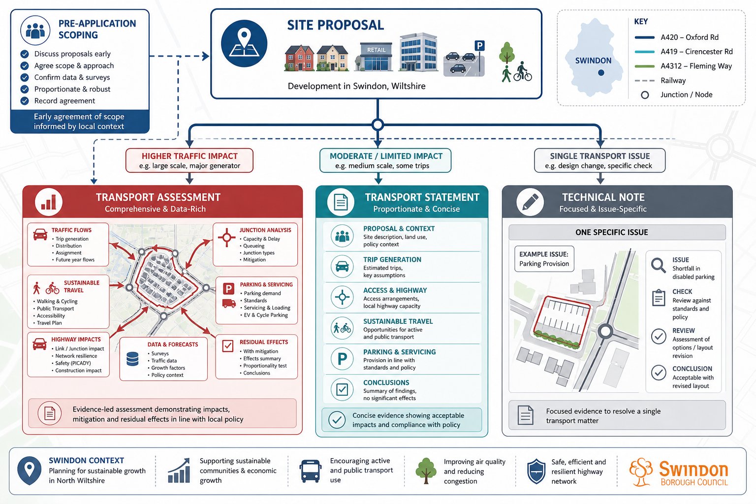
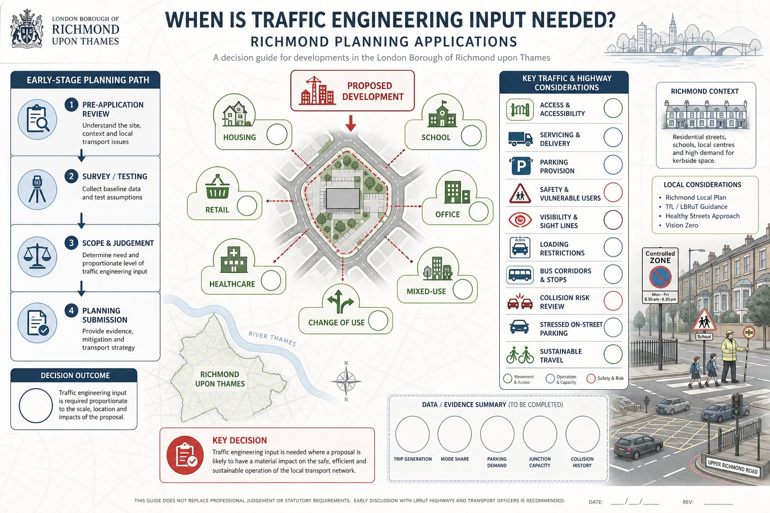
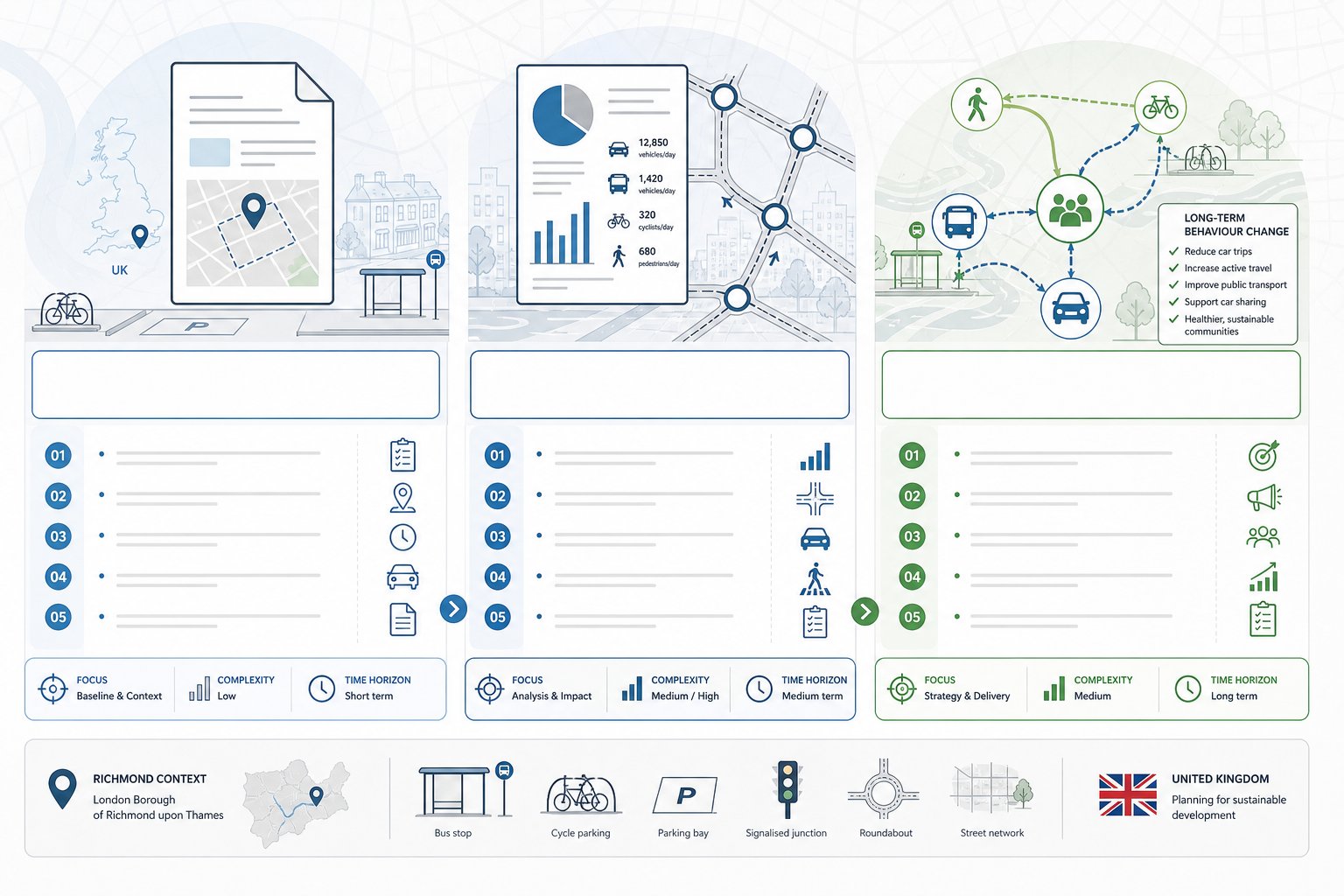
When A Transport Assessment Or Transport Statement Is Needed In Southall
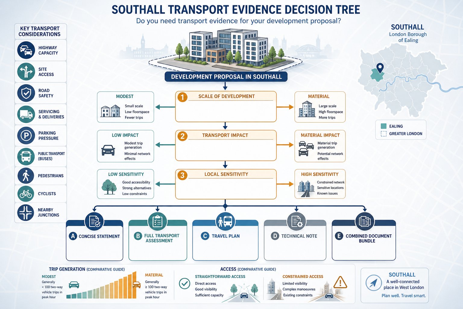
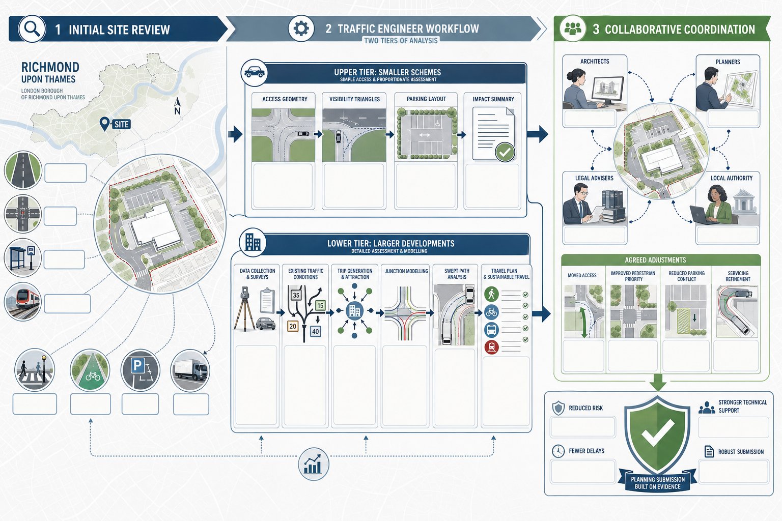
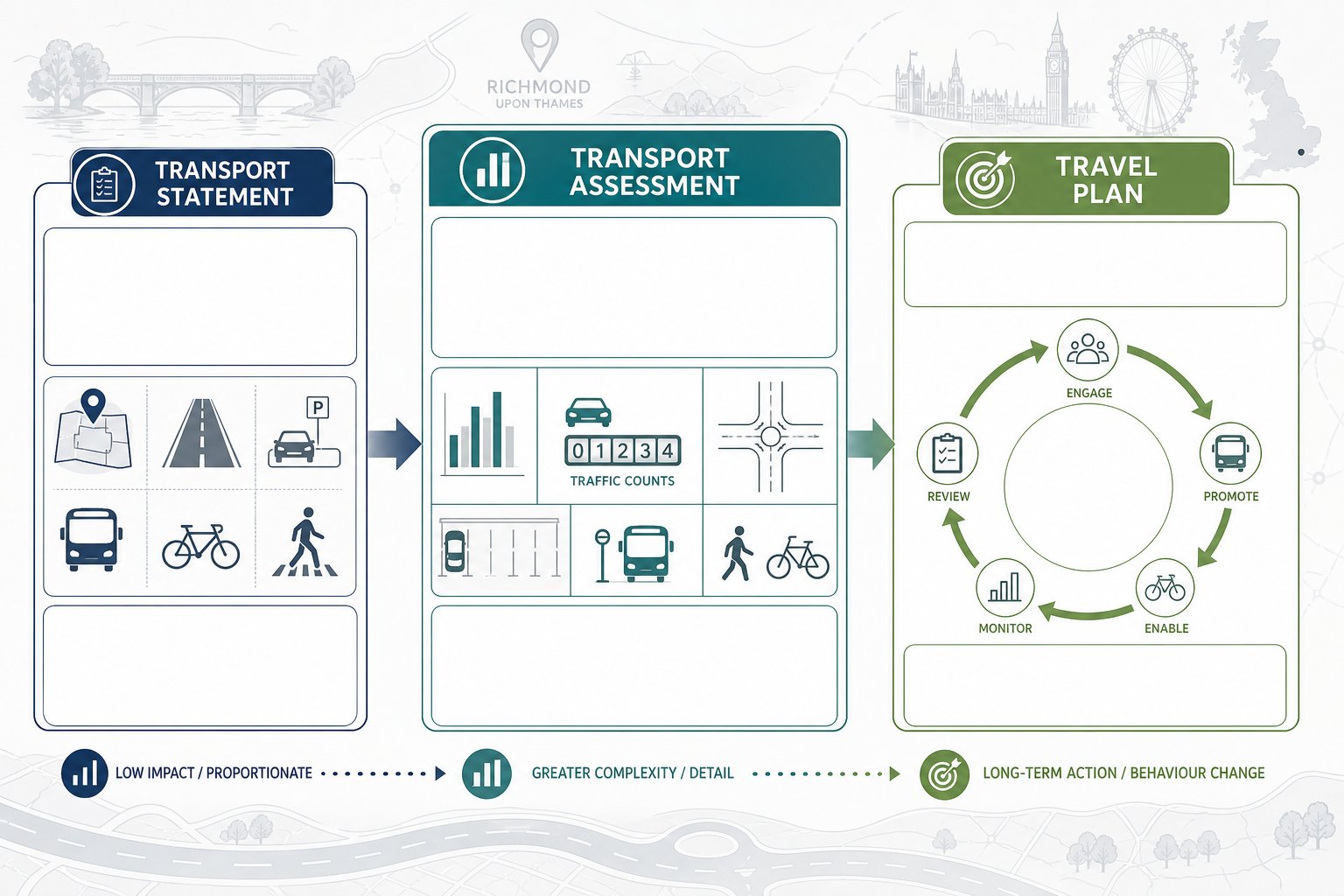
The answer depends on scale, impact, and local sensitivity rather than a single universal trigger. In Southall, a Transport Statement is generally used where impacts are likely to be limited but still need to be explained clearly. A Transport Assessment is usually required where a proposal could materially affect trip generation, highway capacity, site access, road safety, servicing, parking demand, or sustainable travel patterns.
For example, a relatively small infill scheme may still need formal transport evidence if access is constrained, if the surrounding roads already experience pressure, or if the site sits in an area where parking and servicing are contentious. By contrast, some developments with lower trip intensity may only need a concise statement, provided the impacts are demonstrably modest and the evidence is proportionate.
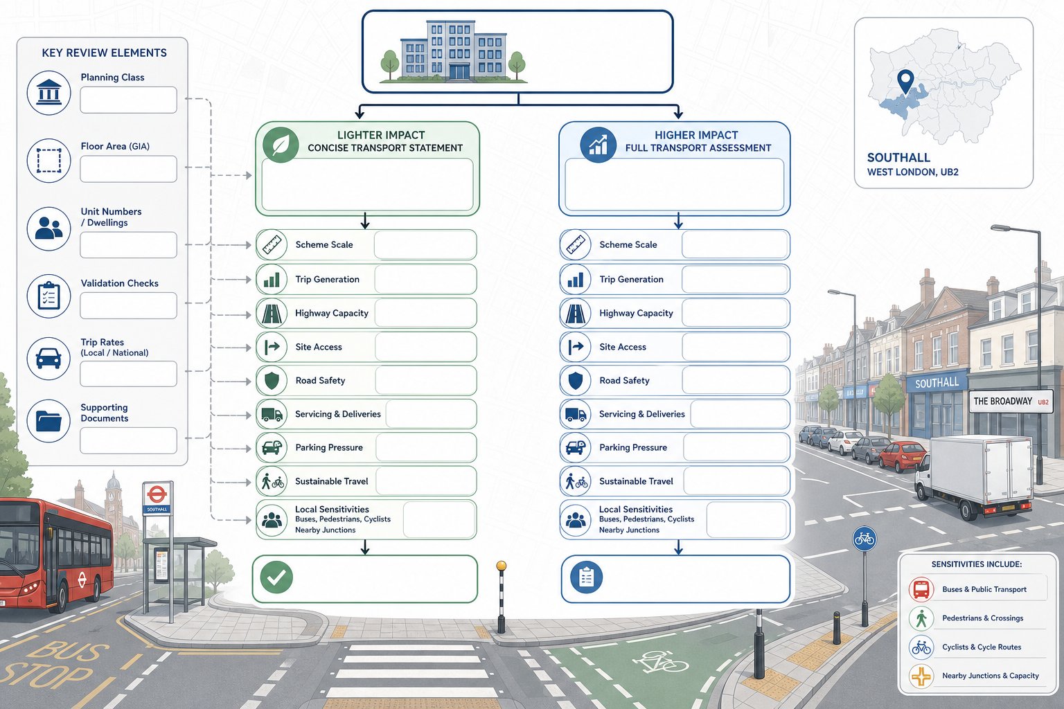
This is where early professional judgement matters. We typically review the planning use class, floor area or unit numbers, local authority validation requirements, likely trip rates, and any known sensitivities around buses, pedestrians, cyclists, or nearby junctions. We then advise whether a statement, full assessment, travel plan, technical note, or a bundle of supporting documents is the right route.
On more complex schemes, lessons from wider urban work, including Commercial Traffic Engineering, can be useful because the real issue is often not raw size alone but operational effect. If a proposal changes how the street works, planners usually want that demonstrated with evidence rather than assumption.
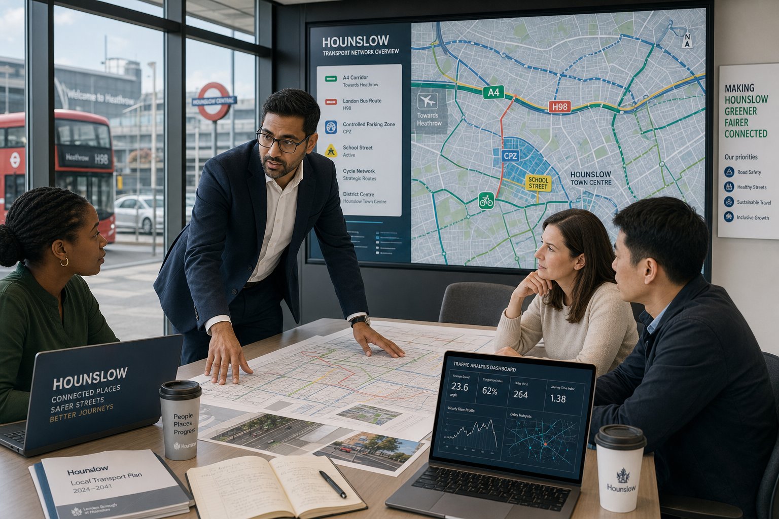
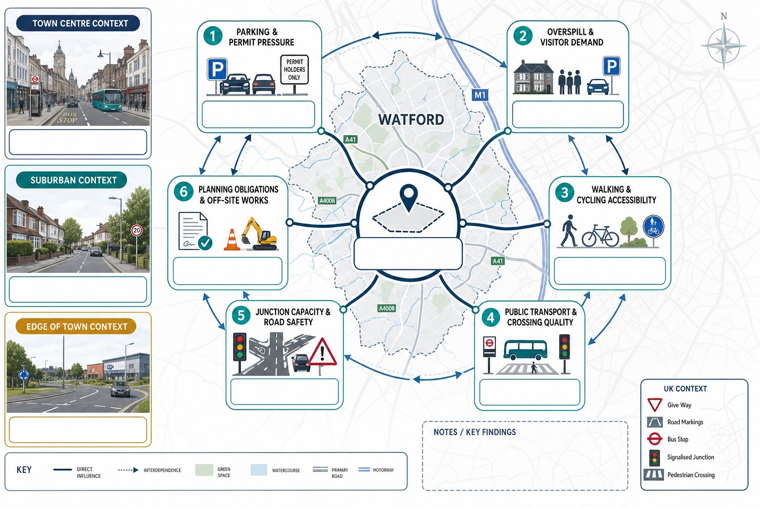
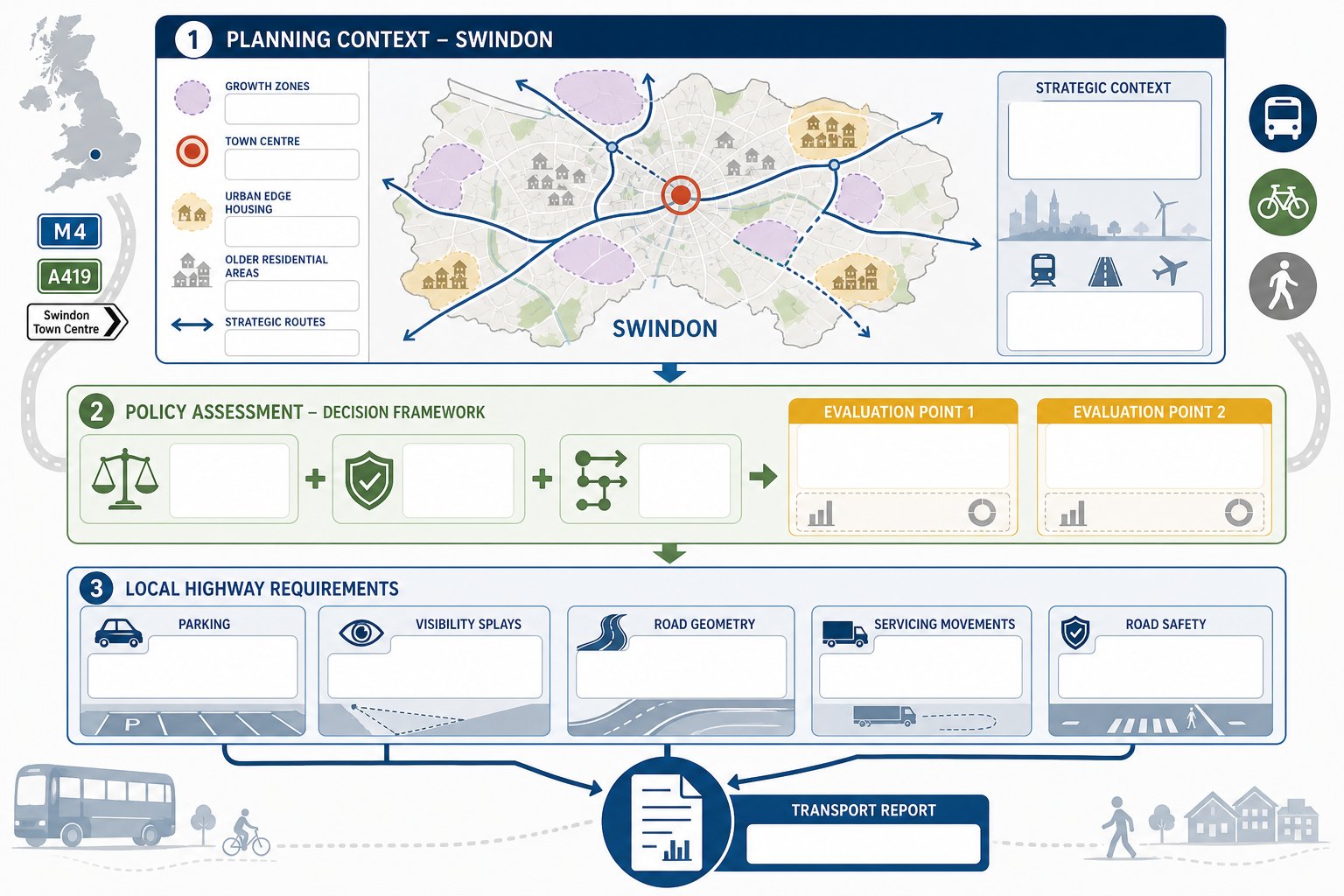
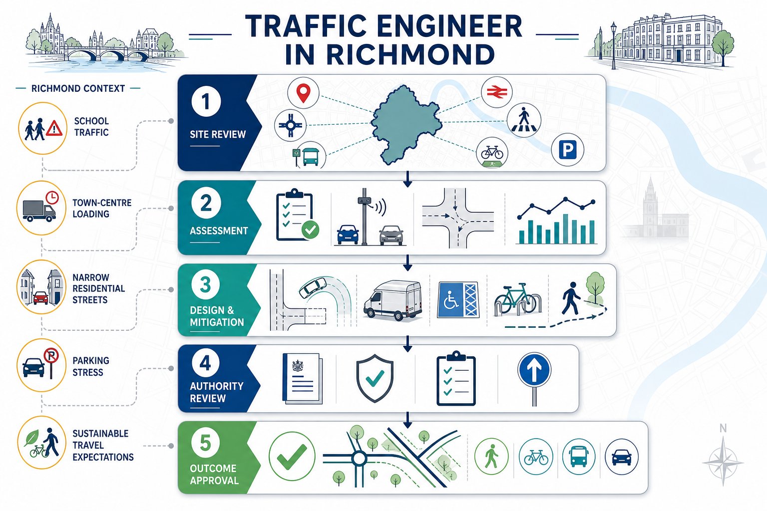
Key Highways And Transport Issues That Affect Development In Southall
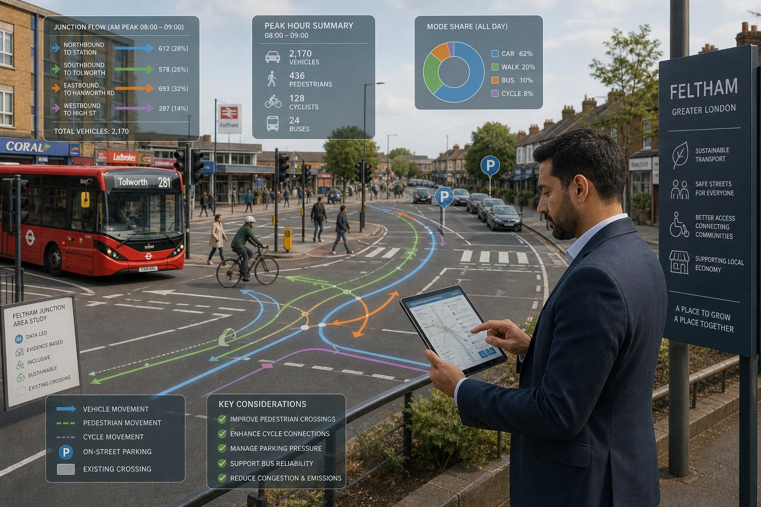
Southall schemes are rarely assessed in a vacuum. Highway and transport questions are shaped by a dense local pattern of movement: through-traffic, bus activity, station-related travel, school-run peaks, deliveries, and constrained kerbside conditions. That means development proposals often need to address more than a simple “net increase in cars” calculation.
Typical issues include local junction stress, access visibility, turning movements, parking overspill, servicing practicality, pedestrian comfort, cycle connectivity, and whether the site genuinely supports non-car travel. There may also be policy-led expectations around reducing car dependence, especially where public transport accessibility is relatively strong. But that policy position has to be backed by site reality. A drawing that shows cycle storage is not the same thing as a route people will actually use.
For many applications, the technical challenge is balancing local detail with strategic context. A site may sit within a highly connected part of west London, but if the immediate approach roads are awkward, if servicing blocks movement, or if a nearby junction is already operating close to practical capacity, those local conditions can dominate the planning discussion. Comparable urban methodologies used by Traffic Engineer In London: teams are often relevant here because Southall’s planning questions are both place-specific and metropolitan in character.
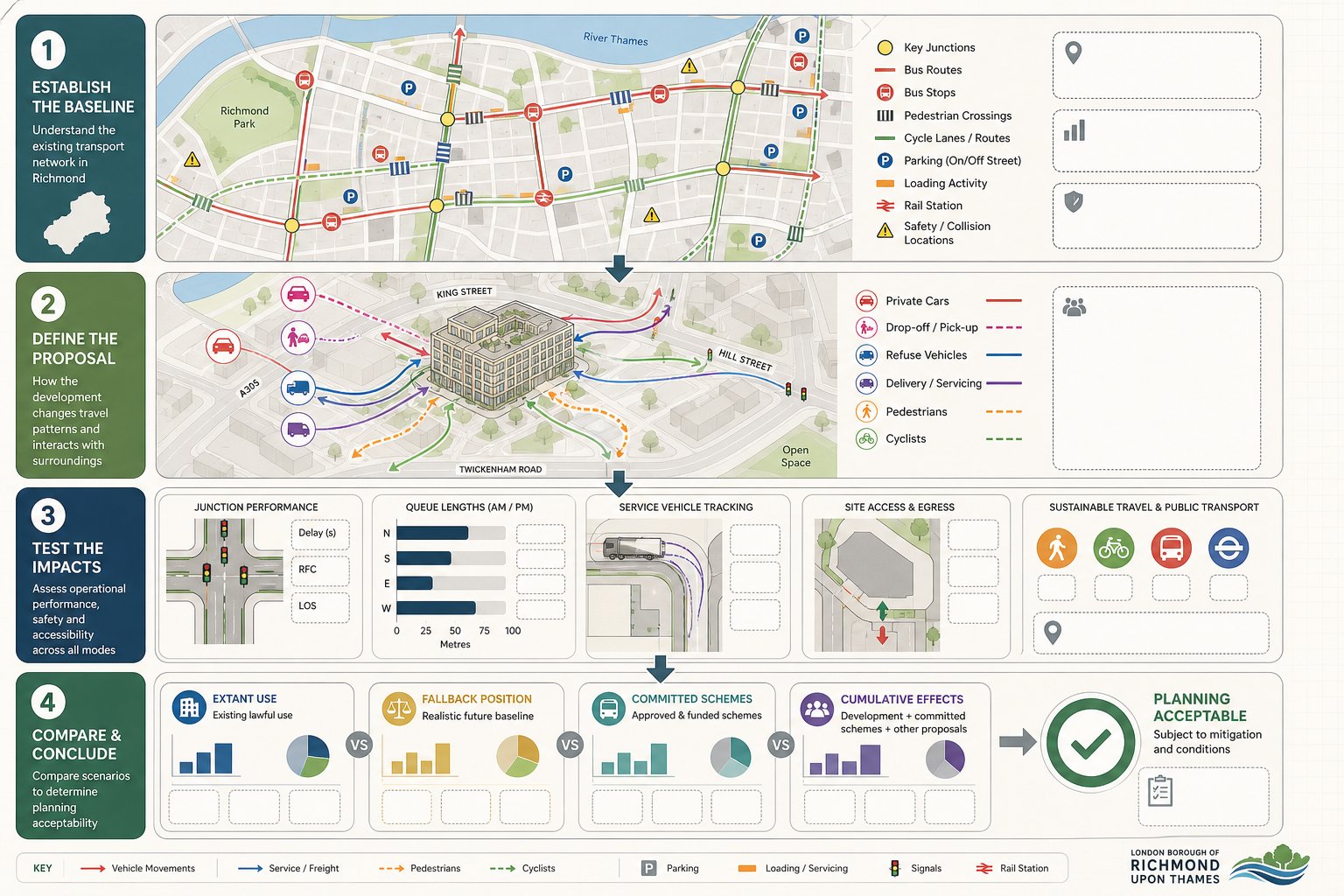
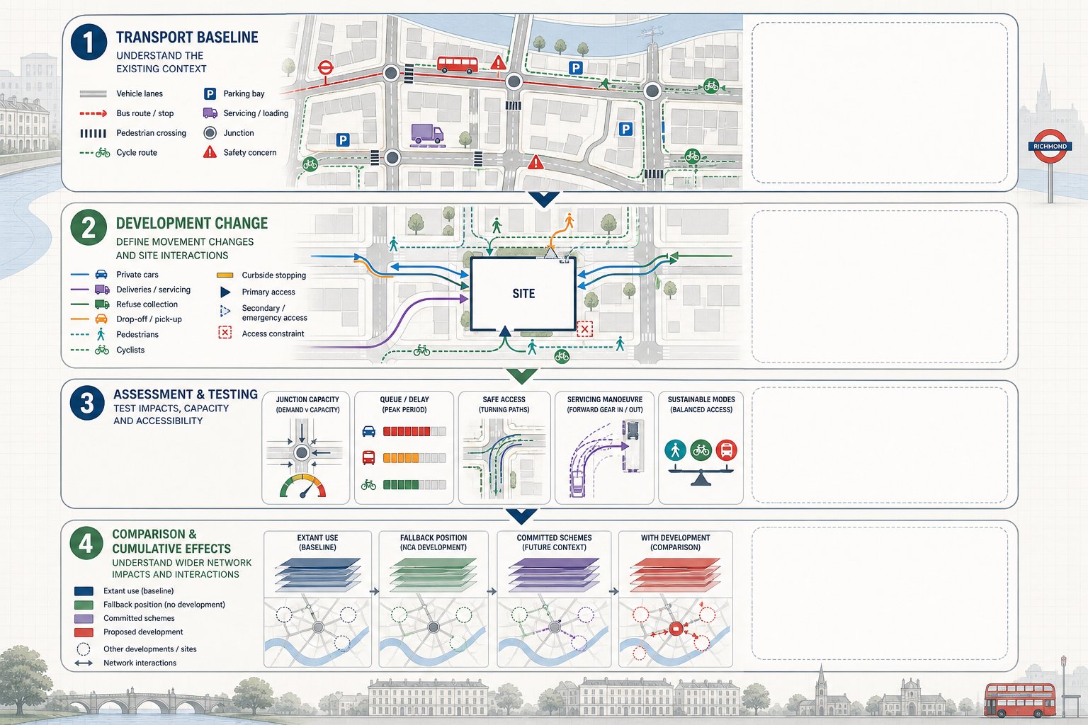
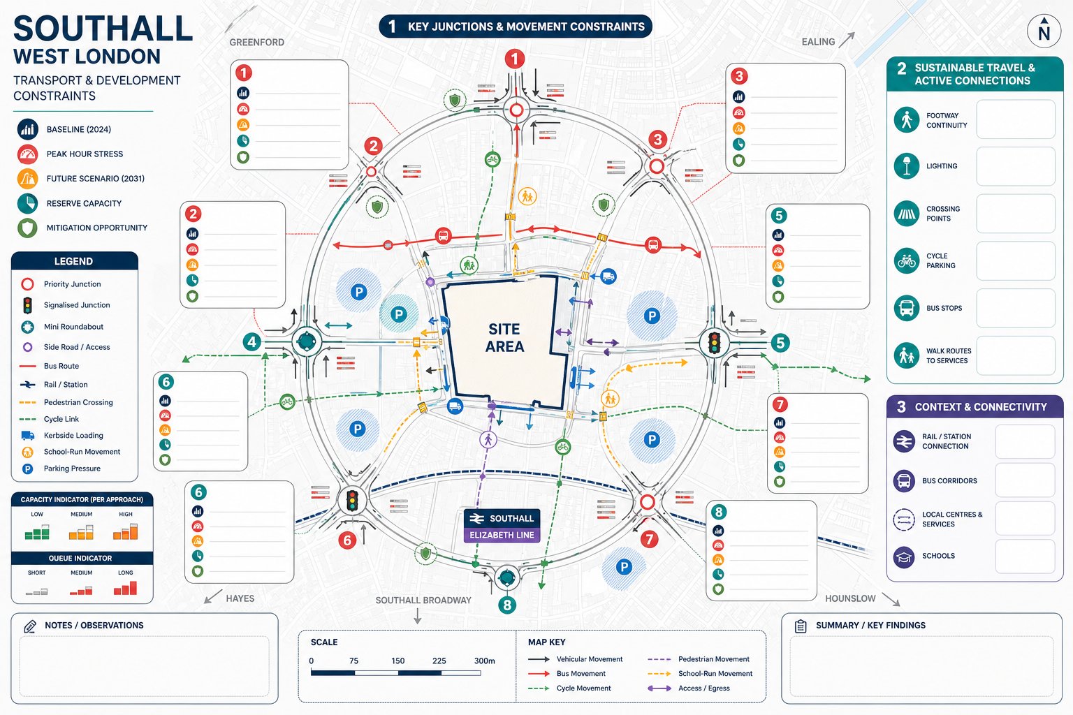
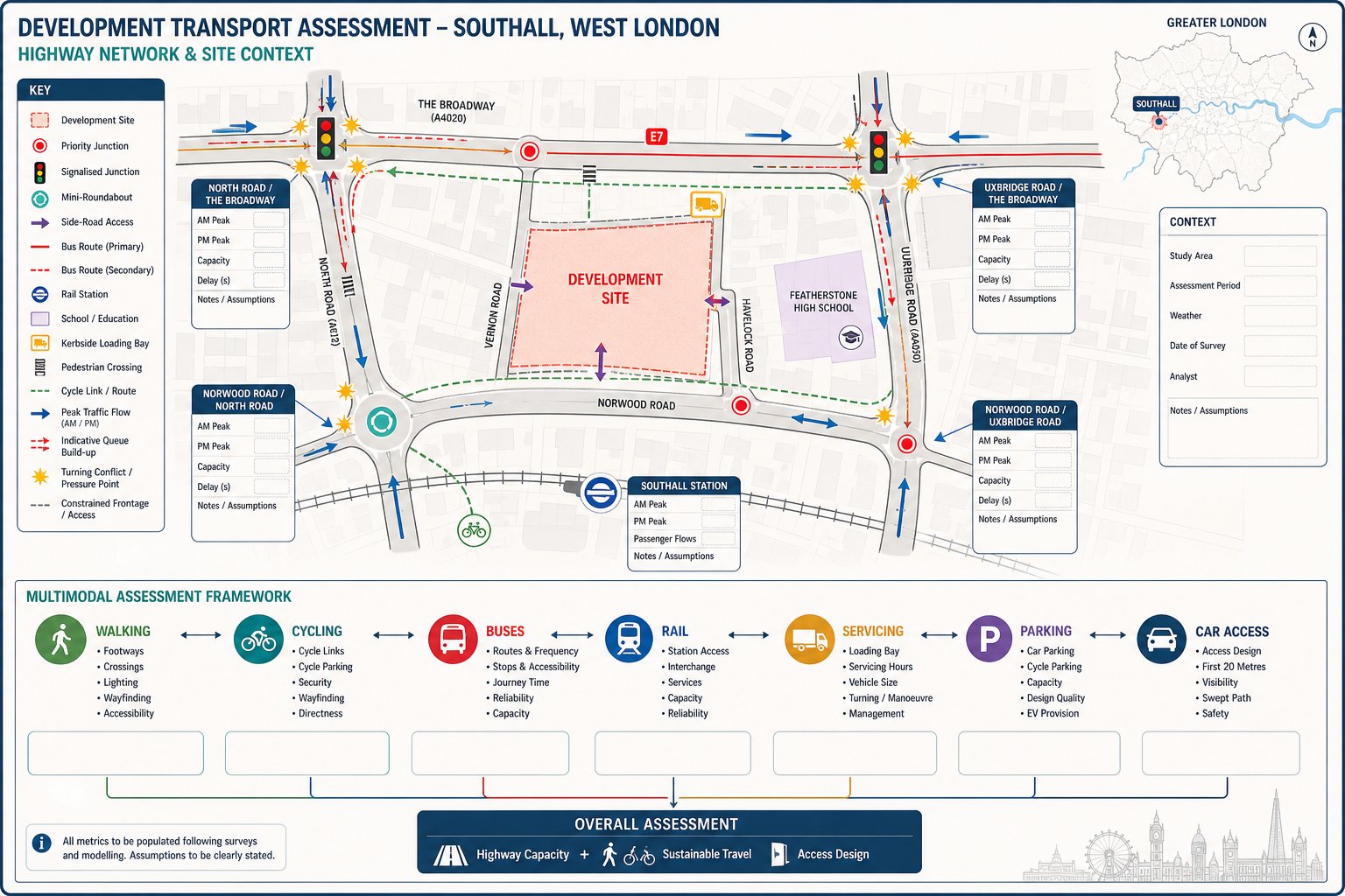
Local Road Network Constraints And Junction Capacity
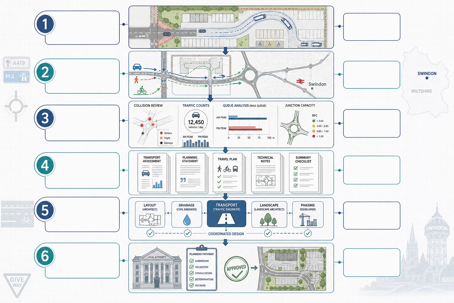
Southall developments are commonly influenced by the performance of nearby priority junctions, signalised junctions, mini-roundabouts, and side-road accesses. The key question is not whether the road network is busy, it usually is, but whether the proposal would make conditions materially worse and, if so, whether mitigation can reduce that effect.
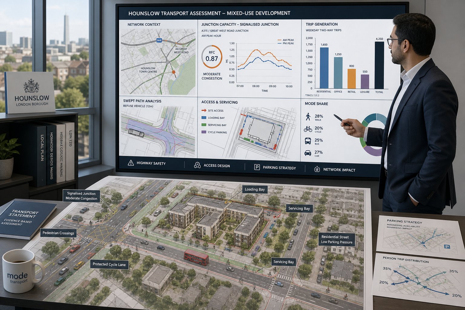
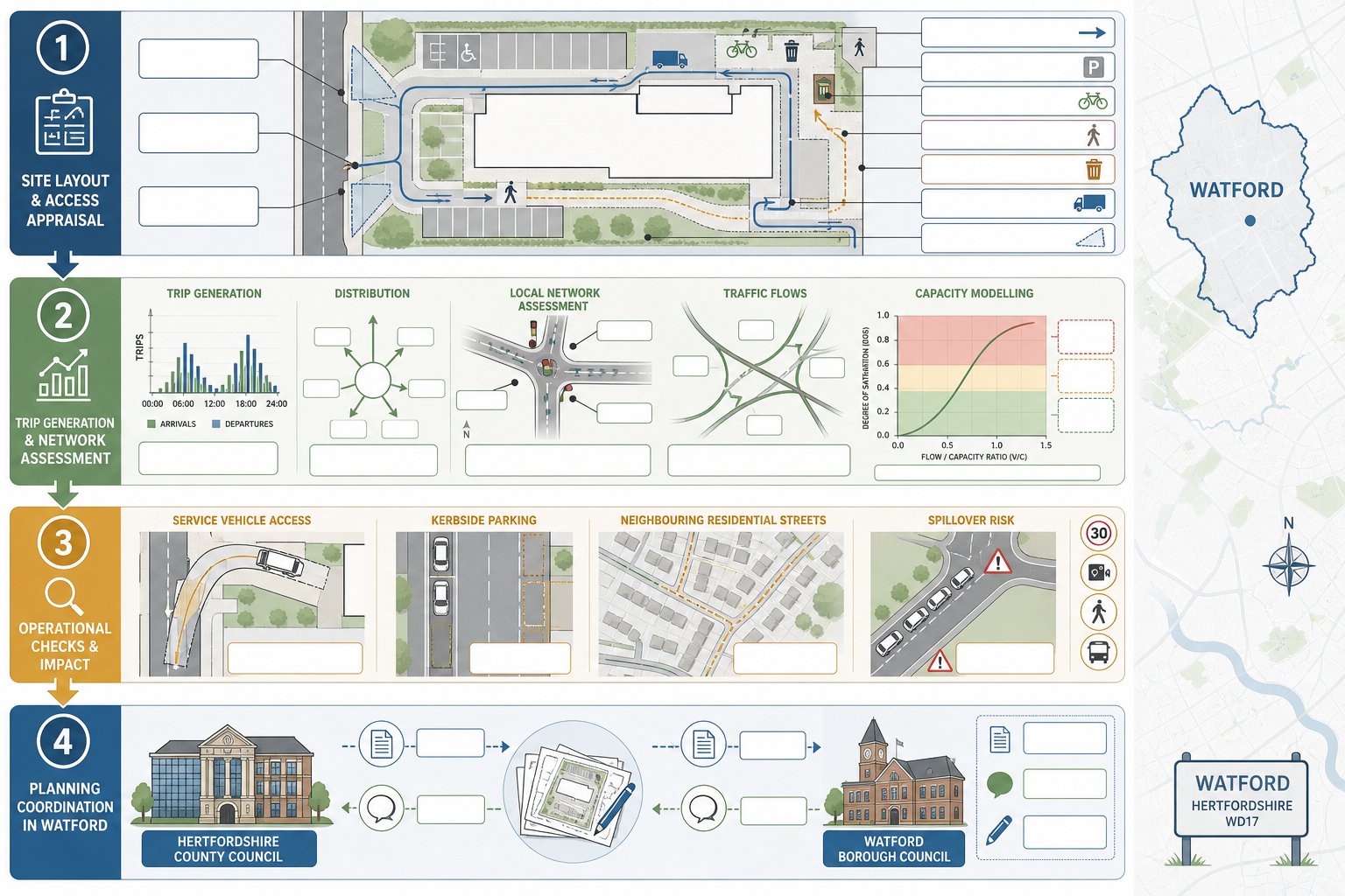
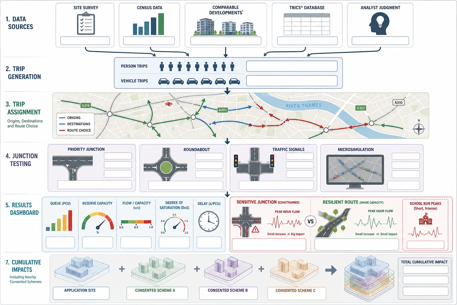
We typically review baseline traffic counts, turning movements, queue patterns, and peak-hour operation. Capacity modelling may then be used to test a committed-development scenario and a future-year scenario with the proposed development added. That helps establish whether reserve capacity exists or whether delays, queue growth, or blocked turning movements are likely to become problematic.
Sometimes the issue is subtle. A development may generate limited overall trips but concentrate them at a sensitive access or at a junction already affected by right-turn delay, bus interference, or pedestrian stages. In those cases, technical evidence needs to be precise. General statements about “negligible impact” are unlikely to carry much weight if the authority expects model outputs and clear assumptions.
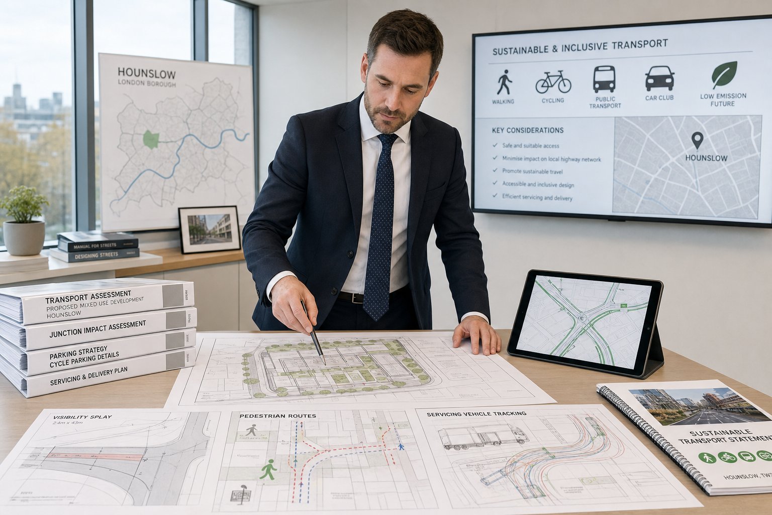
Public Transport, Walking, And Cycling Considerations
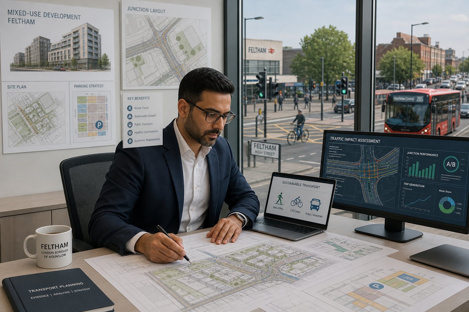
Southall is not assessed solely through a highway lens. Public transport accessibility, walkability, and cycle potential are core parts of modern planning submissions, and rightly so. A credible application should show how the site connects to bus stops, rail services, local centres, schools, employment, and everyday facilities without defaulting to car use.
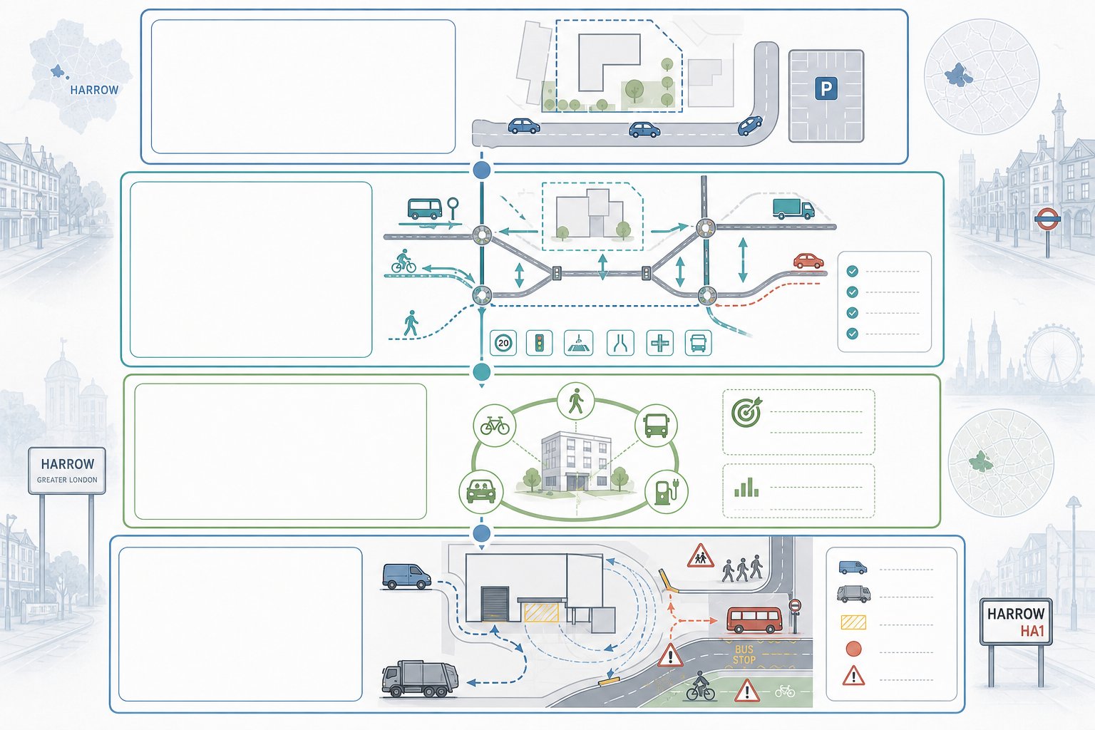
That means reviewing footway continuity, crossing opportunities, street lighting, gradient, route attractiveness, bus service availability, and cycle links in practical terms. We also consider whether the development itself supports sustainable travel through layout, secure cycle parking, travel information, and sensible access design. The design of the first 20 metres outside a site can influence travel behaviour more than broad policy language.
Where needed, we align this work with access design highway principles so the frontage and access arrangement support safe entry, exit, and onward movement for all users. In Southall, that balanced approach matters: highway acceptability and sustainable accessibility are usually judged together, not in separate silos.
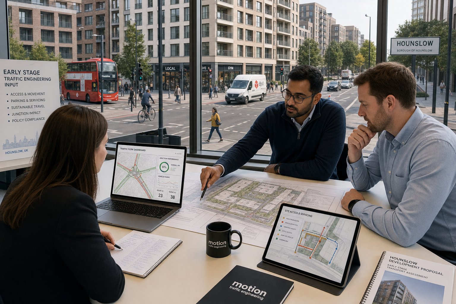
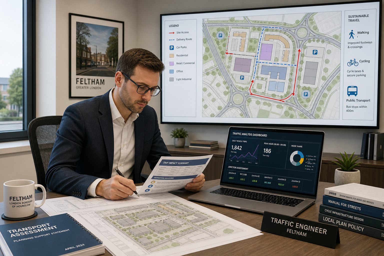
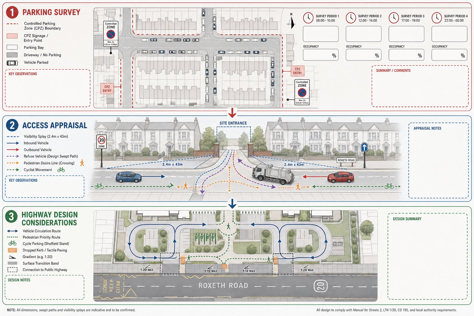
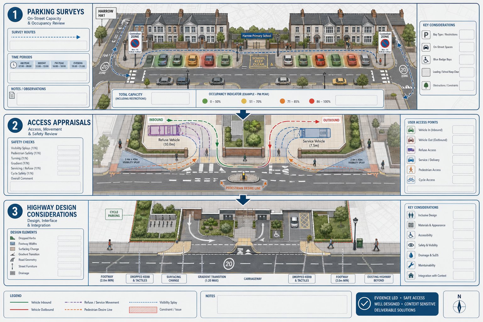
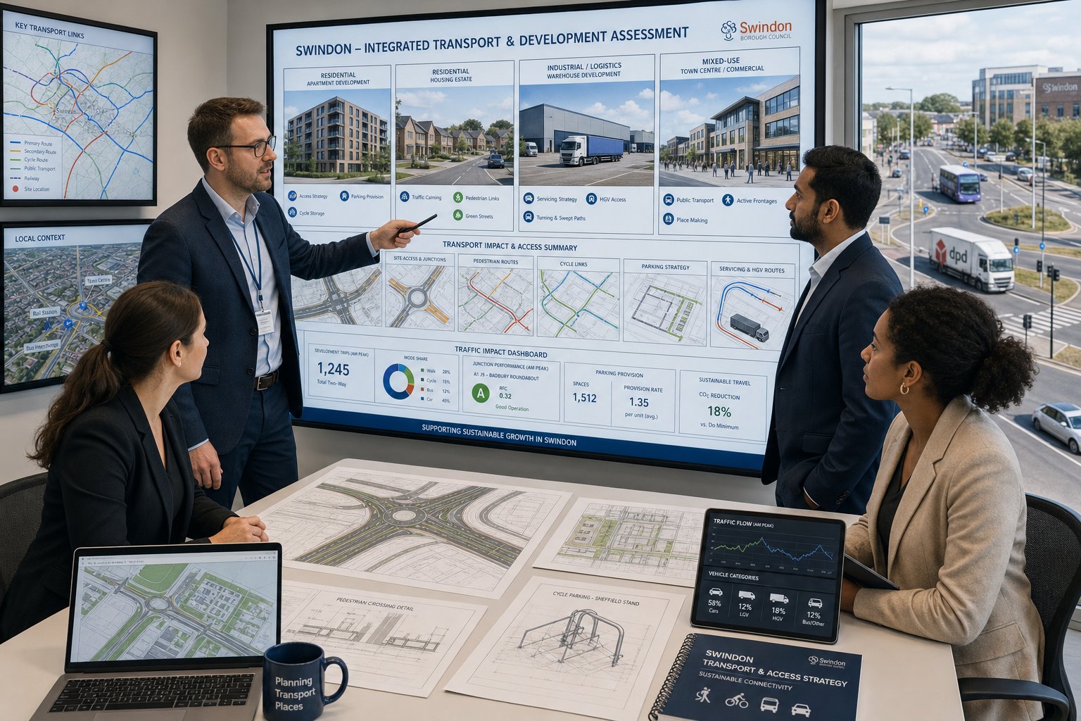
How Traffic Surveys And Technical Evidence Support An Application
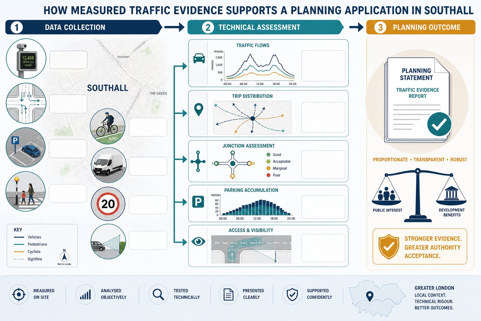
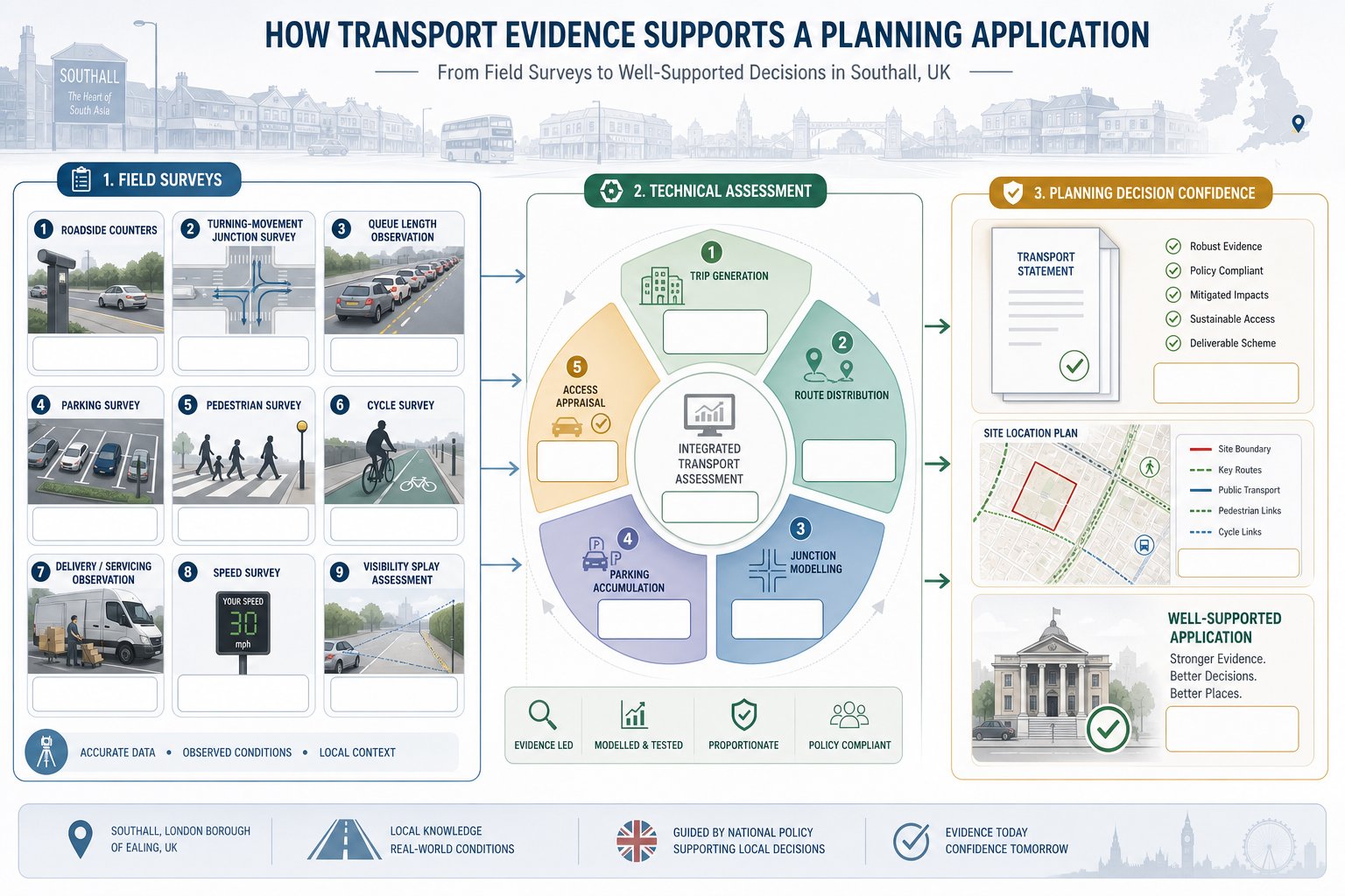
Planning authorities are far more likely to accept a transport case that is measured, evidenced, and transparent. That is why traffic surveys and technical analysis sit at the centre of many Southall applications. They turn a broad claim, “the impact is acceptable”, into something that can be examined and defended.
The evidence base may include automatic traffic counts, classified turning counts, queue surveys, parking beat surveys, pedestrian and cycle counts, and delivery observations. We choose the survey type according to the likely impact of the scheme. A residential development with constrained on-street conditions may need detailed parking evidence. A commercial scheme may need robust servicing observations and peak-hour turning data. A new access arrangement may require geometry checks, speed data, and visibility review.
Once collected, the information feeds into technical assessment: trip generation, distribution and assignment, junction modelling, parking accumulation review, and access appraisal. The value is not in producing data for its own sake. It is in using the right evidence to answer the authority’s actual questions.
This is also where experience shows. Teams grounded in broader Traffic Engineering: Your Complete methods tend to scope surveys more intelligently, avoiding both under-assessment and costly overkill. In planning terms, proportionate evidence is usually stronger than a thick report full of unnecessary tables. The objective is clear: enough technical depth to prove the point, no more and no less.
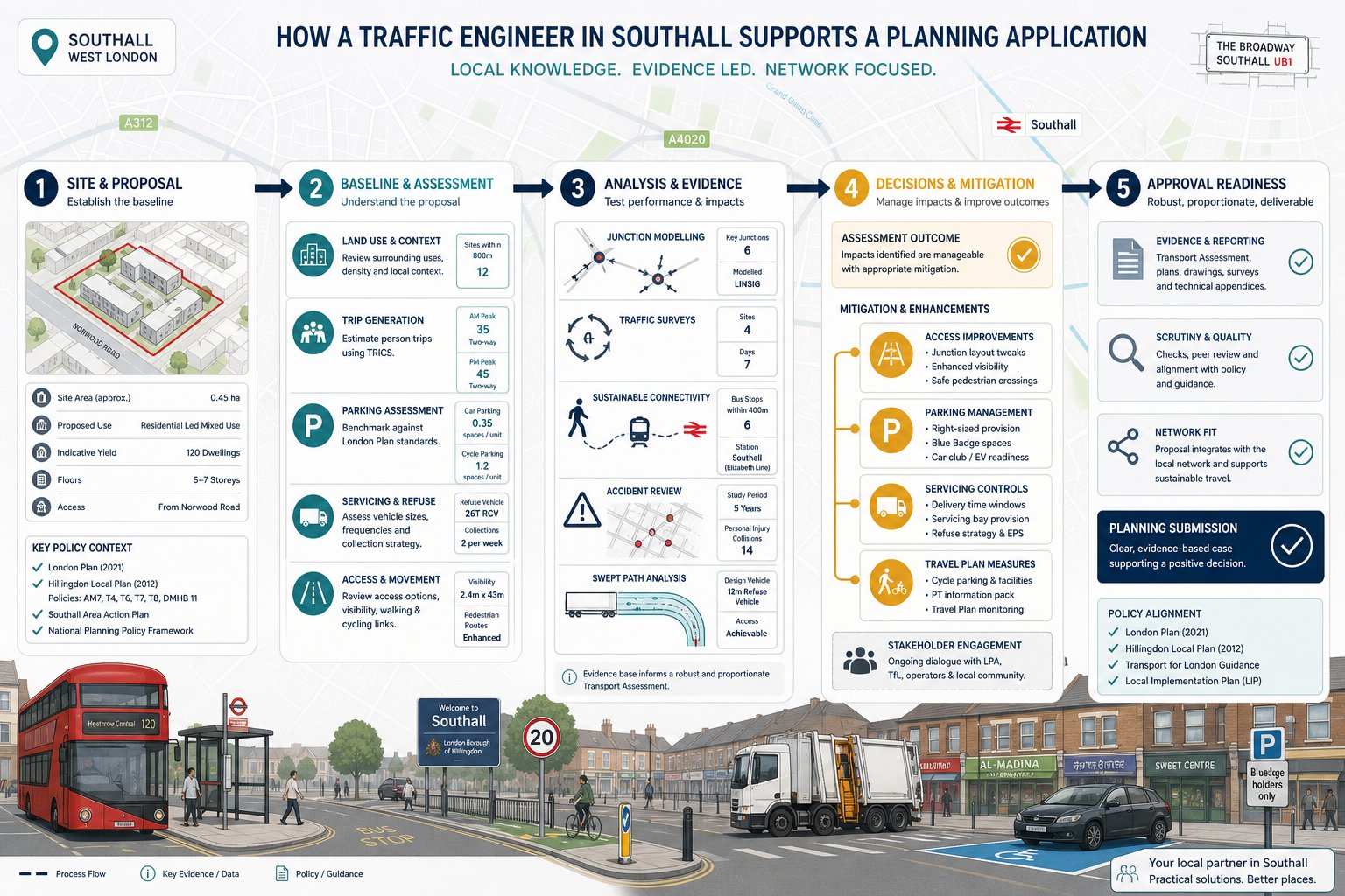
Common Reports Prepared For Southall Developments
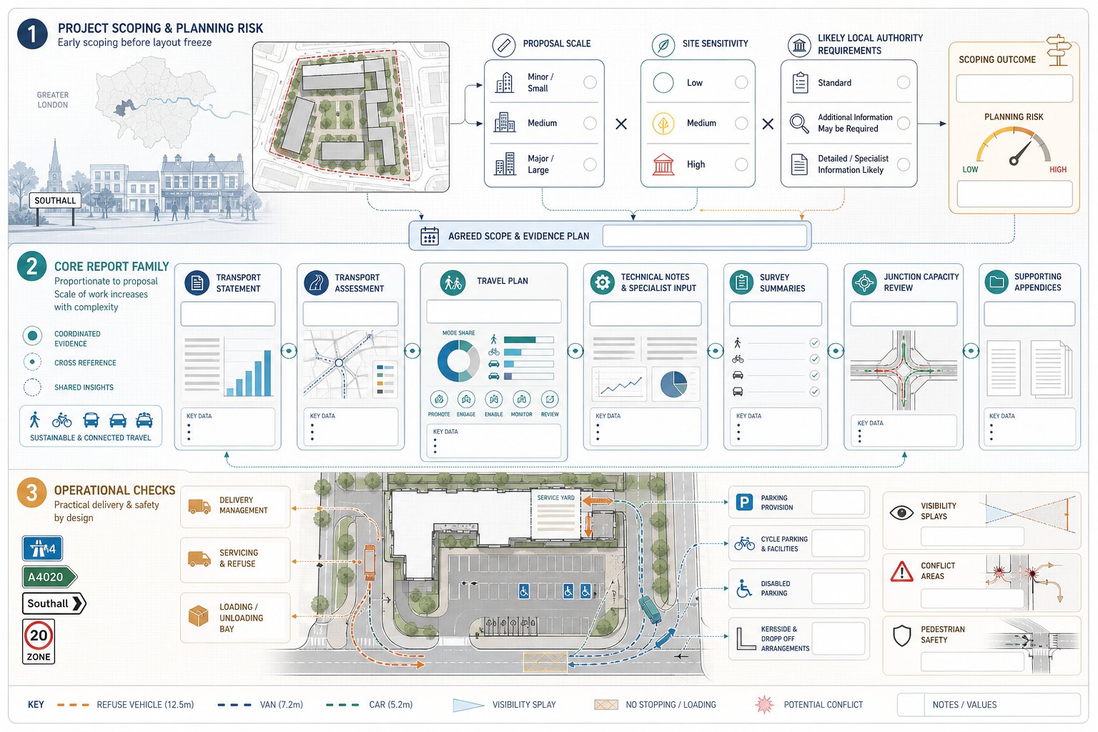
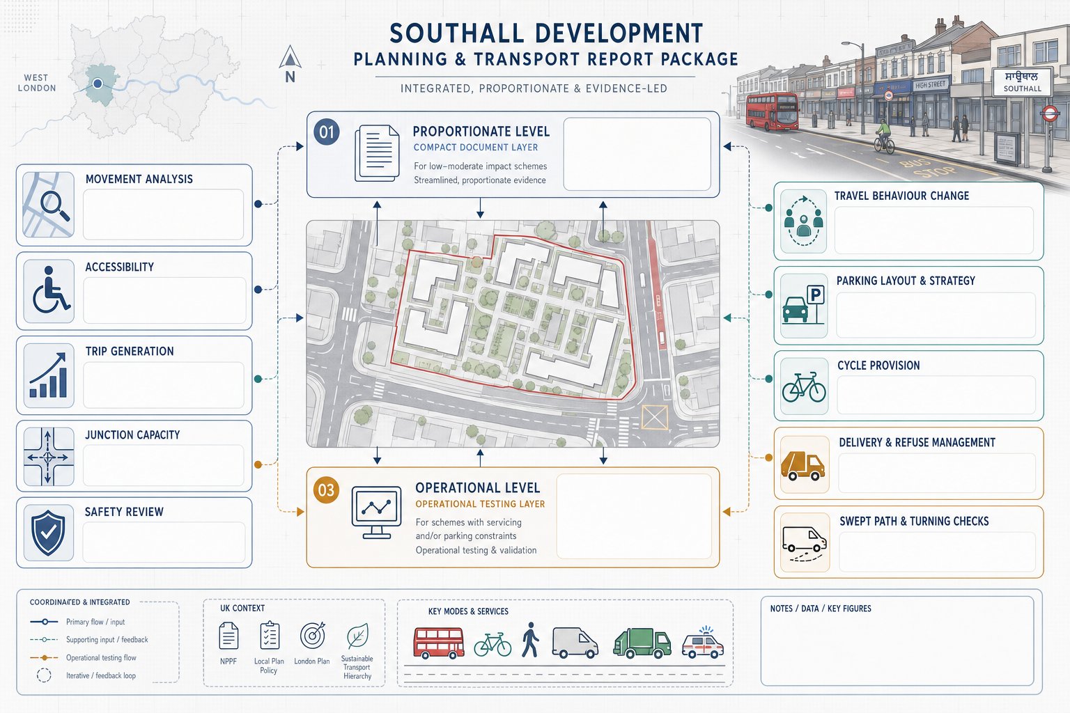
The report package for a Southall scheme depends on what is being proposed, how sensitive the site is, and what the local authority is likely to ask for. Some applications need one concise transport document. Others need a coordinated set of reports and appendices that address movement, access, servicing, parking, and sustainable travel in detail.
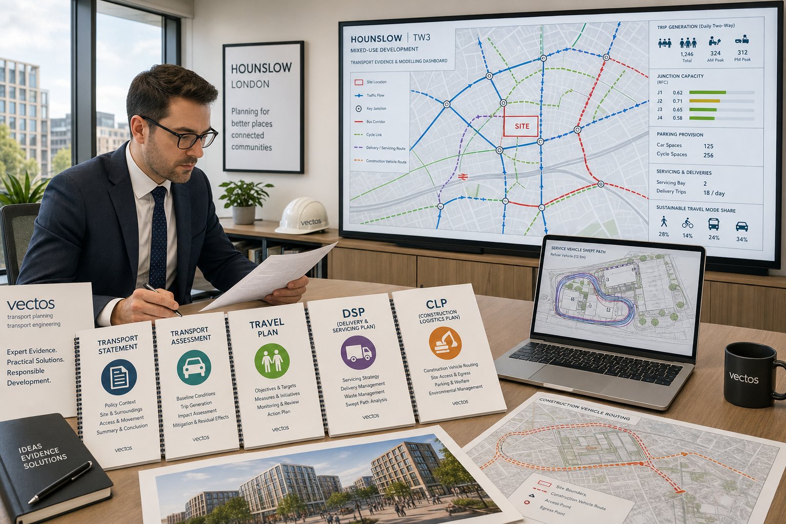
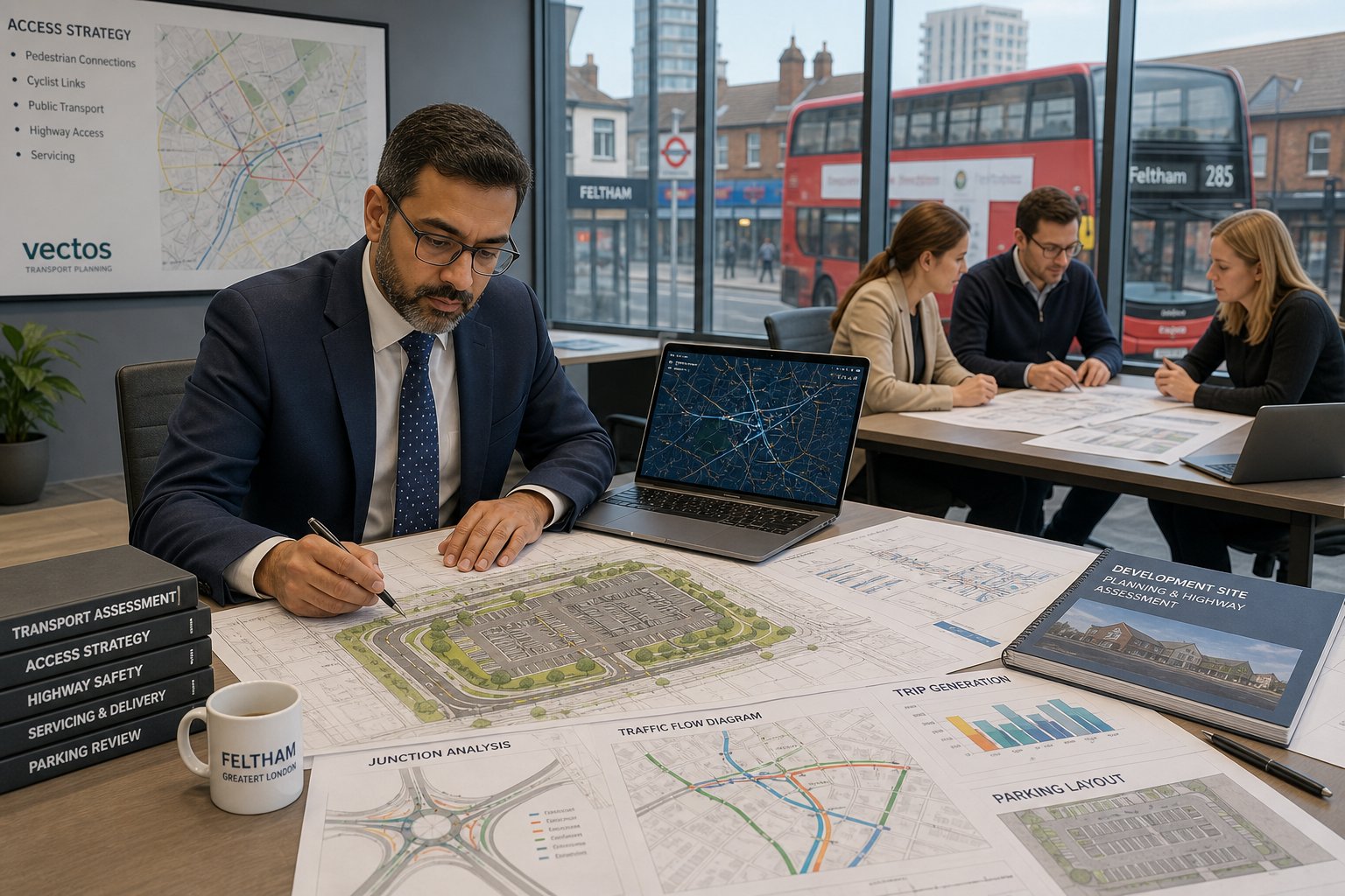
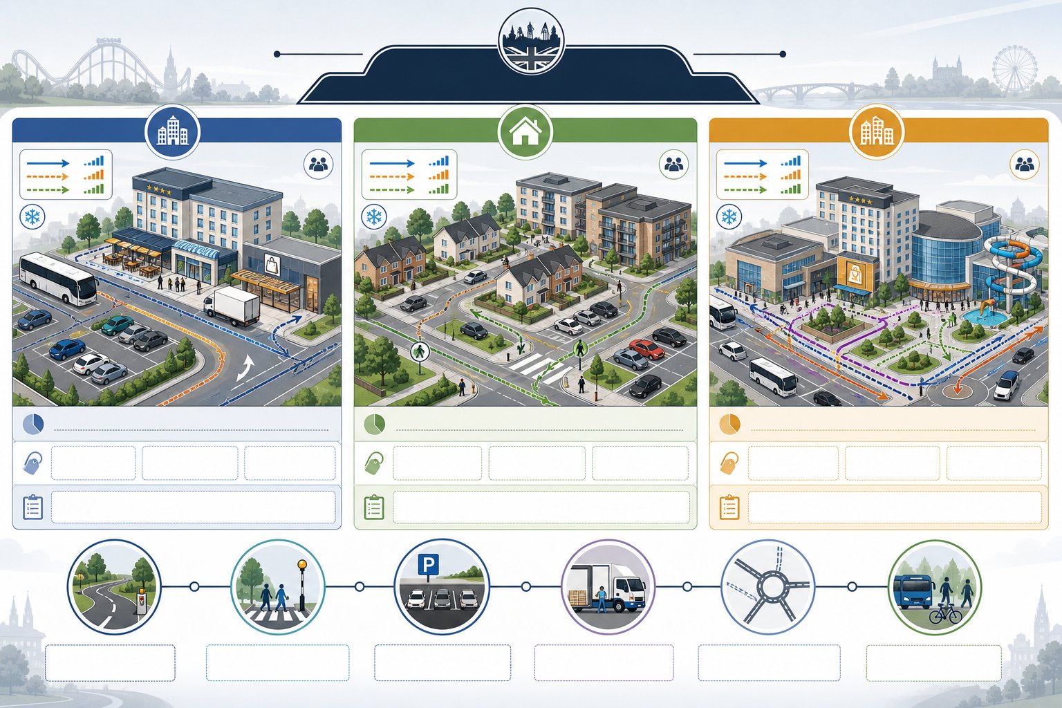
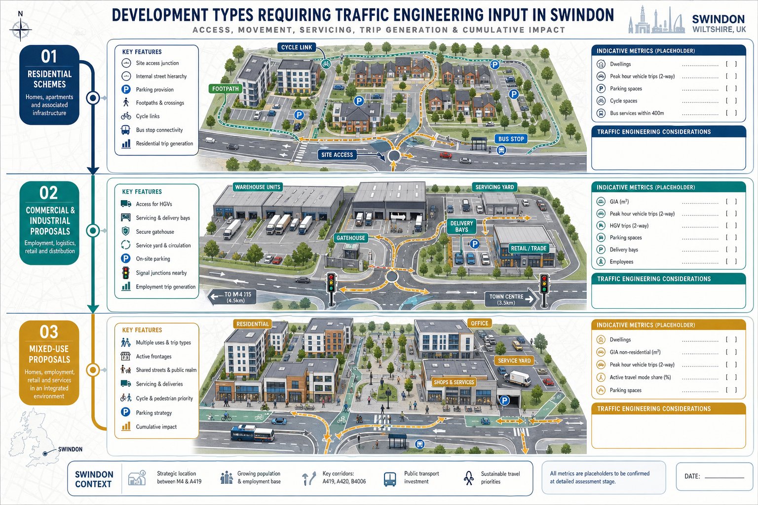
At the core, most projects fall into a familiar group of outputs: Transport Statements, Transport Assessments, Travel Plans, technical notes, traffic survey summaries, junction capacity assessments, parking reviews, swept path drawings, and delivery or refuse management documents. The challenge is not naming the report. It is matching the right level of work to the planning risk.
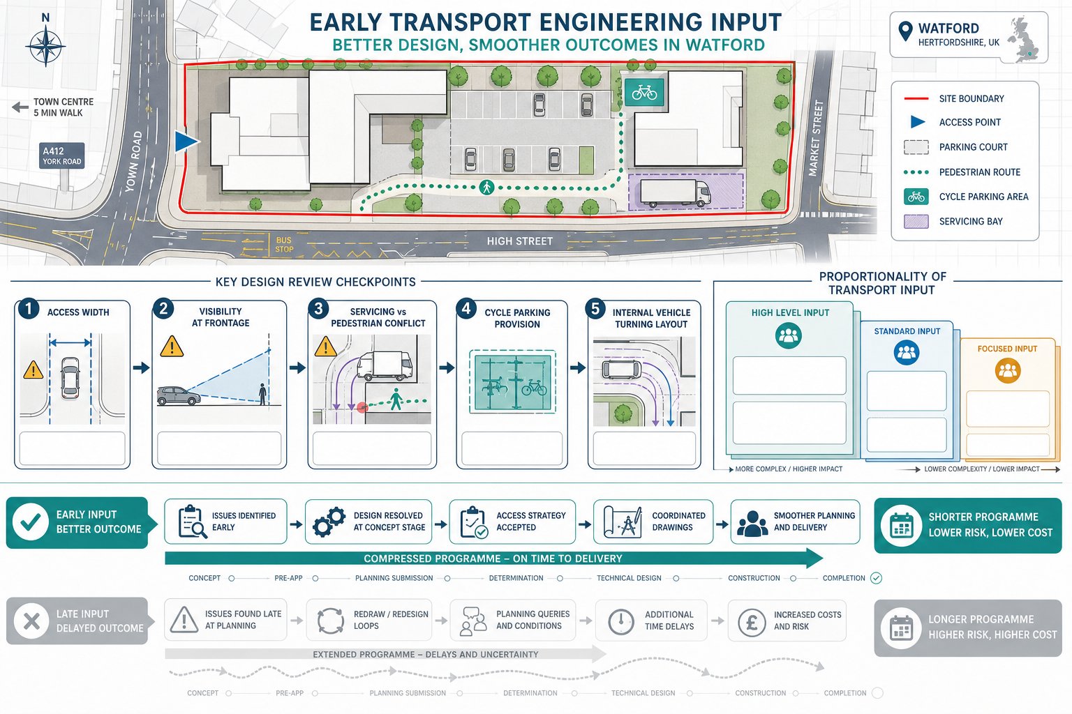
That is why we usually recommend scoping early, ideally before the layout hardens or the application is submitted. If a key transport issue emerges late, say, a refused refuse tracking movement, poor visibility, or unsupported trip assumptions, it can force redesign, delay validation, or invite objections that were avoidable a month earlier.
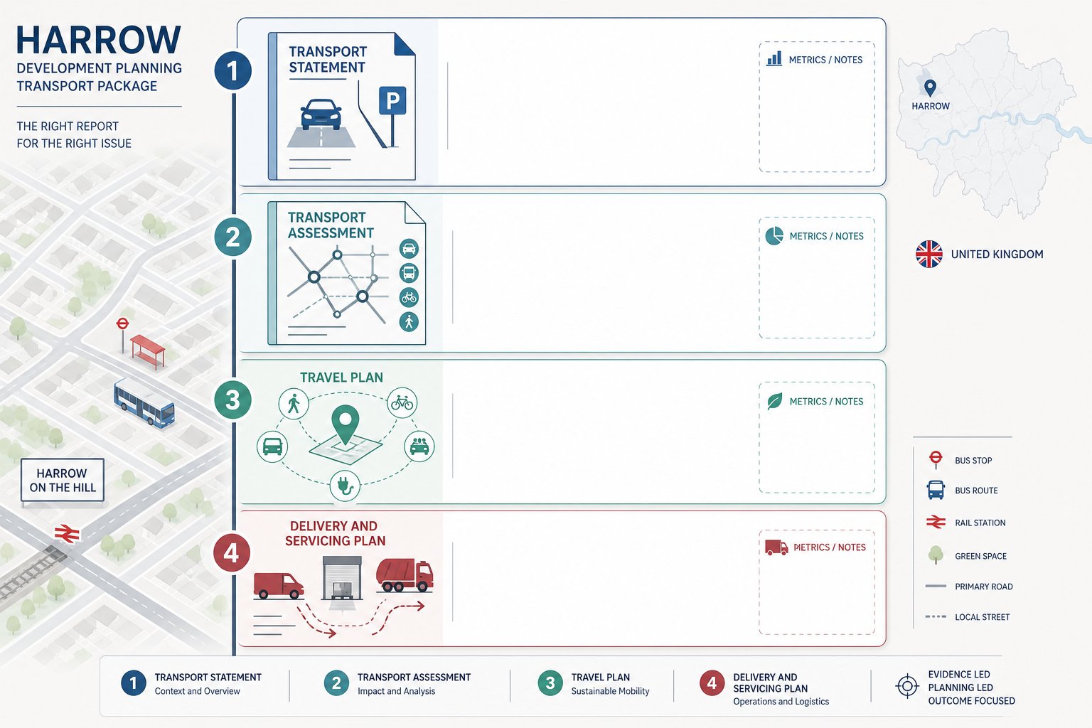
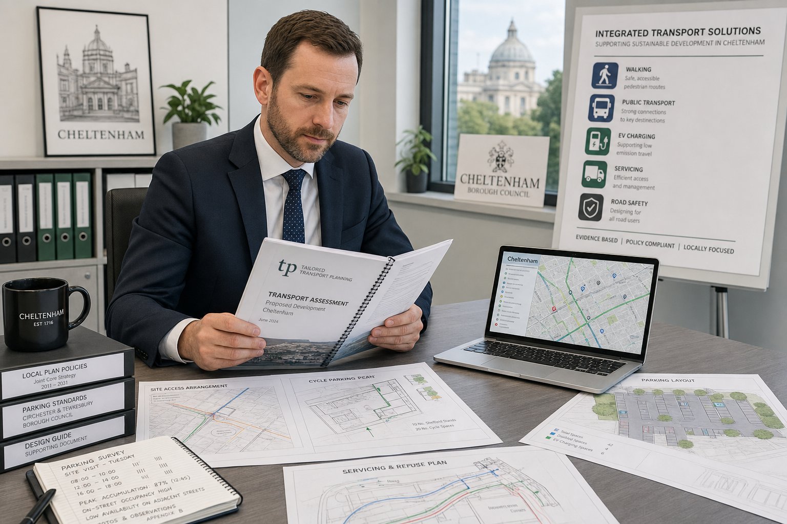
Transport Statements, Transport Assessments, And Travel Plans
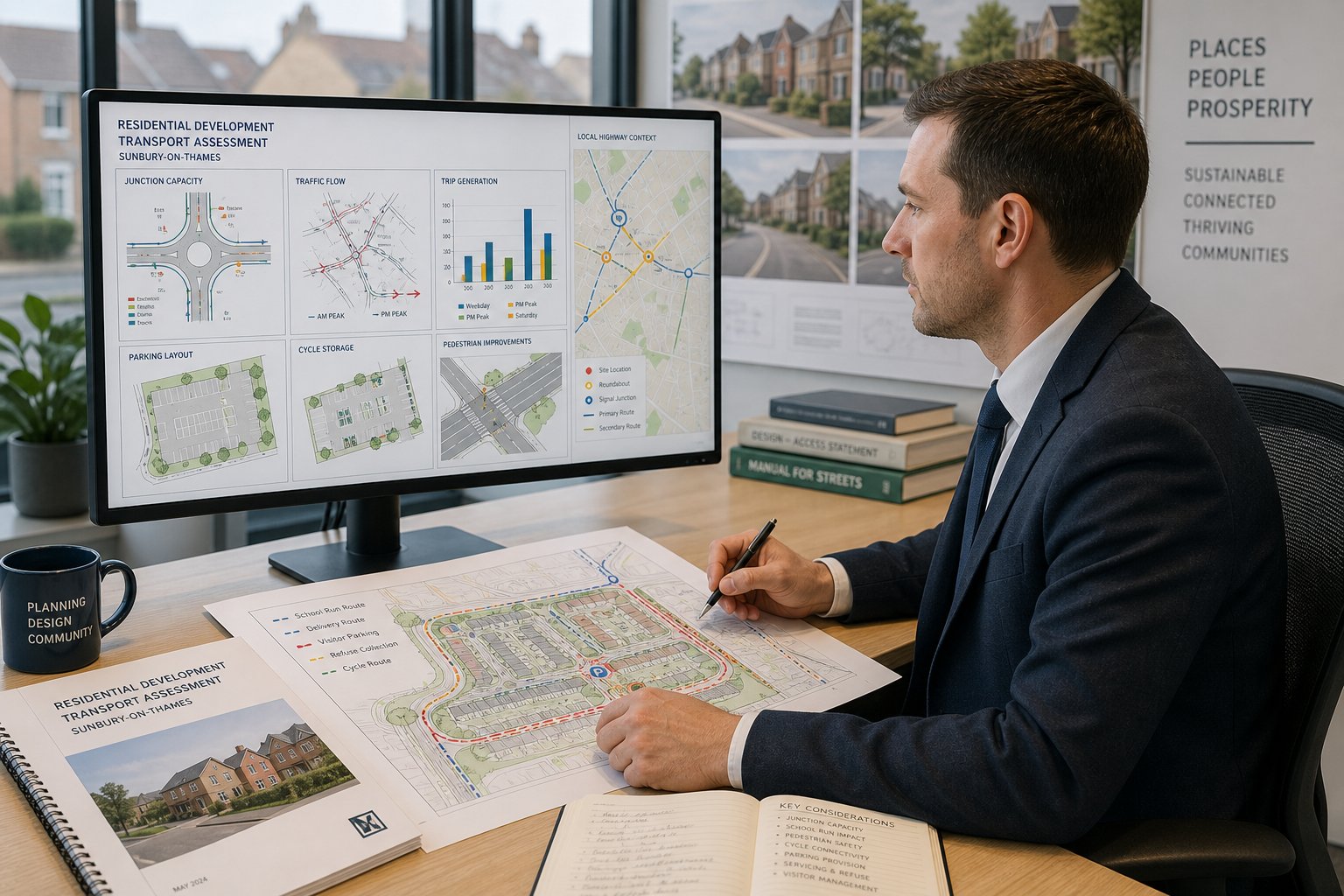
These are the most common planning-support documents. A Transport Statement is generally shorter and proportionate, used where impacts are expected to be limited but still require explanation. It typically covers existing conditions, site accessibility, trip generation, parking, servicing, and a reasoned conclusion on impact.
A Transport Assessment goes further. It is used where the proposal may materially affect movement or highway operation and often includes more detailed forecast trips, distribution, capacity analysis, safety review, and mitigation proposals. Travel Plans then support behaviour change by setting out measures to encourage walking, cycling, public transport use, car sharing, and lower car dependency over time.
In practice, these documents are strongest when they are coordinated rather than treated as separate compliance exercises. A realistic travel plan should follow from the accessibility evidence. A transport assessment should reflect actual site design, not a generic assumption set. For teams working across multiple UK planning contexts, approaches similar to Traffic Engineer In Manchester: schemes show how locally tailored reports tend to perform better than templates.
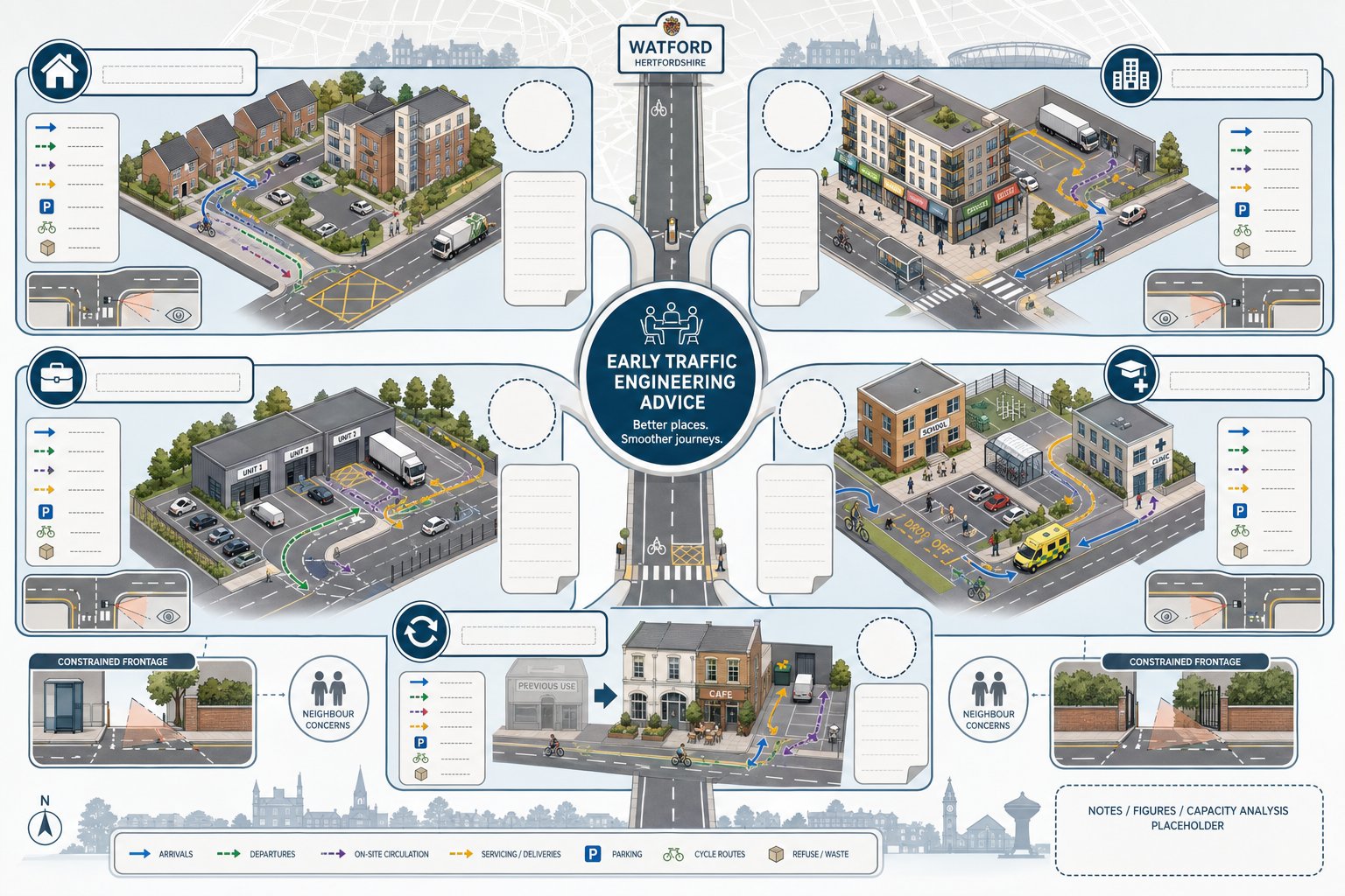
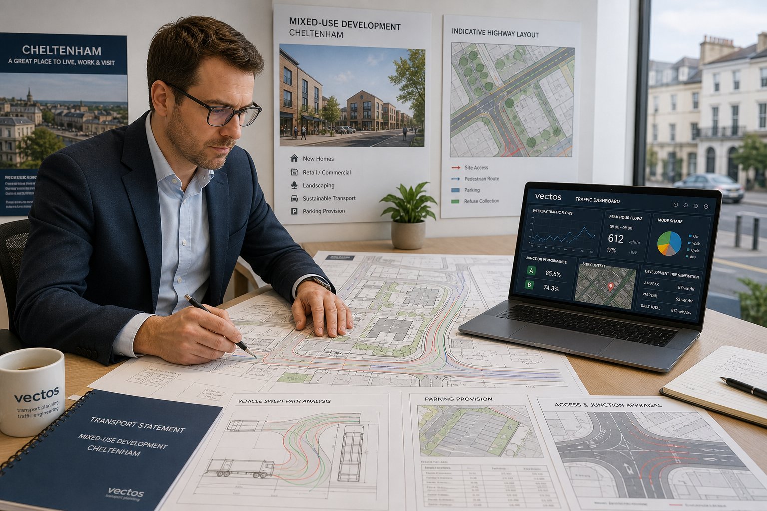
Delivery, Servicing, Parking, And Swept Path Analysis
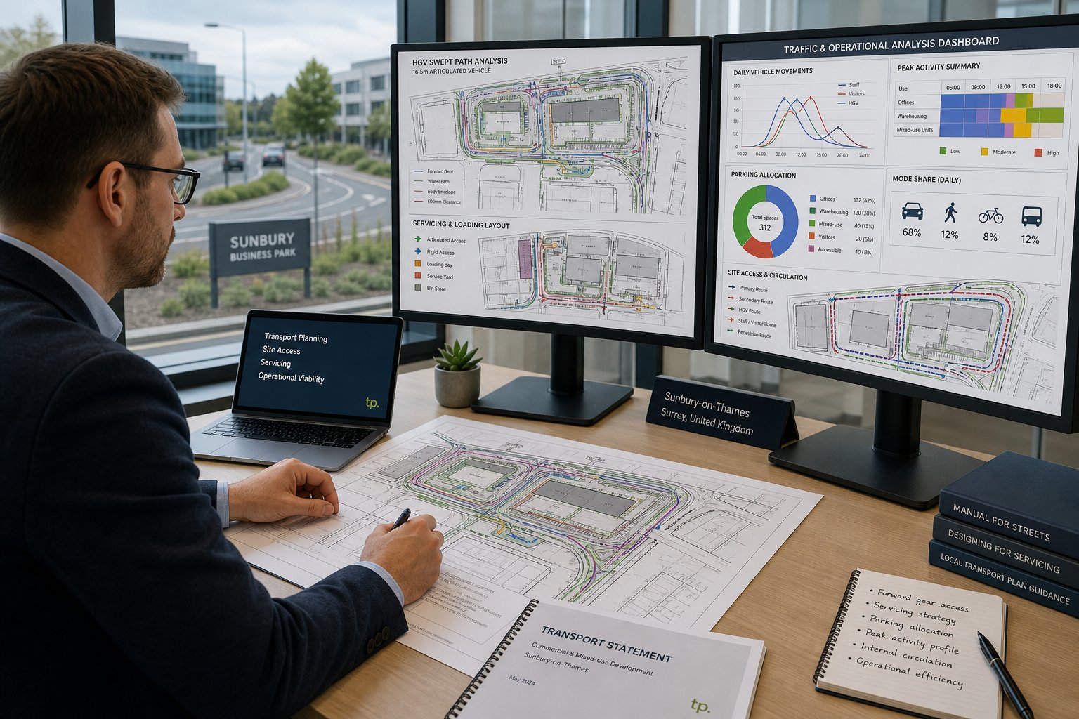
This is where many seemingly straightforward applications become complicated. Southall sites often face limited frontage, tight internal circulation, existing kerbside stress, and practical servicing constraints. If delivery vehicles cannot enter, turn, wait, or leave safely, planners and highway officers will usually focus on that quickly.
We hence test how refuse vehicles, vans, emergency vehicles, and in some cases larger servicing vehicles interact with the layout. Swept path analysis demonstrates whether those movements are physically possible. Parking review then considers quantity, layout, disabled provision, cycle parking, and whether manoeuvring is workable without conflict or overspill.
The detail matters. A scheme can meet parking numbers on paper and still fail operationally if turning is awkward or if a van blocks access every morning. Likewise, a minor adjustment to gate position, aisle width, or internal geometry can resolve an objection that looked serious at first. These are technical issues, but they have very real planning consequences.
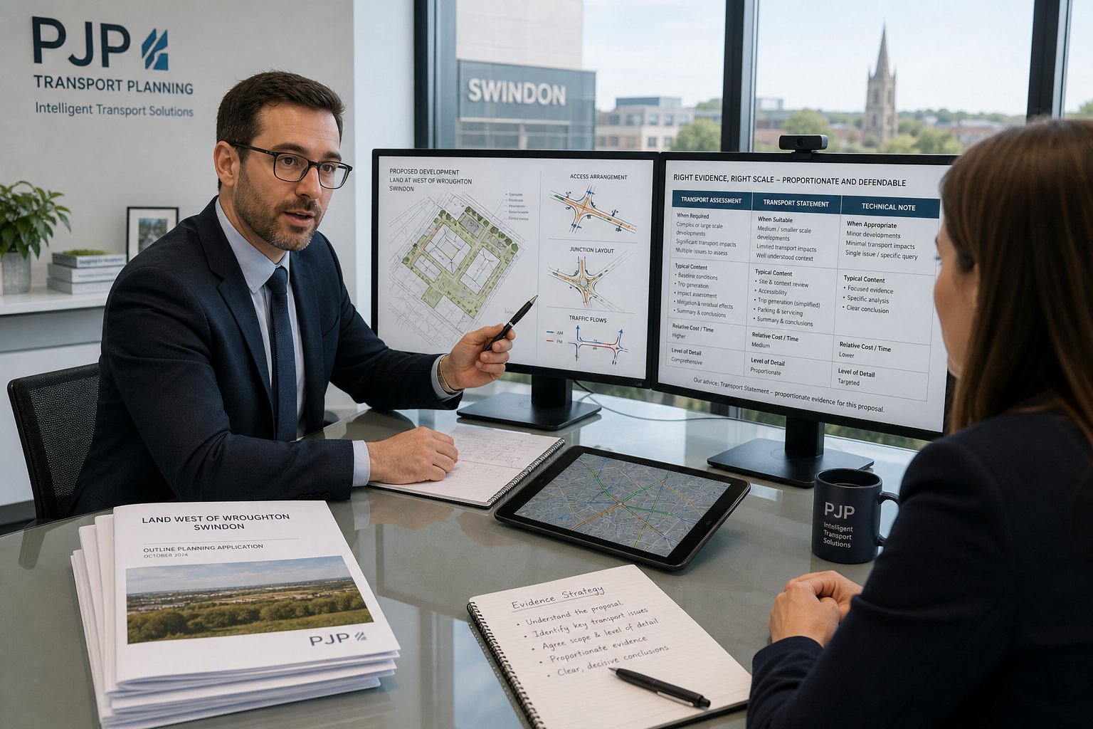
Working With Local Planning Authorities And Highway Authorities
A strong report is important, but planning success in Southall often depends just as much on how the transport case is coordinated with the authority process. Local planning officers and highway officers want clear, proportionate, policy-aware evidence that addresses the actual characteristics of the site. They do not want to spend time decoding a generic document.
Our role usually involves more than authoring a report. We help agree scope where appropriate, respond to consultee comments, refine assumptions, and align transport inputs with the wider design and planning strategy. If an authority questions trip rates, parking restraint, access geometry, or servicing operation, the response has to be technically robust and quick enough not to stall the application.
This is where local authority familiarity becomes valuable. Different authorities place emphasis on different transport matters, and thresholds or validation expectations are not always identical in practice. Experience from schemes handled by Traffic Engineer In Birmingham: and other urban teams can help, but the submission still has to be tuned to Southall’s local planning reality.
Good collaboration also means knowing when to adjust the design rather than argue a weak point. Sometimes a revised access, clearer servicing plan, or modest travel plan commitment will do more for an application than pages of defensive text. That is not giving ground unnecessarily. It is using transport engineering properly: to make a scheme more acceptable, not just more documented.
How To Choose The Right Traffic Engineer For A Southall Project
Not all transport support is equal, and in a place like Southall that difference shows up quickly. The right consultant should be able to do more than produce a competent report. They should understand planning strategy, local highway concerns, proportionality, and how to keep technical work tied to the actual development proposal.
We would usually look for five things. First, relevant experience with planning-led transport work rather than purely highway design or broad strategic policy work. Second, confidence with the core technical tools: trip generation, junction capacity analysis, swept path assessment, parking review, access appraisal, and travel planning. Third, report-writing quality. Even good analysis can be undermined by a report that is vague, bloated, or poorly structured. Fourth, local awareness, not necessarily based only on one postcode, but on repeated work in comparable urban settings. And fifth, responsiveness. Planning timetables are not forgiving.
It also helps to ask practical questions: Who will scope the work? What surveys are likely to be needed? Have they worked with west London authorities before? Can they advise early on whether a statement or full assessment is more realistic? Broader service perspective matters too, which is why some clients compare support models across pieces such as Traffic Engineer In Leeds: and related planning-led transport services.
For many clients, speed matters. But speed without judgement is risky. The best choice is usually a team that can move quickly, write clearly, and identify the transport issue that is most likely to decide the application.
Conclusion
Southall projects succeed more often when transport is treated as part of the planning strategy from the beginning, not as a supporting document bolted on at the end. A capable traffic engineer in Southall helps define that strategy with evidence: whether a Transport Statement is enough, whether a full Transport Assessment is needed, how junctions and access should be tested, and what practical mitigation will make the scheme more acceptable.
For architects, planners, surveyors, lawyers, developers, and local councils, the value is straightforward. Better scoping reduces delay. Better technical work reduces avoidable objections. Better local judgement produces reports that are not only policy-compliant, but credible. And in a transport-sensitive location, credibility is often the difference between a smooth application and a prolonged one.
In 2026, the strongest submissions will be the ones that show a development is safe, accessible, and workable in real-world terms. That is the standard transport evidence needs to meet in Southall.
Frequently Asked Questions About Traffic Engineering in Southall
What does a traffic engineer in Southall do for planning applications?
A traffic engineer in Southall assesses how a proposed development affects local transport, including trip generation, access, parking, and sustainable travel, then prepares detailed transport evidence to satisfy planners and highway authorities, ensuring the scheme is safe and policy-compliant.
When is a Transport Assessment or Transport Statement required in Southall?
A Transport Statement is needed for developments with limited impacts, while a Transport Assessment is required when a proposal could materially affect traffic levels, junction capacity, safety, parking, or sustainable travel. The decision depends on scheme scale, impact, and local requirements.
How do traffic surveys support planning applications in Southall?
Traffic surveys like turning counts, volume measurements, and parking studies provide accurate data on existing conditions. This evidence enables precise assessment of development impacts and helps design mitigation strategies to address local road and junction constraints effectively.
What are common transport concerns for developments in Southall?
Key issues include junction delays, access visibility, parking demand and overspill, servicing logistics, and promoting walking, cycling, and public transport. Mitigating negative impacts on busy local roads and ensuring safe, efficient access are central to successful planning.
How can a traffic engineer help improve sustainable transport options in Southall developments?
They assess the site’s connectivity to bus routes, rail stations, and walking and cycling paths, ensuring proposals support realistic, safe alternatives to car travel. They also advise on features like cycle storage and access design to encourage sustainable travel behaviours.
What should I consider when choosing a traffic engineer for a Southall project?
Look for expertise in transport planning related to local authority processes, strong skills in traffic modelling and report writing, knowledge of Southall’s specific transport challenges, and a proven ability to deliver clear, timely, and proportionate evidence to support planning approvals.