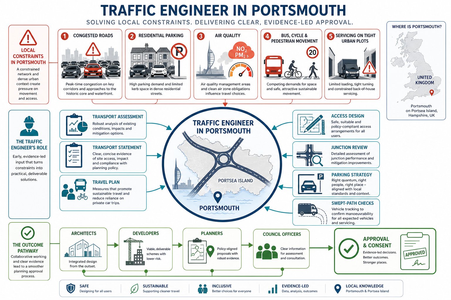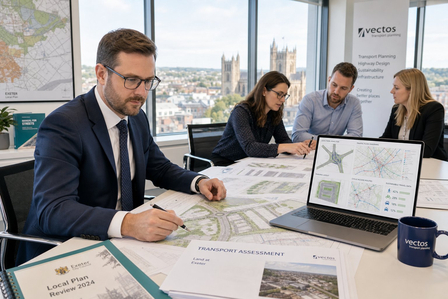
Planning applications in Bolton rarely fail on ambition alone. More often, they run into trouble because the transport case is thin, late, or too generic for the site and policy context. A housing scheme with an awkward access. A retail proposal near a stressed junction. A commercial site where servicing, parking and peak-hour traffic haven’t been tested properly. That is where a traffic engineer in Bolton becomes central to the application, not peripheral to it.
We approach transport evidence as part of the planning strategy from day one. For architects, planners, surveyors, lawyers, developers and public-sector teams, the question usually isn’t whether transport matters: it’s how much evidence is proportionate, what Bolton Council is likely to expect, and how to avoid the kind of late redesign that burns time and budget.
In practice, robust transport support means more than producing a report with the right title. It means understanding local junction pressure, parking standards, sustainable travel expectations, access geometry, servicing demands and, where relevant, interactions with the wider strategic road network. It also means presenting evidence in a way decision-makers can actually use.
Below, we break down what a traffic engineer in Bolton typically does for planning applications, when a Transport Assessment or Statement may be needed, what reports usually support schemes, and how early technical input can materially improve the prospects of consent in 2026.
Key Takeaways
- A traffic engineer in Bolton plays a critical role in crafting transport evidence that aligns with local policy and site-specific conditions to support planning applications effectively.
- Early engagement with a traffic engineer helps identify and resolve access, parking, and network impact issues before designs are finalised, saving time and costs during planning.
- Bolton-specific transport assessments focus on real network conditions, including junction pressures, parking standards, and sustainable travel, ensuring submissions address local concerns.
- Not all developments require a full Transport Assessment; selecting the appropriate level of reporting—Transport Statement, Travel Plan, or technical notes—avoids over- or under-reporting.
- Robust transport evidence in Bolton integrates with overall planning strategies and clearly demonstrates safety, accessibility, and manageable traffic impacts to decision-makers.
- Providing clear project details early aids traffic engineers in delivering proportionate, targeted transport reports that reduce planning risks and facilitate smoother approvals.
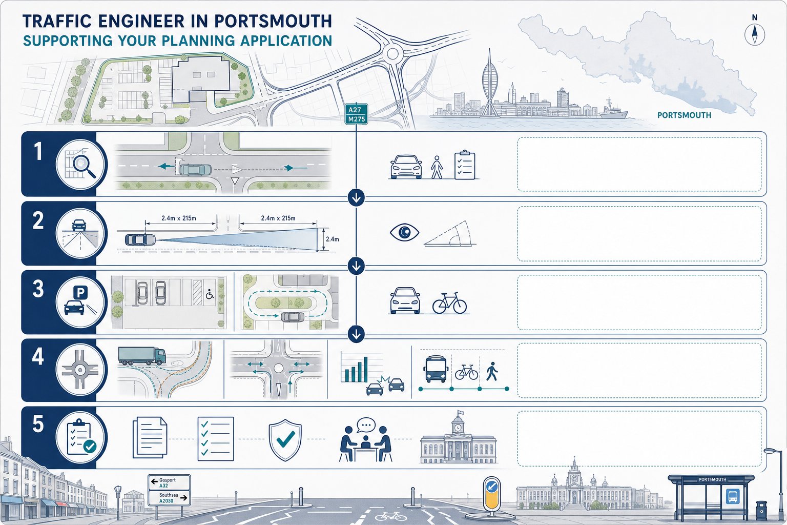
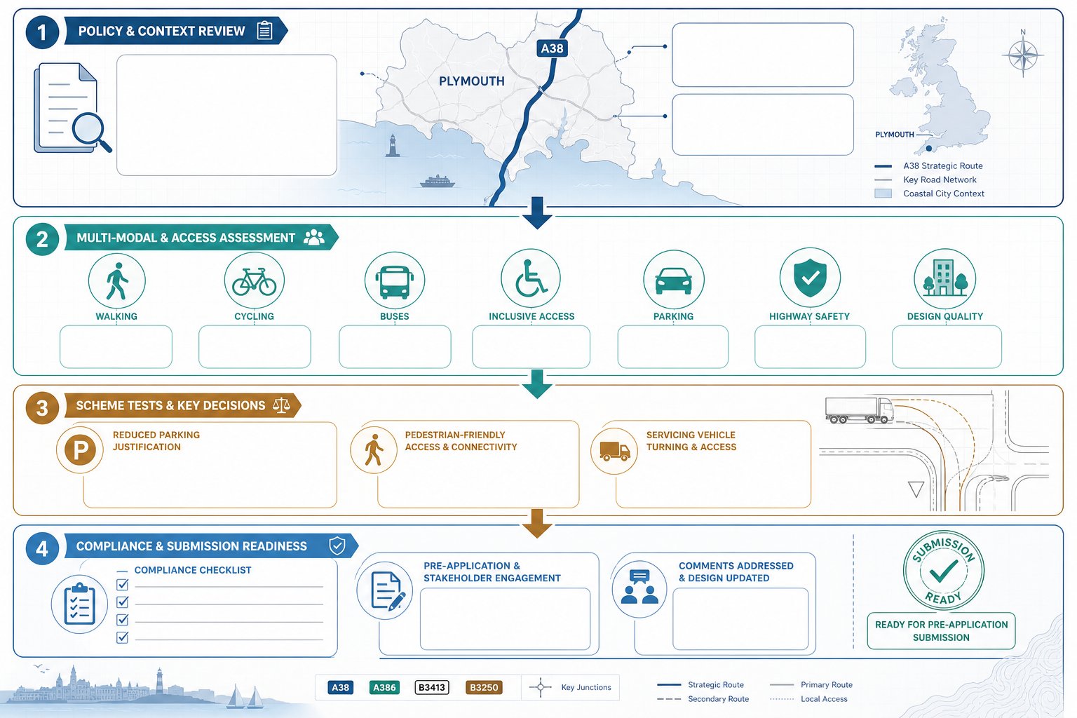
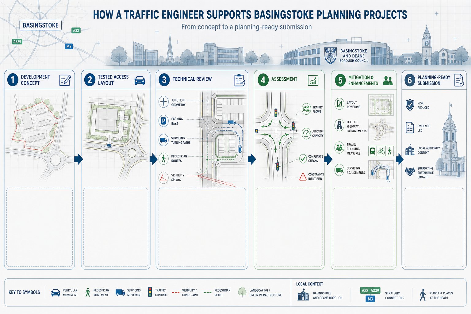
What A Traffic Engineer In Bolton Does For Planning Applications

A traffic engineer in Bolton helps turn a proposal into a planning-ready transport case. That starts with reviewing the development itself: the proposed use, scale, access points, parking numbers, cycle provision, servicing arrangements and likely trip impacts. We then test whether those elements are likely to satisfy both national guidance and local planning expectations.
For most schemes, the real work sits at the intersection of design and evidence. A site access may look acceptable on a drawing, but once visibility splays, speed environment, refuse tracking or peak-hour turning movements are assessed, weaknesses can appear quickly. Our role is to identify those issues early enough to fix them.
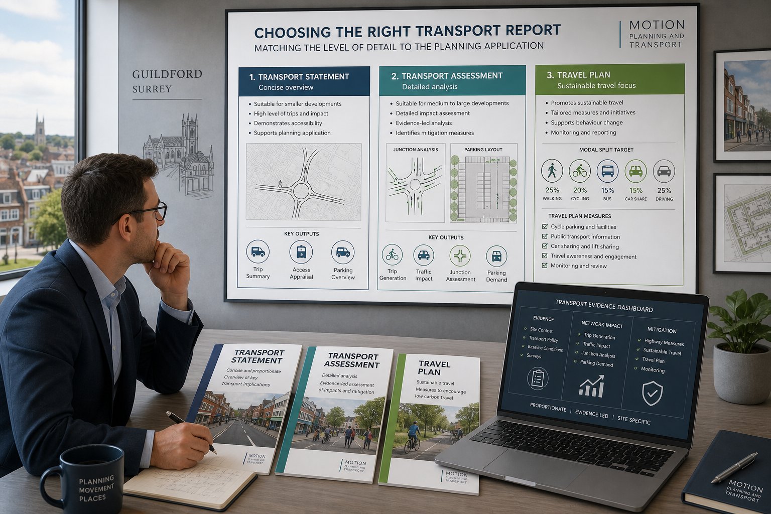
We also advise on the right level of reporting. Some sites need a full Transport Assessment with junction modelling and mitigation. Others need a lighter-touch Transport Statement, a Travel Plan or a focused technical note on a single matter such as parking accumulation or access visibility. That proportionality matters. Over-reporting can waste money: under-reporting can trigger avoidable objections.
In many cases, we also liaise with highways officers and the wider consultant team to close out points before determination. That is often the difference between a transport submission that merely exists and one that actively supports permission. Our wider experience as Traffic Engineering Consultants: helps clients understand where specialist input is likely to carry most weight.
Why Bolton Transport Evidence Needs A Local Planning Focus

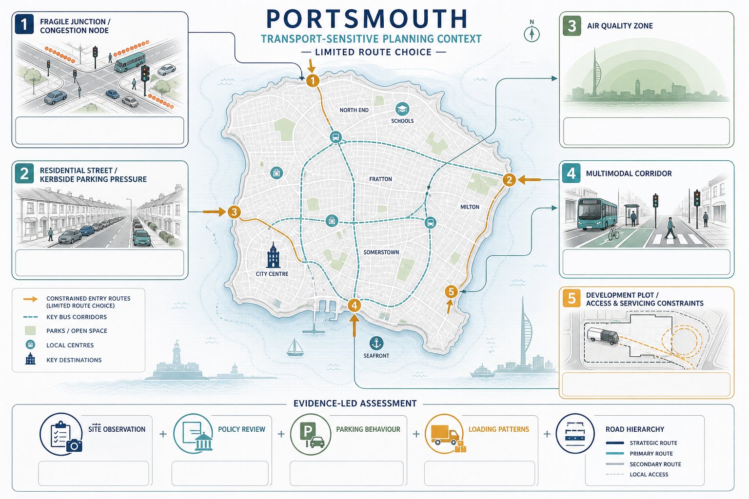
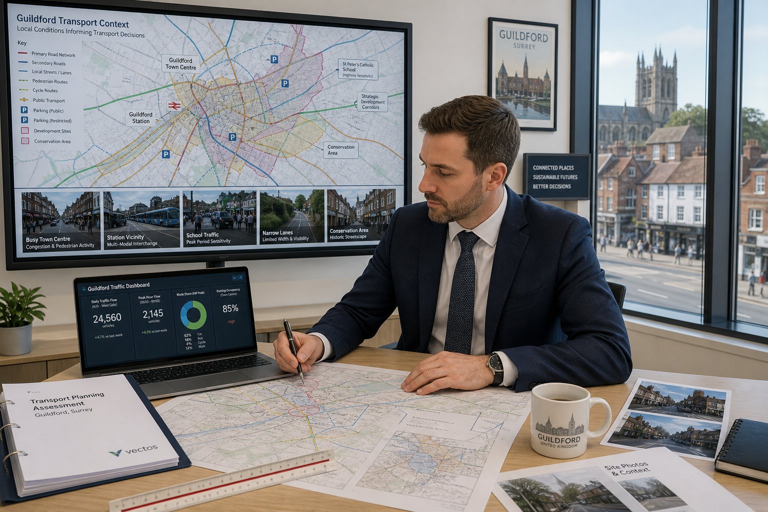
Transport reports are strongest when they are local, not templated. Bolton has its own planning pressures, movement patterns and decision-making context, so evidence that could pass in one authority may feel incomplete here. The issue is not simply whether a report cites the National Planning Policy Framework: it is whether the transport case responds to Bolton-specific concerns on highway safety, capacity, parking and sustainable travel.
That local focus usually means grounding the assessment in real network conditions. Junctions that are stable on paper can operate very differently near school peaks, retail peaks or football/event movements. Nearby committed developments may change baseline assumptions. Historic collision patterns, town-centre priorities, bus accessibility and walkability all influence how a proposal is judged.
Parking is another frequent example. A numerical standard is only the start. In practice, officers often want confidence that overspill won’t migrate onto neighbouring streets, that cycle parking is usable rather than decorative, and that servicing can happen without disrupting movement or safety.
We also find that local framing improves communication with decision-makers. Instead of abstract transport language, the report can speak directly to Bolton conditions and planning concerns. For teams operating across multiple cities, that local calibration is the same reason clients often compare approaches used by a Traffic Engineer In Manchester: or other nearby authorities, because thresholds may rhyme, but they don’t match exactly.
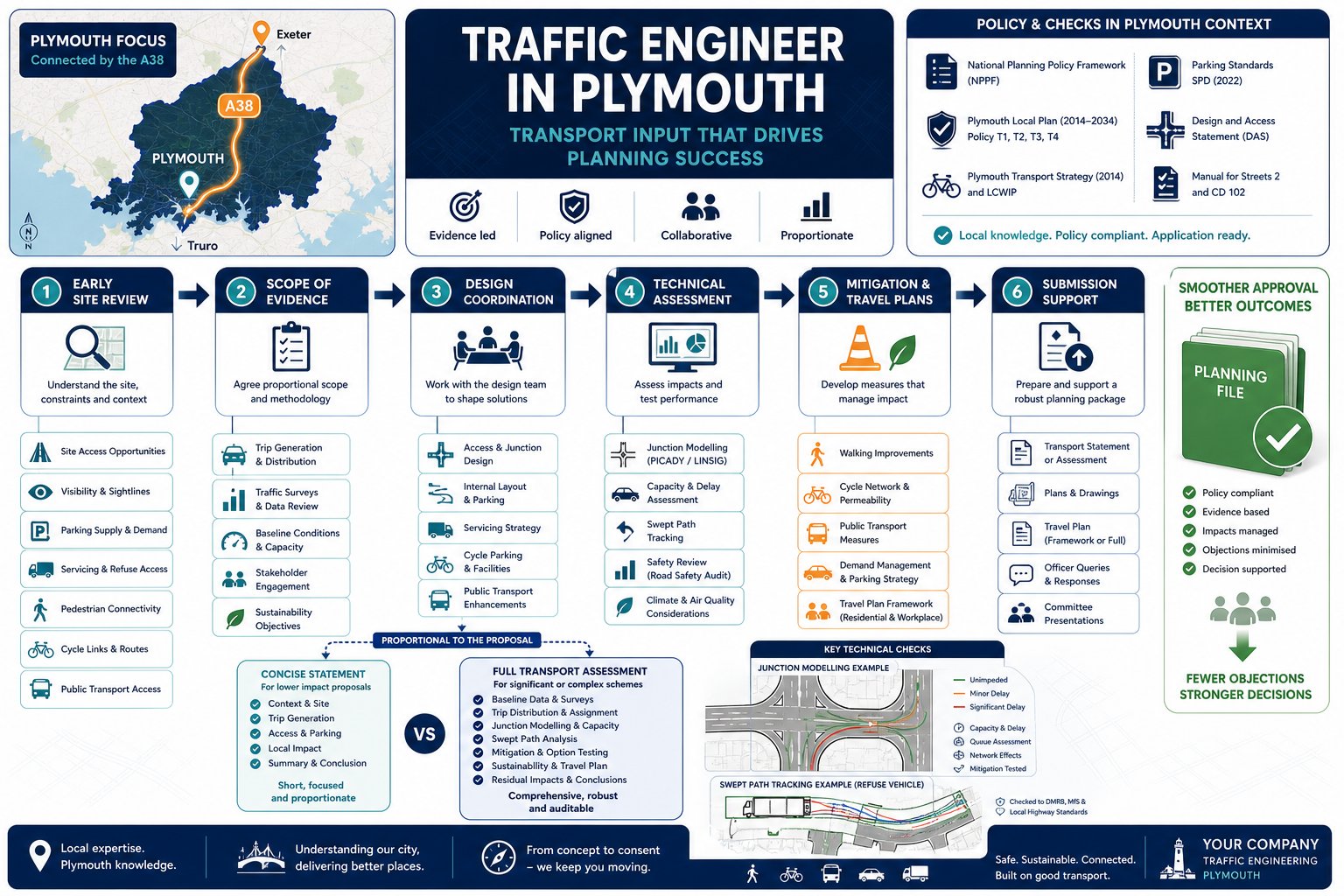
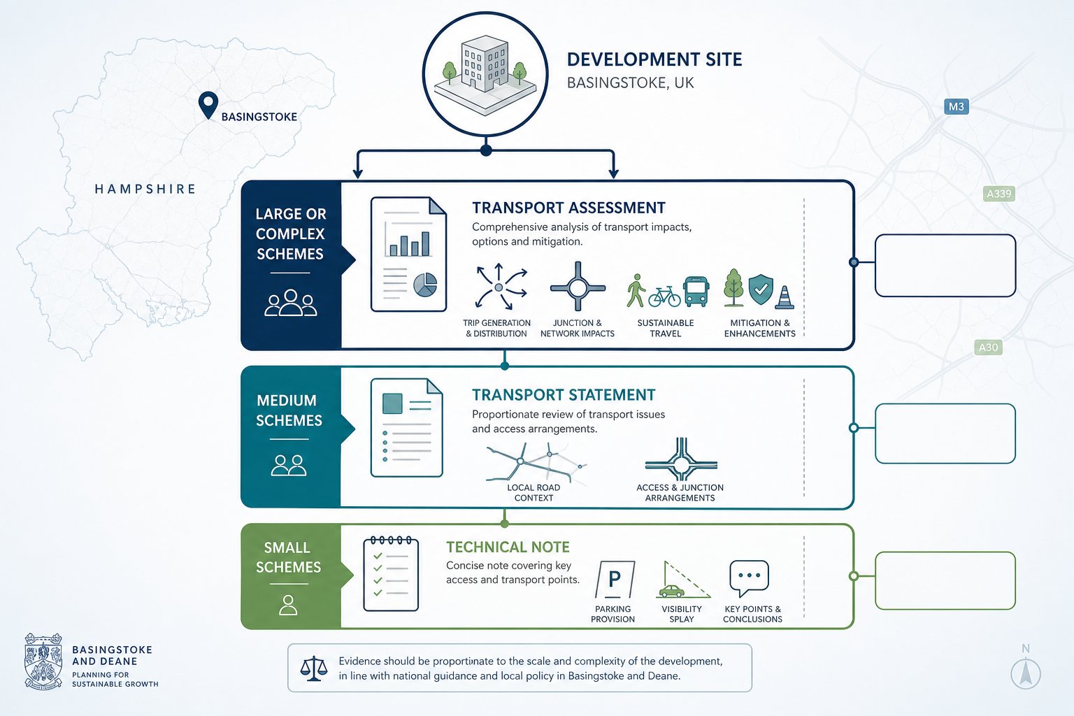
When A Development In Bolton May Need A Transport Assessment Or Statement
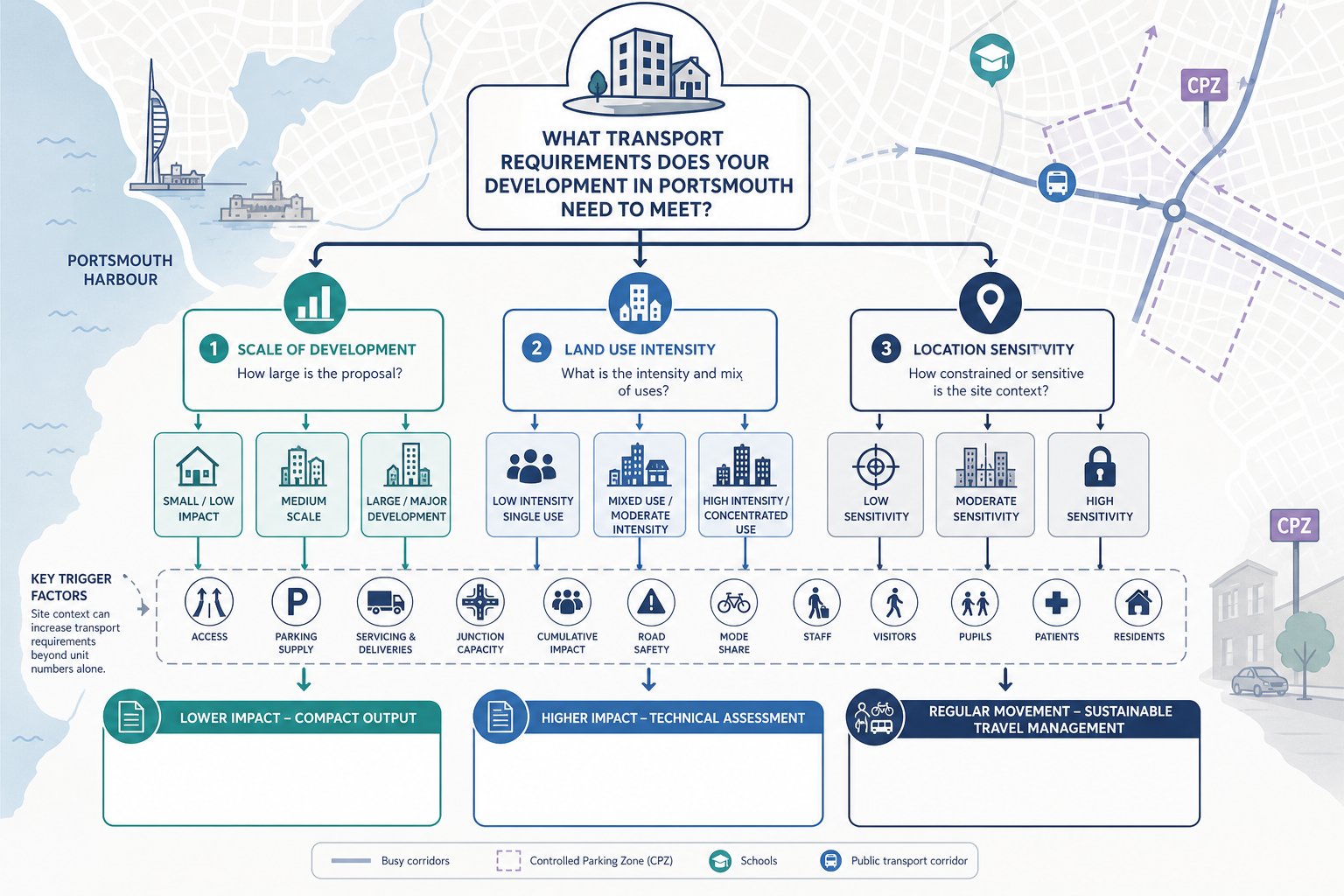
Not every planning application in Bolton requires a full transport submission, but many need more than a standard planning statement paragraph. The trigger is usually whether the proposal is likely to create material transport effects, raise access or safety concerns, or sit in a location where the surrounding network is already sensitive.
As a rule of thumb, a Transport Assessment is more likely where peak-hour trip generation is substantial, where the development connects to a key route or constrained junction, or where the use is known to create concentrated arrival and departure patterns. A Transport Statement is often suitable for smaller schemes with more limited impact, provided access, parking and sustainable travel issues can still be addressed credibly.
In Bolton, applications often move into formal transport-report territory when they affect A-roads, town-centre movement corridors, school-related traffic patterns or locations with known congestion and collision history. If there is any prospect of impact on the Strategic Road Network, National Highways may also need to be considered.
The decision should not be left to guesswork. Early scoping allows the team to decide whether a TA, TS, Travel Plan or technical note is proportionate, and whether surveys or modelling will be needed. On multi-authority portfolios, this mirrors the judgement calls made by a Traffic Engineer In Birmingham: or other city-based transport specialist, but always with Bolton’s own planning context in mind.
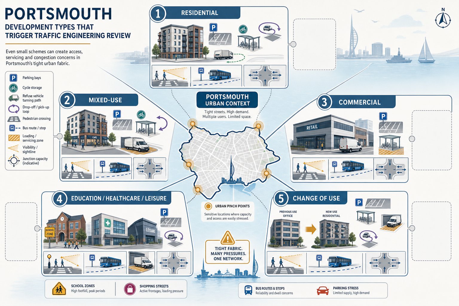
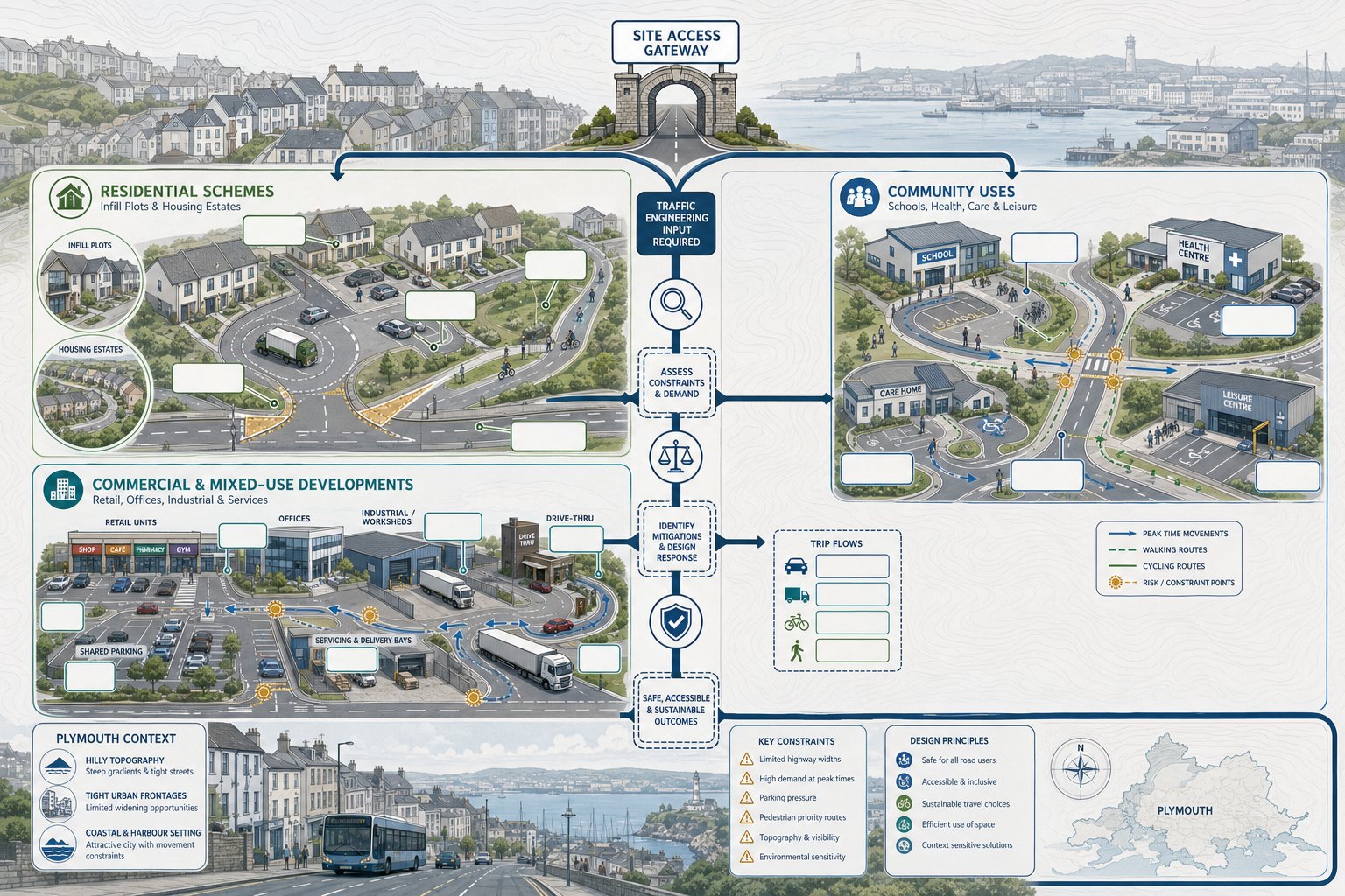
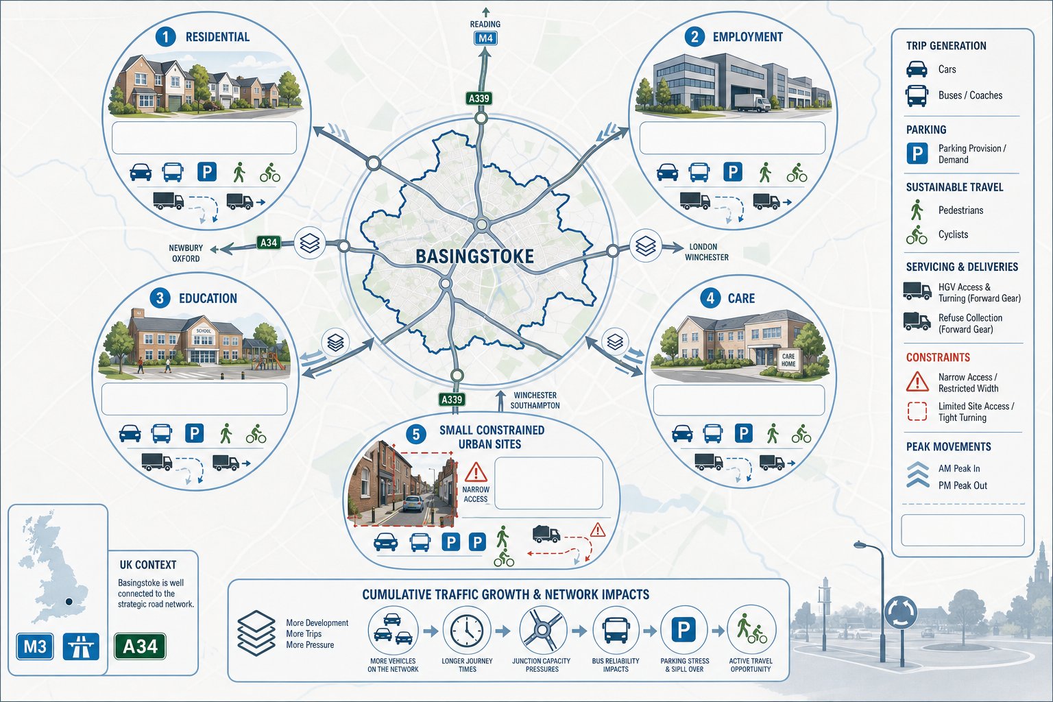
Common Development Types That Often Require Traffic Input
Certain land uses attract transport scrutiny more often than others because their traffic profile is either intensive, peaky or operationally awkward. Large residential schemes fall into that category, especially where a new priority junction, ghost island right-turn lane or internal road hierarchy is proposed. Apartment schemes can also need transport evidence where parking ratios are tight or town-centre servicing needs to be justified.
Retail developments are regularly tested closely, particularly supermarkets, retail parks and drive-thru formats. Those uses can generate short-stay turnover, weekend peaks and queueing pressure that is very different from a standard office or industrial scheme. Employment parks, warehouses and logistics uses also tend to need detailed review because HGV routing, yard circulation and shift-change effects matter as much as pure trip totals.
Education, leisure and event-related proposals can be even more sensitive. Schools, colleges, sports facilities and stadium-linked uses often create compressed demand at specific times, which means local junction performance and active travel planning become central issues rather than appendices.
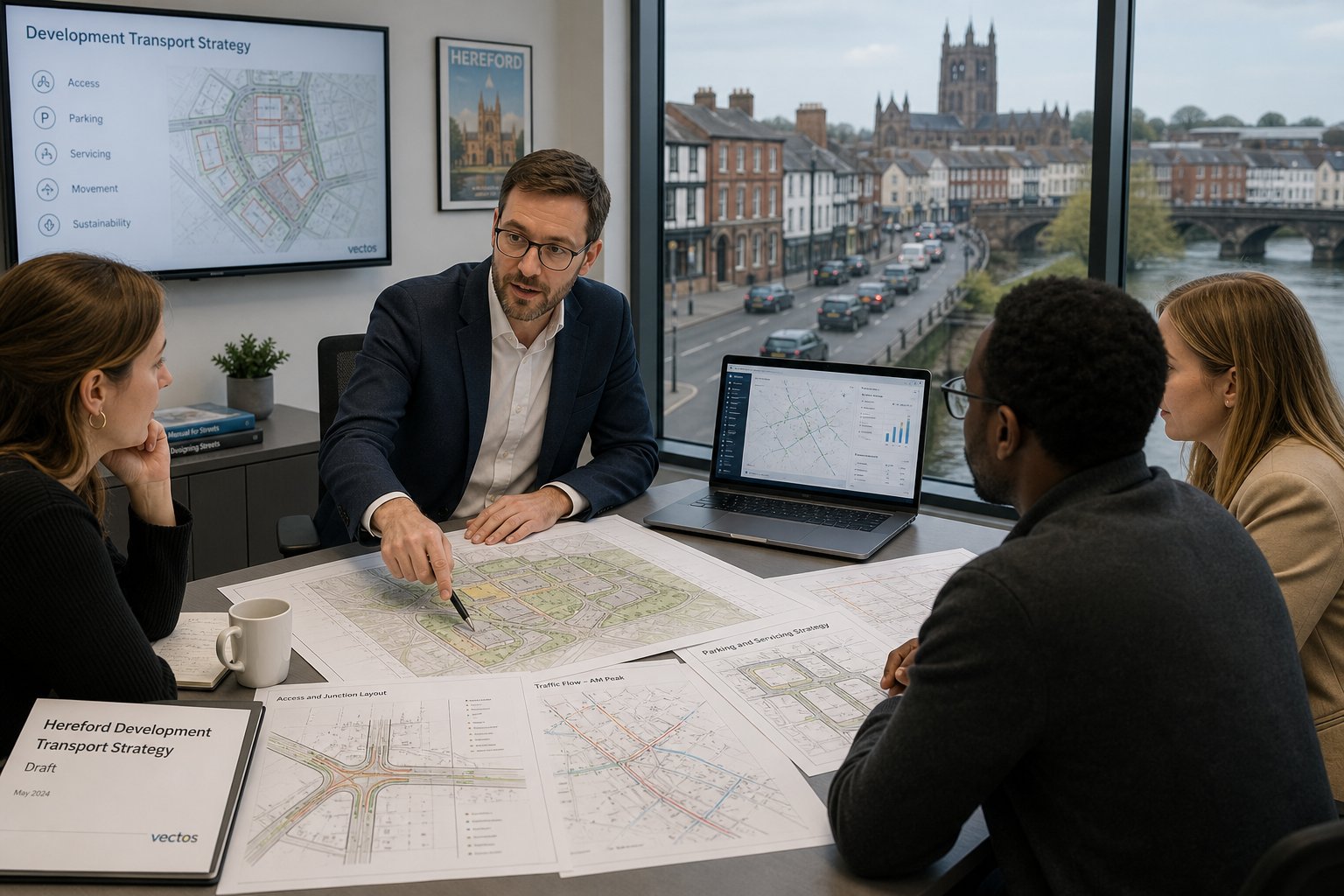
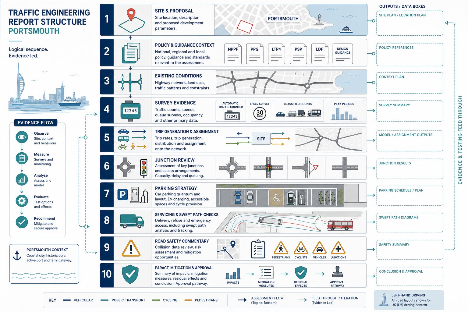
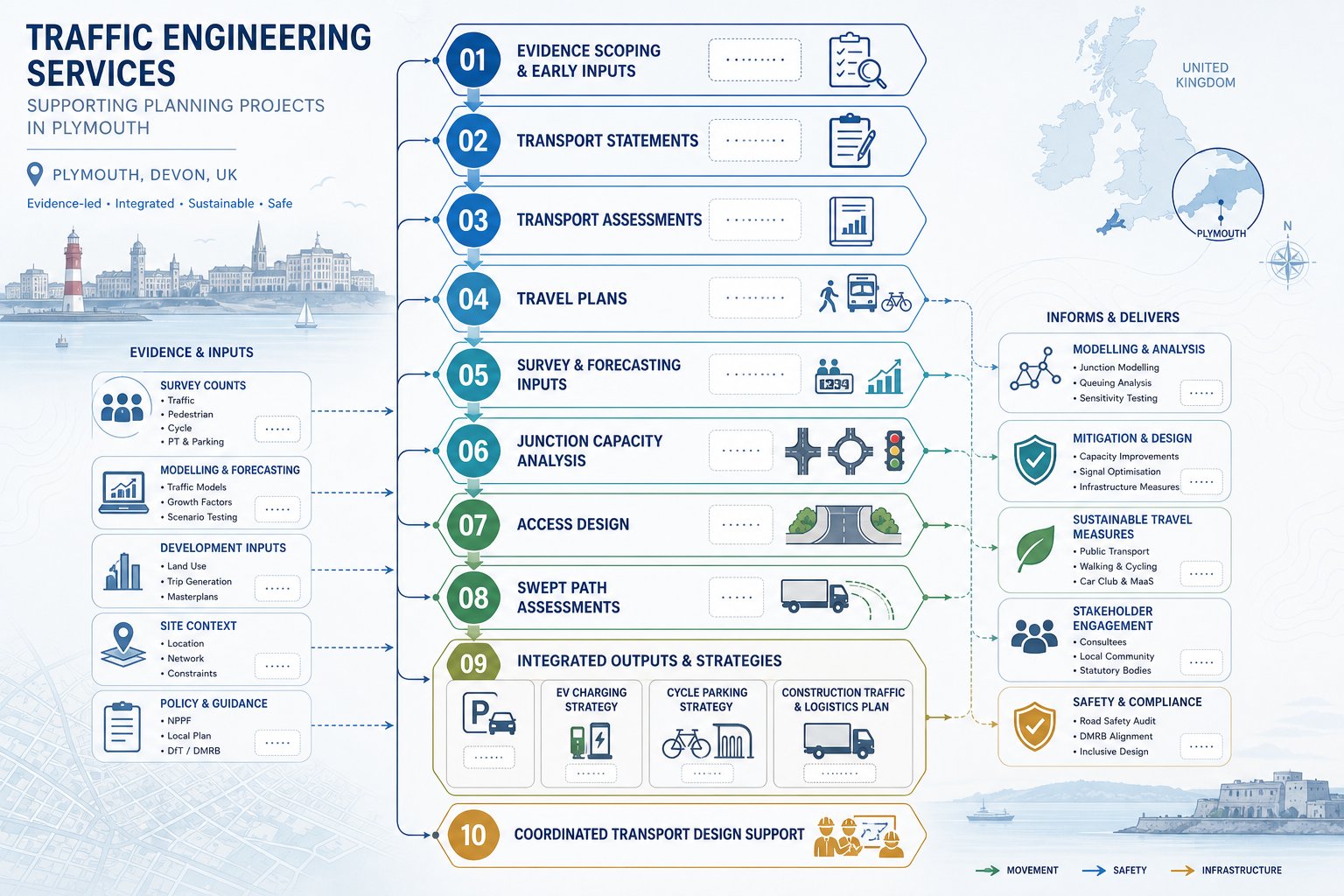
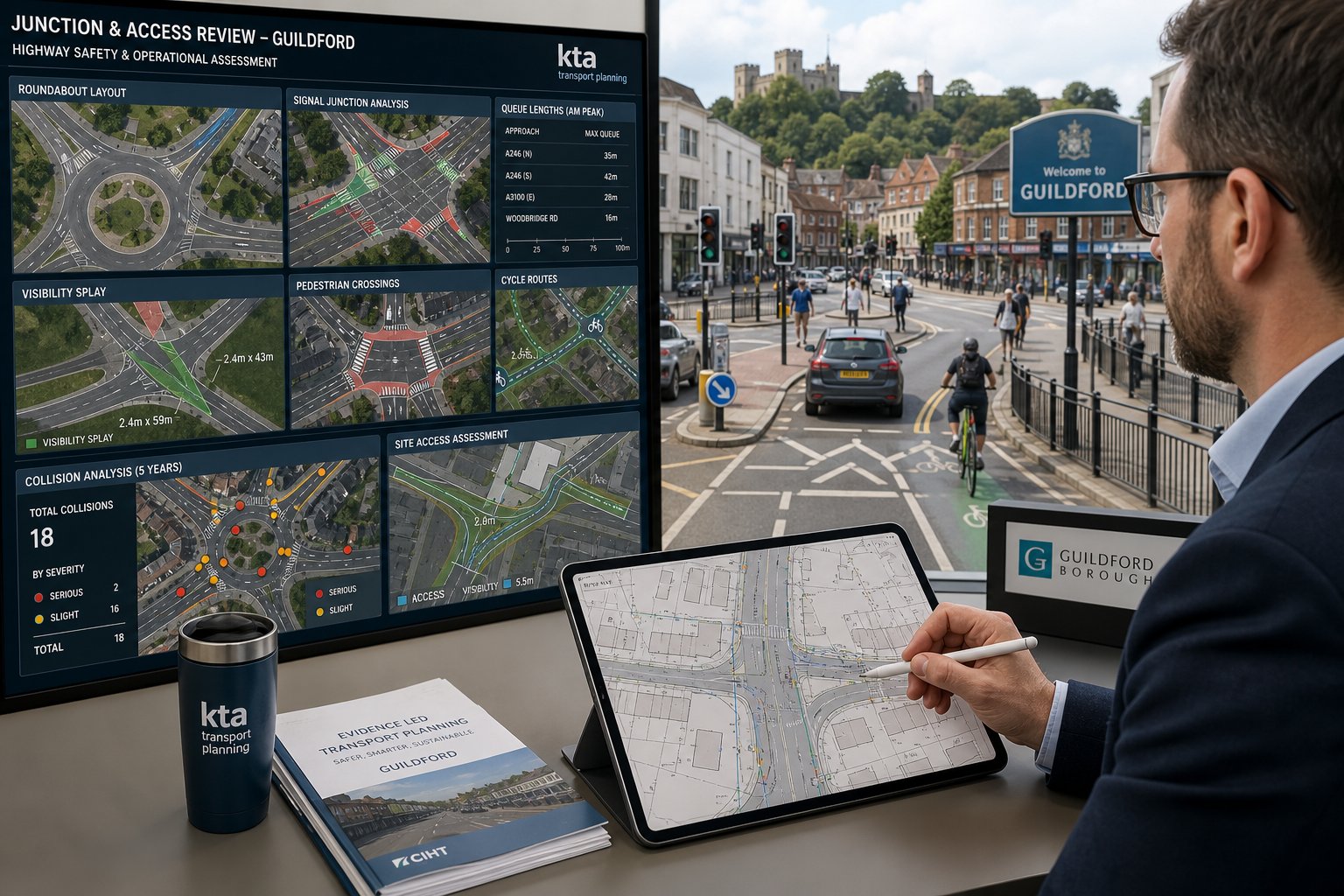
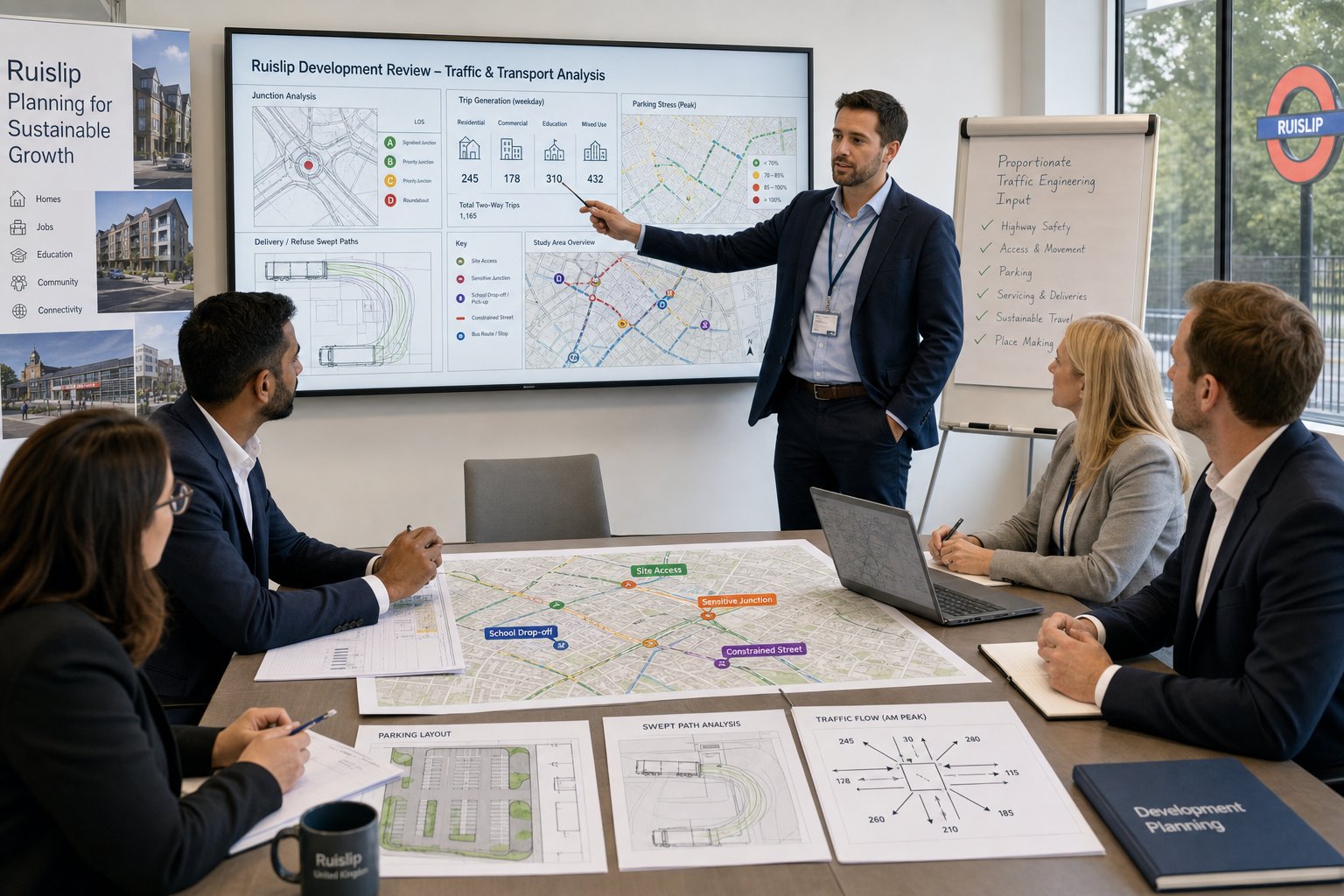
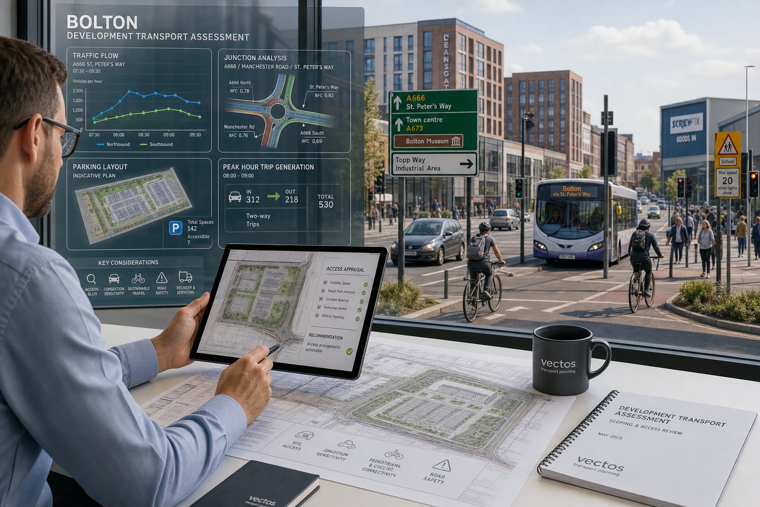
Key Traffic Engineering Reports Used To Support Bolton Schemes
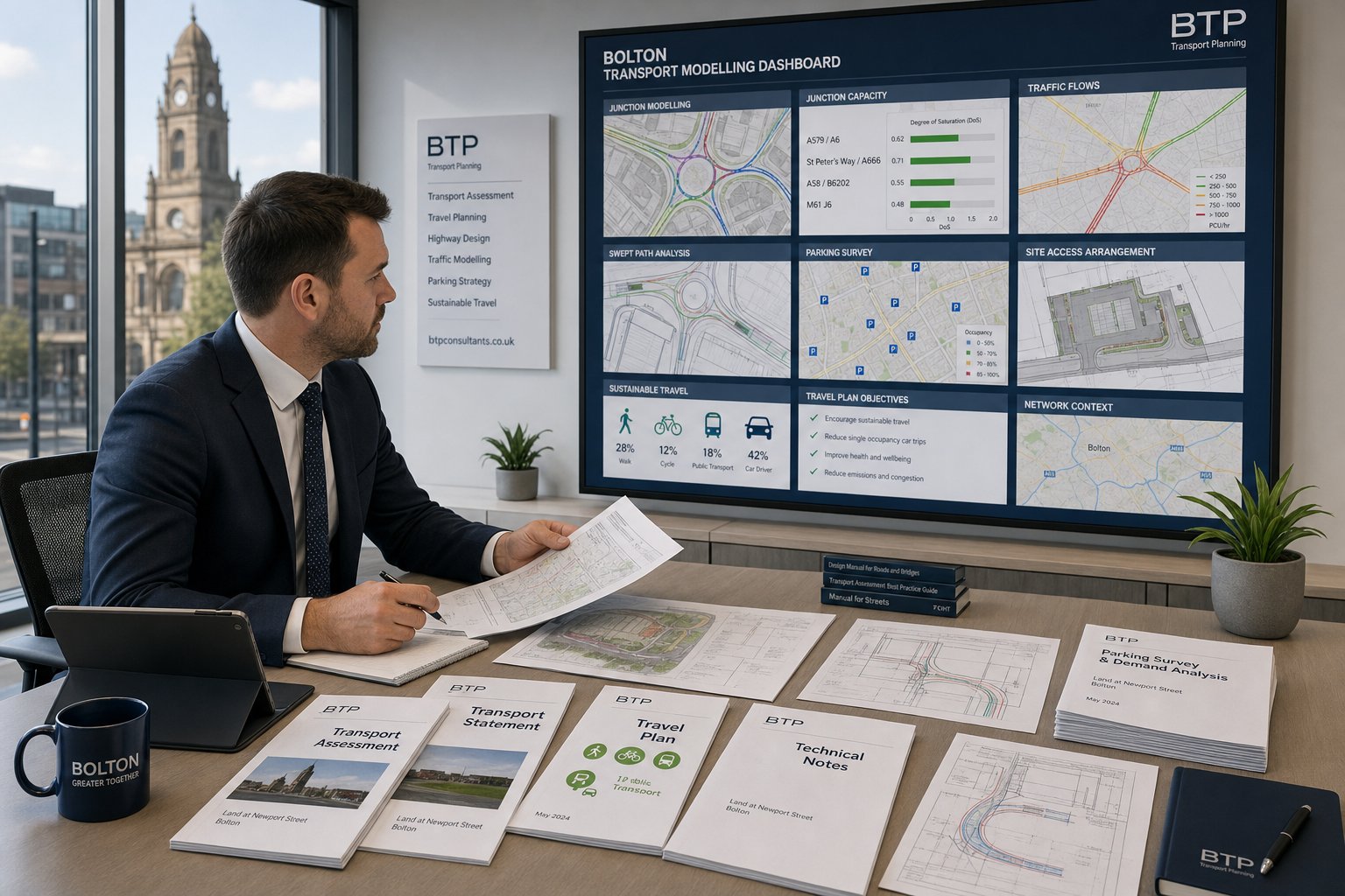
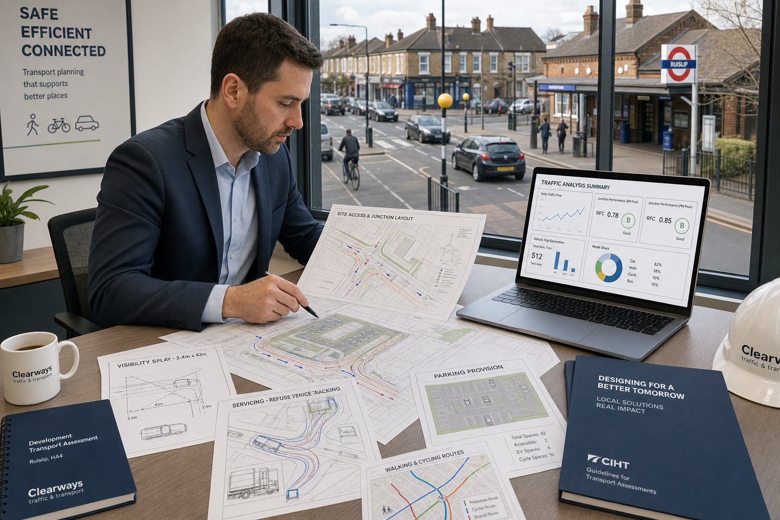
Different schemes need different transport documents, and the choice should reflect risk, scale and likely scrutiny. In Bolton, the most common reporting suite includes Transport Assessments, Transport Statements, Travel Plans and targeted technical notes. Sometimes that package is supported by junction modelling, swept path analysis, parking surveys or access drawings.
The key is not to produce paperwork for its own sake. Each report should answer a planning question clearly: is the access safe, is the traffic impact acceptable, can people arrive by realistic non-car modes, and are any mitigation measures necessary? Where the answer is yes, the report needs to show why in a methodical, evidence-led way.
A good transport submission also works as part of the wider planning narrative. It should align with the Design and Access Statement, drainage strategy, layout drawings and operational assumptions. If one document says delivery vehicles are occasional and another shows frequent articulated movements, credibility disappears fast.
That coordination is one reason concise, planning-led reporting matters. Our approach is built around producing evidence that is technically sound but also readable by officers, consultees and appeal inspectors. Broader Highway And Traffic input can be useful where transport issues overlap with access design, highway works or implementation strategy.
Transport Assessment And Transport Statement
A Transport Assessment is the fuller, more analytical document. It usually sets out baseline conditions, policy context, site accessibility, trip generation, trip distribution, assignment, committed development review, junction impact testing and mitigation if required. Where the application is substantial or potentially contentious, this is typically the core transport document.
A Transport Statement is lighter and more proportionate. It still needs to be robust, but it generally focuses on demonstrating that the proposal’s effects are limited and manageable. For smaller developments, that may be enough to satisfy the authority, especially where no major junction intervention is proposed.
The difference is not just length. It is depth of analysis. A TA might include multiple junction models and sensitivity tests: a TS may rely more on reasoned appraisal, survey evidence and a straightforward explanation of why severe impact is not expected.
Travel Plans, Technical Notes, And Junction Capacity Reviews
Travel Plans are often underestimated. A good one is not a box-ticking exercise: it shows how the development will support realistic mode choice through measures, targets, management arrangements and monitoring. For residential schemes, that may involve welcome packs, cycle storage and public transport information. For employment uses, it can extend to coordinator roles, car-share initiatives and shower/changing provision.
Technical notes are useful where the issue is narrow but important. They can address visibility splays, parking demand, servicing, swept path movements, local collision records or responses to officer comments without reopening the whole assessment.
Junction capacity reviews bring numerical confidence where concern centres on queues, delay or reserve capacity. Depending on the junction form, this may involve PICADY, ARCADY, LINSIG or more detailed modelling. The point is not software for software’s sake: it is demonstrating whether a proposal performs acceptably on the network and, if not, what mitigation is reasonable.
How A Traffic Engineer Assesses Access, Safety, And Network Impact
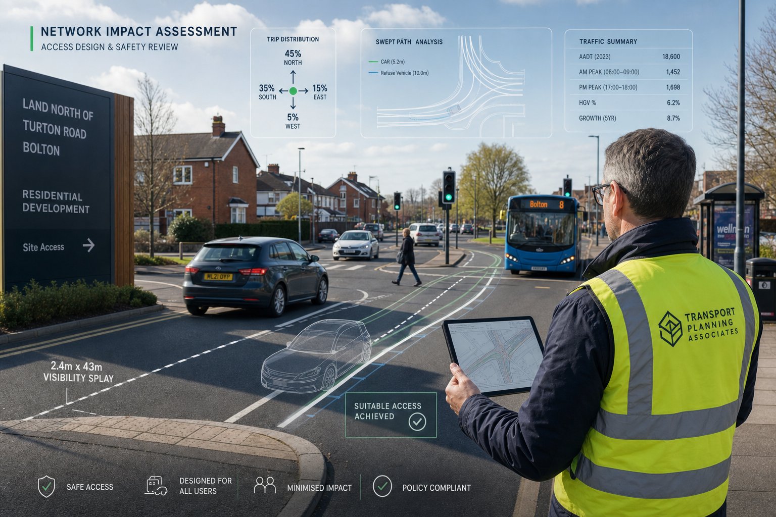
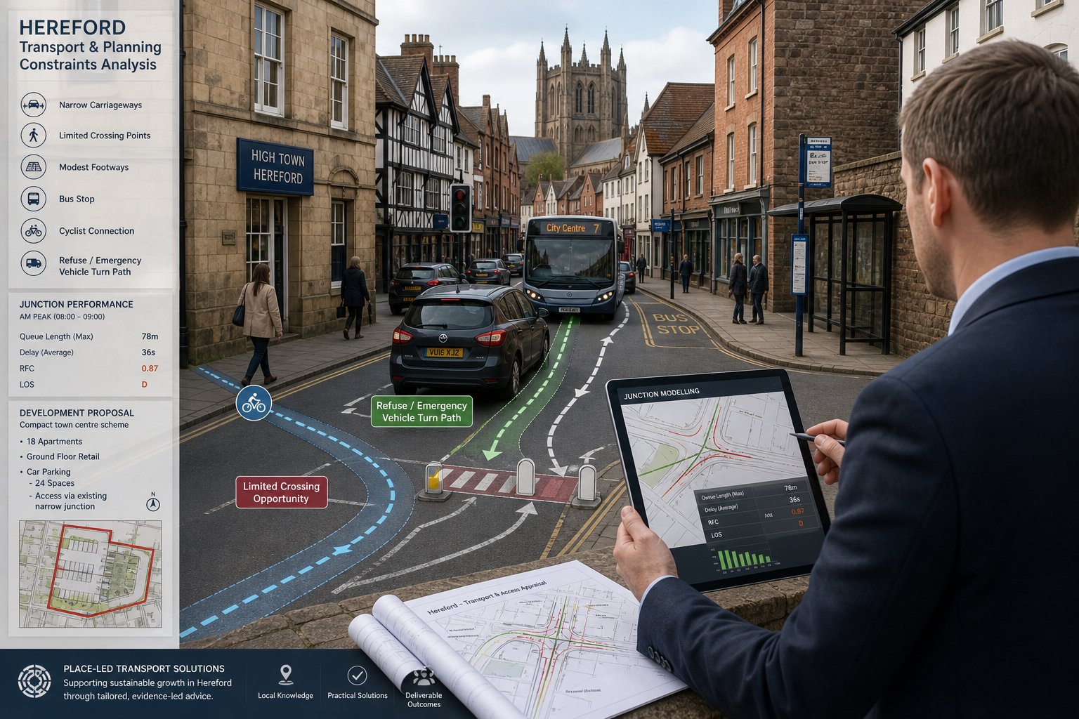
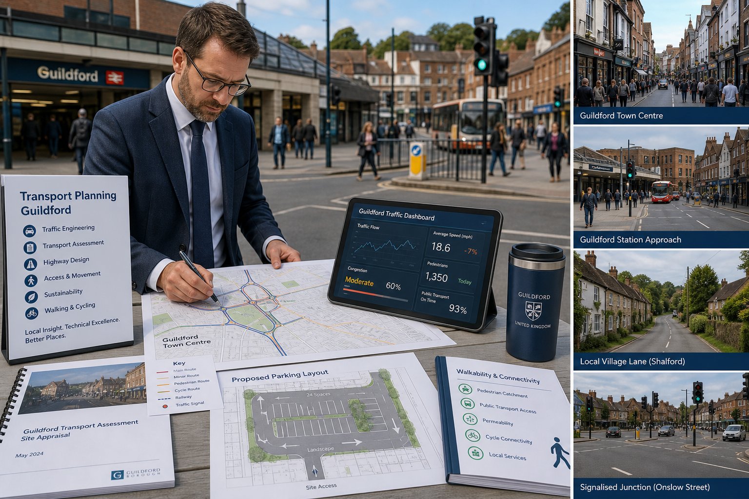
The assessment process usually starts on the ground. We visit the site, review how people actually move around it, and check whether the drawing assumptions reflect reality. That means looking at approach speeds, visibility, footway continuity, crossing opportunities, nearby junction behaviour, on-street parking, bus stops and informal desire lines. Desktop analysis alone misses too much.
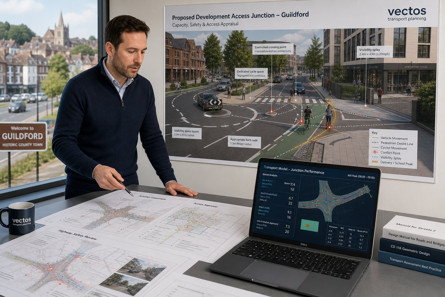
Access assessment then tests whether vehicles can enter and leave safely, whether servicing works without conflict, and whether internal circulation is practical. For many schemes, swept path analysis is essential because refuse vehicles, fire appliances or articulated deliveries can expose geometry issues early. If the access arrangement sits in a faster-speed environment, visibility checks against Manual for Streets or DMRB principles become especially important.
Network impact is typically assessed through trip generation and assignment. TRICS remains the standard source for many land uses, but it still requires judgement: selecting suitable sites, understanding local comparability and avoiding lazy assumptions. Once trips are estimated, they are distributed across the likely routeing pattern and tested at relevant junctions.
Safety is not just a collision-data appendix. We consider whether the proposal changes conflict points, increases turning pressure, affects vulnerable users or creates awkward manoeuvres. Where highway works are proposed, Road Safety Audit coordination may be needed. Similar methodology is used across cities, whether by a Traffic Engineer In Leeds: or elsewhere, but the practical judgement always depends on the local street context.
Bolton Planning Considerations That Can Influence Transport Requirements
Transport requirements in Bolton are shaped by more than trip numbers. Local planning policy, site location and delivery mechanism can all change the level of evidence expected. A town-centre development with strong walk and bus links may justify a different parking approach from an edge-of-settlement site where car dependency is harder to avoid. That sounds obvious, but it is exactly where weak applications can drift into generic language.
Parking standards remain a live issue, especially where schemes propose reduced provision, shared parking or non-standard operational arrangements. Cycle parking, EV charging and accessibility for disabled users can also influence layout decisions and officer responses. If these matters are not integrated early, the transport report ends up defending a design it did not help shape.
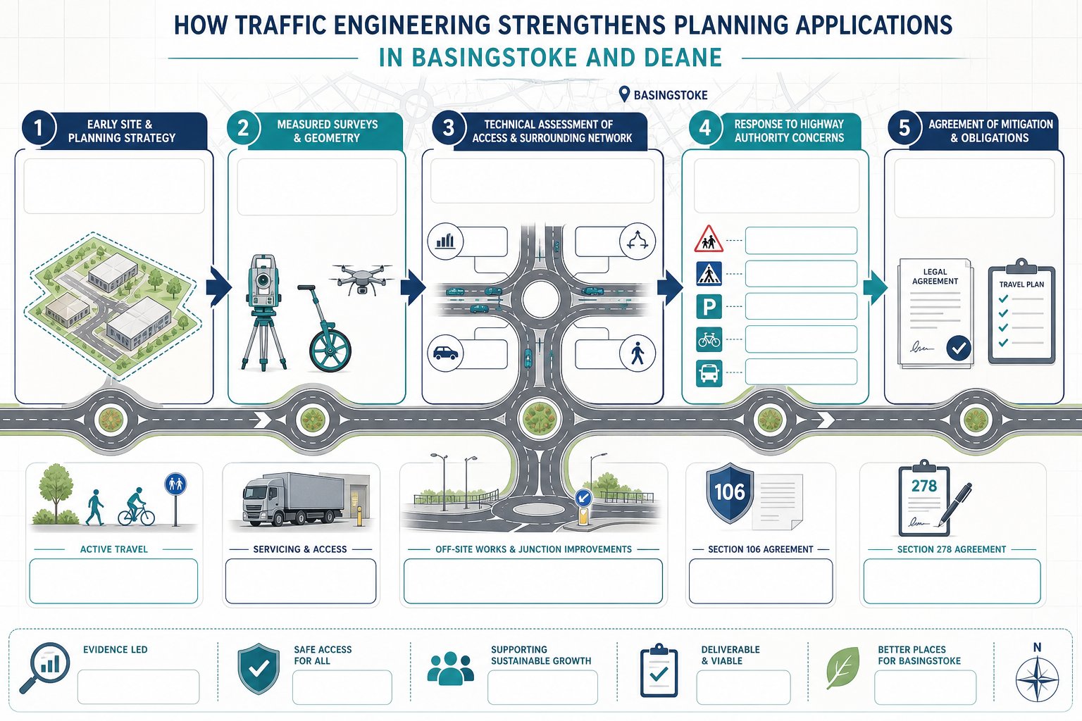
Air quality, regeneration priorities and highway mitigation can also affect requirements. In some cases, a proposal may need off-site works secured through Section 278, financial contributions through Section 106, or targeted upgrades such as lining, signing, crossing improvements or access control measures. Where the scheme sits near a constrained corridor, the authority may expect a clearer explanation of cumulative effects and sustainable travel mitigation.
Bolton’s context also rewards practical realism. Officers generally want to know not just whether a scheme works mathematically, but whether it will function on an ordinary Tuesday morning. That planning-led mindset is common in other urban authorities too, including work typically handled by a Traffic Engineer In Liverpool:, but local evidence remains decisive.
The Value Of Early Traffic Advice For Architects, Developers, And Consultants
Early traffic advice saves more than time: it protects design intent. Once a masterplan, red line boundary or access strategy has hardened, transport problems become expensive. We often find that a one-hour early review can prevent weeks of redesign later, especially on constrained urban sites where access geometry, parking efficiency and pedestrian movement all compete for the same space.
For architects, the value is usually layout confidence. We can sense-check whether the proposed access point is likely to work, whether servicing can be accommodated, whether parking numbers are realistic and whether a Travel Plan-led approach could support a leaner site arrangement. For planners and lawyers, early advice reduces risk by clarifying what level of evidence will probably be needed and where objections are most likely to arise.
Developers benefit because programme certainty improves. If surveys, modelling or junction design work will be required, it is better to know before the submission date is fixed. That allows the team to sequence information properly rather than scrambling for technical evidence after validation or, worse, after an objection.
This is particularly helpful on mixed-use and phased schemes, where transport assumptions need to align with delivery stages. Comparable benefits are often seen on projects led by a Traffic Engineer In London: or other major-city consultant teams, but in Bolton the same principle holds: earlier transport thinking generally means fewer surprises.
What Information To Prepare Before Instructing A Traffic Engineer
A traffic engineer can start quickly when the core project information is clear. The essentials are usually the site boundary, the proposed use, scale and access concept. That means plans showing the red line boundary, existing highway connections, any known level changes, nearby constraints and the draft layout if one exists.
We also need a solid description of the development quantum: unit numbers, gross floor area, use classes, servicing assumptions, parking provision and, if relevant, phasing. Even at early stage, approximate figures help us advise on likely scope. A scheme described simply as “commercial” or “residential-led” is too vague to price or scope properly.
Pre-application feedback is particularly useful. If Bolton Council has already commented on access, parking, sustainable travel or junction impacts, that steers the assessment straight away. Nearby consented schemes, known local objections, land ownership constraints and any operational peculiarities should also be shared early. The more transparent the starting brief, the fewer surprises later.
Programme matters too. We always want to know the target submission date, whether surveys are season-sensitive, and whether other design packages depend on transport input. In practice, the best briefs are short but specific: a drawing pack, a land-use schedule, existing context, and a realistic deadline. That is usually enough to define whether the job needs a TA, TS, Travel Plan or focused note.
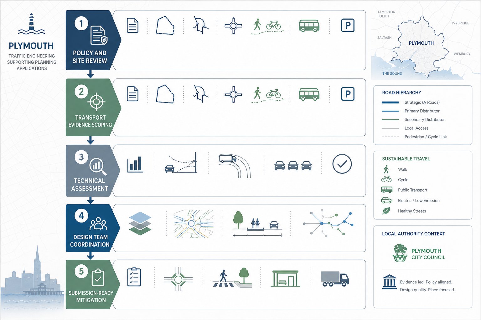
How The Traffic Engineering Process Typically Works From Enquiry To Submission
Most transport commissions follow a fairly consistent sequence, even though the detail varies by scheme. We begin with an initial review of the proposal, site context and likely planning risk. At that stage, we advise on the probable scope: whether the project needs a Transport Assessment or Statement, whether surveys are likely, and whether access design or modelling will be central.
The next step is usually methodology agreement, formally or informally, with the local highway authority. That can save a lot of friction later. If everyone understands which junctions will be assessed, what survey periods are relevant and what development assumptions are being tested, the reporting process becomes far more efficient.
Data collection follows. Depending on the site, this may include traffic counts, queue surveys, speed surveys, parking beat surveys, collision analysis and accessibility review. We then test access design, servicing, parking and internal layout, before moving into trip generation, distribution and junction assessment.
If impacts arise, mitigation is developed and tested. That may involve geometric improvements, local highway works, operational changes or sustainable travel measures. Where required, Road Safety Audit input is coordinated. The reporting stage then pulls everything together into a clear planning document, supported by drawings and appendices.
Finally, post-submission support matters more than many teams expect. Highways officers may ask for clarifications, updated plans or a short rebuttal note. On more complex or contentious schemes, that continuing role can be as valuable as the original report. A similar end-to-end process underpins work in other locations, including a Traffic Engineer In Bristol:, but the best outcomes always come from tailoring the scope to the local authority and the actual development risk.
Conclusion
A strong planning application in Bolton needs more than a transport document attached at the end. It needs a transport case that fits the site, the scale of development, the local network and the authority’s likely concerns. That is the real value a traffic engineer brings: not just calculations, but judgement.
When the scope is proportionate, the evidence is local, and access and network issues are addressed early, applications tend to move more cleanly through the system. Risks are easier to identify, layouts are more efficient, and highways objections are less likely to derail programme or cost.
For architects, planners, developers, legal teams and councils alike, the message is straightforward. Bring transport advice in early, define the right level of assessment, and make sure the submission speaks to Bolton rather than to planning in the abstract. In 2026, that planning-led approach is still one of the simplest ways to build faster, stronger applications.
Frequently Asked Questions About Traffic Engineering in Bolton
What role does a traffic engineer in Bolton play in planning applications?
A traffic engineer in Bolton reviews proposed developments for access, parking, servicing, and trip impacts against national and local standards. They prepare key documents such as Transport Assessments and liaise with Bolton Council to address transport objections, ensuring the application meets local transport policy requirements.
When is a Transport Assessment or Transport Statement required in Bolton?
Developments typically require a Transport Assessment when trip generation is substantial, access involves sensitive junctions or A-roads, or uses generate concentrated traffic. Smaller schemes with limited impact often need a lighter Transport Statement, provided access and parking are credibly addressed.
Why is local planning focus crucial for transport evidence in Bolton?
Bolton’s unique highway safety concerns, traffic patterns, and planning policies mean transport evidence must reflect local junction pressures, accident clusters, and town-centre priorities. Generic reports may miss these factors, affecting the likelihood of planning approval.
What types of developments commonly require traffic engineering input in Bolton?
Large residential estates, retail parks, supermarkets, drive-thru restaurants, employment parks, warehouses, and schools or leisure venues often need detailed transport assessments due to their traffic intensity, access complexity, or peak demand patterns.
How early should developers seek traffic engineering advice in Bolton?
Early traffic advice is valuable to optimise site layouts, access, and parking before masterplans are fixed. This reduces late-stage redesigns, aligns transport assessments with planning submissions, and lowers the risk of objections or delays.
How does a traffic engineer in Bolton assess access safety and network impact?
They conduct site visits, speed and visibility surveys using Manual for Streets and DMRB guidance, analyse trip generation from TRICS data, and model junction capacity. Safety audits and coordination ensure that access and network effects comply with local and national standards.