A planning application can look sound on paper, then come unstuck on one familiar point: transport. Can vehicles get in and out safely? Will nearby junctions still work in the peak hour? Is parking realistic, or just optimistic line-drawing on a layout plan? In Stafford, those questions matter early, and they matter more when local roads are constrained, town-centre conditions are sensitive, or highway officers expect clear evidence rather than assumptions.
That is where a traffic engineer in Stafford becomes central to the planning strategy, not an afterthought. We use transport evidence to show that development can be accessed safely, that traffic effects are understood properly, and that any issues can be mitigated in a way that aligns with local and national policy. For architects, planners, solicitors, surveyors, developers and councils, that usually means moving beyond generic commentary and into robust, location-specific analysis.
In this guide, we set out what a traffic engineer actually does on Stafford planning projects, which schemes commonly need transport input, how Transport Statements, Transport Assessments and Travel Plans differ, and what information helps at instruction stage. The aim is straightforward: to explain how the right technical work can reduce risk, answer highway concerns early, and improve the prospects of planning permission in 2026.
Key Takeaways
- A traffic engineer in Stafford plays a crucial role in securing planning permission by providing robust, location-specific transport evidence that ensures safe access and manages traffic impacts effectively.
- Local transport data such as traffic counts, speed surveys, and collision history are essential for creating credible Transport Statements and Assessments tailored to Stafford’s unique road conditions and policy environment.
- The choice between a Transport Statement, Transport Assessment, or Travel Plan depends on the development’s size, location, and potential transport effects, with larger or sensitive sites typically requiring more comprehensive analysis.
- Early involvement of a traffic engineer helps identify and mitigate access, visibility, parking, and highway safety issues before finalising site layouts, which reduces the risk of planning delays or refusals.
- Comprehensive transport modelling and junction capacity analysis provide decision-makers with clear insights into how proposed developments will affect local traffic flows and congestion in Stafford.
- Preparing detailed site information and coordinating transport evaluations with broader planning strategies enhances application credibility and improves the likelihood of successful planning outcomes in Stafford in 2026.
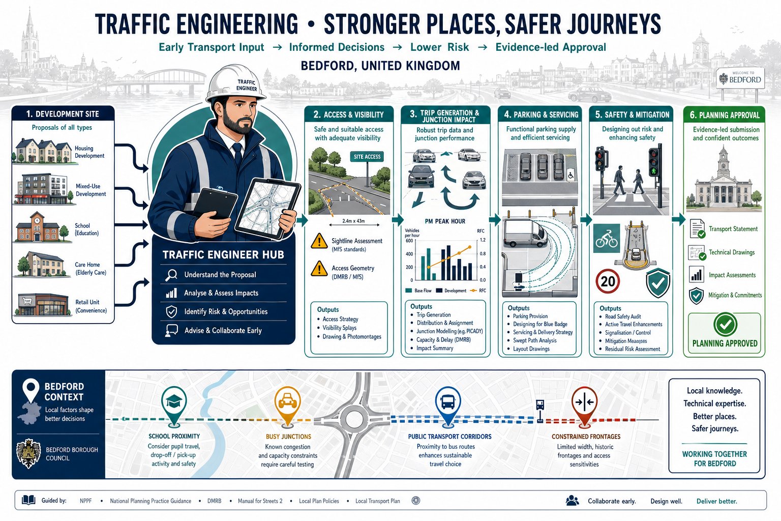
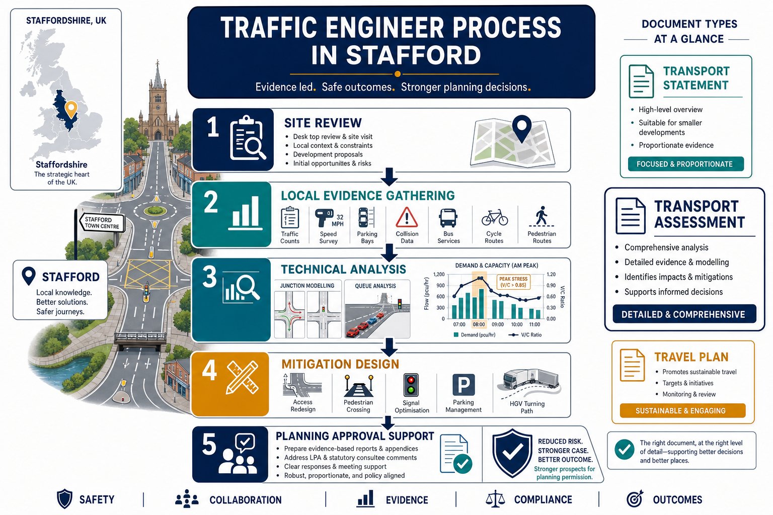
What A Traffic Engineer Does In Stafford Planning Projects
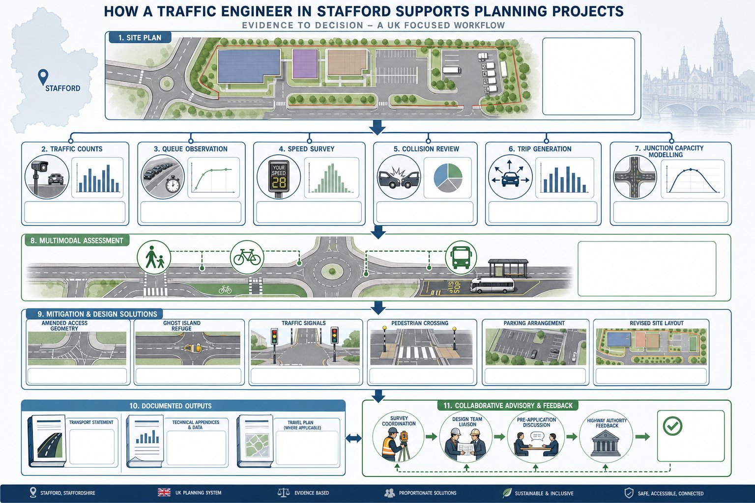
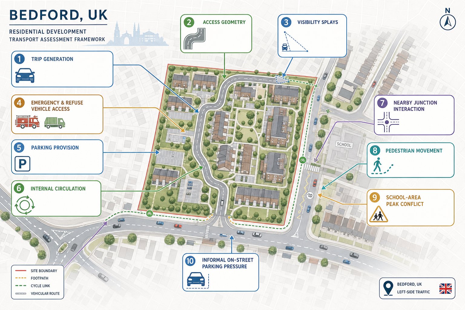
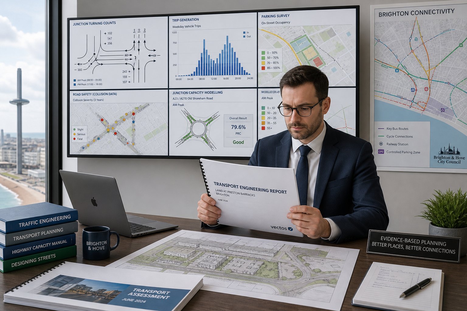
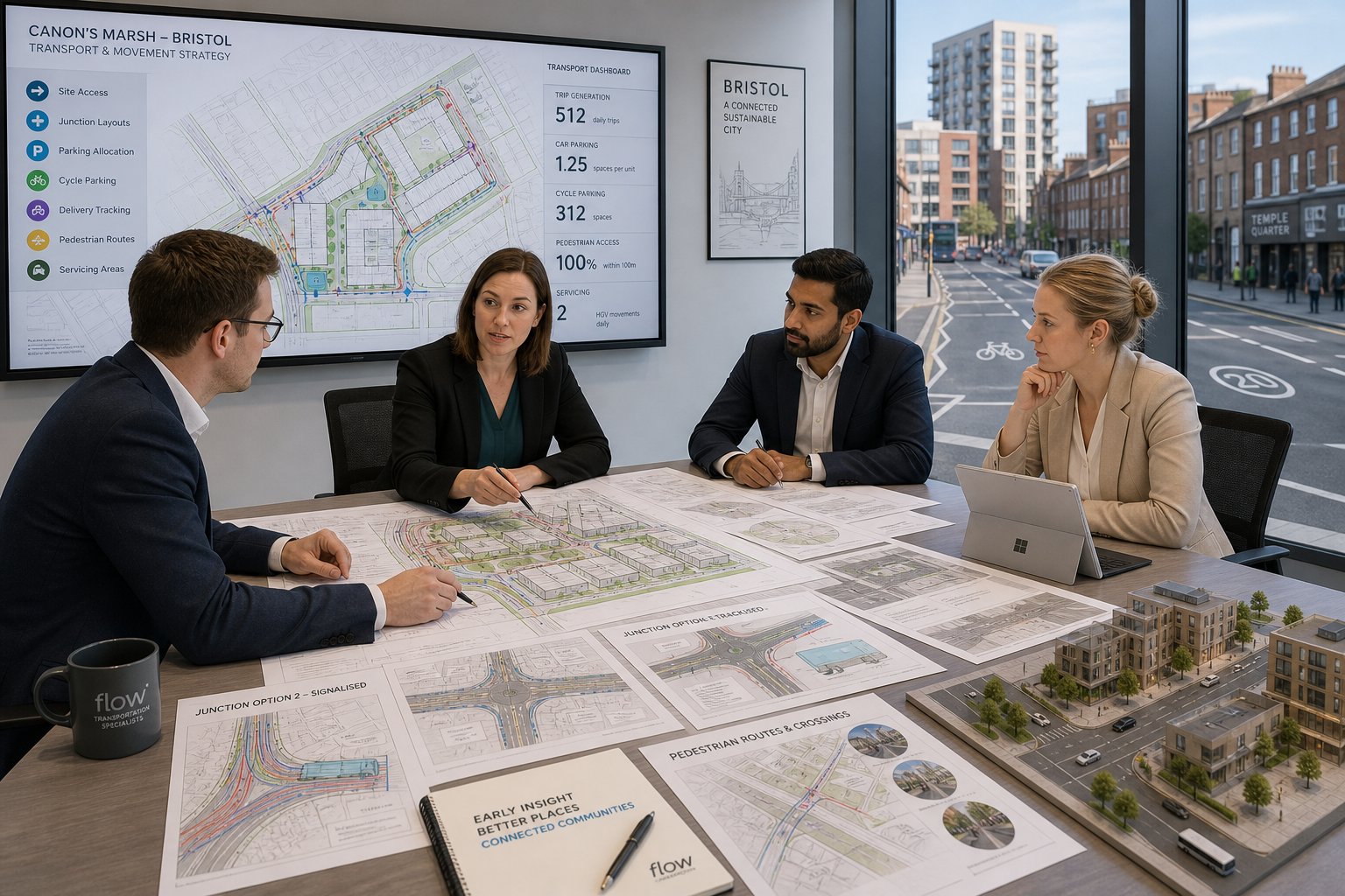
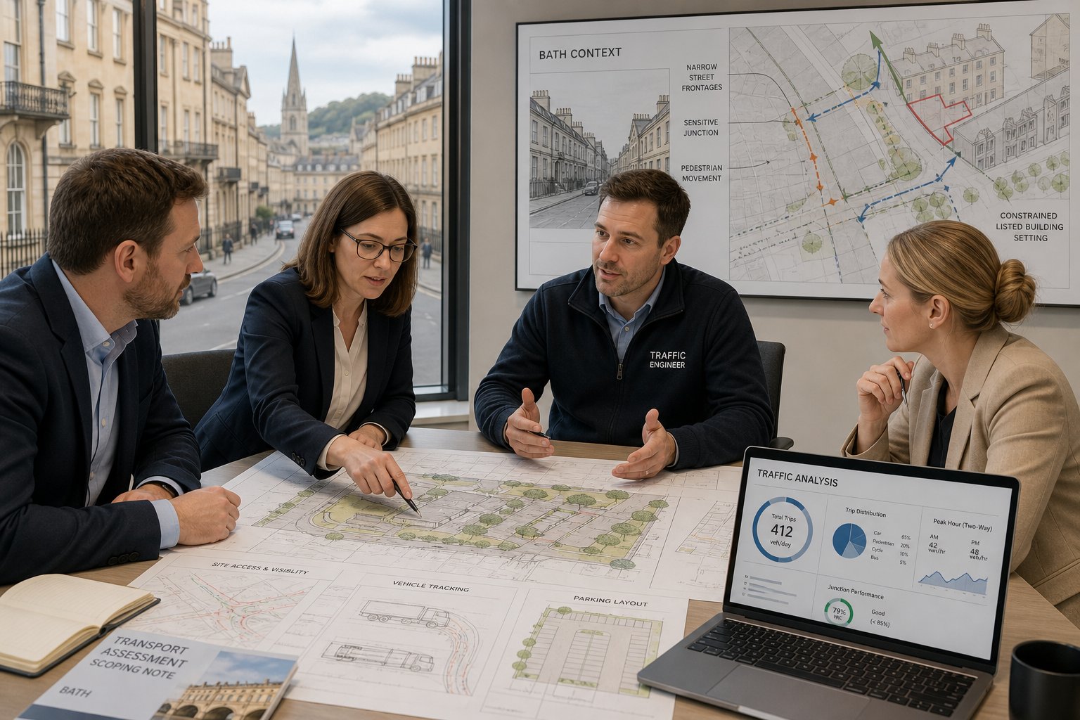
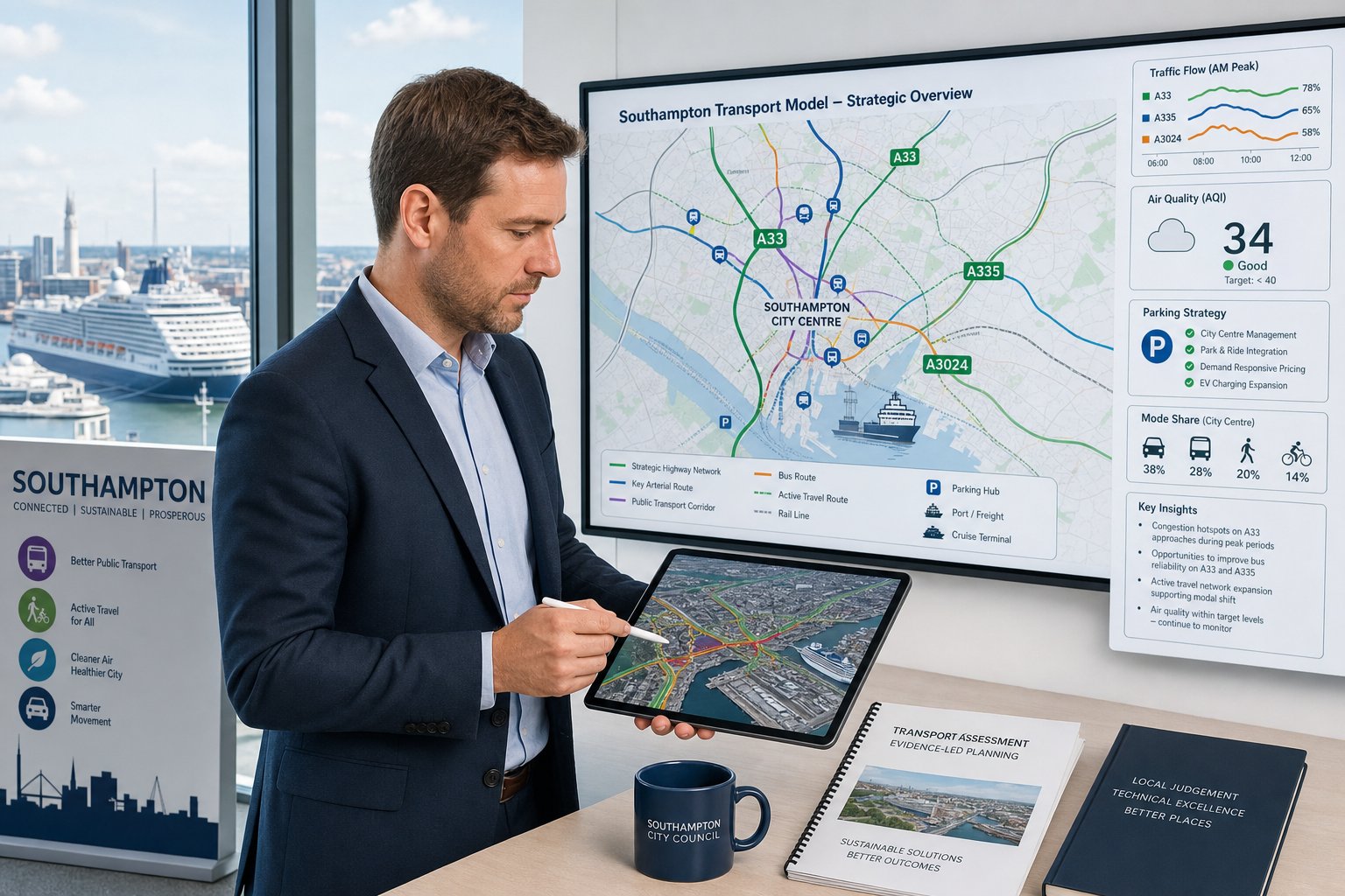
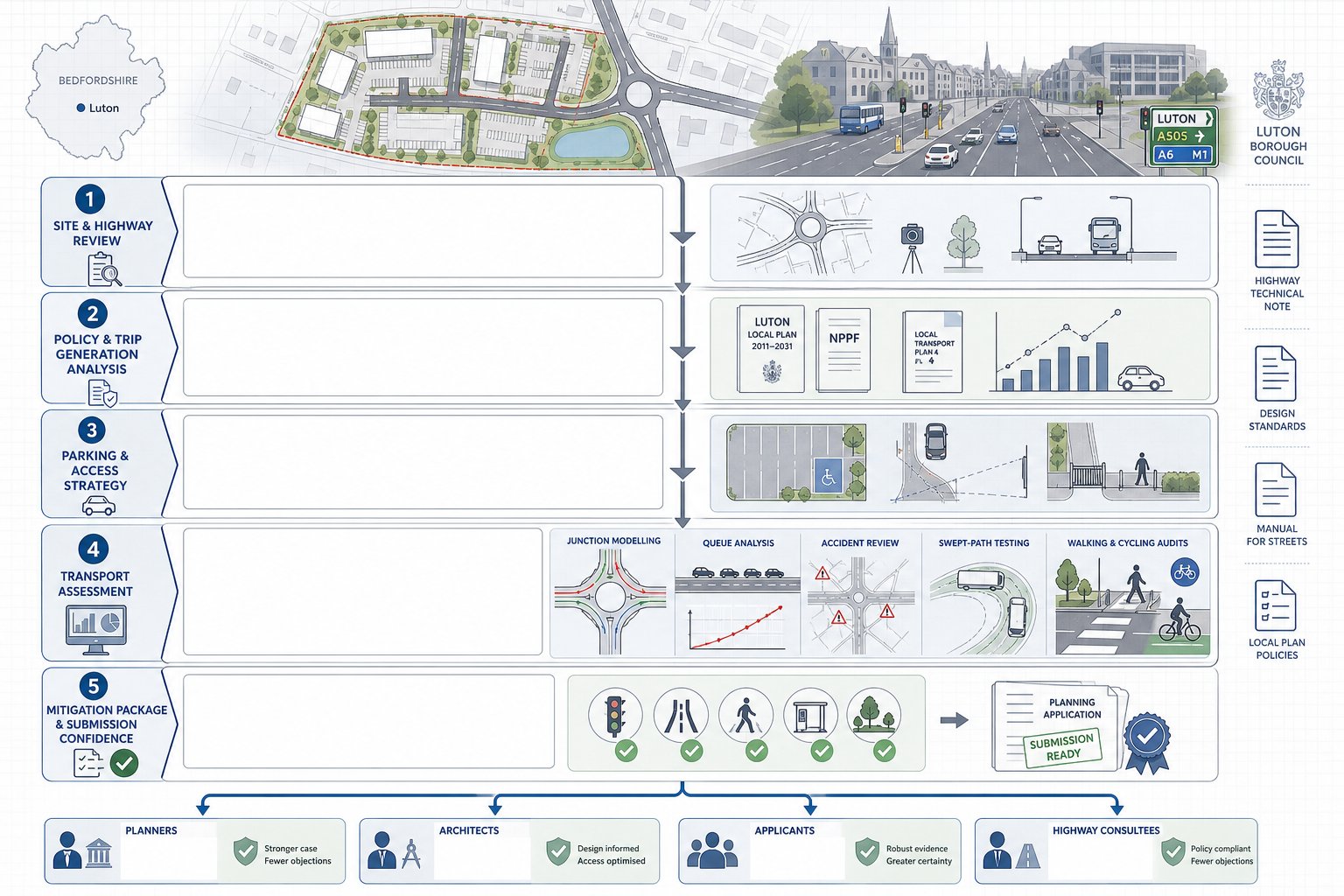
A traffic engineer in Stafford supports the planning process by turning transport risk into evidence-led decision-making. In practice, that starts with the basics: reviewing the site location, proposed land use, access points, parking provision, servicing arrangements and likely travel demand. But the work quickly becomes more technical. We test whether a site can function safely and acceptably on the surrounding network, and whether the proposal is likely to satisfy highway authority expectations.
That can involve traffic counts, queue observations, speed surveys, collision review, trip generation analysis and capacity modelling at nearby junctions. It also includes a detailed look at walking, cycling and public transport opportunities, because modern planning decisions are not based on car movements alone. If a proposed scheme needs changes, we advise on mitigation such as access amendments, ghost islands, signal optimisation, pedestrian crossings, parking management or layout revisions.
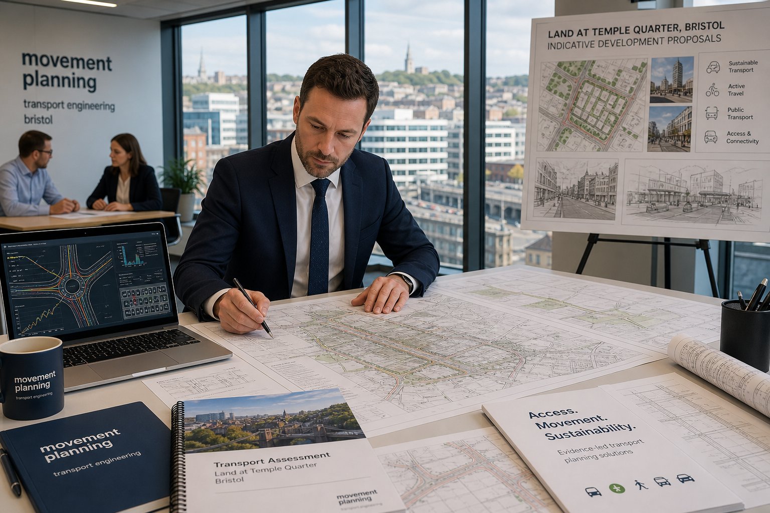
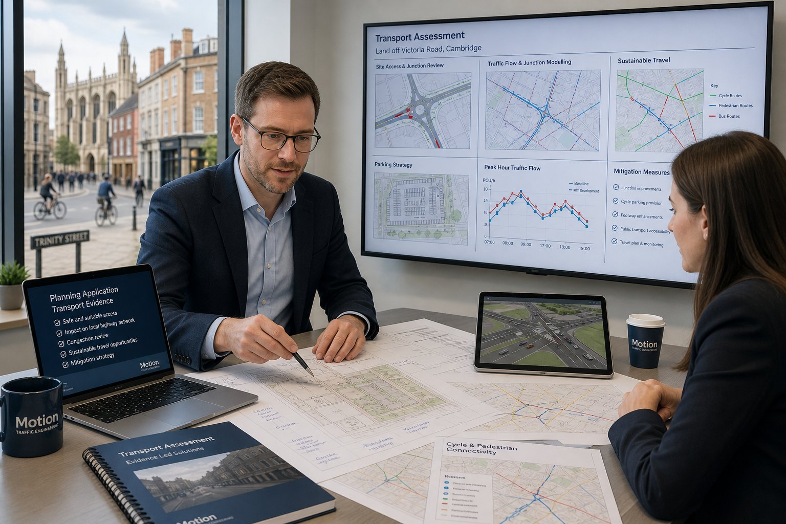
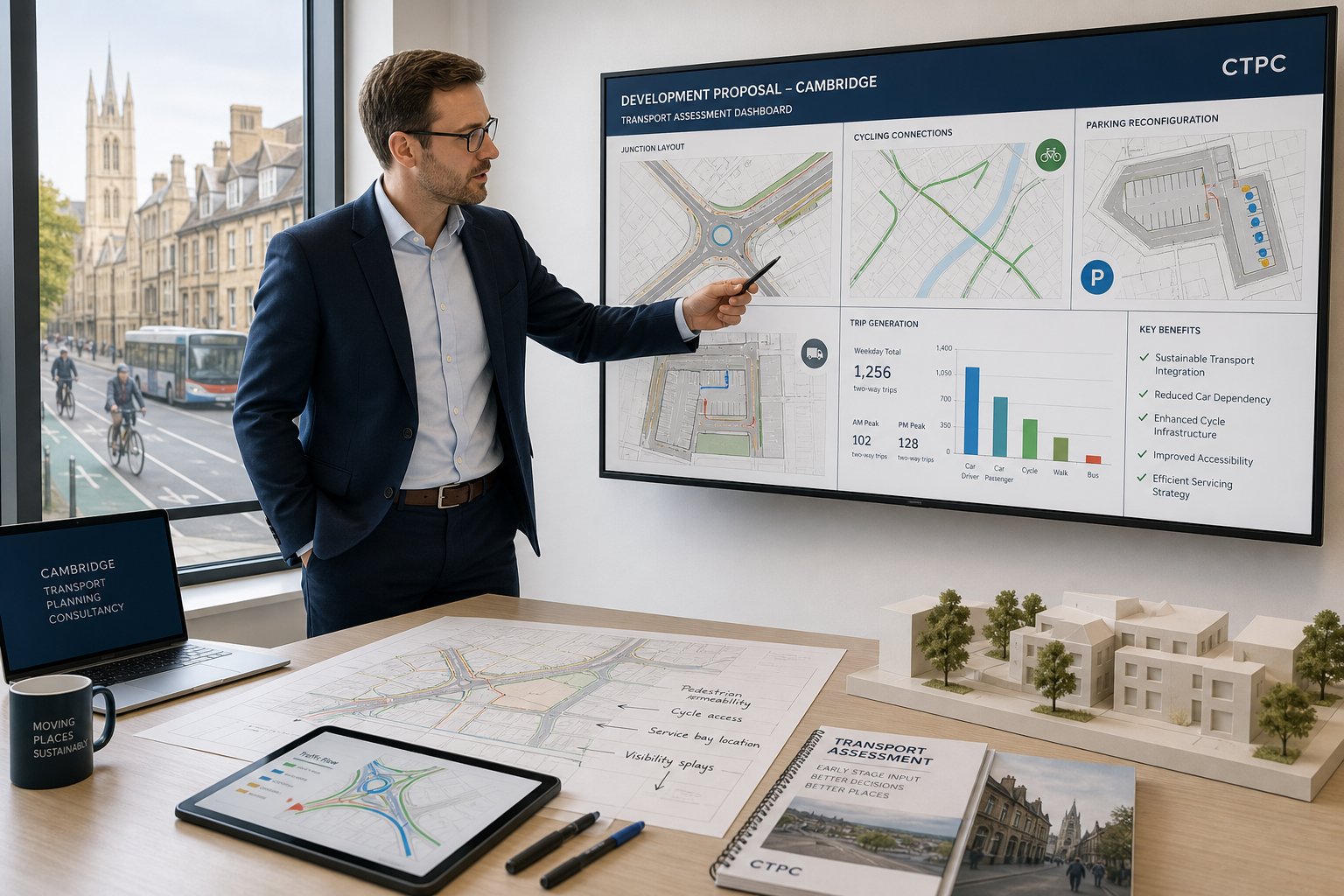
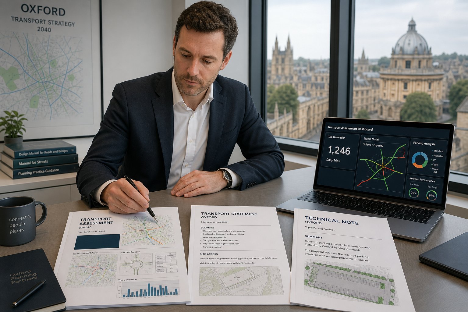
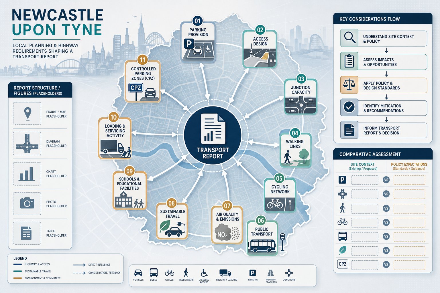
For many projects, the main deliverables are formal planning documents: Transport Statements, Transport Assessments and Travel Plans. These reports need to be proportionate, technically defensible and tailored to the site rather than copied from unrelated schemes. On wider projects, we may also liaise with design teams, coordinate surveys, support pre-application discussions and respond to highway comments after submission. That broader advisory role is one reason many clients appoint specialist Traffic Engineering Consultants: early, before layouts harden into something difficult to fix.
Why Local Transport Evidence Matters For Stafford Developments
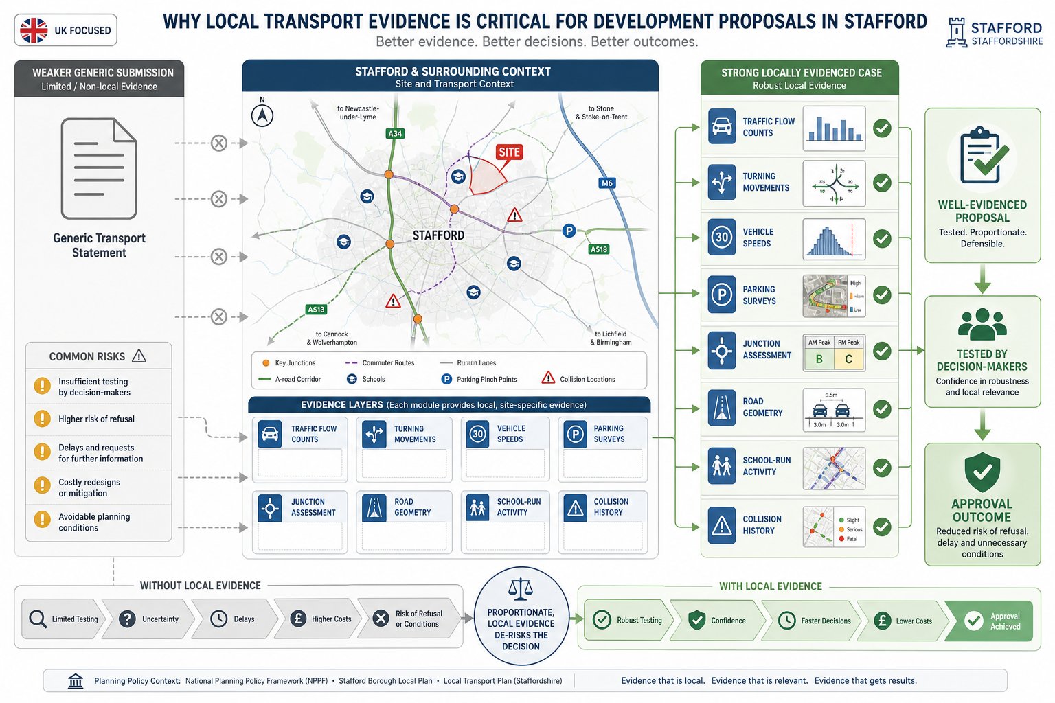
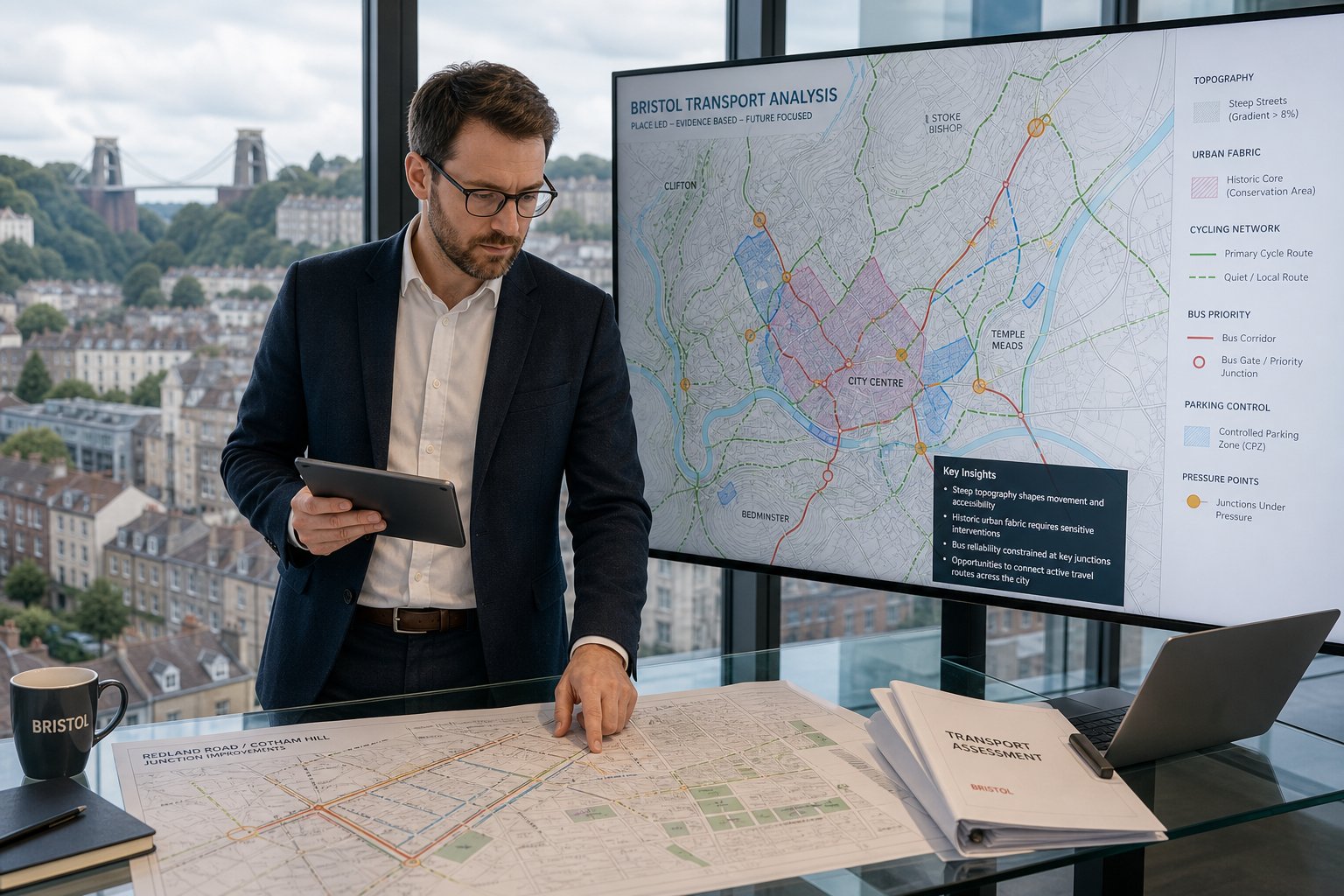
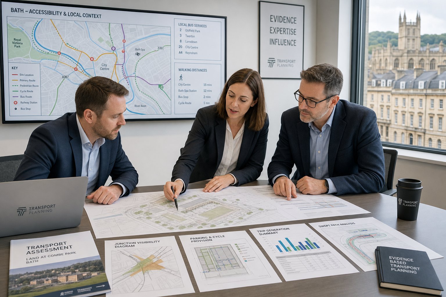
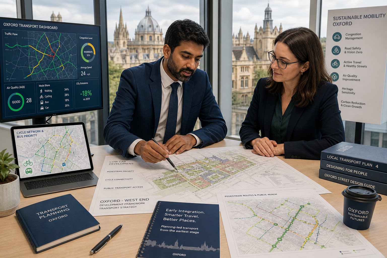
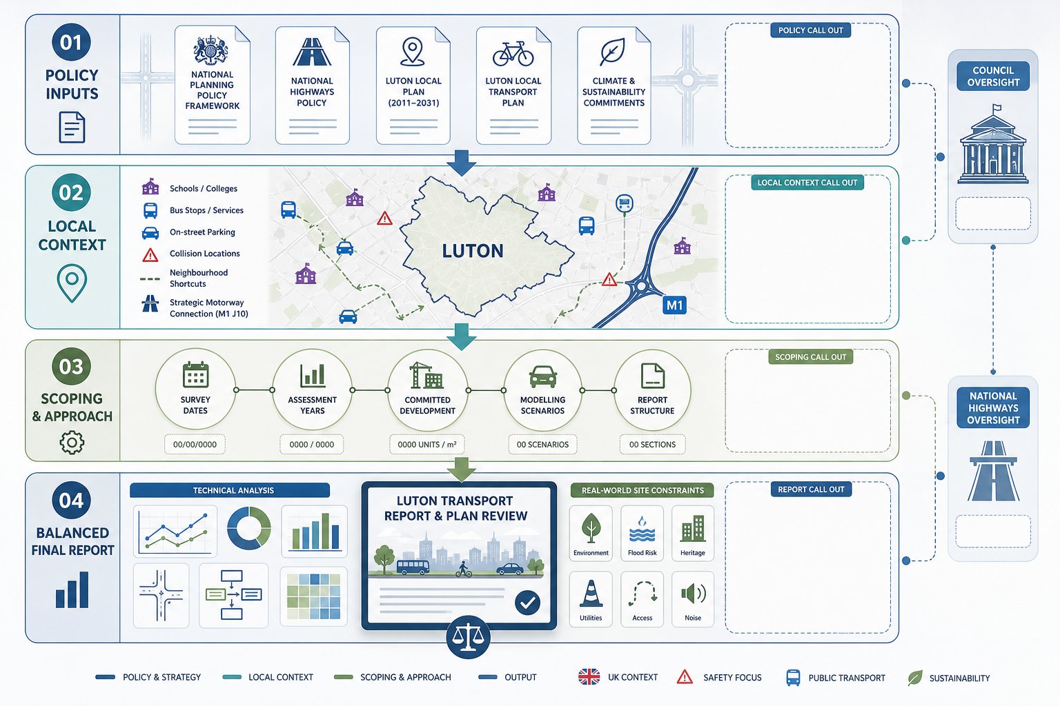
Local evidence is often the difference between a transport submission that reassures decision-makers and one that creates more questions than it answers. Stafford Borough and Staffordshire County Council will typically want to understand how a development interacts with the actual network around it, not a theoretical network somewhere else. That means local traffic flows, local peak patterns, local road geometry, local school-run behaviour, and local collision history all matter.
A generic statement saying “the impact will be limited” rarely carries much weight on its own. By contrast, recent turning counts, speed data, parking surveys and a reasoned assessment of nearby junctions give officers something they can test. That matters especially where development sits on constrained rural lanes, close to busy A-roads, around commuter corridors, or near locations where on-street parking already causes friction.
Local context also affects thresholds and emphasis. Two sites with similar unit numbers can attract very different levels of scrutiny depending on access conditions, nearby receptors and policy sensitivities. We see this in many authorities, not just Stafford: the local nuances reflected in places such as Traffic Engineer In Birmingham: and Traffic Engineer In Manchester: work show why location-specific evidence matters. Poorly evidenced assumptions can lead to refusals, delayed validation, expensive redesign, or conditions that would have been avoidable with a stronger technical case at the outset.
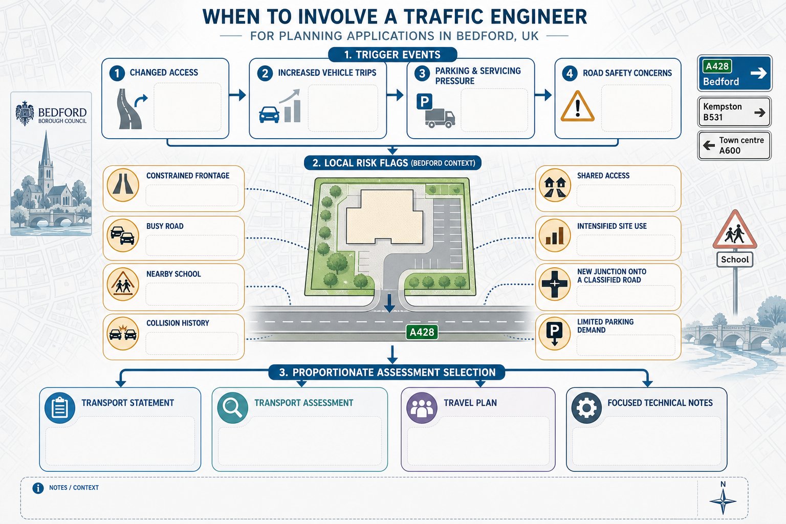
Stafford Planning Applications That Commonly Need Traffic Input
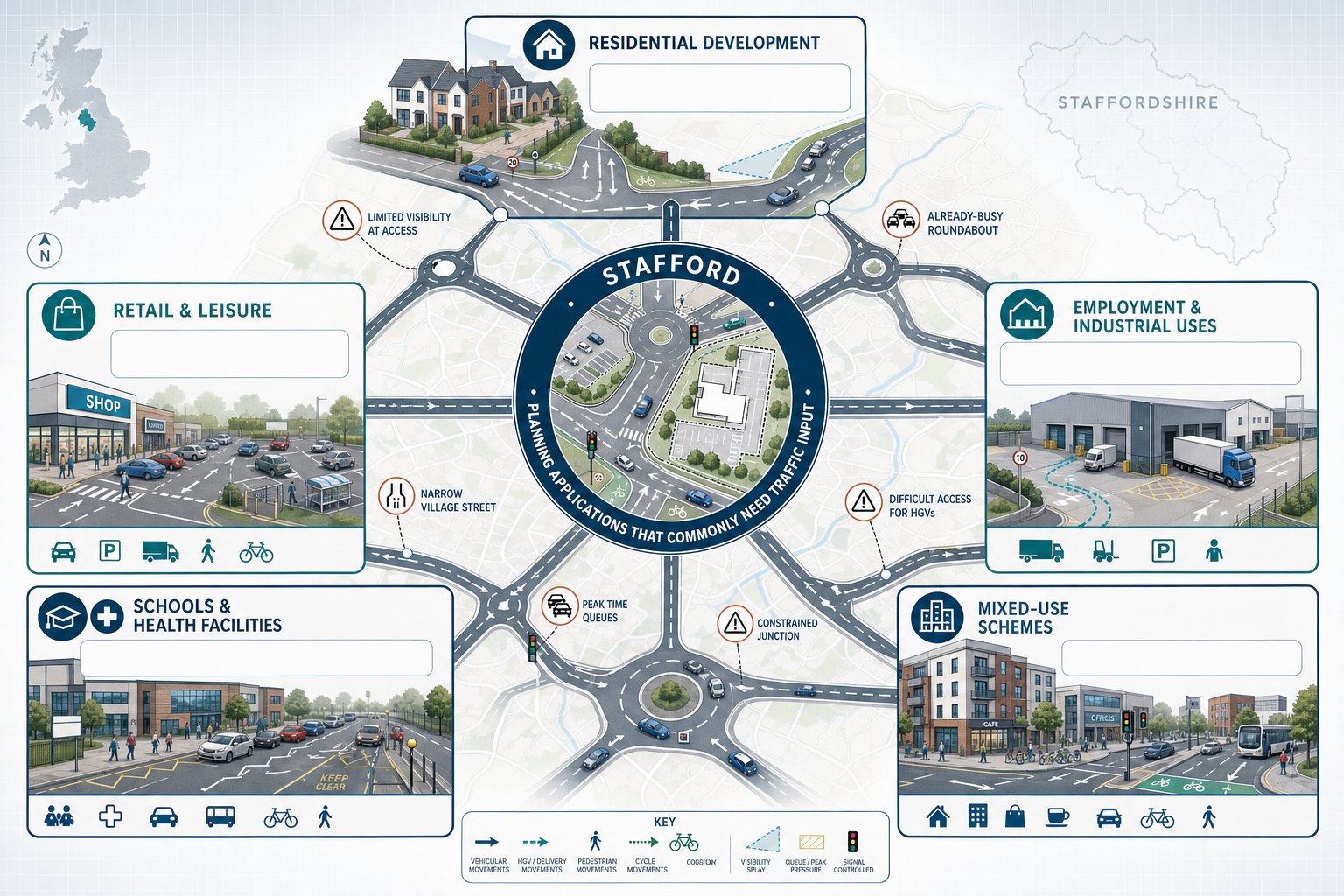
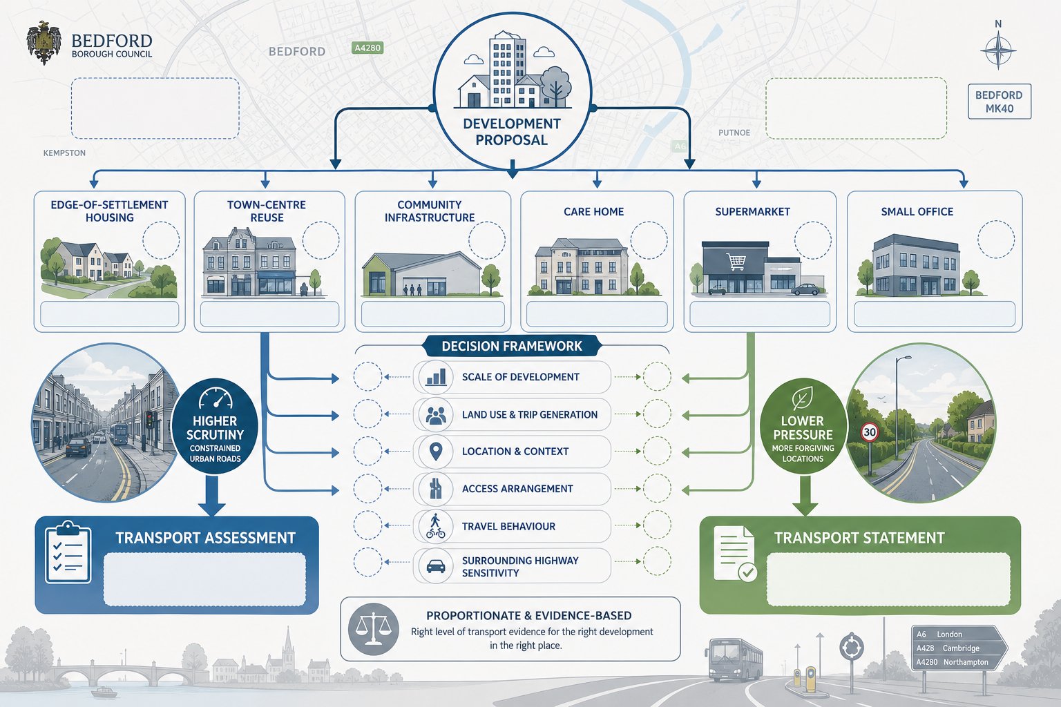
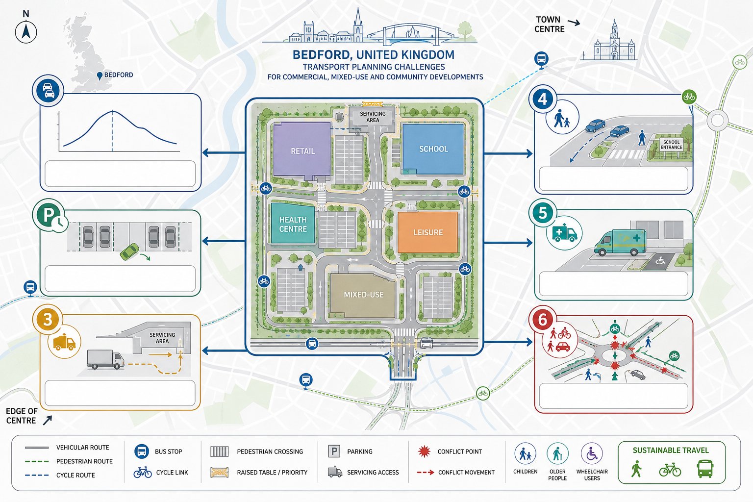
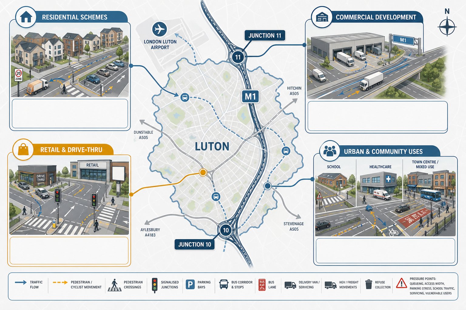
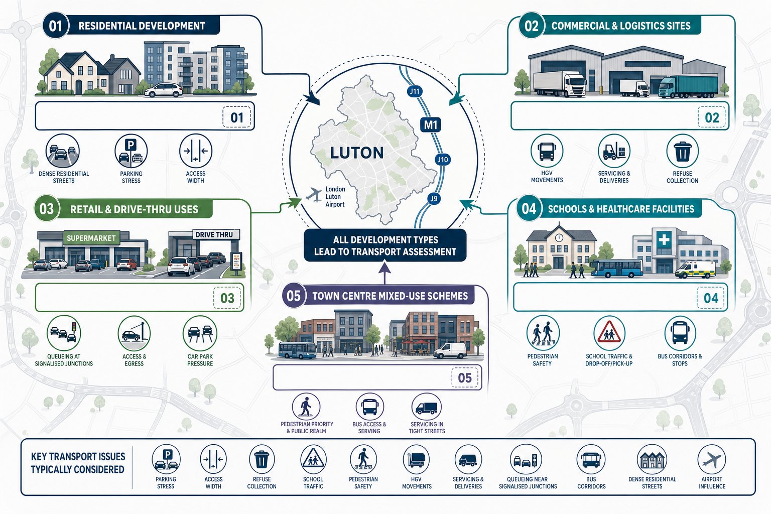
Not every planning application in Stafford needs a detailed traffic report. But many do, particularly where vehicle movements, parking demand, servicing, highway safety or sustainable travel issues could be material to the decision. Residential schemes are an obvious example, from small edge-of-village developments using existing accesses to strategic housing sites affecting multiple junctions. The bigger the scheme, the more likely it is that transport evidence will be expected.
Retail and leisure proposals also commonly require traffic input because arrivals can be concentrated into short peak periods, and parking demand is often sensitive. Employment developments, industrial sites and logistics uses raise a different set of questions: HGV routing, staff travel patterns, servicing space, turning manoeuvres and impacts on nearby roundabouts or signal junctions. Schools, colleges and health uses can be particularly challenging because their peak activity may coincide with already-stressed network conditions.
Mixed-use schemes often need the most careful handling because they combine several travel patterns at once. Even relatively modest projects may need a Transport Statement if the site sits near a difficult access, a village main road with limited visibility, or a junction already known to queue. The principle is simple: if transport effects could influence planning judgement, a traffic engineer should usually be involved. Broader principles are also covered in Traffic Engineering: Your, but the local site specifics will always drive the actual scope.
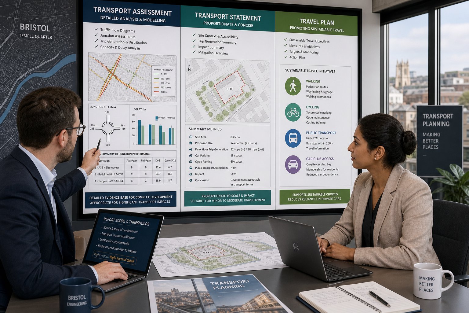
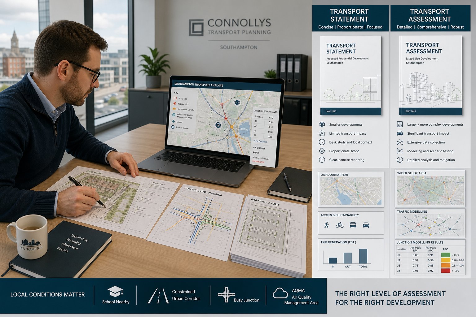
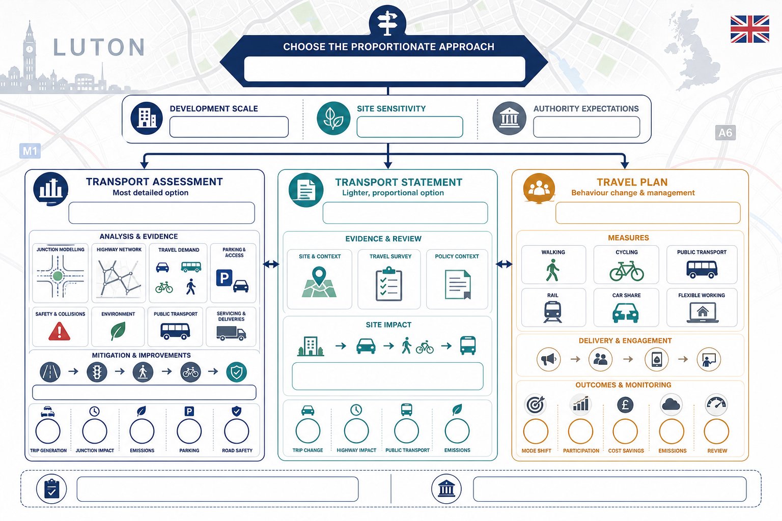
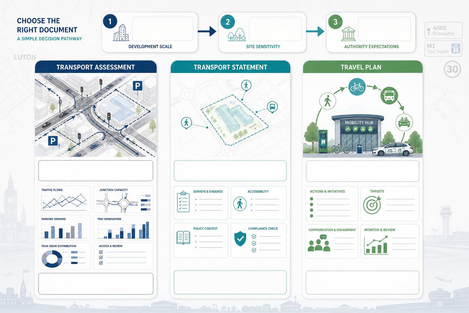
Transport Statement Vs Transport Assessment Vs Travel Plan
These three documents are related, but they do different jobs, and choosing the wrong one can slow an application down.
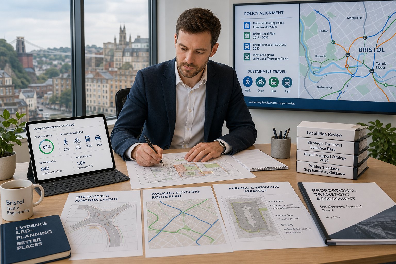
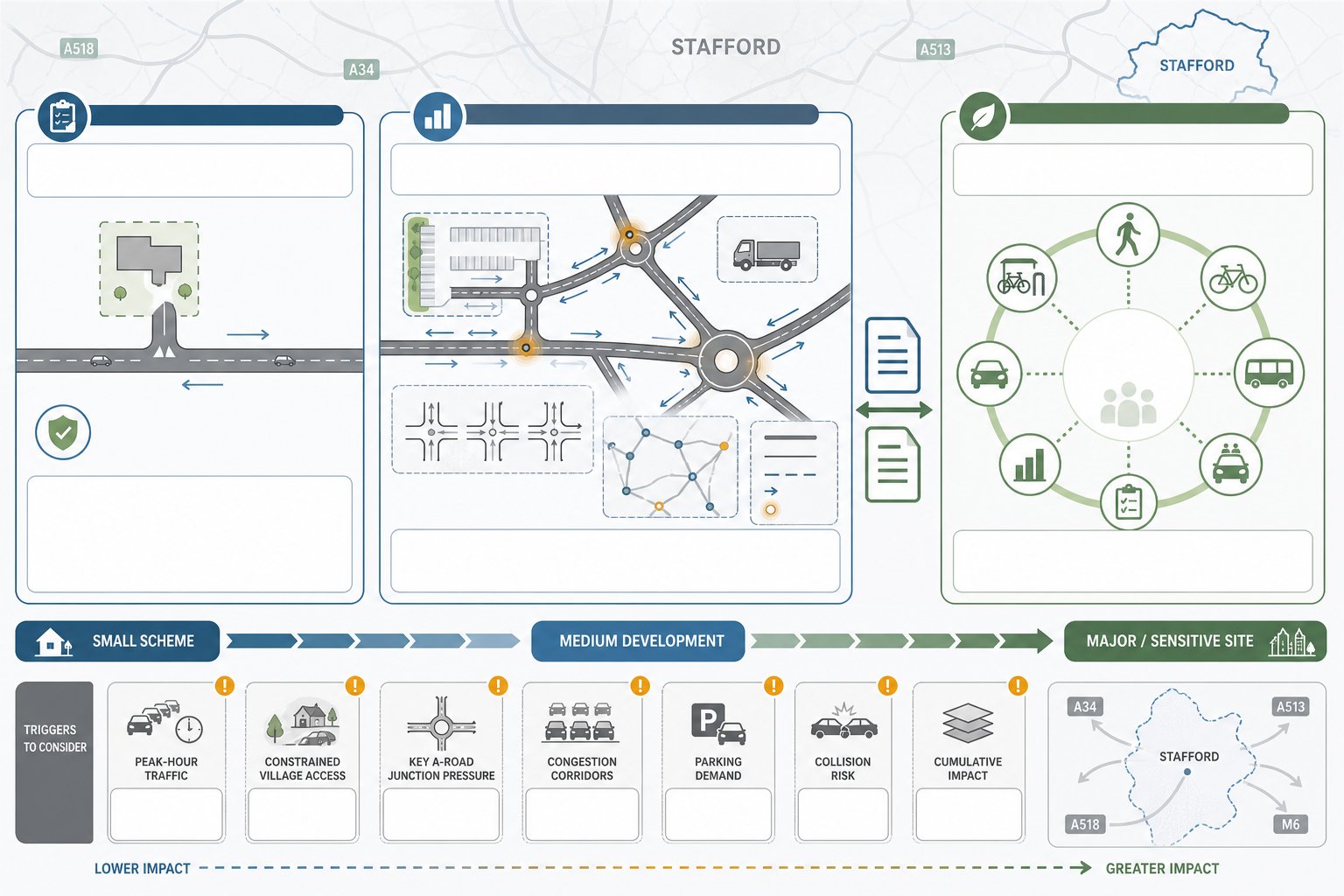
A Transport Statement is generally a concise, proportionate document for smaller or less transport-intensive schemes. It usually summarises existing access conditions, the local transport context, anticipated trip effects and any straightforward mitigation. The emphasis is on demonstrating that impacts are limited and manageable without the depth of analysis expected for larger development.
A Transport Assessment is more detailed. It examines existing and future network conditions, trip generation, trip distribution, assignment, junction performance, parking demand, servicing and mitigation in a much more structured way. It is the document most often associated with major schemes or sites where transport effects are likely to be material.
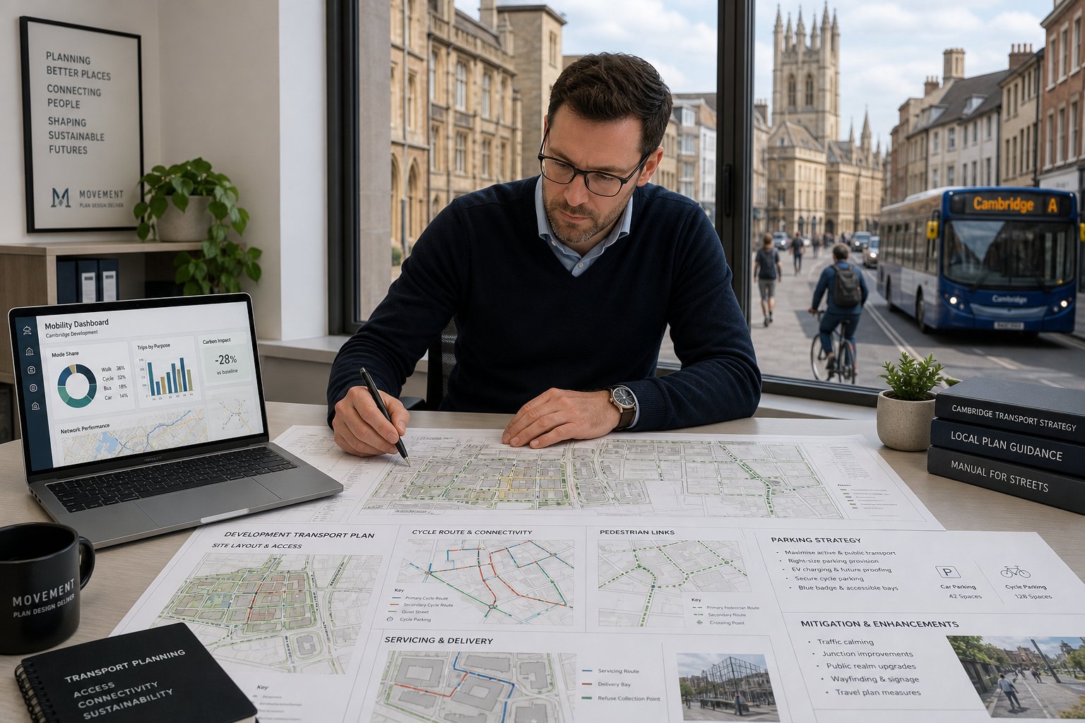
A Travel Plan is different again. Rather than focusing mainly on network capacity, it sets out how sustainable travel will be encouraged and monitored. That may include walking and cycling measures, public transport information, car-sharing initiatives, welcome packs, cycle parking, shower provision, parking management and targets for reducing single-occupancy car use.
In many cases, the documents are paired. A residential development may need a Transport Assessment plus Residential Travel Plan. A smaller office proposal might need only a Transport Statement, but with modest sustainable travel commitments. The right package depends on scale, sensitivity and local authority expectations.
When A Transport Assessment Is Typically Required
A Transport Assessment is typically required for larger schemes, developments expected to generate material peak-hour traffic, or sites in sensitive locations where the margin for error is small. In Stafford, that can include proposals affecting key A-road junctions, town-centre networks, constrained village accesses or corridors where congestion is already a concern.
The trigger is not just size on its own. A moderate scheme on a difficult site may justify a TA where a larger scheme in a well-connected location might need less work. Highway officers usually look at likely trip generation, collision risk, parking and servicing implications, cumulative impacts, and whether the proposal changes the operation of surrounding junctions in any meaningful way. If there is any realistic prospect that modelling, mitigation testing or a fuller evidence base will be needed, it is usually safer to scope a TA early rather than argue later.
When A Travel Plan May Be Requested
A Travel Plan may be requested where a scheme is expected to generate significant person-trips, especially for major residential, employment, education, healthcare and retail development. It is also commonly sought where policy support depends partly on demonstrating that non-car travel has been considered seriously rather than mentioned in passing.
A good Travel Plan is not a generic appendix. It should reflect who will use the site, how they are likely to travel, what realistic alternatives exist locally, and how measures will be implemented and monitored over time. In some cases, the authority may expect targets, monitoring periods, remedial measures and a named coordinator. That is particularly relevant on schemes where parking pressure or peak-hour travel demand is likely to be contentious.
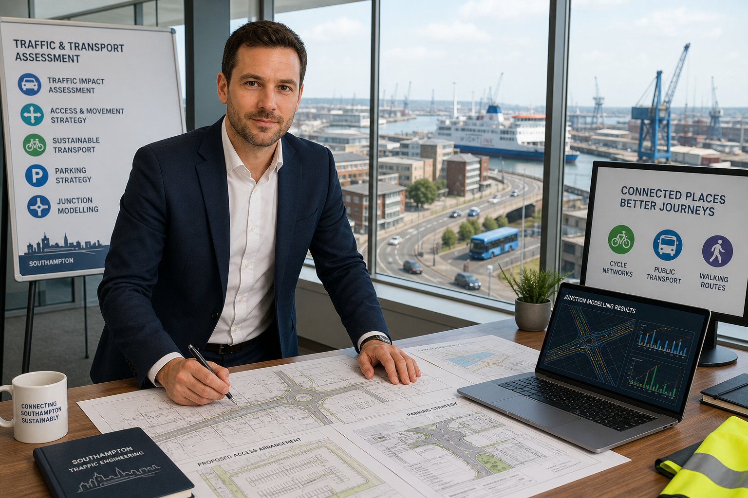
Core Traffic Engineering Services For Stafford Sites
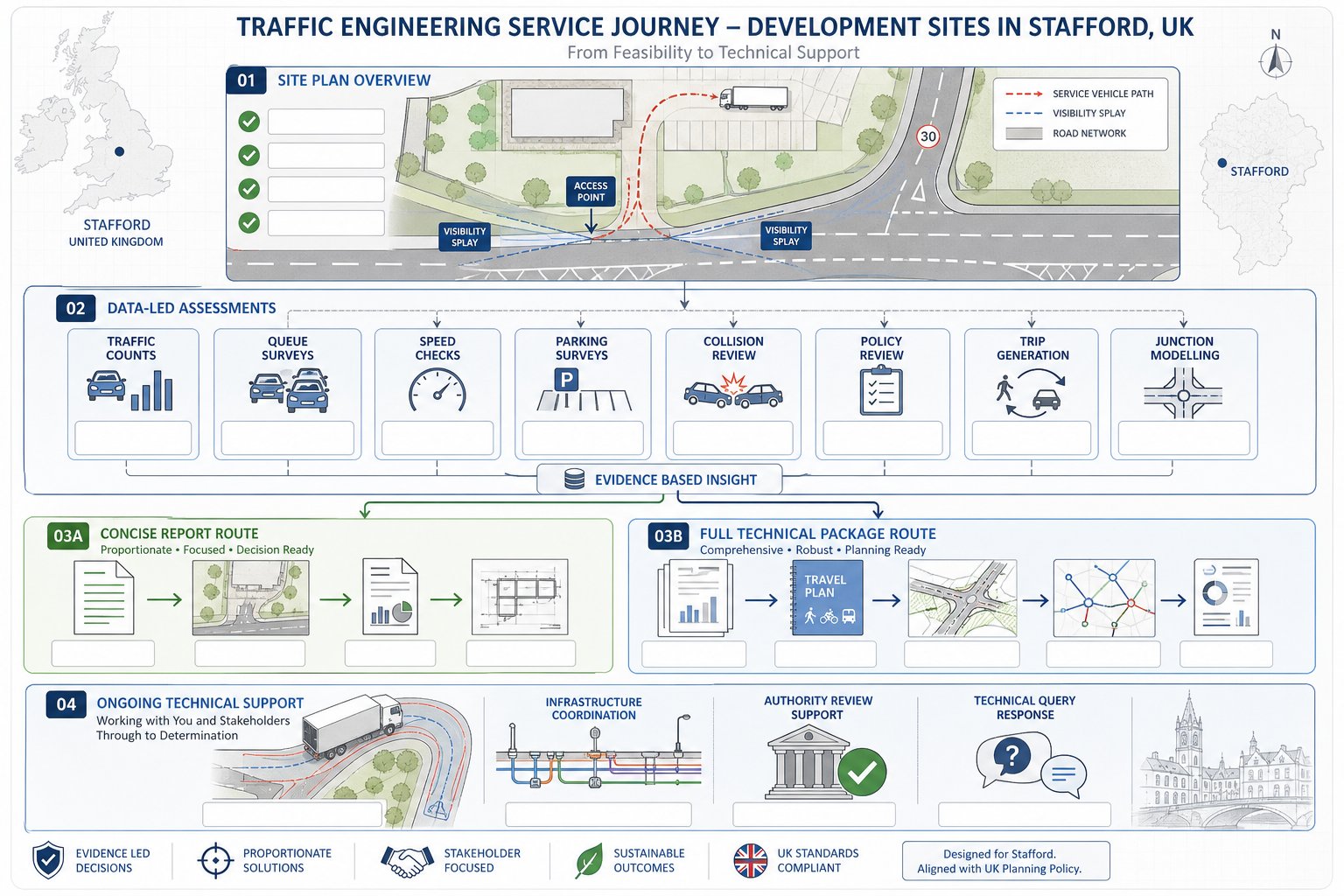
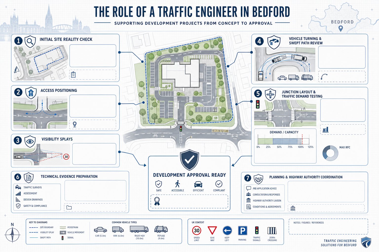
For Stafford sites, core traffic engineering services usually begin before any formal report is drafted. Early feasibility work can test whether an access is likely to be acceptable, whether visibility is realistic within land control, whether servicing can be accommodated, and whether the scale of development is broadly aligned with network capacity. That kind of front-end advice often saves clients from pursuing layouts that look efficient on a plan but are awkward in highway terms.
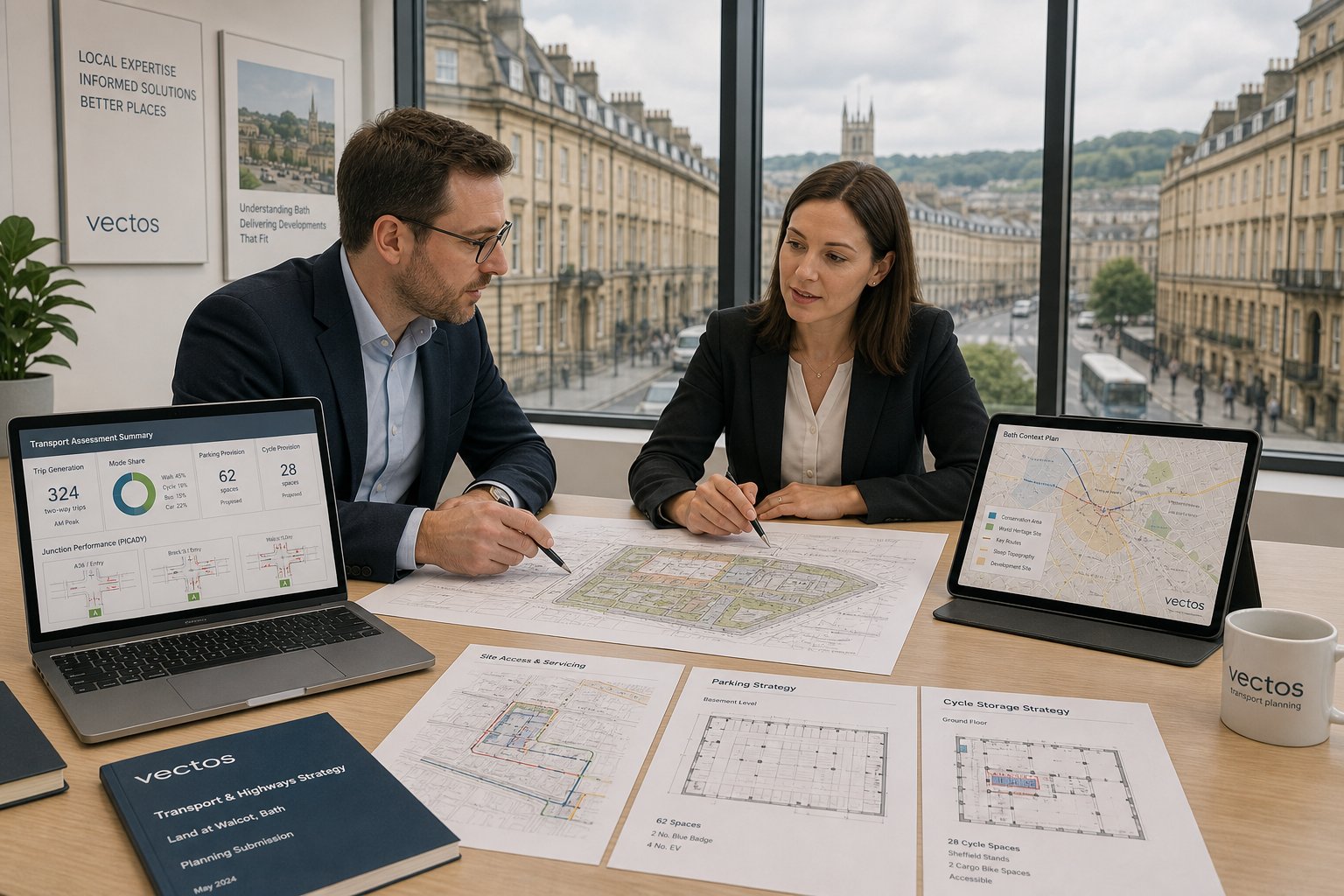
Once a scheme progresses, the service scope usually expands to data collection and technical assessment. We may commission classified turning counts, queue surveys, speed surveys, parking beat surveys and collision analysis. We review policy context, identify likely scoping requirements, estimate trip generation and decide whether junction modelling or network testing is needed. Some sites need only a concise report: others require a full suite of TA, Travel Plan, drawings and mitigation strategy.
On more complex schemes, the service can extend into swept path analysis, access design review, coordination with drainage and civil teams, support at appeal, and responses to technical queries from the highway authority. Comparable planning-led support in other cities, including Traffic Engineer In Leeds: and Traffic Engineer In London:, follows the same principle: reports must be concise where possible, but robust where necessary. With more than 30 years of experience behind our wider approach, speed matters, but accuracy matters more.
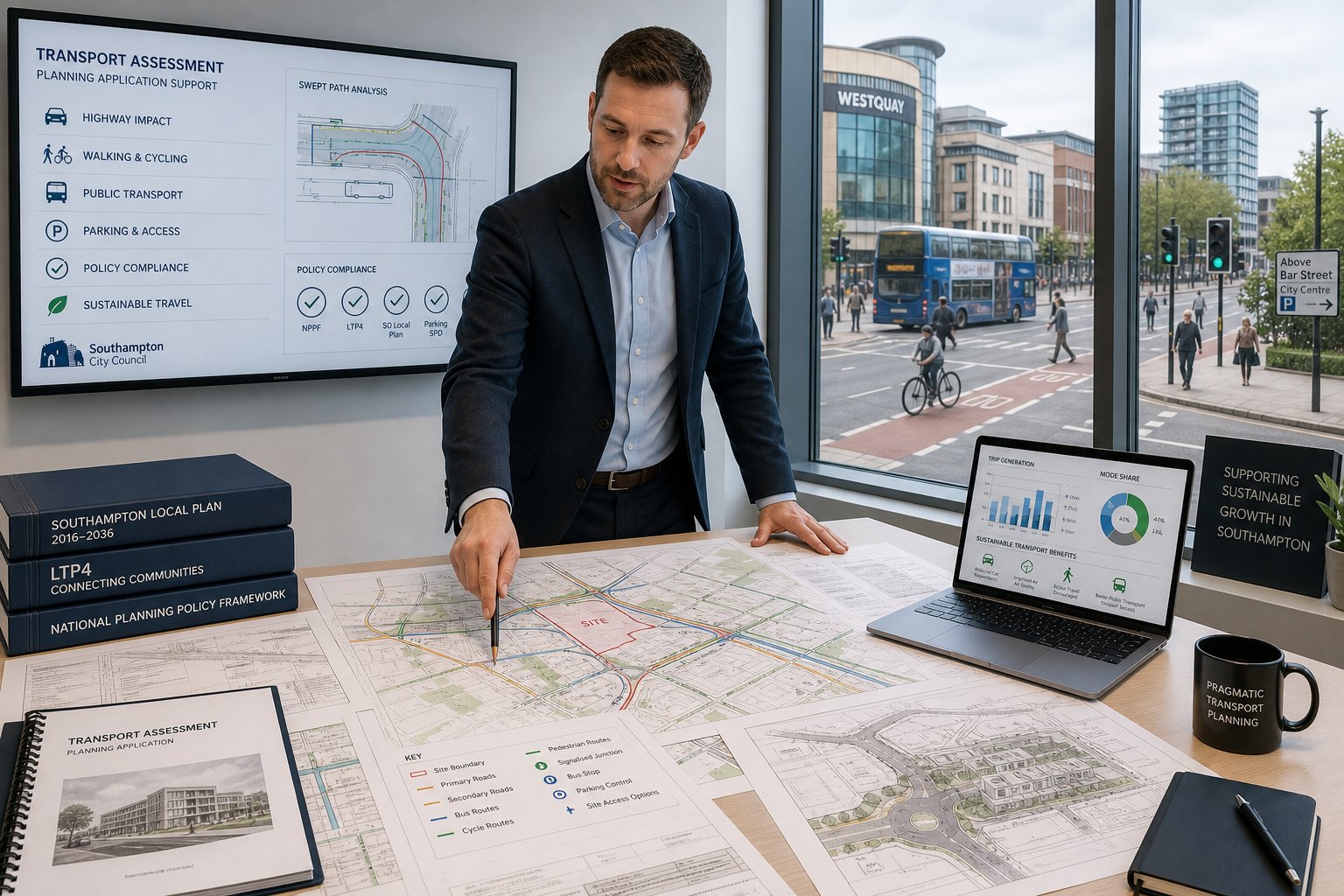
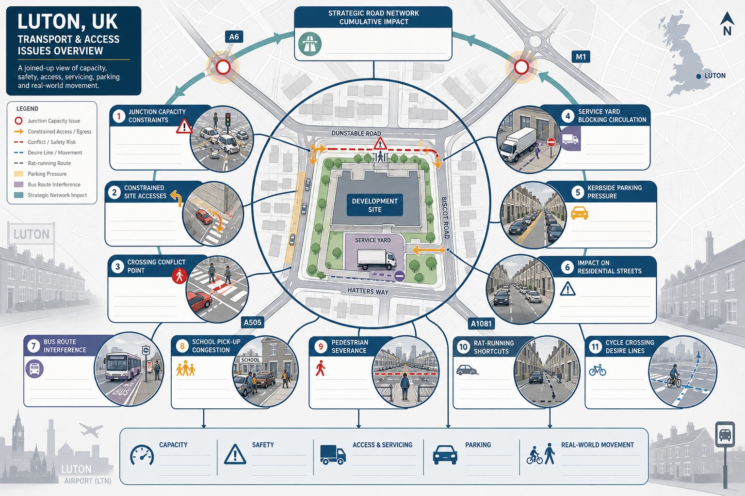
Access Design, Visibility, And Highway Safety Considerations
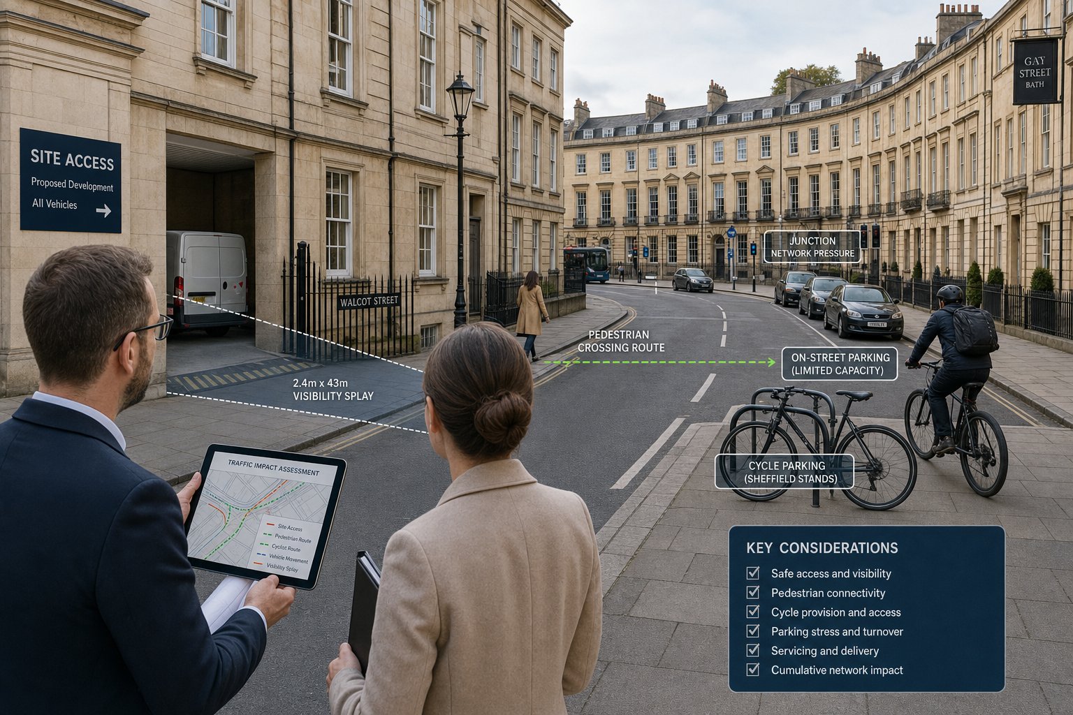
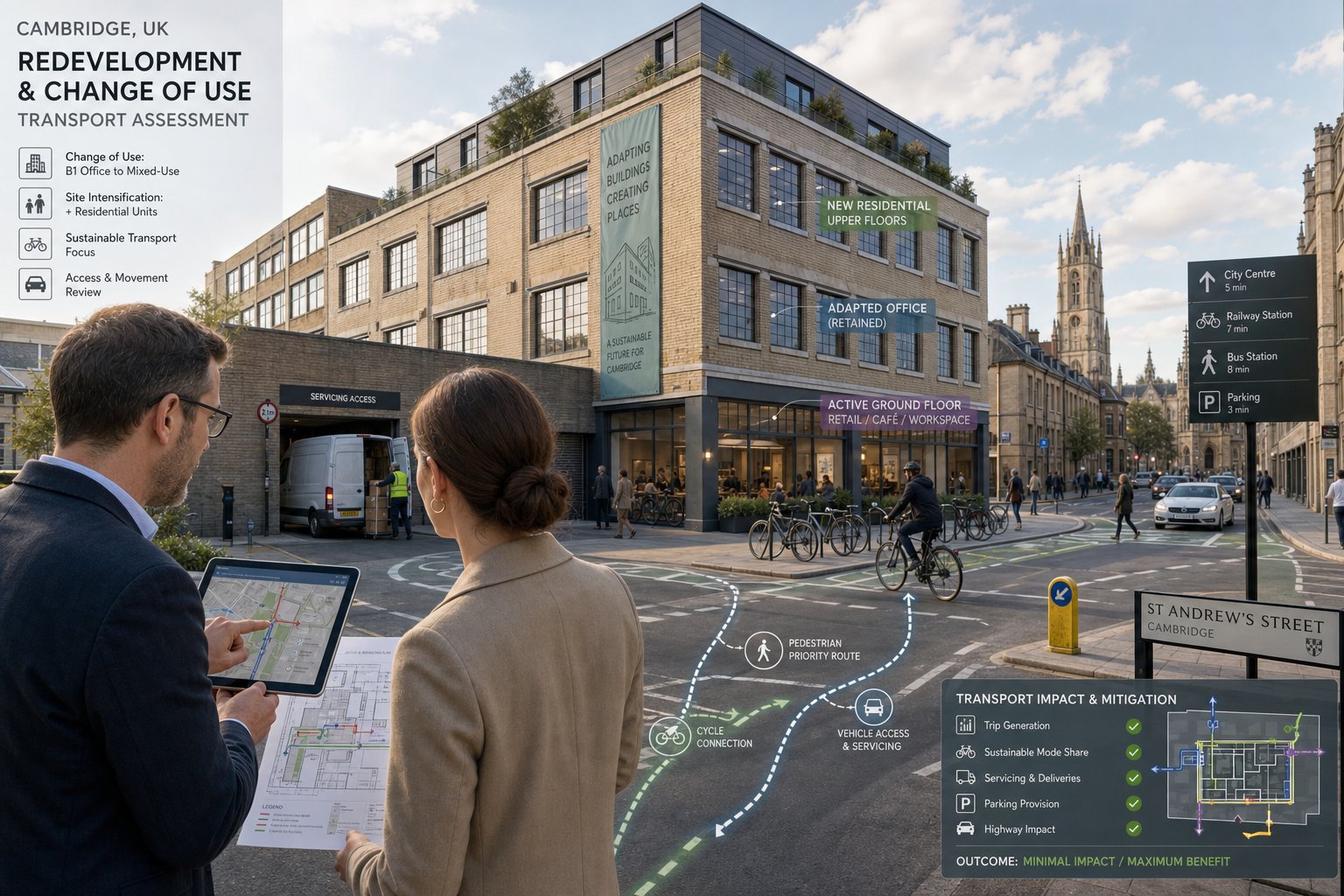
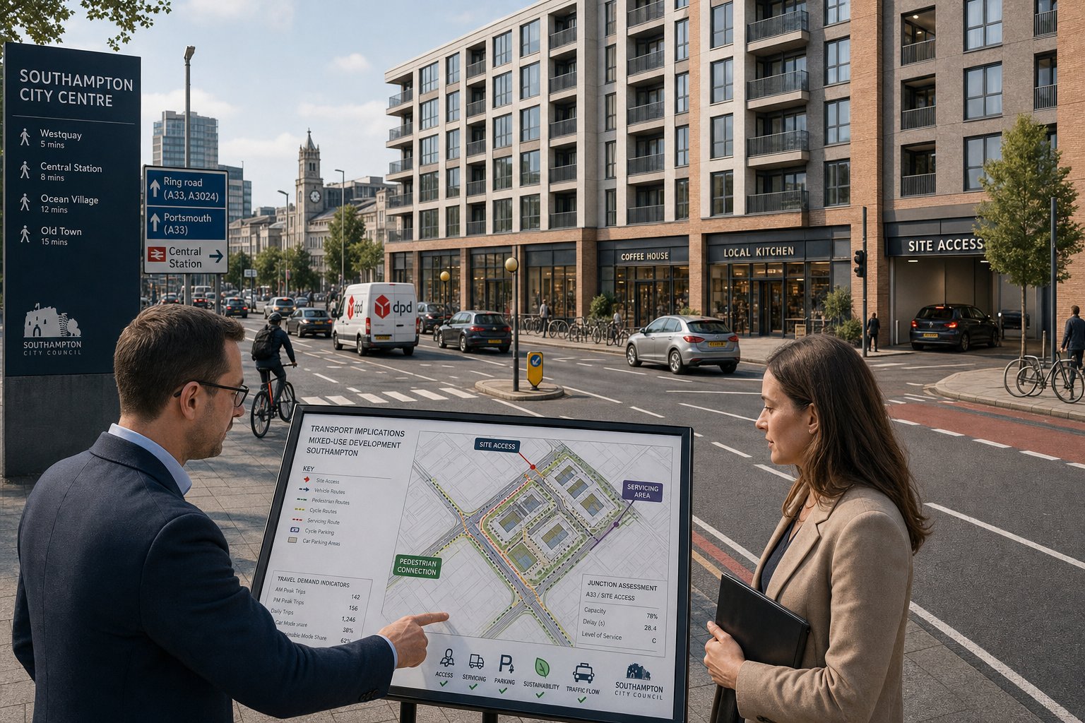
Access is where transport strategy becomes very tangible. A proposed development may be acceptable in planning terms overall, but if vehicles cannot enter and leave safely, or if pedestrians are forced into poor conditions, the application is vulnerable. That is why access design is scrutinised early and in detail.
For vehicular access, we look at junction form, lane widths, radii, gradients, visibility splays, stopping sight distance, proximity to neighbouring junctions and whether drivers can emerge without undue risk. On rural Staffordshire sites, visibility is a recurring issue because hedgerows, bends, vertical alignment and higher approach speeds can all limit what is achievable. On urban sites, the problem may be different: constrained frontage, existing parking, bus stops, crossing demand or heavy pedestrian movement.
Internal layout matters too. Refuse vehicles, delivery vans and emergency services need workable routes and turning space. If a scheme relies on awkward reversing, overrun into opposing flows or unrealistic manoeuvres, that tends to attract objections quickly. We also review pedestrian and cycle access with reference to Manual for Streets principles and relevant highway standards, aiming for routes that are direct, legible and safe.
Collision analysis can shape design choices as well. If there is a pattern of shunt-type incidents, turning conflicts or vulnerable-road-user collisions nearby, that history should inform mitigation. Sometimes the answer is geometric improvement: sometimes it is speed management, signing, crossing provision or a different access strategy altogether.
Junction Capacity, Trip Generation, And Traffic Modelling
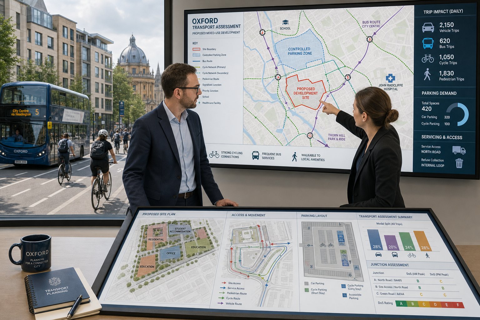
This is the part many clients associate most strongly with transport work, and for good reason. If a scheme materially increases movement at already-busy junctions, decision-makers will want to know what happens to capacity, delay and queues. That requires a structured evidence base rather than instinct.
Trip generation usually starts with the proposed land use, scale and likely mode share. We derive forecast trips using recognised databases, comparable sites and informed professional judgement, then distribute and assign those trips across the local network. The result is a forecast of where development traffic is likely to go and when it will arrive.
From there, we test relevant junctions under baseline and future scenarios, with and without development. Depending on the junction type, that may involve priority modelling, roundabout modelling or signal assessment. The outputs often focus on indicators such as ratio of flow to capacity, reserve capacity, delay and queue length. Those numbers matter, but interpretation matters just as much. A technical pass/fail mindset can be misleading if a model is not calibrated properly or if peak spreading changes observed conditions.
Where issues emerge, mitigation can include lane widening, flare provision, signal staging changes, access relocation, revised site distribution or more strategic measures. Similar methodologies are used nationally, including in work around Traffic Engineer In Bristol: and Traffic Engineer In Liverpool:. The difference in Stafford is the local network context: what is acceptable on one corridor may not be acceptable on another a few miles away.
How A Traffic Engineer Supports The Planning Application Process
A traffic engineer’s role is not limited to writing a report and disappearing. The best support usually starts early, when site layouts are still flexible and before fixed assumptions have been priced in. At that stage, we can advise on likely report requirements, access feasibility, parking strategy, servicing constraints and whether pre-application engagement with the highway authority is sensible.
As the planning package develops, we coordinate the technical evidence needed for submission. That often includes transport reports, appendices, survey summaries, drawings, junction modelling outputs and travel planning measures. The value here is not just technical competence: it is making the evidence coherent. Highway officers should be able to follow the logic from site context to impacts to mitigation without tripping over gaps or contradictions.
During determination, we respond to consultation comments, clarify assumptions, revise drawings and, where necessary, negotiate proportionate mitigation. Sometimes that means demonstrating that a concern is already addressed. Sometimes it means accepting that a layout needs to change. Either way, prompt and clear responses tend to keep the process moving.
And if a scheme goes to appeal, transport evidence often becomes even more important. A well-structured assessment, supported by sound surveys and defensible judgement, is far easier to stand behind than a rushed document produced only to satisfy validation.
Common Challenges On Stafford And Wider Staffordshire Sites
Stafford and the wider county present a mix of urban and rural transport issues, which is one reason off-the-shelf reporting often falls short. Rural sites can look straightforward until you examine actual road conditions: narrow carriageways, soft verges, ditches, hedgerows, limited forward visibility and higher approach speeds than the road geometry really deserves. Bringing a new access onto that kind of network needs careful judgement.
In and around Stafford itself, pressure points are more likely to involve junction capacity, queue interaction, pedestrian movement and parking stress. Town-centre and edge-of-centre proposals can run into concerns about congestion, servicing windows and how development traffic interacts with existing demand in the network peaks. School sites and healthcare uses create another layer of complexity because arrivals may be highly peaked and parking behaviour can spill onto surrounding streets.
Public transport accessibility can also be uneven. That matters when policy expects a meaningful shift towards sustainable travel, but the actual bus or rail offer is limited. In those cases, Travel Plan measures still have value, but they need to be realistic. Promising a dramatic reduction in car use where alternatives are thin is not persuasive.
There is also the cumulative impact issue. A single scheme may appear acceptable in isolation, yet concern grows when several committed or emerging developments are nearby. That is why local planning knowledge and up-to-date background growth assumptions are so important.
What To Prepare Before Instructing A Traffic Engineer
A good instruction starts with clear information. The more complete the early brief, the faster we can identify likely issues, scope the right level of work and avoid wasted survey effort. At minimum, it helps to provide a red-line boundary, an outline layout, proposed unit numbers or floorspace by land use, and any concept drawings showing access options.
We also need to understand how the site is expected to operate. Proposed hours, staffing levels, delivery patterns, school start times, patient appointment profiles or shift changes can all affect trip patterns. If development is phased, that should be explained early because phasing can influence both the assessment year and the mitigation strategy.
Any existing history is valuable: pre-application advice, highway comments on earlier schemes, known collision concerns, third-party objections, previous surveys or nearby technical work. Even if the material is a few years old, it can help frame likely authority concerns. Topographical constraints and land ownership details are useful too, especially where visibility splays or off-site works may be an issue.
The best outcomes usually come when the transport brief is aligned with the wider design and planning programme. If we are instructed only after the layout is fixed and the submission date is immovable, options narrow quickly. Early collaboration gives everyone more room to solve problems rather than simply explain them away.
Conclusion
For many developments, transport is the issue that decides whether a scheme feels credible to the local authority. A traffic engineer in Stafford helps turn that uncertainty into something measurable: safe access, realistic parking and servicing, defensible trip forecasts, and proportionate mitigation where impacts arise.
The key is not producing the biggest report. It is producing the right one, based on local evidence and a clear understanding of how Staffordshire highway issues actually play out on site. When transport input comes in early, layouts tend to improve, authority queries are easier to answer, and avoidable delay becomes less likely.
For architects, planners, developers, legal teams and public-sector clients, the practical lesson is simple. Prepare the right site information, scope the work properly, and treat transport as part of the planning strategy from the start. In 2026, that remains one of the most reliable ways to strengthen an application and improve the chances of permission.
Frequently Asked Questions About Traffic Engineering in Stafford
What role does a traffic engineer play in Stafford planning projects?
A traffic engineer in Stafford assesses site access, parking, junction capacity, and local traffic impacts to ensure safe, policy-compliant development. They prepare detailed Transport Statements, Assessments, and Travel Plans, providing evidence-led transport advice to support planning approvals.
When is a Transport Assessment required for developments in Stafford?
A Transport Assessment is usually needed for larger or sensitive schemes affecting busy junctions or constrained locations in Stafford. It offers a detailed analysis of trip generation, junction capacity, and mitigation options to demonstrate that transport impacts are manageable.
How does local transport evidence influence planning applications in Stafford?
Stafford Borough and Staffordshire County Council require robust local traffic data such as counts, collision records, and speed surveys. This evidence ensures the transport impacts of a development are accurately assessed, reducing risk of refusals or onerous planning conditions.
What are the key differences between a Transport Statement, Transport Assessment, and Travel Plan?
A Transport Statement provides a concise overview for smaller sites; a Transport Assessment is a comprehensive study for larger or complex schemes; and a Travel Plan outlines measures to promote sustainable travel such as walking, cycling, and public transport use.
What challenges might a traffic engineer face on Staffordshire development sites?
Challenges include narrow rural roads with limited visibility, capacity pressures at A-road and town-centre junctions, balancing car access with limited public transport options, and managing peak school or commuter traffic affecting local parking and safety.
How can early engagement with a traffic engineer improve planning outcomes in Stafford?
Early involvement allows a traffic engineer to advise on access design, layout feasibility, and transport evidence requirements before layouts are fixed. This proactive approach helps avoid costly redesigns, answers highway concerns upfront, and enhances the likelihood of smooth planning approval.