Indoor go-karting looks straightforward on paper: a leisure use in a building, customers arriving in booked slots, plenty of excitement once they’re through the door. In planning terms, though, it rarely behaves like a generic indoor attraction. The transport profile is sharper, more concentrated, and often more sensitive than applicants first expect.
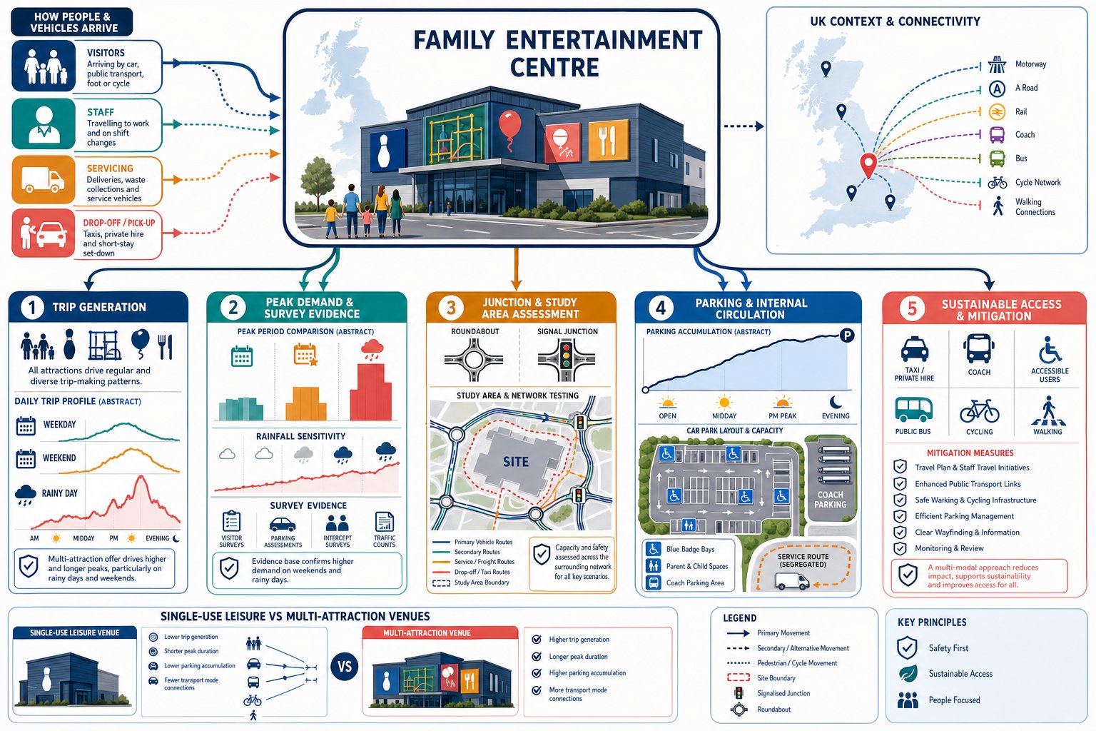
We usually see the same pressure points emerge early. Evening arrivals can bunch around race start times. Saturdays can outperform weekdays by a wide margin. Corporate events, children’s parties and league sessions create pulse demand rather than a smooth spread of trips. Add food and drink, arcade space or a bar, and dwell times stretch further. That combination matters when local planning authorities and highway officers are deciding whether the proposal is acceptable.
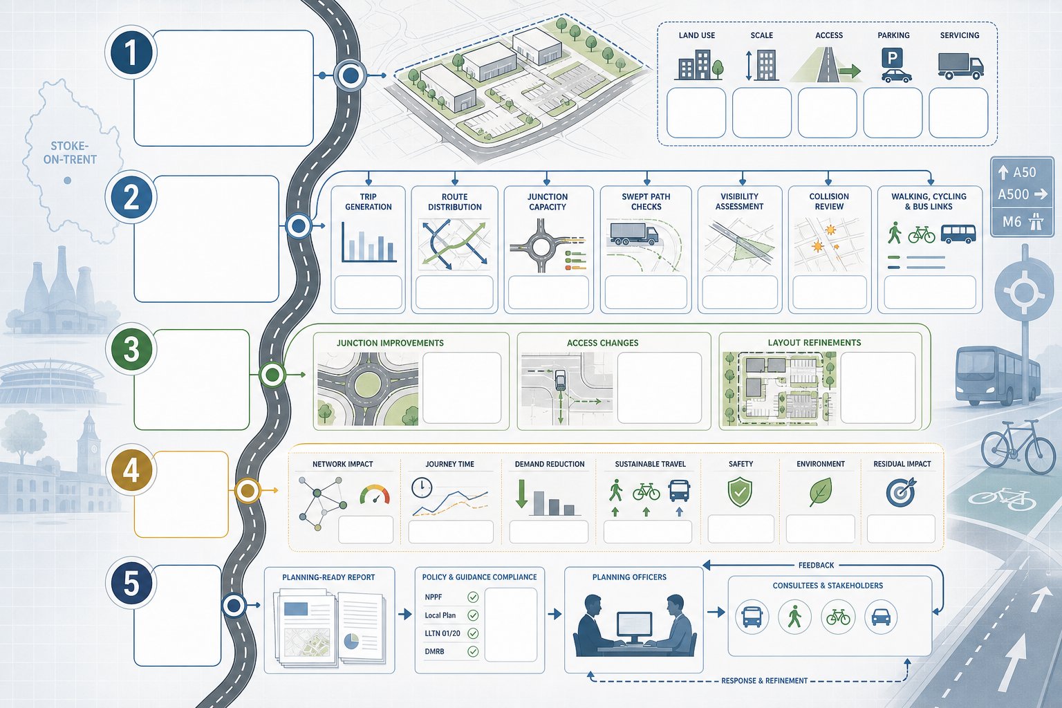
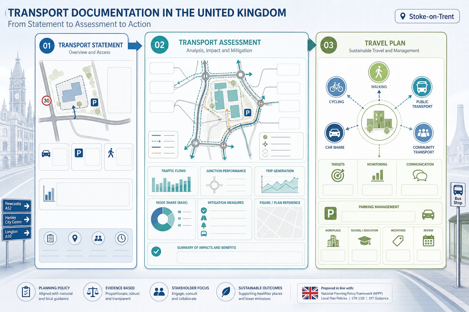
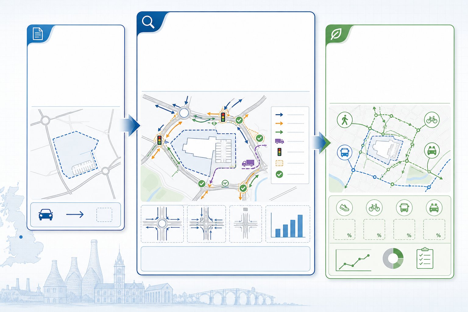
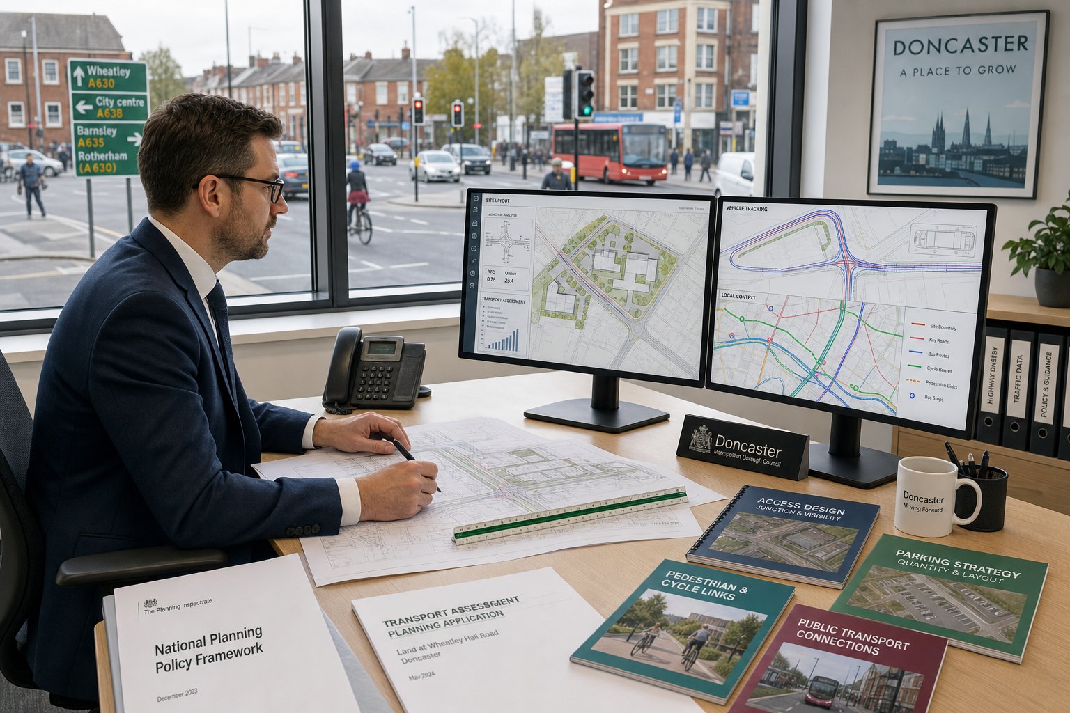
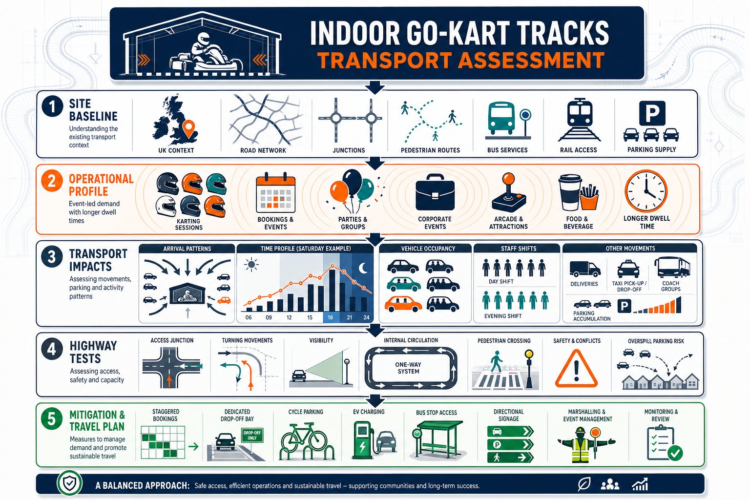
An Indoor Go-Kart Tracks Transport Assessment hence needs to do more than tick standard boxes. It has to explain how the venue will actually operate, how people will arrive and leave, whether nearby junctions can cope, and whether parking, drop-off and servicing can be managed without causing harm. For architects, planners, lawyers, surveyors, developers and councils, the detail is where applications are won or delayed.
In this text, we set out what a proportionate UK assessment should cover in 2026, where indoor karting differs from other leisure uses, and what local authorities are most likely to test when a planning application lands on their desk.
Key Takeaways
- An Indoor Go-Kart Tracks Transport Assessment must detail site baseline conditions, operational parameters, trip generation, parking, and access design to address local authority concerns effectively.
- Indoor go-karting generates sharp, event-driven peak traffic unlike generic leisure uses, requiring assessments to consider group bookings, longer dwell times, and Saturday and evening peaks.
- Early scoping with highway authorities and tailored evidence from comparable sites improve the accuracy and acceptance of transport assessments.
- Parking assessments should focus on accumulation and overspill risks due to clustered arrivals and extended stays, with clear drop-off and taxi management strategies.
- Sustainable travel opportunities, especially for staff, alongside road safety analysis and realistic mitigation measures, are critical components of a robust transport case.
- Integrating mitigation and travel planning into the venue’s operating model from the start strengthens the planning application and helps manage transport impact effectively.
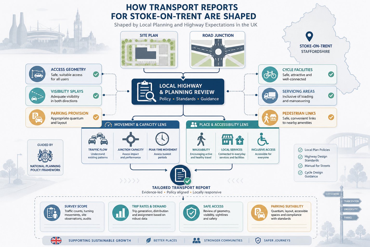
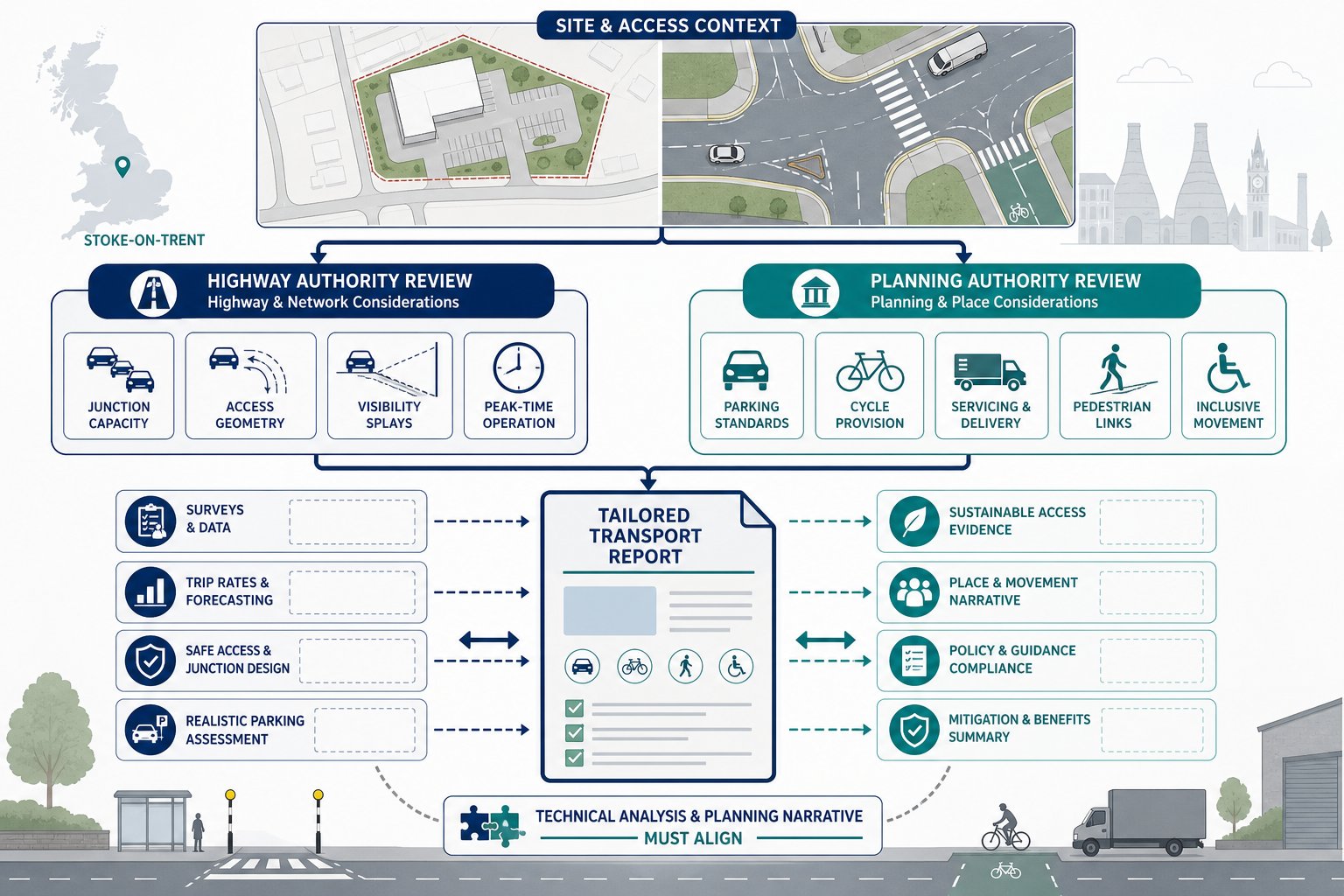
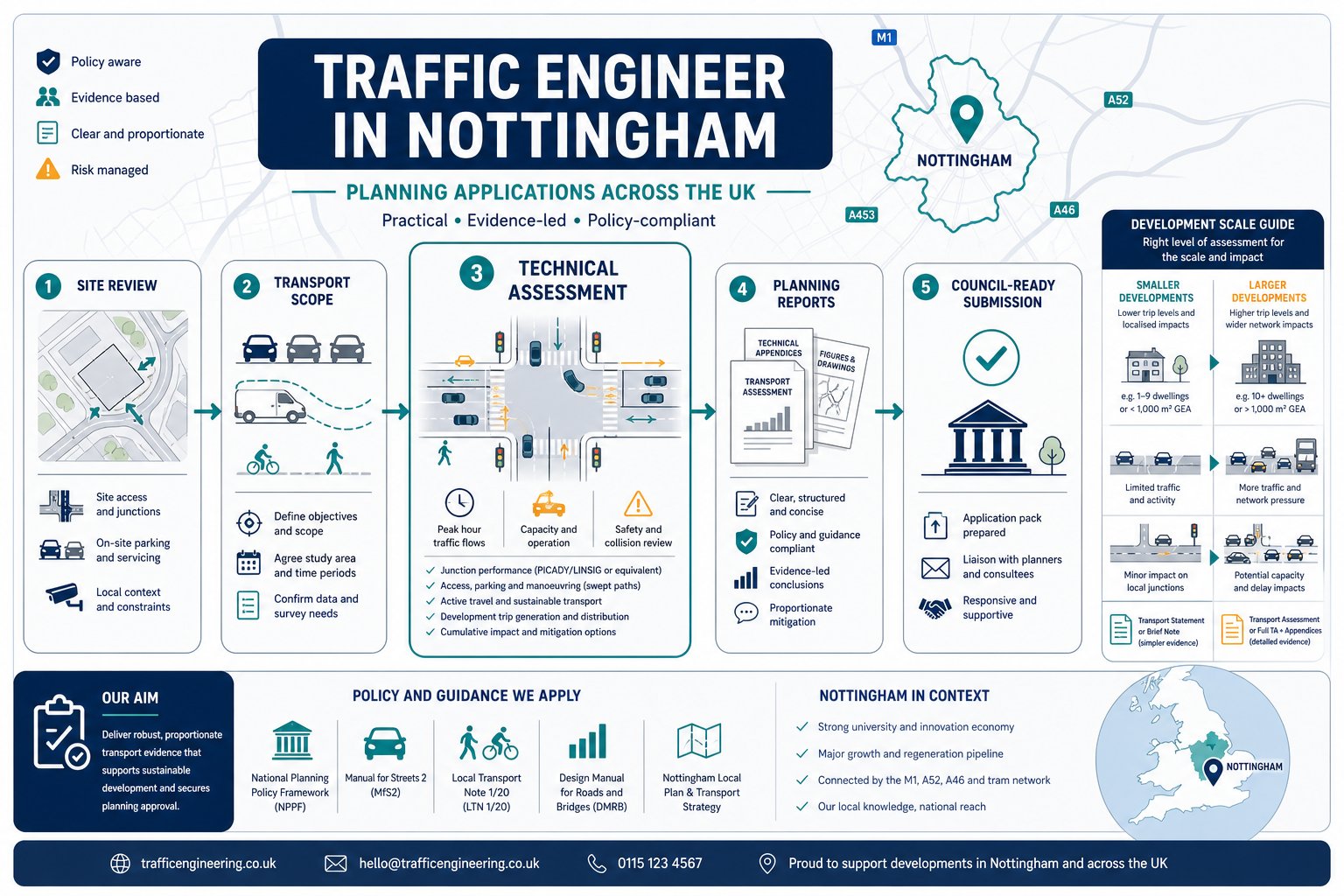
What An Indoor Go-Kart Track Transport Assessment Needs To Cover
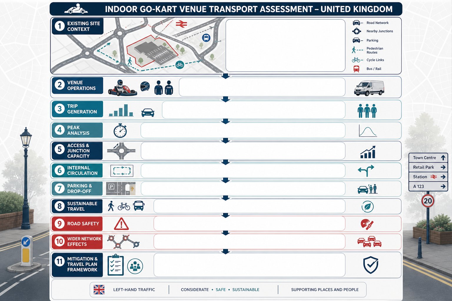
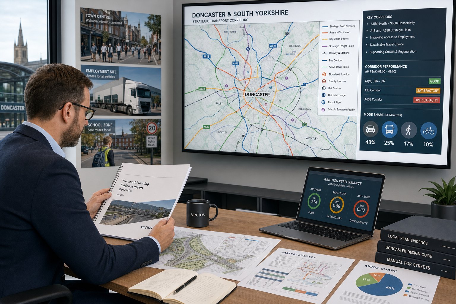
A sound assessment starts with the site as it exists today, not just the proposal in isolation. That means baseline traffic conditions, surrounding junction operation, road safety history, parking stress, and the quality of walking, cycling and public transport links. Without that context, even a neatly presented forecast can feel thin.
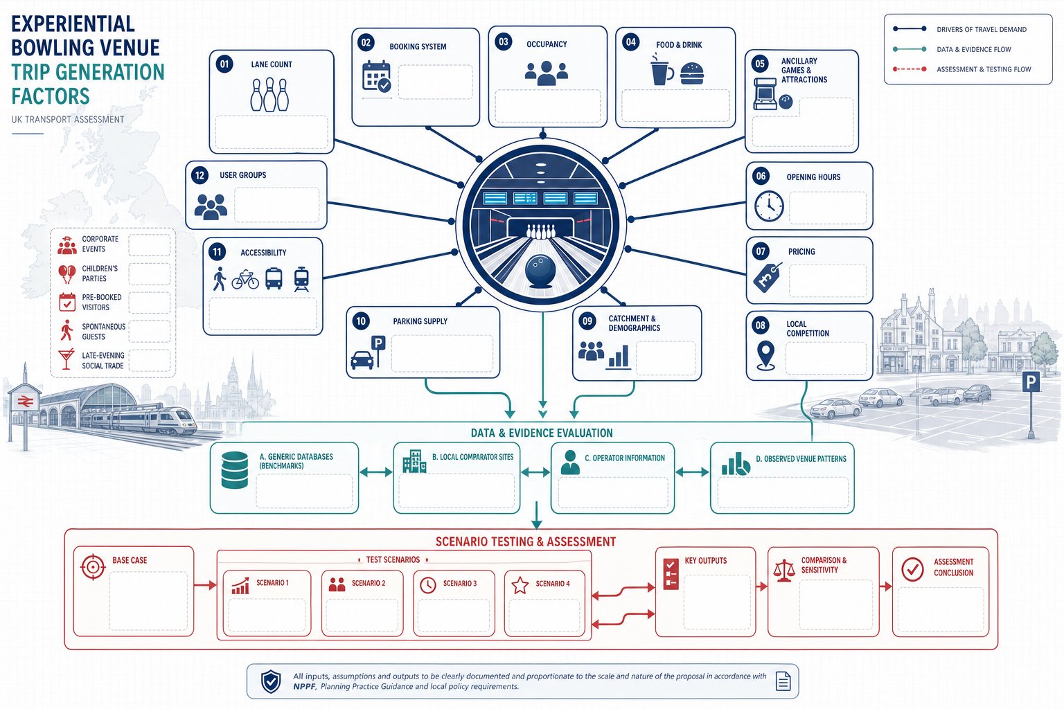
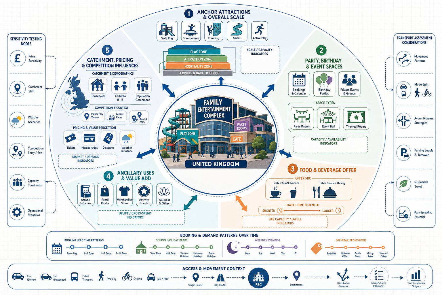
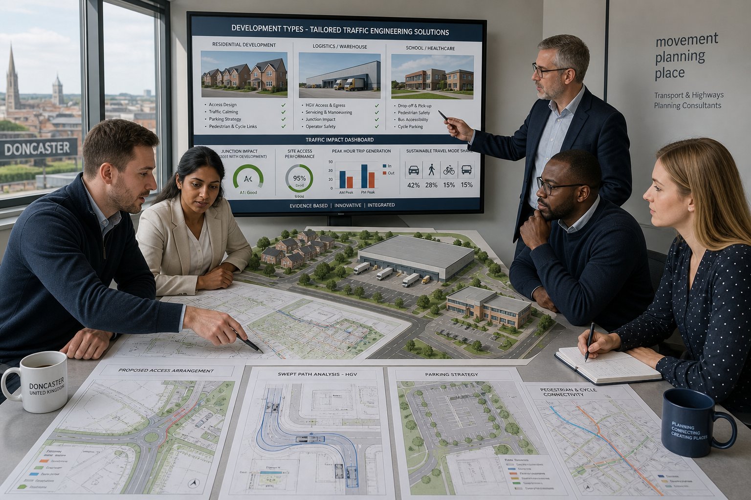
For indoor karting schemes, we also need a clear operational description. Gross floorspace alone is not enough. Highway authorities will usually want to understand kart numbers, race throughput, briefing arrangements, ancillary uses, likely opening hours, staff numbers and whether the venue will host parties, leagues or corporate bookings. These details drive trip generation far more than a broad land-use label does.
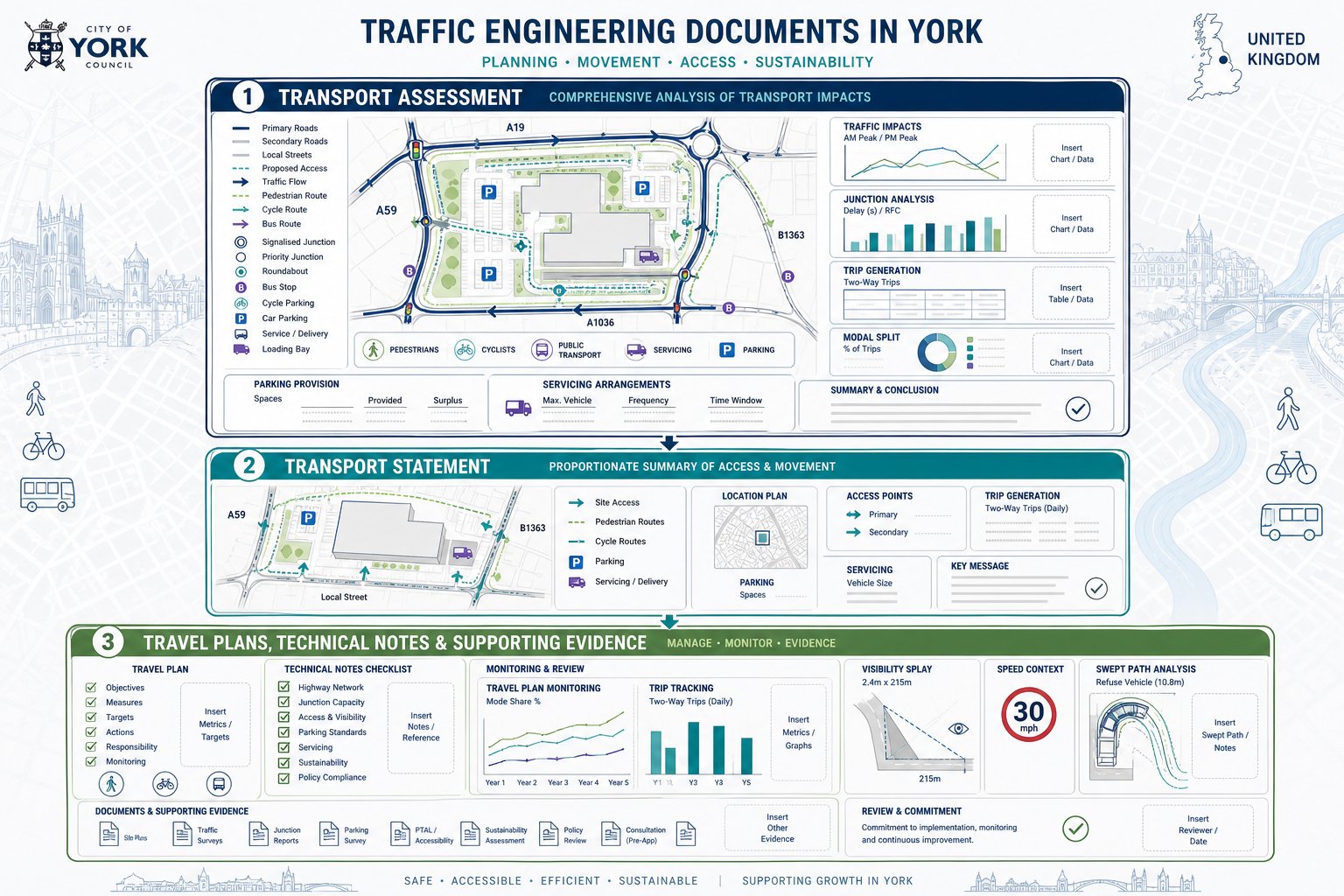
A robust TA or TS should then address:
- existing highway and transport conditions
- proposed development parameters and operating model
- customer, staff and servicing trips
- peak hour and peak period analysis
- access design and junction capacity
- internal circulation and pedestrian routes
- parking provision, drop-off and overspill risk
- sustainable travel opportunities
- road safety effects and wider network impacts
- mitigation and a framework Travel Plan
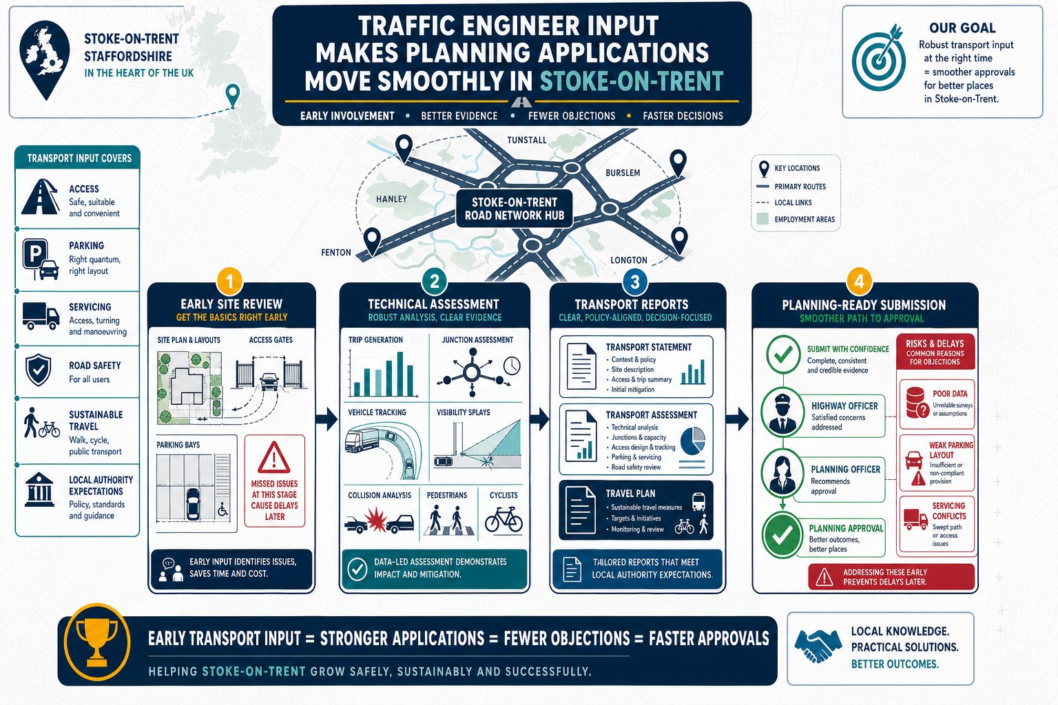
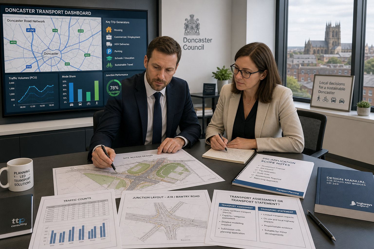
In practice, the best submissions are scoped early with the local authority and written around the site’s real constraints. We often find that a strong transport assessment for application is less about volume of paper and more about answering the right operational questions before they’re asked in a consultee response.
How Indoor Go-Kart Developments Differ From Standard Leisure Uses
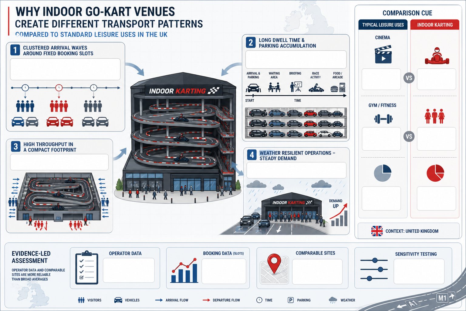
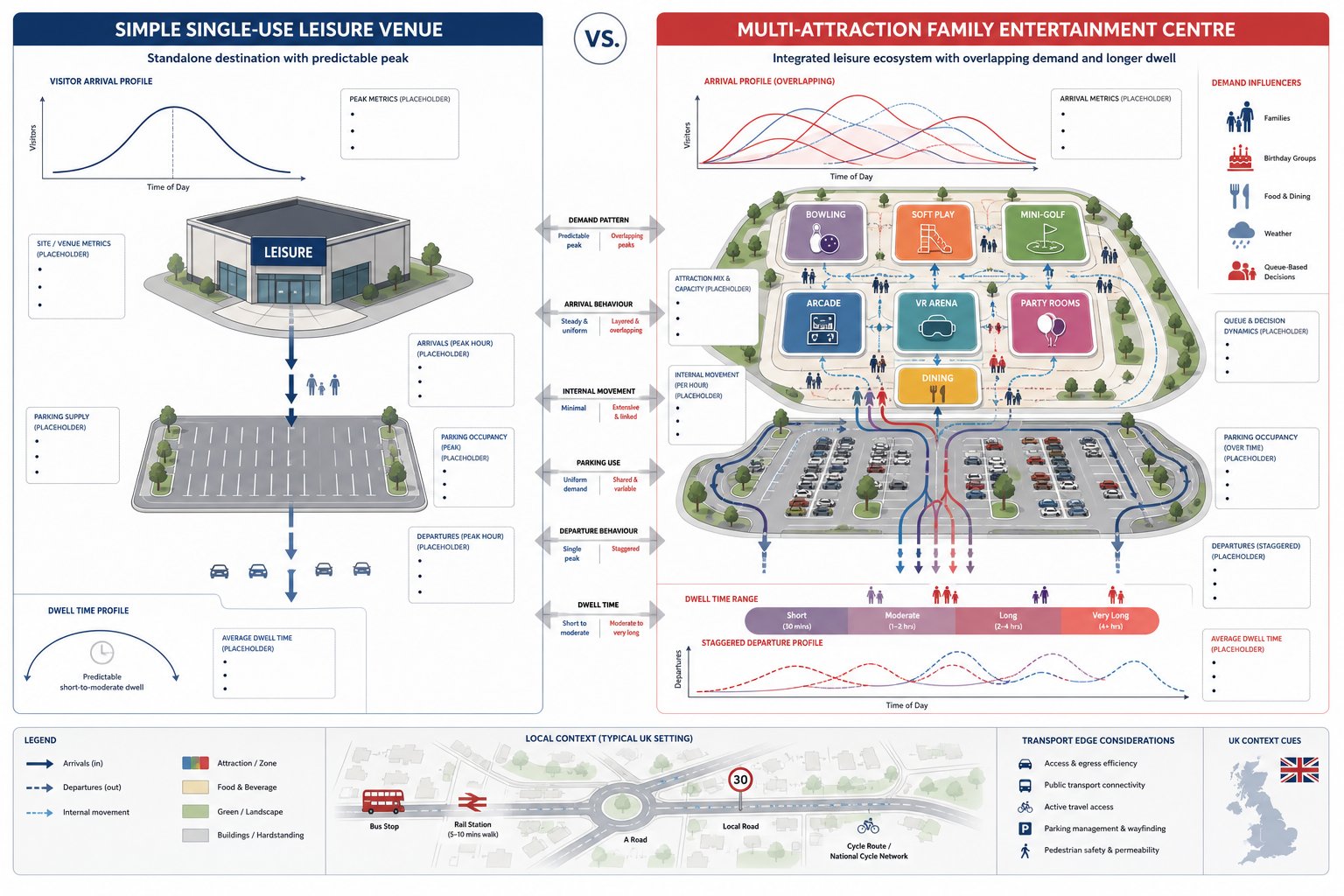
Indoor go-karting is usually grouped with indoor leisure or entertainment, but that classification can hide the transport reality. A cinema has film timetables, yes, though arrivals are often spread across multiple screens. A gym may have regular peaks, but members tend to trickle in and out. Karting is different: sessions are bookable, group-based and often synchronised.
Three differences matter most.
First, demand is event-driven. Birthday parties, team-building sessions and group bookings are not side activity: they’re often central to the business model. That creates bursts of arrivals and departures clustered around fixed start times.
Second, dwell times can be long. Customers may arrive early for briefing, stay for multiple races, and spend additional time in food, drink or arcade areas. Parking accumulation hence builds more quickly than some planners expect.
Third, modern facilities can achieve high throughput within relatively compact buildings, particularly with multi-level track layouts. So the intensity of activity per square metre may exceed what generic leisure trip rates imply.
There is also the weather factor. Because the attraction is indoors, poor weather does not suppress demand in the same way it can for outdoor recreation. Sometimes it does the opposite.
That is why generic database comparisons need care. Comparable-site evidence, operator booking data and sensitivity testing are often more persuasive than broad leisure averages when defending an Indoor Go-Kart Tracks Transport Assessment.
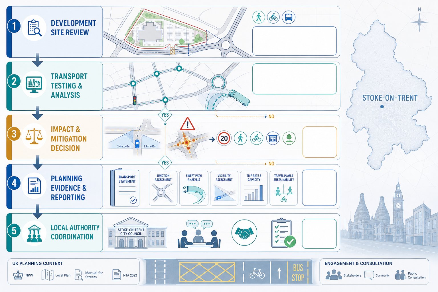
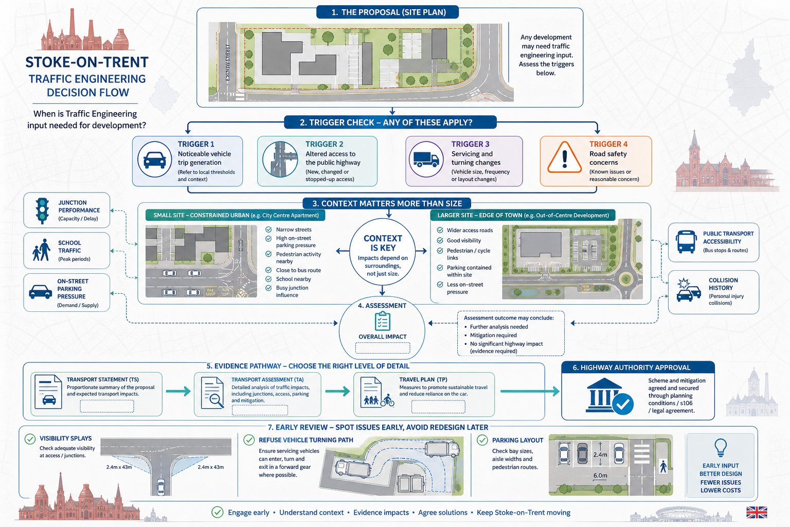
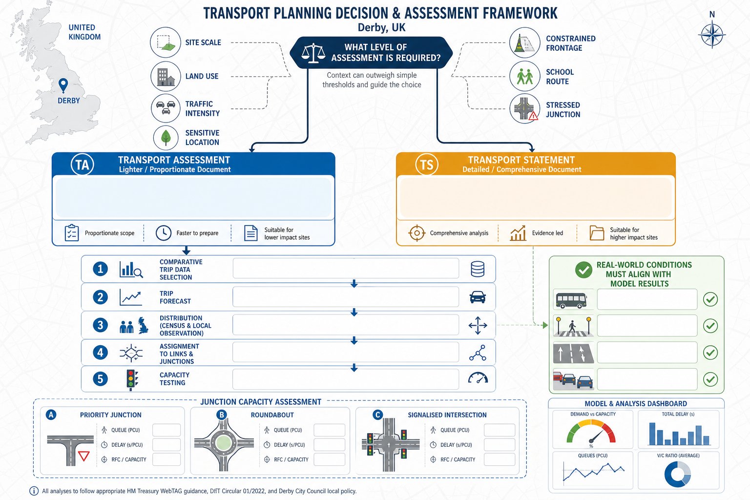
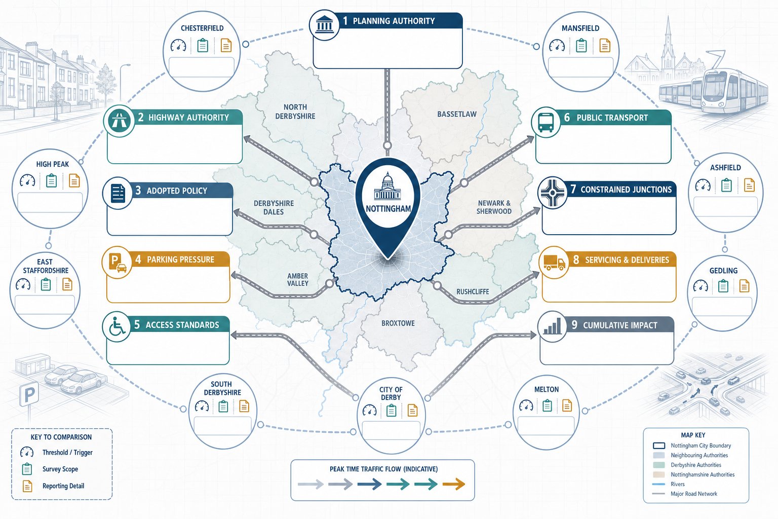
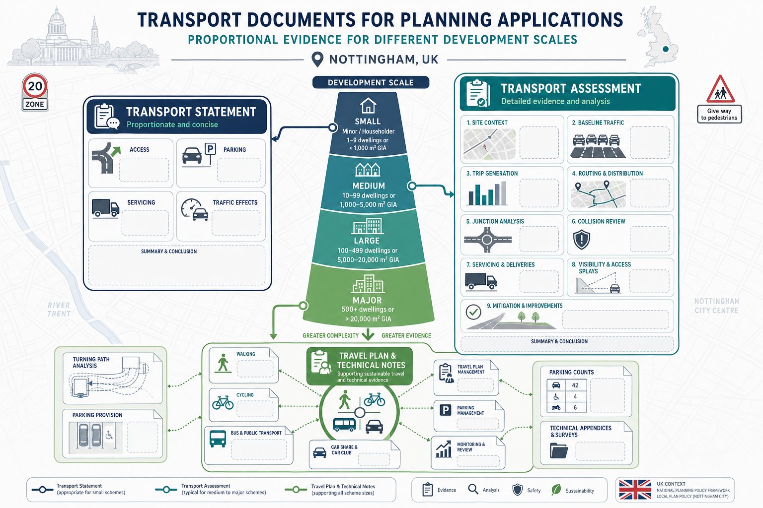
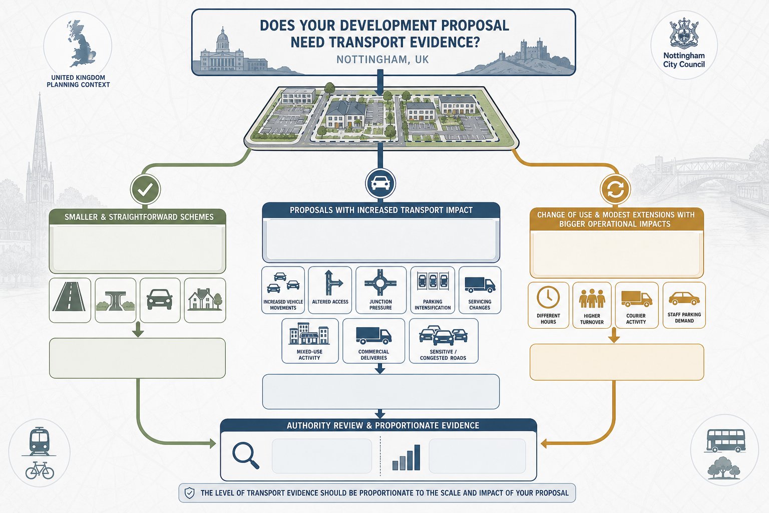
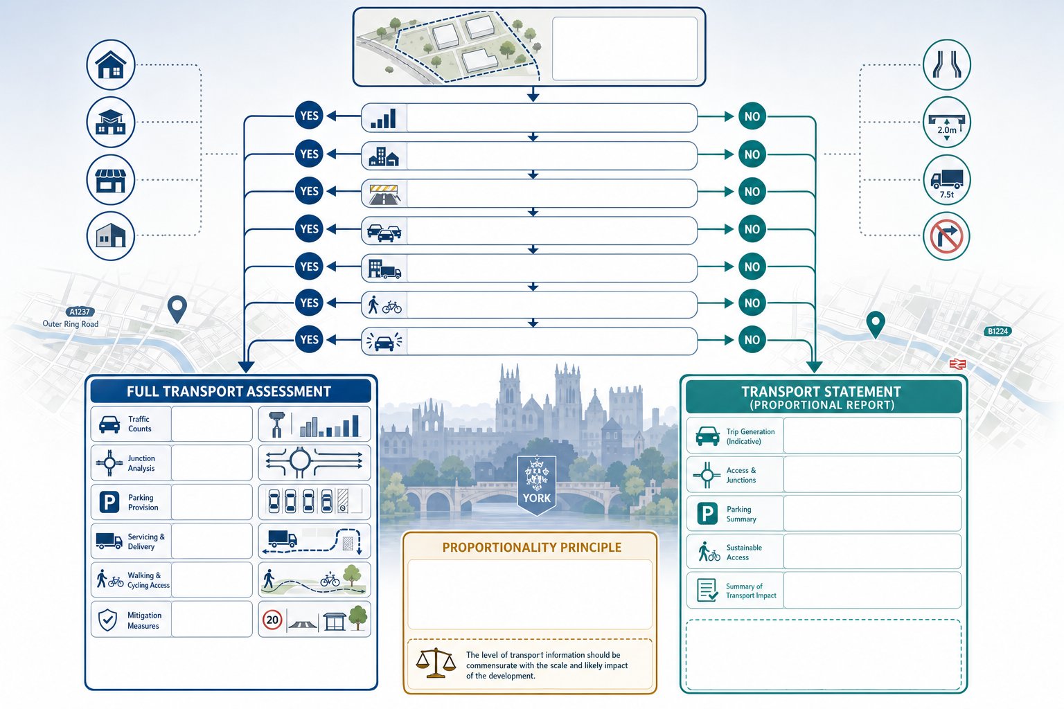
When A Transport Assessment Or Transport Statement Is Likely To Be Required
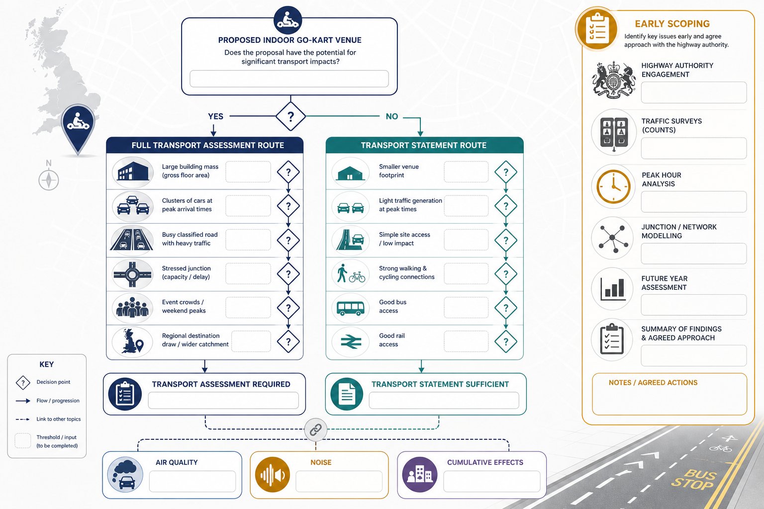
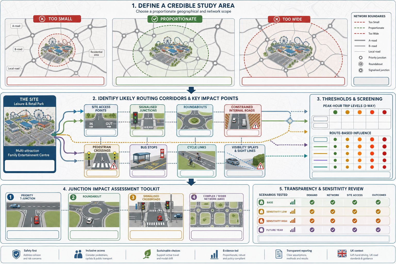
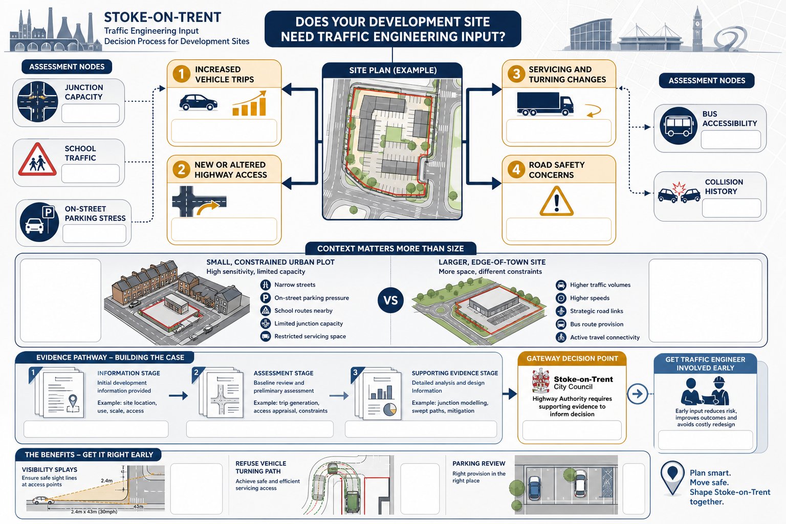
There is no single UK threshold that automatically settles whether a full Transport Assessment or a lighter Transport Statement is required for every indoor karting proposal. In practice, the decision is site-specific and authority-led. Still, there are predictable indicators.
A full TA is more likely where the scheme is relatively large, expected to generate strong peak traffic, or proposed in a location with constrained access conditions. That can include a direct access onto a busy classified road, a site close to an already stressed junction, or a venue likely to host frequent large events. Regional-scale attractions and larger-format schemes above typical local thresholds will usually push in the same direction.
A TS may be acceptable where the floorspace is modest, the network is uncongested, access is simple, and there is genuinely good accessibility by non-car modes. But even then, indoor karting’s event-based profile can still justify more detailed analysis than applicants initially assume.
Early scoping matters. Pre-application dialogue with the highway authority can confirm study area, survey scope, peak periods and modelling expectations. That is often the difference between a proportionate package and a late request for more evidence.
Where wider planning effects overlap with air quality, noise or cumulative transport issues, the transport work may also need to sit alongside an environmental impact assessment. The key point is simple: classification as “leisure” does not, by itself, make the transport case straightforward.
Key Planning And Highway Considerations At Site Selection Stage
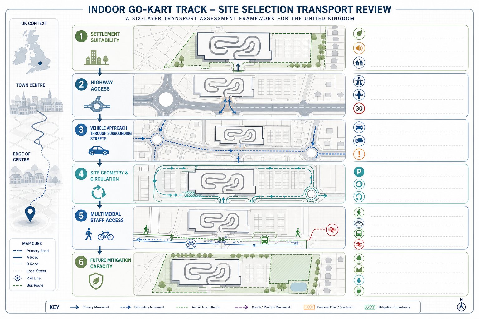
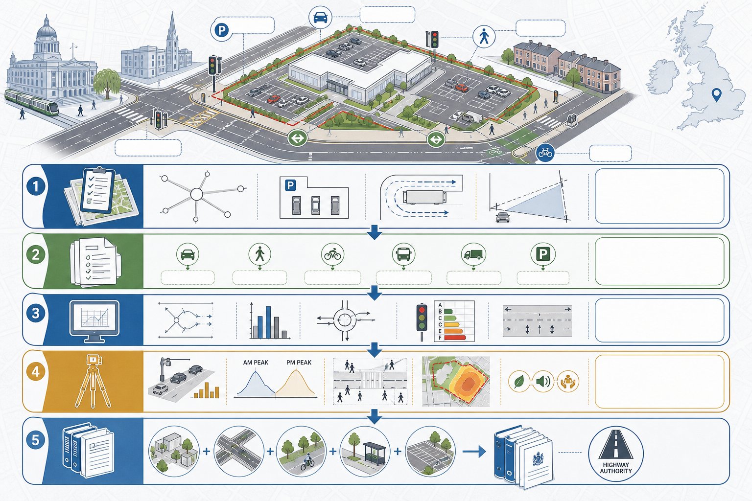
The best time to solve transport problems is before a site is fixed. Once a lease is agreed or a layout is advanced, options narrow fast.
For indoor go-karting, location within the settlement hierarchy still matters. Town and city centres, edge-of-centre sites, established leisure parks and accessible commercial areas generally align better with policy than isolated rural plots. Not because karting must always be central, but because accessibility and impact are easier to justify where transport infrastructure already exists.
Highway context is just as important. A site near an A-road may sound attractive, yet if all traffic must pass through a tight residential approach, objections are predictable. We hence look beyond strategic visibility and ask how vehicles actually reach the building, where queues form, and whether late-evening movements could irritate nearby homes.
Site geometry also plays a large role. Indoor tracks need more than a shell building. They need room for entrance sequencing, briefing areas, circulation, parking, servicing and, often, a layout that can safely absorb arrival peaks. If those functions spill awkwardly onto the frontage, transport concerns tend to multiply.
At feasibility stage, we would usually test:
- likely highway access form
- on-site parking and turning capacity
- potential for coach or minibus arrivals
- relationship with nearby housing
- staff accessibility by bus, rail, walking and cycling
- prospects for future mitigation if the authority asks for it
That early filter can prevent a lot of expensive redesign later.
Trip Generation For Indoor Go-Kart Tracks
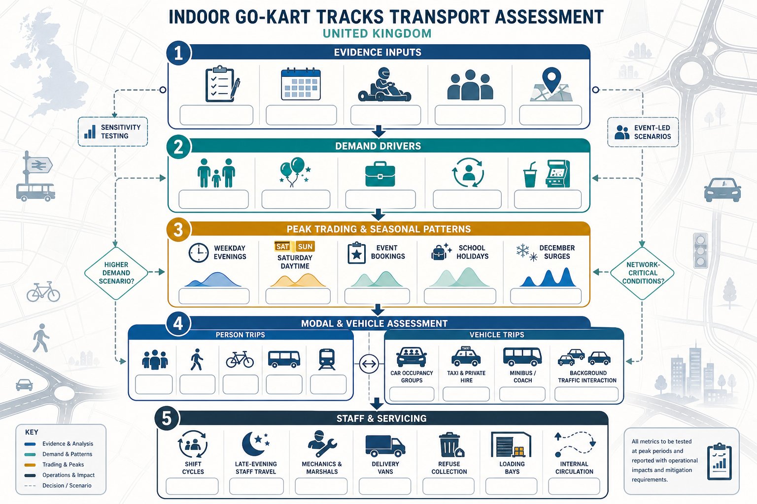
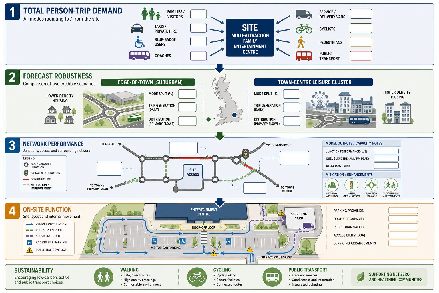
Trip generation is usually the heart of the assessment, and it is where indoor karting most obviously departs from standard leisure assumptions. We need to estimate not only how many trips are likely, but when they occur, how they are split by mode, and how heavily they overlap.
The strongest forecasts typically blend several evidence sources: surveys from comparable sites, operator booking patterns, race throughput assumptions, expected occupancy per booking, and local accessibility characteristics. Where possible, we separate person trips from vehicle trips because group bookings can materially affect car occupancy. A party of ten arriving in four cars has a very different transport effect from ten single-occupancy arrivals.
For planning purposes, we would normally test at least a weekday evening peak, a Saturday daytime peak and, where relevant, an event-led scenario. Some authorities will also expect sensitivity testing around school holidays or December trading.
The trip-generation narrative should explain demand drivers clearly:
- recreational customers and families
- children’s parties
- corporate and team events
- league or repeat-user sessions
- ancillary spend in food, drink or arcade areas
If the evidence base is weak, authorities may default to cautious assumptions. So a tailored methodology is worth the effort. On more technical schemes, capacity effects may then be assessed using tools such as Junctions 11 Software, but only after the operational logic behind the trip rates has been properly established.
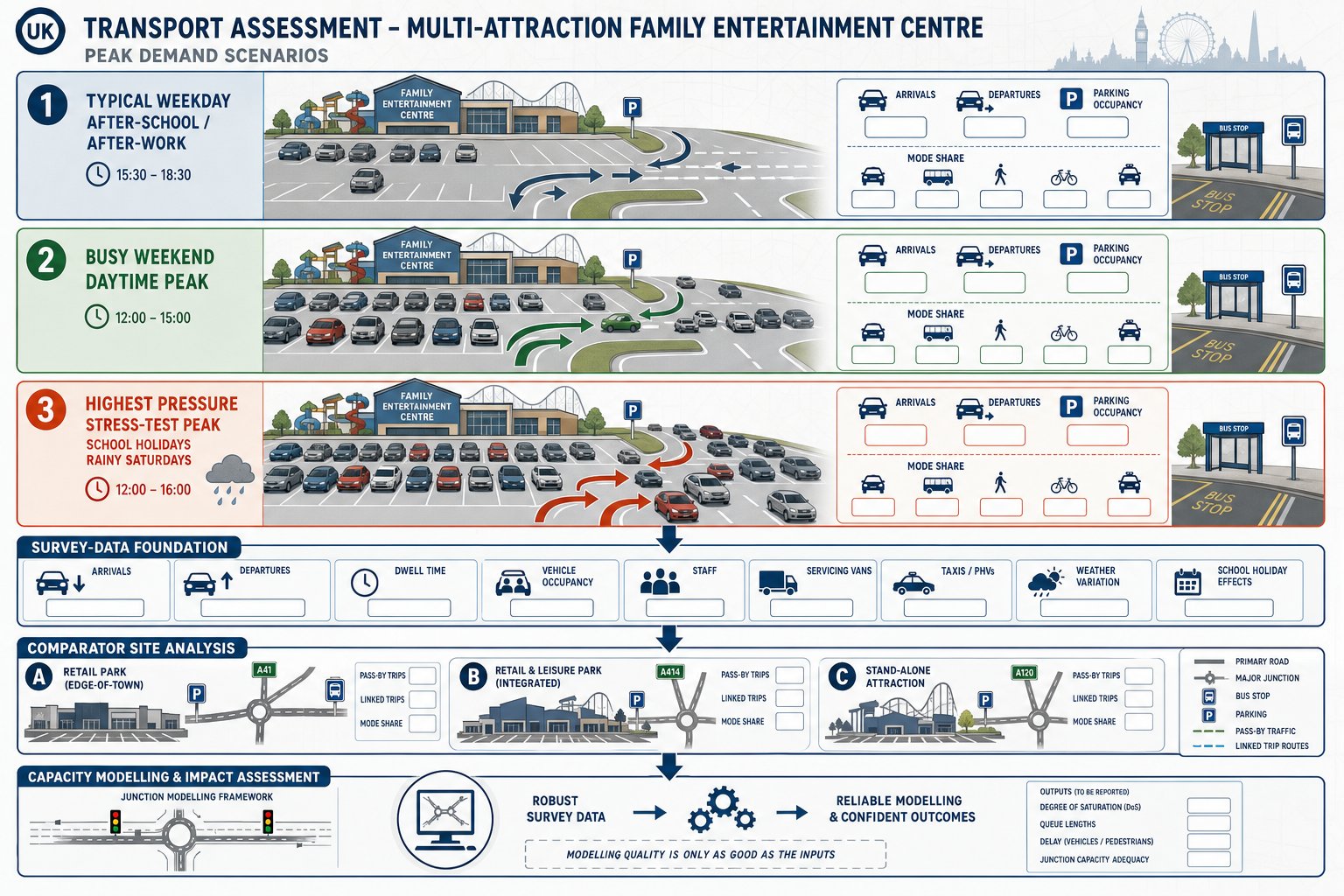
Peak Trading Periods, Event Bookings, And Seasonal Demand Patterns
Peak demand for indoor karting rarely mirrors the standard commuter peaks that dominate office or residential assessments. The pressure is often later in the day and more concentrated around booked sessions. Weekday early evenings can be critical, especially where work-related group events are common. Saturdays often become the principal trading day, with flows building from late morning through the afternoon.
Seasonality also needs a realistic treatment. Indoor venues are less exposed to weather swings than outdoor attractions, which can make demand comparatively resilient through the year. School holidays, half-terms and the run-up to Christmas can all shift booking intensity upward. Corporate parties in December are a classic example: one quiet-looking industrial estate can suddenly experience several overlapping group arrivals on a Thursday evening.
That matters because local authorities do not just want an annual average. They want to know the network-critical conditions. A good assessment will hence identify the periods when the combination of site demand and background traffic creates the greatest strain.
Where the business model includes regular event bookings, we should also test higher-occupancy scenarios, taxi and private hire activity, and occasional coach or minibus arrivals. The point is not to design for every imaginable worst case, but to show that the likely busy periods have been understood and sensibly modelled.
Staff Travel, Shift Changes, And Servicing Activity
Staff trips are often underplayed in leisure assessments, yet for indoor karting they can be operationally significant. Venues may run seven days a week, often into the evening, and staffing can include reception teams, track marshals, mechanics, catering staff, cleaners and managers. Shift overlaps around opening, peak sessions and closing periods can create distinct travel pulses of their own.
We hence need staffing numbers by shift, likely changeover times and a realistic mode split. If the site is poorly served by public transport after 9 pm, for example, the authority is unlikely to accept an optimistic assumption that evening staff will arrive by bus. Conversely, strong urban locations can genuinely support lower staff car use, particularly where cycle parking, lockers or discounted season tickets are in place.
Servicing is the other piece that can catch applicants out. Karts, tyres, parts, catering supplies and waste collections all generate vehicle activity. It may not be HGV-intensive compared with logistics use, but poorly timed van and refuse movements can conflict with customer peaks and constrain internal circulation.
A clear servicing plan should identify:
- vehicle types and likely frequency
- loading and unloading locations
- swept-path suitability
- hours of delivery and waste collection
- controls to avoid peak customer periods
Those details help turn a broad trip estimate into a credible operational case.
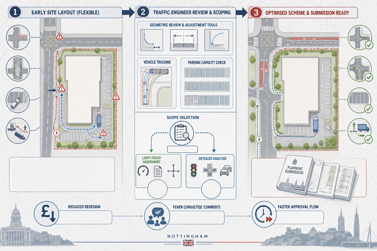
Access Design, Junction Capacity, And Internal Circulation
Access design for indoor karting needs to do three jobs at once: allow vehicles to enter and leave safely, protect the surrounding network from avoidable delay, and keep on-site movement legible during busy session changes.
In some locations, a simple priority access will be entirely adequate. In others, particularly on busier roads or where right-turn demand is high, a ghost island, dedicated turn lane or signal-controlled arrangement may be necessary. The right solution depends on observed traffic conditions, turning patterns and safety context rather than a generic leisure template.
Nearby junctions also need careful review. The critical node may not be the site access itself but a retail park roundabout, signal junction or estate road priority junction a short distance away. If indoor karting arrivals coincide with existing shopping or commuter peaks, modest additional flows can still have a noticeable operational effect.
Internal circulation deserves equal attention. Customers arriving for children’s parties, casual users searching for spaces, delivery vans and pedestrians crossing from parking areas can create friction very quickly if the layout is muddled. We generally look for a one-way arrangement where possible, clear aisle widths, direct pedestrian routes, and physical separation between service areas and customer parking.
For more complex schemes, modelling and drawings should work together. The access may be technically compliant, but if the internal routeing feels awkward on a busy Saturday, the local authority will notice that gap.
Car Parking, Overspill Risk, And Drop-Off Management
Parking is one of the most common points of concern for indoor go-kart applications. The issue is not simply the total number of spaces. It is the accumulation profile. Because customers often arrive in groups, stay for briefing and racing, and then remain on site for food or socialising, occupancy can stack up faster than planners assume.
That is why parking assessments for karting should be evidence-led. Comparable-site surveys, booking assumptions and accumulation analysis are usually more useful than a flat ratio per square metre. A venue may not look large, yet if several sessions overlap, the car park can fill abruptly.
Overspill risk also needs an honest appraisal. If neighbouring roads are residential, tightly controlled, or already heavily parked, any shortfall becomes a planning risk. The same applies on mixed-use retail or leisure parks where shared parking sounds attractive in principle but may fail during coincident peaks.
Drop-off and pick-up management is especially important where children’s parties are expected. Taxis and private hire vehicles need a safe place to wait or turn without blocking aisles. Short-stay activity can generate more conflict than long-stay parking if it is not planned.
Good submissions usually address:
- standard and accessible parking provision
- EV charging expectations
- short-stay/drop-off space
- taxi and private hire management
- overspill controls and monitoring
- any shared-use arrangements and their limits
A practical management strategy is often what reassures highway officers that the site will function in the real world, not just on a layout plan.
Walking, Cycling, And Public Transport Accessibility
Even where customer travel is likely to remain car-dominated, sustainable access still matters. The National Planning Policy Framework and local policy do not require every leisure site to achieve a metropolitan mode split, but they do expect reasonable opportunities for walking, cycling and public transport to be identified and, where practical, improved.
For indoor karting, staff accessibility is often the strongest sustainable transport argument. Many venues employ younger workers and evening staff who may not all drive. A site within walking distance of residential areas, bus corridors or a railway station can materially improve both planning prospects and operational resilience.
We would normally map walk catchments to nearby neighbourhoods and commercial areas, review crossing points, lighting and footway quality, and test whether cycle routes are usable in practice rather than merely present on a plan. Public transport assessment should cover evening and weekend frequency, not just daytime service levels. A bus every thirty minutes that stops at 6 pm is of limited value to a venue closing late.
Practical improvements can include upgraded footways, better crossing provision, lighting, wayfinding, secure cycle stands and staff travel incentives. The same structured approach used in a Residential Development Transport study often helps here too, although the trip purpose and timing are obviously different.
Where the site is genuinely embedded in an accessible urban location, that should be evidenced clearly. If it is not, the assessment should say so honestly and focus on reasonable mitigation rather than over-claiming mode shift.
Road Safety, Visibility, And Potential Network Impacts
Road safety remains central even though the activity itself takes place indoors. Highway authorities will expect the assessment to show that vehicles can enter, leave, turn and queue without creating unacceptable risk.
The basics matter: visibility splays appropriate to design speed, a clear understanding of frontage conditions, and a review of personal injury collision data on the surrounding network, typically over at least five years. But the analysis should not stop there. We also need to consider whether the proposal could intensify existing issues, particularly at sensitive points such as school frontages, narrow local streets or constrained junctions.
Potential impacts often include:
- turning conflicts at the site access
- queue back affecting nearby junctions
- erratic parking or stopping associated with drop-off
- increased evening traffic near residential frontages
- occasional larger-vehicle movements in tight spaces
If a collision pattern already exists, authorities will want to know whether the development worsens the same movement or whether mitigation can reasonably address it. Sometimes the answer is geometric change: sometimes it is signing, lining, speed management or revised servicing hours.
The important thing is proportionality. We should neither overdramatise modest effects nor underplay a weak access arrangement. A balanced safety case tends to carry more weight than a defensive one.
Mitigation Measures And Travel Planning For Planning Applications
Mitigation for indoor go-kart schemes is rarely one single intervention. More often, it is a package combining site design, parking management, operational controls and modest off-site improvements.
Physical measures may include access alterations, lining, directional signing, crossing upgrades, lighting or small junction improvements. On busier sites, signal optimisation or lane adjustments can be justified if modelling shows a clear operational benefit. Parking management can be just as important: marked short-stay areas, controlled taxi pick-up points, overspill monitoring and staff parking rules often solve problems that extra spaces alone do not.
Operational mitigation matters especially for event-led uses. Staggered booking times, capped party overlap, coach routing, marshalling on busy days and timed servicing windows can all reduce network stress without expensive construction works.
A Travel Plan should sit behind that package and be realistic. For staff, that may involve cycle facilities, public transport discounts, car-sharing support and rostering that reflects actual service availability. For customers, booking confirmations and websites can provide straightforward travel information, including public transport directions and advice on pick-up arrangements.
Local authorities also like to see monitoring. If parking pressure or modal split assumptions are important to the planning balance, a review mechanism gives confidence that the operation can be adjusted after opening.
In our experience, the strongest planning applications present mitigation as part of the operating model from day one, not as a last-minute appendix.
Conclusion
Indoor go-karting may sit within the broad leisure category, but its transport effects are often more concentrated and operationally specific than that label suggests. Evening peaks, Saturday demand, event bookings, longer dwell times and comparatively high car use can all combine to create issues that generic leisure trip rates miss.
That is why a successful Indoor Go-Kart Tracks Transport Assessment needs to be proportionate but properly tailored. In 2026, local planning and highway authorities will usually expect a clear explanation of how the venue works, when demand peaks, whether the access and parking arrangements are robust, and what realistic opportunities exist for sustainable travel.
For developers, architects, planners and councils, the message is fairly simple: scope early, use evidence from comparable operations, and treat transport as an operational question rather than a box-ticking exercise. When that is done well, the planning case becomes much easier to defend.
Indoor Go-Kart Tracks Transport Assessment FAQs
What key elements must an Indoor Go-Kart Tracks Transport Assessment include?
An effective Indoor Go-Kart Tracks Transport Assessment should cover existing transport conditions, detailed operational parameters, trip generation profiles, access and junction capacity, parking and drop-off management, sustainable travel opportunities, road safety impacts, and propose mitigation measures with a supporting Travel Plan.
How do indoor go-kart tracks differ in transport impact compared to other leisure uses?
Indoor go-kart tracks generate event-driven, concentrated peak demand with group bookings leading to sharp arrival and departure surges, longer dwell times due to races and ancillary activities, and often higher trip intensity per square metre, unlike cinemas or gyms where trips are more spread out.
When is a full Transport Assessment required instead of a Transport Statement for indoor go-kart proposals?
A full Transport Assessment is generally needed for larger schemes with high peak traffic, sites accessing congested or sensitive junctions, or venues hosting frequent large events. Smaller developments with good non-car access and on uncongested networks may only require a lighter Transport Statement, subject to local authority guidance.
What are common transport challenges associated with parking and drop-off at indoor go-kart tracks?
Due to event-based surges and group arrivals, parking demand can peak sharply with accumulation of vehicles during briefing and racing. Managing overspill parking, providing short-stay drop-off zones for parties, and controlling taxi/private hire waiting areas are critical to avoid parking conflicts and operational delays.
How can sustainable travel options be integrated into an Indoor Go-Kart Tracks Transport Assessment?
Assessments should evaluate walking, cycling and public transport accessibility, focusing on staff travel due to evening shifts. Proposals can include safe pedestrian routes, secure cycle parking, improved crossings and public transport incentives to reduce car dependency where practical.
What mitigation strategies are most effective for managing transport impacts of indoor go-kart tracks?
Mitigation typically involves a combination of site access improvements, parking management, operational measures like staggered bookings and marshalling, off-site pedestrian and cycle infrastructure upgrades, and a practical Travel Plan with monitoring to adjust measures as needed.