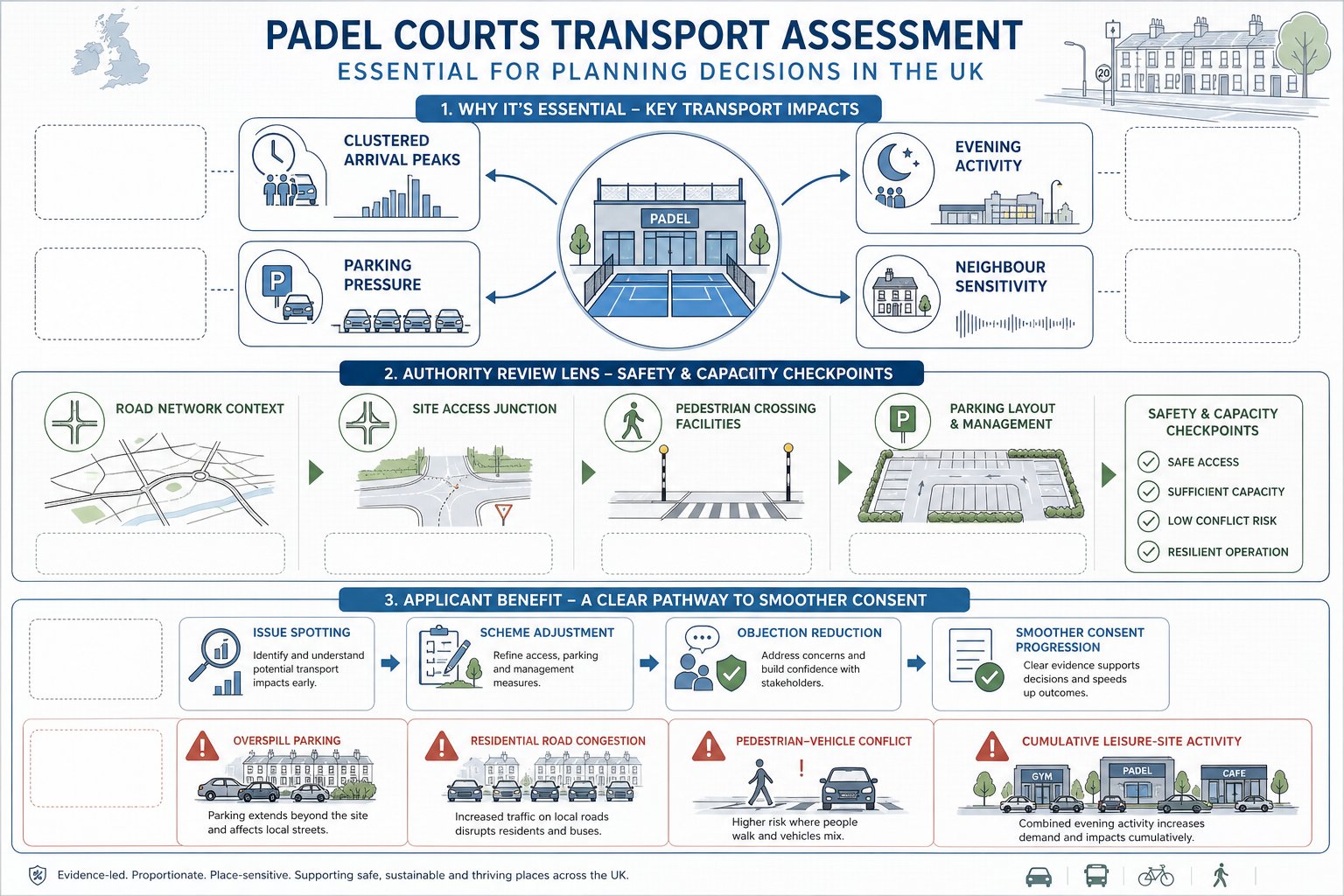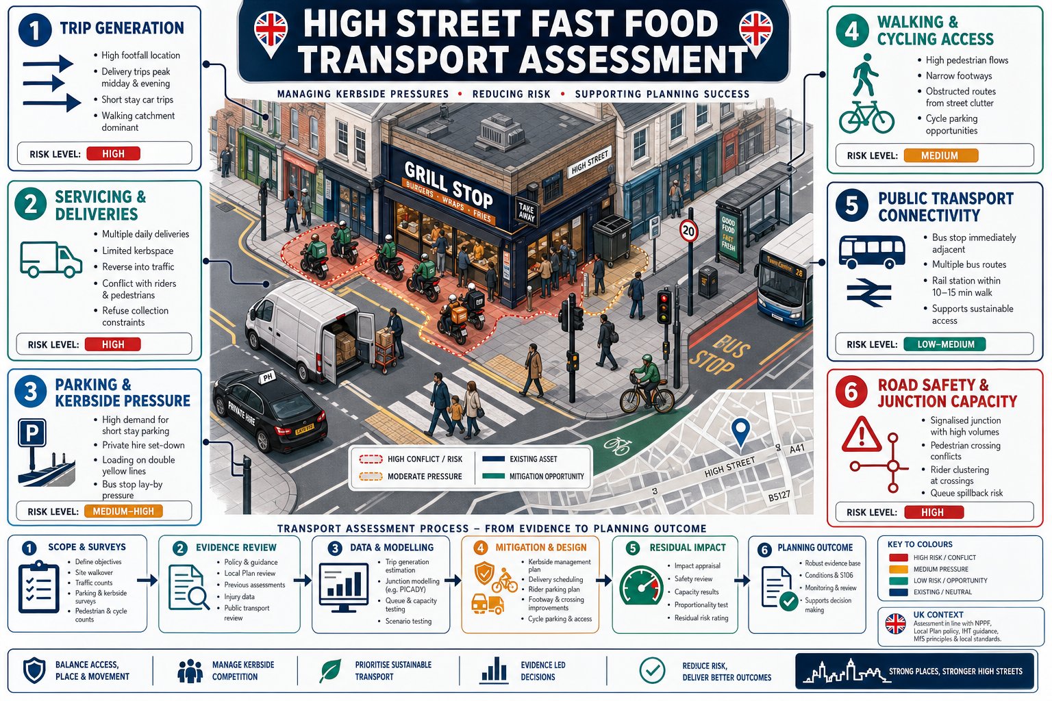
A high street fast food unit can look straightforward on a planning drawing: a shopfront, a counter, a kitchen, maybe a modest seating area. On the ground, though, it often behaves very differently. Peak customer arrivals can bunch into short windows. Delivery riders cluster at the frontage. Refuse collection, food supply vans, passenger pick-up and quick-stop parking all compete for the same few metres of kerb. And on a busy town centre street, those details are usually where planning risk sits.
That is why a Fast Food Restaurants on High Street Transport Assessment matters. It is not simply a box-ticking exercise for validation. Done properly, it shows whether a proposal can operate safely, whether the street can absorb the activity, and what mitigation is needed to make the transport effects acceptable in planning terms.
In 2026, local authorities are looking harder at real operating patterns rather than broad land-use assumptions. They want evidence on trip generation, rider activity, servicing practicality, parking stress, pedestrian comfort and road safety around the site. We see this particularly on constrained urban corridors, near schools, bus interchanges, signalised junctions and streets already under pressure from short-stay stopping.
In this guide, we set out what planners, developers, architects, lawyers and councils usually need to consider when preparing or reviewing a transport assessment for a high street fast food proposal, and where applications most often run into avoidable objections.
Key Takeaways
- A Fast Food Restaurants on High Street Transport Assessment is essential to demonstrate safe operation, manage street impact, and identify necessary mitigation for planning approval.
- Local authorities demand detailed evidence on peak trip generation, delivery rider activity, servicing logistics, parking pressure, pedestrian comfort, and road safety, especially in constrained urban areas.
- Trip generation should reflect real operating patterns including app-based ordering and delivery collections, recognising peak periods and local accessibility rather than relying on generic assumptions.
- Kerbside management is critical as delivery vehicles, refuse collection, customer pick-up, and short-stay stopping intensify competition for limited space and must be realistically assessed and mitigated.
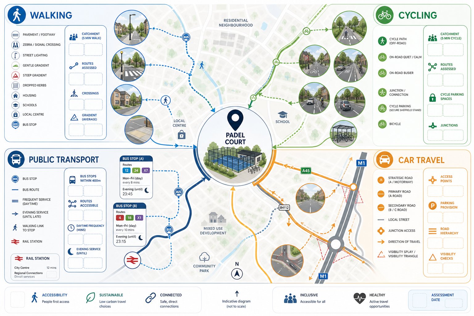
- A comprehensive assessment includes evaluating walking, cycling, and public transport accessibility with emphasis on route quality, secure cycle parking, and safe crossings to support sustainable travel.
- Early scoping and honest reporting, including the use of local surveys and practical mitigation measures, enhance the credibility of the transport assessment and reduce planning objections.
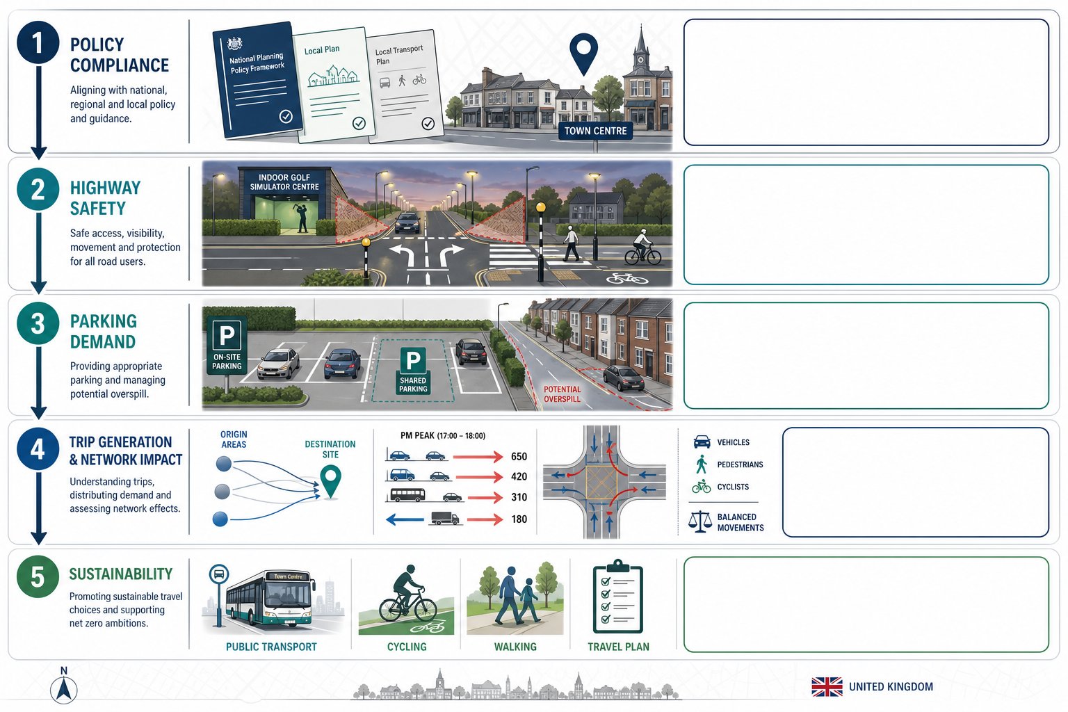
Why Transport Assessment Matters For High Street Fast Food Uses
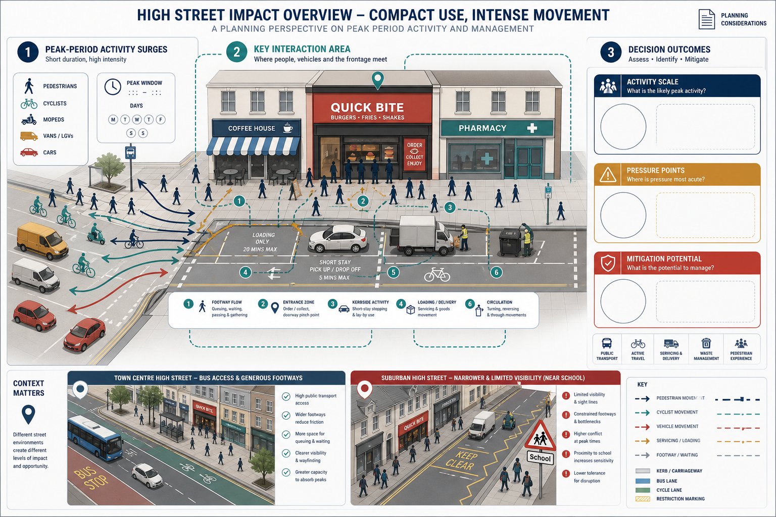
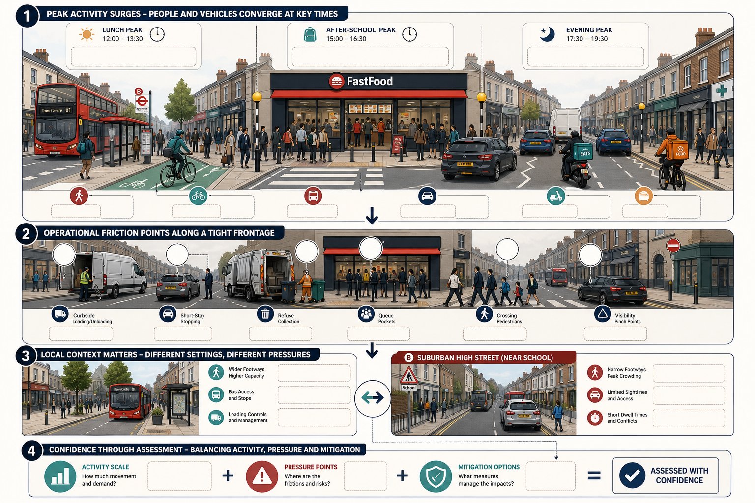
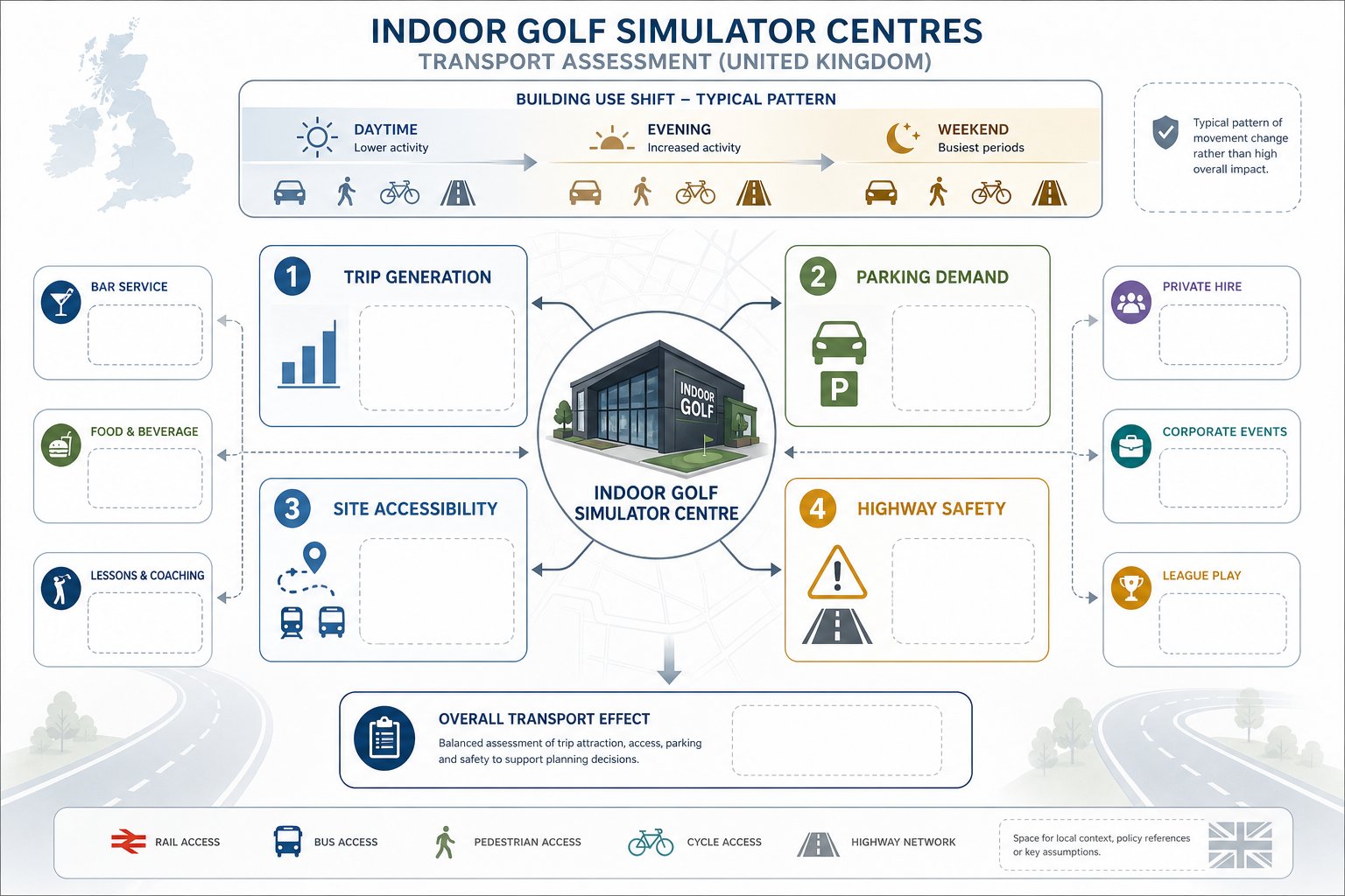
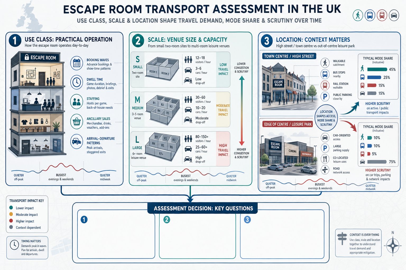
Fast food uses on a high street tend to generate a pattern of movement that is sharper, noisier and more operationally complex than the floor area alone suggests. A small unit can still create intense turnover in the lunch, after-school and evening periods, especially where app-based ordering and collection are part of the business model. That is exactly why transport assessment is often central to planning strategy rather than a supporting afterthought.
From a highway authority’s perspective, the issue is rarely just “how many vehicles”. It is how people, cycles, mopeds, vans, refuse vehicles and pedestrians interact in a tight frontage environment. A proposal may have no drive-through and no dedicated car park, yet still create repeated stopping, loading, waiting and crossing movements that affect safety and traffic flow.
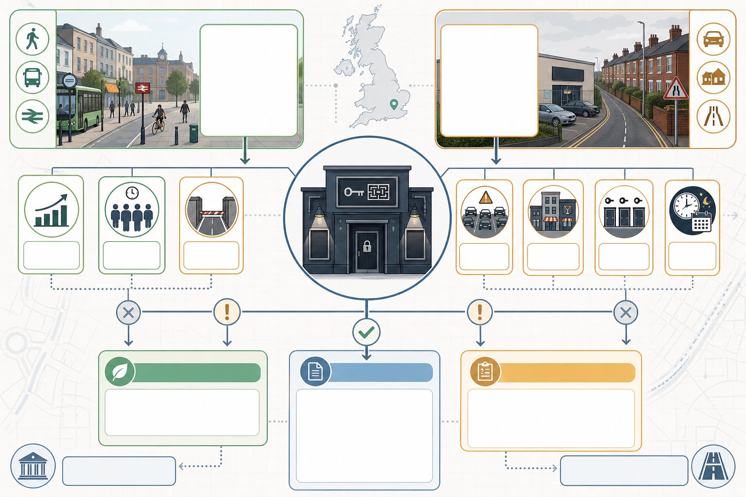
We also need to think about local character. A town centre site with generous footways, loading restrictions and strong bus access behaves differently from a narrow suburban high street with limited visibility and schools nearby. The same use class description can hence produce very different planning outcomes.
A robust assessment gives decision-makers confidence on three things: the likely scale of activity, where the pressure points will arise, and whether practical mitigation exists. In broader terms, a good transport assessment for this kind of scheme should connect policy, site reality and operational detail. When those pieces line up, the application tends to move more smoothly.
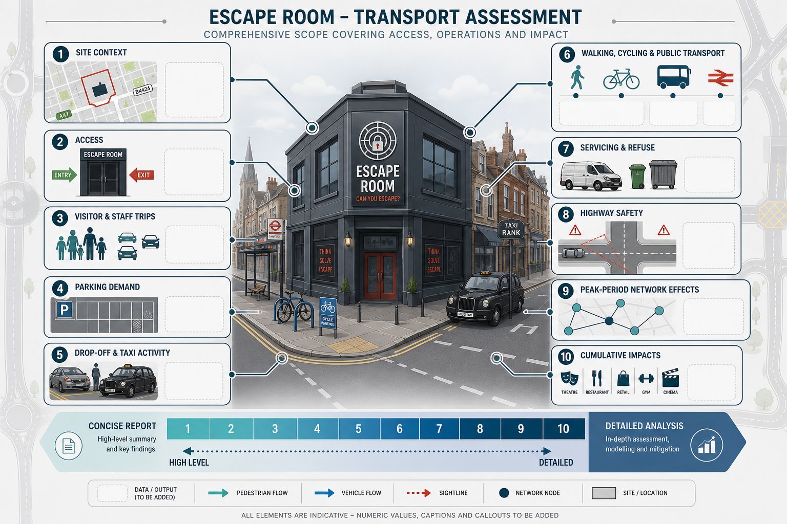
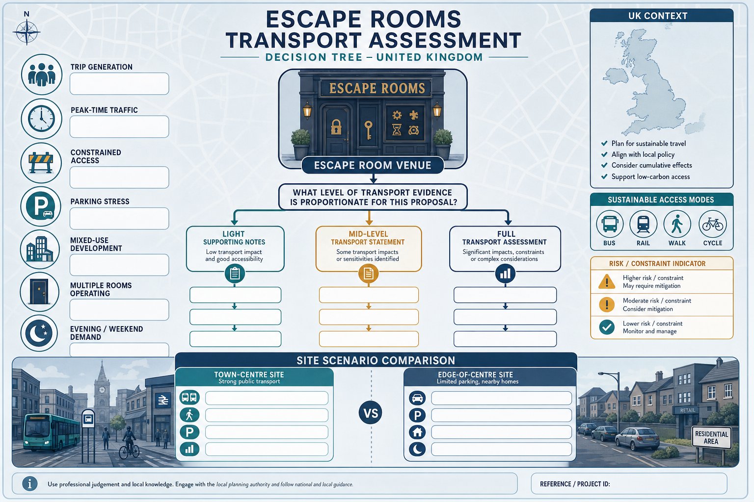
When A Fast Food Restaurant On High Street Is Likely To Need A Transport Assessment
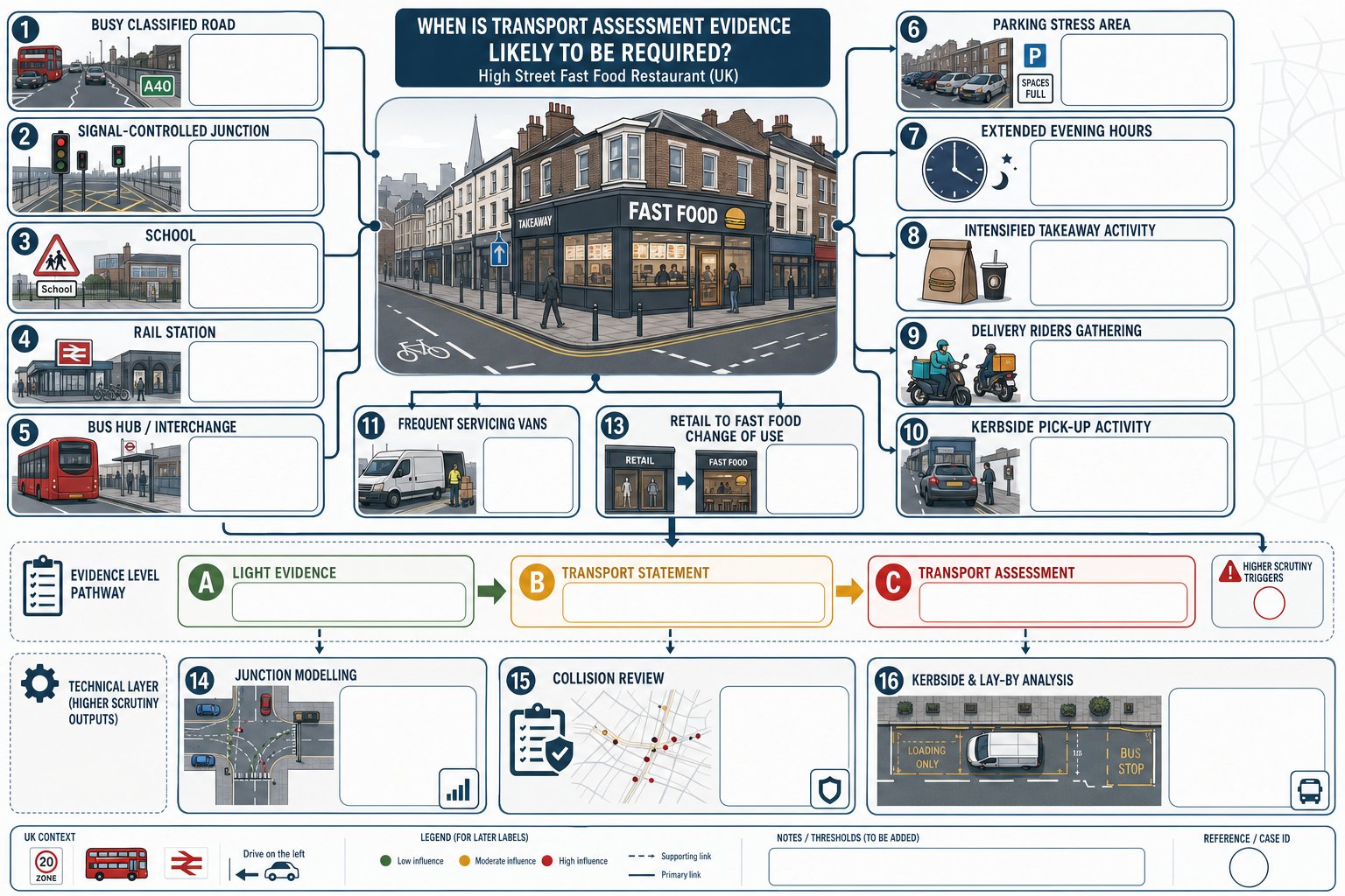
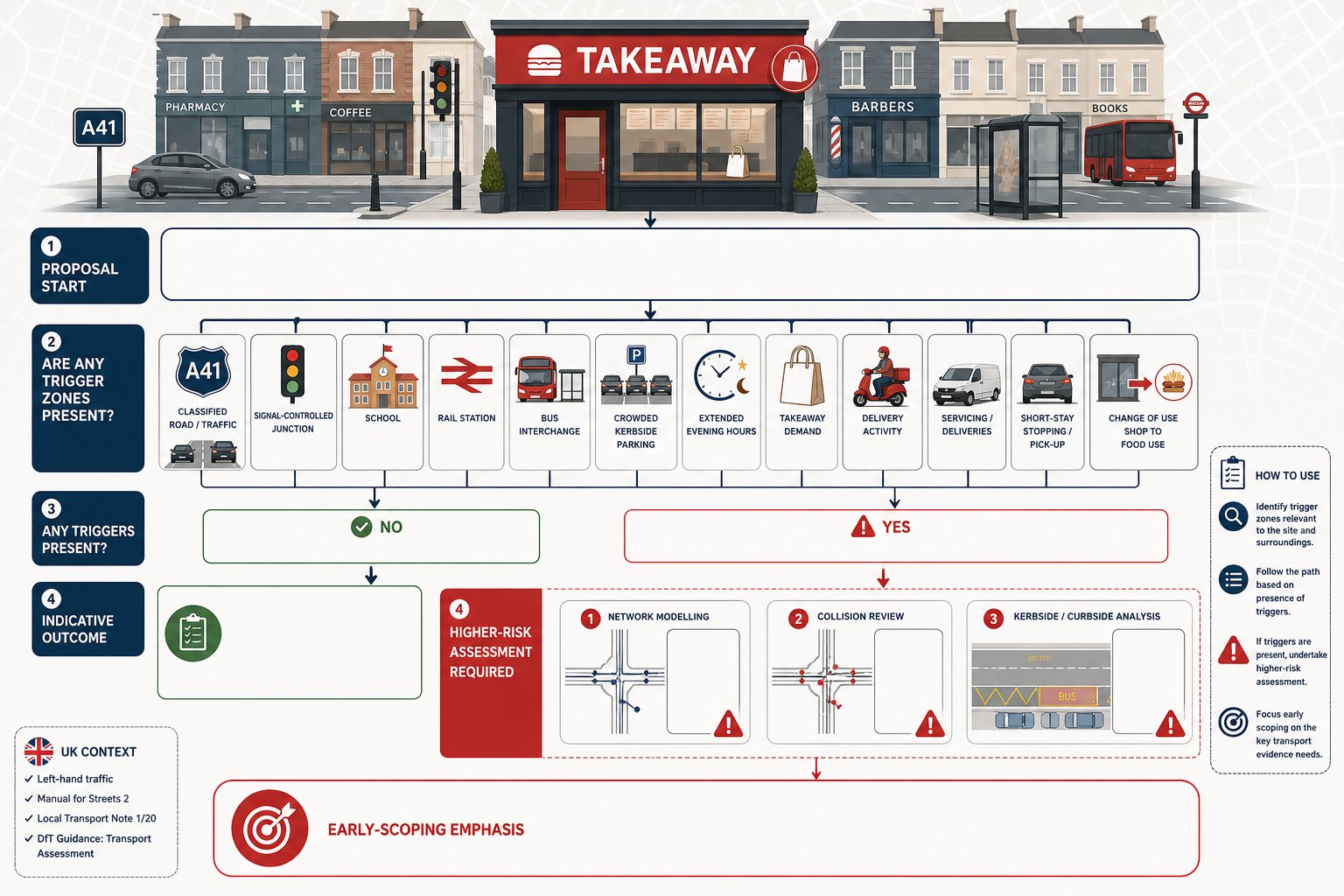
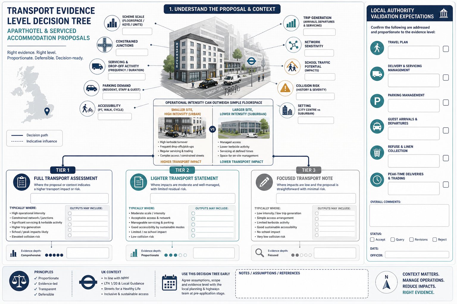
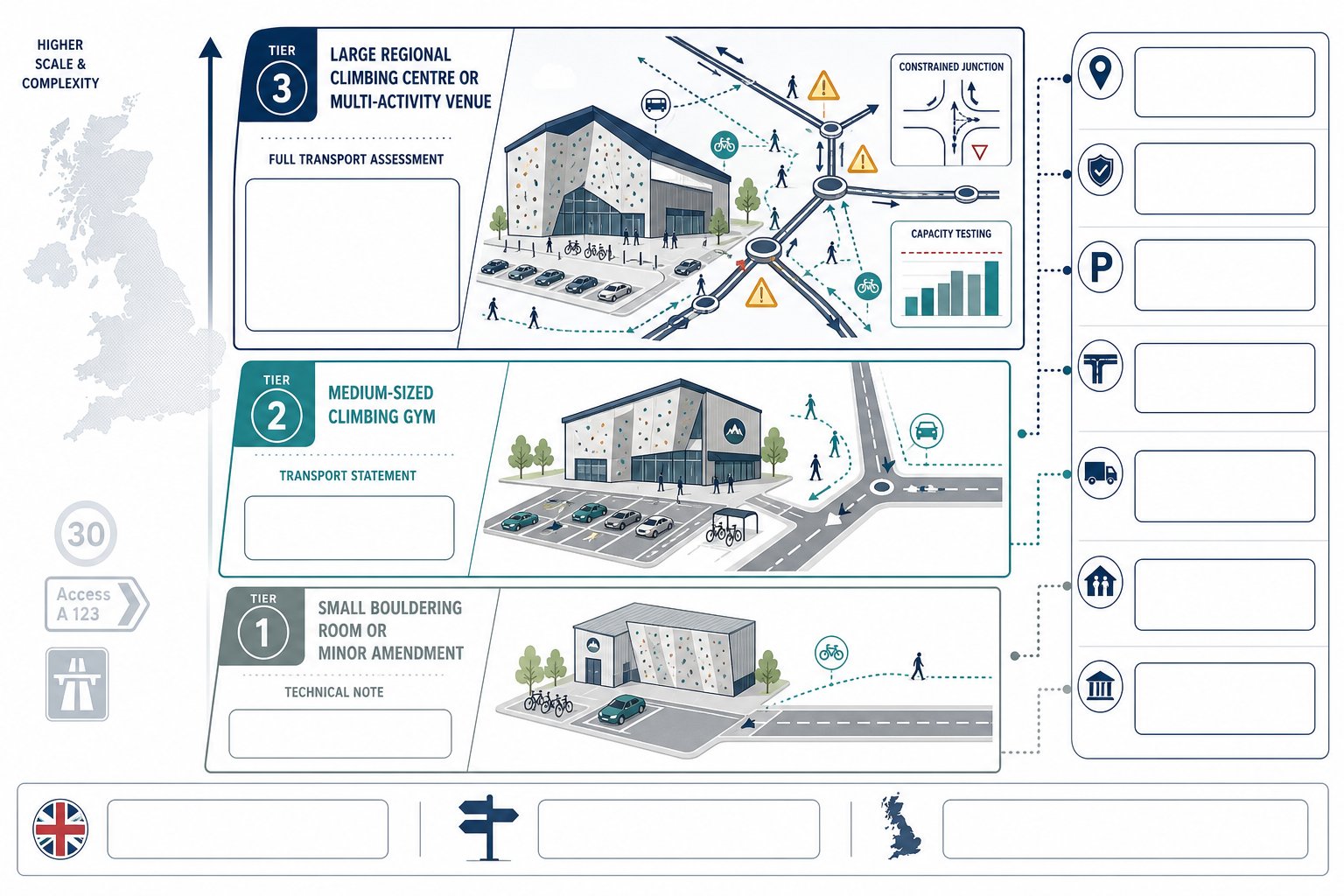
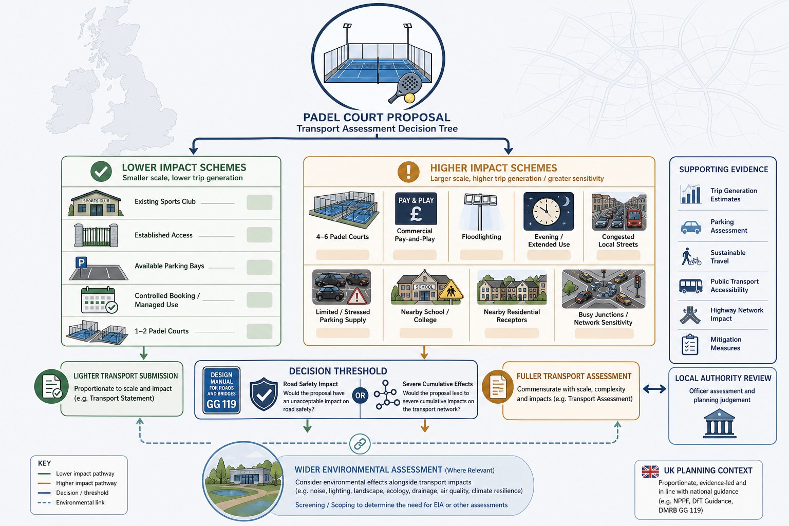
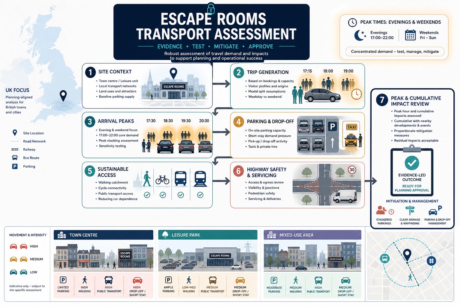
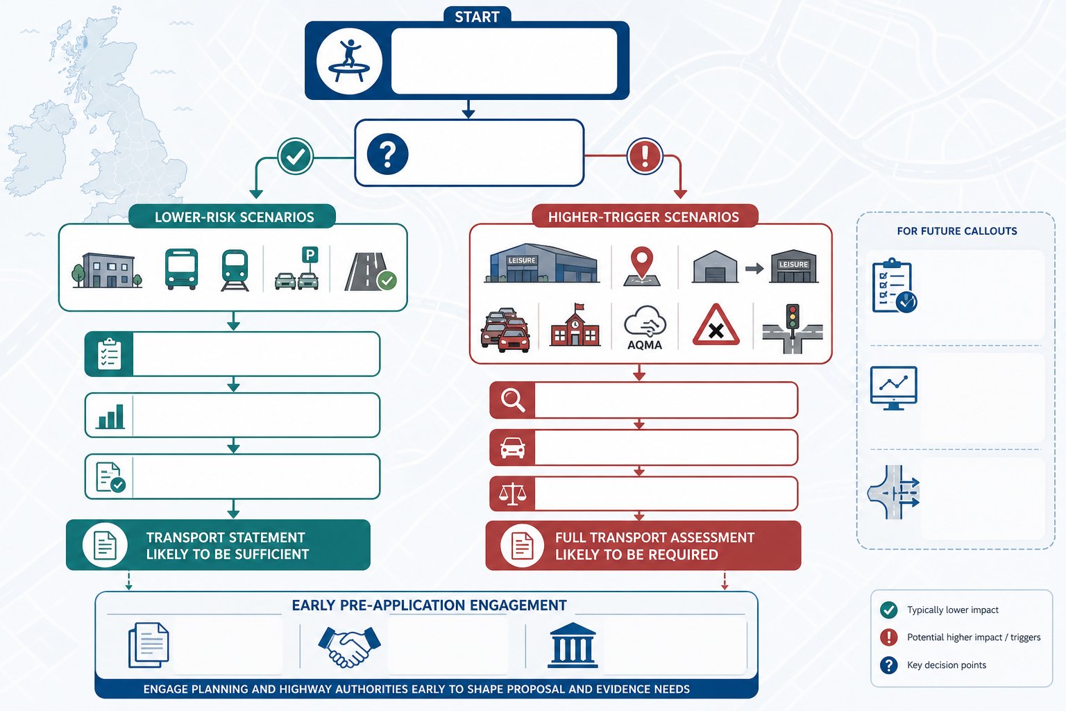
Not every high street fast food proposal needs a full-scale Transport Assessment, but many need at least some transport evidence, and a surprising number need more than applicants first assume. Local thresholds vary, so the starting point is always the relevant authority’s validation requirements and pre-application advice. In practice, a TA or focused Transport Statement is often triggered where traffic and servicing effects could be material.
That usually includes sites on busy classified roads, near signal-controlled junctions, close to schools, beside rail stations or bus hubs, or in locations with established parking stress. Authorities also look carefully at proposals that extend opening hours, intensify takeaway activity, or rely heavily on delivery platforms. Even if customer car trips are modest, rider arrivals and kerbside occupation may still justify assessment.
Change-of-use schemes deserve special care. Applicants sometimes assume that reusing an existing retail unit means limited transport impact. But the operational profile of a fast food use can differ sharply from a standard shop. More evening demand, more collections, more frequent servicing and stronger short-stay stopping behaviour can all make the change material in planning terms.
Where there is any doubt, scoping early is worth it. For schemes with wider network implications, authorities may expect technical modelling using tools such as Junctions 11 Software, collision review and detailed kerbside analysis rather than broad qualitative commentary. In our experience, early agreement on scope saves far more time than trying to repair an under-scoped submission after objections land.
Key Planning And Highway Issues Local Authorities Usually Review
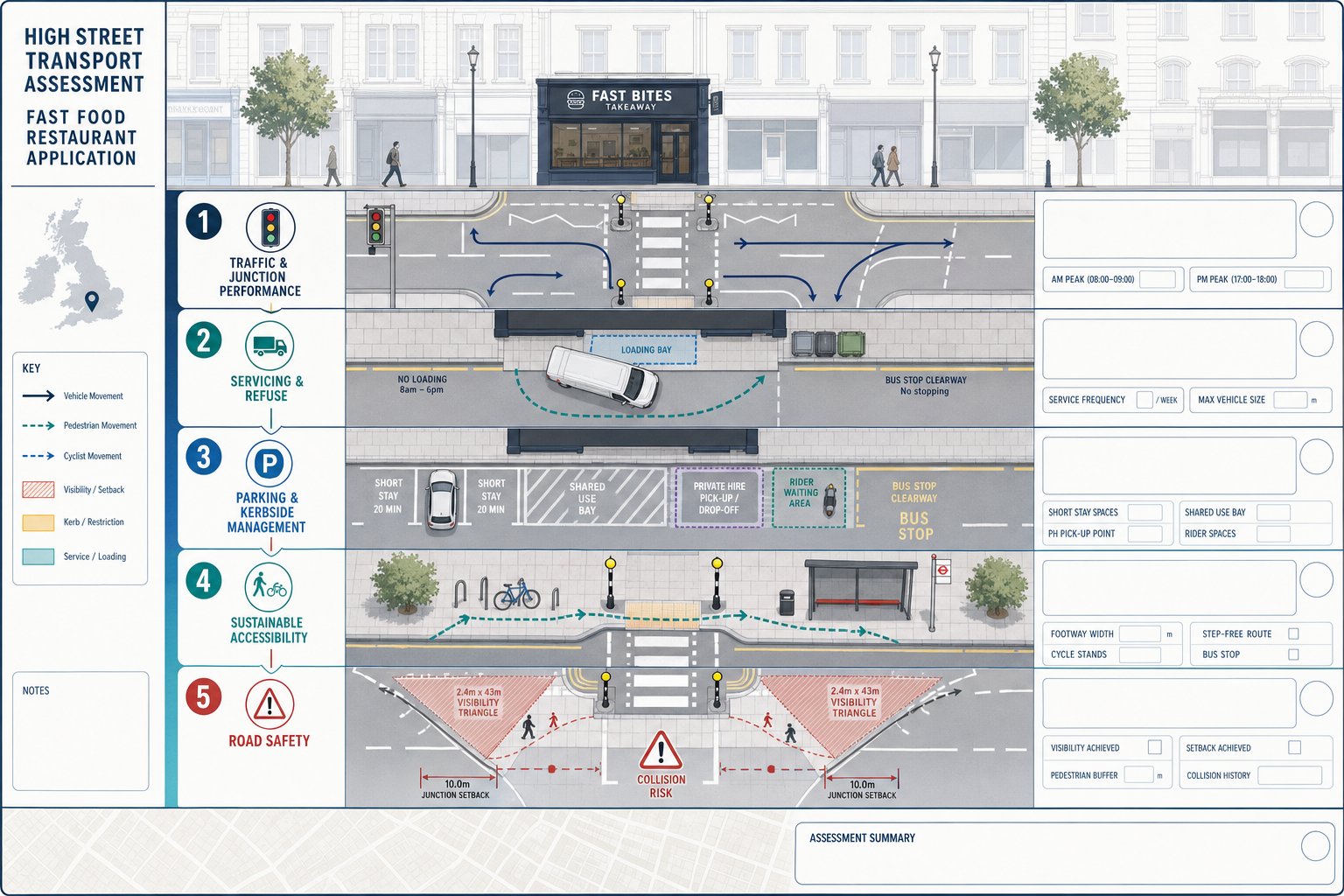
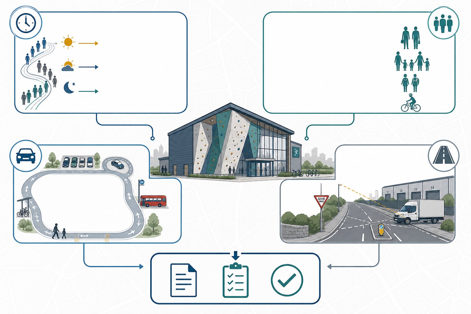
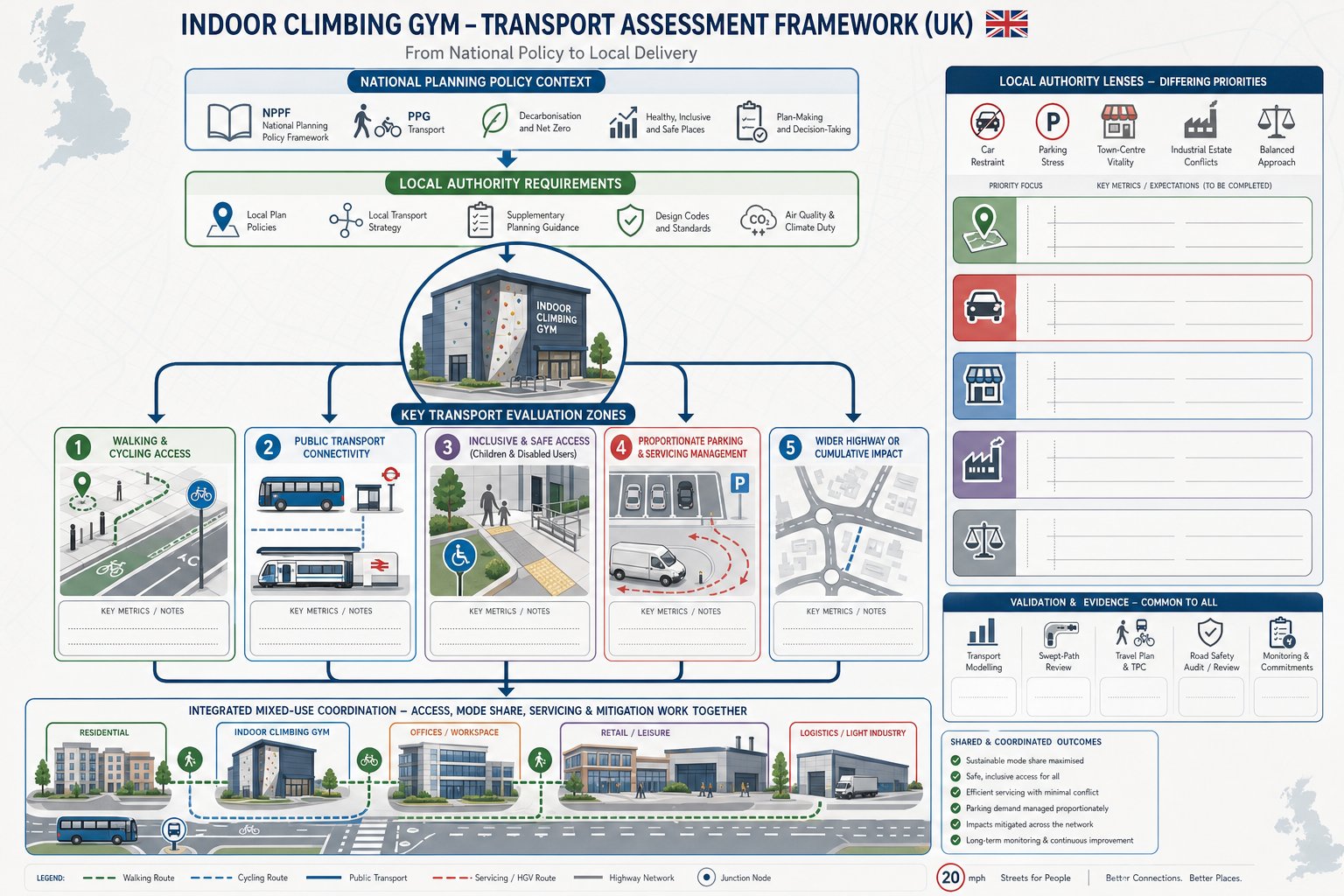
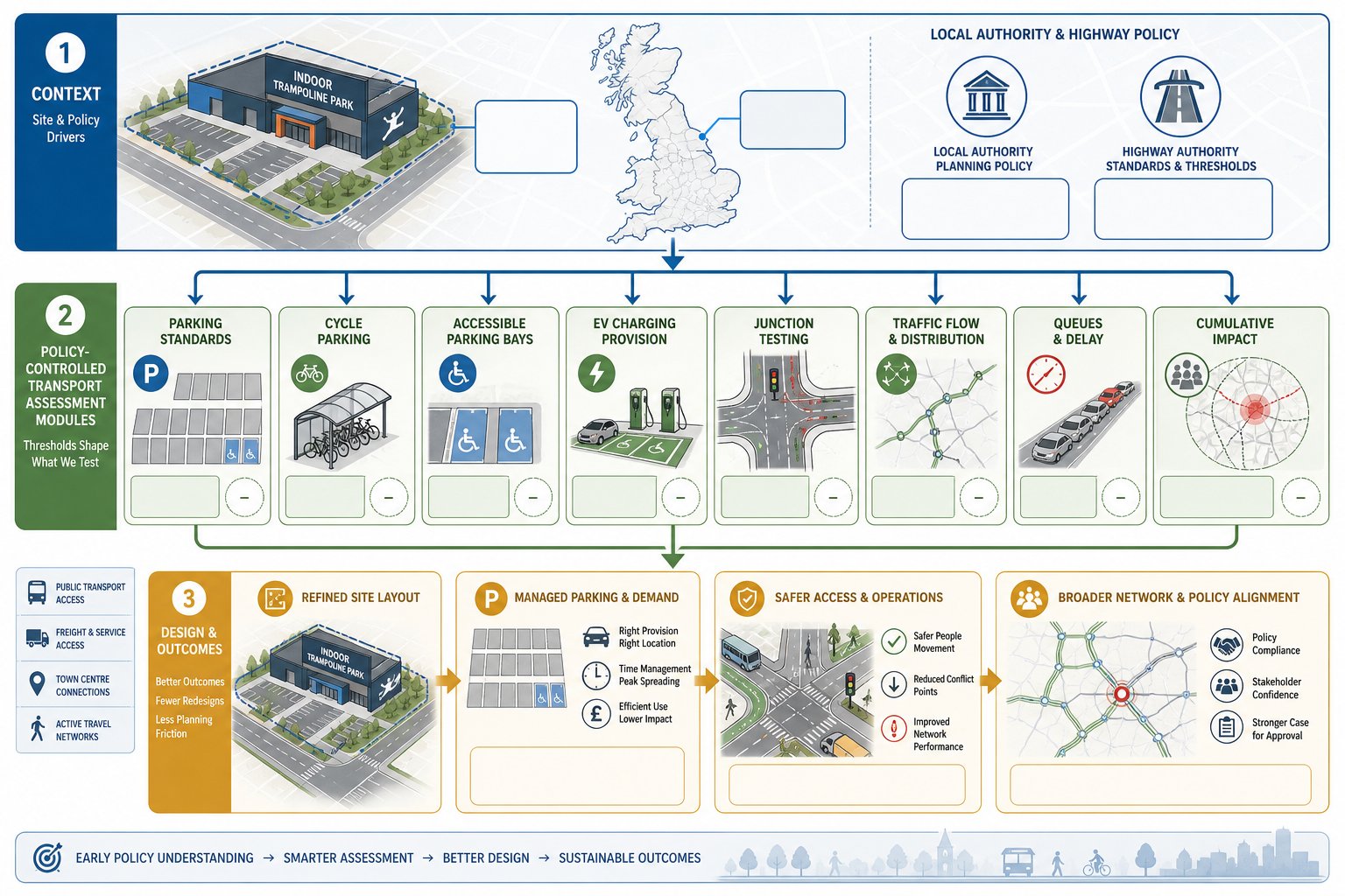
Most authorities review high street fast food applications through a practical lens: can the use function on this street, at this frontage, without creating unacceptable impacts? That broad question usually breaks into a familiar set of transport and highway topics.
First, there is traffic impact and junction performance. Even where net vehicle generation is not huge, authorities want to know whether new movements coincide with existing peak stress, especially at nearby priority junctions, signals and crossings. A few extra turning vehicles in the wrong place can matter more than a larger number spread across a resilient network.
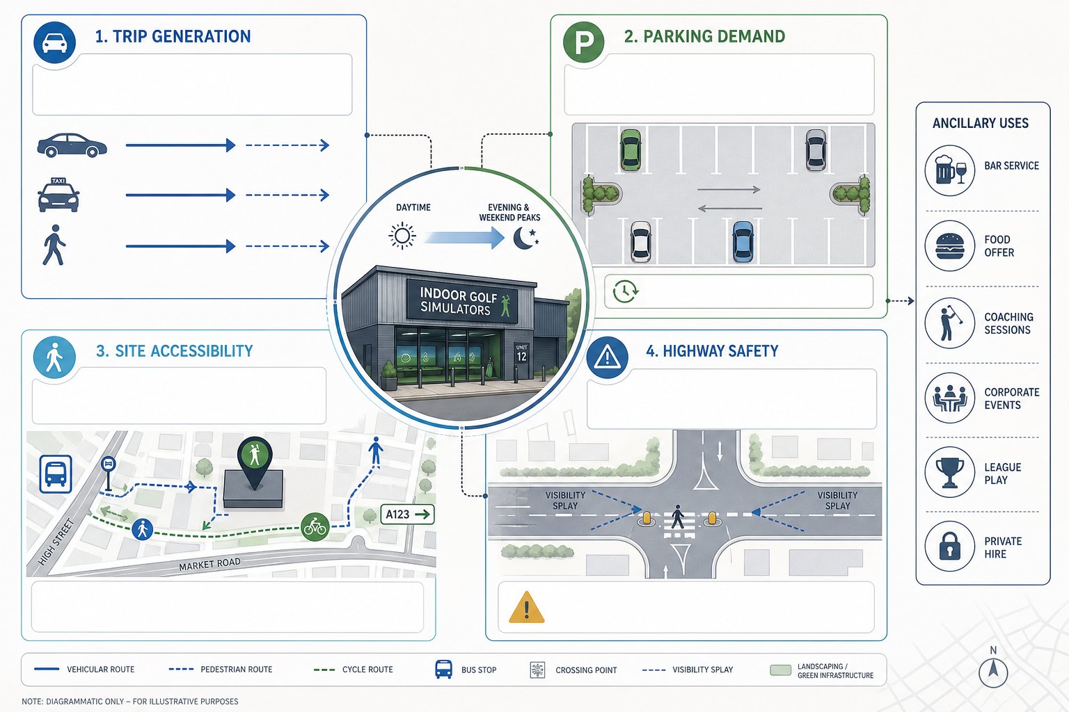
Second, servicing matters a lot. Officers typically examine delivery frequency, vehicle size, refuse collection, loading location and whether manoeuvres can occur lawfully and safely. On-street loading that blocks a lane, cycle route, bus stop clearway or crossing point is a common concern.
Third, they review parking and kerbside management. That includes customer parking demand, short-stay stopping, private-hire pick-up, rider waiting and the effect on Controlled Parking Zones or shared-use bays. Fast food uses often intensify competition for kerb space, which is already scarce on many town centre streets.
Then there is sustainable accessibility: footway width, crossing quality, step-free routes, cycle parking and public transport access. If the site is promoted as highly sustainable, the evidence needs to prove it.
Finally, road safety is never optional. Recorded collision patterns, frontage visibility, interaction with pedestrians and buffers to junctions all feed into the planning balance. On larger mixed streets, this can sit alongside wider movement planning comparable to a mixed use masterplan approach, even for a single unit.
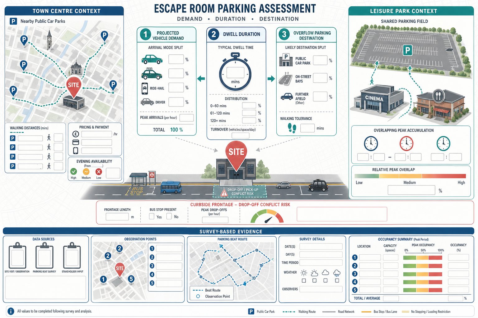
Trip Generation For Fast Food Restaurants In Town Centre And High Street Locations
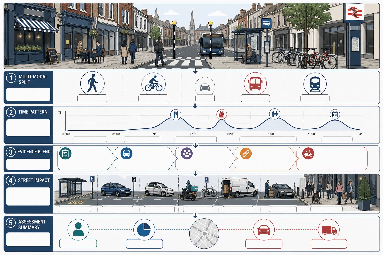
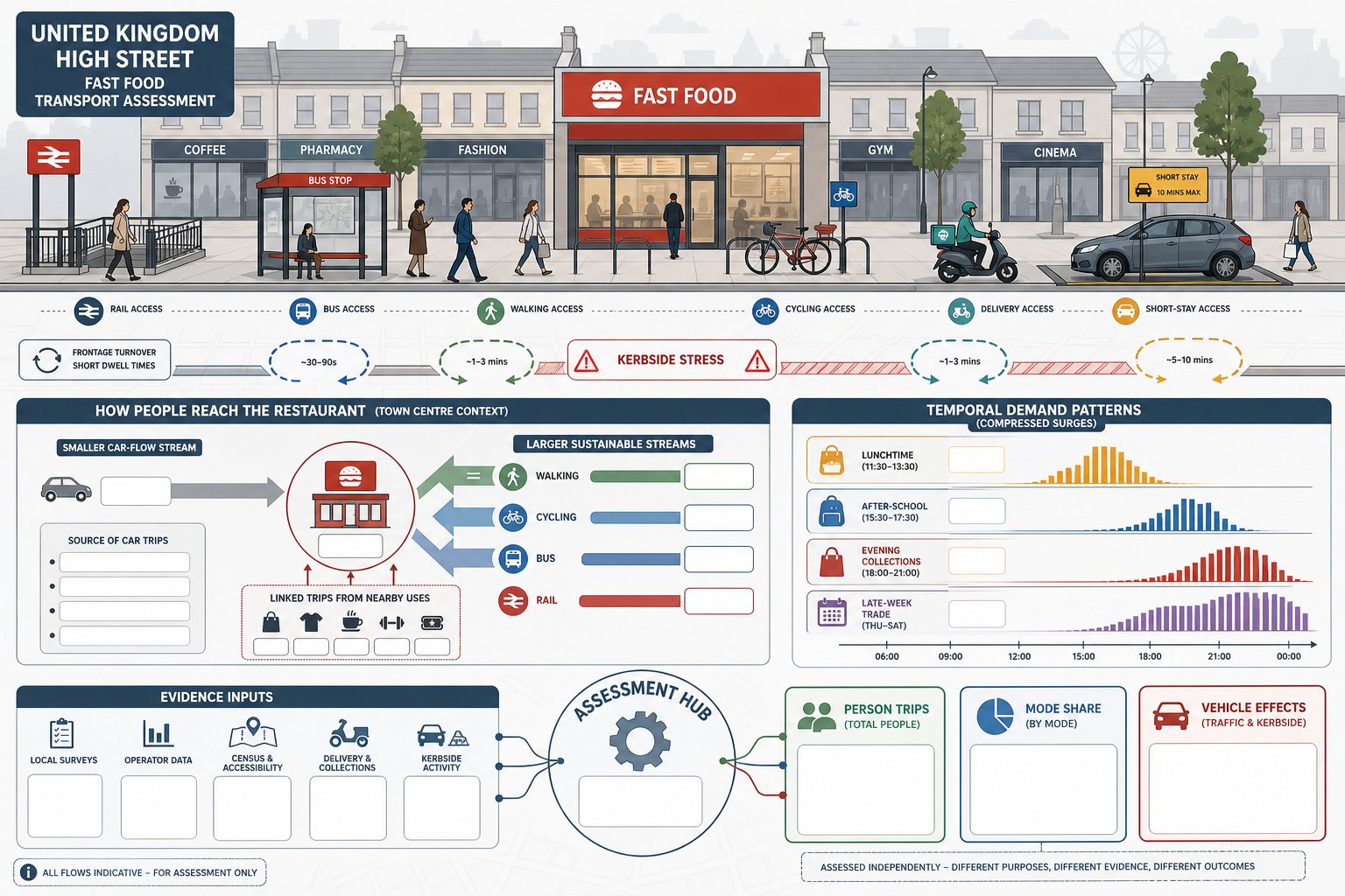
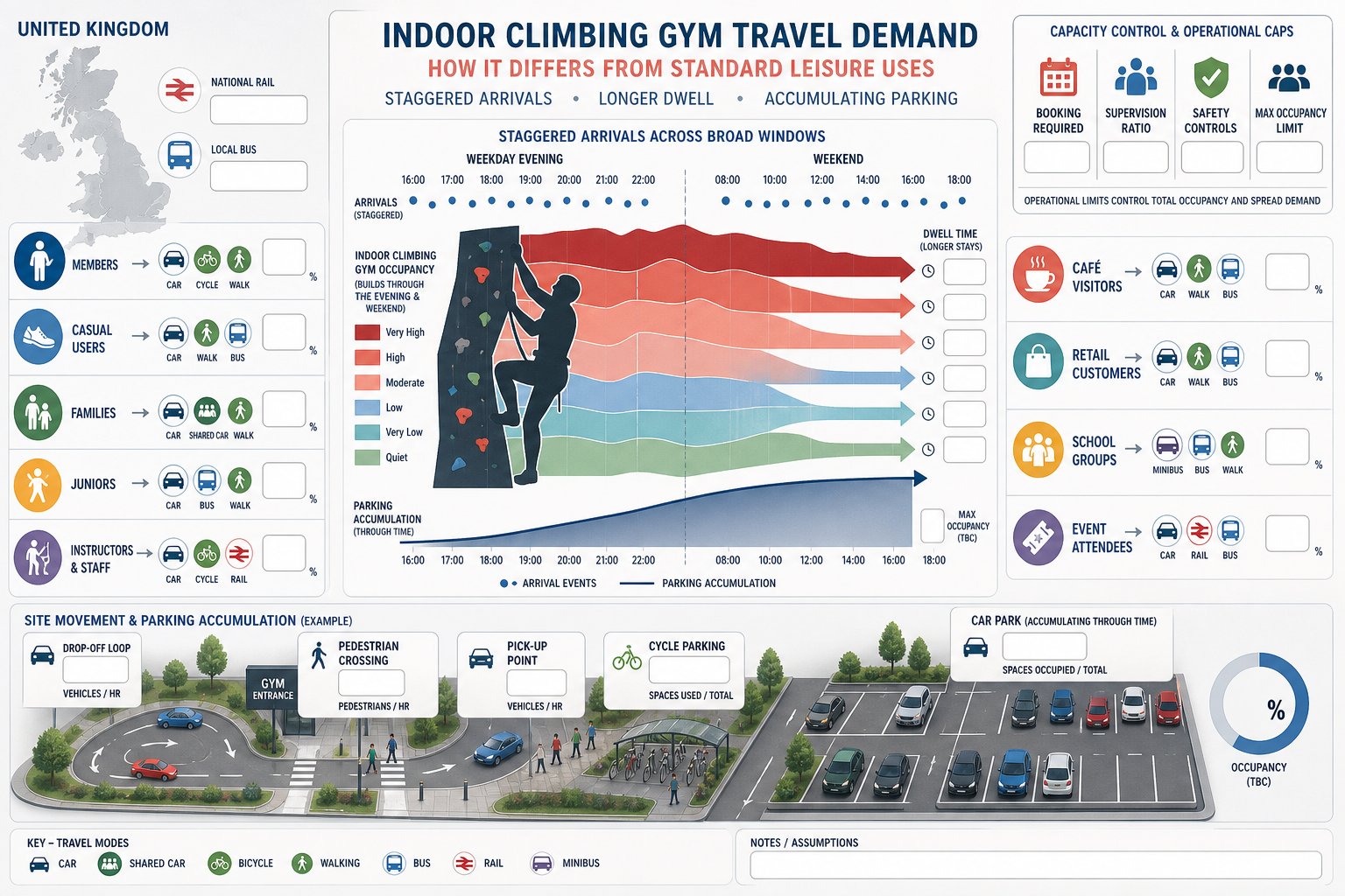
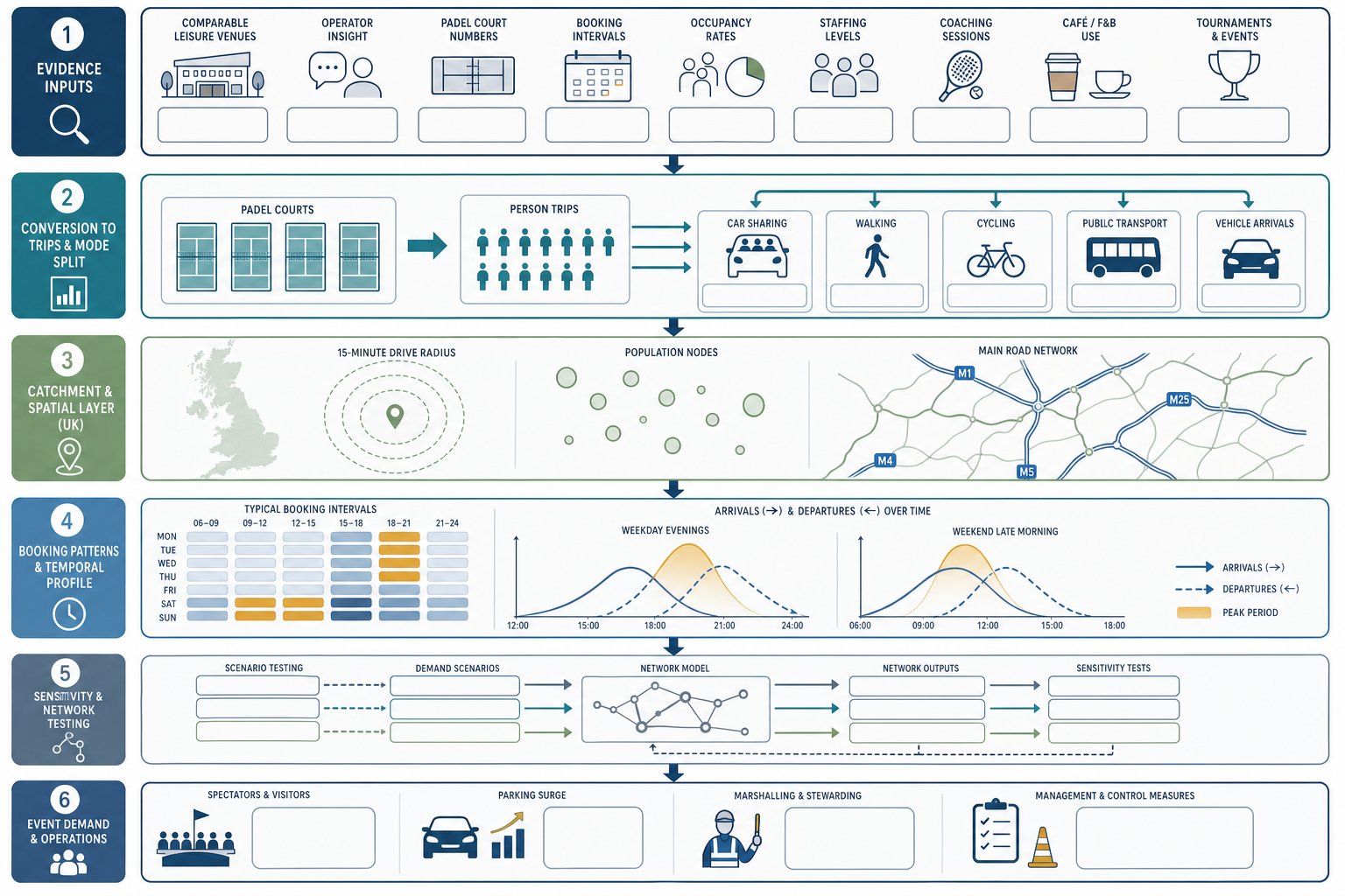
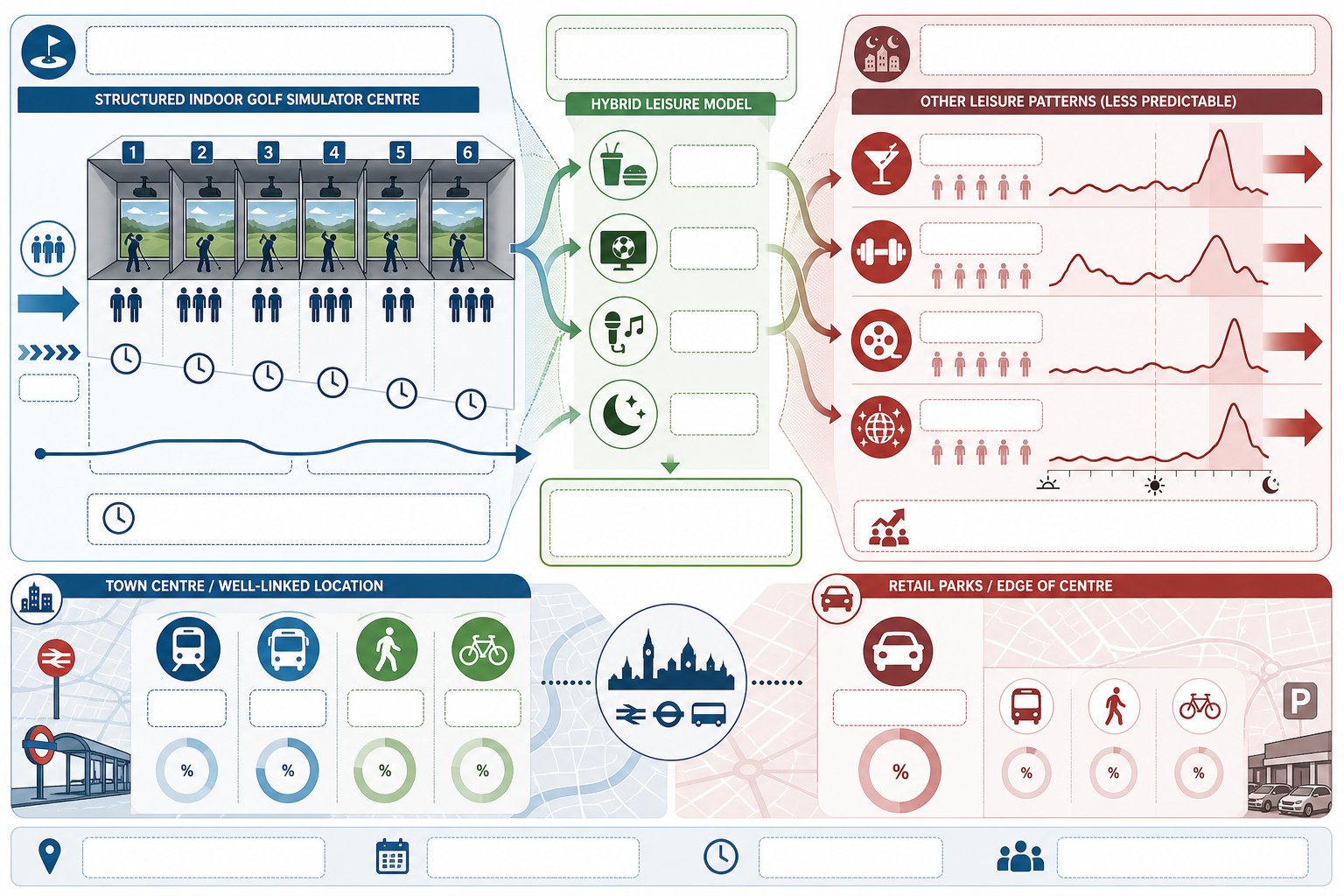
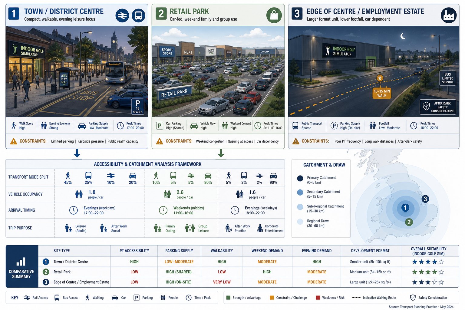
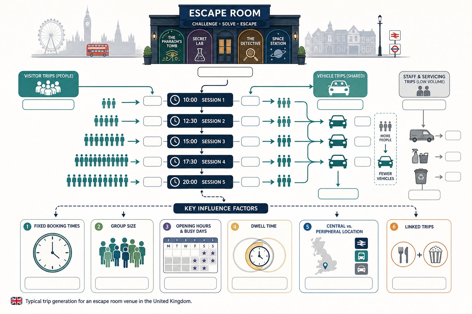
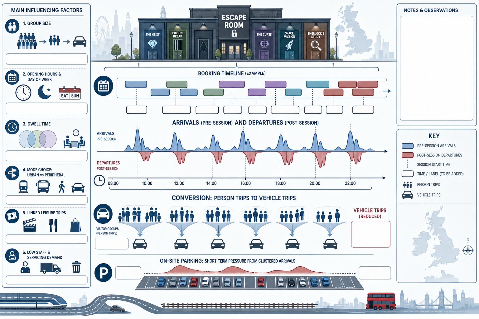
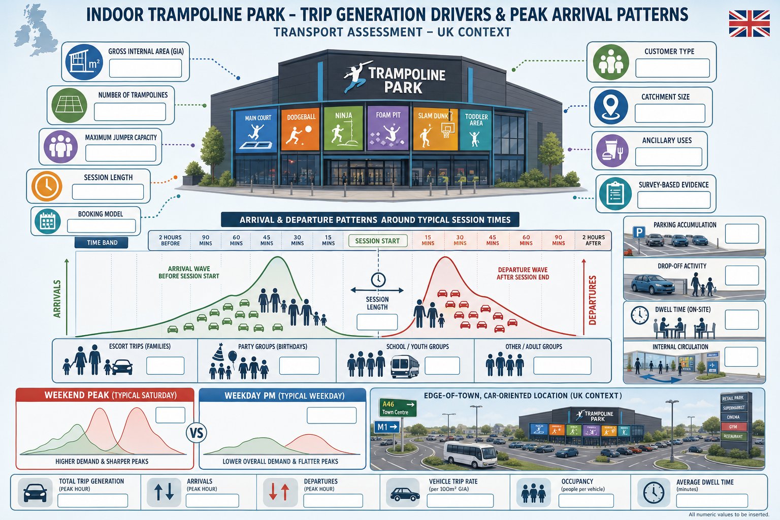
Trip generation is one of the most contested parts of a Fast Food Restaurants on High Street Transport Assessment because standard database rates rarely tell the whole story. Town centre and high street sites often produce lower car-driver trip rates than edge-of-centre or freestanding roadside locations. That is because a larger share of customers arrive on foot, by cycle, by bus, by rail, or as linked trips from existing shopping and leisure activity.
But lower car mode share does not mean low impact. The pattern is often peaky and compressed. We regularly see strong lunchtime demand, after-school surges, evening collections and late-week trade that differs substantially from surrounding retail. These temporal spikes matter for network stress and kerbside demand.
The right approach is usually a blend of evidence: comparable local surveys, operator information where available, census and accessibility context, and a realistic allowance for delivery collections. Linked trips should be considered carefully, but not used as a blanket discount without evidence. Authorities are increasingly sceptical of generic assumptions that most visits are merely pass-by or diverted trips.
High street exposure also influences behaviour. Sites in dense “mobile environments”, where people pass multiple food outlets during everyday journeys, can attract frequent impulsive visits with high turnover at the frontage. That tends to support lower stay durations but faster cycle times in nearby bays.
So our advice is simple: estimate person trips, mode share and vehicle effects separately. A sound assessment should explain not just how many trips are generated, but when, by whom, and how those trips interact with the surrounding street.
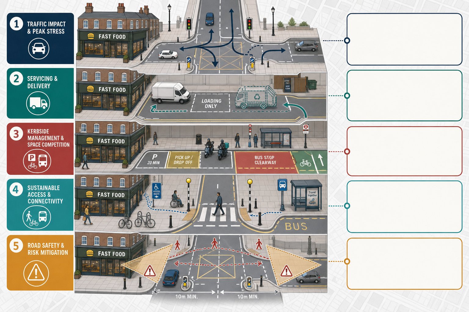
Assessing Delivery Activity, Servicing, And Kerbside Pressure
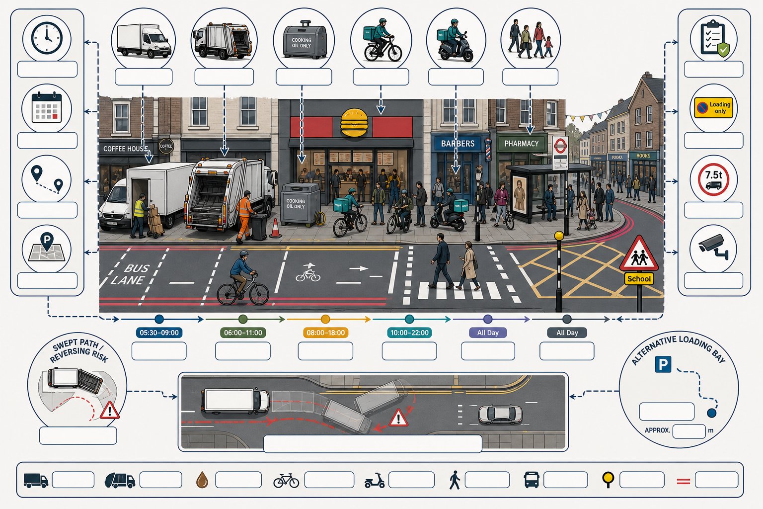
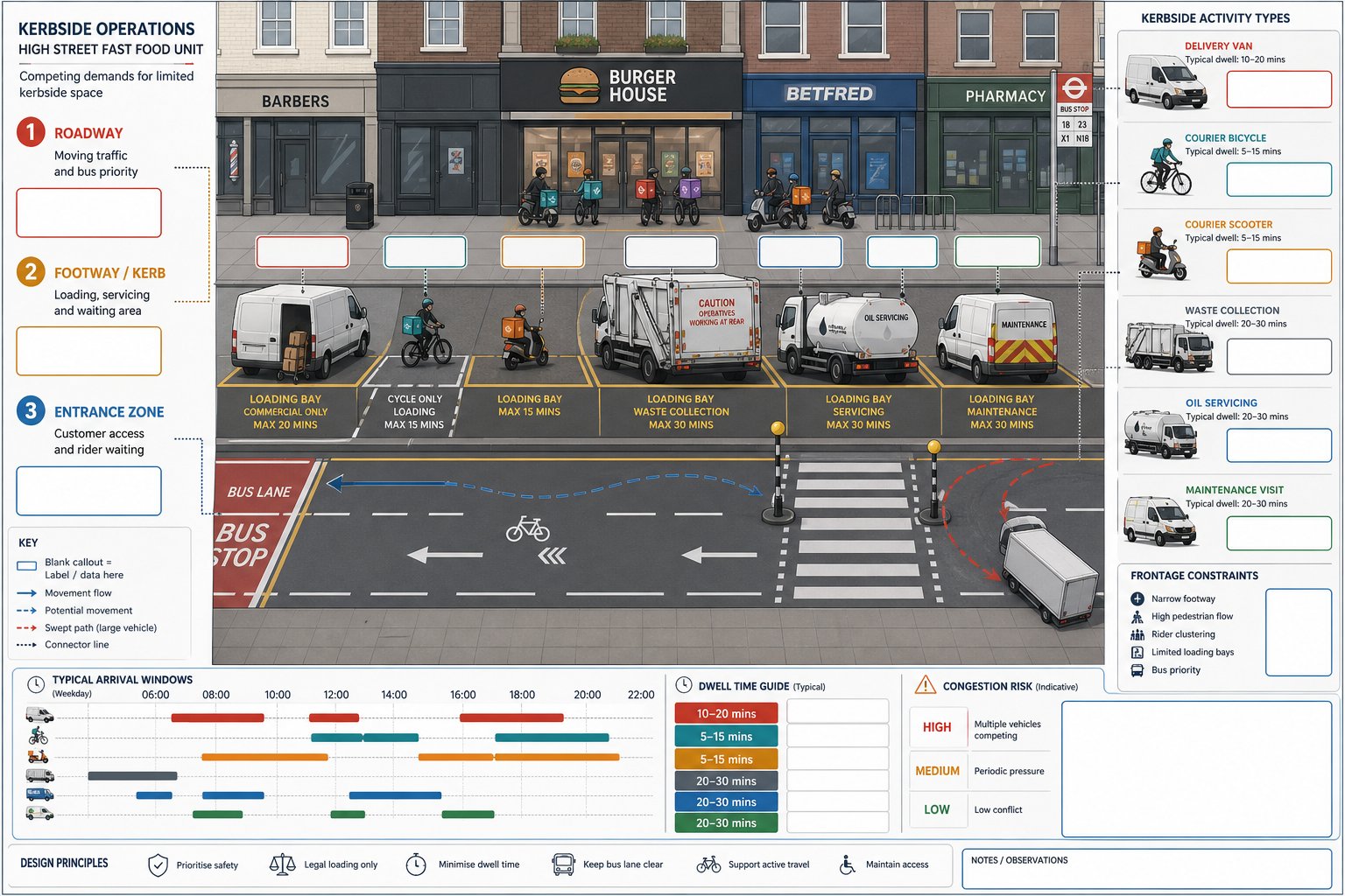
For many high street fast food units, servicing and delivery activity are the real operational test. Food supply vans, courier collections, waste movements, cooking oil servicing and ad hoc maintenance visits all place demands on the kerb, often within tight time windows. If the site has no rear service yard, the frontage arrangement becomes critical.
A robust assessment should identify the likely vehicle types, delivery frequency, typical dwell times and preferred arrival periods. Morning servicing may appear benign until it coincides with school drop-off, bus lane operation or peak pedestrian flows. Evening refuse collection can be equally sensitive on narrow streets with restaurant activity nearby.
App-based delivery adds another layer. Riders may arrive early, wait on footways, lean cycles or scooters against shopfronts and cluster around the entrance during intense order periods. That is not always captured in traditional servicing reviews, but authorities increasingly expect it to be.
We usually assess whether loading can occur legally and without blocking traffic, crossings or cycle movement, and whether alternative loading bays are realistically close enough for routine use. Swept-path checks may be needed if larger vans reverse or turn in constrained geometry.
Where the proposal forms part of a broader planning package, servicing analysis can sometimes overlap with wider environmental impact assessment work, particularly if there are cumulative urban centre effects. But for most single units, the deciding factor is simpler: does the operational plan reflect what will actually happen at the kerb?
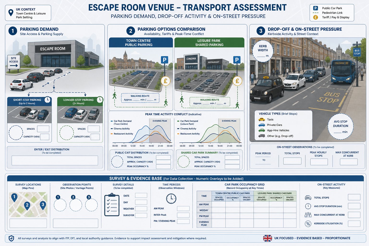
Parking, Pick-Up, And Drop-Off Impacts Around The Site
Parking around a high street fast food site is rarely about long-stay demand. The more common issue is fast-turnover occupation of already constrained spaces: five-minute stops, private-hire arrivals, quick collections, rider waiting and occasional illegal parking that feels trivial in isolation but becomes significant in aggregate.
Authorities want to understand whether the proposal will intensify pressure on nearby bays, side streets, loading areas and Controlled Parking Zones. That means looking beyond the red line boundary. If a unit depends on public parking or informal stopping, the surrounding network becomes part of the assessment.
Just as important, we need to distinguish between formal parking demand and behavioural stopping demand. A site may technically have adequate public car parks within walking distance, yet still attract short-stay frontage stopping because customers prioritise convenience over compliance. That gap between policy assumption and real-world behaviour is where objections often arise.
Car Parking Demand In Constrained Urban Streets
In constrained urban streets, car parking analysis should focus on availability, turnover and stress rather than headline bay counts. Existing occupancy surveys help establish whether nearby parking can absorb additional short-stay demand, particularly during lunch and evening peaks. If surrounding bays already operate at or near practical capacity, even small increments can displace parking into less suitable streets.
We also consider the type of parking available. Shared public car parks may work well for dine-in customers, while quick collection trips tend to seek the closest lawful space. Controlled Parking Zone restrictions, pay-and-display tariffs and time limits all shape actual behaviour. A realistic assessment should say so plainly.
Short-Stay Stopping, Delivery Riders, And Passenger Pick-Up
Short-stay stopping deserves separate treatment because it often drives local objection. Private-hire vehicles, passenger pick-up, food courier waiting and casual double-parking can obstruct traffic and reduce visibility, particularly on narrow high streets.
Mitigation may include dedicated rider parking, clear staff protocols, timed loading, frontage management, road markings or Traffic Regulation Order changes where justified. The point is not to assume perfect compliance: it is to design for likely behaviour. On difficult sites, modest management measures can make the difference between a defensible application and a refused one.
Walking, Cycling, And Public Transport Accessibility Requirements
High street fast food proposals are often promoted on the basis that they sit in sustainable locations. Sometimes that is absolutely right. But the evidence needs to move beyond a simple list of nearby bus stops.
A proper accessibility review should test the quality of walking routes, not just their existence. Are footways wide enough for two-way movement at peak times? Are crossings direct and safe? Is there good lighting, dropped kerbs and step-free access from surrounding streets and public transport stops? A busy frontage with riders waiting outside can undermine an otherwise sustainable location if pedestrian comfort is poor.
Cycling is similar. If a unit is expected to attract staff, customers or couriers by cycle, secure and practical cycle parking matters. So does the relationship to local cycle routes, junction treatment and conflict with footway activity. Informal cycle locking to railings and signs is usually a symptom of under-provision rather than user failure.
Public transport assessment should consider service frequency, operating hours, walking distance, accessibility and, where relevant, capacity. Late-evening trade can expose gaps in service assumptions that look acceptable on a daytime plan.
For some applications, a concise Travel Plan framework helps demonstrate how sustainable access will be supported in operation. The principles are broadly similar to those applied in a Residential Development Transport context, but adapted for staff travel, customer information and rider management rather than household mode choice.
Road Safety, Visibility, And Junction Capacity Considerations
Road safety analysis should be proportionate, but it must be credible. High street fast food uses can alter conflict patterns even where traffic growth appears modest, because the use changes how people stop, cross, turn and wait around the frontage.
We normally begin with personal injury collision records in the vicinity, looking for patterns rather than isolated numbers. Clusters involving pedestrians, cycles, rear-end shunts near loading activity, or turning conflicts at nearby junctions deserve particular attention. If existing safety issues are already present, the assessment should address whether the proposal could worsen them or whether mitigation can reduce exposure.
Visibility is another recurring issue. On-street parking, loading vehicles, street furniture and rider activity can all affect effective visibility at accesses and along the frontage. A technically compliant drawing is not enough if real-world operation routinely blocks the sightlines that matter.
Junction capacity may also need testing, especially where the site sits close to priority junctions, mini-roundabouts or signals. Here we need to compare baseline and with-development conditions at relevant peak periods, including queueing and reserve capacity indicators. A small development can still be material if network conditions are already tight.
And if modelling is used, the inputs have to reflect actual high street conditions: side friction, parking activity, crossing demand and delivery manoeuvres. Clean spreadsheet assumptions often look tidy: actual streets rarely are.
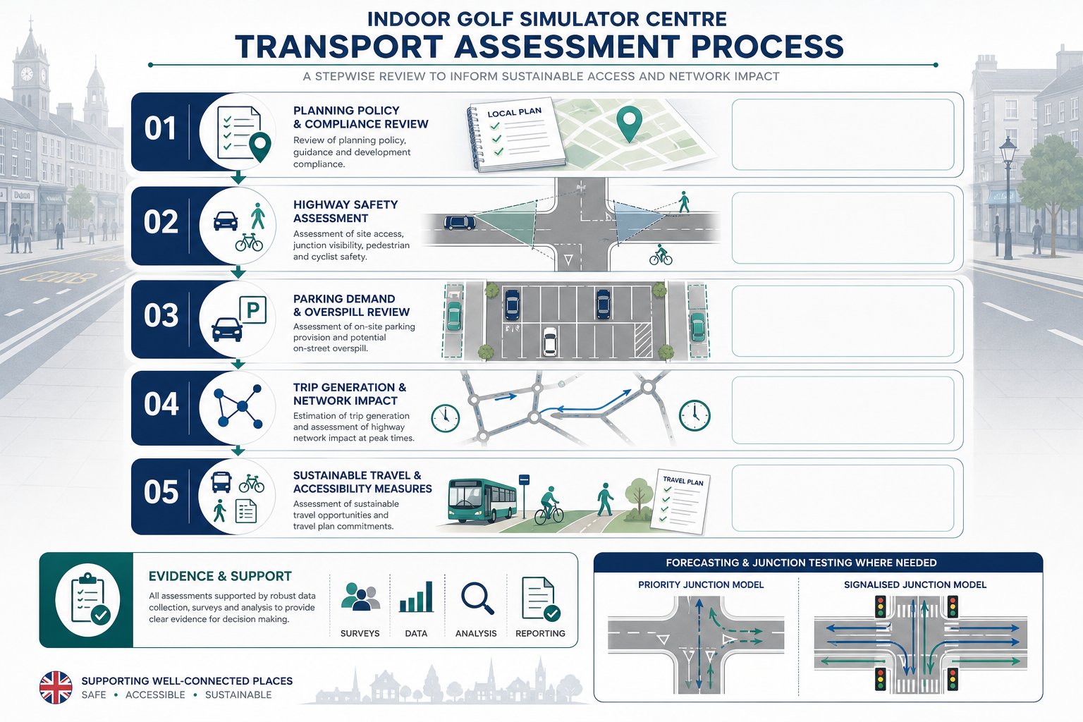
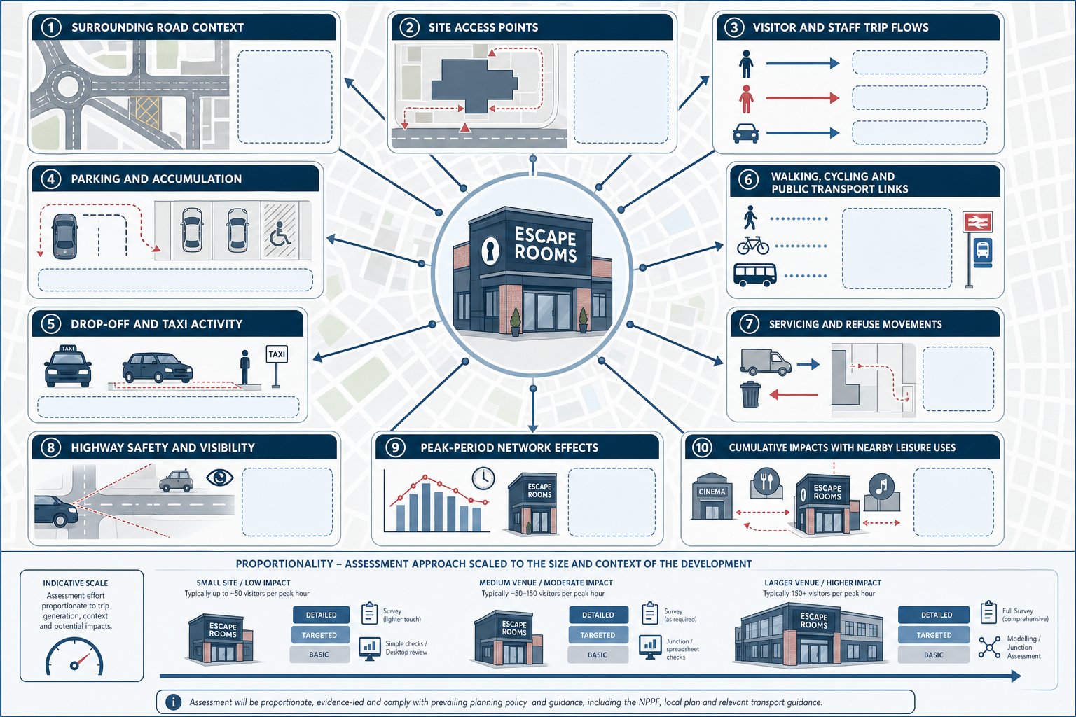
Scope, Surveys, And Evidence Needed For A Robust Submission
A robust submission usually starts with the right scope, agreed early where possible with the local planning and highway authority. That sounds obvious, but many weak reports are not badly written: they are simply under-scoped.
For high street fast food schemes, evidence commonly includes classified turning counts, pedestrian and cycle flows, parking beat surveys, frontage observations, delivery activity logs and collision data review. Survey timing matters. Counts taken outside the relevant lunch, school release or evening collection periods can miss the very behaviour under scrutiny.
Comparable site surveys are often useful, particularly where the operator format is similar and local evidence is thin. But comparables need to be genuinely comparable in context, opening hours, delivery model and town centre accessibility. Otherwise, they create more questions than they answer.
Submissions may also need junction modelling, swept-path analysis for servicing, tracking of refuse vehicles, accessibility mapping and a framework Travel Plan. On cumulative schemes or sensitive urban locations, interaction with wider strategy documents can be important too.
The strongest reports do something else well: they explain uncertainty honestly. If rider demand is still emerging, say so and test a sensible range. If kerbside use varies by day, show the observation basis. That level of candour usually carries more weight with officers than false precision.
From our side, concise evidence tends to be more persuasive than bulky appendices. Decision-makers want enough data to trust the conclusion, not a mountain of tables with no operational narrative.
Common Reasons High Street Fast Food Transport Assessments Are Challenged
Most challenged assessments fail in familiar ways. The first is underestimating trip generation by relying on generic land-use rates without adjusting for local trading patterns, app-based collection or evening peaks. A report may be technically formatted, yet still feel detached from how the unit will actually operate.
The second is ignoring kerbside reality. Authorities quickly spot when a submission assumes deliveries will use a bay that is usually full, or when customer pick-up is treated as negligible even though obvious frontage pressure. If the highway officer can stand outside the site for twenty minutes and disprove the assumptions, the report loses credibility fast.
Another common weakness is incomplete safety analysis. That might mean failing to review collision records properly, overlooking visibility constraints caused by parked vehicles, or not testing the nearest stressed junction because the red line boundary sits a little farther away. Boundaries on plans do not define the real impact area.
Assessments are also challenged when mitigation is vague. Phrases such as “deliveries will be managed” or “staff will discourage illegal parking” are not enough on their own. Authorities want practical, enforceable measures linked to the actual street.
Finally, some reports simply overcomplicate simple points and under-explain the critical ones. A good Fast Food Restaurants on High Street Transport Assessment should be technically sound, but also readable by planners, councillors and objectors. If the logic is not transparent, confidence drops, and objections rise.
Conclusion
A high street fast food proposal can succeed in planning terms, but only when the transport case reflects real operation rather than generic assumptions. In 2026, councils and highway authorities are rightly focusing on the things that shape everyday street performance: peaky demand, rider activity, loading practicality, parking stress, frontage safety and sustainable access.
For planners, architects, developers and legal teams, the lesson is straightforward. Scope early. Survey the right periods. Test kerbside behaviour honestly. And make mitigation practical, specific and proportionate to the street.
When that is done well, a transport assessment becomes more than a technical submission. It becomes the document that shows the use can function safely, fit its urban context and withstand scrutiny during determination. That is usually what makes the difference between a scheme that stalls in objections and one that moves forward with confidence.
Frequently Asked Questions about Fast Food Restaurants on High Street Transport Assessments
Why is a transport assessment important for fast food restaurants on high streets?
A transport assessment is crucial because fast food units generate intense, peaky trip activity and kerbside loading that can impact safety and traffic flow. It ensures the proposal operates safely within the urban context and identifies necessary mitigation measures to make transport effects acceptable.
When does a high street fast food restaurant typically require a transport assessment?
Transport assessments are often required when trip generation exceeds local thresholds or affects junction performance, particularly on busy high streets, near signalised junctions, schools, or public transport hubs. Extended opening hours or heavy reliance on delivery platforms can also trigger the need.
How does trip generation differ for fast food restaurants in town centre locations versus out-of-centre sites?
Town centre fast food sites usually have lower car-driver trip rates due to higher walking, cycling, and public transport use but exhibit sharper, peaky demand during lunch and evening periods. These temporal spikes can create significant network and kerbside stress despite lower overall trip rates.
What factors are considered regarding delivery and servicing activity in transport assessments?
Assessments consider delivery frequency, vehicle types, dwell times, and timing to evaluate kerbside pressure. They analyse whether loading occurs legally without blocking traffic or pedestrian access, including impacts of refuse collection and app-based delivery riders clustering at the frontage.
How do parking and pick-up/drop-off activities affect transport assessments for high street fast food sites?
These activities generate high short-stay parking demand on already constrained streets, with private-hire and rider waiting often causing kerbside competition and occasional illegal stopping. Assessments evaluate parking turnover, Controlled Parking Zone stress, and potential mitigation like dedicated rider parking and clear protocols.
What role does pedestrian, cycling and public transport accessibility play in these transport assessments?
Authorities require evidence of quality walking routes, safe crossings, step-free access, and secure cycle parking. Public transport proximity and capacity are assessed to ensure sustainable access. Poor pedestrian comfort due to clustered riders, for example, can undermine claims of sustainable location.