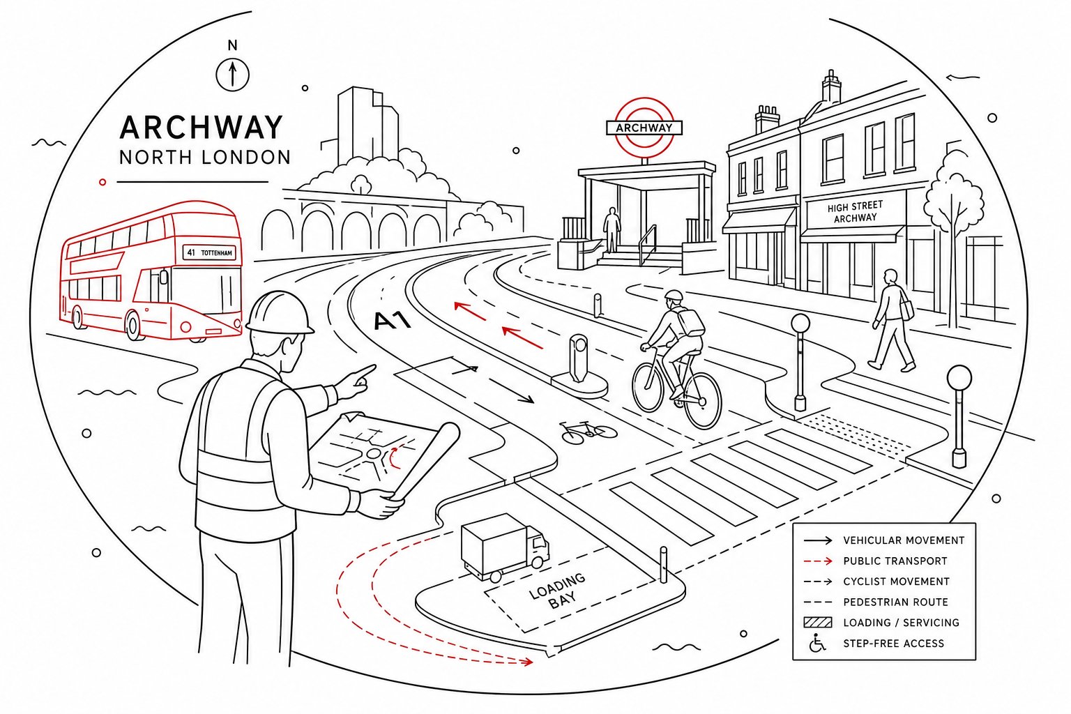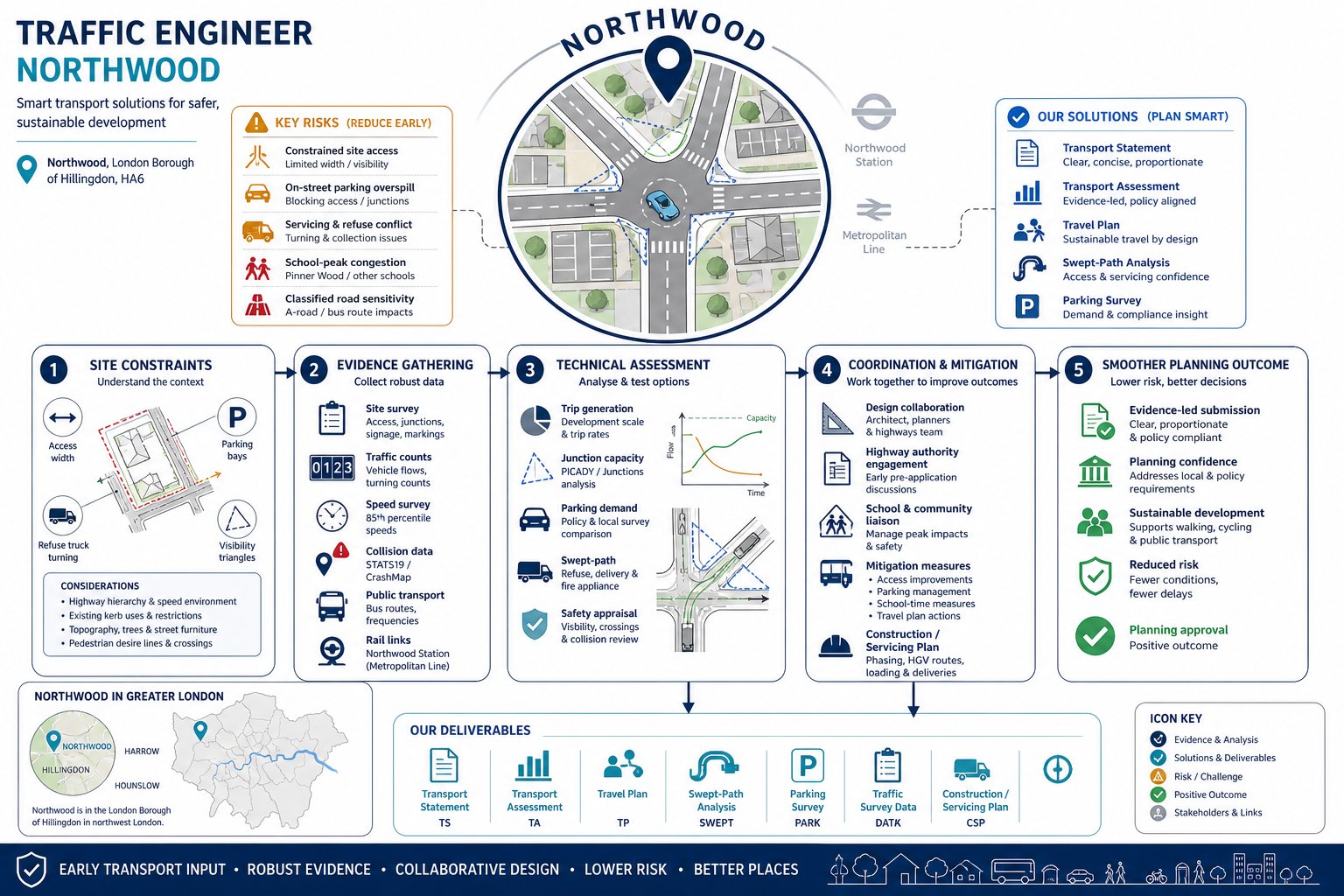
Planning in Northwood rarely falls apart because of one dramatic transport issue. More often, schemes get delayed by a cluster of smaller concerns: a tight access, nervous comments about overspill parking, unclear servicing, school-peak congestion, or a local highway officer asking for evidence that simply was not prepared early enough. That is where a traffic engineer in Northwood becomes genuinely useful.
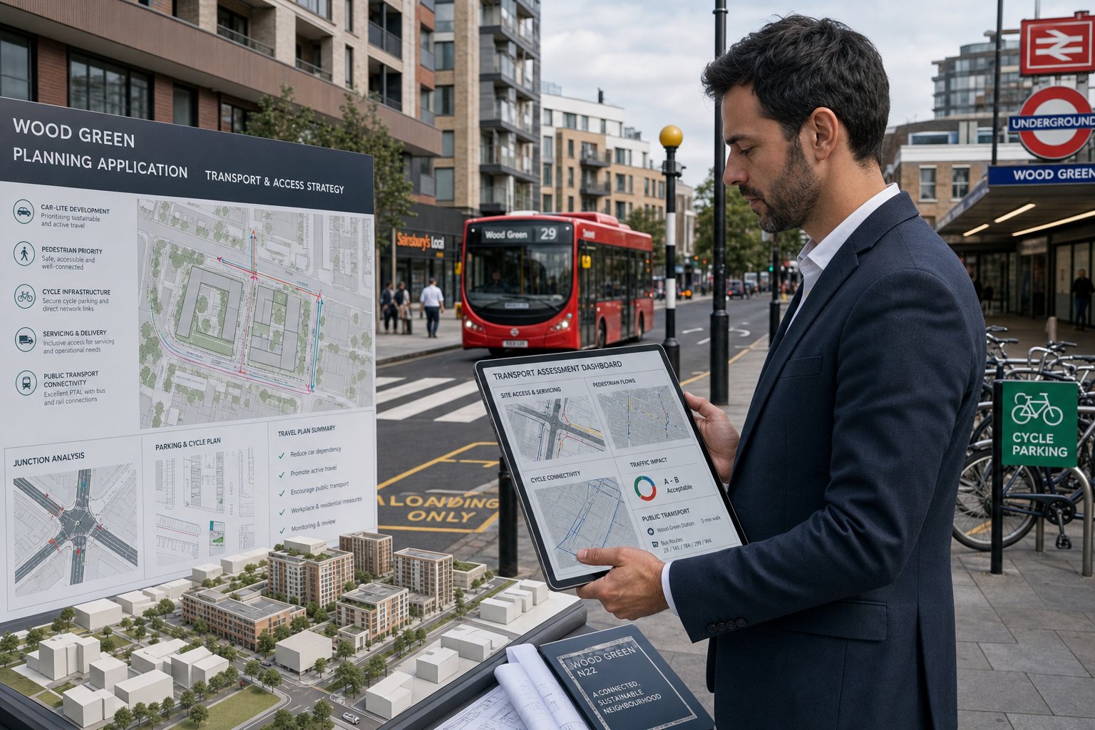
We work at the point where design, policy and real-world street conditions meet. For architects, planners, developers, surveyors and councils, that means turning transport risk into something measurable and manageable before an application is determined. In practice, we assess how a proposal will function, whether it aligns with local and London-wide standards, and what level of reporting is needed to keep the planning process moving.
Northwood has its own mix of suburban sensitivity and strategic transport context. Residential streets can be highly sensitive to parking pressure. Accessibility to the Metropolitan line and bus services can support lower-car approaches in some locations, but not automatically. And if a site sits near a school, parade, junction or classified road, the burden of proof usually rises.
In this guide, we explain what a traffic engineer in Northwood does, when transport input is needed, which reports are commonly requested, and how early coordination can materially improve the odds of a smoother planning outcome in 2026.
Key Takeaways
- A traffic engineer in Northwood ensures planning applications address local transport risks early, making schemes safer and compliant with policies.
- Early traffic engineering input can prevent delays by resolving access, parking, servicing, and visibility issues before submission.
- Transport reports like Transport Statements or Assessments must be tailored to the development’s scale and local sensitivity for effective planning support.
- Robust, timely traffic surveys and local data underpin convincing transport evidence to counter objections and satisfy highway authorities.
- Collaboration between traffic engineers, architects, planners, and councils leads to practical, workable designs and smoother planning approvals.
- Choosing a traffic engineer familiar with Northwood’s policies and conditions ensures clear, focused advice that balances technical detail with planning priorities.
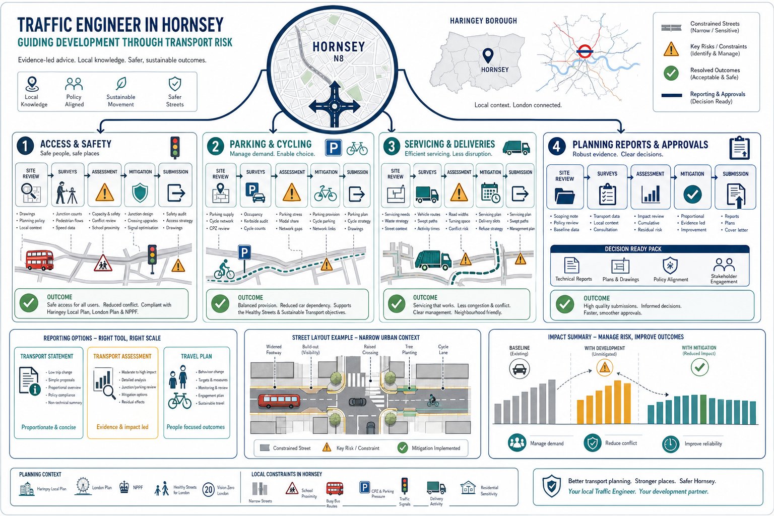
What A Traffic Engineer In Northwood Does For Planning Applications
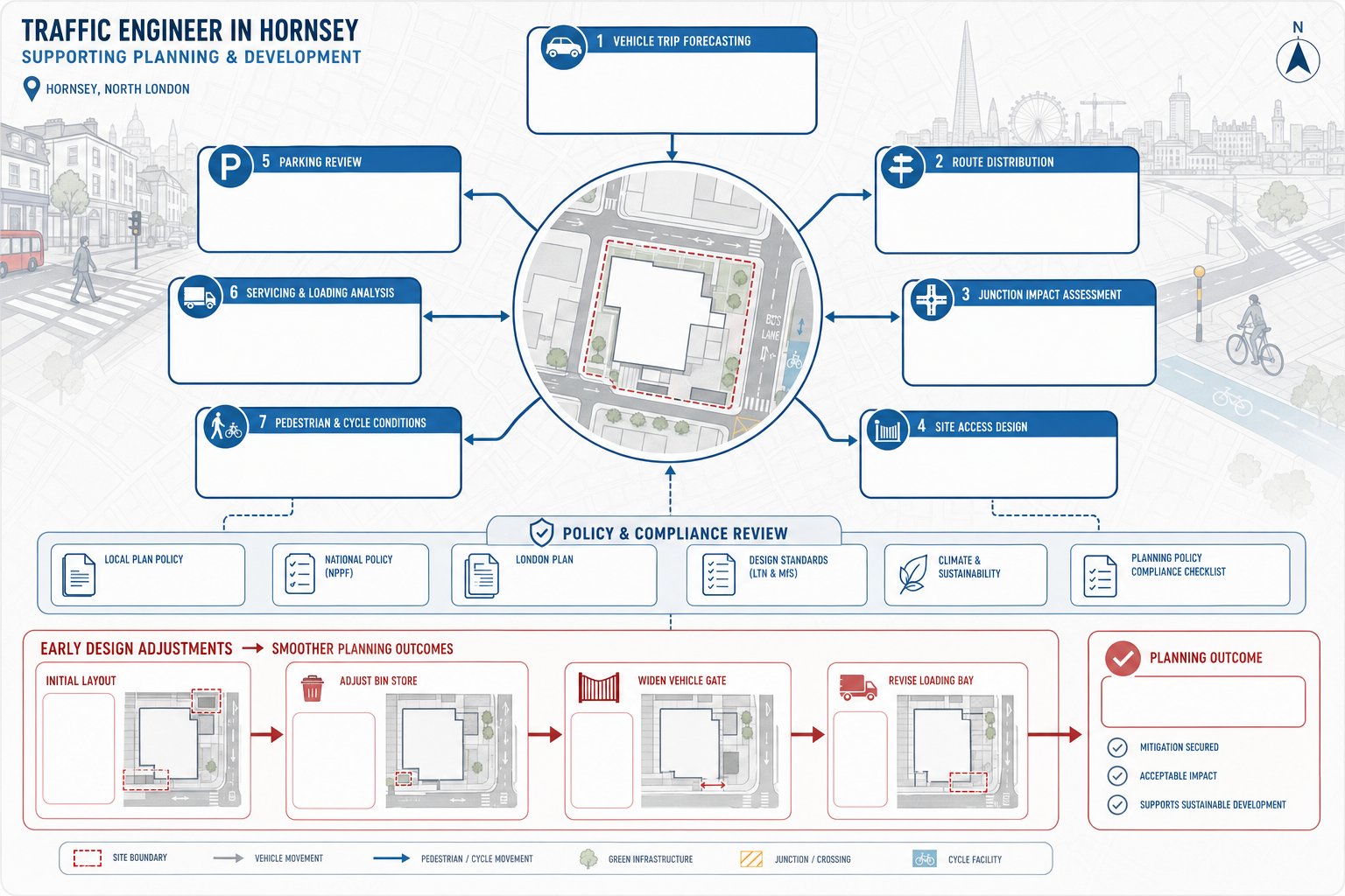
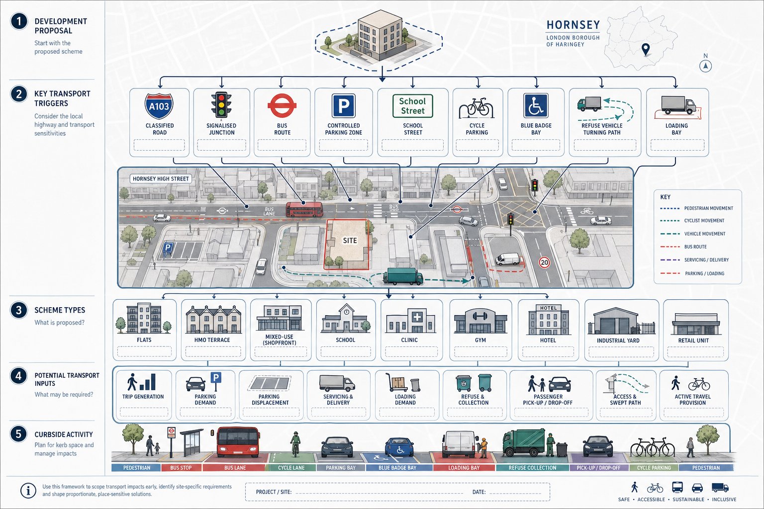
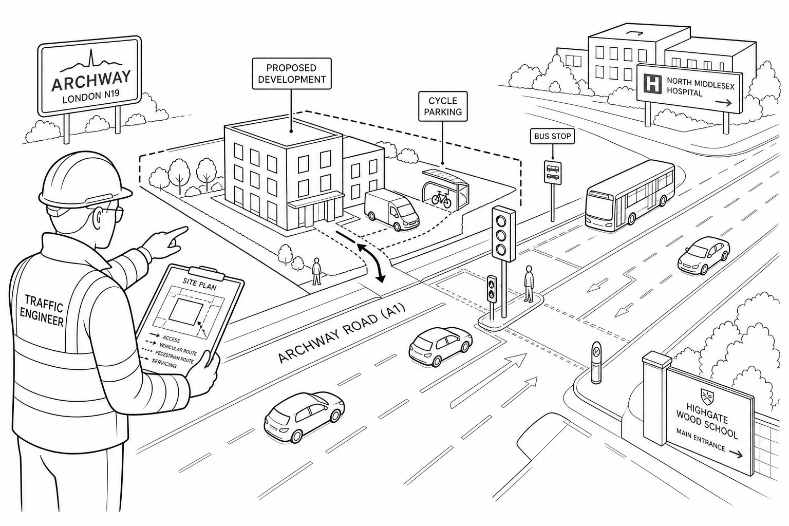
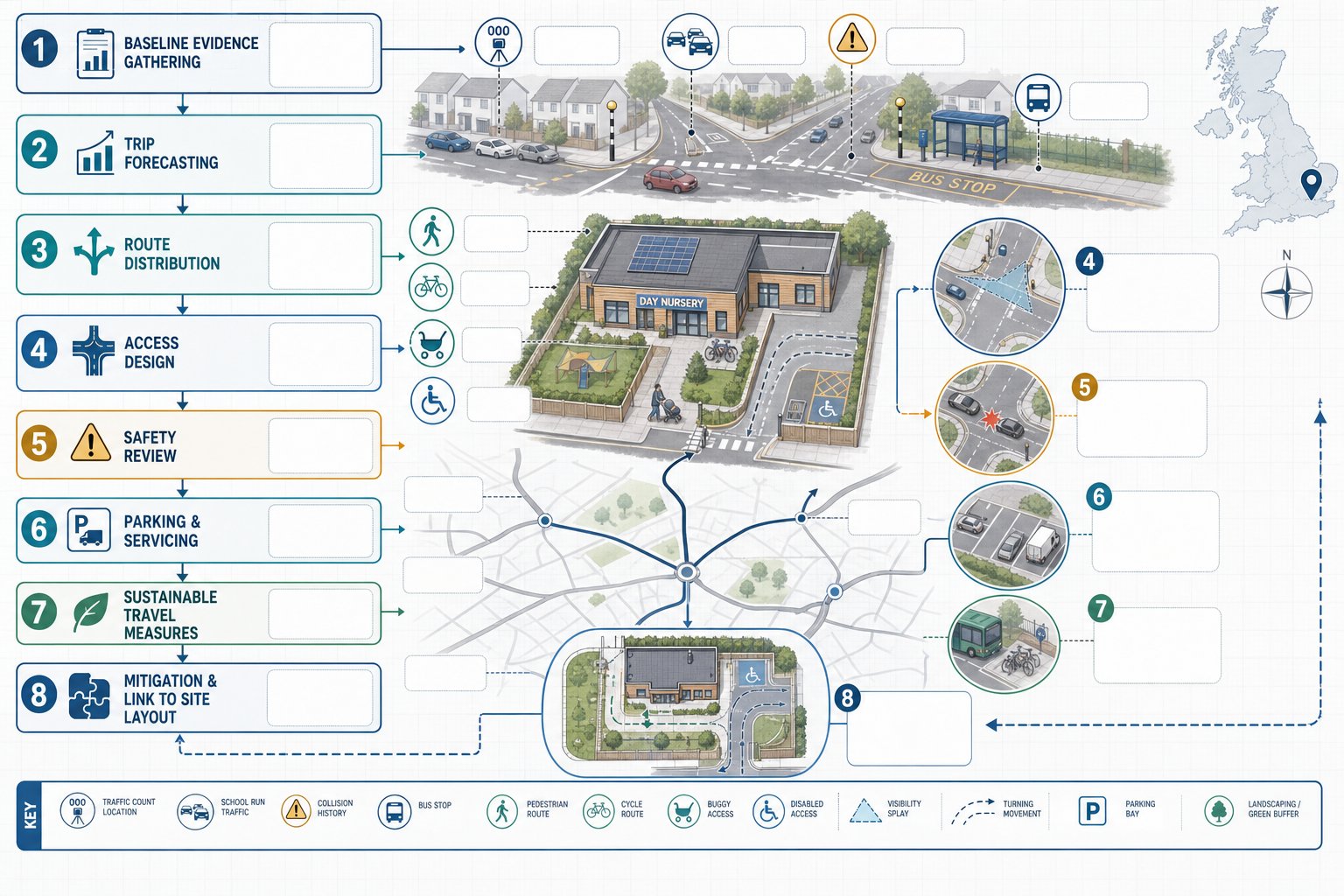
A traffic engineer in Northwood provides technical transport and highways advice that helps planning applications stand up to scrutiny. At a basic level, we review how people, vehicles, deliveries, refuse trucks and emergency services will reach and use a site. But the real value is rarely just producing a report. It is identifying planning risk early enough to fix it.
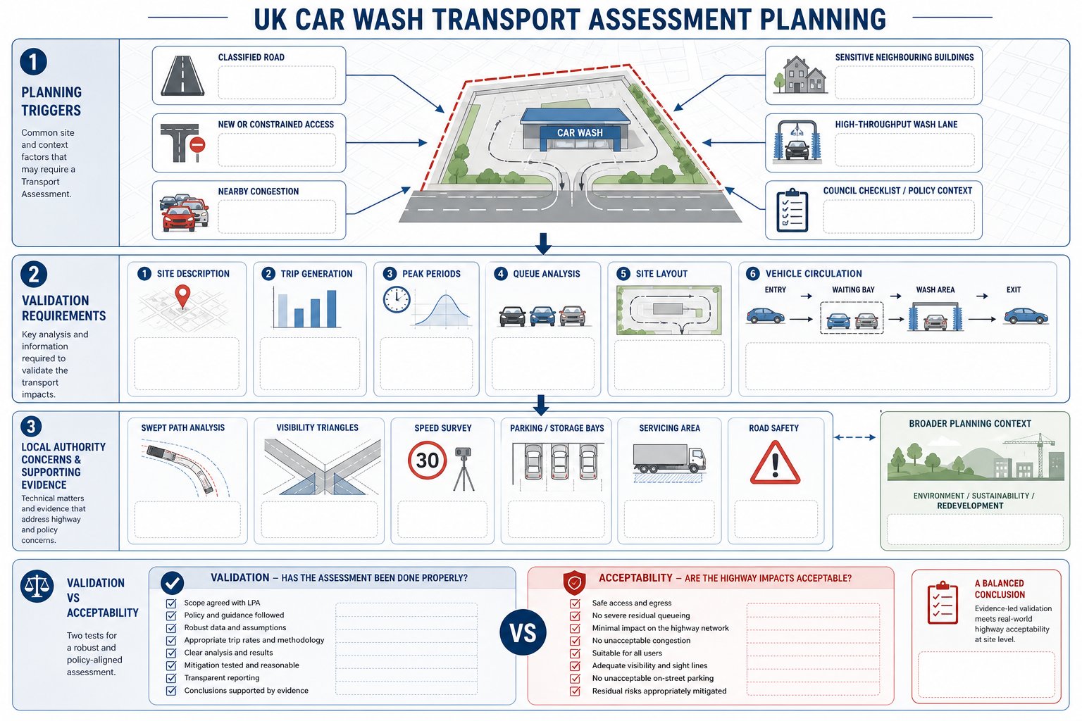
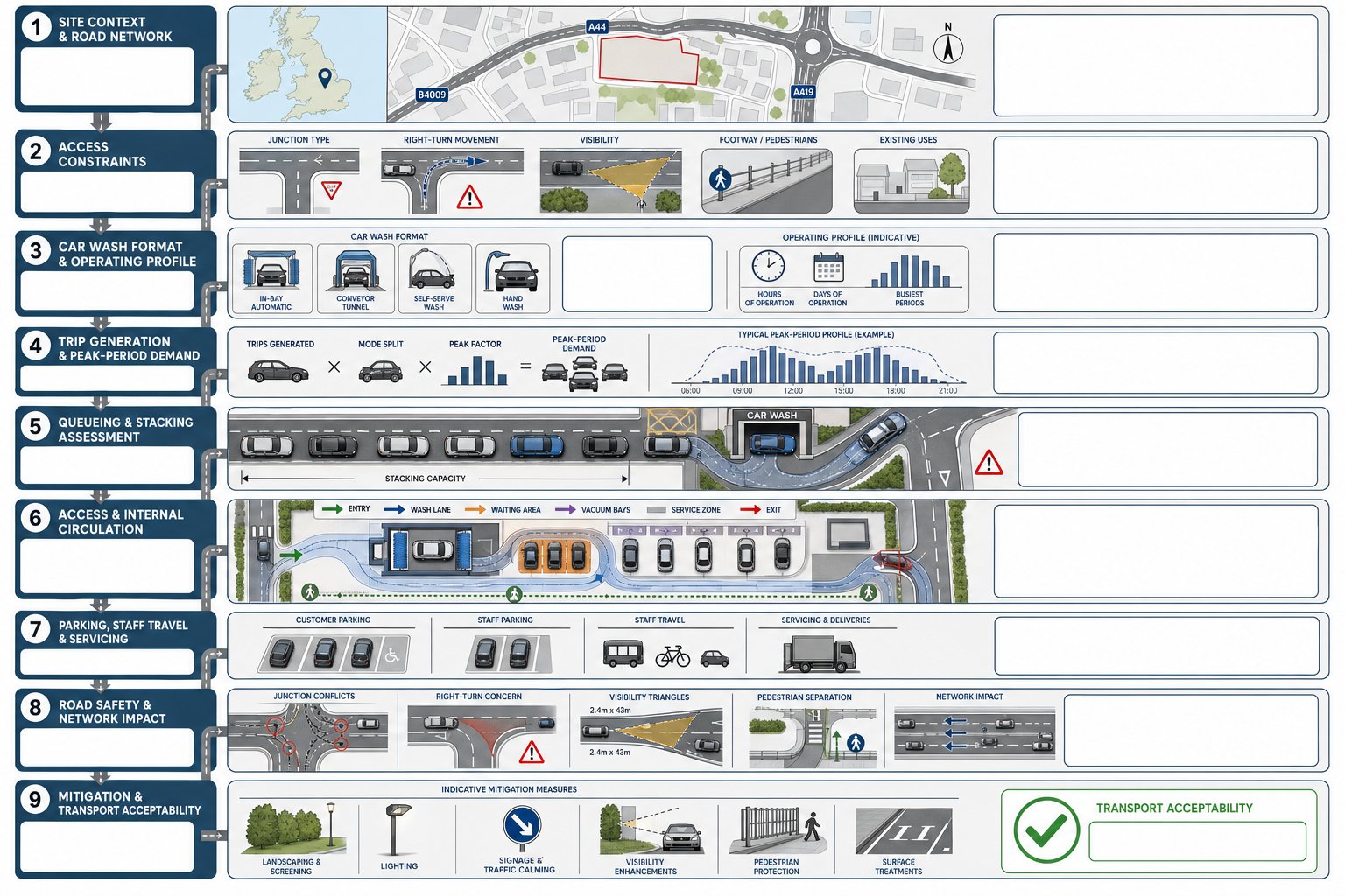
That usually starts with access geometry, parking layout, servicing practicality, turning movements, visibility splays, cycle provision and likely trip generation. We then compare those findings against local policy, London Plan expectations, highway design standards and the likely concerns of the planning and highway authority. A modest residential infill scheme may need only a concise statement. A more sensitive site may need surveys, mitigation and detailed justification.
We also act as translators between disciplines. Architects may produce an elegant layout that needs small changes to achieve compliant vehicle tracking. Planners may need a transport narrative that aligns with policy wording. Developers want to know whether a transport objection is a fatal issue or simply something that needs evidence. That coordination role is often as important as the technical analysis.
For project teams operating across regions, the same principles that apply in Northwood often sit within a wider planning framework discussed in Traffic Engineering Consultants: and broader urban authority experience such as Traffic Engineer In London:. In short, our job is to produce robust evidence, reduce avoidable objections and help a scheme look safe, workable and policy-compliant.
When Traffic Engineering Input Is Needed For Northwood Developments
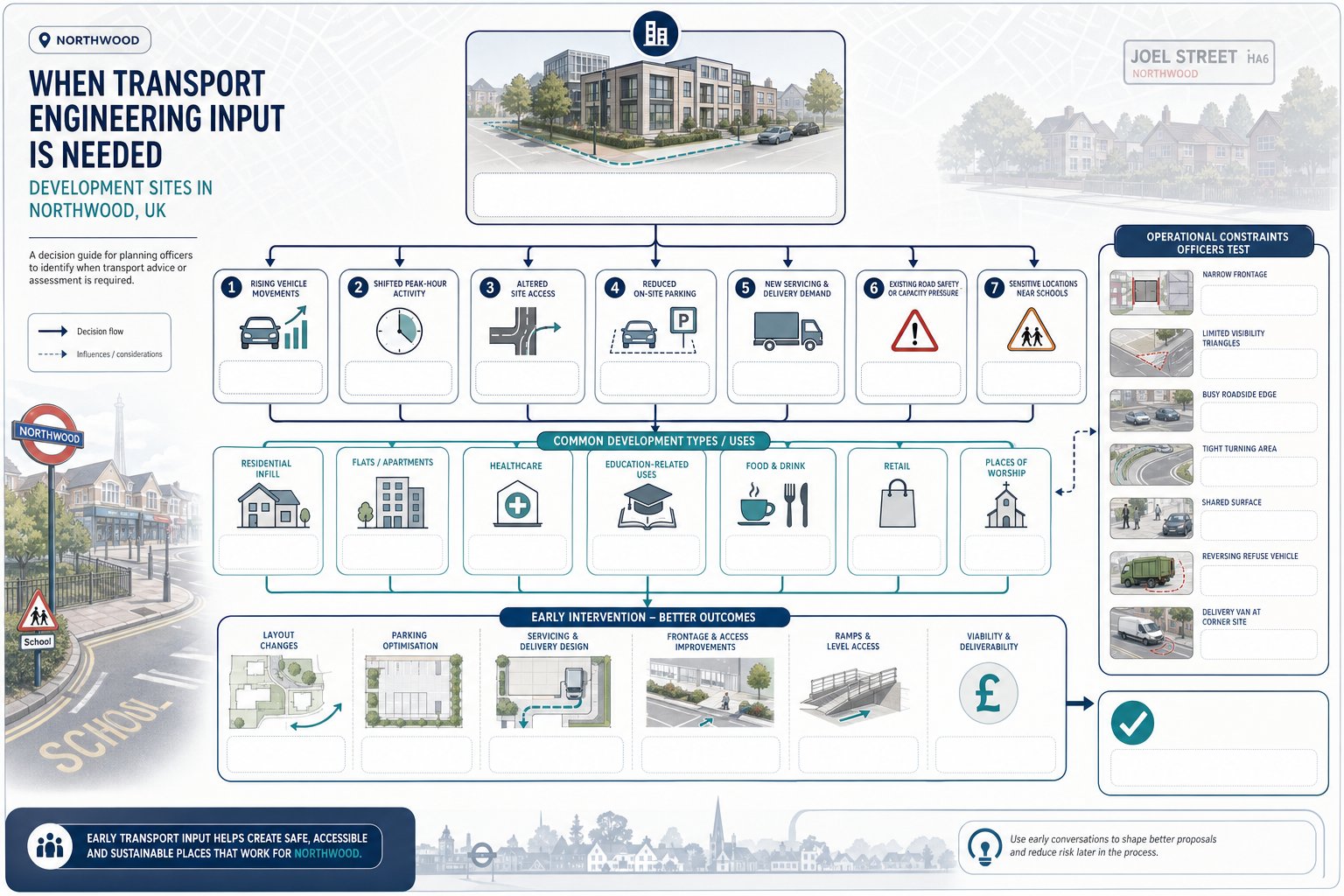
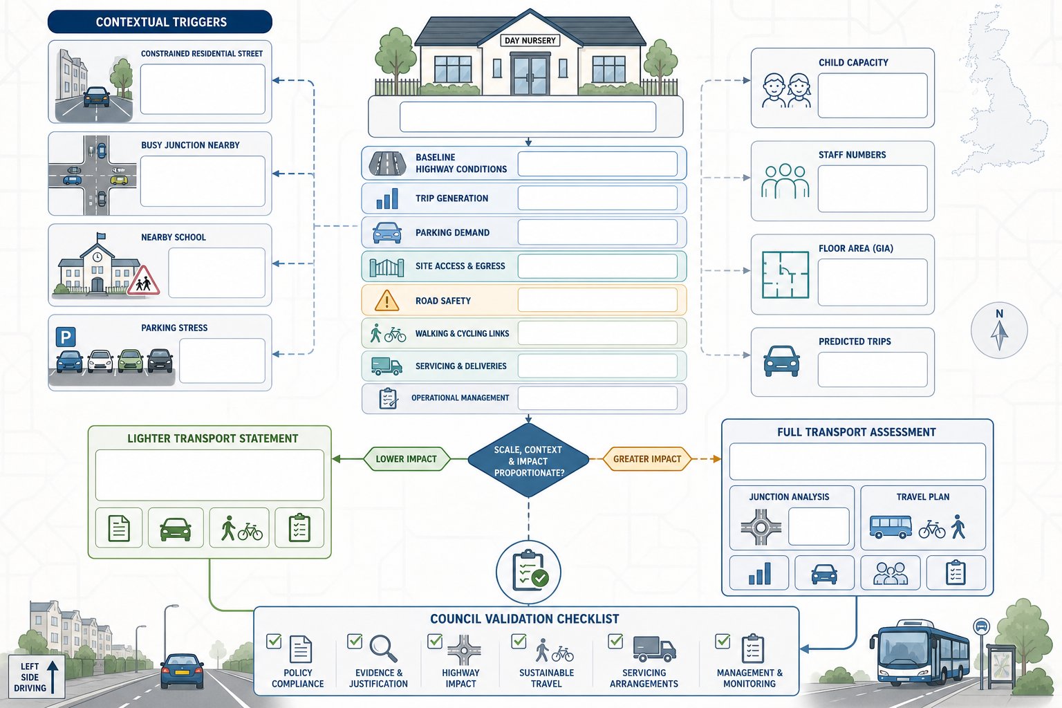
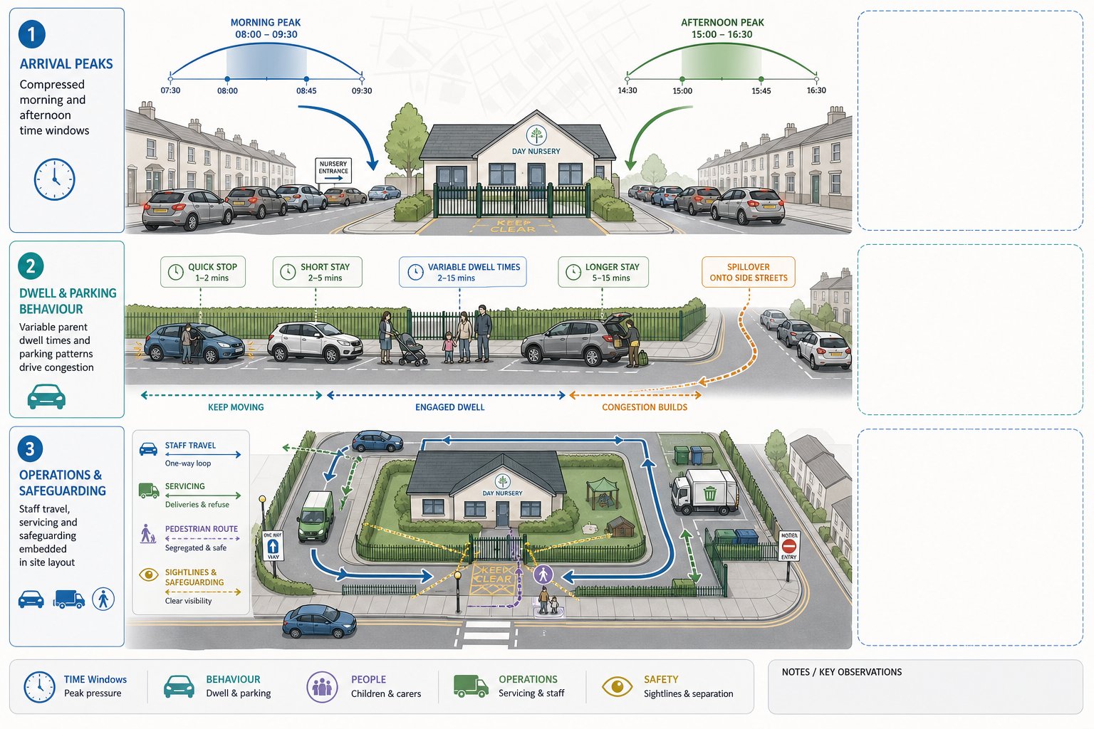
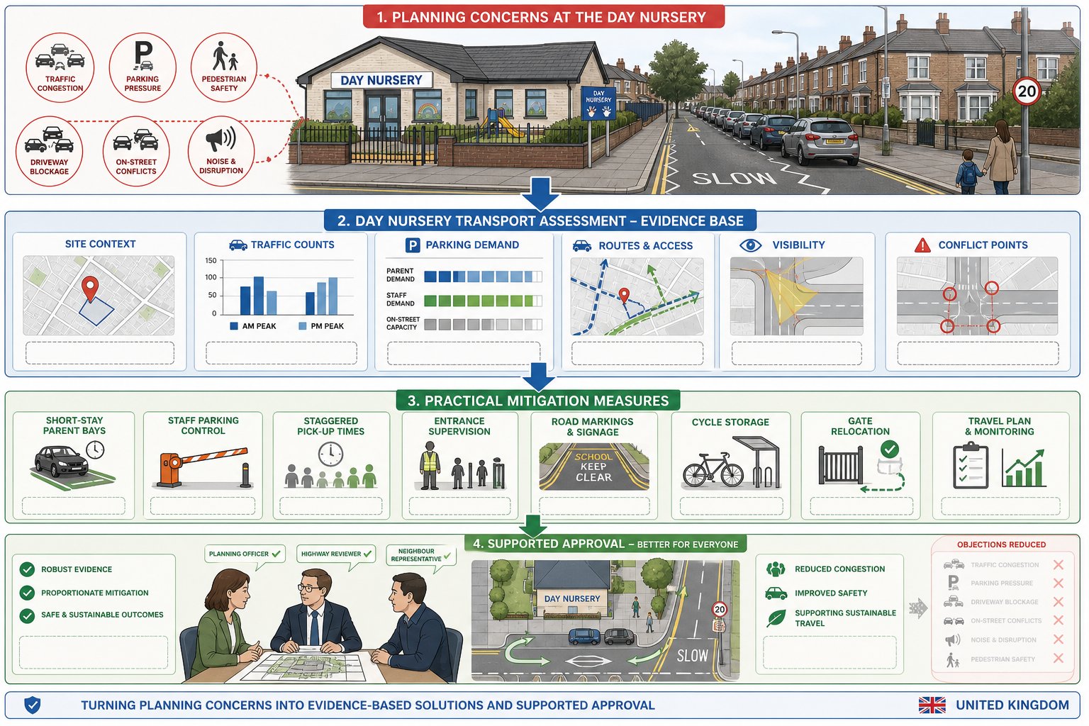
Transport input is not reserved for major schemes. In Northwood, relatively small developments can trigger meaningful highway questions if they increase trips, intensify use or rely on constrained access arrangements. Change-of-use proposals are a common example. A building that functioned quietly as an office may create very different arrival patterns as a nursery, clinic, café or place of worship.
We are usually brought in when a proposal does one or more of the following: increases vehicle movements, changes peak-hour behaviour, alters access, reduces on-site parking, introduces servicing demand, or sits on a road where safety and capacity are already live issues. Sites near schools deserve particular care because objections often focus on drop-off chaos rather than technical trip totals.
Early advice matters because transport issues can affect layout, unit numbers, refuse strategy, basement ramps, frontage treatment and viability. If those questions are left until submission week, the result is often a reactive report trying to defend a design that should have evolved sooner.
That is especially true for mixed or business-led schemes, where trip profiles and servicing expectations can be nuanced, as explored in Commercial Traffic Engineering. A good rule of thumb: if transport could become a reason for refusal, a condition that alters viability, or a source of local objection, bring a traffic engineer in before the planning package is fixed.
Common Project Types That Require Transport Advice
In Northwood, the most common instructions come from residential infill developments, small blocks of flats, extensions that intensify occupation, healthcare uses, education-related sites, food-and-drink premises and local retail proposals. Places of worship can also require careful assessment because activity patterns may be concentrated at specific times rather than evenly spread.
We also regularly advise on schemes with awkward constraints rather than obvious scale: narrow frontages, substandard visibility, shared surfaces, limited turning space, or sites fronting busy roads. Even a relatively small proposal can attract a request for a Transport Statement if neighbours raise concerns about parking stress or if the council expects a clearer explanation of traffic effects.
Another common trigger is a proposal that looks simple on plan but is operationally messy. Think of a corner site where deliveries must occur without blocking a footway, or a residential scheme where refuse collection depends on a vehicle reversing too far. These are not abstract design points. They are exactly the details highway officers test.
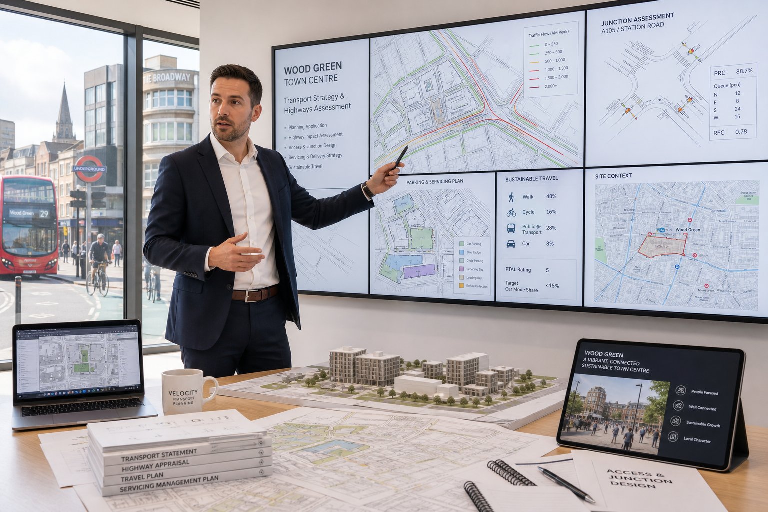
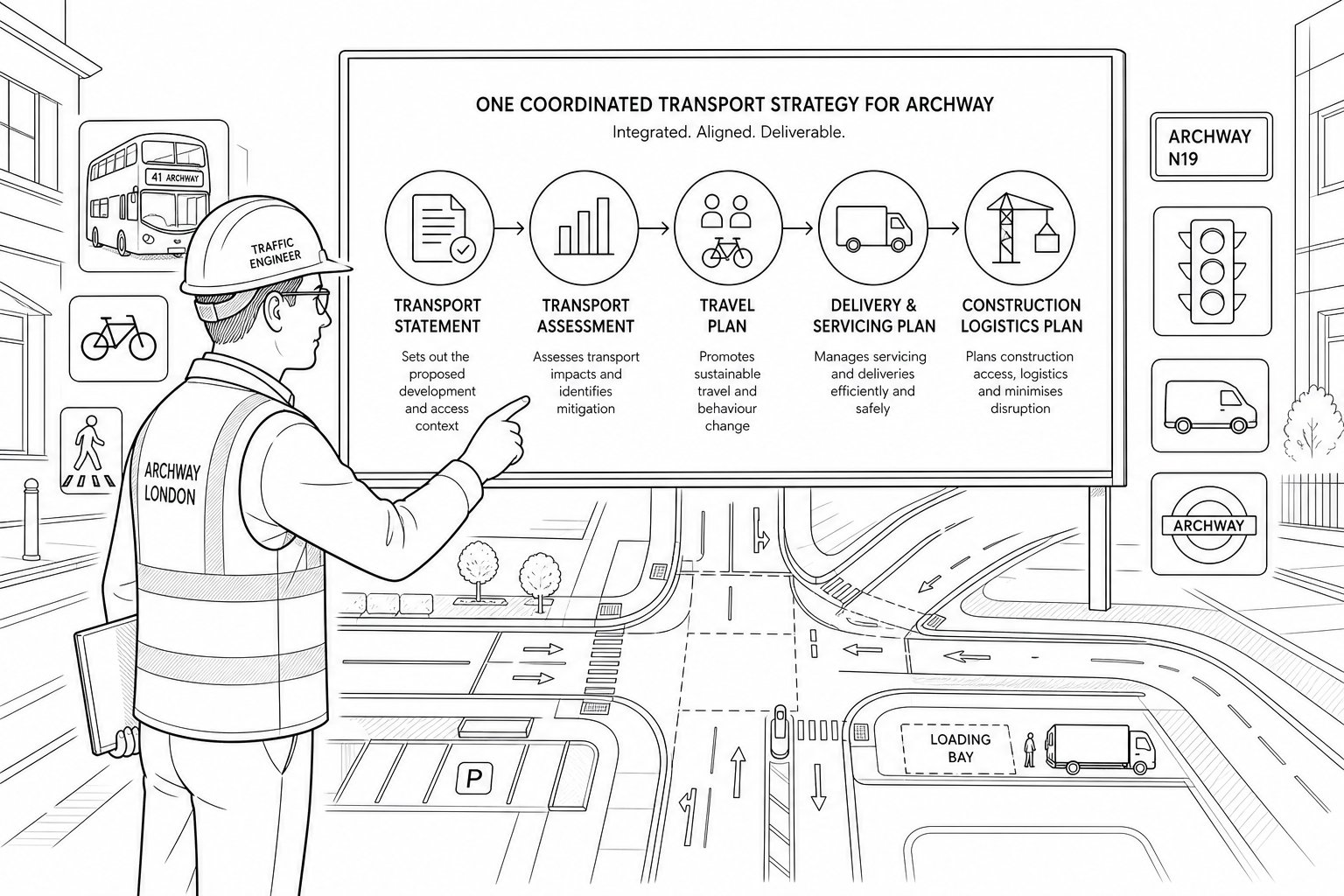
Key Transport Reports Often Requested By Local Planning Authorities
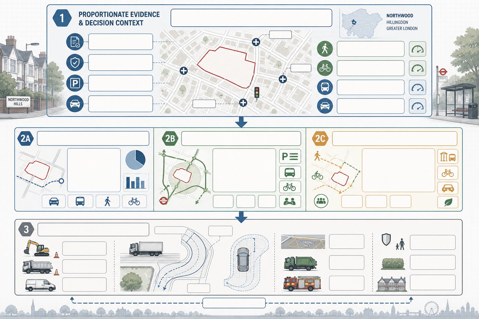
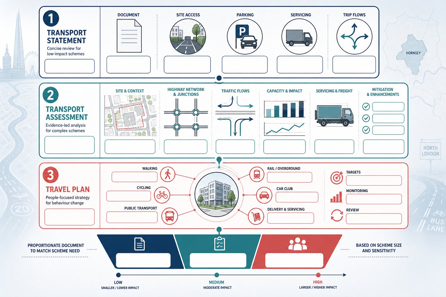
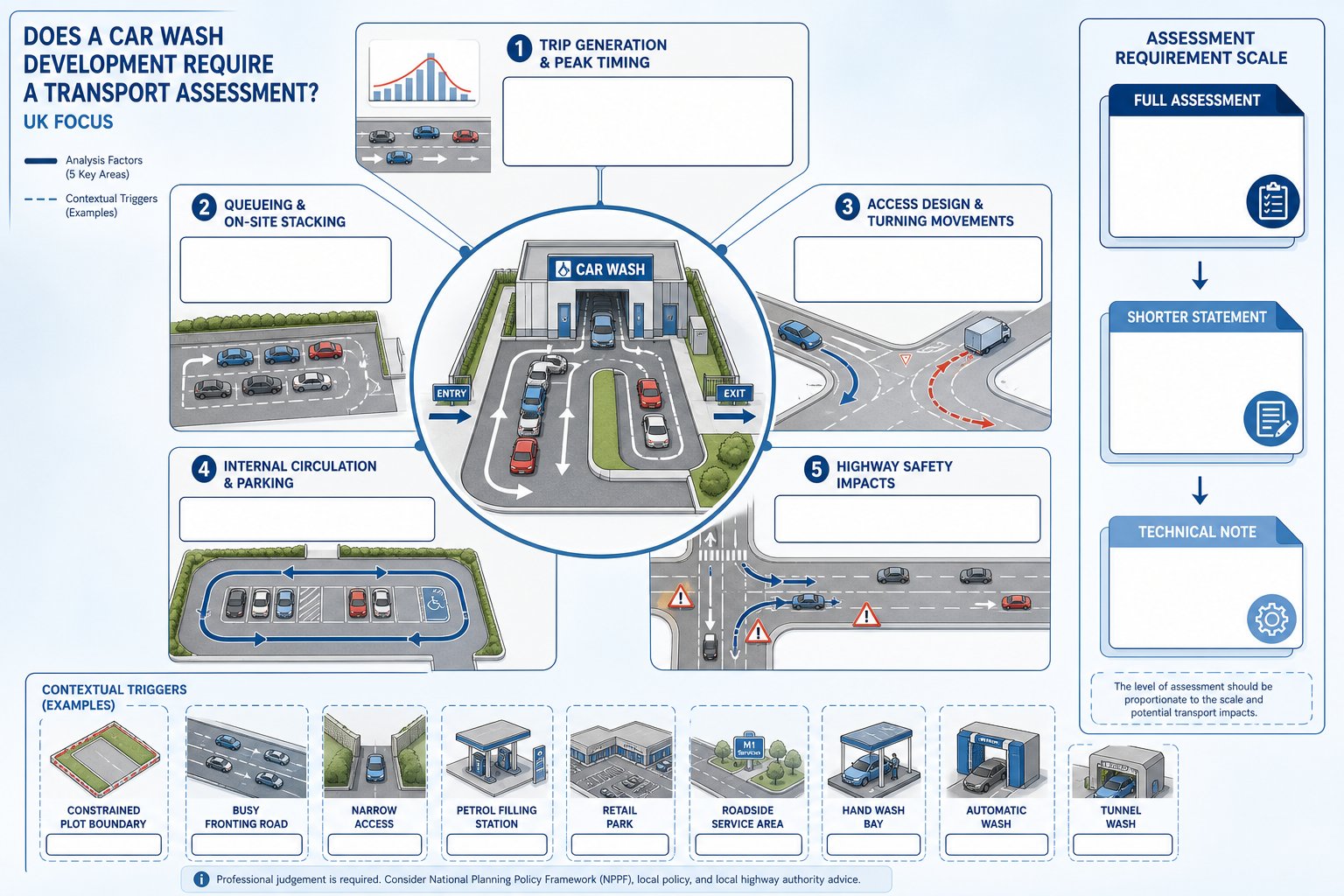
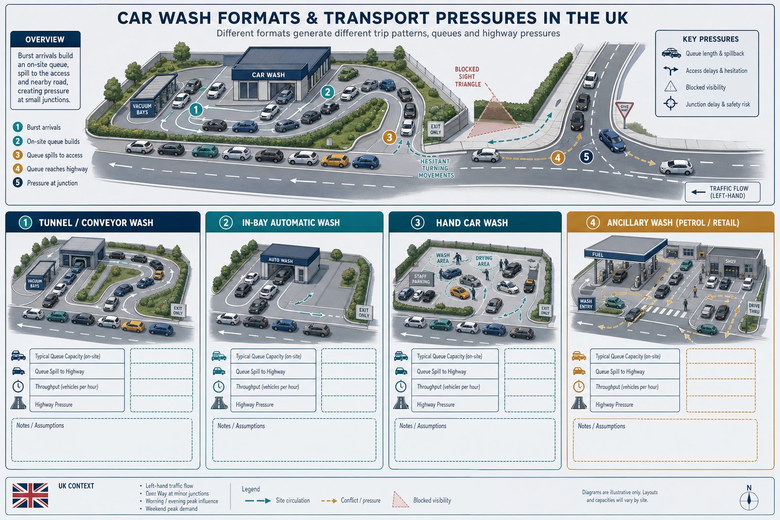
Local planning authorities typically want transport evidence that is proportionate to the scale and sensitivity of the proposal. The mistake we still see is assuming that “small” means “no report needed”. In reality, report type depends on impact, context and policy concern.
A concise, well-scoped report can be enough where effects are limited and access is straightforward. But where there are capacity questions, vulnerable road user concerns, servicing constraints or notable parking impacts, authorities generally expect more than a few transport paragraphs in a planning statement. They want technical evidence that can be reviewed by highway officers.
Our role is to recommend the right package early. That may include a Transport Statement, a fuller Transport Assessment, a Travel Plan, an access note, swept-path analysis, parking surveys, or construction and servicing documentation. The package should answer likely questions before they are asked. That sounds obvious, but it is often the difference between a clean consultation response and several rounds of avoidable queries.
For teams comparing expectations in different authorities, approaches described in Traffic Engineer In Birmingham: and Traffic Engineer In Leeds: show how thresholds may vary while the core discipline stays the same.
Transport Statements, Transport Assessments, And Travel Plans
A Transport Statement (TS) is usually prepared for developments with limited to moderate transport effects. It explains existing site conditions, access arrangements, parking, likely trip generation, servicing and any local impacts. In many Northwood applications, a TS is the right tool when the issue is not severe congestion but the need to demonstrate that a scheme is sensible and safe.
A Transport Assessment (TA) is broader and more analytical. It is commonly required for larger, more sensitive or potentially contentious schemes. A TA may include junction assessments, a more detailed review of sustainable access, survey-led baseline conditions and a clearer mitigation strategy.
A Travel Plan (TP) focuses on behavioural measures that reduce reliance on the private car. For residential schemes, that might mean cycle parking, travel information packs and car club measures. For schools or workplaces, it may involve mode-share targets, monitoring and appointed coordinators. In London contexts, Travel Plans can carry real weight because they connect site design to policy objectives around sustainable movement.
Supporting Documents Such As Construction And Servicing Reviews
Supporting transport documents are often where practical credibility is won or lost. A planning officer may accept the principle of development, yet highway concerns can remain around how the site will actually operate during construction and occupation.
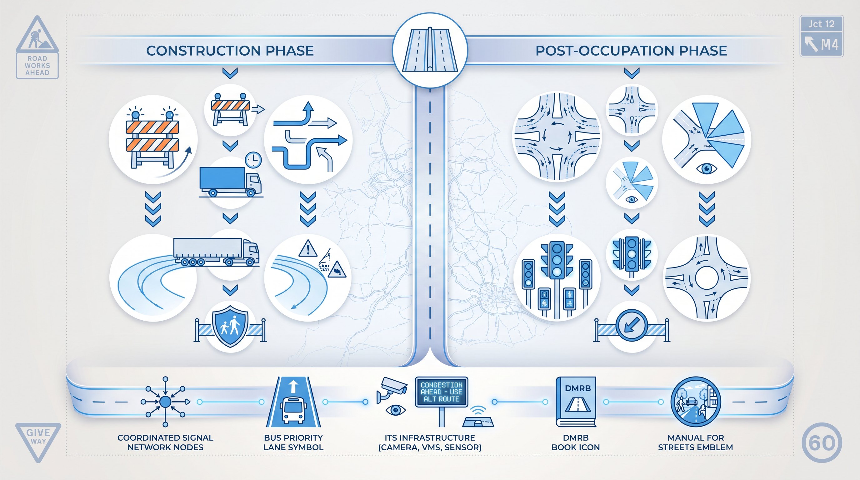
A Construction Traffic Management Plan or Construction Logistics Plan can set out routing, delivery timing, contractor parking controls, wheel washing, banksman arrangements and measures to protect pedestrians and neighbours. On tighter urban or suburban sites, this is not box-ticking. It reassures the authority that the build process itself will be manageable.
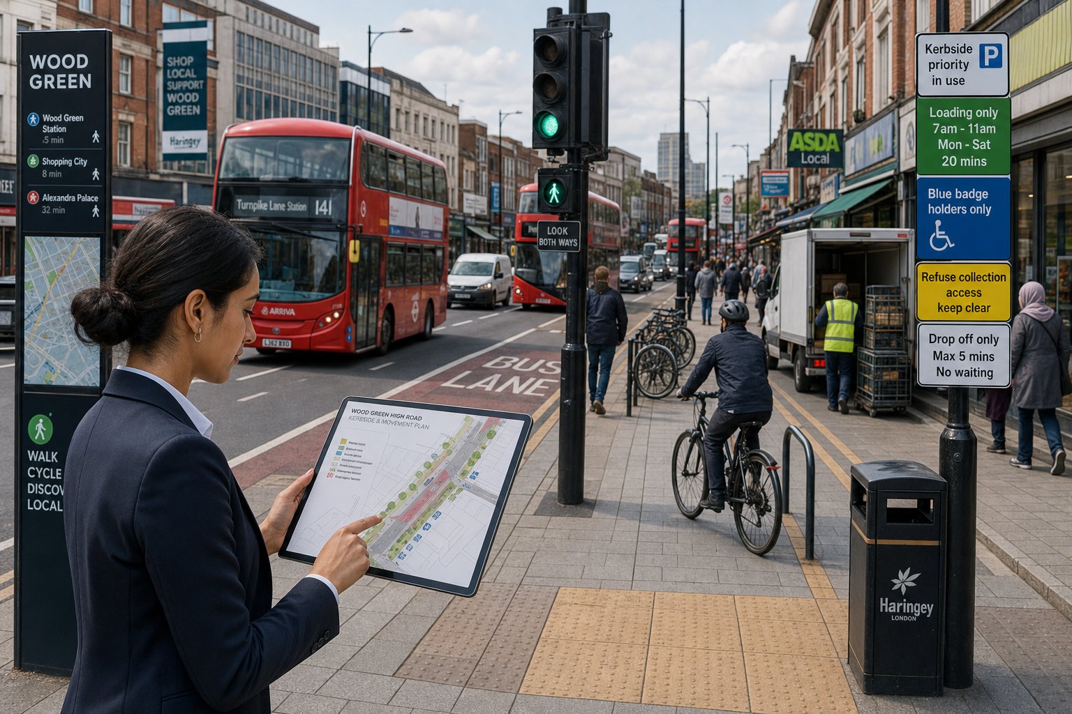
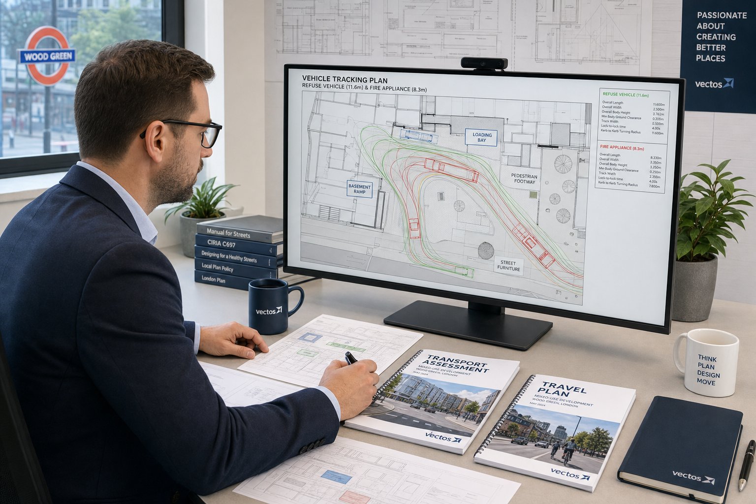
A Servicing and Delivery Management Plan is useful where deliveries are frequent, spaces are limited or kerbside activity could conflict with residents and through traffic. We also prepare swept-path analysis to demonstrate that refuse vehicles, vans and emergency vehicles can enter, turn and exit safely.
In many cases, these supporting documents resolve the “yes, but how?” questions that otherwise linger into determination or condition discharge.
Northwood Planning And Highway Considerations That Can Affect A Scheme
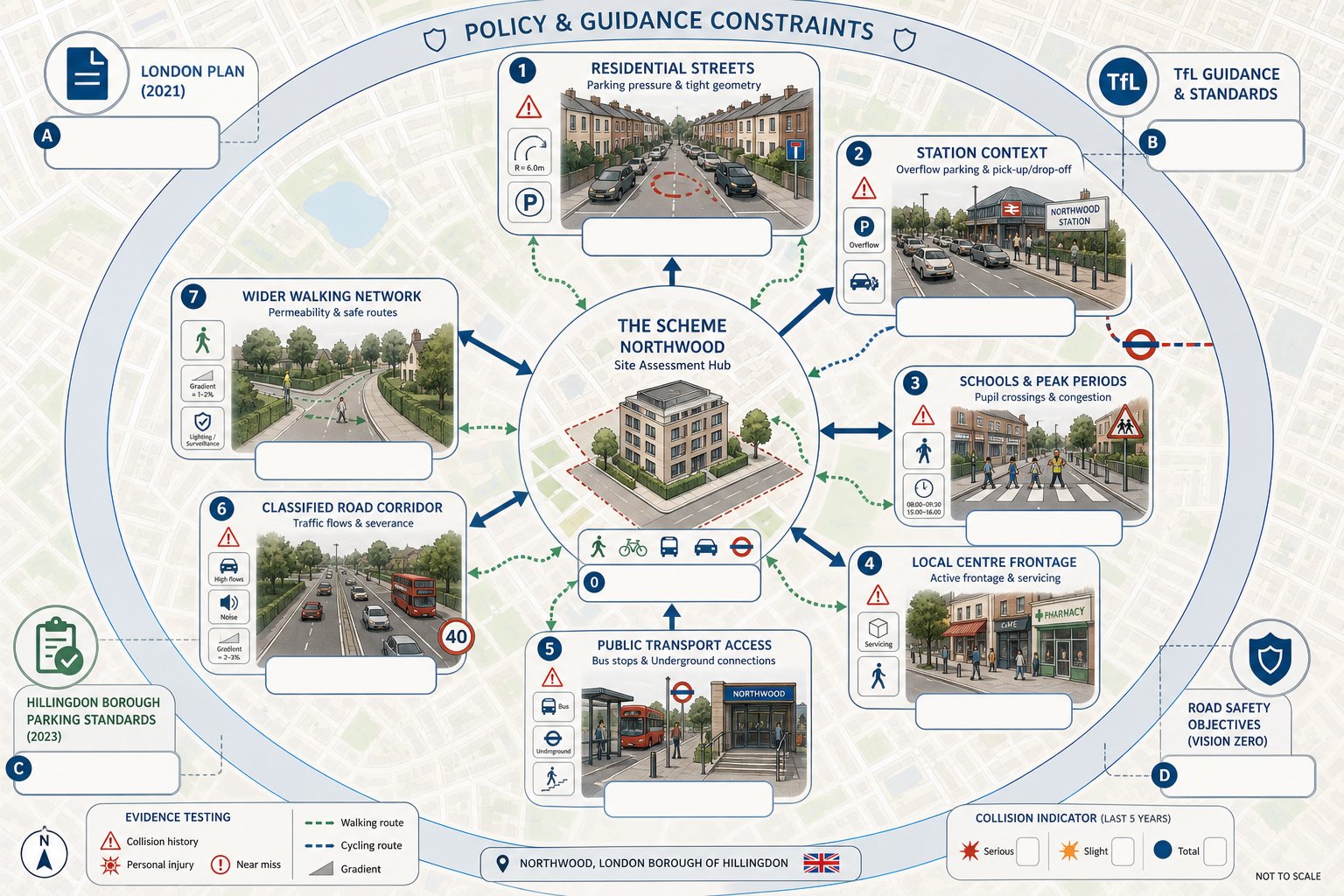
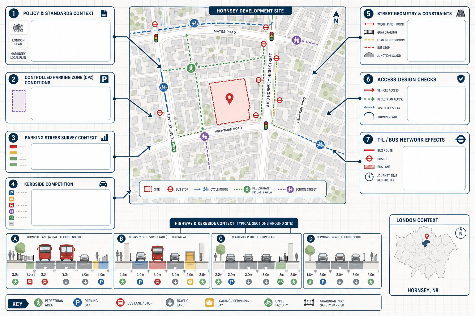
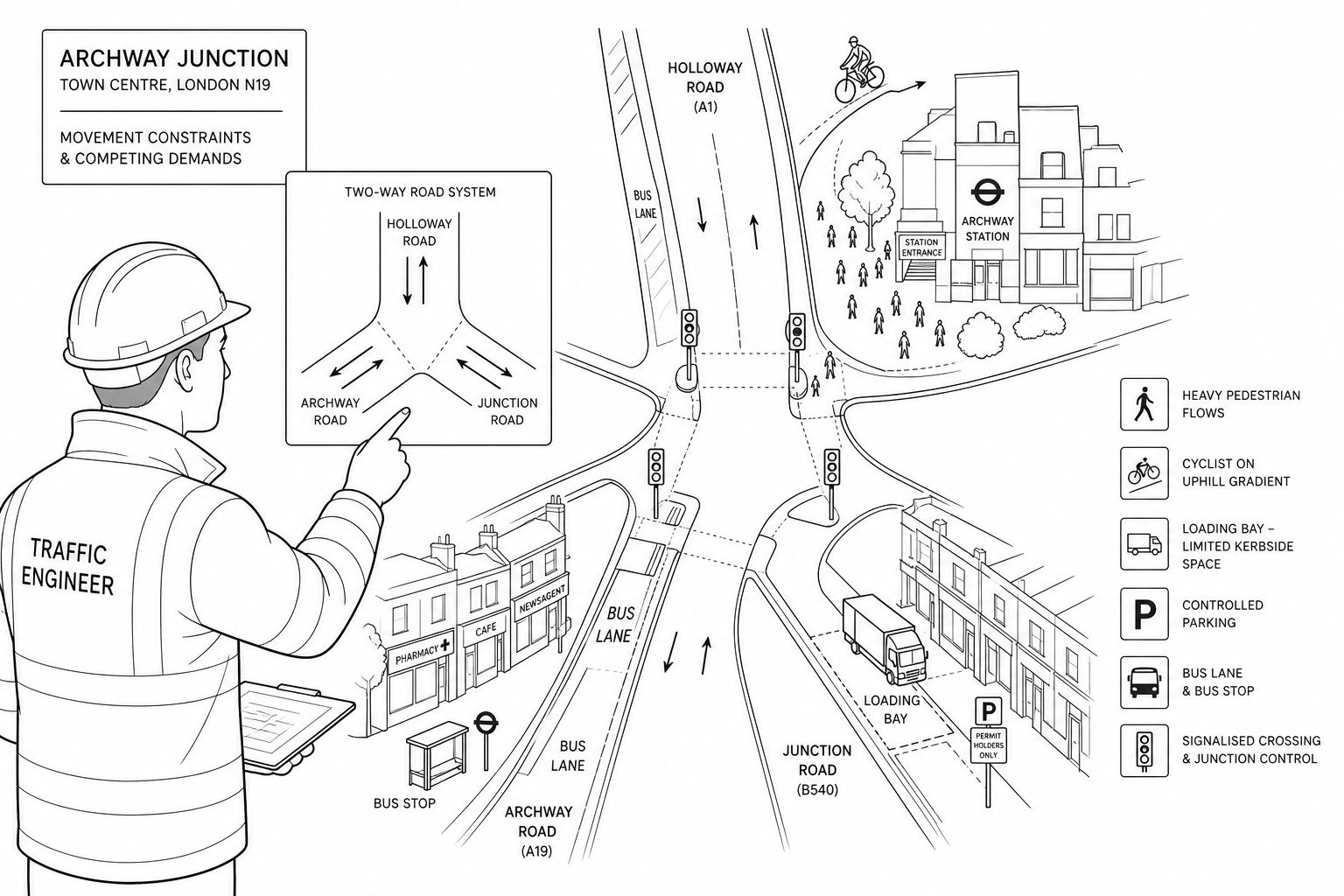
Northwood is not assessed in a vacuum. A proposal may be modest in pure trip terms but still sensitive because of street character, parking pressure, frontage conditions or nearby schools and local centres. That is why context matters as much as scale.
One recurring issue is the effect on local residential roads. Residents often know exactly when parking is stressed and when turning movements become awkward, particularly near station-adjacent areas or roads used as informal overflow parking. If a proposal removes existing spaces, introduces car-dependent units or relies on weak assumptions about displaced demand, objections can build quickly.
Public transport accessibility is also relevant, but it must be handled carefully. Access to the Metropolitan line and local bus services can support lower parking provision or stronger sustainable travel arguments. Still, PTAL-style reasoning should be grounded in the actual catchment, walk routes, gradients and user profile of the development. A retirement-focused scheme and a commuter-led apartment scheme may not justify the same assumptions.
We also review collision records, school peak conditions, classified road impacts and London-wide policy expectations. In practice, the authority may test whether the proposal aligns with the London Plan, TfL guidance, borough parking standards and local road safety objectives all at once.
That mix of local detail and policy structure is why seemingly straightforward sites can become transport-sensitive. The strongest submissions do not minimise those issues. They acknowledge them, quantify them and address them with workable mitigation.
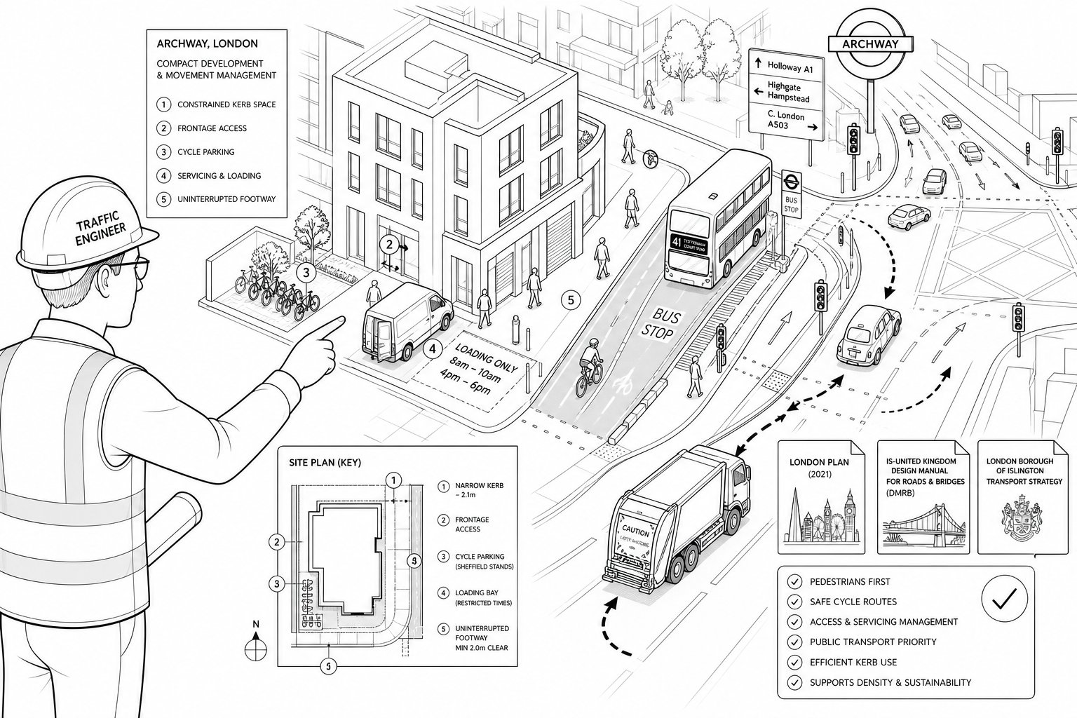
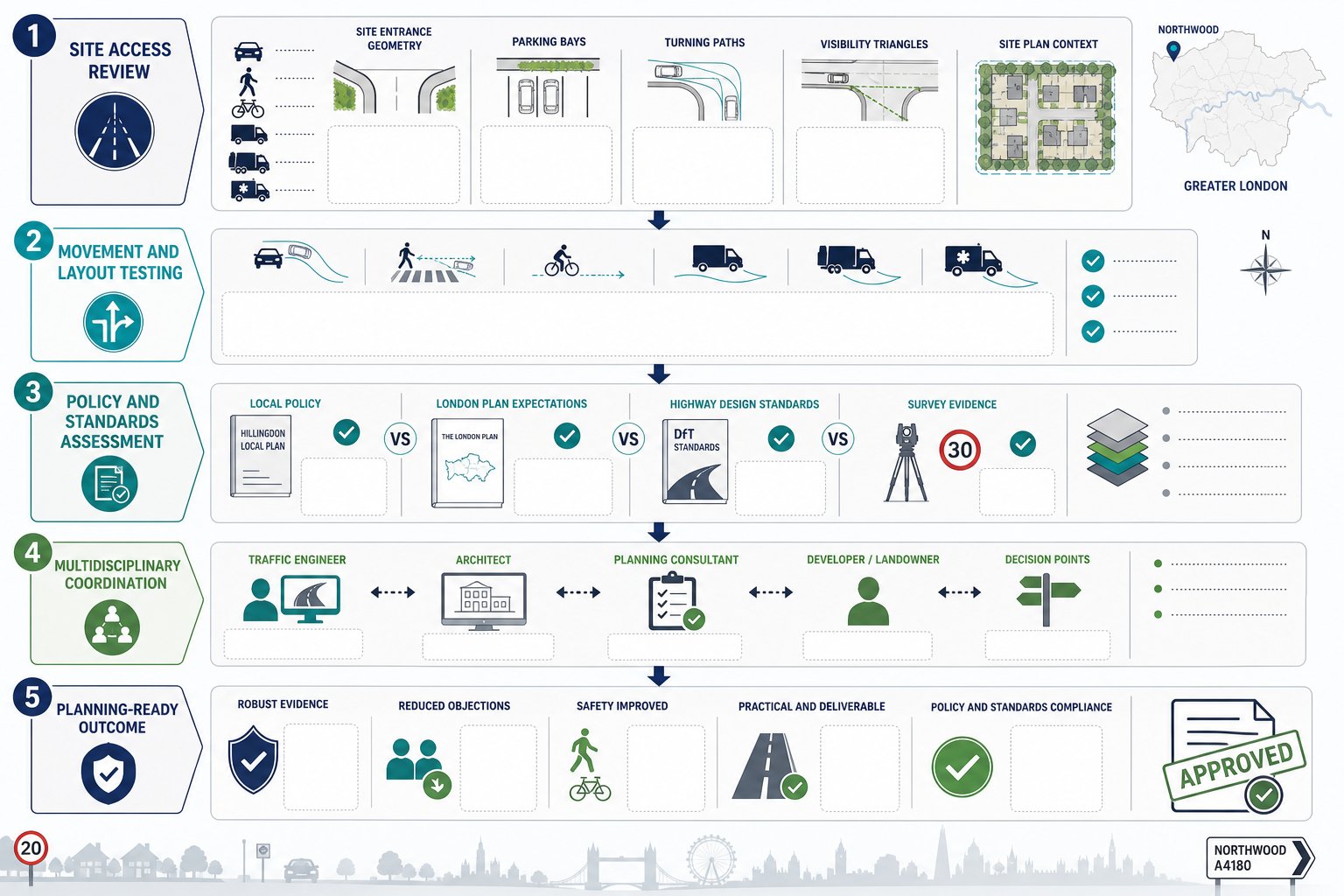
Access, Parking, Servicing, And Visibility Requirements
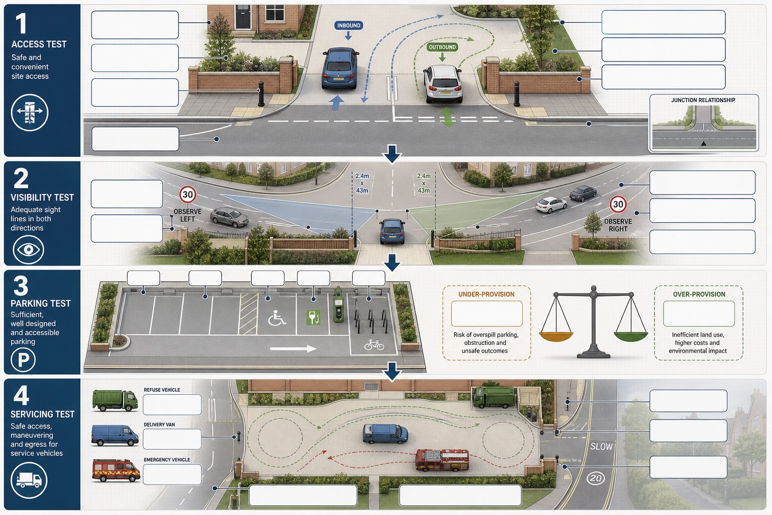
Highway officers tend to focus on the operational basics first: can vehicles enter and leave safely, can they see and be seen, is parking appropriately provided, and can servicing occur without creating new hazards? If those fundamentals are weak, the planning case becomes harder regardless of wider design quality.
Access design is about more than a gate width. We test whether the proposed arrangement works for the vehicles that will actually use it, whether gradients are acceptable, whether the crossover relationship is safe, and whether turning can occur on site where policy or practicality requires it. On constrained sites, small design changes can make a disproportionate difference.
Visibility splays remain a frequent point of challenge. Boundary walls, planting, parked vehicles and curvature can all compromise what initially looks acceptable on a drawing. We hence review visibility in line with relevant standards and with local conditions in mind, including observed vehicle speeds where necessary.
Parking provision must also be policy-compliant and operationally credible. That includes disabled spaces, cycle parking, electric vehicle infrastructure expectations and the likely real-world demand generated by the use. Under-provision can attract resident objections: over-provision may conflict with sustainable transport policy.
Servicing is often the hidden issue. Refuse vehicles, delivery vans and emergency access all need a realistic strategy. If a design only works by assuming perfect driver behaviour on a narrow frontage, the council will usually spot it. Our job is to make sure the site functions on an ordinary Tuesday, not just on a tidy CAD drawing.
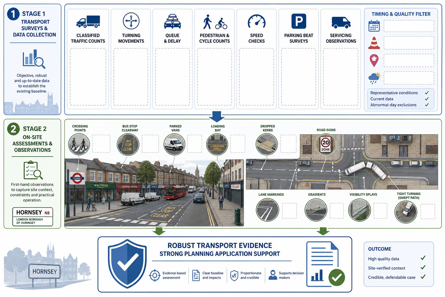
How Traffic Surveys And Local Data Inform A Robust Submission
Strong transport reporting is evidence-led. Opinions about traffic, parking or safety carry more weight when supported by surveys and local datasets collected at the right time and interpreted properly. In Northwood, where objections often focus on lived street conditions, data can be the difference between a vague defence and a convincing one.
Depending on the scheme, we may commission classified turning counts, queue surveys, automatic traffic counts, speed surveys, parking beat surveys and pedestrian observations. For residential proposals, parking stress data is frequently crucial. For access visibility assessments, speed data may be needed to justify splay requirements. For larger or sensitive developments, peak-hour turning counts can establish whether a junction effect is material.
We also draw on collision data, census travel patterns, public transport accessibility information and site-specific operational evidence. The point is not to collect every dataset available. It is to assemble the evidence most likely to answer the authority’s actual questions.
Survey timing matters too. School-term conditions, weather, roadworks, rail disruption and holiday periods can all distort the picture. A rushed survey programme that misses representative conditions often creates more problems than it solves.
Across practice, we find that early survey planning is one of the biggest predictors of a smooth programme. Wider examples in Traffic Engineer In Liverpool: and Traffic Engineer In Bristol: reflect the same lesson: robust local data gives planning arguments something solid to stand on.
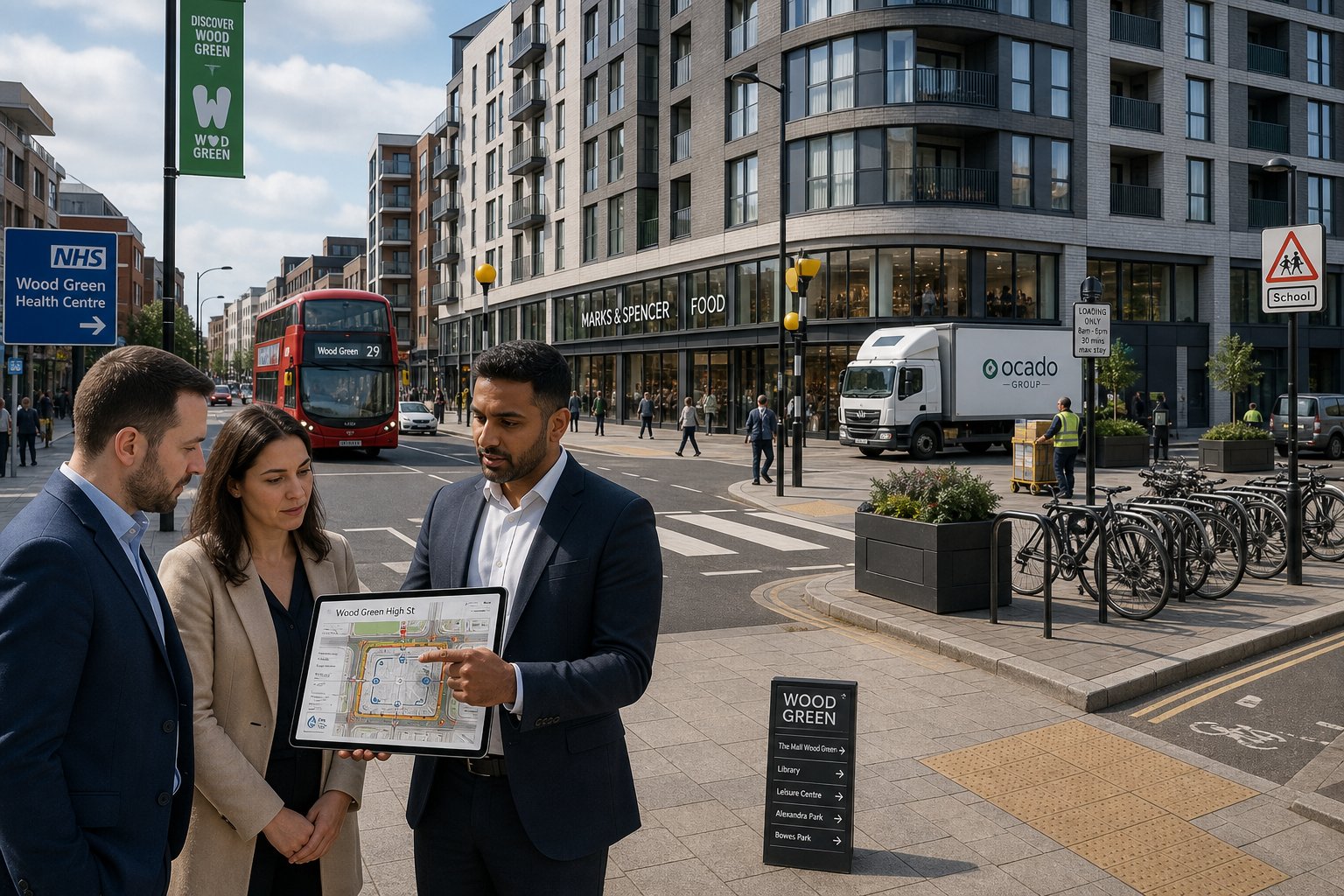
Working With Architects, Planners, Developers, And Councils
Traffic engineering works best when it is integrated, not bolted on. We usually add most value when we are involved while layouts are still flexible, because transport changes are cheaper and easier before the scheme has hardened.
With architects, we focus on the details that affect site function: access width, tracking, bin collection points, cycle stores, parking geometry, pedestrian routes and frontage visibility. A half-metre shift in a boundary or a slight rearrangement of bays can sometimes resolve a problem that would otherwise require pages of justification.
With planners and planning lawyers, the focus is often policy strategy. We help frame transport effects in language that aligns with decision-making tests: severity, safety, sustainability, neighbour impact and proportional mitigation. For developers, there is also the commercial angle. We need solutions that protect viability, not idealised designs that collapse under delivery pressure.
Engagement with councils matters as well. Pre-application dialogue, scope agreement and responsive clarification can all shorten the path to a decision. Highway officers are far more likely to accept a transport position if they can see the methodology is proportionate and the team has addressed practical concerns rather than dodged them.
That collaborative approach reflects how we work at ML Traffic: concise reporting, locally tuned advice and early problem-solving shaped by more than 30 years of transport planning experience. In most Northwood projects, the smoother applications are not the ones with no constraints. They are the ones where the team coordinated early enough to manage them.
How To Choose The Right Traffic Engineer For A Northwood Project
Not every transport consultant is the right fit for a Northwood planning application. Technical competence is essential, of course, but so is judgement. You want someone who understands when a short, focused statement will do and when a scheme needs a deeper package of surveys, drawings and mitigation.
We would look for four things. First, proven experience with planning-led transport work rather than only highway design in isolation. Second, familiarity with London borough expectations, including parking restraint, sustainable travel policy and the way local highway concerns are typically framed. Third, clear writing. A report can be technically sound and still unpersuasive if it is vague, overlong or disconnected from the actual planning issues. Fourth, responsiveness: the ability to discuss scope early, answer consultation points and support meetings or appeals if needed.
Chartered status or equivalent senior experience helps, but track record matters more than badges alone. Ask practical questions. Have they dealt with constrained suburban access points? Can they prepare swept-path analysis? Do they know when a Travel Plan adds value and when it is unnecessary padding? Can they liaise confidently with architects and case officers?
A good consultant should make a complicated issue feel manageable without pretending every site is easy. That balance of realism and problem-solving is usually what separates a helpful traffic engineer from a report factory.
Typical Challenges, Timescales, And Next Steps
Northwood projects often run into a familiar group of transport challenges: tight frontage widths, poor visibility because of boundary treatment or alignment, neighbour concern about overspill parking, servicing on narrow roads, and congestion linked to school peaks or local centre activity. None of these issues is unusual. What matters is how early they are identified and whether the design team leaves enough room to respond.
Timescales are usually manageable if the process starts early. Surveys can often be organised within 1 to 3 weeks, depending on scope and representative conditions. Once data is available, a Transport Statement or modest assessment may take around 2 to 4 weeks. Larger or more iterative projects can take longer, especially if layout revisions, further survey work or pre-application feedback need to be folded in. The biggest delays typically come from rework, not analysis.
Our preferred next steps are straightforward. Engage a traffic engineer at RIBA Stage 2 or 3 if possible. Agree the likely report scope before the planning pack is finalised. Commission the right surveys, not every survey imaginable. Then align the transport narrative with the site layout, planning statement and access drawings.
If the council is likely to focus on parking, prove the parking case. If the risk is servicing, test it properly. And if visibility is marginal, do not leave it to assumption. In planning, transport problems rarely improve by being ignored: they improve when they are measured, explained and designed around.
Conclusion
A well-chosen traffic engineer in Northwood does more than produce a report for the planning portal. We help shape a scheme so it works on the ground, aligns with policy and answers the highway authority’s likely concerns before they become delays or refusal reasons.
For architects, planners, developers, surveyors and councils, the practical lesson is simple: bring transport advice in early, especially where access, parking, servicing or local sensitivity could influence the outcome. The strongest submissions are usually not the most complicated. They are the ones where the evidence is proportionate, the design has been tested properly, and the transport case reads as part of a coherent planning strategy.
In 2026, that kind of clarity matters. Northwood schemes still need local awareness, sound data and reports that are concise but technically credible. Done properly, transport planning support is not an obstacle to design ambition. It is often the reason a good scheme gets over the line.
Common Questions About Traffic Engineering in Northwood
What does a traffic engineer in Northwood do for planning applications?
A traffic engineer in Northwood assesses site access, parking, servicing, and circulation using highway standards. They prepare transport reports, advise on mitigation, and liaise with local highway officers to ensure the scheme is safe and policy-compliant.
When is traffic engineering input required for developments in Northwood?
Input is needed when a development increases vehicle movements, changes peak-hour traffic, alters access, reduces on-site parking, or is near busy roads or schools. Even small changes like change-of-use can require professional transport advice.
What types of transport reports are typically requested by Northwood planning authorities?
Common reports include Transport Statements for schemes with moderate traffic impact, Transport Assessments for larger or sensitive projects, and Travel Plans focused on reducing car use and encouraging sustainable travel options.
How do traffic surveys and local data support a robust planning application in Northwood?
Traffic surveys like classified turning counts, parking beat surveys, and speed measurements provide evidence of real conditions. This data helps address local concerns on congestion, safety, and parking stress, strengthening the transport case.
What are typical traffic and parking challenges for developments in Northwood?
Developments often face issues with narrow frontages, poor visibility, neighbour concerns about overspill parking, servicing on restricted roads, and school peak-time congestion. Early identification and design adaptation help manage these challenges.
How should I choose the right traffic engineer for a Northwood project?
Choose an experienced, chartered traffic engineer familiar with London borough policies, who provides clear, concise reports and coordinates well with architects, planners, and local authorities. Responsiveness and a strong local track record are key.