A planning application can look solid on paper and still stall once transport becomes the sticking point. We see that a lot. A site may have the right land use, a capable design team and a clear commercial case, yet questions about traffic impact, access safety, parking, servicing or sustainable travel can slow everything down.
That is where a traffic engineer in Wolverhampton earns their place in the project team. For architects, planners, developers, surveyors, legal teams and local authorities, transport input is rarely just a box-ticking exercise. It shapes whether a scheme feels credible, proportionate and policy-compliant from the start.
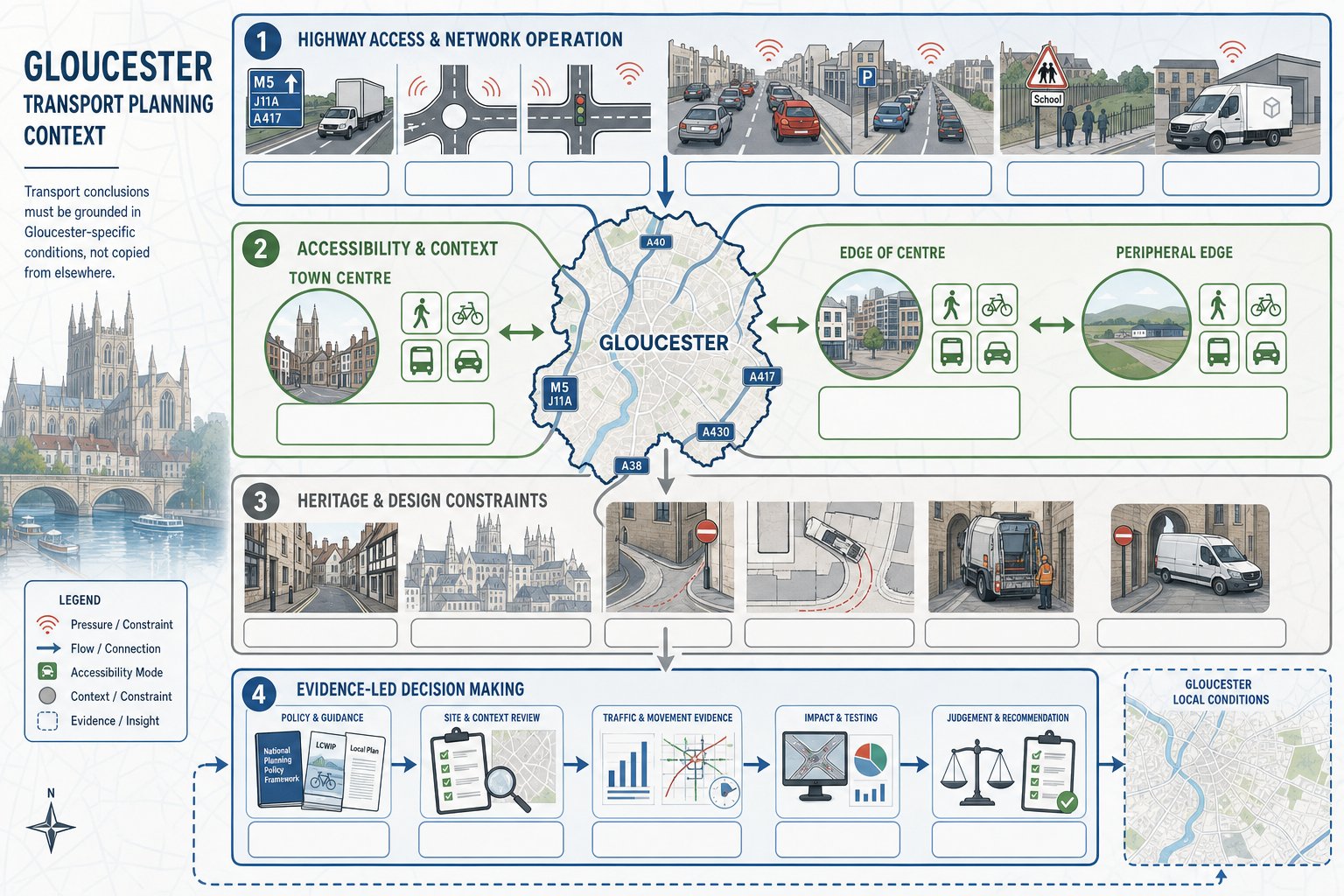
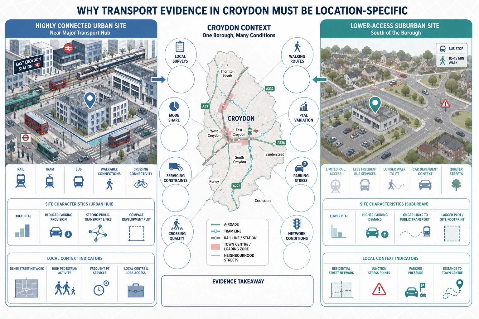
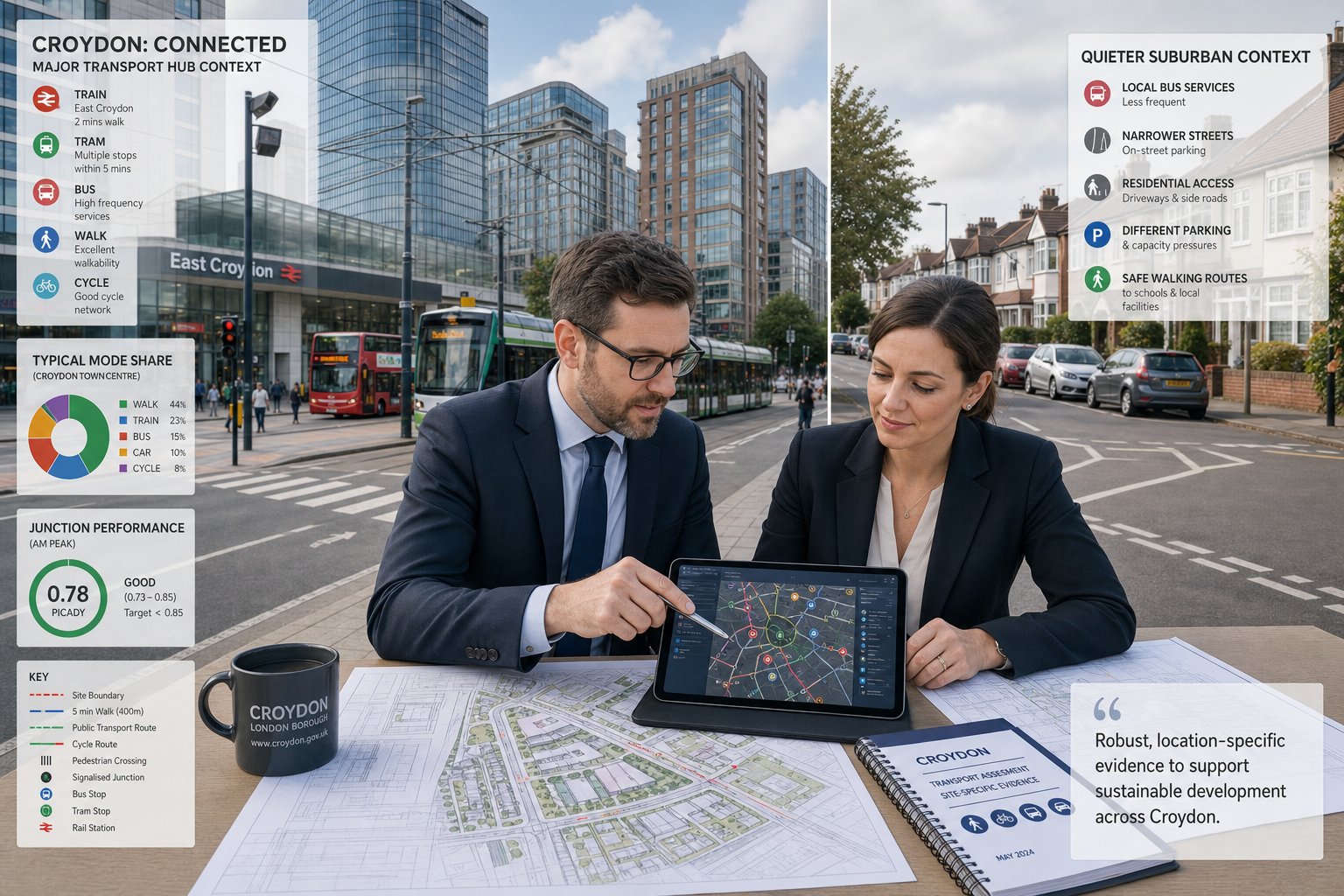
In Wolverhampton, that matters even more because local context changes the answer. A residential scheme near established urban streets raises different issues from a logistics site close to strategic routes. A town-centre conversion will be assessed differently from an edge-of-settlement development with more car dependency. The technical standards may be national, but the judgement is always local.
With more than 30 years of transport planning experience, we know that concise, accurate reporting usually helps projects move faster than overcomplicated paperwork. In this guide, we explain what a traffic engineer in Wolverhampton actually does, when Transport Assessments or Statements are needed, how junction and access issues are addressed, and what to look for when appointing the right consultant in 2026.
Key Takeaways
- A traffic engineer in Wolverhampton plays a vital role in ensuring planning applications meet local transport requirements, making projects more credible and policy-compliant.
- Local knowledge of Wolverhampton’s unique transport conditions is essential for accurate traffic impact assessments and successful planning outcomes.
- Transport Assessments or Statements must be appropriately scoped to the development size and impact, with full assessments for larger schemes and concise statements for smaller ones.
- Effective access design, visibility checks, swept path assessments, and operational layout considerations are critical to avoid common planning delays and ensure safety.
- Sustainable travel strategies and Travel Plans tailored to the local context support lower car dependency and improve planning success.
- Choosing a traffic engineer with local experience, clear communication skills, and relevant UK planning expertise accelerates project approvals and reduces objections.
What A Traffic Engineer In Wolverhampton Does For Planning And Development
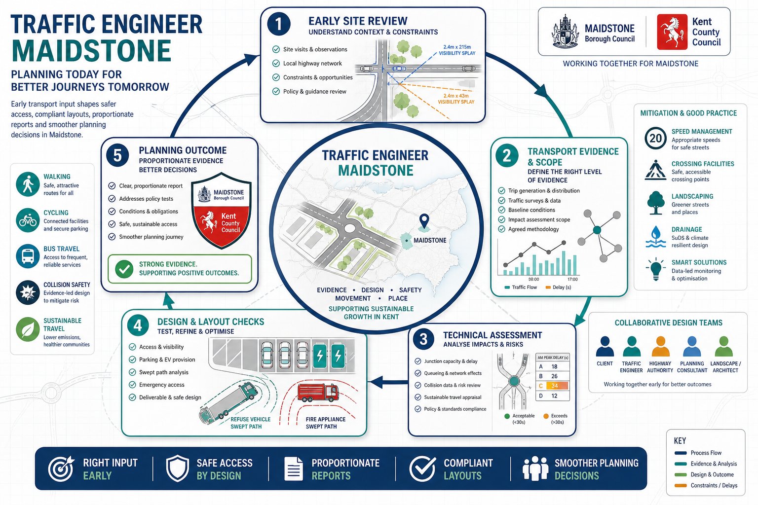
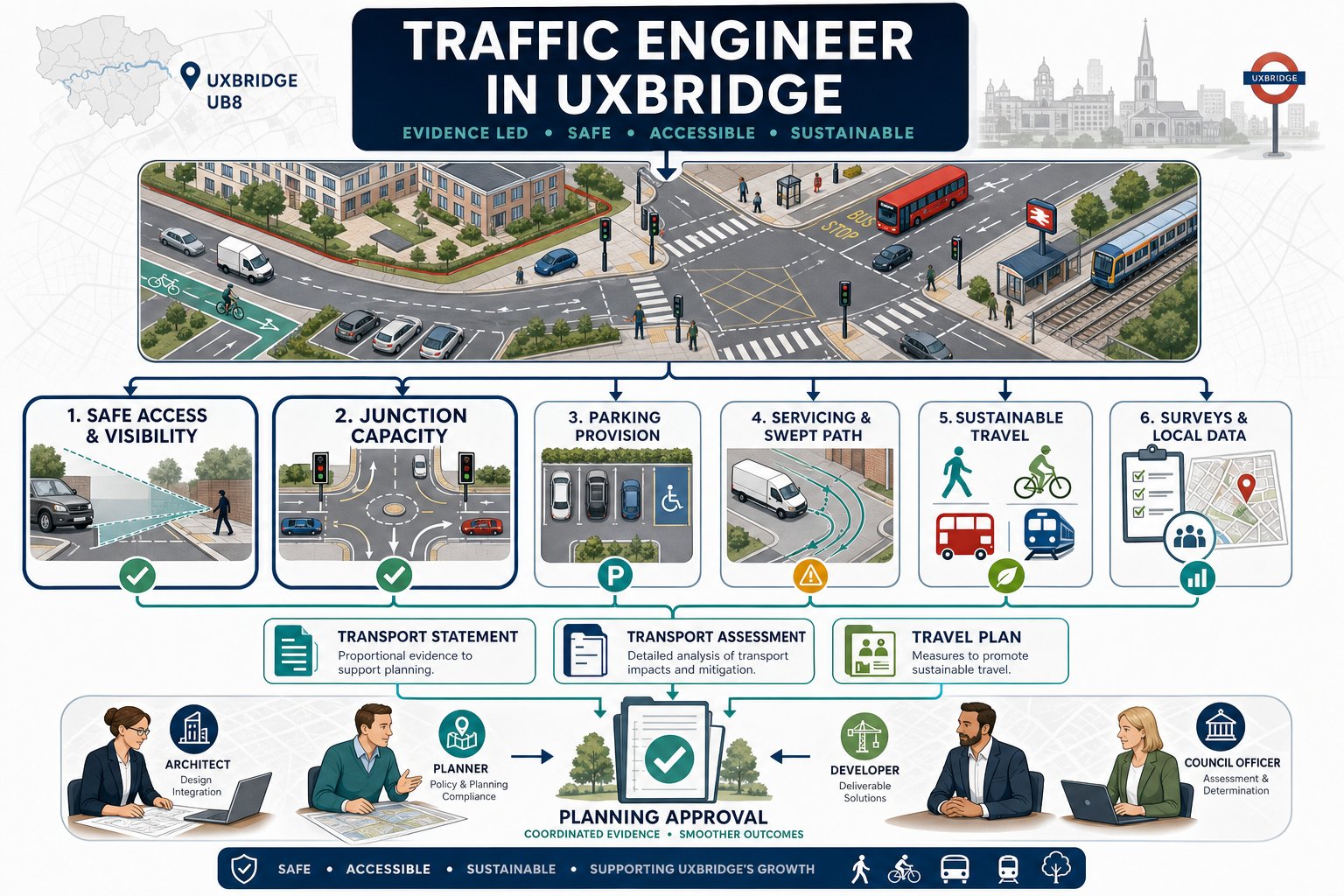
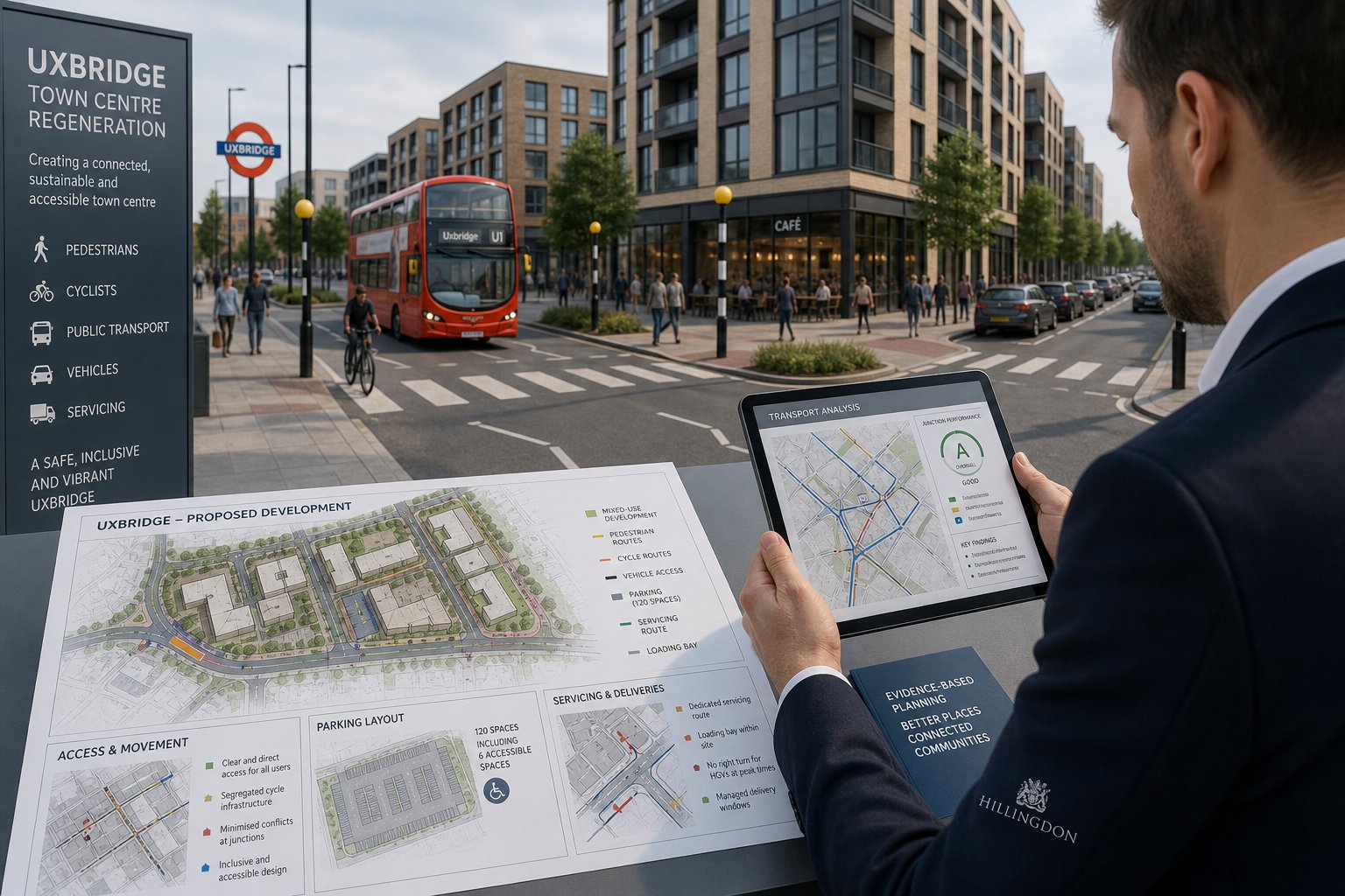
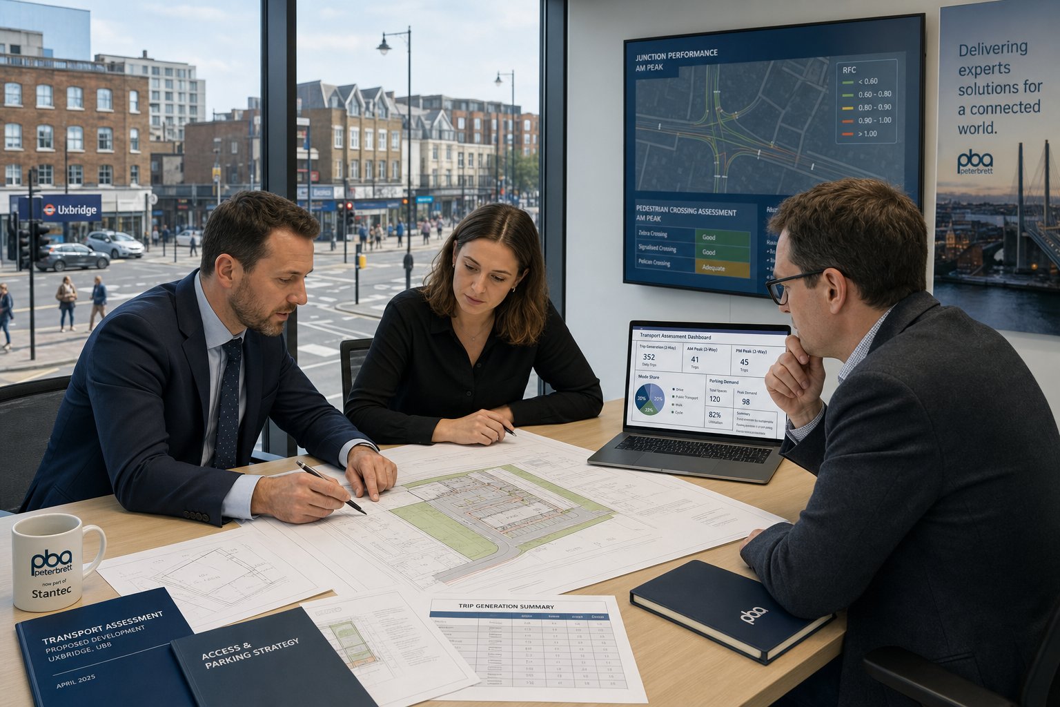
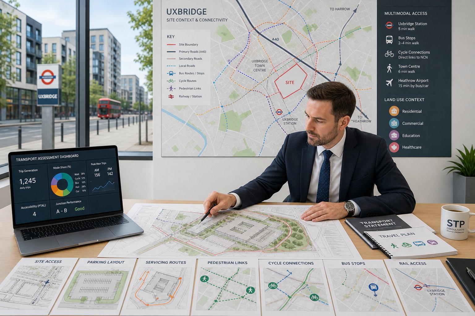
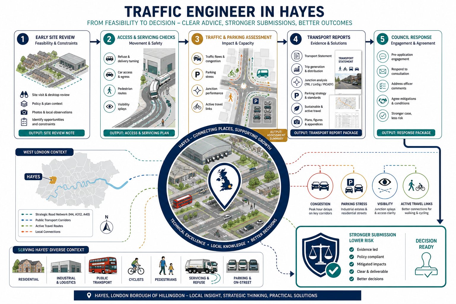
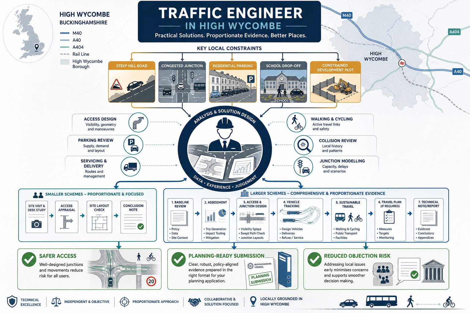
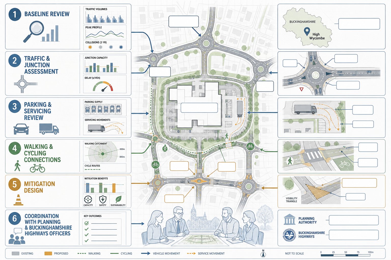
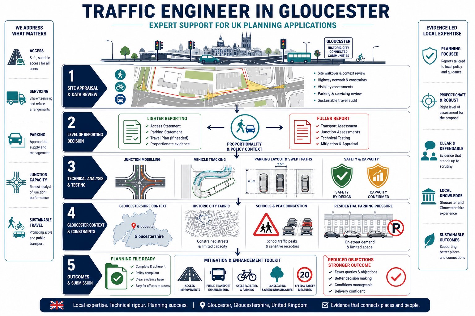
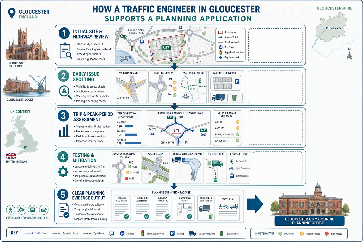
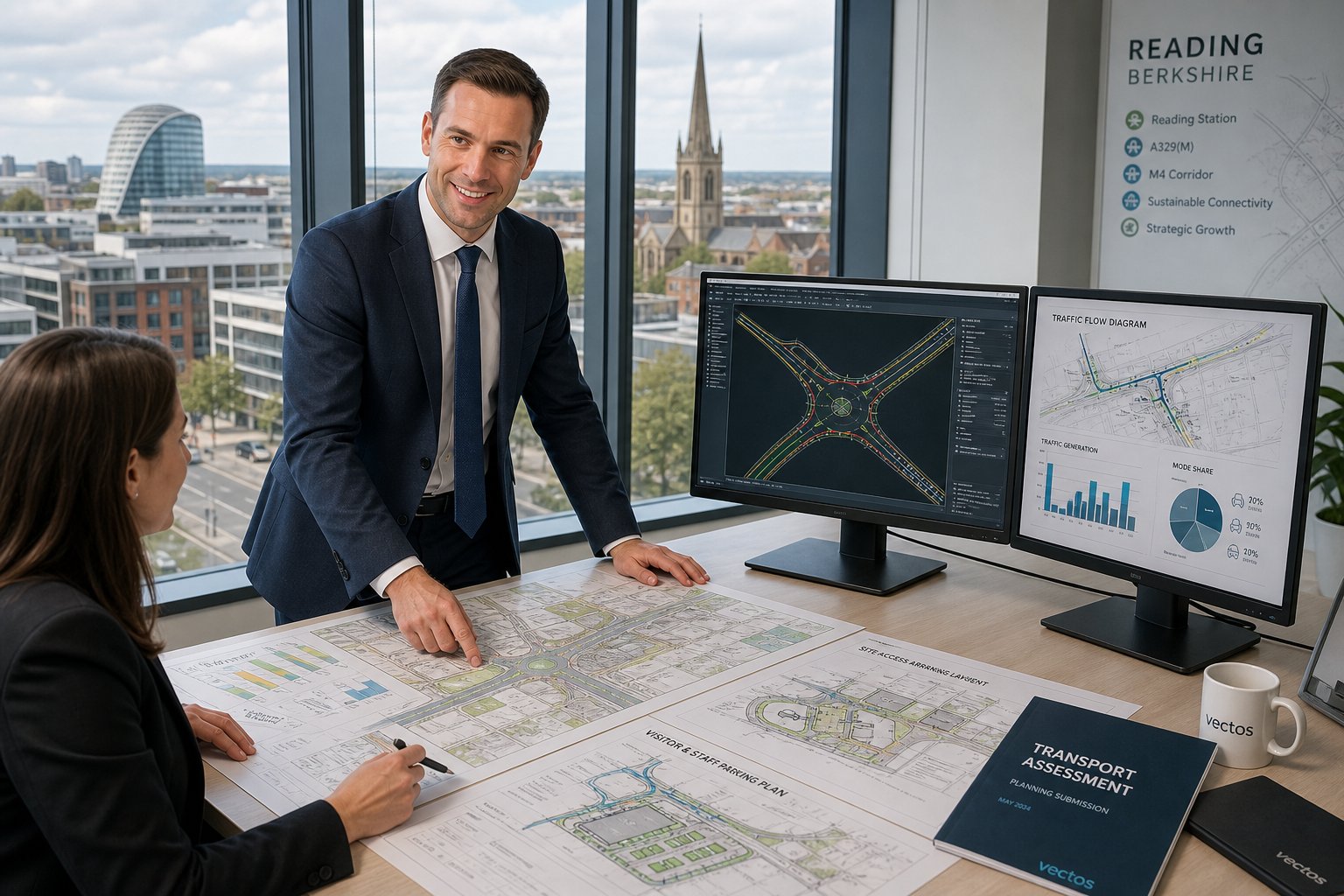
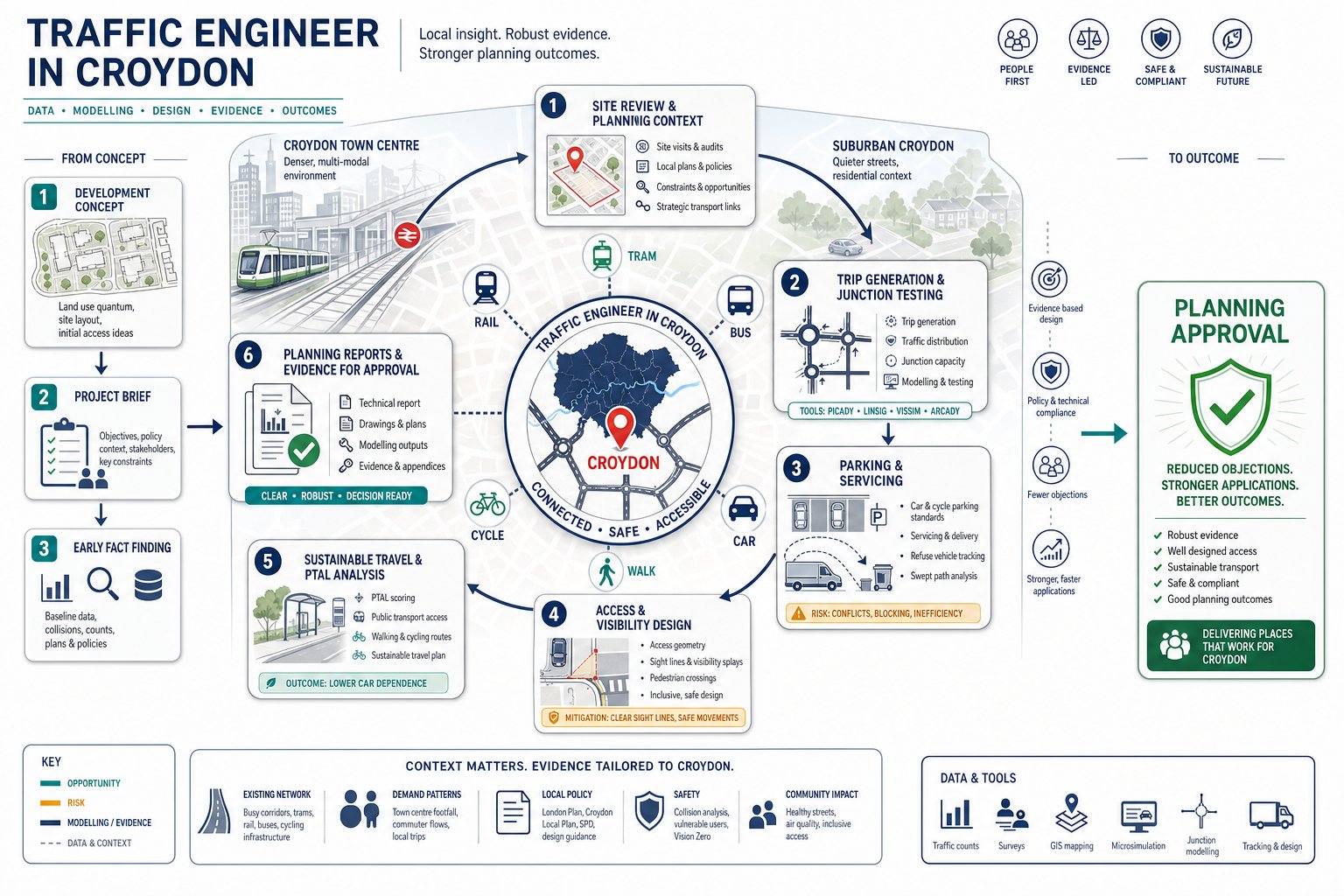
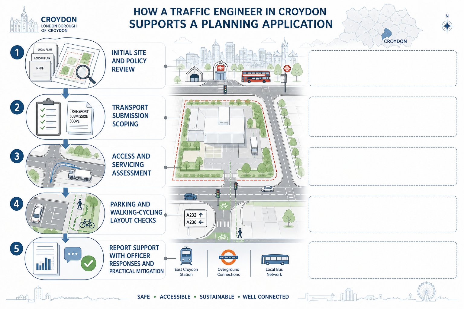
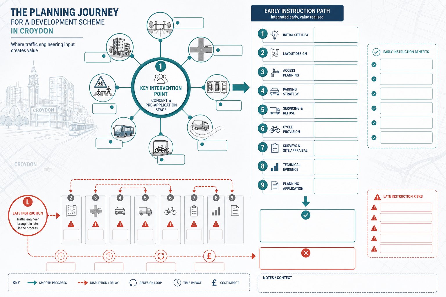
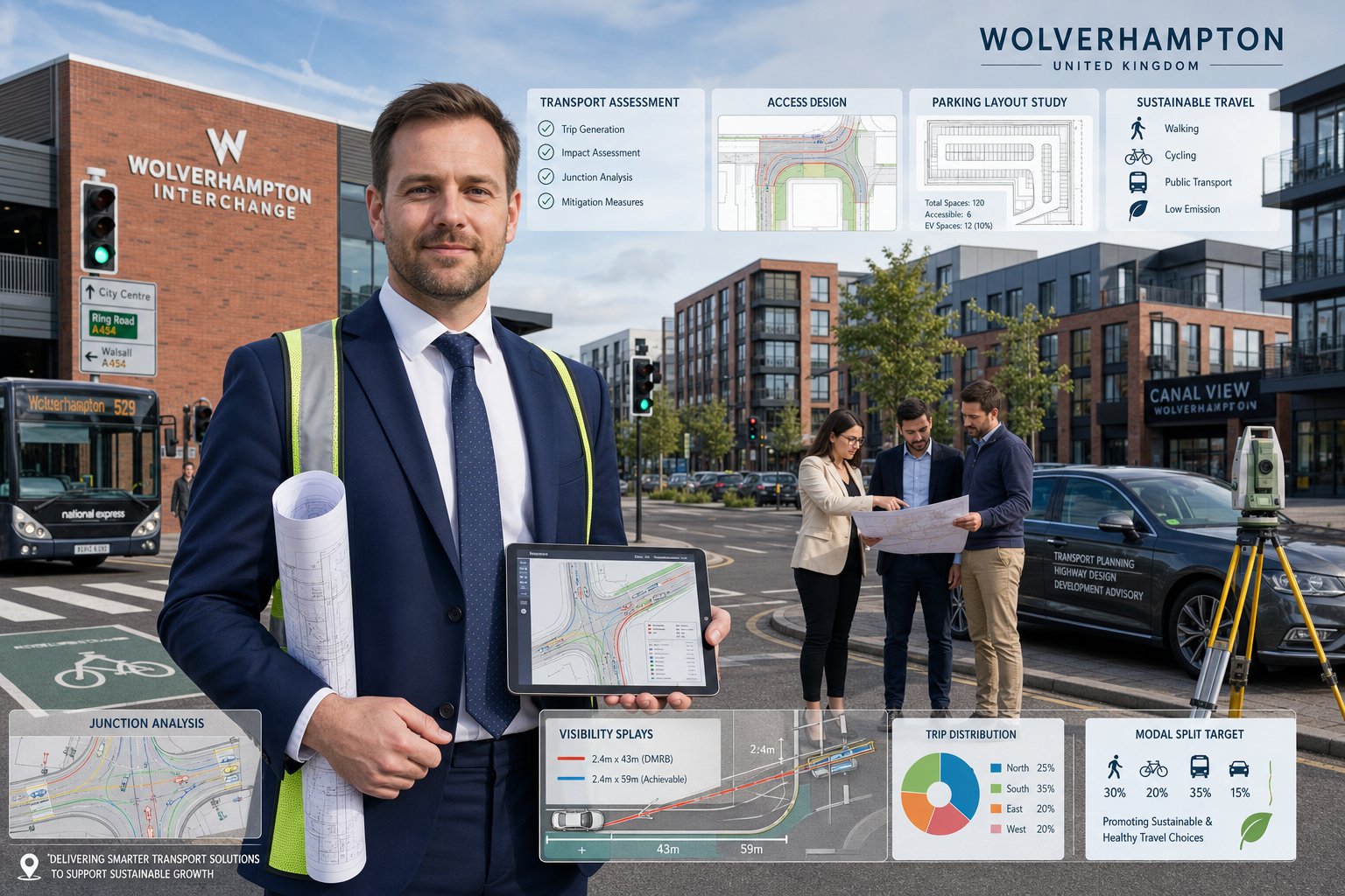
A traffic engineer in Wolverhampton supports development by translating transport risk into evidence, design and practical mitigation. In day-to-day terms, that means we assess how a proposal will affect the surrounding highway network, whether site access is safe, how people will arrive, and what level of reporting is needed to satisfy planning requirements.
For some schemes, the task is strategic. We may review trip generation, traffic distribution and junction capacity to show whether the local network can absorb development traffic. For others, it is highly physical: access geometry, visibility splays, internal circulation, refuse collection routes, delivery turning, cycle parking and pedestrian links.
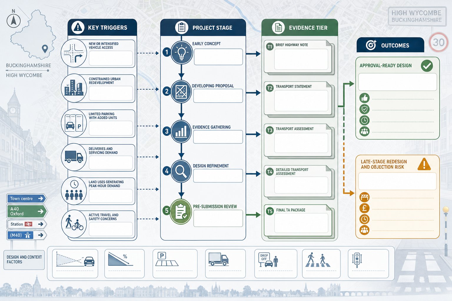
We also help shape planning strategy early. That is often the difference between a straightforward submission and a delayed one. If likely transport concerns are identified at feasibility stage, the wider team can adjust site layout, parking provision or access arrangements before the design hardens. That tends to save time and cost.
Good transport input is not just about numbers on a drawing. It includes judgement on local policy, officer expectations and proportionality. Our role often overlaps with wider Traffic Engineering Consultants: What support, especially where transport evidence needs to align neatly with planning statements, drainage strategy and site constraints.
At its best, traffic engineering makes a proposal easier to understand and easier to approve.
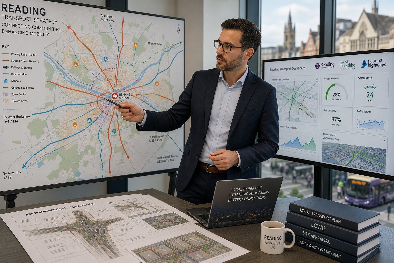
Why Wolverhampton Projects Need Local Transport Planning Knowledge
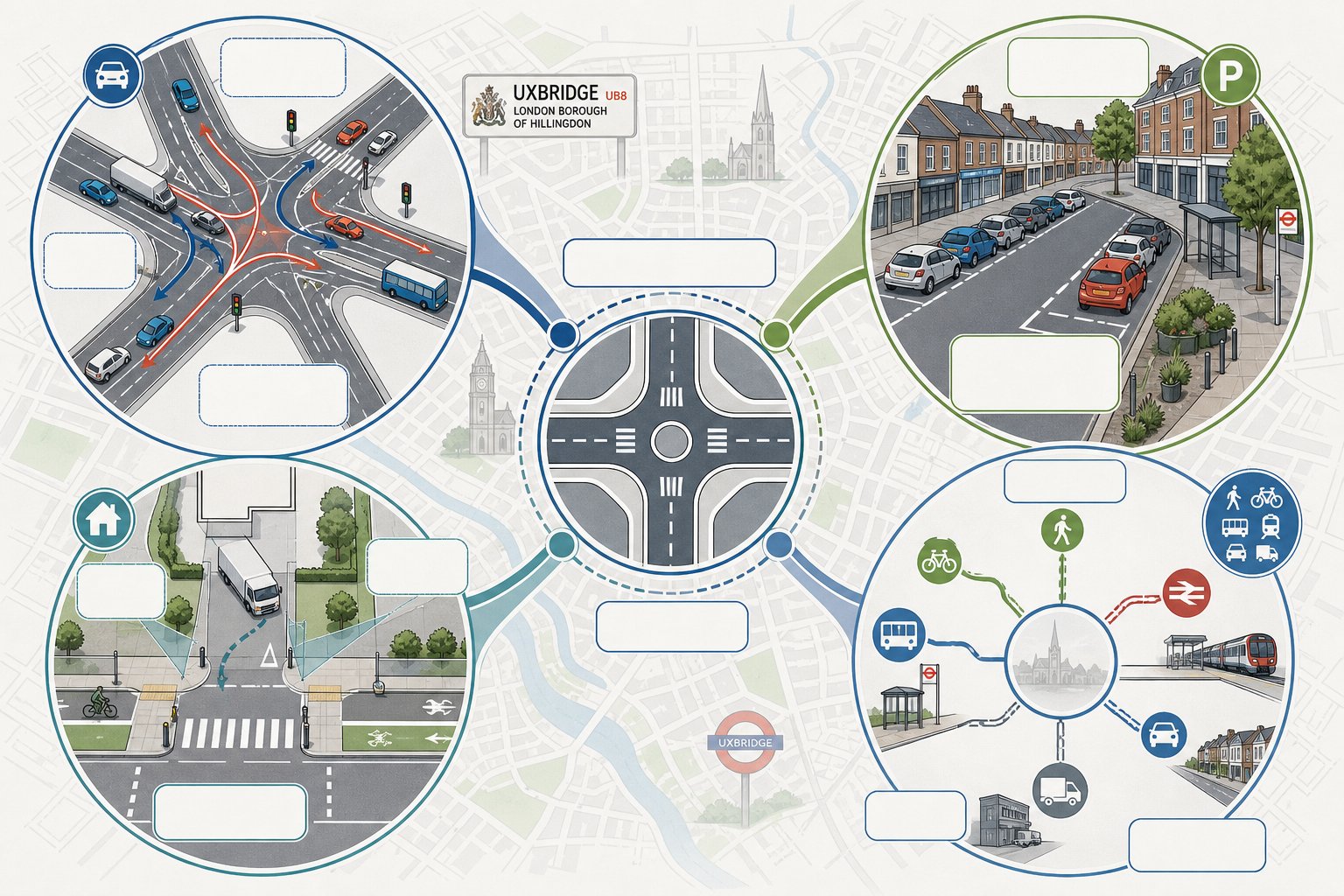
Transport planning is never completely generic, and Wolverhampton is a good example of why. National guidance such as Manual for Streets, DMRB and TSRGD sets the framework, but local interpretation matters. Highway officers want to see a report that responds to actual conditions on the ground, not one recycled from another authority area with a few names changed.
Wolverhampton schemes often sit within established urban networks, constrained frontages, mixed movement patterns and corridors where buses, pedestrians and general traffic all compete for space. Some sites are influenced by strategic routes: others are shaped by school traffic, neighbourhood parking pressure or nearby junction sensitivity. Those issues need local reading, not broad assumptions.
We hence look closely at Wolverhampton Council requirements, West Midlands transport priorities and the way similar schemes have been treated in practice. That includes threshold discussions, scoping expectations, baseline data needs and whether mitigation should focus on access design, operational management or wider sustainable travel measures.
The same principle appears when comparing work across regions. Lessons from Traffic Engineer In Birmingham: or Traffic Engineer In Manchester: assignments can be useful, but they cannot simply be transplanted into Wolverhampton. Local highway character, officer preference and policy wording can shift the best response quite a bit.
That local knowledge is what turns technical competence into planning value.
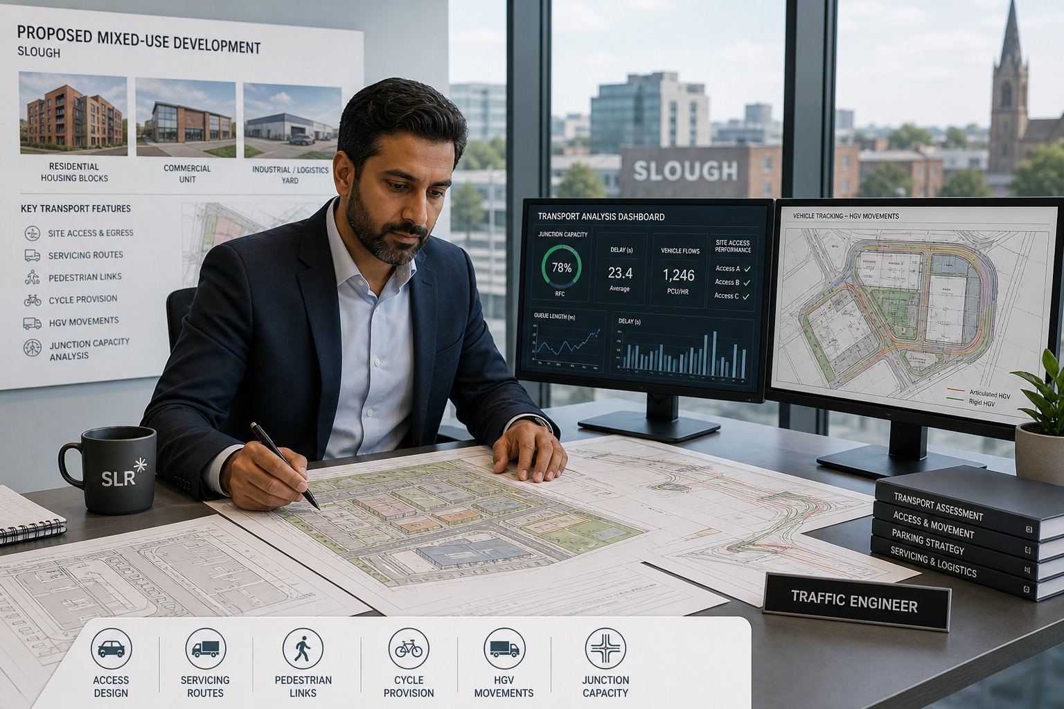
Common Developments That Require Traffic Engineering Input
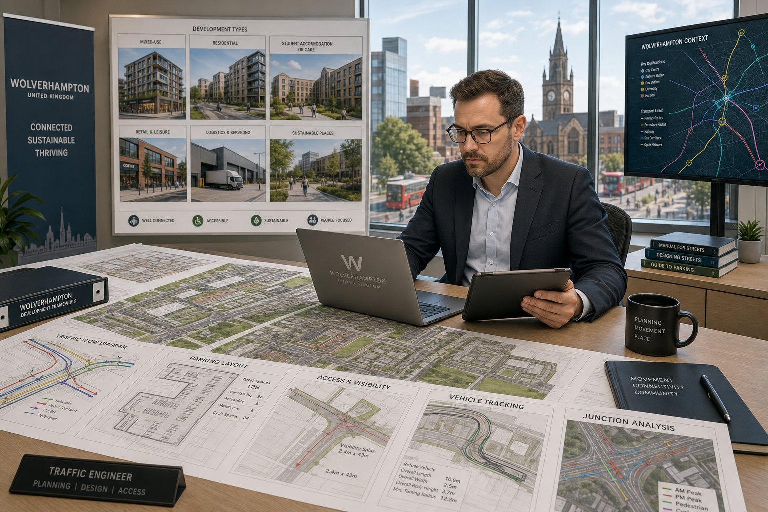
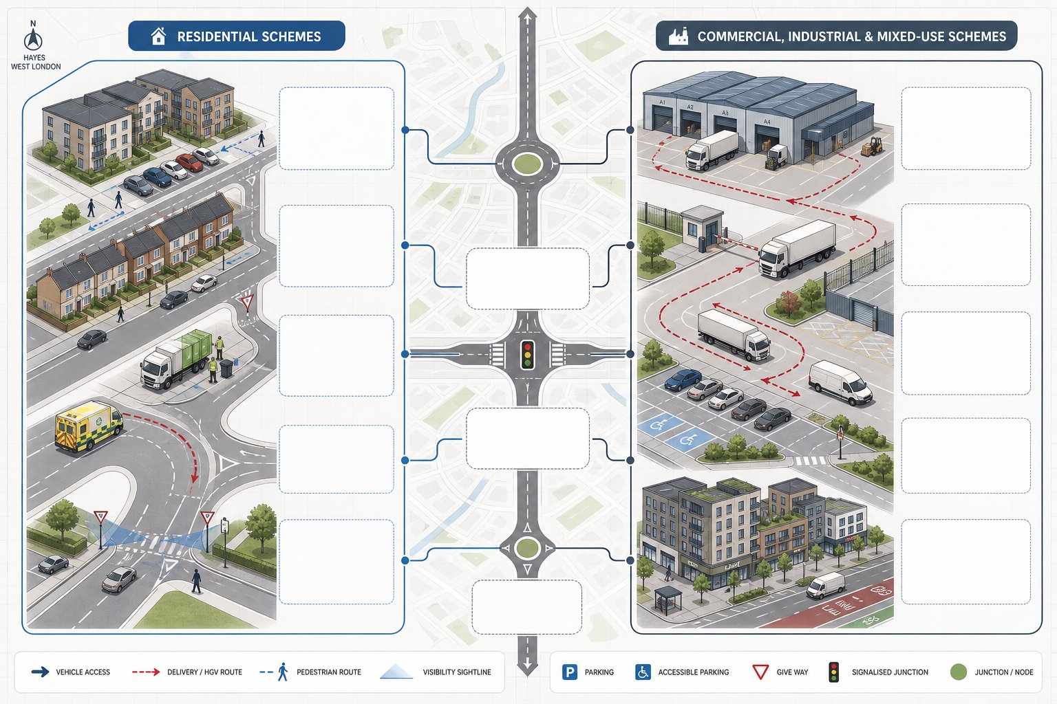
A wide range of developments need traffic engineering input, though the level of detail varies. The obvious cases are major residential, retail, employment and mixed-use schemes. They generate enough movement, parking demand or servicing activity to justify formal transport evidence almost every time.
But smaller projects can also trigger transport concerns. Student accommodation, schools, medical facilities, care uses, last-mile logistics units, roadside trade counters and town-centre change-of-use schemes often create concentrated peaks or unusual arrival patterns. Even where total trip numbers are moderate, the local effect can still be sensitive.
Residential development is a common example. A modest housing scheme may still require access visibility checks, refuse tracking, parking review and a short assessment of nearby junctions. Commercial projects usually bring another layer: delivery activity, staff shift patterns, disabled parking, van waiting space and operational conflict between service yards and customer movement. That is why many applicants benefit from early thinking drawn from wider Commercial Traffic Engineering practice.
Mixed-use schemes are often the most nuanced because they combine competing demands within one site. Retail frontage wants convenience. Residential elements need amenity. Servicing needs to function without dominating the public realm. Public transport access may support lower parking ratios, but only if the evidence is presented properly.
In short, if a proposal changes how people, vehicles or goods move to and through a site, traffic engineering input is usually worthwhile, and often essential.
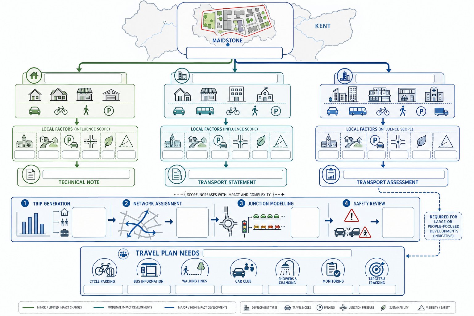
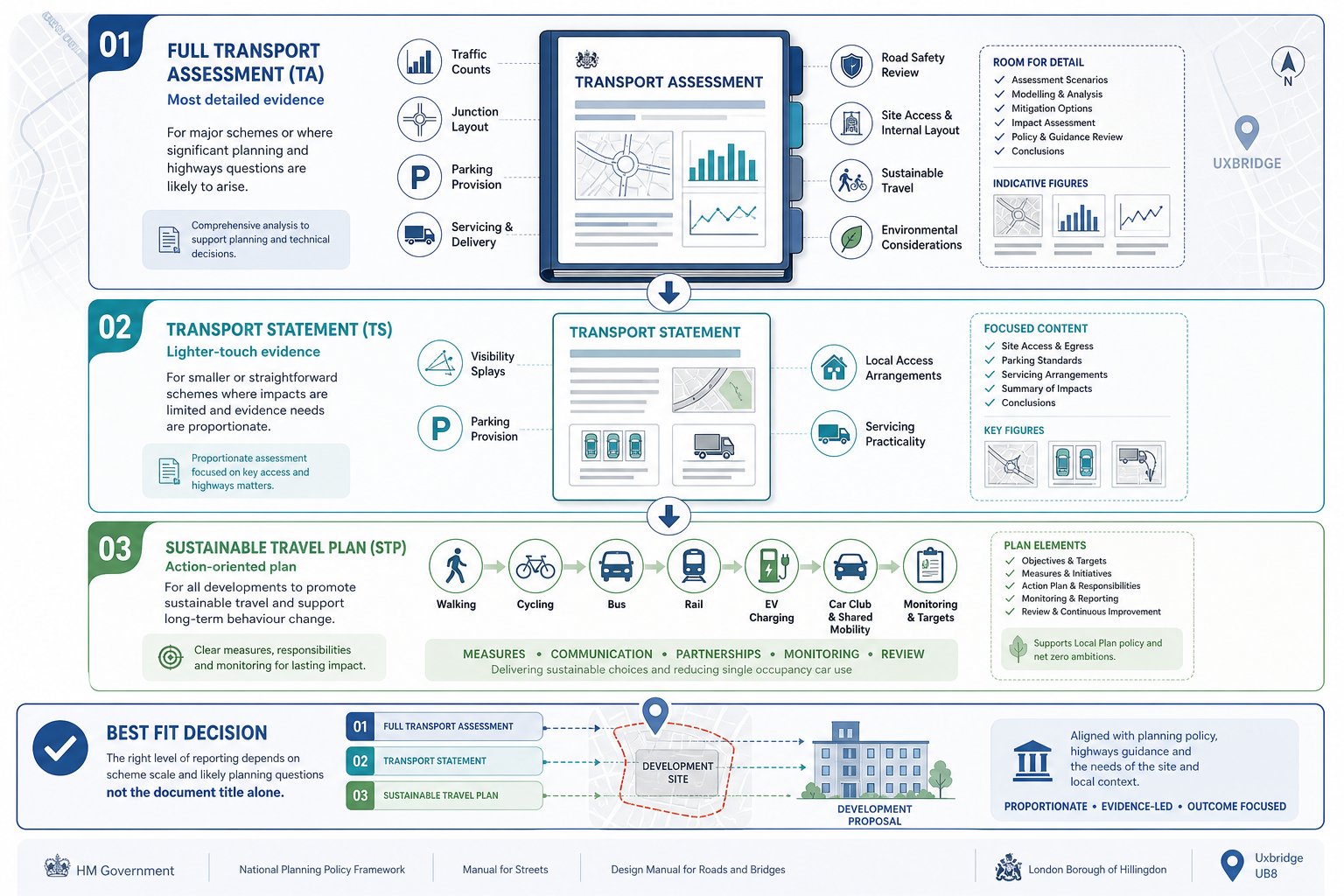
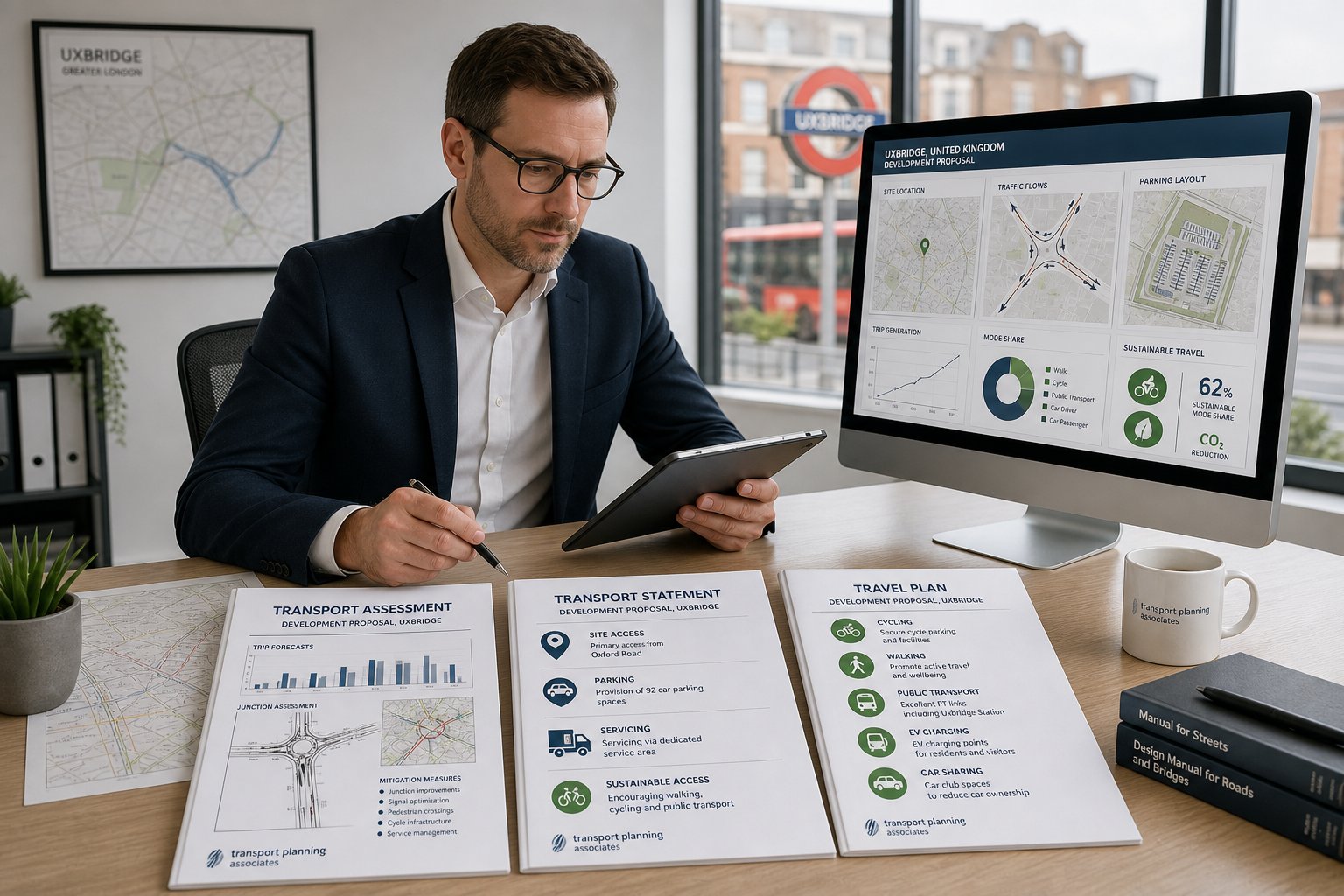
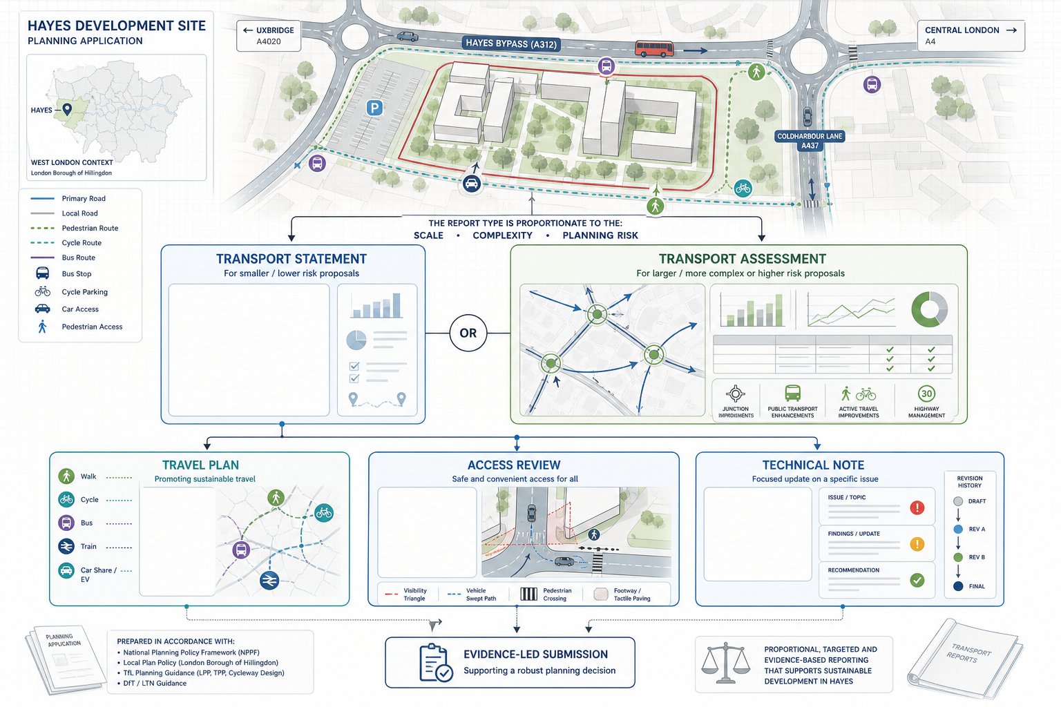
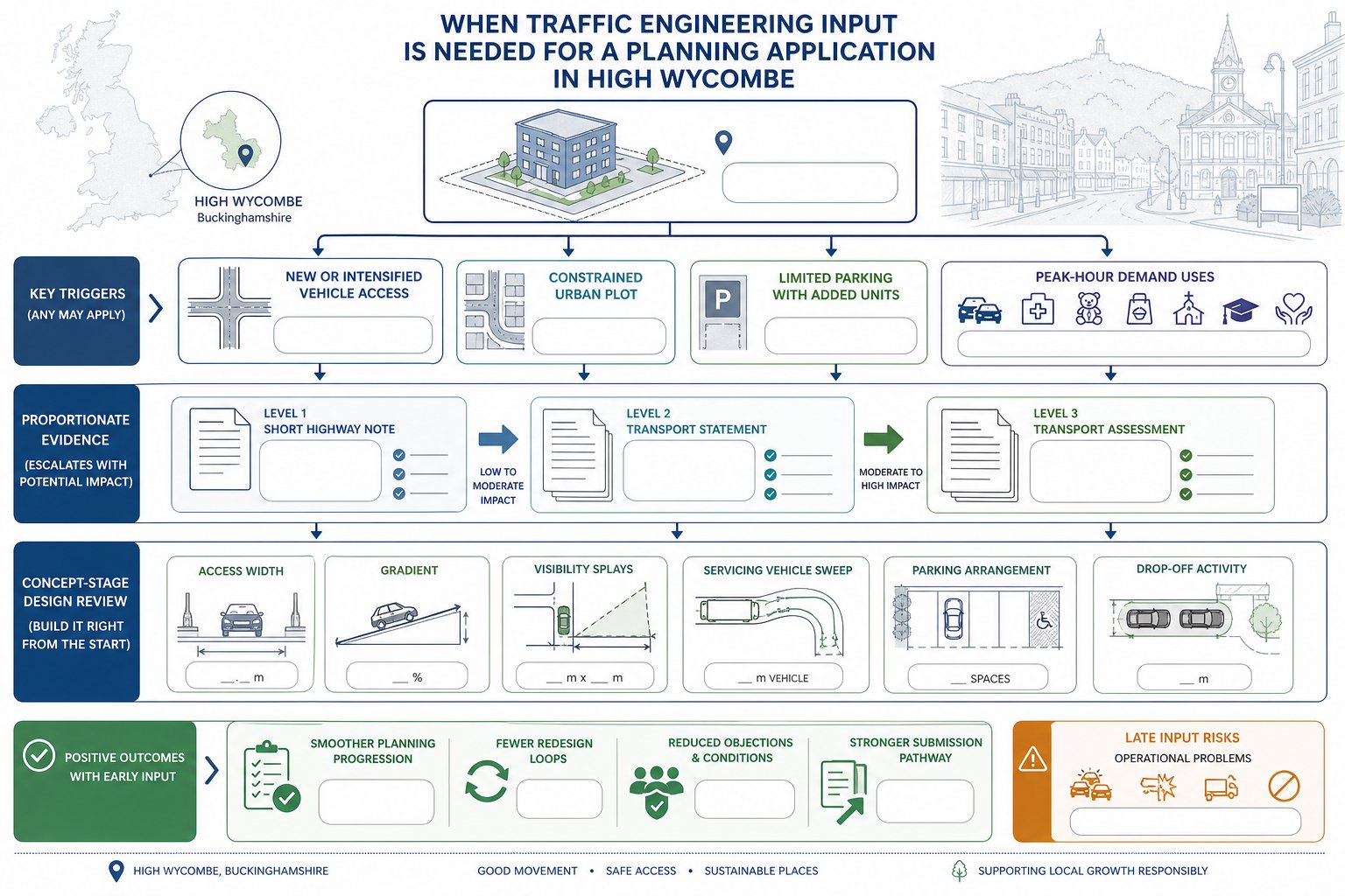
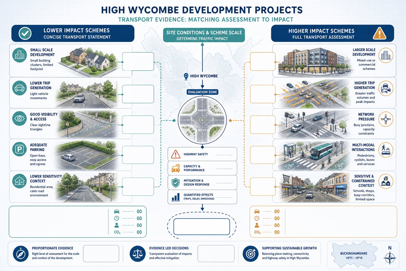
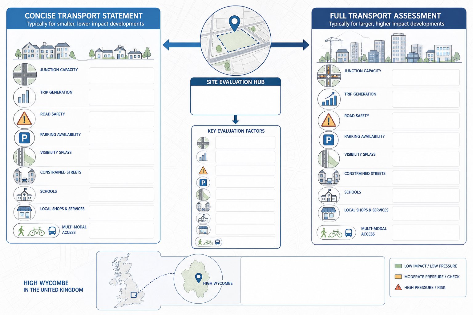
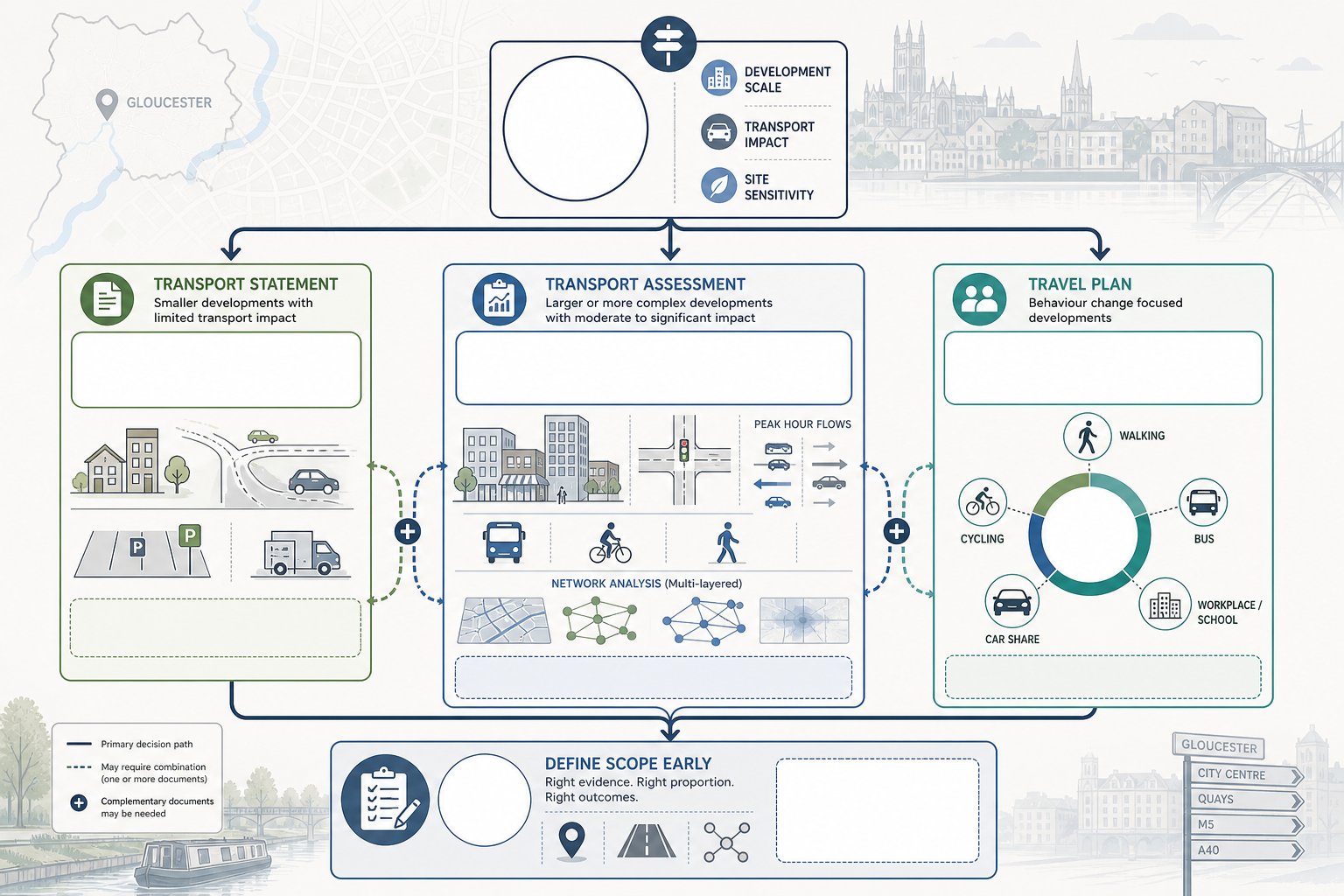
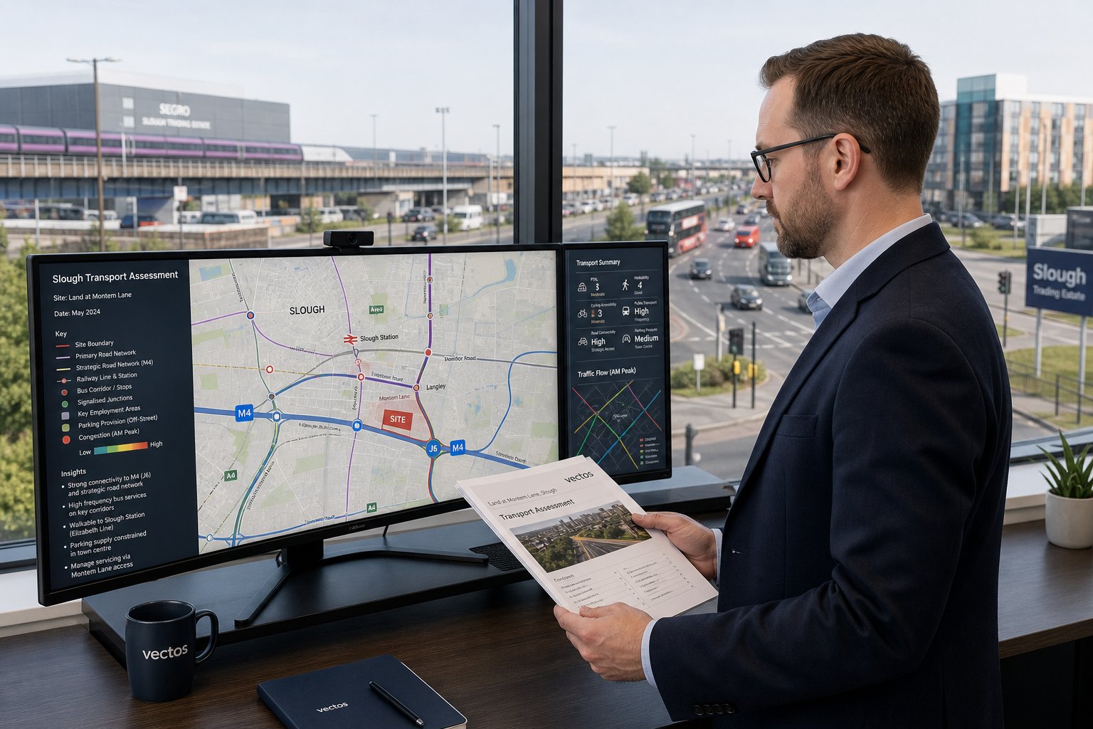
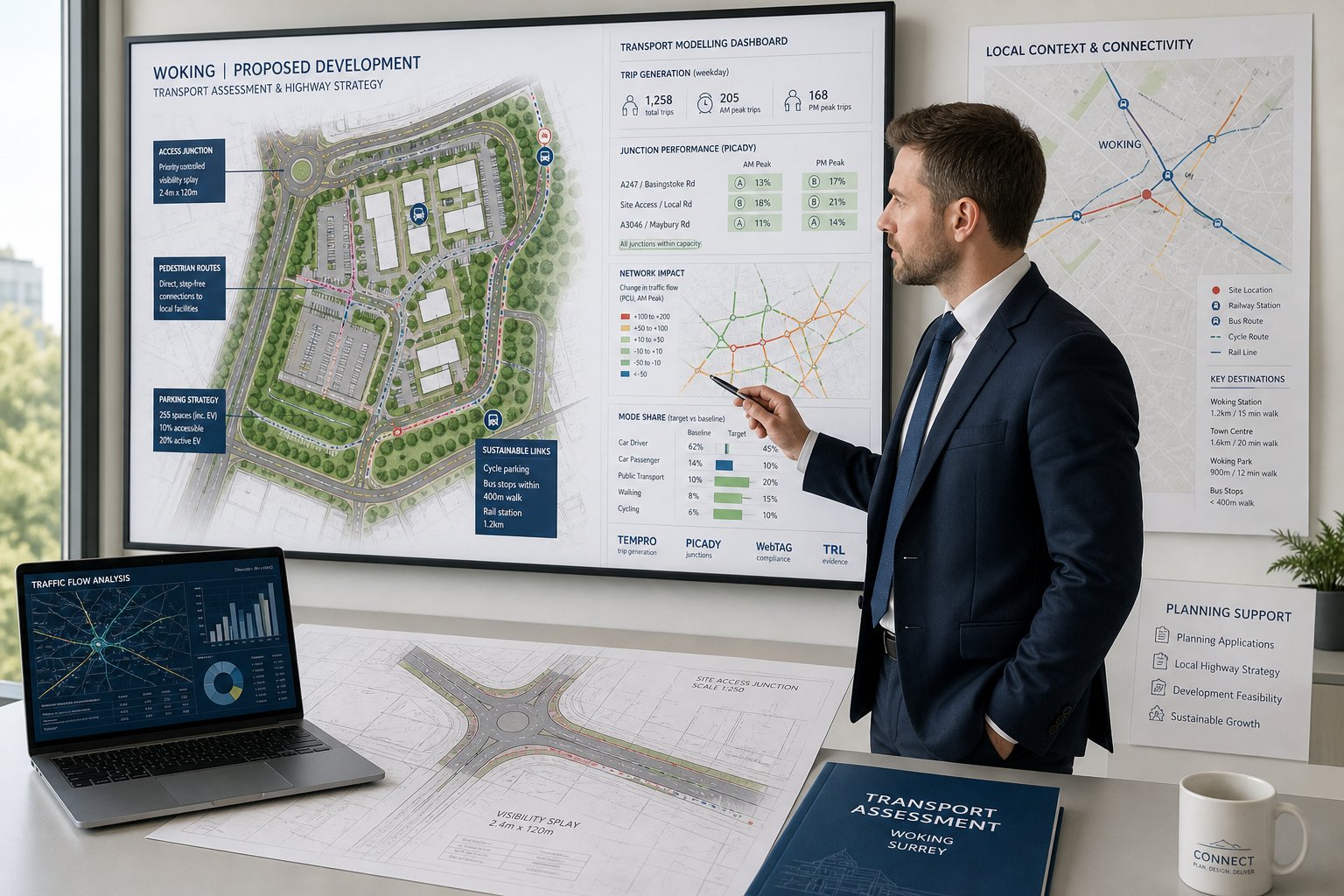
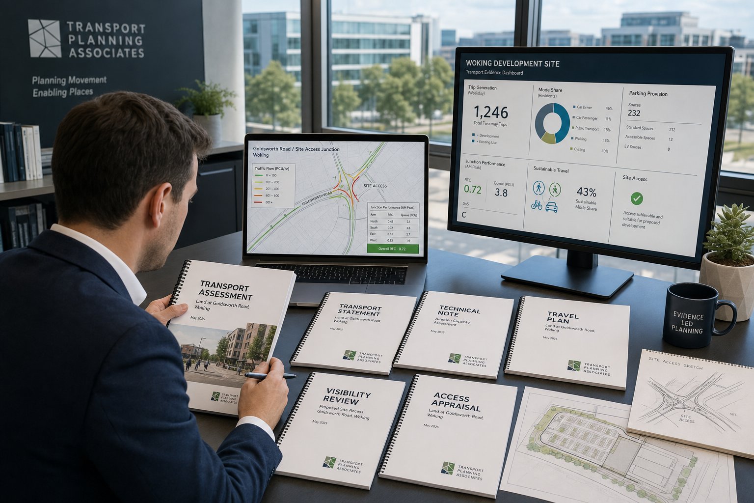
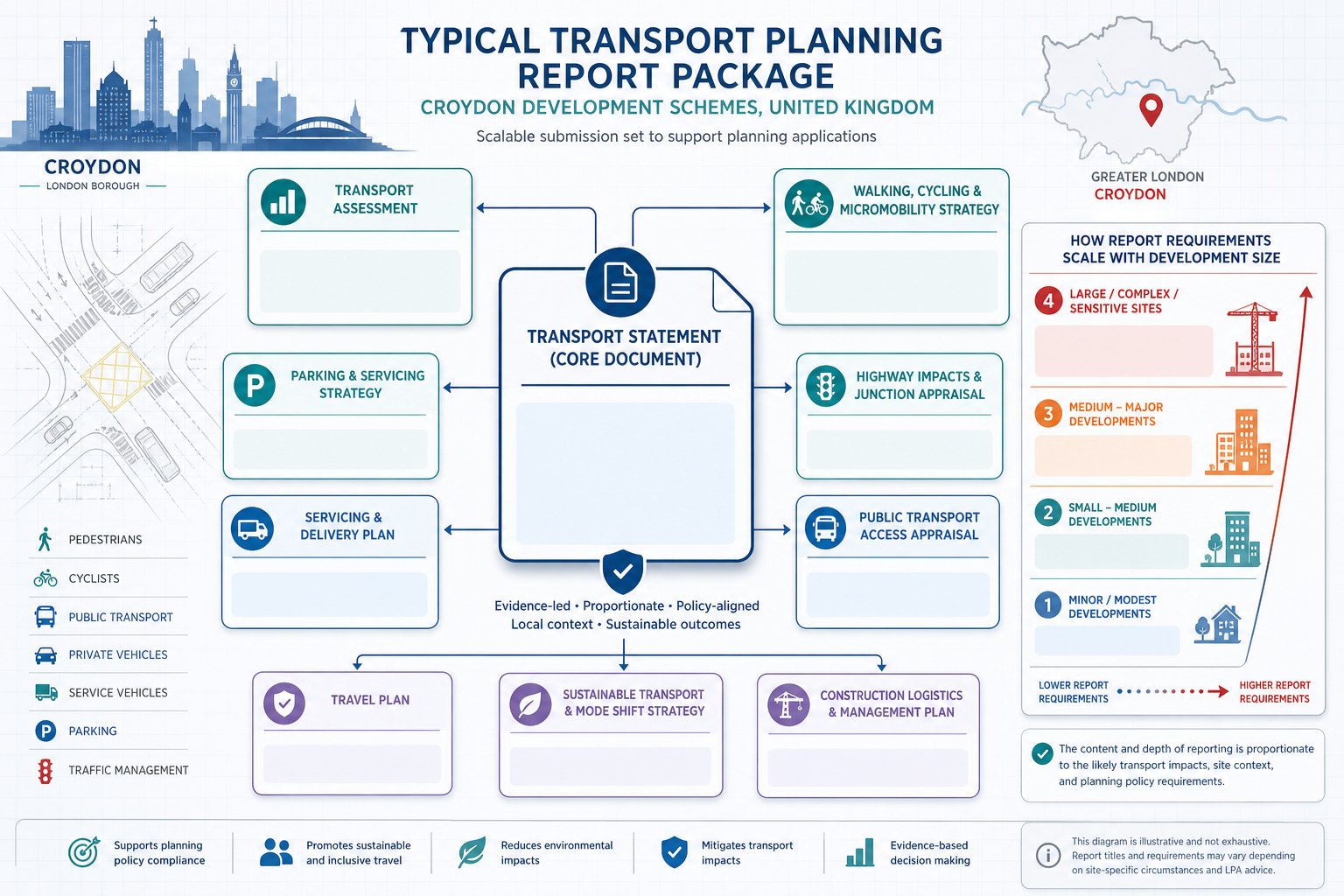
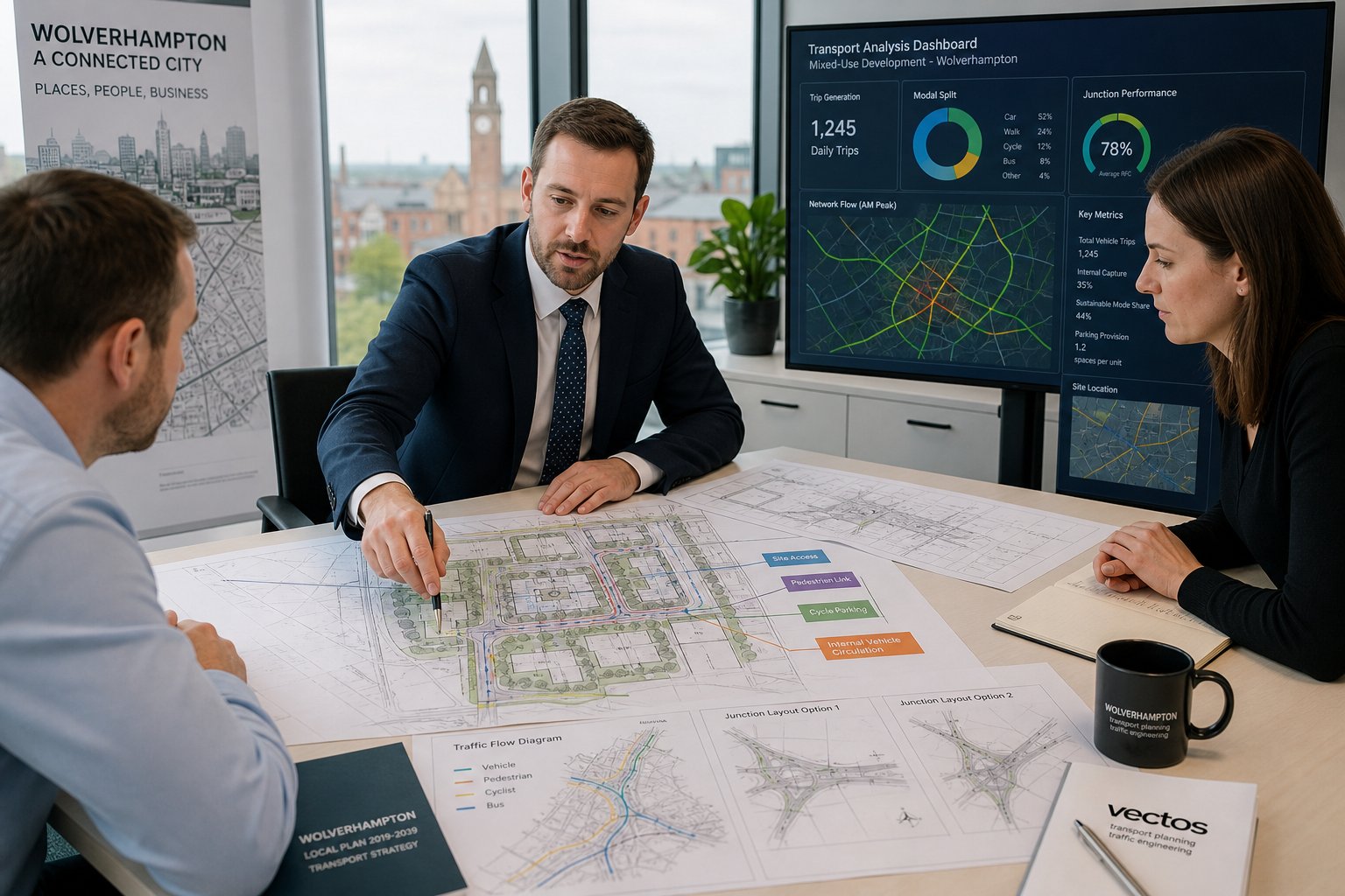
Transport Assessments And Statements For Planning Applications
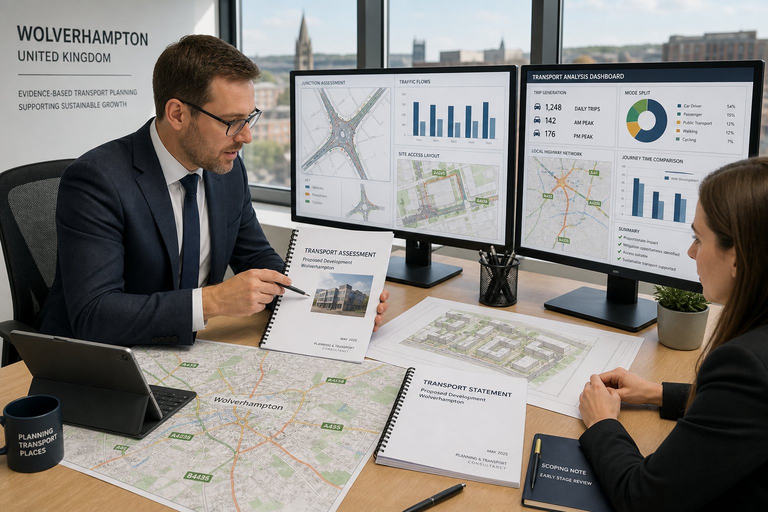
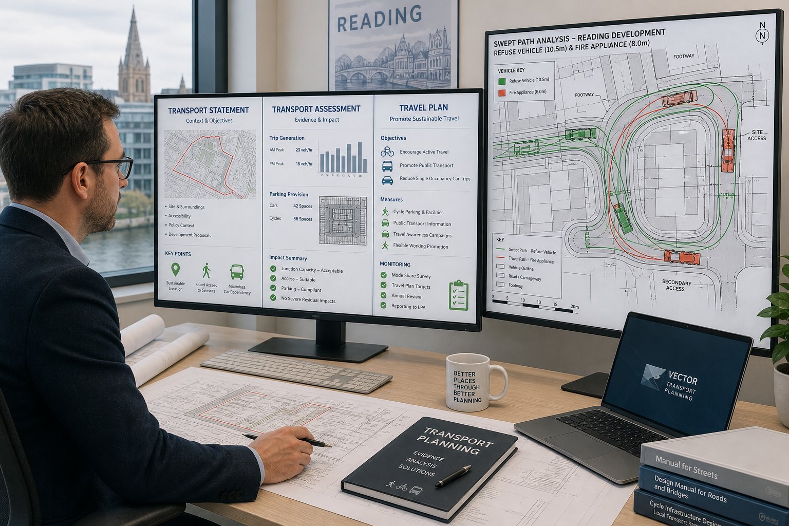
Transport Assessments and Transport Statements are the core planning documents used to explain how a development interacts with the transport network. Both are evidence-based, but they differ in depth and scope.
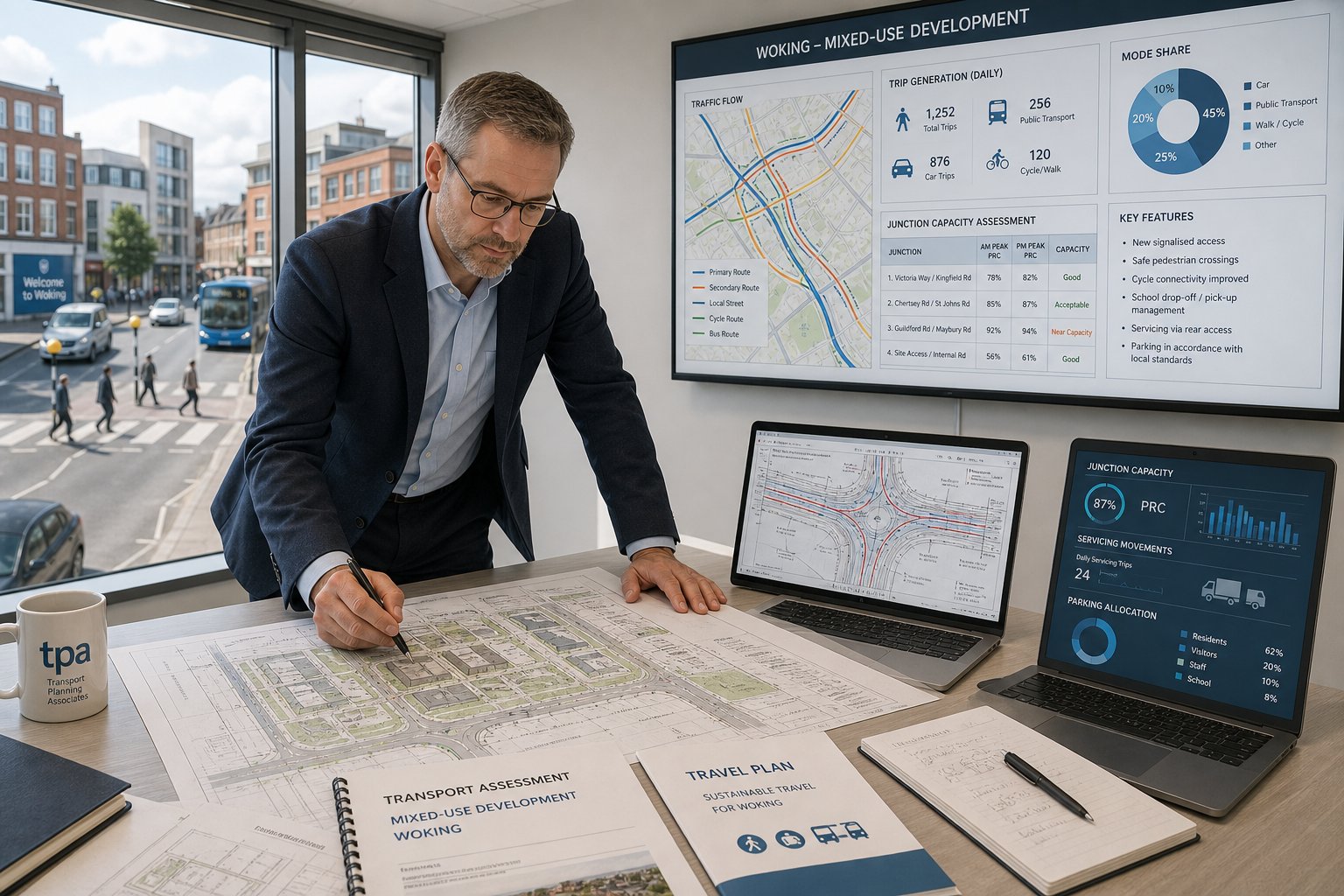
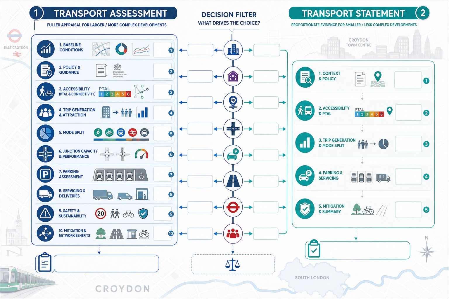
A Transport Assessment, usually called a TA, is the fuller exercise. It typically examines existing transport conditions, trip generation, trip distribution, assignment, junction capacity, road safety context, accessibility by walking, cycling and public transport, and any mitigation required. It is designed for schemes where transport effects may be material.
A Transport Statement, or TS, is shorter and more proportionate. It still needs to be robust, but it is aimed at development where impacts are likely to be limited and a full TA would be excessive. The quality test is not document length. It is whether the report answers the real planning questions.
The best submissions are scoped early, especially where Wolverhampton Council may have specific expectations on survey periods, modelling extent or local junction coverage. We often align this work with broader Traffic Engineering: Your input so the transport report supports the planning narrative rather than sitting beside it awkwardly.
Poorly scoped reports create predictable problems: too much irrelevant data, too little local analysis, or mitigation that appears after the design is fixed. A well-prepared TA or TS should do the opposite. It should make the transport implications of the scheme clear, proportionate and difficult to challenge.
When A Full Transport Assessment Is Needed
A full Transport Assessment is usually needed where a development is large, traffic-intensive or likely to affect sensitive junctions and corridors. Major housing, larger retail schemes, employment sites, logistics uses and mixed-use proposals commonly fall into this category. The same applies where a site sits close to already congested junctions, interacts with strategic routes, or raises clear concern from the highway authority.
In practice, a TA is appropriate when decision-makers need a rounded picture of existing conditions and future impact. That often means surveyed turning counts, committed development review, forecast year testing, junction modelling, road safety commentary, accessibility analysis and a structured mitigation package. Depending on the site, modelling may use Junctions, LinSig, TRANSYT, VISSIM, Synchro or HCS.
We also recommend a TA where legal or commercial risk is high. If a scheme is likely to draw objection from neighbours, ward members or statutory consultees, a more comprehensive evidence base usually gives the application better resilience.
When A Transport Statement May Be Sufficient
A Transport Statement may be sufficient for small to medium developments where traffic impacts are expected to be modest, nearby junctions are not especially sensitive and the transport questions are relatively narrow. Typical examples include small residential schemes, local change-of-use applications, light refurbishment projects, or infill development on roads with established movement patterns.
That does not mean a TS is casual or lightly argued. It still needs to explain baseline conditions, likely trip effects, access arrangements, parking, servicing and sustainable travel opportunities. The difference is proportionality. If the likely impact is limited, the evidence should be concise and targeted rather than inflated.
A strong TS can be very effective because officers tend to appreciate clarity. If the proposal has modest trip generation, safe access, acceptable parking and no meaningful effect on local capacity, a sharp statement often serves the application better than a bulky report trying to imitate a TA.
Travel Plans And Sustainable Access Strategies
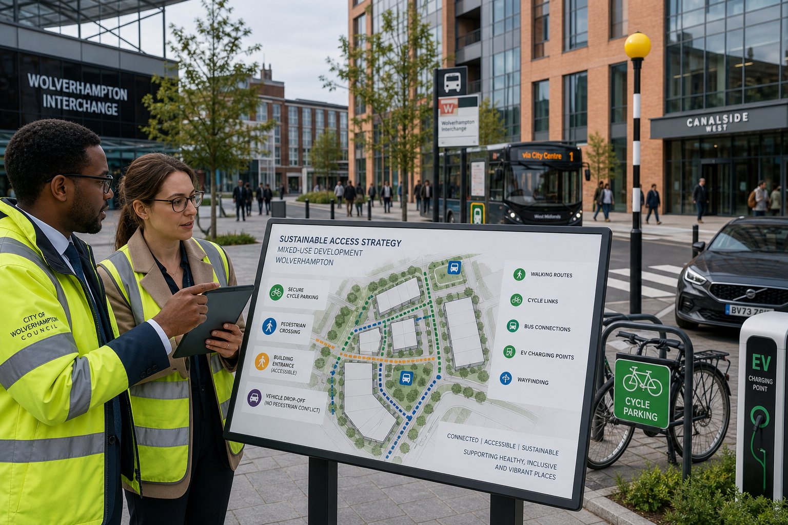
Travel Plans are often misunderstood as soft add-ons. In reality, they are practical management tools that show how a development will support lower car dependency over time. For many Wolverhampton schemes, especially employment, education, healthcare and larger residential proposals, they help demonstrate that sustainable access has been considered seriously rather than mentioned in passing.
A useful Travel Plan sets out specific measures. These can include cycle parking, showers and lockers, bus information, welcome packs, car share matching, public transport ticket support, EV charging, pedestrian wayfinding, freight management measures and monitoring arrangements. The strongest plans are tailored to the actual site and occupier profile. Generic promises are easy to spot and rarely persuasive.
We also look beyond the Travel Plan document itself. Sustainable access should be embedded in the design: direct walking routes, safe crossing points, cycle storage in sensible locations, accessible entrances, and layouts that do not force conflict between pedestrians and vehicles. That is where planning and engineering need to work together.
Experience from urban projects such as Traffic Engineer In London: and Traffic Engineer In Leeds: reminds us that sustainable travel measures work best when they are realistic. A Travel Plan should not pretend every site can behave like a city-centre transport hub. It should reflect actual local bus links, walk catchments, cycle potential and occupier habits.
Done well, these strategies improve planning outcomes and operational performance at the same time.
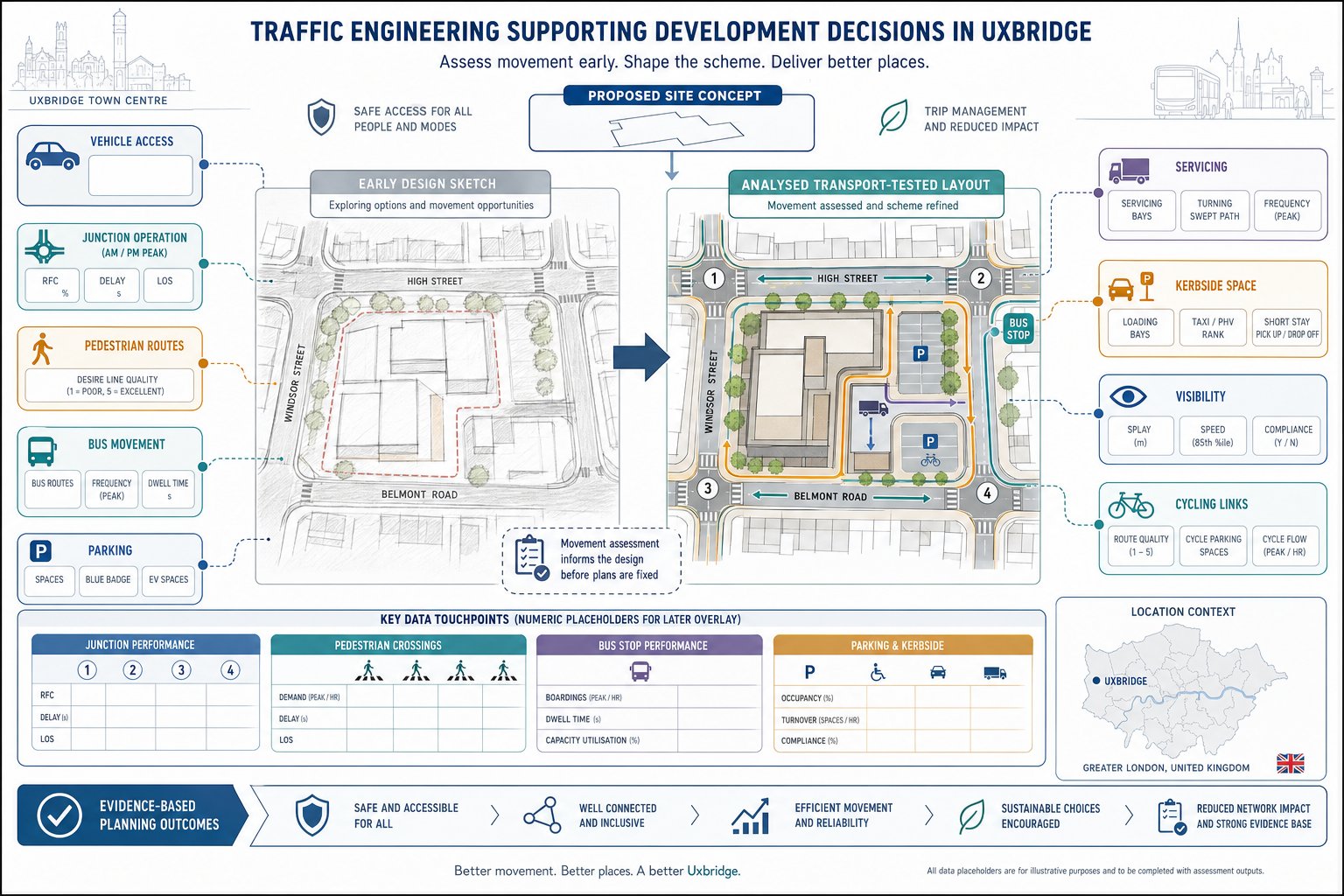
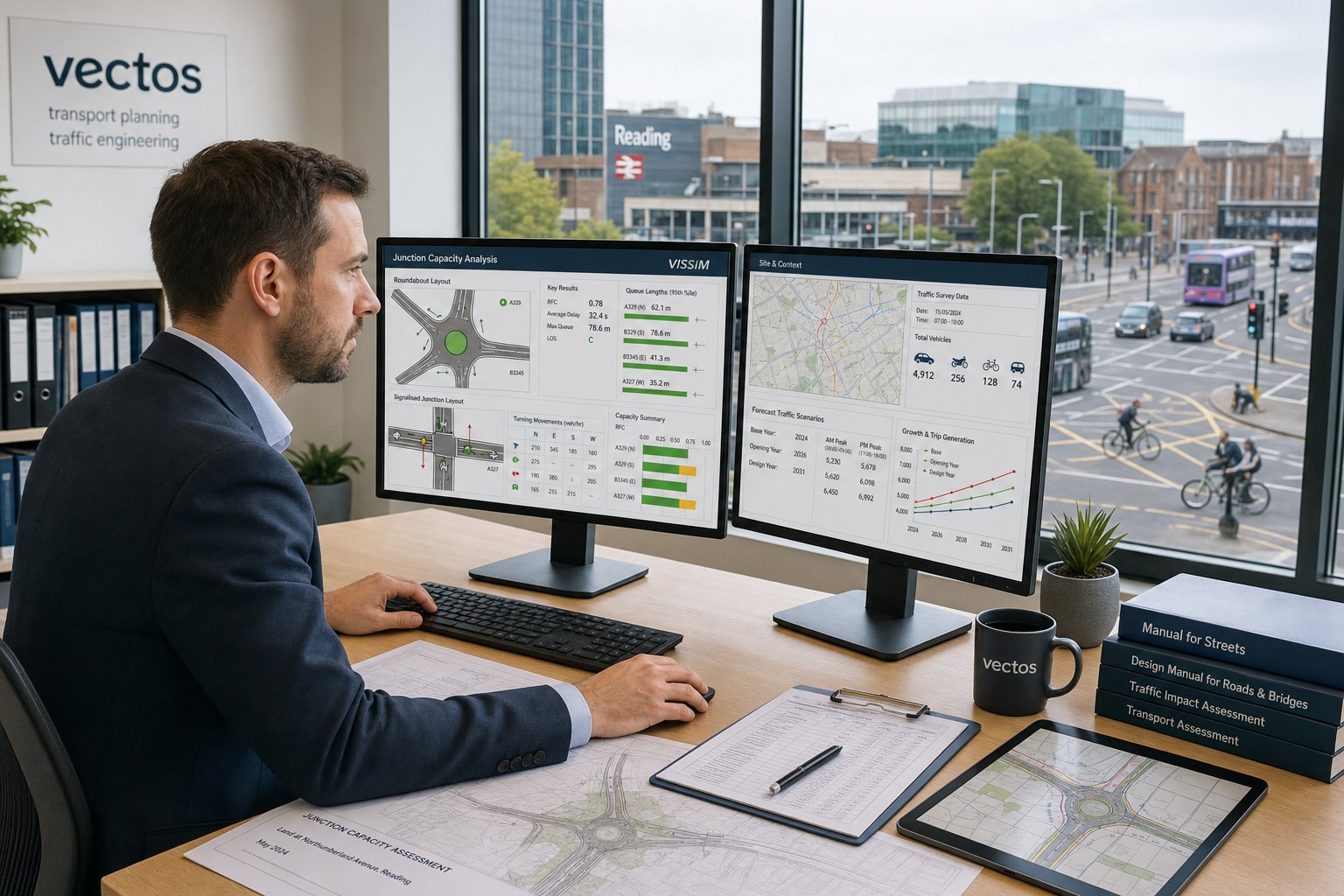
Junction Capacity Modelling And Highway Impact Analysis
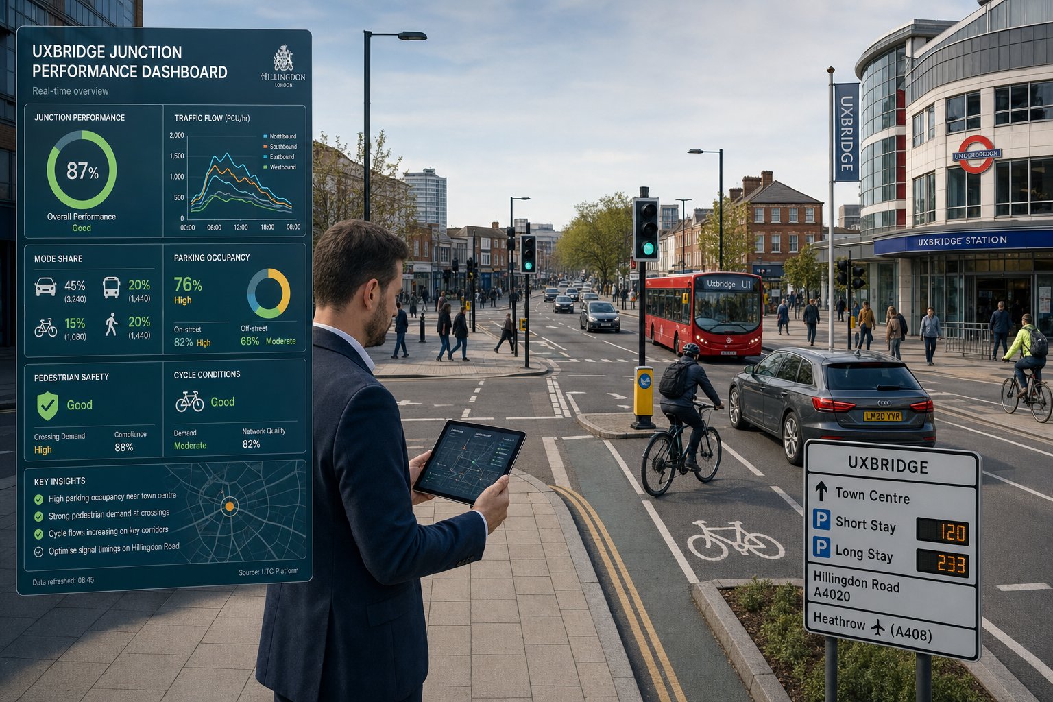
Junction capacity modelling is often the technical core of a planning submission. It answers a simple question with a lot of detail behind it: can the surrounding network accommodate the development safely and efficiently?
We start by understanding the existing operation of nearby junctions, not just their theoretical form. Queueing behaviour, lane discipline, school-run peaks, bus activity, parking friction and signal staging all matter. Then we test forecast conditions with development traffic added, usually across agreed future assessment years.
The modelling tool depends on the junction type and the issue being tested. Priority and roundabout junctions may be reviewed in Junctions software. Signal-controlled nodes may require LinSig. More complex network interactions can call for TRANSYT, Synchro or microsimulation such as VISSIM. Software is useful, but judgement matters more than people sometimes admit. Inputs, assumptions and interpretation can change the planning conclusion.
Highway impact analysis also goes beyond queue lengths. We review whether delays create knock-on effects, whether mitigation is physically deliverable, and whether the residual impact is likely to be severe in planning terms. Sometimes a development needs geometric alteration, signal optimisation or lane reassignment. Sometimes the right answer is operational management or phased occupation.
This is one of the clearest areas where concise reporting helps. Decision-makers do not need endless screenshots. They need a transparent explanation of conditions, assumptions, outputs and practical consequences.
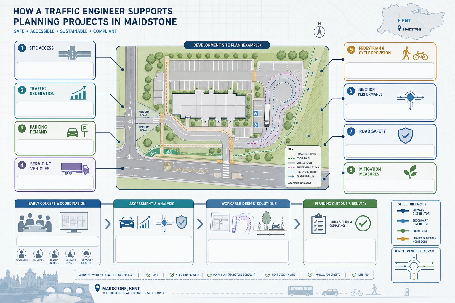
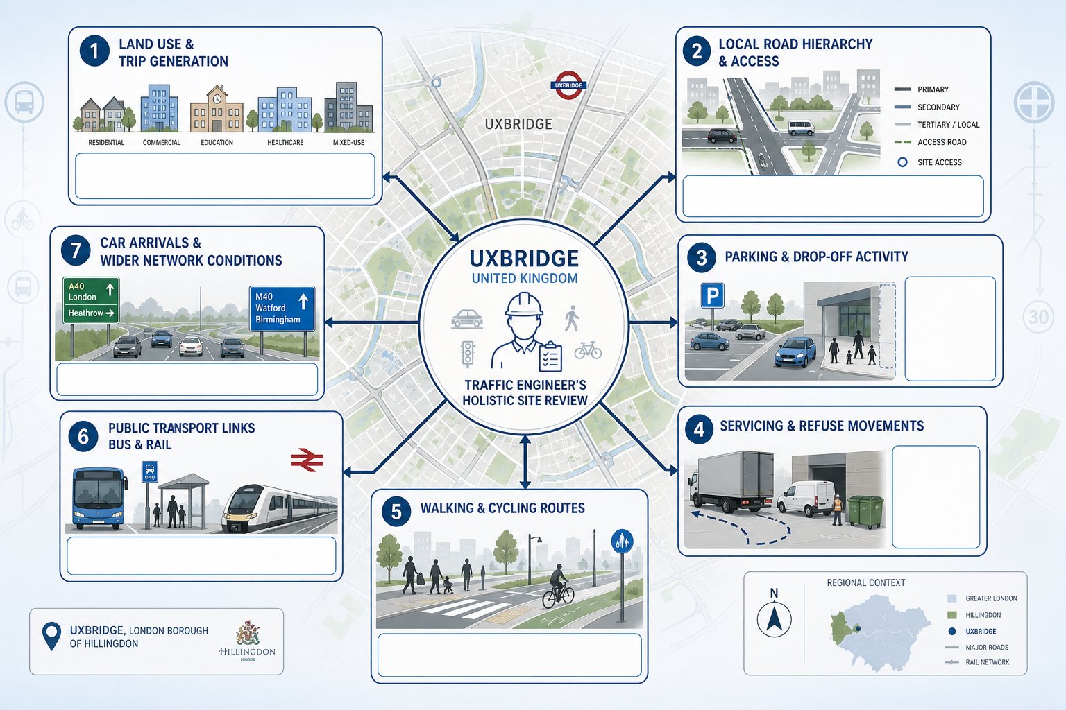
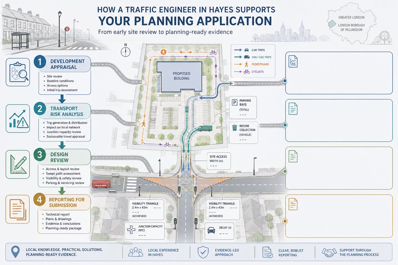
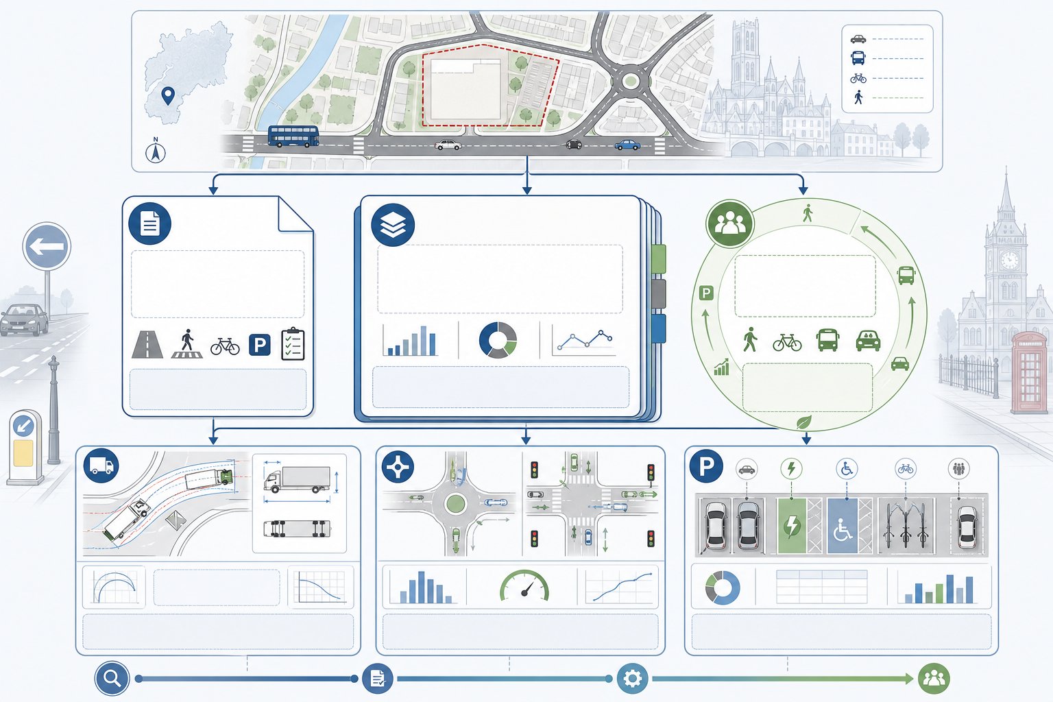
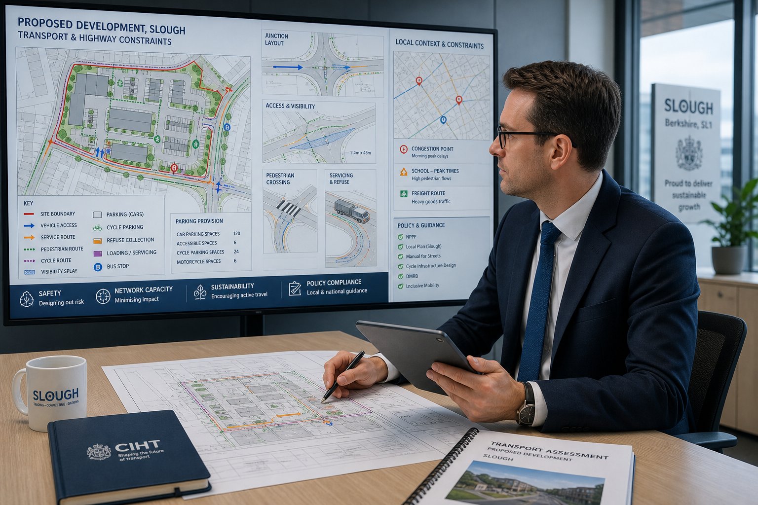
Access Design, Visibility, And Swept Path Assessment
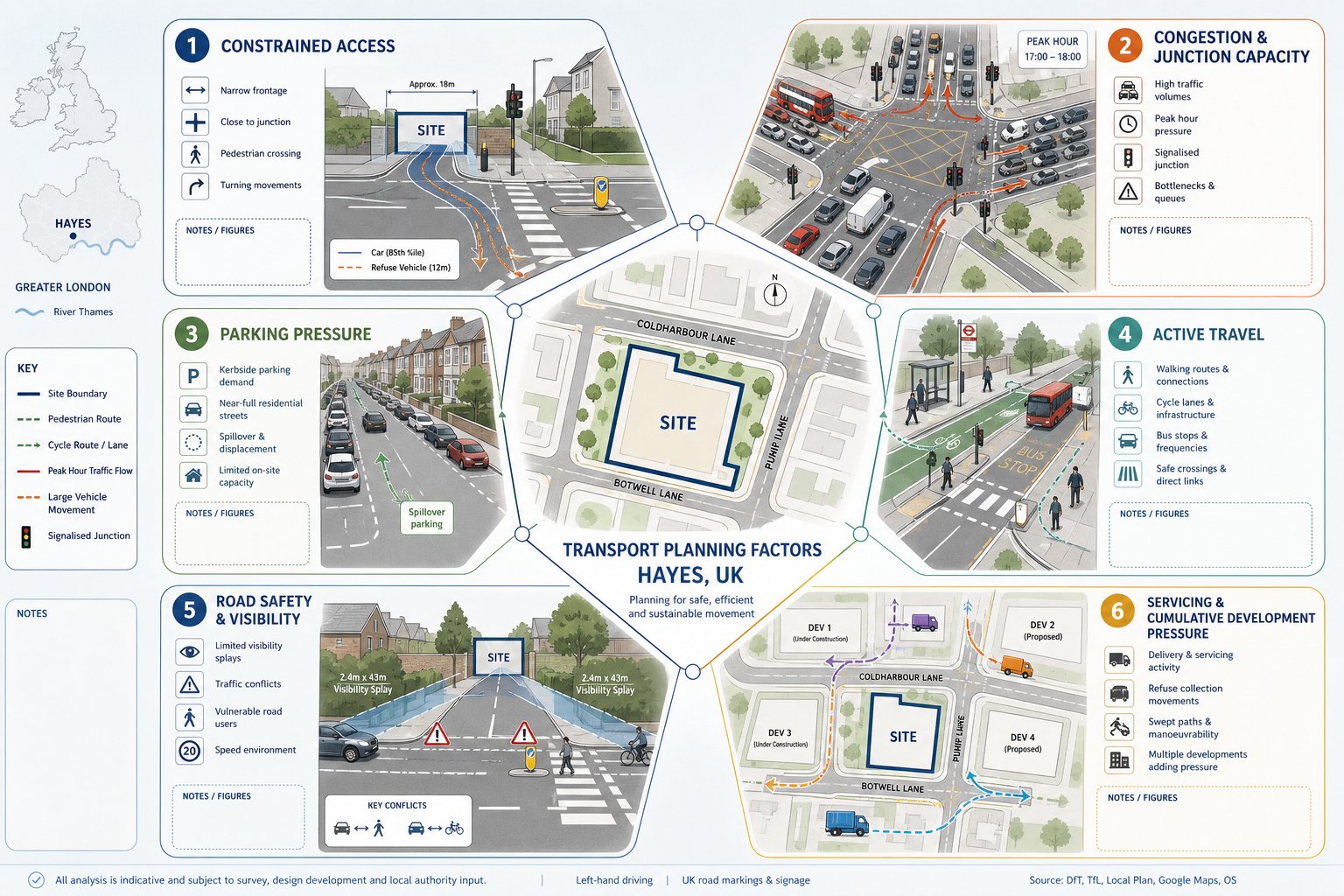
Access design is where transport planning becomes very tangible. A planning officer, highway engineer or committee member can usually grasp a poor access point immediately, even before reading the report. If visibility is weak, geometry is awkward or large vehicles cannot manoeuvre safely, confidence in the scheme drops fast.
We hence test access arrangements against the relevant standards and the local street context. That includes entry width, radii, gradient, pedestrian crossing points, likely vehicle speeds and the visibility splays needed to provide safe emerging movement. Manual for Streets principles are often central on lower-speed urban roads, while more strategic environments may point toward different design expectations.
Swept path assessment is especially important for developments involving refuse vehicles, delivery vans, articulated vehicles, fire appliances or service yard circulation. Using tools such as AutoTrack or Vehicle Tracking, we check whether vehicles can enter, turn, load and exit without unrealistic manoeuvres or conflict with parked cars, walls, bins or pedestrian routes.
Some of the most common planning delays come from apparently small access issues: a gate set too close to the highway, a turning head that does not actually work for refuse collection, or visibility splays obstructed by landscaping that looked harmless on the architect’s plan. Sorting those matters early is much cheaper than redesigning after submission.
And yes, those details can decide whether a transport response feels confident or fragile.
Parking, Servicing, And Operational Layout Considerations
Parking is rarely just about numbers. For Wolverhampton planning applications, the real issue is whether the parking, servicing and internal layout work together in daily operation. A technically compliant parking count can still fail if bays are unusable, servicing blocks circulation, or refuse vehicles reverse through pedestrian space.
We review the whole operational picture: car parking demand, disabled provision, cycle parking, EV charging, motorcycle space where relevant, loading arrangements, turning areas, bin collection strategy and likely conflict points. Residential schemes need layouts that are straightforward for residents and visitors. Commercial schemes need servicing space that reflects actual delivery patterns rather than idealised assumptions.
Under-provision can trigger overspill and local objection. Over-provision can undermine design quality, sustainable travel goals and developable area. The right answer is usually balanced and evidence-led. Comparable approaches used on Traffic Engineer In Liverpool: and similar urban assignments show the same pattern: layouts succeed when they account for what users really do, not what the drawing hopes they will do.
Servicing is often the neglected part until late stage. Yet for schools, healthcare, retail and industrial schemes, it can become the operational issue. If deliveries cannot happen cleanly and safely, the site will create friction from day one. A strong transport submission deals with that honestly.
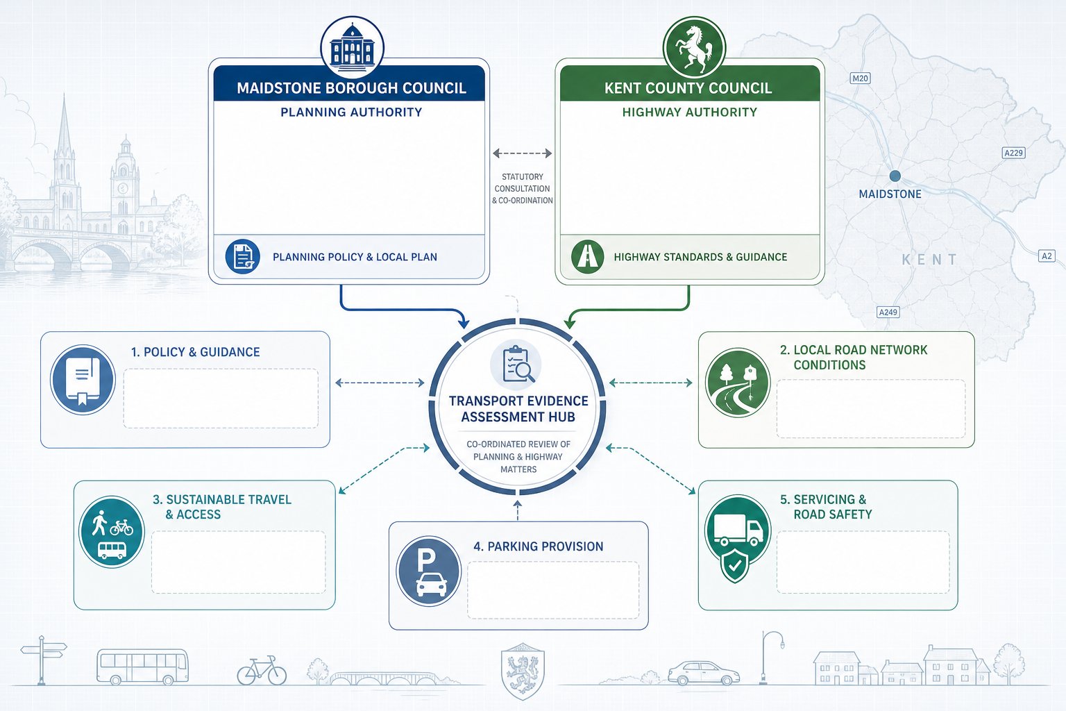
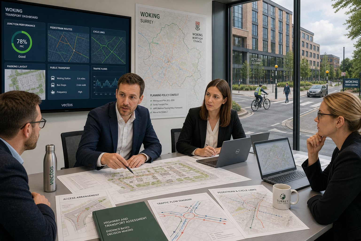
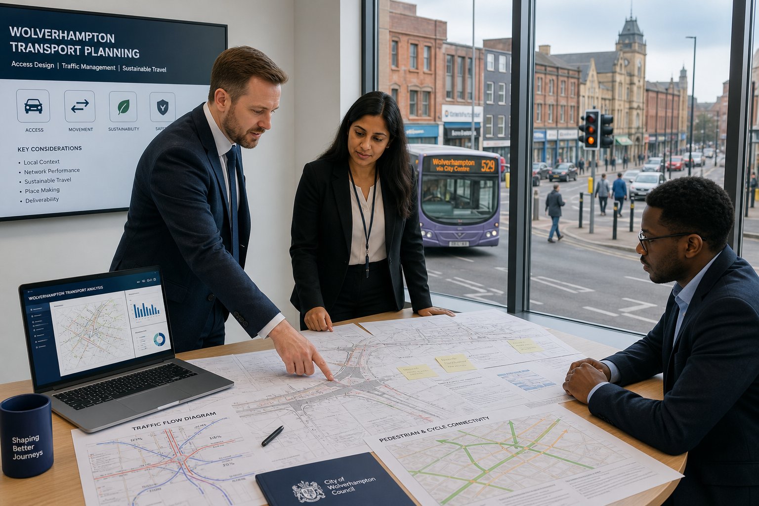
Working With Wolverhampton Council And Highway Authorities
Good outcomes often depend as much on process as on technical skill. Working with Wolverhampton Council and, where relevant, National Highways is not simply about submitting a finished report and waiting for a response. The better approach is to agree scope, identify likely concerns early and keep the transport evidence proportionate to the development.
That may involve discussing survey requirements, defining the study area, agreeing which junctions need assessment, confirming future year scenarios or setting expectations for Travel Plan content. On strategic or sensitive sites, those early conversations can prevent wasted work. They also reduce the chance of a late request for more modelling or revised mitigation after the planning package has already been assembled.
We have found that officers respond well to reports that are concise, transparent and locally grounded. They do not need a mountain of generic text. They need a clear explanation of the proposal, baseline, forecast effect and any mitigation. That sounds obvious, but plenty of transport documents still miss the point.
This is also where experience across multiple authority areas helps. Methods used in Traffic Engineer In work elsewhere can inform approach, but local authority dialogue still shapes the final strategy. Wolverhampton officers will understandably focus on Wolverhampton impacts. A consultant should be comfortable with that and able to respond without turning every query into a long dispute.
Planning progresses faster when the transport discussion is structured, evidence-led and professional.
How To Choose The Right Traffic Engineer For Your Project
Choosing the right consultant is partly about qualifications and partly about judgement. A capable traffic engineer should have the technical grounding, usually through a civil or transportation engineering degree, and ideally recognised professional membership such as MICE or MCIHT. But credentials alone do not guarantee a useful planning report.
We would look for three things. First, proven experience with UK planning applications: Transport Assessments, Transport Statements, Travel Plans, junction modelling and access design. Second, the ability to write clearly. A report may be technically correct and still fail to persuade if it is cluttered, vague or badly structured. Third, local understanding. Wolverhampton knowledge can make a real difference when deciding what level of analysis is proportionate and which issues are likely to matter most.
Track record matters too. Ask whether the consultant has supported similar schemes in urban, suburban and commercial settings. Ask how they scope work to avoid over-reporting. Ask who will actually prepare the analysis, not just who attends the fee call. If the answers feel slippery, that usually tells you something.
For many clients, speed also matters. Fast should not mean rushed, but it should mean responsive, organised and realistic about planning timetables. Our own approach at ML Traffic is built around concise, accurate reporting with local authority context in mind, because most project teams do not need theatre: they need dependable progress.
In a market full of broad claims, clarity is still a pretty good filter.
Conclusion
Using a locally experienced traffic engineer in Wolverhampton usually improves more than just the transport chapter of a planning submission. It helps shape site layout, de-risk access design, keep reports proportionate and answer the right policy questions early.
For architects, planners, lawyers, surveyors, builders, developers and public sector teams, that translates into something very practical: fewer avoidable objections, clearer technical evidence and a better chance of timely progress through planning. Whether a project needs a full Transport Assessment, a concise Transport Statement, a Travel Plan or detailed junction and access work, the value lies in combining sound engineering with local judgement.
In 2026, that blend matters more than ever. Standards remain national, but decisions are still made on local evidence, local roads and local consequences. Get that right, and the whole project tends to move with more confidence.
Frequently Asked Questions about Traffic Engineering in Wolverhampton
What does a traffic engineer in Wolverhampton do for planning applications?
A traffic engineer in Wolverhampton assesses transport impacts of proposed developments, designs safe access and parking, and prepares technical reports like Transport Assessments or Statements to support planning applications in line with local and national policies.
When is a full Transport Assessment required in Wolverhampton?
A full Transport Assessment is usually needed for large or traffic-intensive developments, such as major housing, retail, employment sites, or projects near congested junctions, to provide detailed analysis of trip generation, junction capacity, safety, and required mitigation.
How does local knowledge impact traffic engineering in Wolverhampton?
Local knowledge ensures transport assessments align with Wolverhampton Council policies and West Midlands strategies, addressing specific urban road conditions, traffic patterns, and officer expectations which differ from other regions like Birmingham or Manchester.
What developments commonly need traffic engineering input in Wolverhampton?
Common developments requiring traffic engineering include residential estates, student housing, retail parks, logistics sites, schools, healthcare facilities, employment centres, and mixed-use schemes due to their traffic, parking, and servicing impacts.
How do Travel Plans support sustainable access strategies?
Travel Plans outline tailored measures to reduce car dependency, such as cycle parking, EV charging, bus information, car sharing, and pedestrian improvements, helping Wolverhampton developments promote sustainable travel and meet planning expectations.
What key qualifications should I look for when choosing a traffic engineer in Wolverhampton?
Look for a civil or transportation engineering degree, professional memberships like MICE or MCIHT, proven UK planning application experience including Transport Assessments and junction modelling, clear report writing skills, and local Wolverhampton knowledge for best planning outcomes.