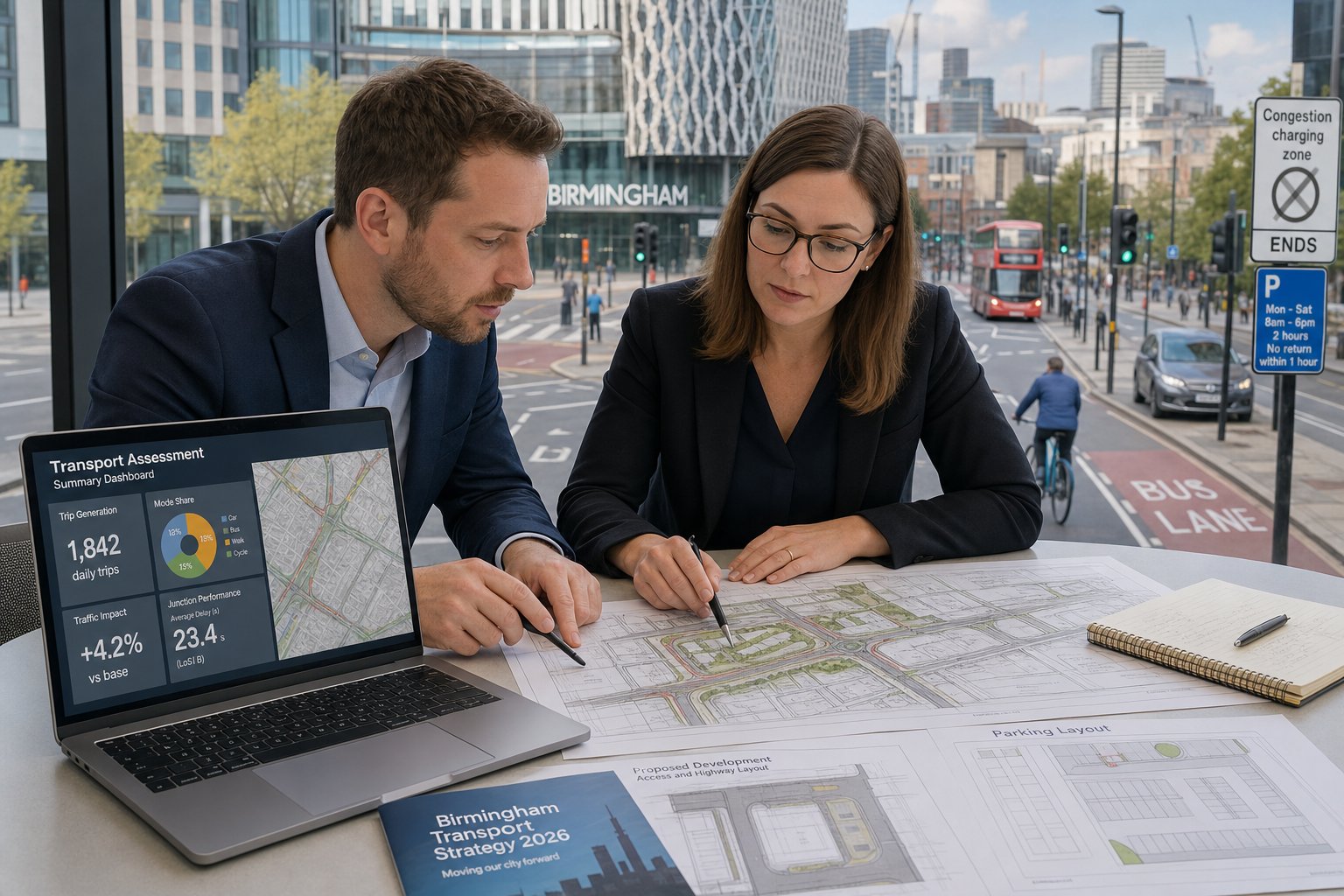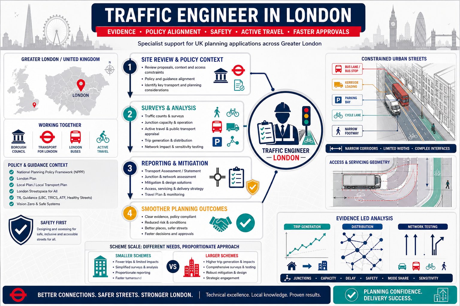
A planning application can look perfectly sound on paper and still stall the moment highway questions land on the case officer’s desk. Access width, visibility, turning, parking stress, trip generation, junction impact, these details often decide whether a scheme moves forward smoothly or gets dragged into revisions, objections, and delay.
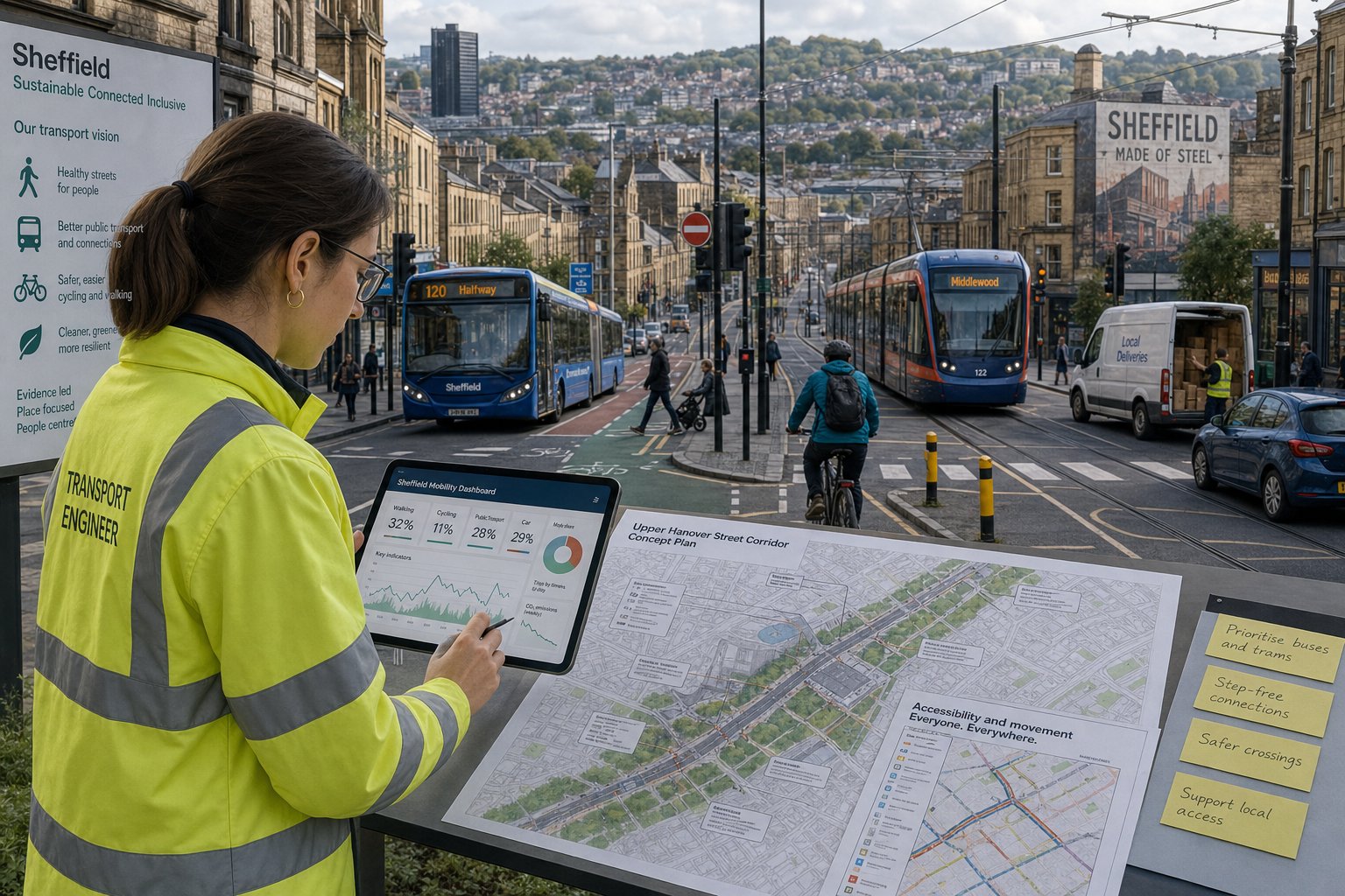
That is where a Traffic Engineer in Durham becomes essential. In practice, our role is not simply to “do a report”. We assess whether a development is safe, workable, and defensible from a transport perspective, then turn that analysis into planning evidence that local authorities, design teams, and applicants can rely on. For architects, planners, lawyers, surveyors, developers, and councils, that evidence can be the difference between a straightforward validation process and months of avoidable back-and-forth.
In Durham, transport planning sits at the intersection of national guidance, local policy, and very site-specific highway constraints. A village infill scheme, a roadside commercial unit, and an education expansion might all need different levels of technical assessment, even when the planning issues appear similar at first glance.
Below, we set out what a traffic engineer does in Durham planning projects, when a Transport Assessment or Transport Statement is typically required, which reports matter most, and why early technical advice usually saves both time and money later in the planning process.
Key Takeaways
- A Traffic Engineer in Durham evaluates whether a development proposal will function safely and efficiently within the local transport network, addressing site-specific access, visibility, and traffic concerns.
- Early involvement of a traffic engineer during the concept stage helps shape compliant access, parking, and movement strategies, reducing planning delays and objections.
- Transport Assessments or Transport Statements are essential reports that vary in detail depending on the scale and impact of the development, with local planning authorities determining submission requirements based on site context.
- Tailored transport evidence reflecting Durham’s unique policy and highway constraints is crucial; generic reports often fail to satisfy planning officers and highway reviewers.
- Common developments like residential, commercial, and education projects regularly require detailed traffic engineering input to address local access, trip generation, and highway safety issues.
- Choosing a traffic engineer with local planning knowledge, relevant report experience, and ability to deliver accurate, timely advice can significantly streamline the planning process in Durham.
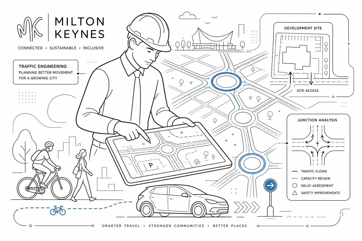
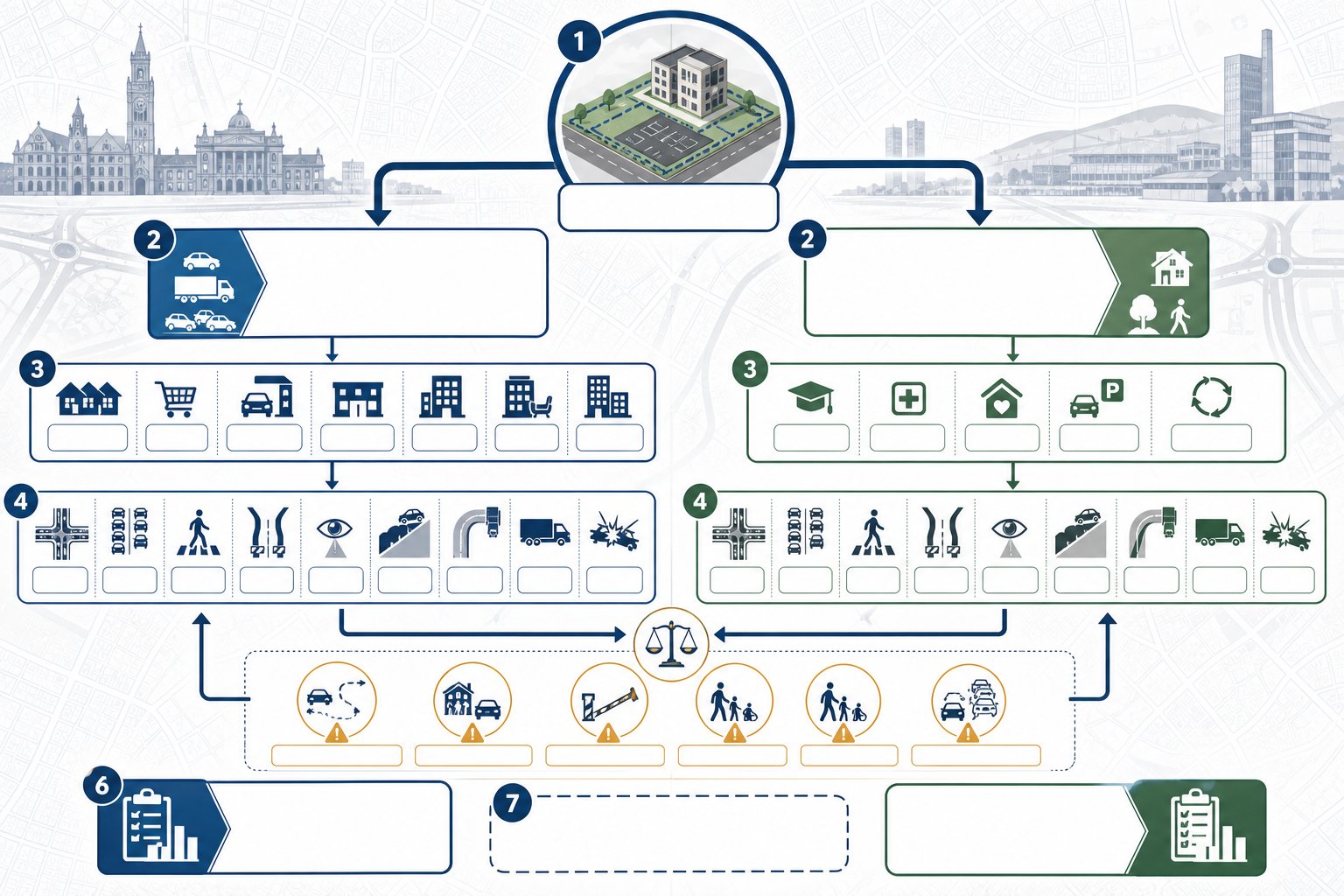
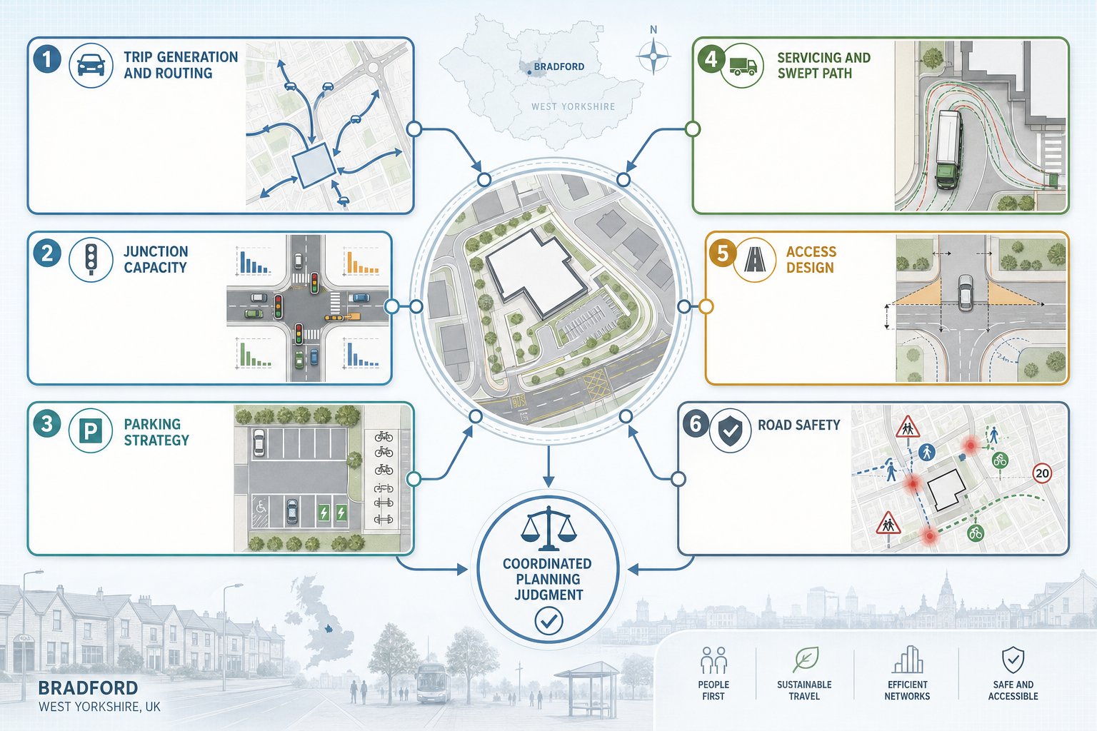
What A Traffic Engineer Does In Durham Planning Projects
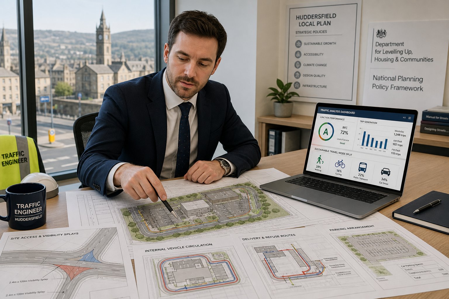
A traffic engineer supporting a Durham planning application looks at one core question: will the proposal function safely and acceptably on the local transport network? That sounds simple. It rarely is.
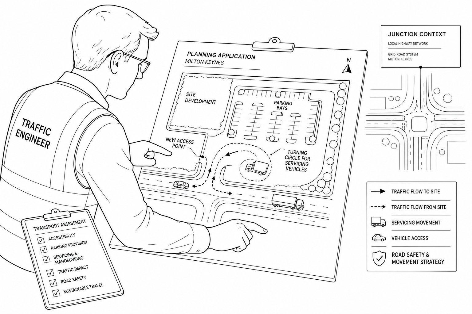
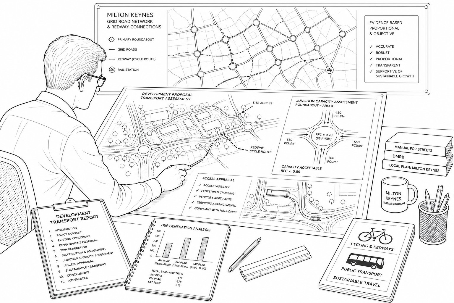
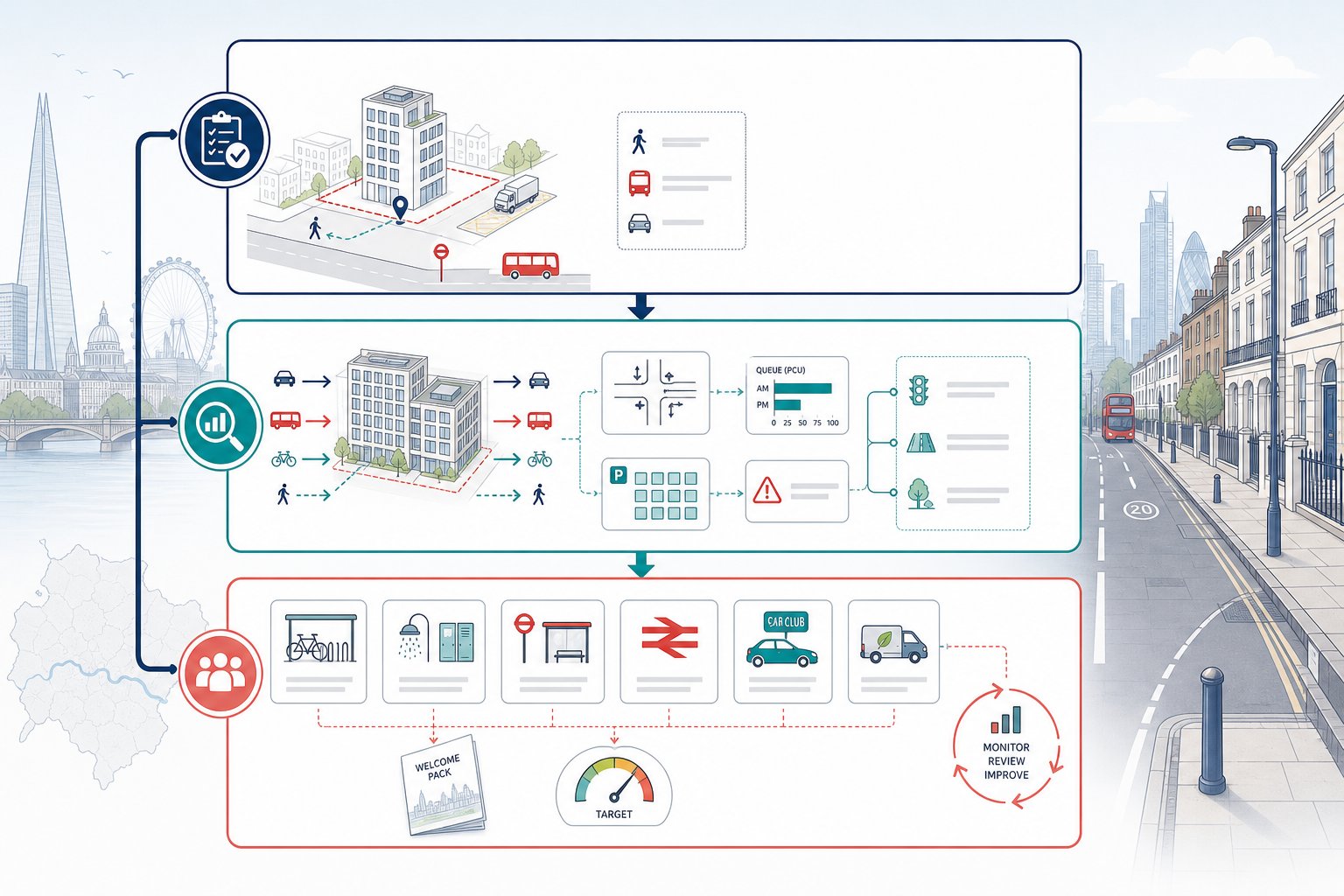
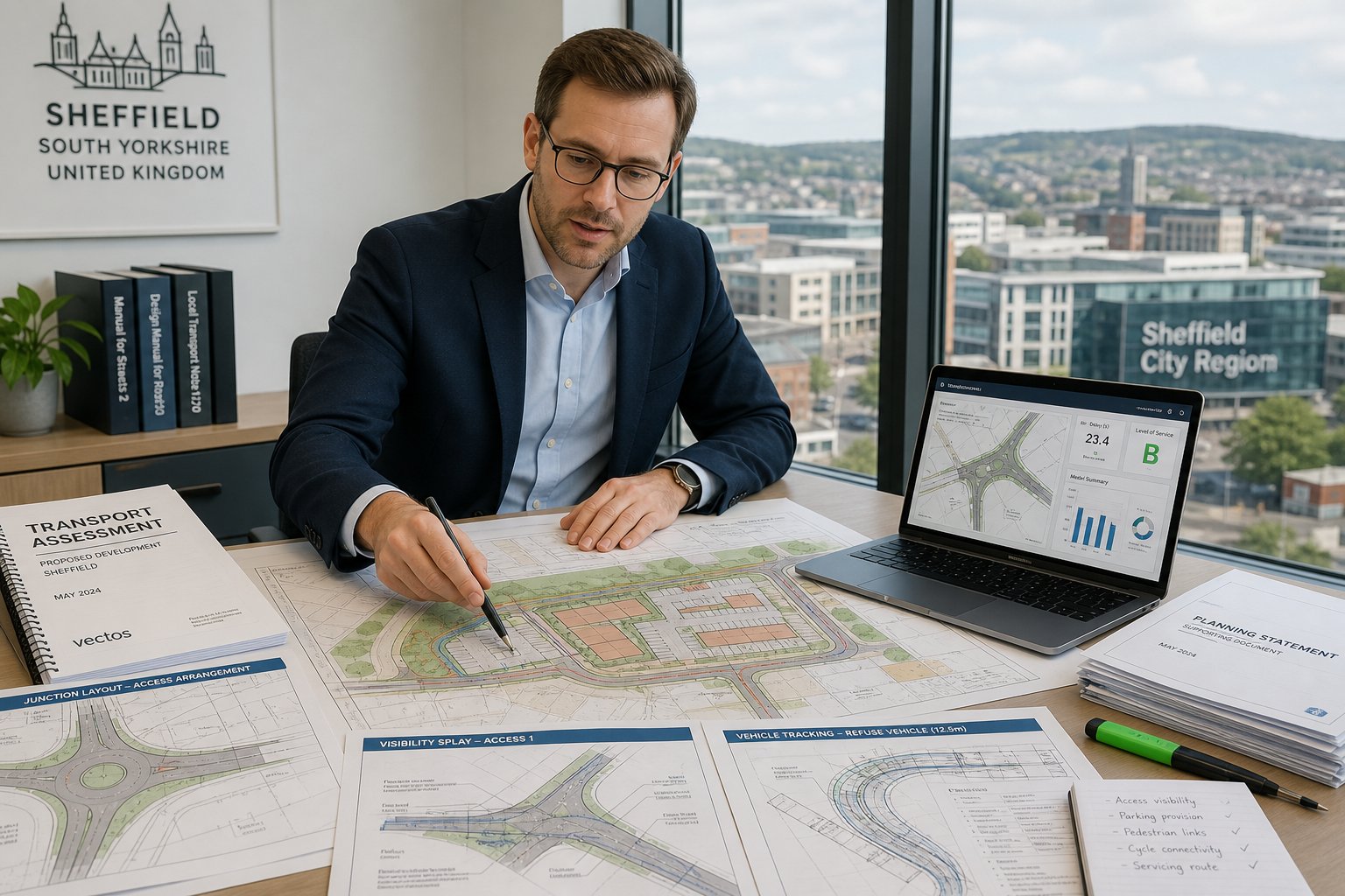
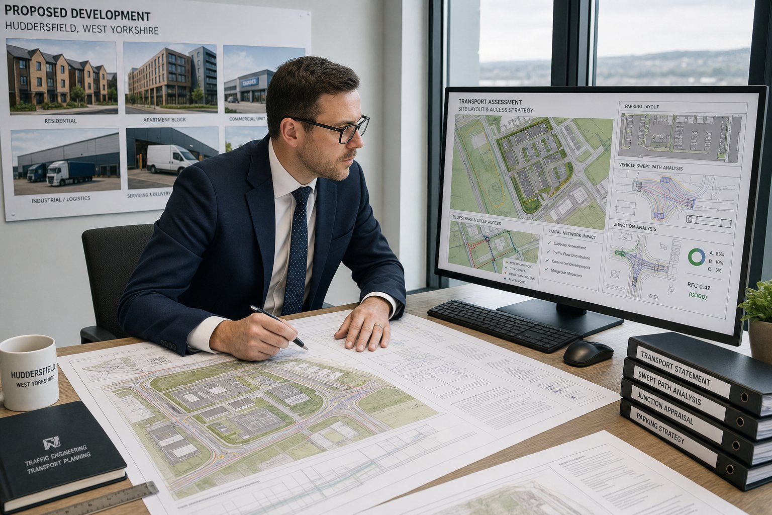
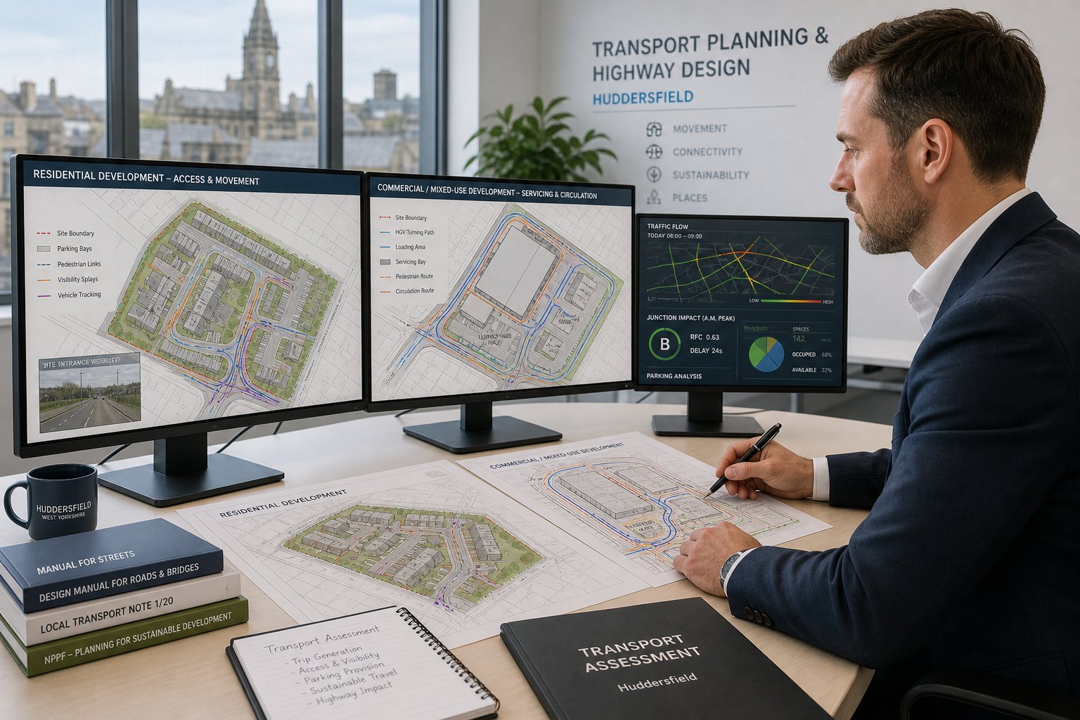
We typically review the proposed access strategy, junction arrangement, internal layout, parking provision, servicing, pedestrian links, cycle connections, and likely vehicle movements. We also test whether a site can accommodate the vehicles it needs to serve. On some projects, the key issue is visibility at an access. On others, it is peak-hour traffic at a nearby junction, refuse vehicle tracking, delivery conflict, or overspill parking on surrounding streets.
Data is a big part of the job. We analyse traffic counts, collision records where relevant, speed environment, local trip patterns, and site context. That evidence is then translated into planning-ready conclusions. If a scheme needs changes, we identify them early, before a weak layout becomes expensive to fix.
In our experience, Durham projects benefit from transport input at concept stage rather than after the design is fixed. The earlier the technical review happens, the easier it is to shape access, parking, frontage design, and movement strategy into something planning officers and highway reviewers can support. Broader Traffic Engineering: Your Complete principles apply everywhere, but local interpretation always matters.
That is why planning teams often bring us in not just to write a report, but to pressure-test whether the proposal is genuinely ready to submit.
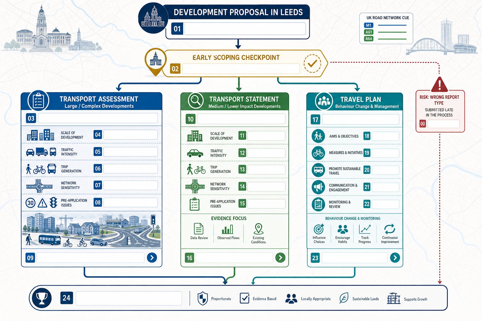
When A Transport Assessment Or Transport Statement Is Needed

A Transport Assessment or Transport Statement is usually needed when a development could materially affect traffic conditions, accessibility, or highway safety, or when the local planning authority wants formal evidence before determining the application.
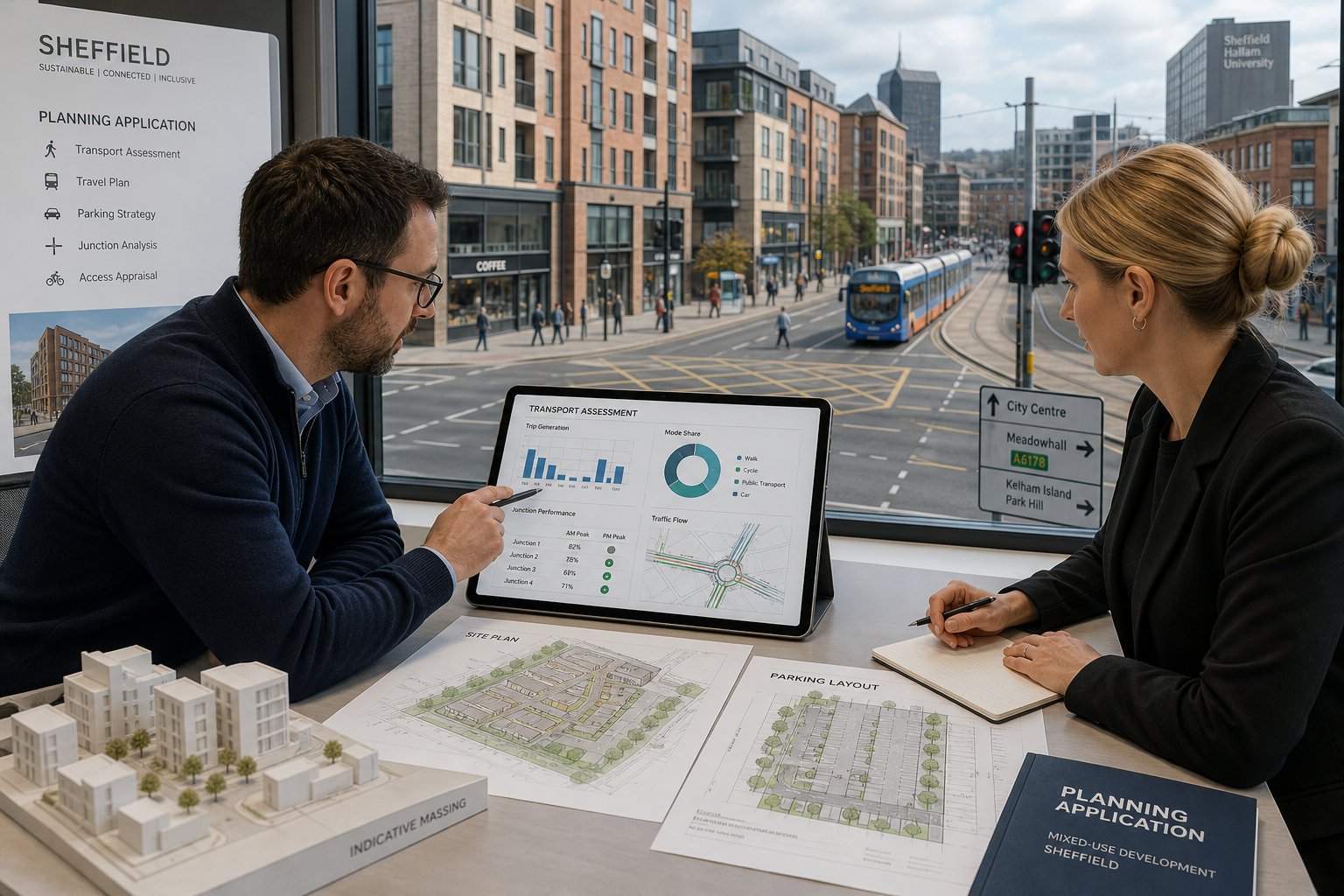
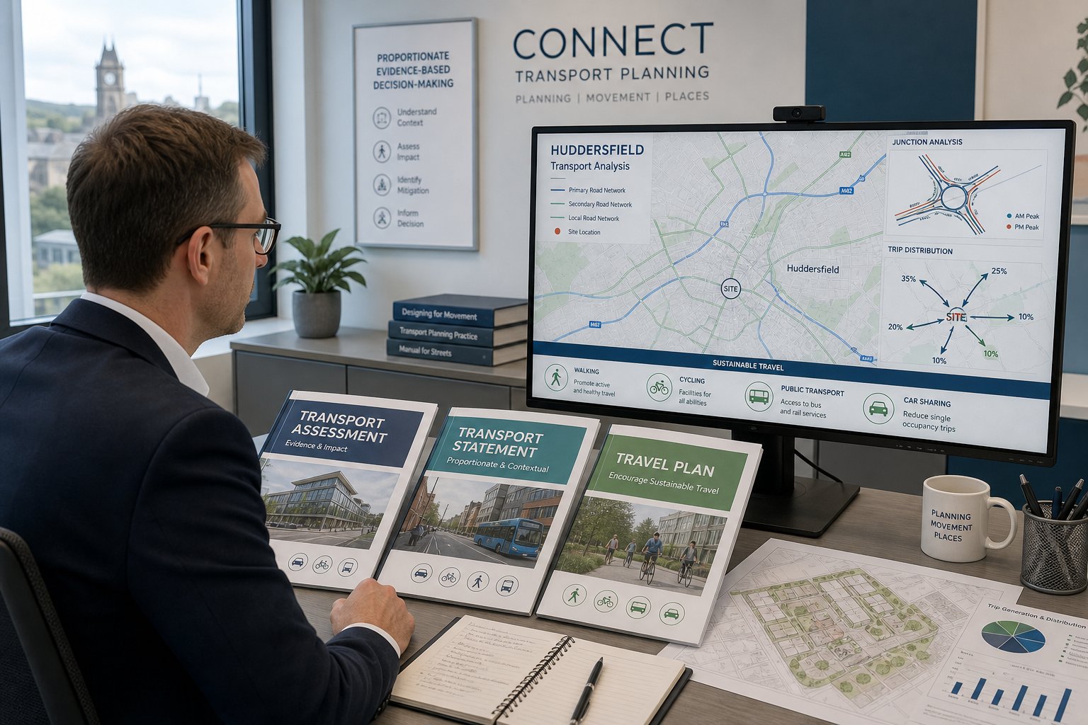
The distinction is generally one of scale and complexity. A Transport Statement is the lighter-touch document, used for proposals with more limited transport implications. It still needs to be robust. We would normally set out the site context, existing access conditions, sustainable travel opportunities, expected trip generation, parking and servicing arrangements, and whether the proposal is likely to create any significant highway concerns.
A Transport Assessment is more detailed and is typically required for larger or more sensitive schemes. That can involve a fuller appraisal of junction performance, traffic distribution, committed development, multimodal accessibility, mitigation, and cumulative impact. If the proposal may influence a constrained junction, alter travel patterns materially, or raise substantial local concern, a full assessment is often the prudent route.
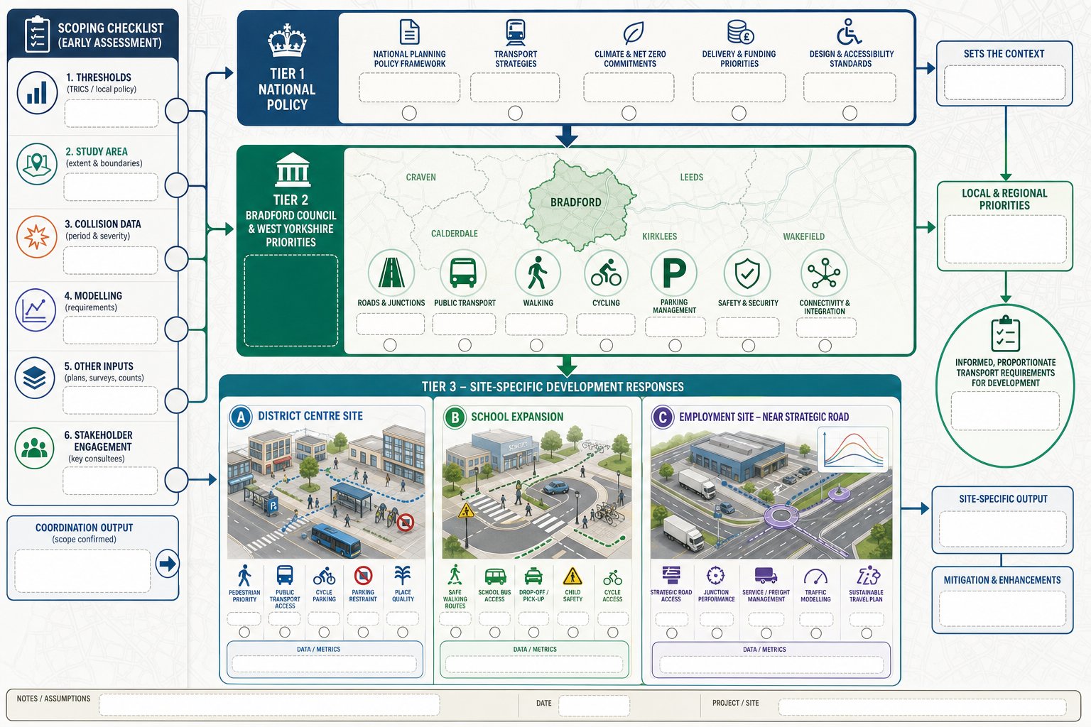
There is no universal threshold that works neatly for every site. Durham planning officers and highway consultees will consider scale, use class, local road conditions, and context. A modest proposal in a constrained location can trigger more scrutiny than a larger one in a resilient setting.
For teams comparing local approaches elsewhere, our pieces on Traffic Engineer In Leeds: and Traffic Engineer In Birmingham: show how thresholds and expectations can shift between authorities. In Durham, the best approach is usually to agree scope early and avoid under-submitting evidence.
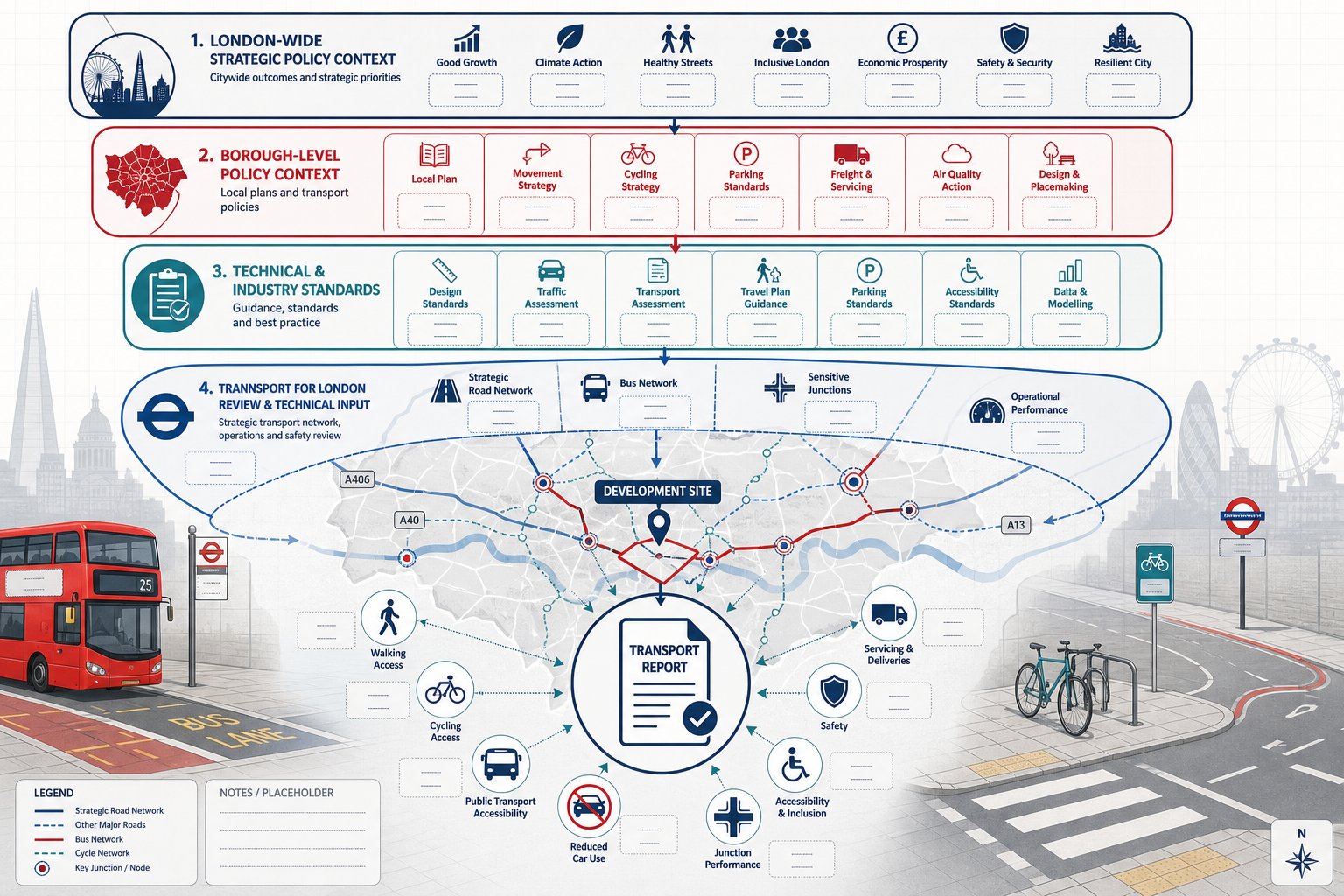
How Durham Planning Policy And Local Highway Requirements Affect Development
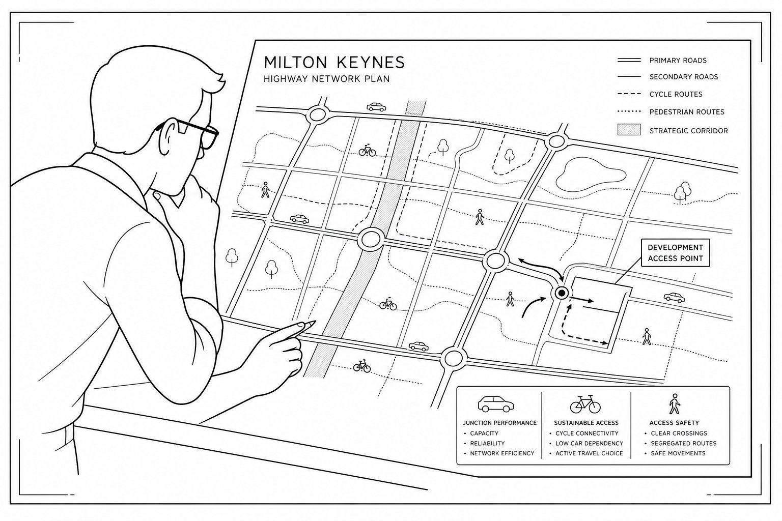
In Durham, transport evidence is not prepared in a vacuum. Planning outcomes are shaped by local policy expectations, highway design standards, site-specific constraints, and the judgement of officers reviewing whether a proposal is safe and suitable.
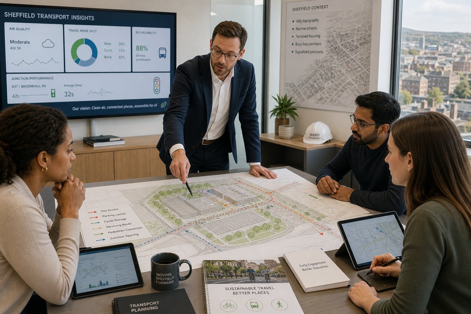
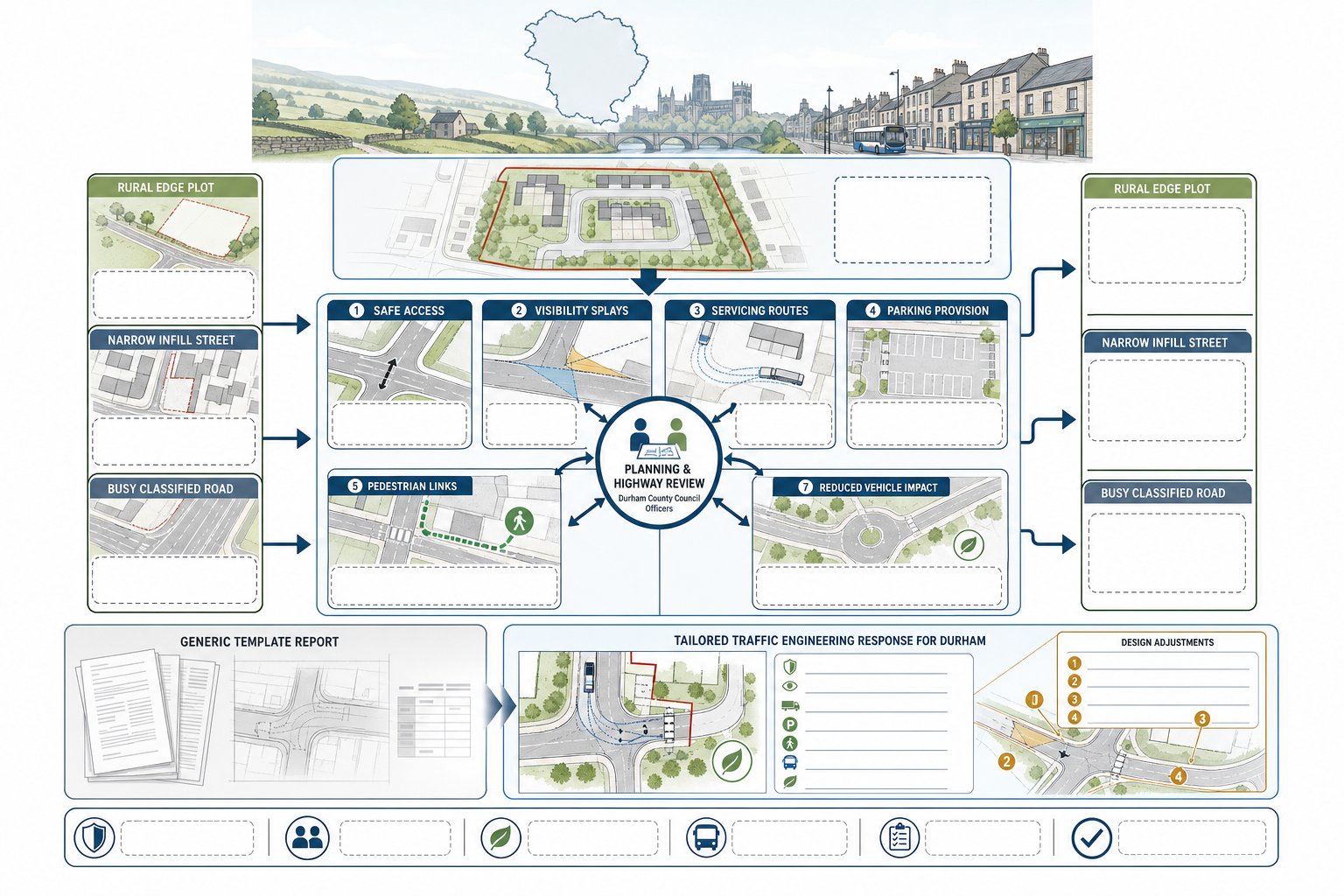
At a practical level, most applications need to demonstrate safe access, acceptable visibility, workable servicing, suitable parking, and an overall layout that supports efficient movement. Depending on the location, there may also be stronger emphasis on walking routes, public transport availability, or how the scheme minimises unnecessary vehicle impact. Rural edge sites, infill plots on narrower streets, and developments fronting busier classified roads all tend to attract different questions.
This is why generic reporting often falls flat. A report that simply repeats national policy language without addressing the actual geometry, traffic conditions, and likely local concerns does not help a planning officer much. We need to show how the development responds to Durham’s highway context, not just that it has been described in technical terms.
Highway officers may request evidence on vehicle tracking, access gradients, parking accumulation, junction operation, or visibility splays before they are comfortable supporting a scheme. In some cases, a proposal is broadly acceptable but requires redesign. In others, the planning risk sits less in trip generation and more in a poor access arrangement.
That local tailoring is one reason clients often use specialist Traffic Engineering Consultants: rather than relying on standard templates. Good transport planning in Durham means understanding both the policy framework and how reviewers are likely to interrogate the details.
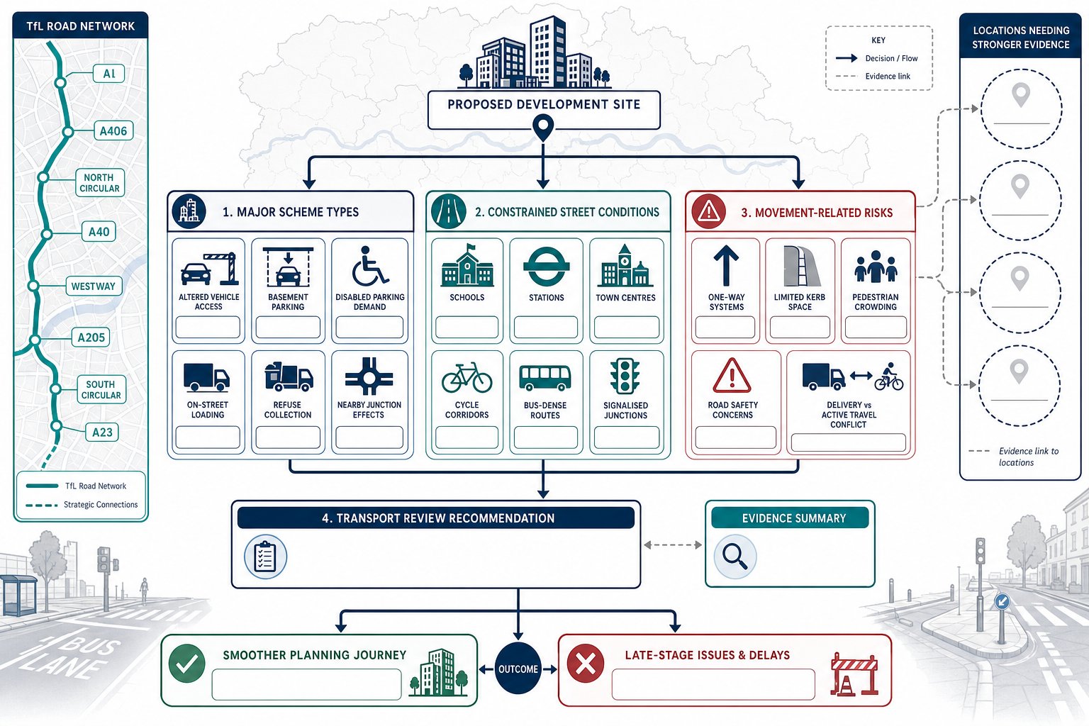
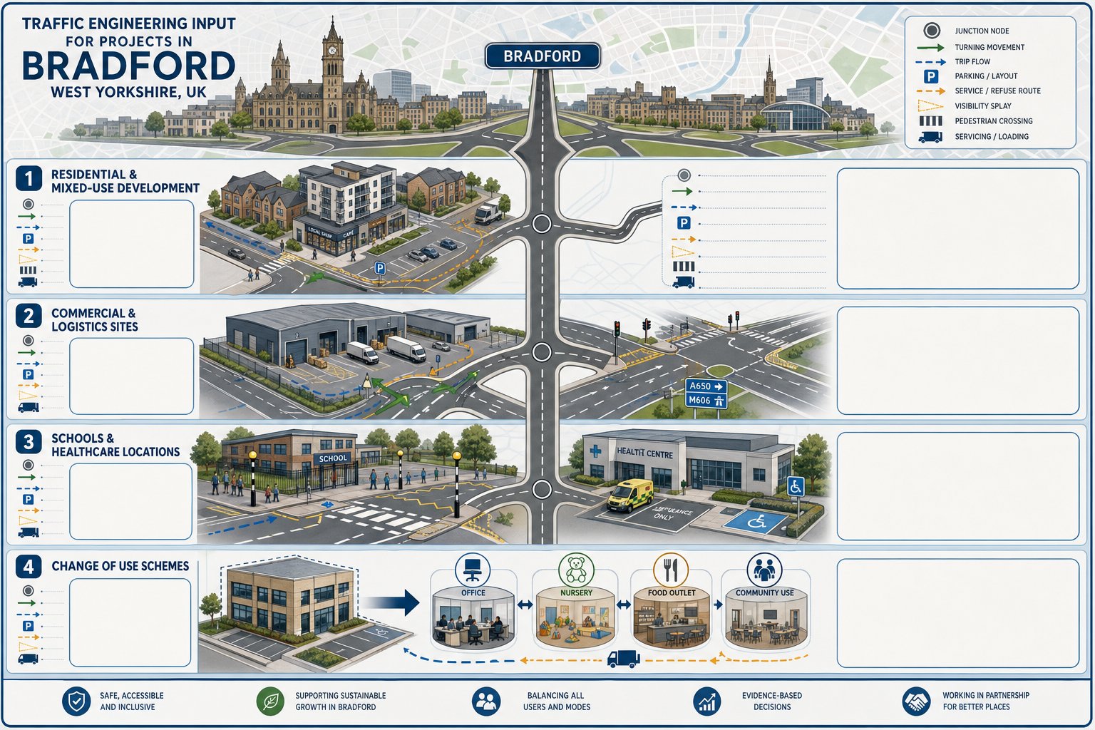
Common Development Types That Need Traffic Engineering Input
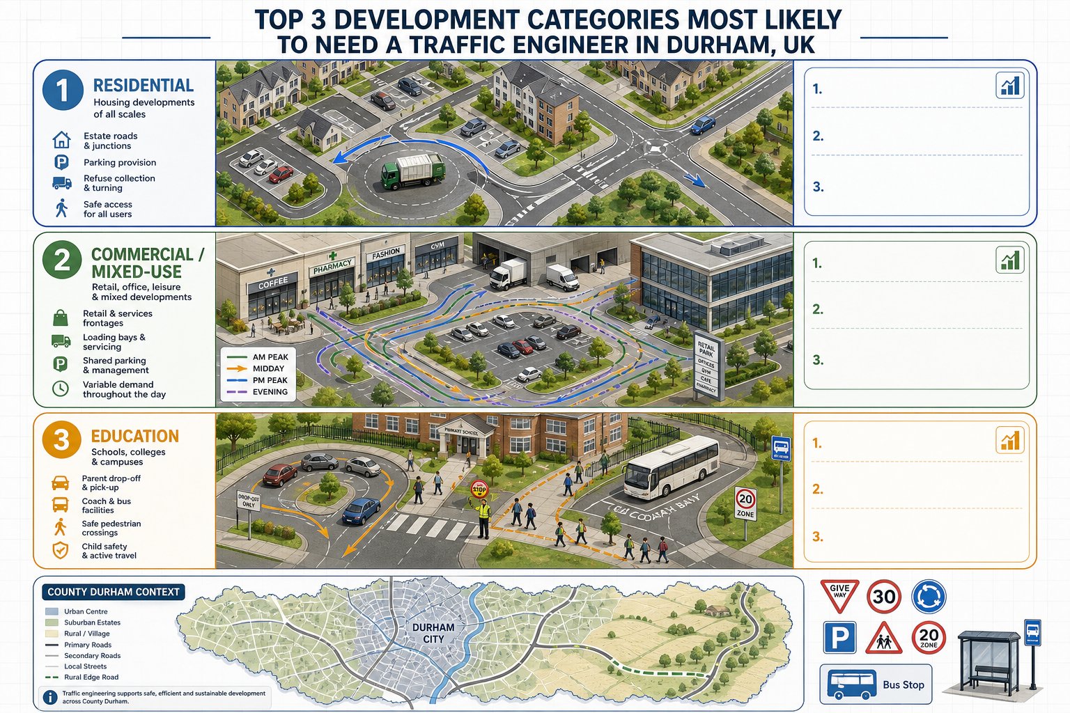
Not every planning application needs the same level of transport evidence, but some development categories appear again and again because they routinely raise access, movement, and highway capacity questions.
Residential Schemes
Residential development is one of the most common triggers for traffic engineering input in Durham. Even relatively modest housing schemes can raise issues around site access, turning provision, parking pressure, refuse collection, emergency access, and the effect of additional traffic on nearby junctions.
For larger residential proposals, we usually assess forecast trip generation, route distribution, internal road hierarchy, pedestrian permeability, and links to schools, shops, and public transport. For smaller schemes, the focus may be sharper: can vehicles enter and leave safely, can service vehicles turn within the site, and is parking realistically aligned with likely demand rather than simply policy minimums?
Village and suburban edge locations often need especially careful judgement. A scheme may look low-impact numerically but still generate concern if it feeds onto a narrow road, sits near a bend, or depends on weak walking infrastructure. In those cases, the report needs to do more than count trips, it needs to explain operational reality.
Commercial, Mixed-Use, And Education Sites
Commercial and mixed-use schemes usually involve more varied trip patterns than housing. Staff arrivals, customer traffic, deliveries, servicing windows, and shared parking demand can all overlap in messy ways. Education projects add another layer again: concentrated peaks, parent drop-off behaviour, coach movements, and safeguarding pedestrian routes.
These schemes often require us to test not just total traffic, but how the site works hour by hour. Can delivery vehicles manoeuvre without conflict? Is the access suitable for expected vehicle types? Will peak arrivals stack back onto the highway? Are there enough sustainable travel options to support the planning case?
Education and mixed-use proposals also attract scrutiny because local concern tends to be high. Residents may accept the principle of development but object strongly on congestion or safety grounds. Technical evidence has to be clear, realistic, and easy for non-specialists to follow.
That pattern is not unique to County Durham. Similar planning issues arise in dense urban contexts covered in our article on Traffic Engineer In London: and in regional city projects like Traffic Engineer In Liverpool:. The difference in Durham is often the mix of urban, suburban, and rural edge conditions within the same authority area.
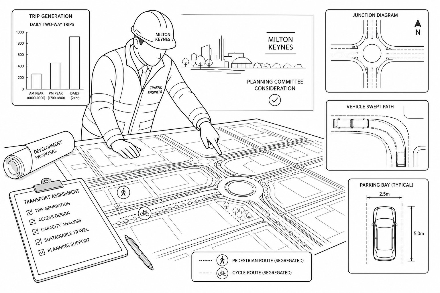
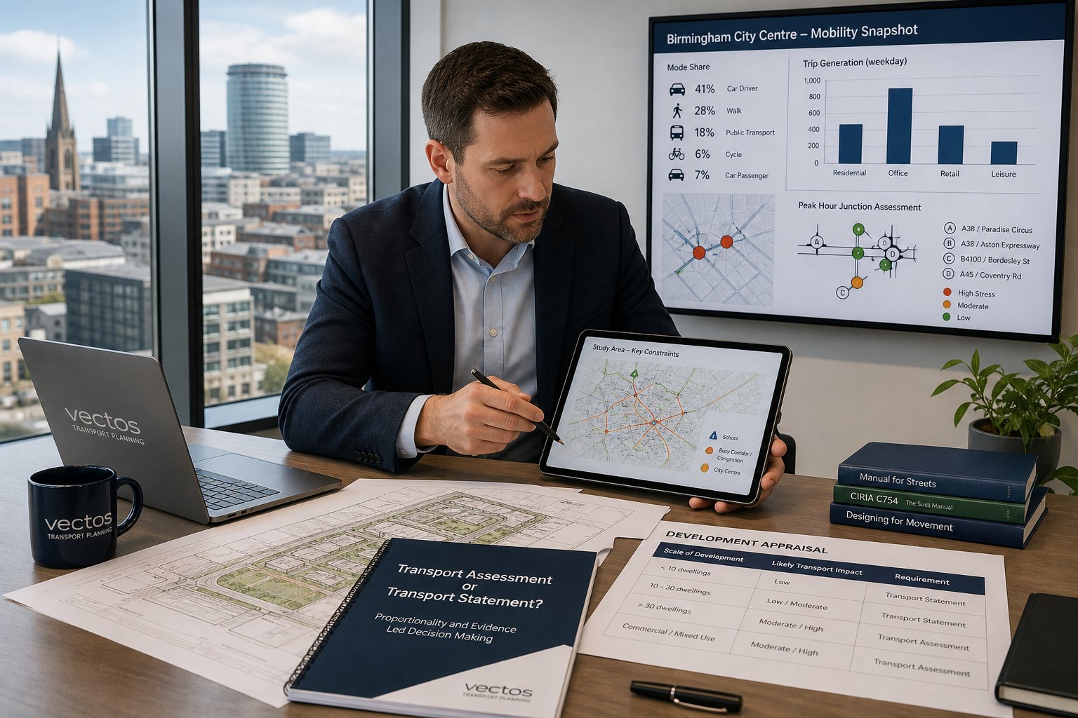
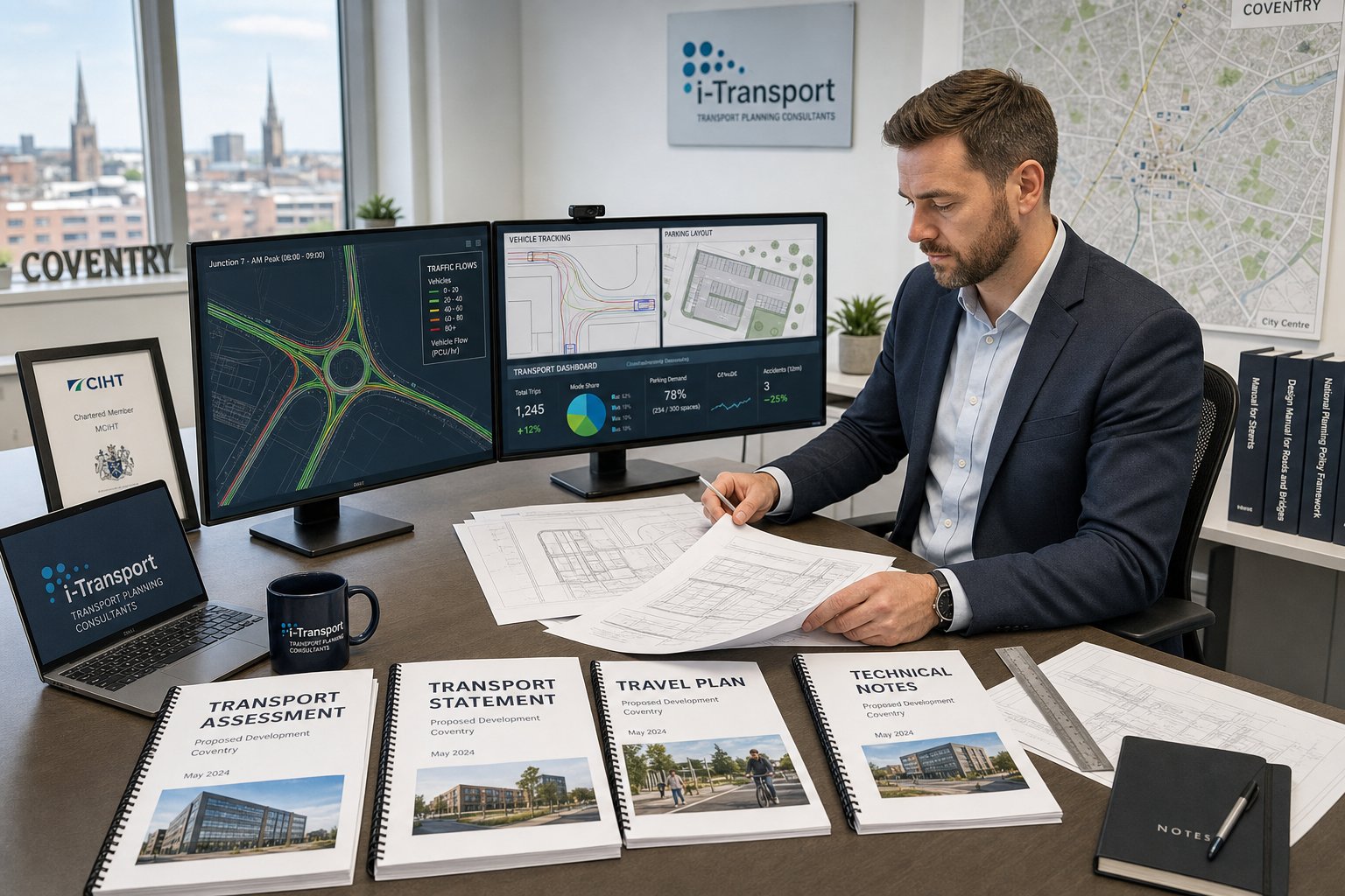
Key Traffic Engineering Reports For Planning Applications
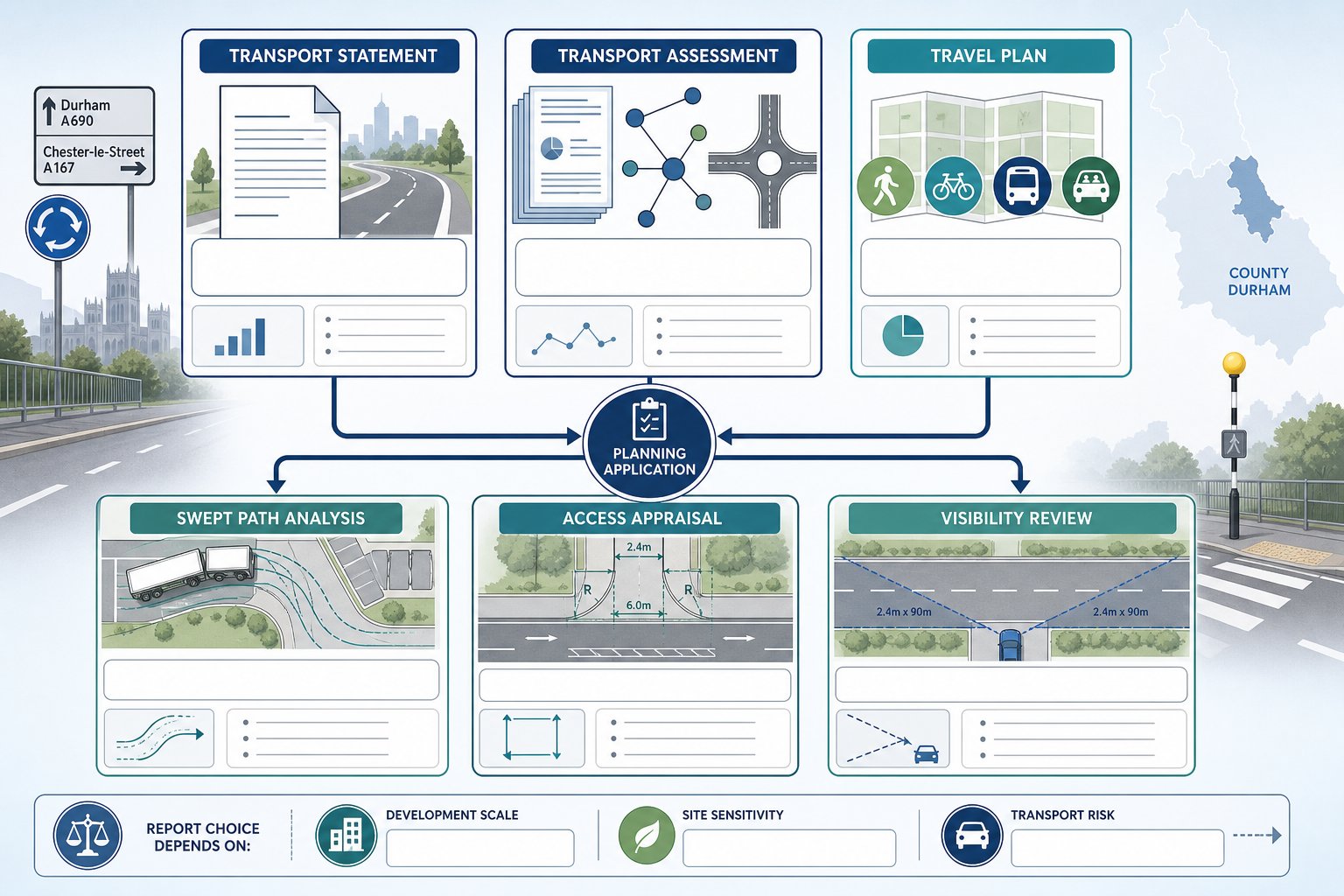
The right report depends on the scale of development, the sensitivity of the location, and the issues most likely to influence determination. But in Durham planning work, a fairly consistent group of documents comes up again and again.
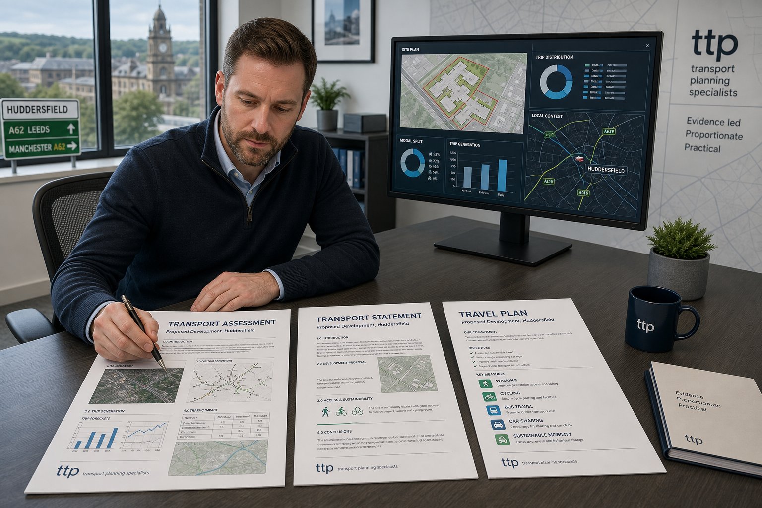
Transport Assessments, Transport Statements, And Travel Plans
These are the core planning reports for most development proposals with transport implications.
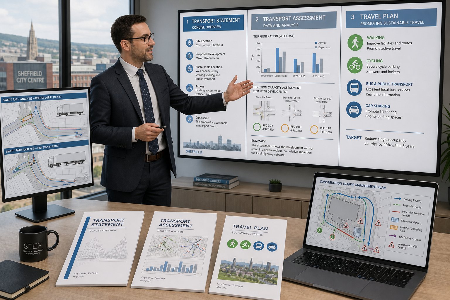
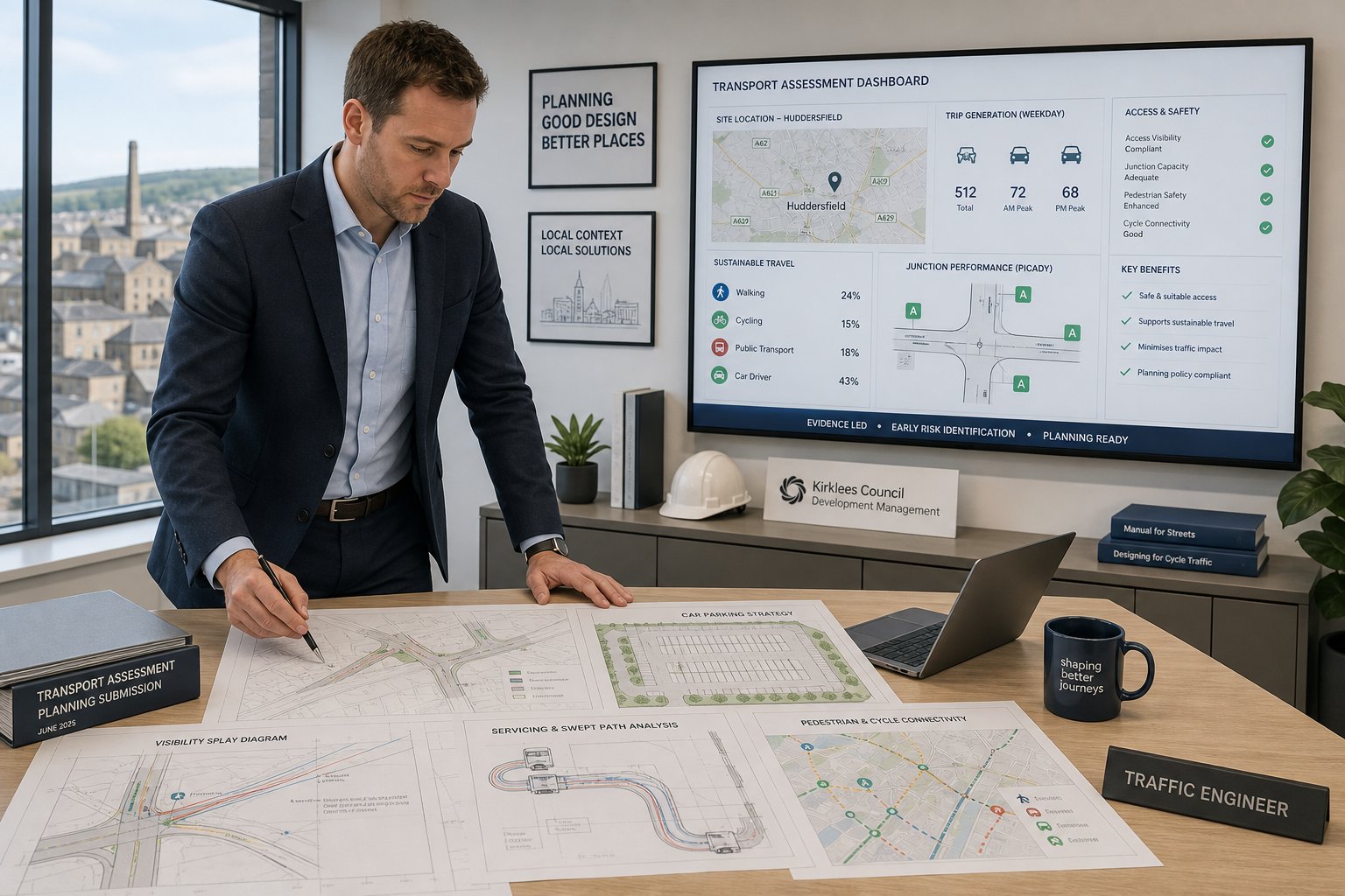
A Transport Statement is typically prepared where the transport case can be made through concise but structured evidence. It covers site context, accessibility, trip generation, parking, servicing, and any likely effect on the surrounding network. It is shorter than a full assessment, but it still needs to be technically credible and tailored to the scheme.
A Transport Assessment goes further. We would usually include baseline traffic conditions, development trips, distribution and assignment, junction analysis where required, access review, sustainable travel considerations, and mitigation proposals. The aim is not to overwhelm the reader with spreadsheets. It is to demonstrate, with evidence, that the development can operate acceptably.
A Travel Plan is often used alongside these documents, especially for developments where travel behaviour management matters. It sets out practical measures to encourage walking, cycling, public transport use, car sharing, or staggered travel demand. A decent Travel Plan is specific, monitored, and proportionate, not a generic appendix dusted off from another scheme.
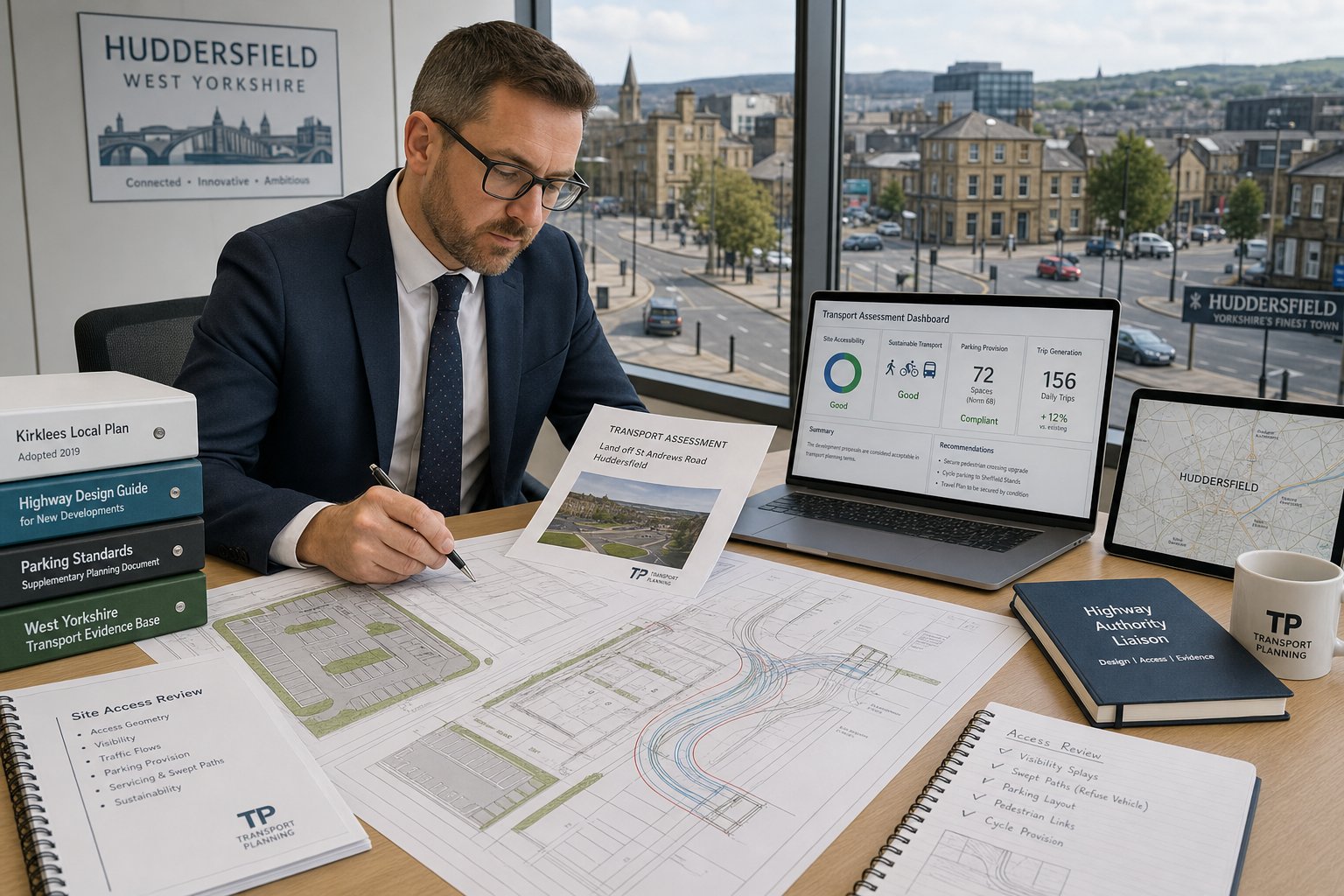
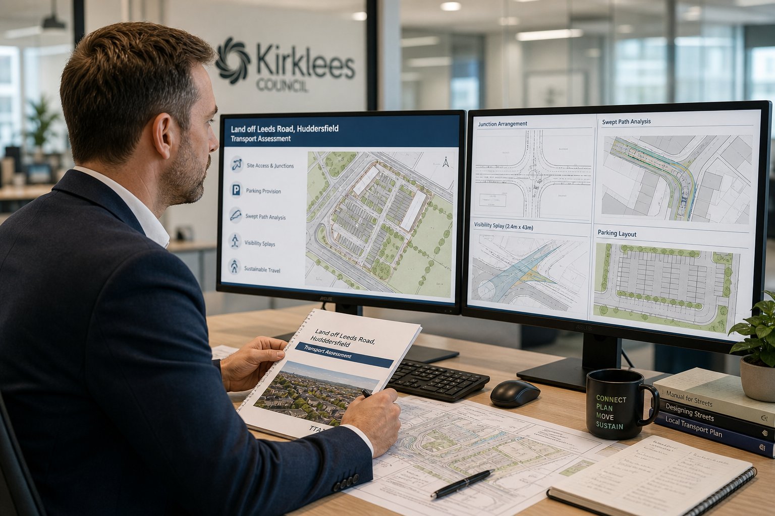
Swept Path Analysis, Access Appraisals, And Visibility Reviews
Some planning decisions turn less on traffic volume and more on whether the physical layout works. That is where these technical documents become vital.
Swept path analysis tests whether vehicles such as refuse wagons, delivery lorries, coaches, or emergency vehicles can manoeuvre safely within the site and at the access. If a layout only works in theory but requires vehicles to overrun kerbs, reverse excessively, or block circulation, it will attract scrutiny quickly.
Access appraisals look at the suitability of the proposed access in context. Width, geometry, proximity to junctions, gradient, interaction with pedestrians, and general road environment all matter. A narrow access onto a busy route raises a different set of questions from a broad access on a lightly trafficked frontage.
Visibility reviews test whether drivers can see and be seen appropriately, based on the site conditions and road characteristics. They sound basic, but they are often decisive.
For developers working across multiple authorities, examples from Traffic Engineer In Bristol: and Traffic Engineer In Manchester: show the same principle: the strongest planning submission is the one that matches the report type to the real risk on the site.
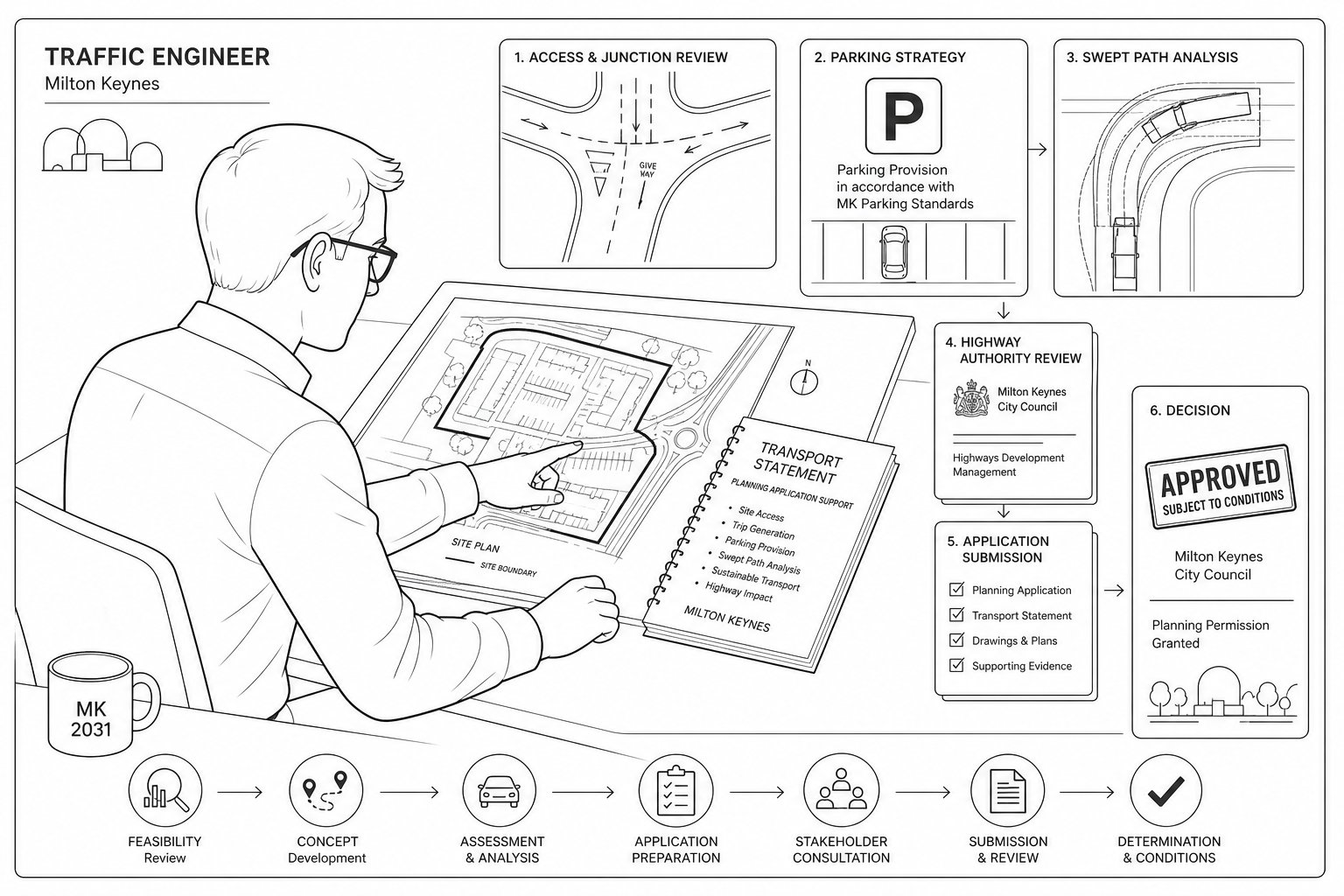
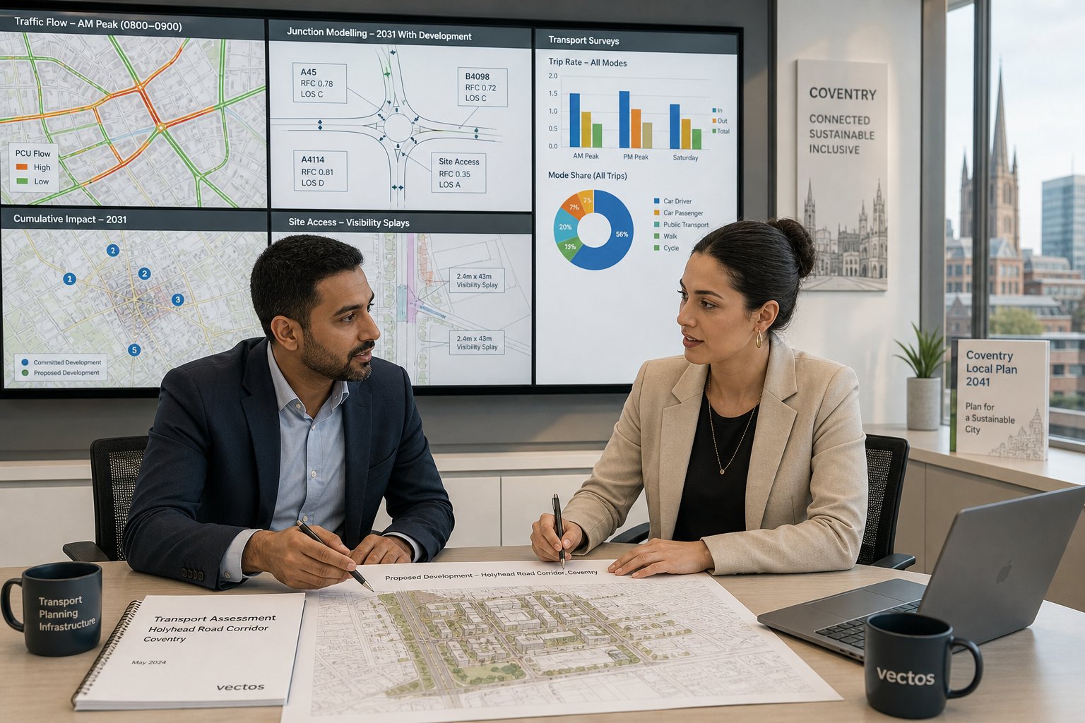
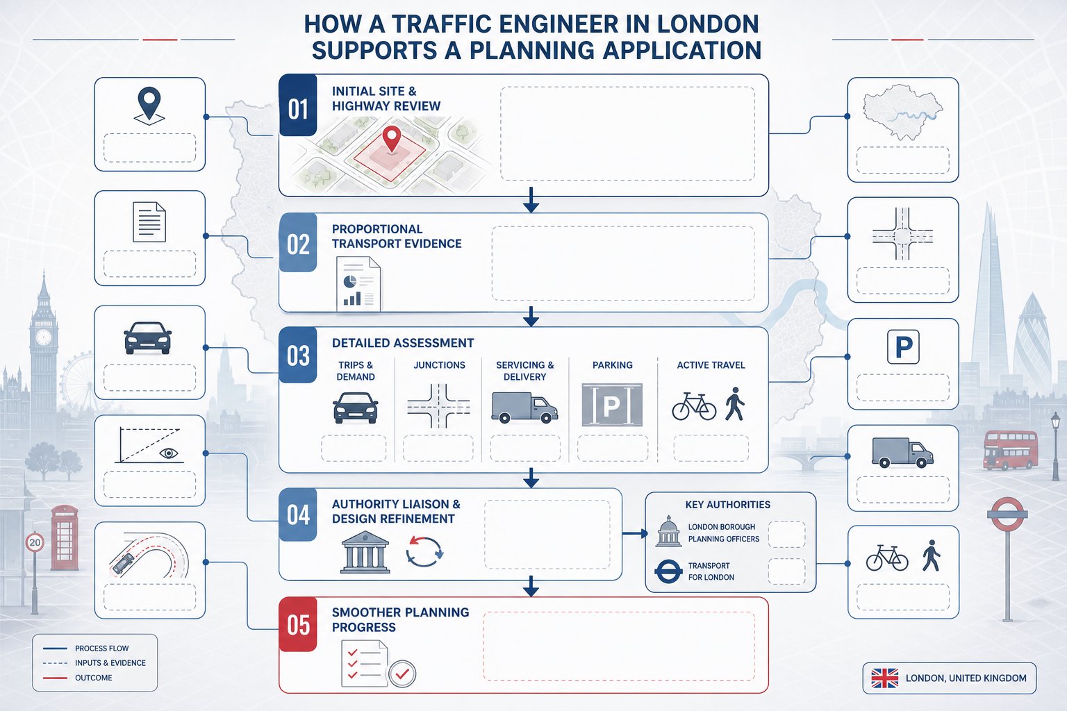
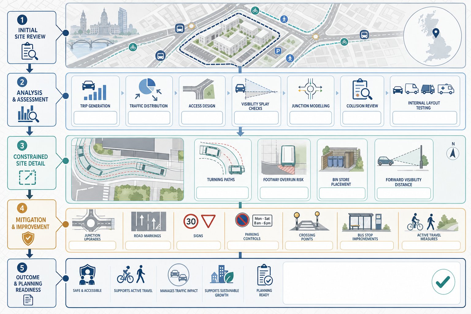
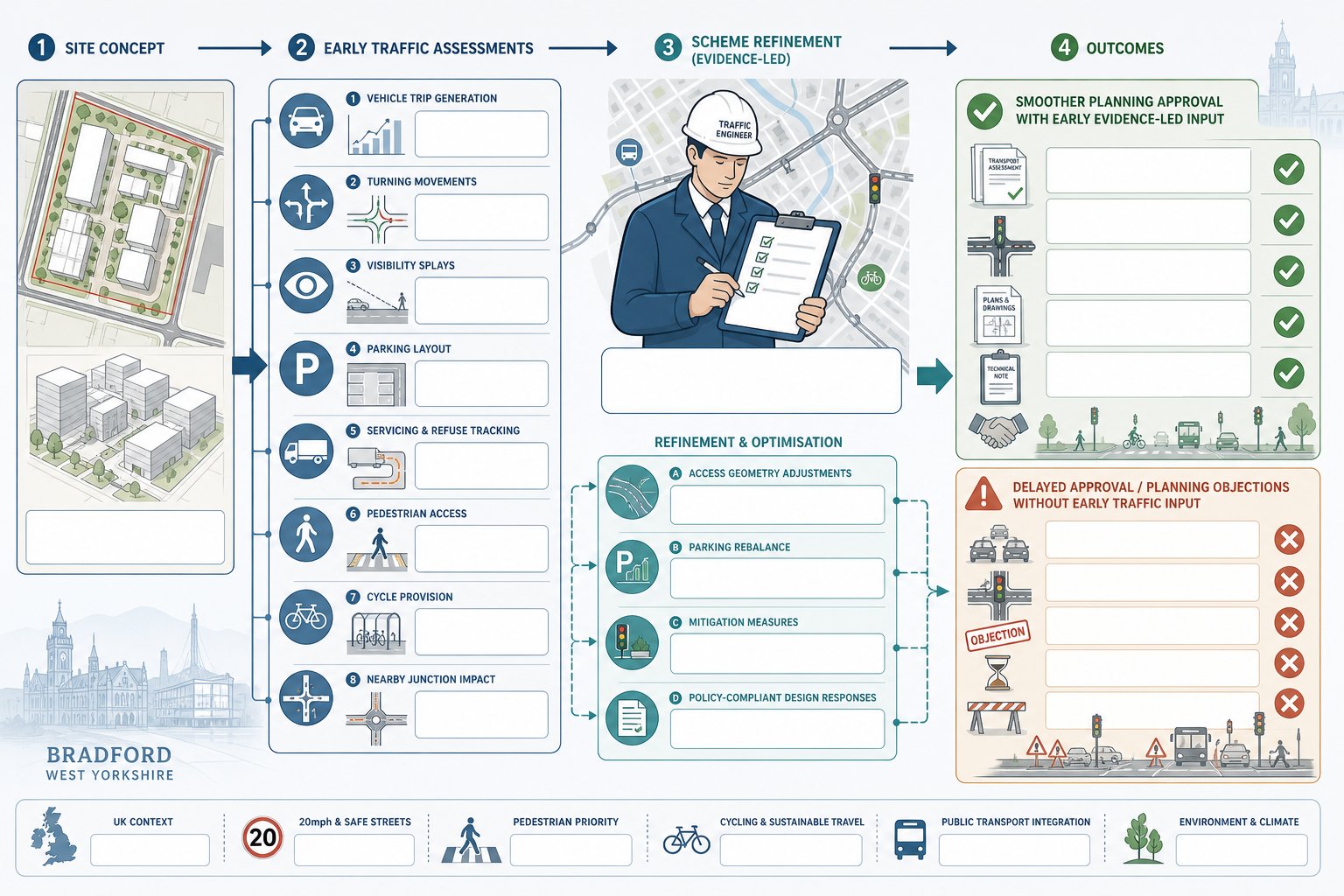
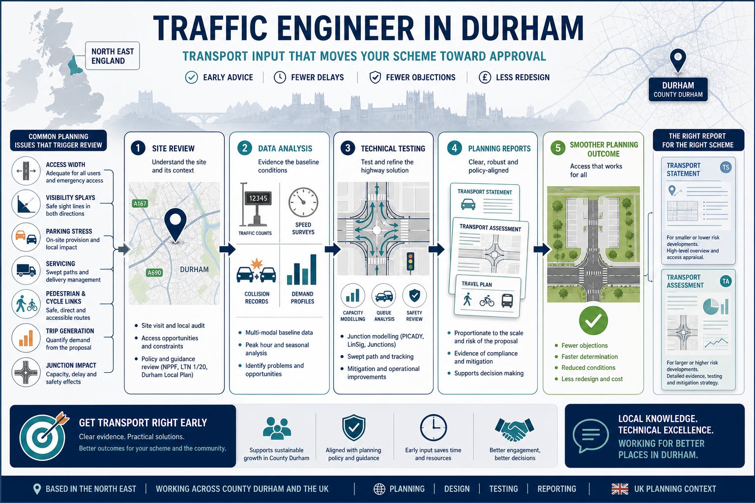
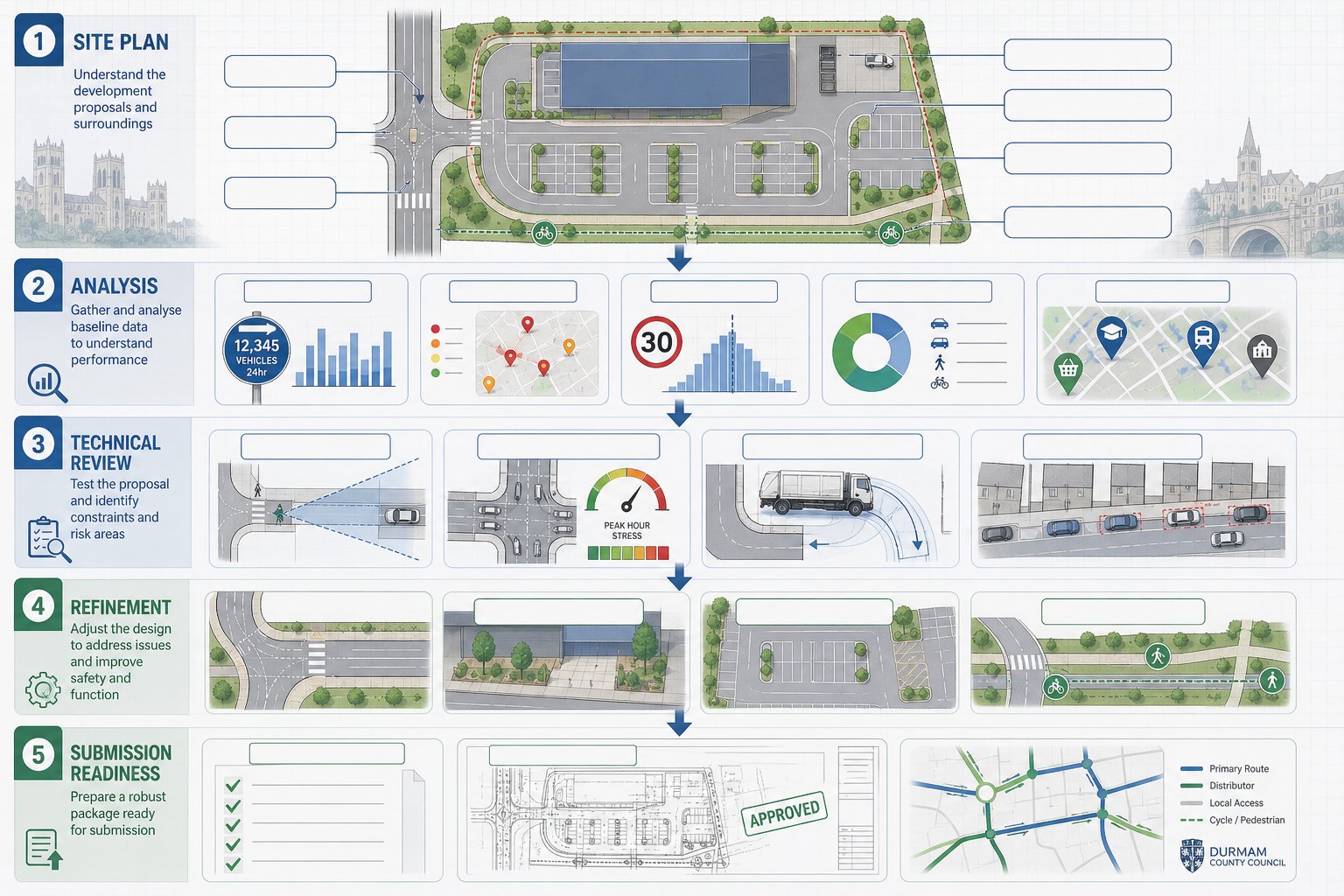
The Traffic Engineering Process From Site Review To Planning Submission
A good traffic engineering process is methodical, but it should not feel slow or overcomplicated. For most Durham projects, we move through a clear sequence designed to identify issues early and present evidence cleanly.
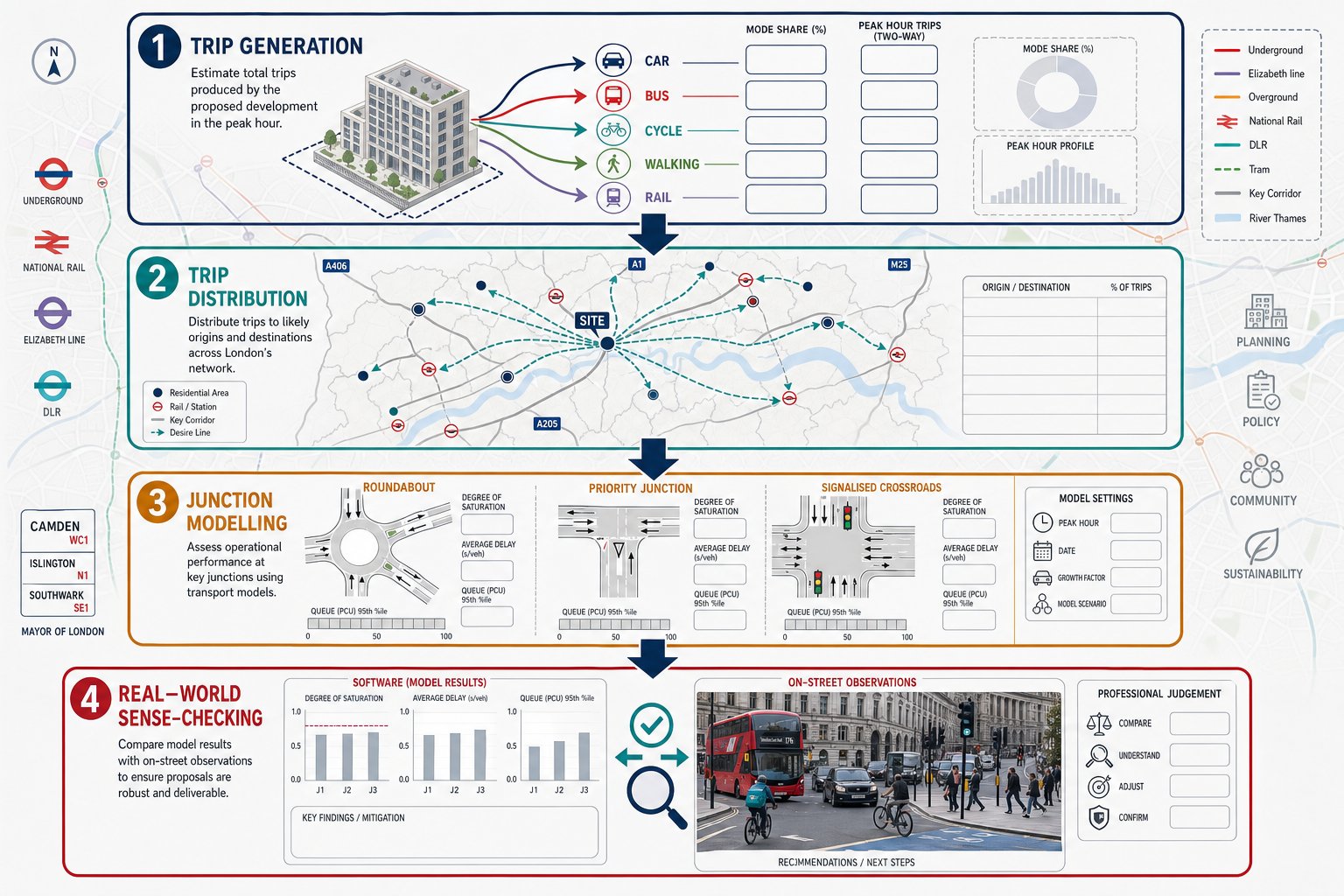
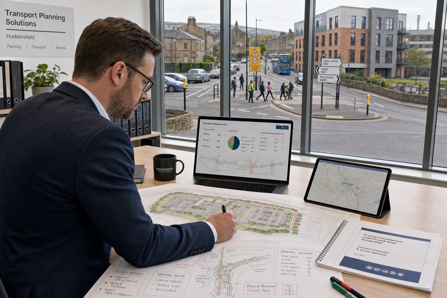
First comes the site review. We examine the location, surrounding roads, existing access conditions, nearby junctions, frontage characteristics, walking and cycling links, public transport availability, and any obvious physical constraints. This stage often reveals the real planning risks faster than the drawings do.
Next is data collection and analysis. Depending on the scheme, that may include traffic counts, speed data, parking surveys, collision review, or site observations during peak periods. The point is to build a factual baseline. Assumptions without evidence are exactly what objectors and consultees tend to pull apart.
We then move into technical testing. That might involve trip generation, distribution, junction modelling, swept path analysis, visibility measurement, parking review, or access design commentary. If the initial concept does not work, this is the moment to refine it, not after submission.
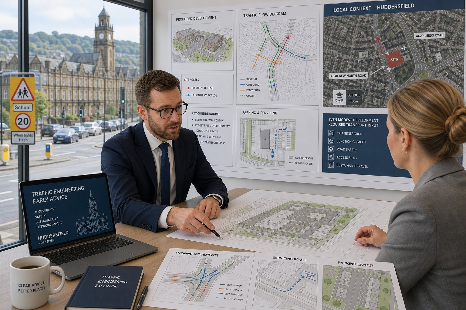
Finally, we prepare the planning report package. The report needs to be accurate, proportionate, and readable by both technical and non-technical audiences. That balance matters more than people think. A case officer needs clear conclusions: a highway engineer needs sound methodology: a committee member may only read the summary.
At ML Traffic, our focus is concise, accurate reporting delivered quickly, shaped by over 30 years of experience and the practical realities of local planning timescales.
Why Early Traffic Advice Can Reduce Planning Delays And Objections
Early traffic advice is one of the cheapest forms of planning risk management available. That is not a flashy claim: it is just how these projects tend to unfold.
When transport input comes in late, the report often ends up defending a fixed layout with obvious weaknesses. Maybe the access is too close to a junction. Maybe a refuse vehicle cannot turn. Maybe parking is technically compliant but clearly inadequate in real use. At that stage, the team is not solving problems efficiently, it is trying to explain them away, which rarely works for long.
By contrast, early review lets us identify what is likely to trigger concern before drawings are finalised. We can test whether visibility is achievable, whether the internal layout can accommodate service vehicles, whether a junction review is likely to be requested, and whether a full Transport Assessment may be wiser than a lighter statement. Small design changes made early usually cost little. The same changes made after objection can be painful.
It also helps with stakeholder management. Highway officers are more receptive when an application arrives with transport issues already addressed rather than only acknowledged. Neighbour objections are harder to avoid entirely, but they are easier to answer when the evidence is clear and specific.
Put bluntly: the planning process is slow enough already. Early traffic advice removes avoidable friction.
Choosing A Traffic Engineer In Durham For Accurate, Timely Reporting
Choosing the right traffic engineer is not just about technical competence. It is about whether the consultant understands planning risk, communicates clearly, and can deliver robust evidence within the programme pressures that real projects face.
We would look for three things first.
Local planning awareness. A consultant does not need to have worked on every street in Durham, but they do need to understand how local highway expectations shape report scope, access design, and mitigation strategy.
Relevant report experience. Planning submissions often need more than a standard Transport Statement. A strong consultant should be comfortable with Transport Assessments, Travel Plans, swept path work, access appraisals, visibility reviews, and the judgement required to know which tools are actually necessary.
Speed without sloppiness. Delays in transport reporting can hold up the wider application. But fast is only useful if the work is accurate. A report that comes back quickly and then attracts avoidable technical challenge has not saved any time at all.
We also think responsiveness matters more than many teams admit. Architects and planners need clear answers while layouts are still evolving. Lawyers need evidence that stands up. Developers need to know whether a site is likely to be deliverable before sunk costs mount.
That is why our approach is built around concise, planning-focused advice rather than over-engineered reporting. In Durham, accuracy and timing are not competing priorities. They have to arrive together.
Conclusion
For most schemes, the value of a Traffic Engineer in Durham is straightforward: we help show that a development is safe, accessible, and realistic from a highway and transport perspective. That means more than producing a document for validation. It means understanding what the site is likely to be asked to prove, testing the proposal honestly, and presenting evidence that planning officers and highway reviewers can rely on.
Whether the project involves housing, a commercial site, a school expansion, or a mixed-use scheme, the transport case needs to be proportionate, locally aware, and technically sound. And in 2026, with planning scrutiny still tight and programme certainty still precious, early transport input remains one of the smartest ways to reduce delay.
If the transport issues are identified early, the application usually stands on firmer ground. If they are ignored until the end, they have a habit of becoming the reason everything slows down.
Frequently Asked Questions about Traffic Engineers in Durham
What does a traffic engineer in Durham do for planning projects?
A traffic engineer in Durham assesses whether a development is safe and suitable for the local transport network by reviewing site access, junctions, parking, servicing, pedestrian and cycle safety. They analyse traffic data and provide technical reports to support planning applications.
When is a Transport Assessment or Transport Statement required in Durham?
A Transport Assessment or Transport Statement is needed when a development could significantly impact traffic, accessibility, or highway safety. The choice depends on the scale and complexity of the project, with larger schemes usually requiring a full Transport Assessment.
How do local Durham planning policies affect traffic engineering requirements?
Durham planning policies require developments to demonstrate safe access, visibility, appropriate parking, and efficient movement tailored to local highway standards. Reports must reflect site-specific constraints and local context, not just national policy, to satisfy planning authorities and highway officers.
What types of developments commonly need traffic engineering input in Durham?
Residential schemes, commercial, mixed-use, and education developments frequently require traffic engineering due to their potential impact on access, parking, and highway safety. Issues like vehicle manoeuvrability, peak-time traffic, and pedestrian safety are often assessed.
Why is early traffic engineering advice beneficial in Durham planning applications?
Obtaining early traffic advice helps identify potential access or capacity issues before submission, reducing costly redesign and delaying objections. Early input allows smoother approval by addressing concerns proactively and providing clear evidence to planning officers.
How should I choose a traffic engineer in Durham for my development project?
Choose a traffic engineer in Durham who understands local planning risks, produces timely and accurate reports, has experience with relevant reports like Transport Assessments and swept path analysis, and communicates clearly with planners, architects, and developers throughout the project.