In Ealing, transport issues can make or break a planning application. A scheme might look sound on paper, stack up commercially, and even fit local design policy, but if access is weak, parking is unresolved, or the highway impact feels uncertain, objections arrive quickly. That’s especially true in a borough shaped by busy corridors, dense town centres, rail hubs, school traffic, controlled parking zones, and a strong policy push towards walking, cycling and public transport.
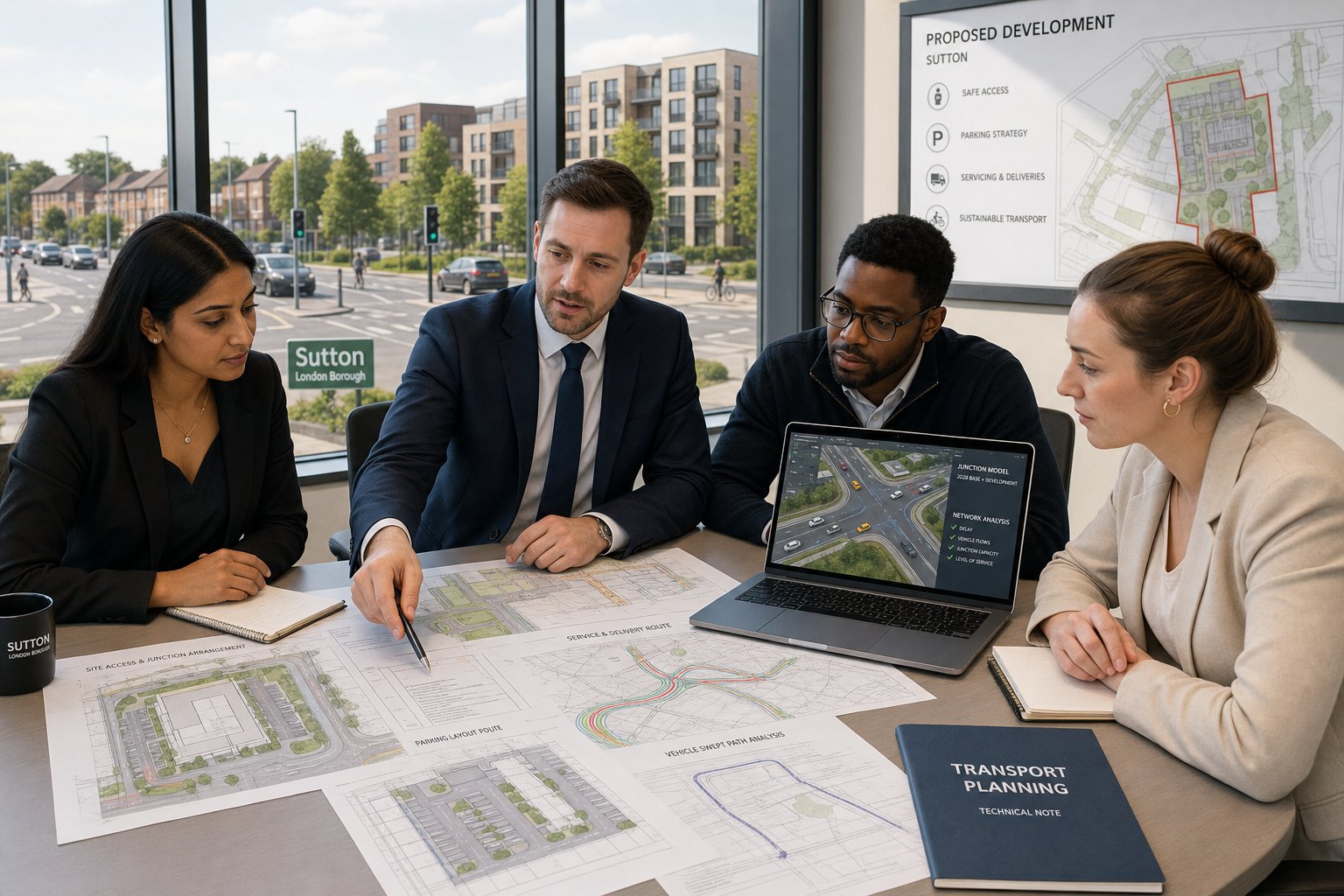
That’s where a Traffic Engineer in Ealing becomes central to the development team, not an afterthought. We’re often brought in to answer practical questions that sit right at the heart of planning risk: will the junction cope, does the access work safely, how many trips will the site really generate, is a Transport Statement enough, and what mitigation is likely to satisfy officers?
For architects, planning consultants, surveyors, developers, legal teams and local authorities, the value of transport input is rarely just about writing a report. It’s about de-risking the application, aligning the scheme with policy, and making sure the development functions in the real world once occupied. In this guide, we explain how traffic engineering supports planning applications in Ealing, when transport reports are usually needed, what gets assessed, and how to choose the right consultant for the job in 2026.
Key Takeaways
- A Traffic Engineer in Ealing is crucial to successful planning applications by addressing access, parking, and highway impacts early in the design process.
- Transport engineering in Ealing integrates safety, sustainable travel, and local policy compliance to de-risk developments and ensure functional outcomes.
- Transport Statements, Assessments, and Travel Plans vary by project scale and impact, and selecting the right type is essential for smooth planning approval.
- Parking demand, servicing practicality, and access design require detailed local knowledge to prevent objections related to congestion, safety, and usability.
- Effective trip generation, junction impact analysis, and sustainable travel provisions support development acceptance in Ealing’s complex transport environment.
- Choosing a Traffic Engineer with local expertise, strong communication skills, and technical breadth helps navigate Ealing’s planning challenges efficiently.
Why Traffic Engineering Matters For Development In Ealing
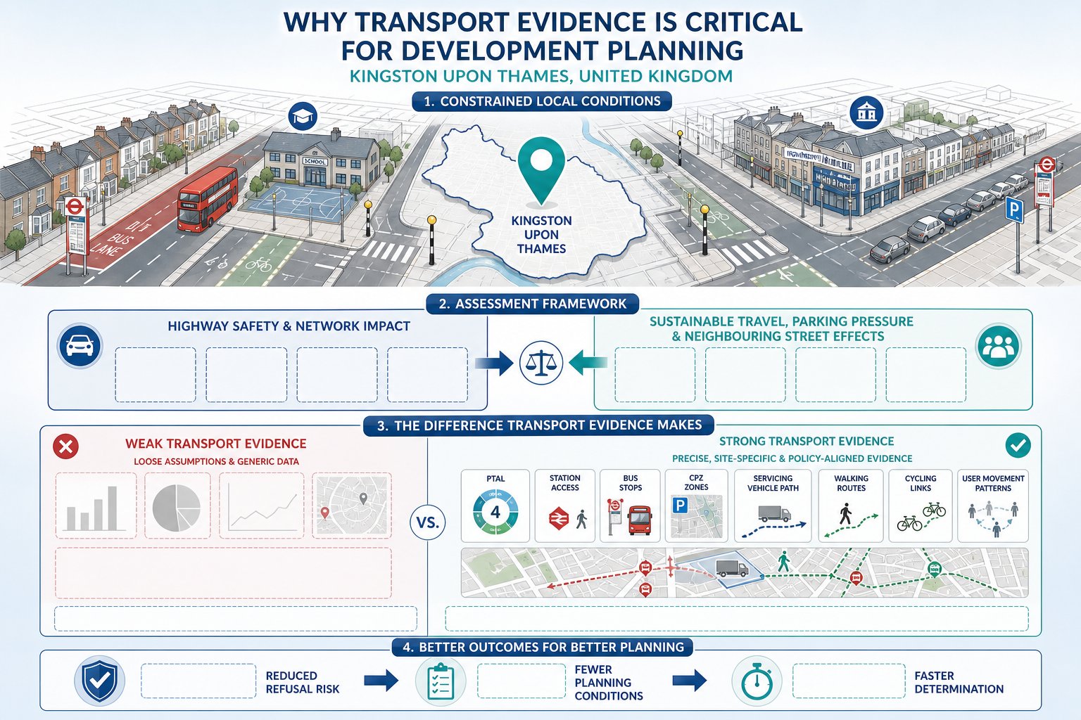
Ealing is one of those boroughs where transport planning can’t be treated as a tick-box exercise. Development takes place against a complicated backdrop: strategic roads such as the A40 and A406, heavily used corridors like Uxbridge Road, established town centres, neighbourhood shopping parades, low-rise suburban streets, and some of west London’s most important public transport connections. Add in borough and London-wide policy expectations around mode shift, road danger reduction and sustainable growth, and transport becomes central to planning viability.
A well-prepared traffic engineering response helps decision-makers understand whether a proposal can be accommodated safely and efficiently. That covers more than vehicle capacity. It includes access design, servicing, pedestrian movement, cycle provision, bus interaction, parking demand, road safety, and the likely travel behaviour of future residents, employees or visitors. In Ealing, those issues often overlap. A minor access change might affect crossing safety: a servicing arrangement might conflict with cyclist desire lines: a modest increase in trips might be acceptable on one street but problematic near a constrained junction.
In practice, good transport input gives planning teams evidence rather than assumptions. That’s why wider guidance on Traffic Engineering and Transportation is so relevant to borough-specific schemes. We find that early assessment usually leads to better layouts, clearer planning submissions and fewer surprises during consultation. Put simply, transport engineering protects both planning prospects and the operational quality of the finished development.
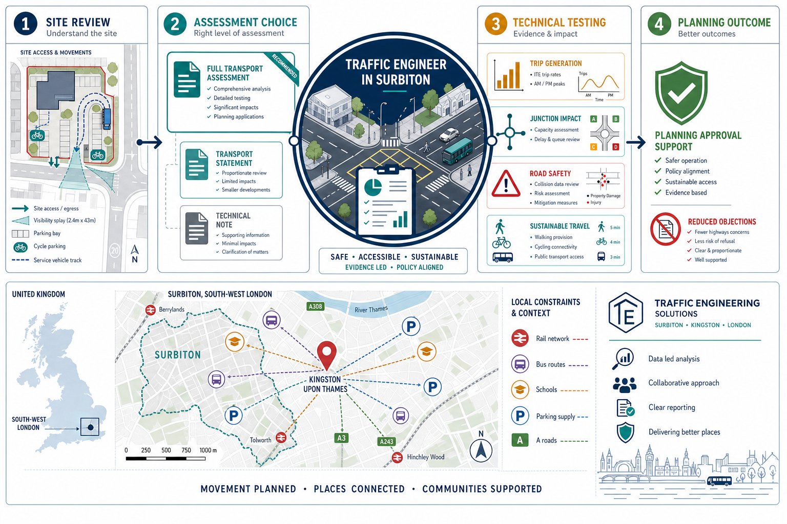
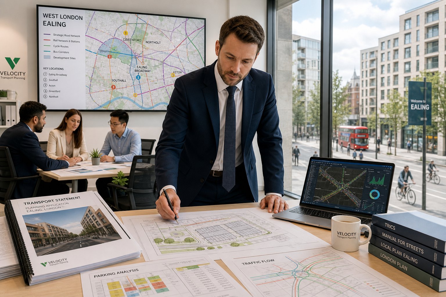
How A Traffic Engineer Supports The Planning Process
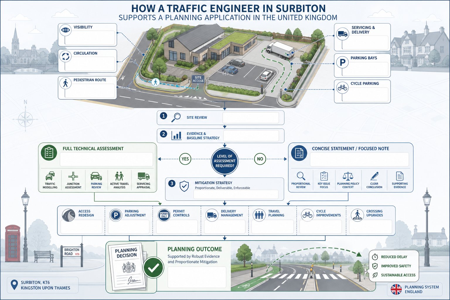
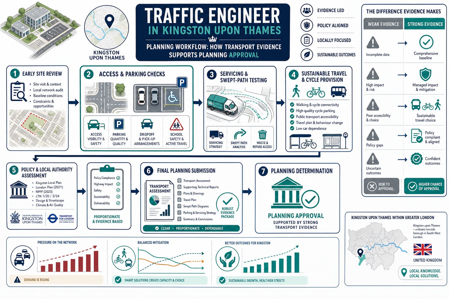
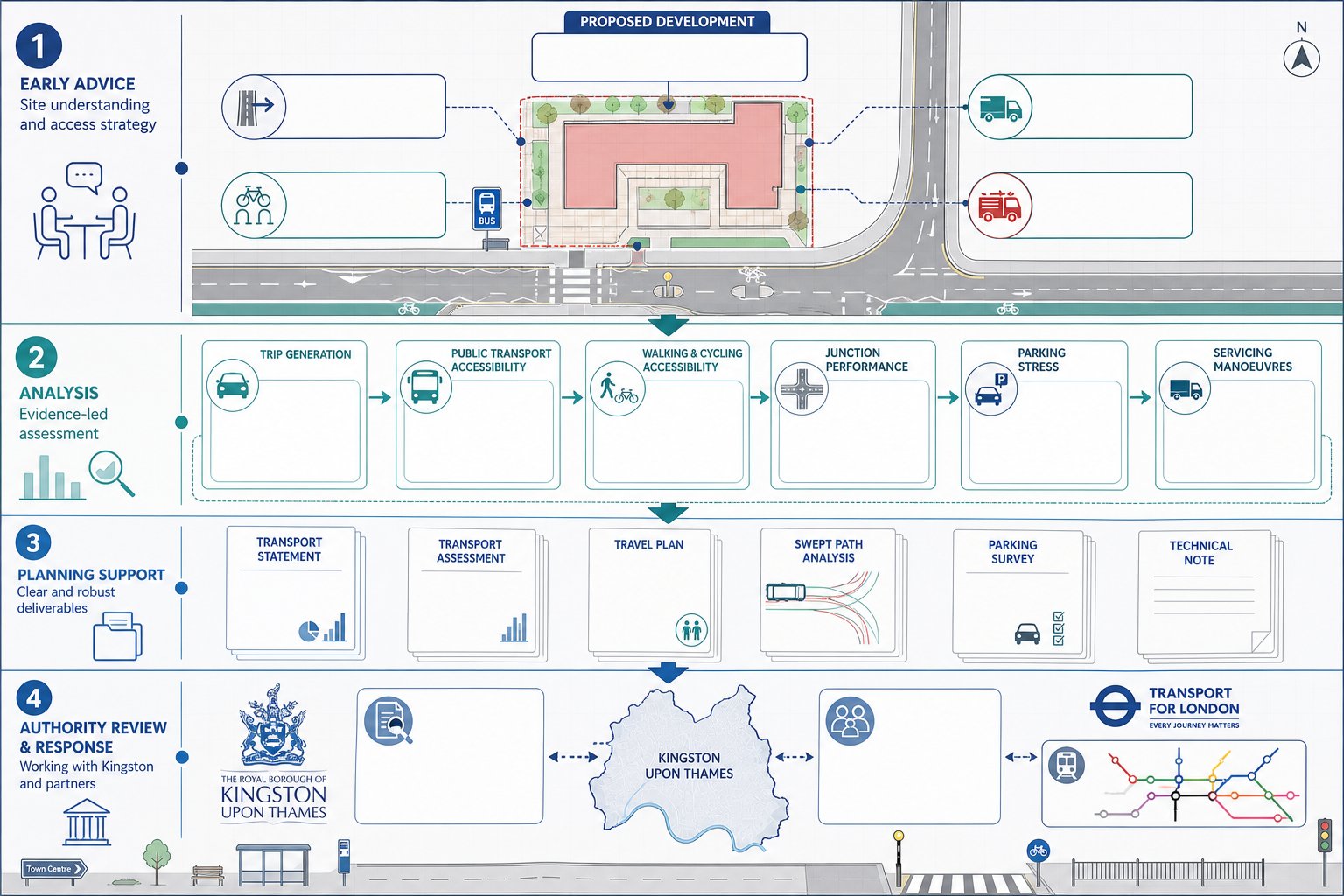
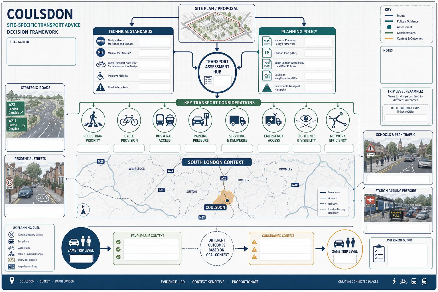
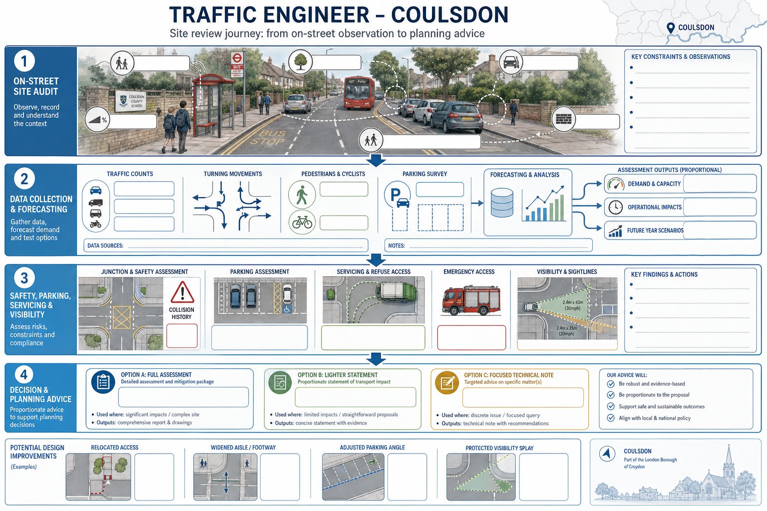
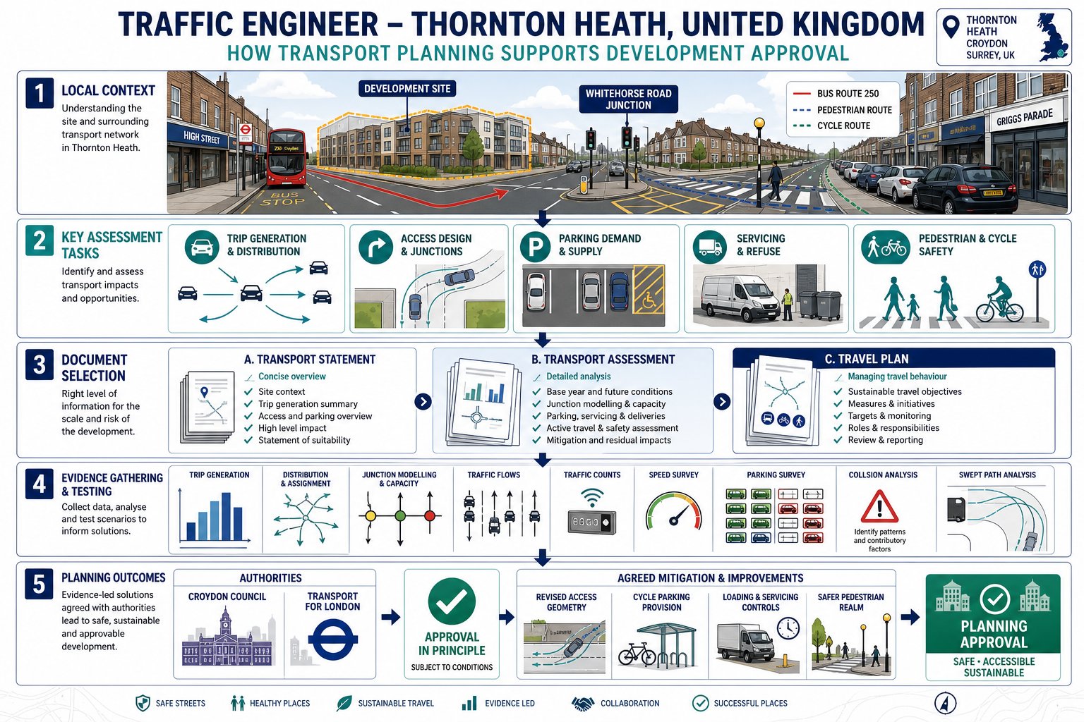
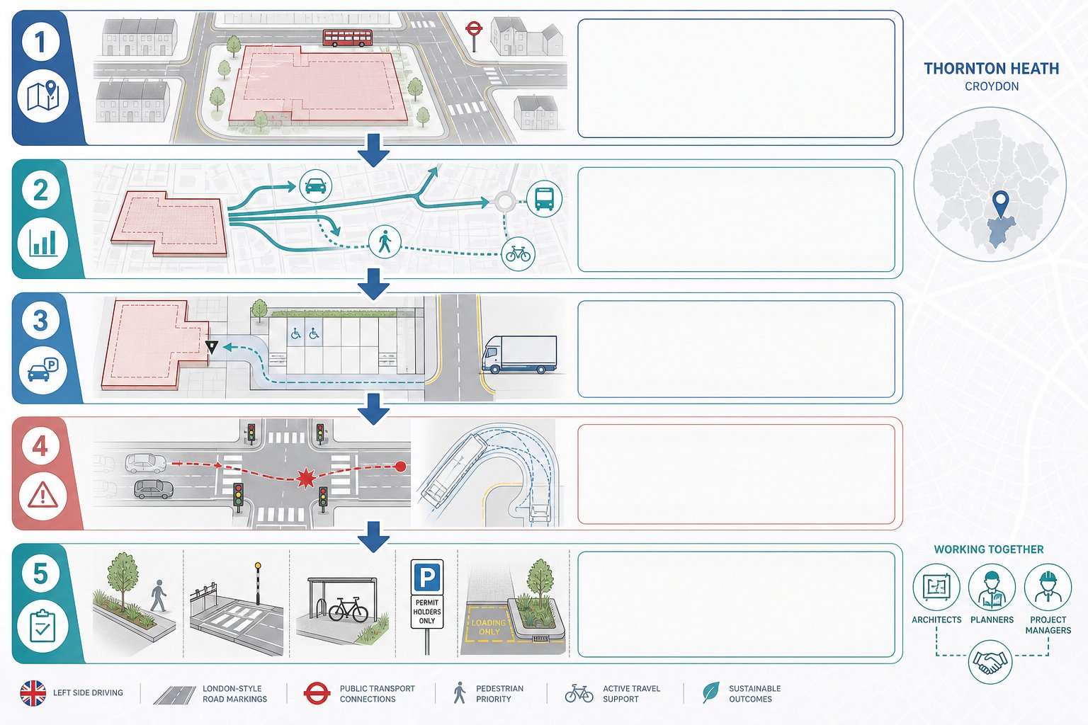
A traffic engineer’s role starts well before an application is submitted. At pre-application stage, we typically review the site context, likely planning constraints, local transport policy, access opportunities and probable reporting requirements. That early advice can shape the scheme itself. Sometimes the right answer is a revised access point: sometimes it’s a different servicing arrangement, a reduction in parking, or a stronger active travel offer to align with policy and local PTAL conditions.
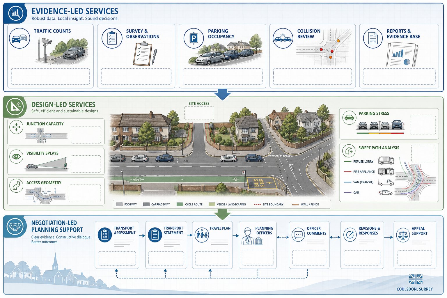
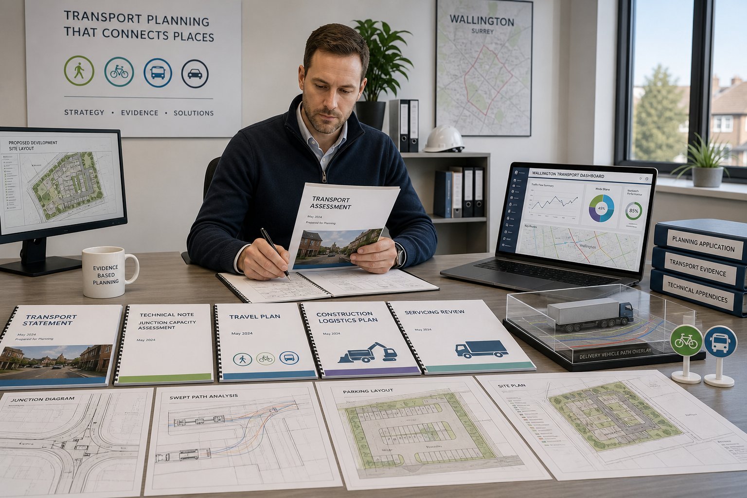
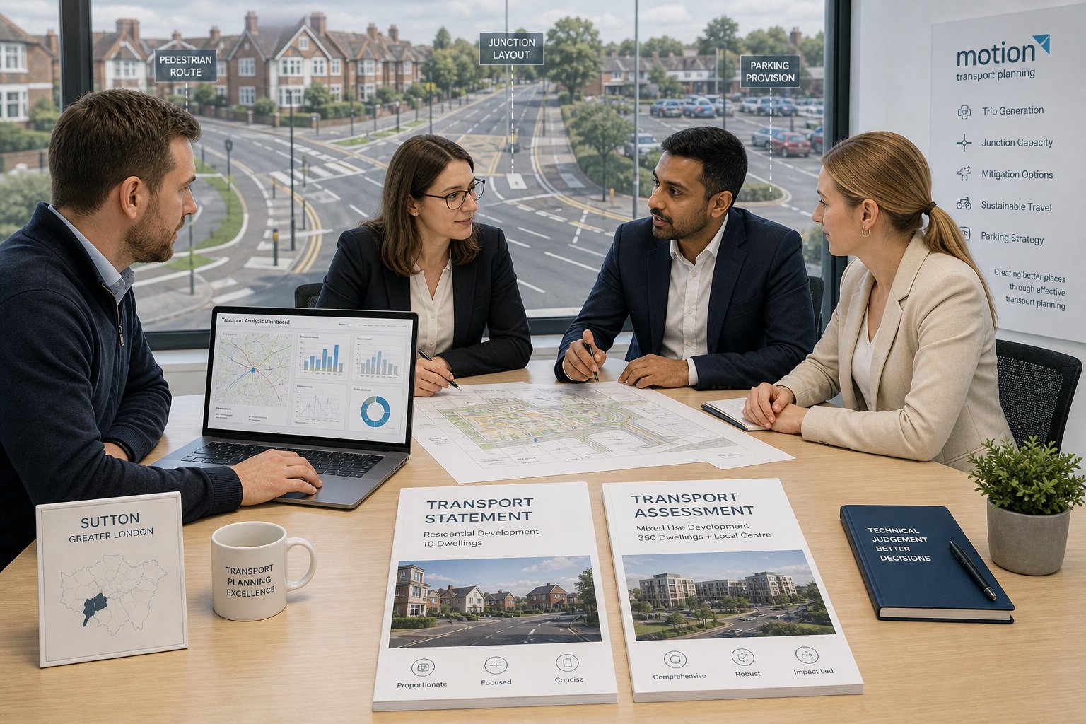
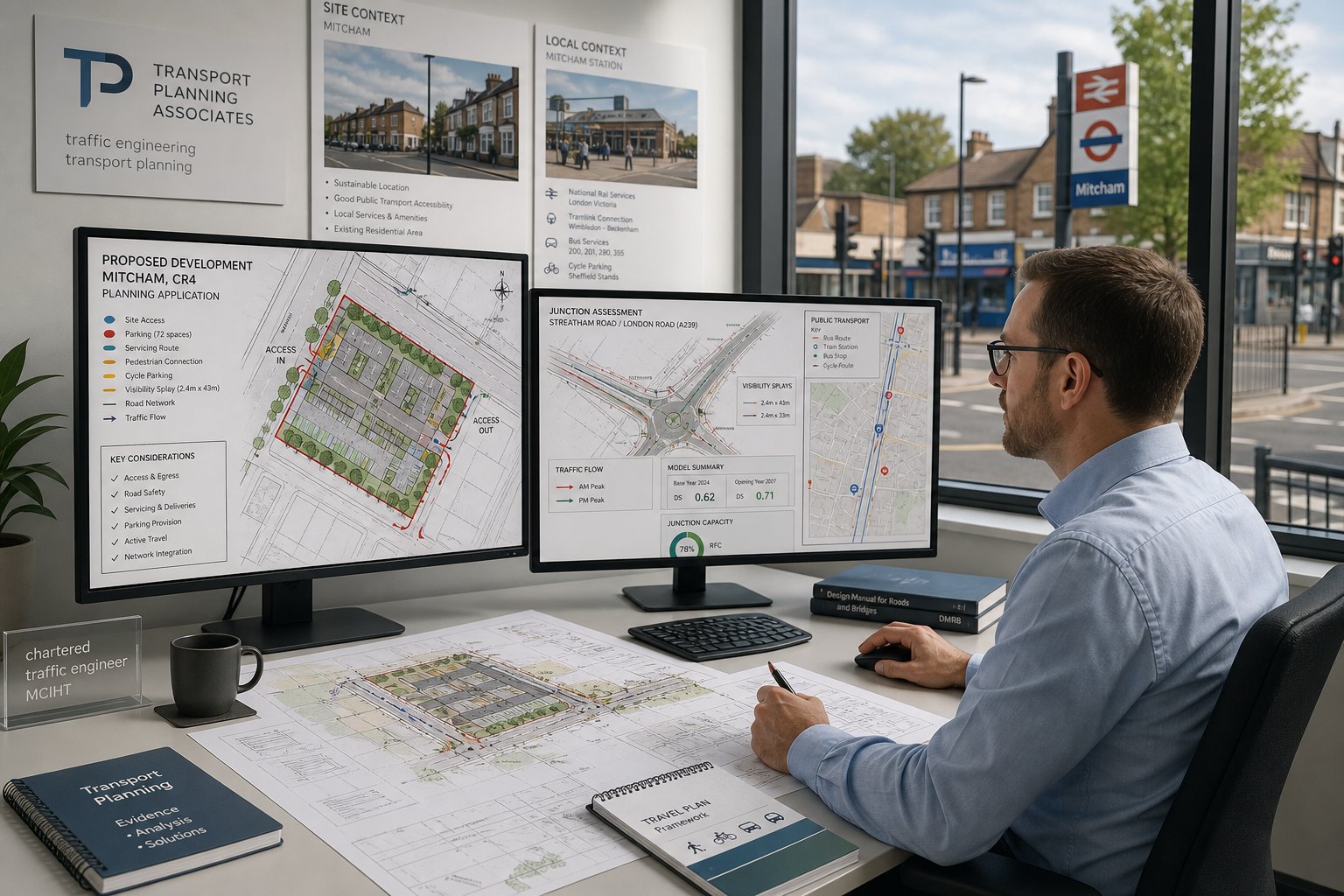
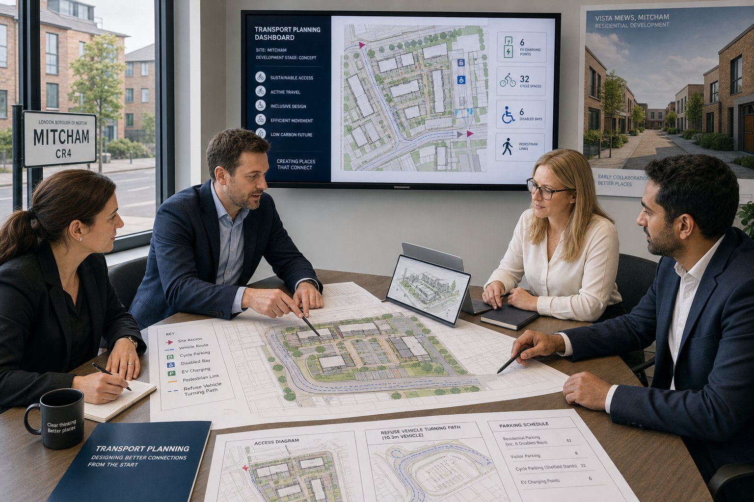
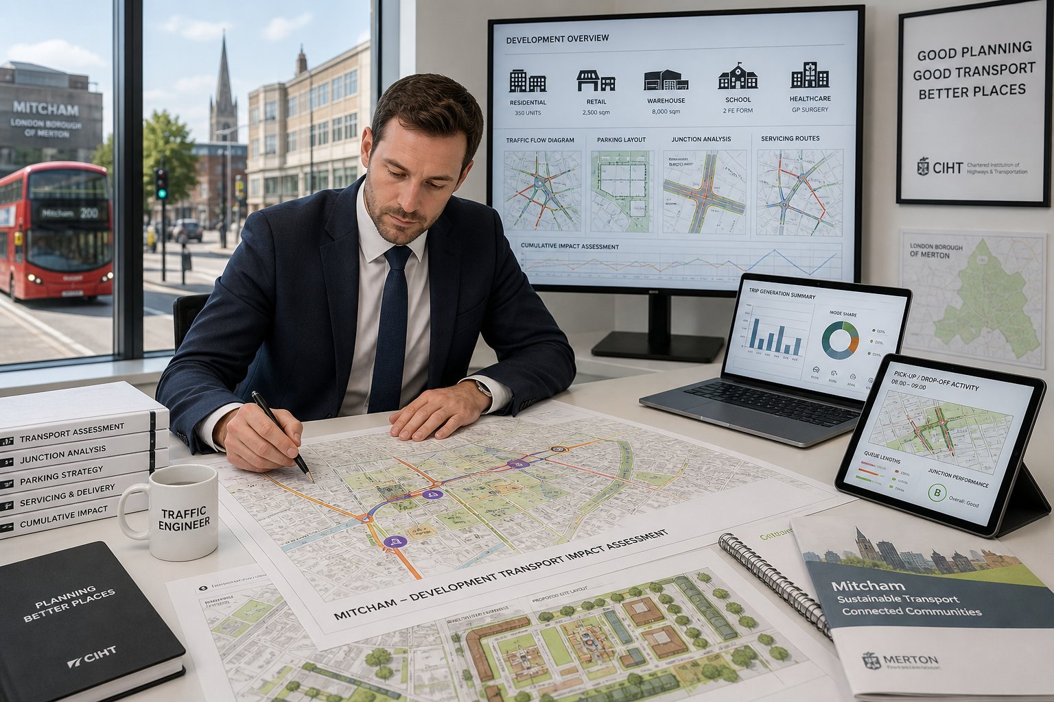
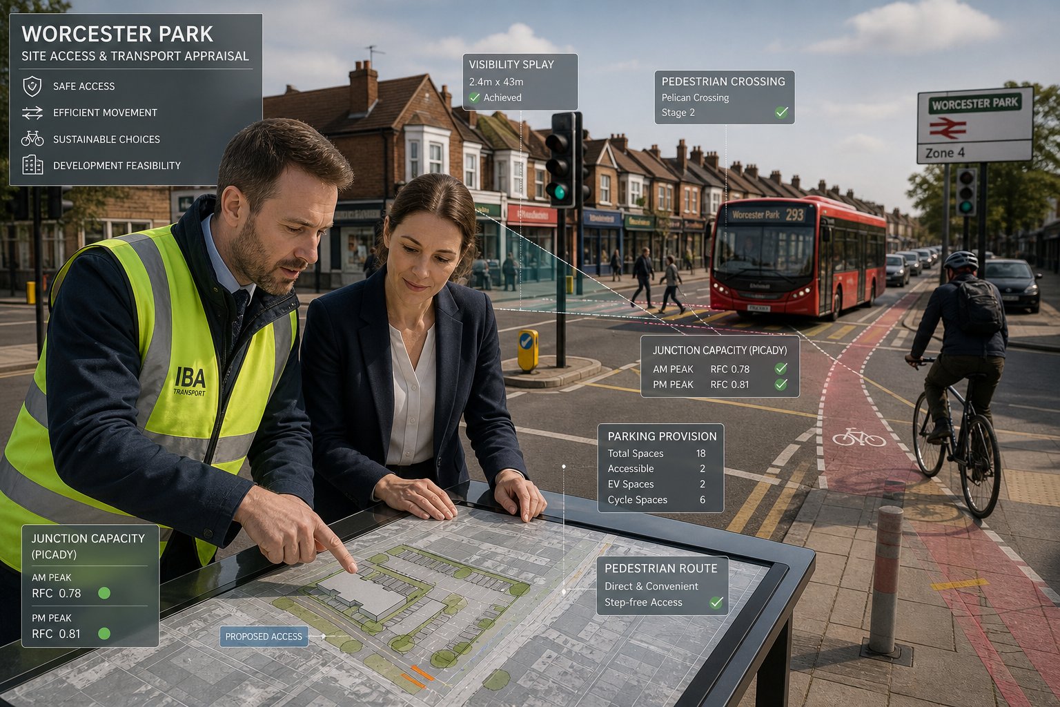
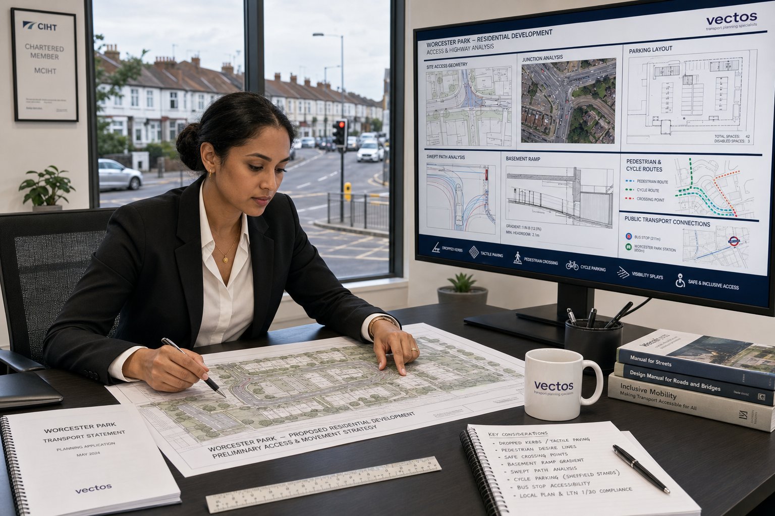
As the design develops, we support the wider consultant team with transport strategy, report preparation and technical evidence. That may include a Transport Statement, a full Transport Assessment, a Travel Plan, swept path analysis, access drawings, trip generation work, parking stress surveys, collision analysis or junction capacity modelling. On more complex sites, we also help draft mitigation proposals such as crossings, waiting restrictions, signal amendments, visibility improvements or internal layout changes.
Just as importantly, we help with negotiation. Officers and highway authorities usually want clear, proportionate evidence, not jargon-heavy documents. A strong consultant can explain what matters, why it matters, and what can reasonably be secured by condition or obligation. For teams wanting broader context, articles on Traffic Engineering Consultants: What and Highway And Traffic often help frame the bigger picture. In Ealing specifically, success usually comes from combining technical competence with a practical understanding of how local planning concerns are actually raised and resolved.
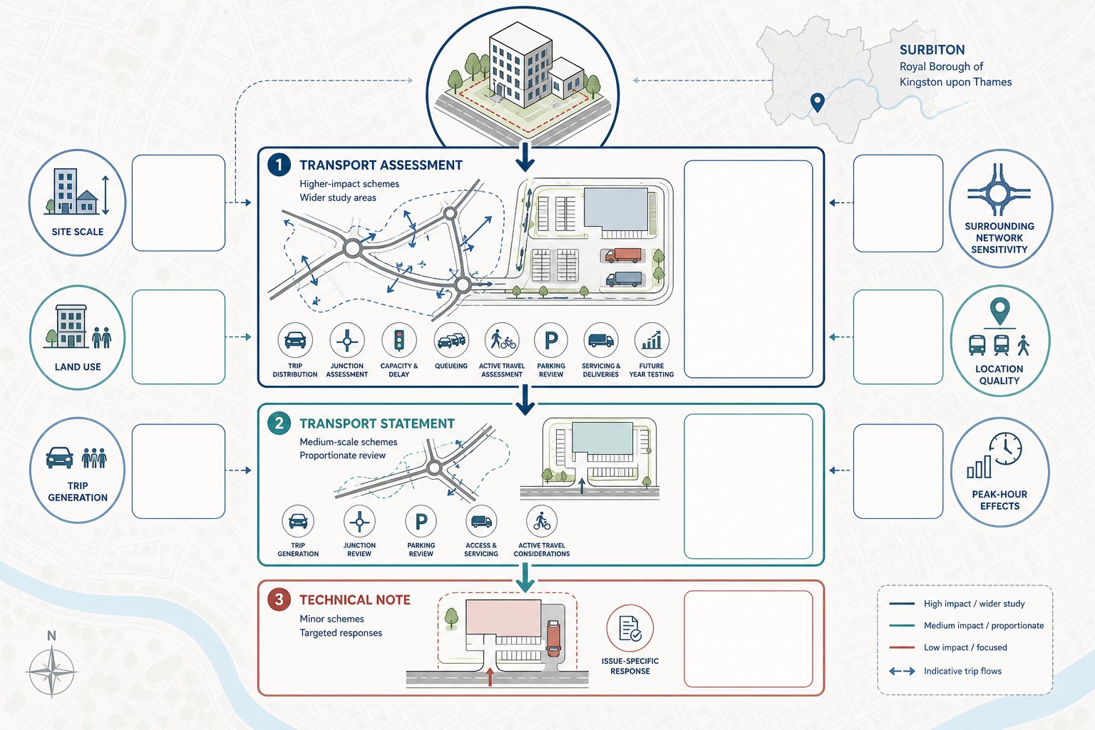
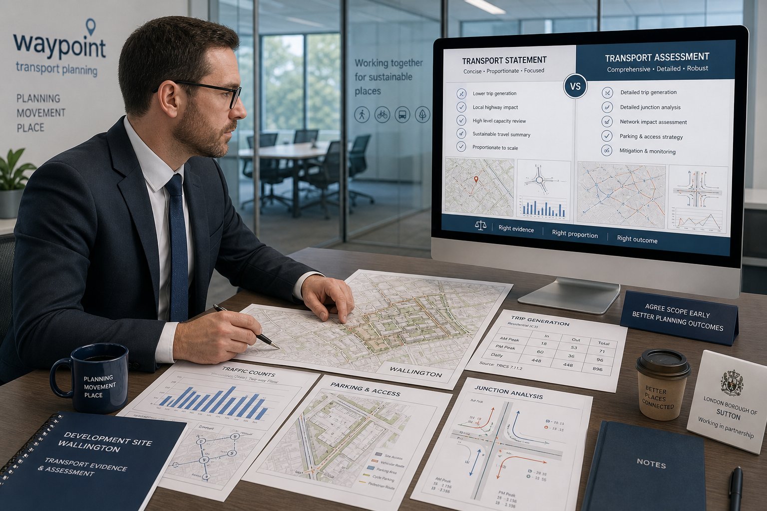
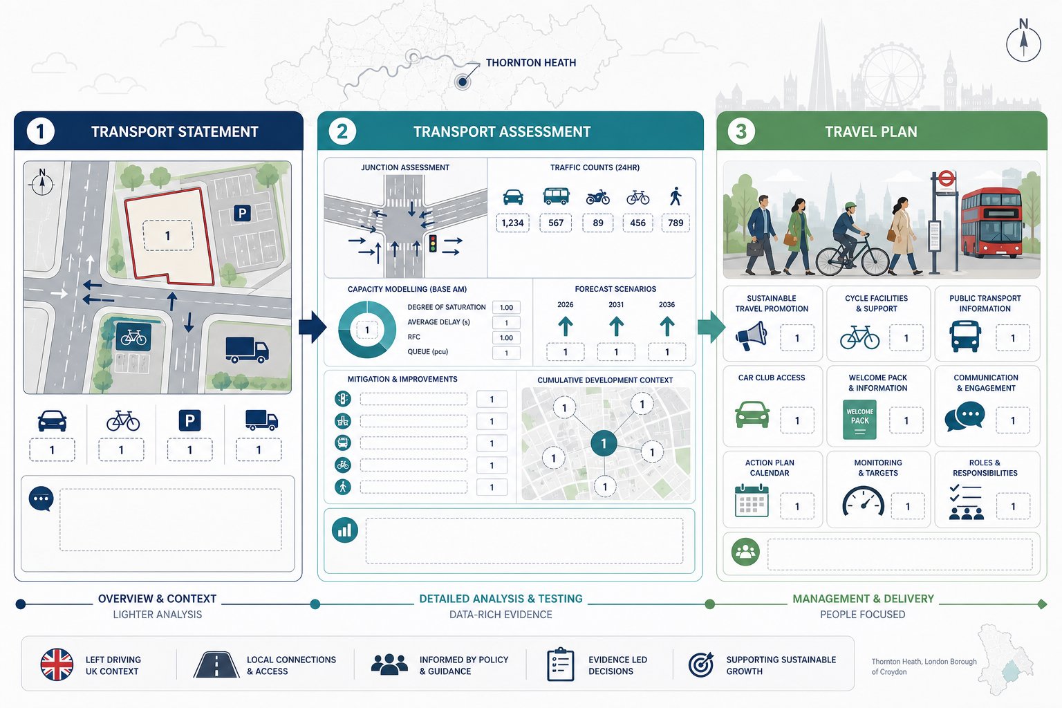
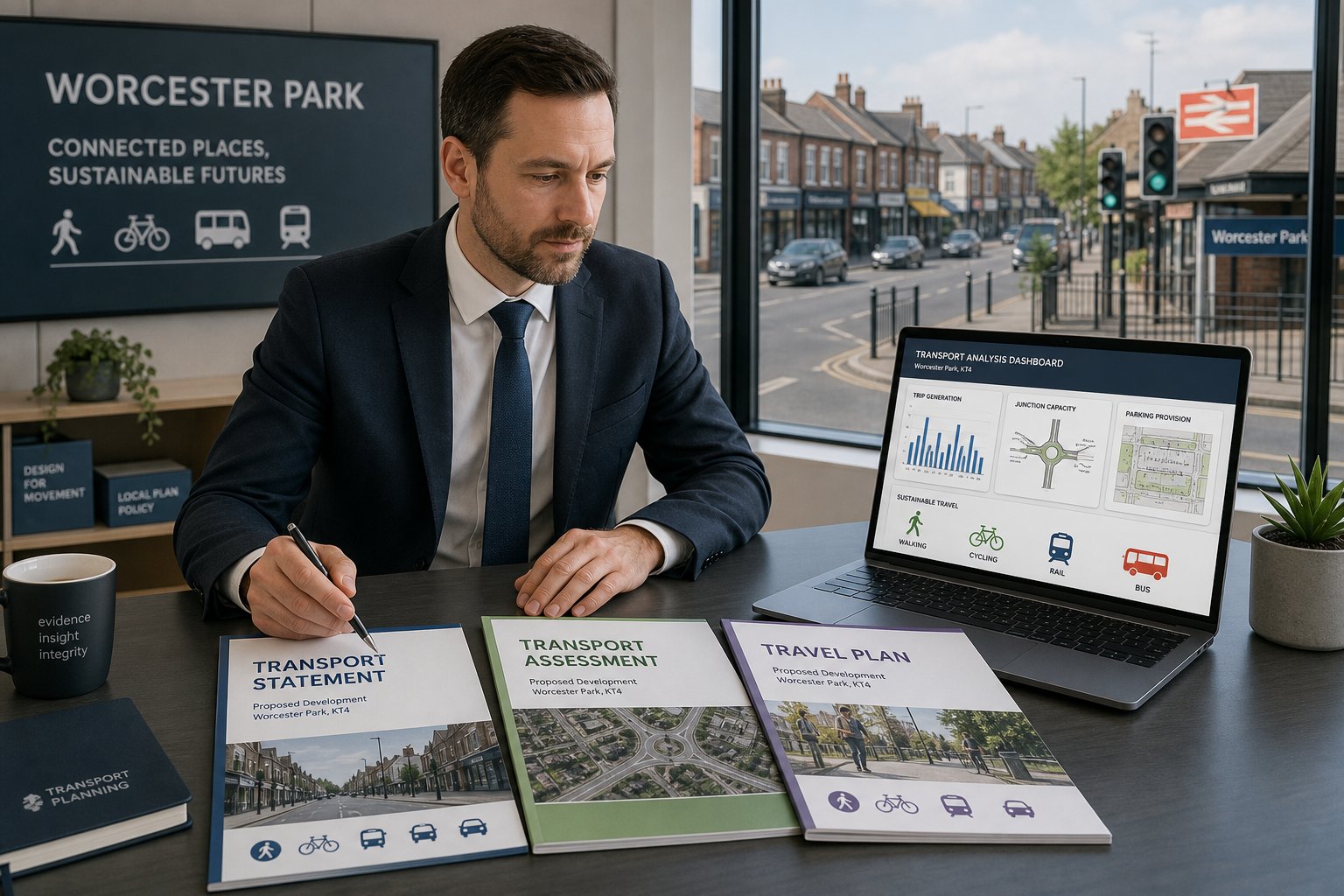
Transport Statements, Transport Assessments, And Travel Plans Explained
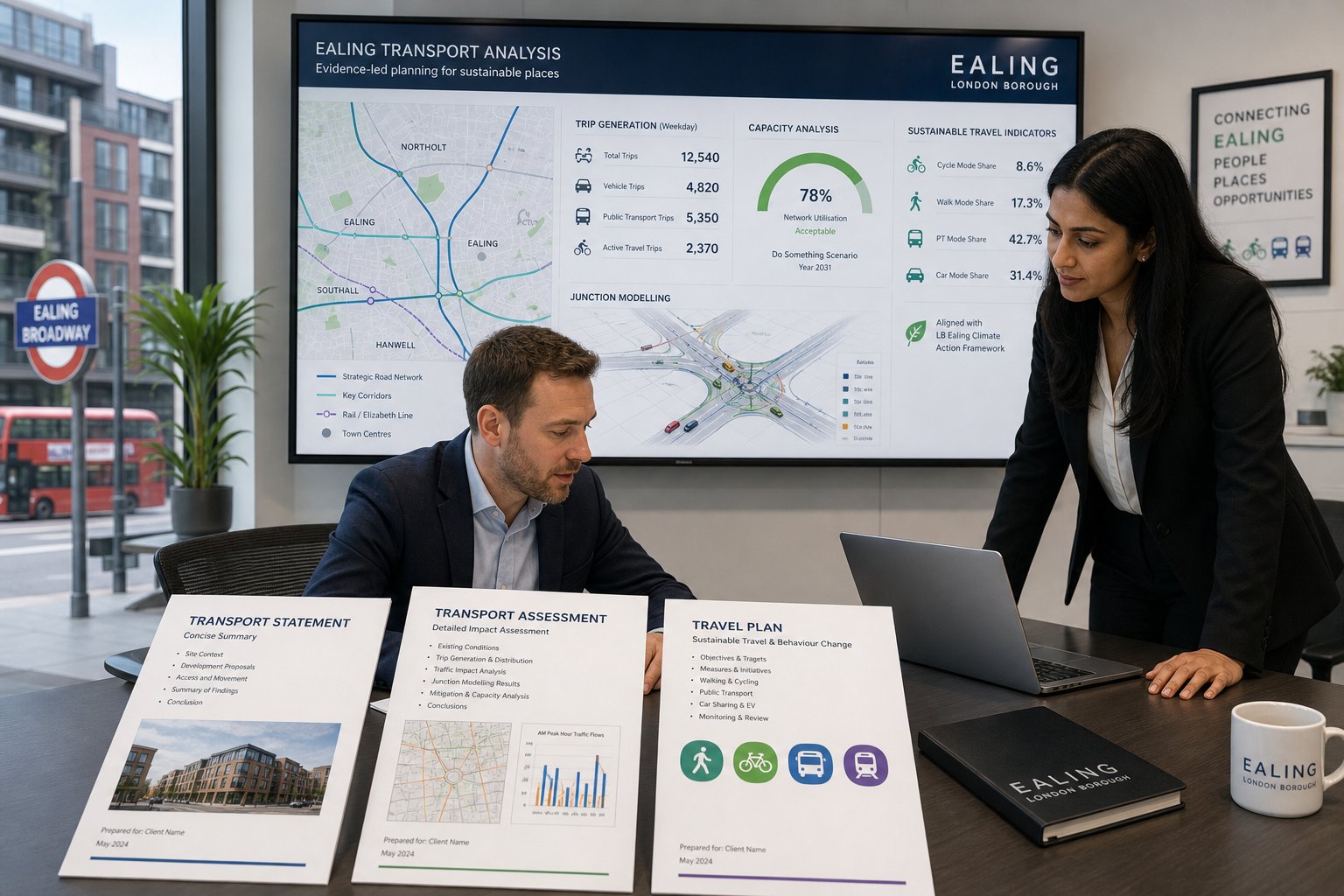
These three documents are often mentioned together, but they serve different purposes.
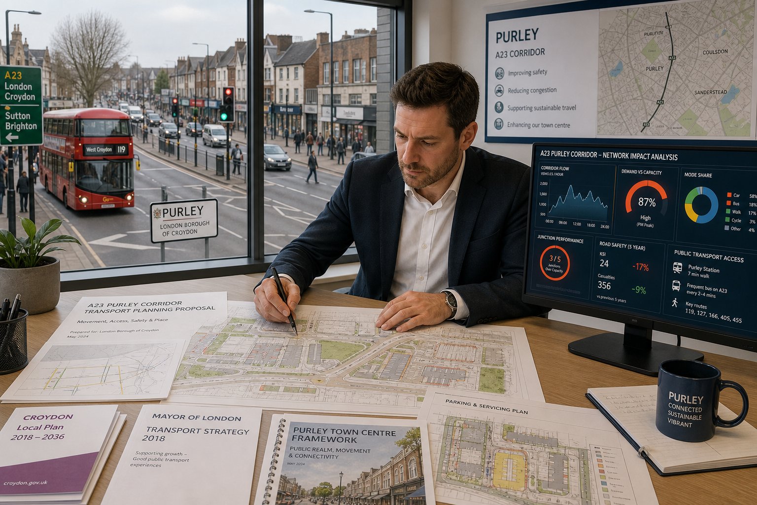
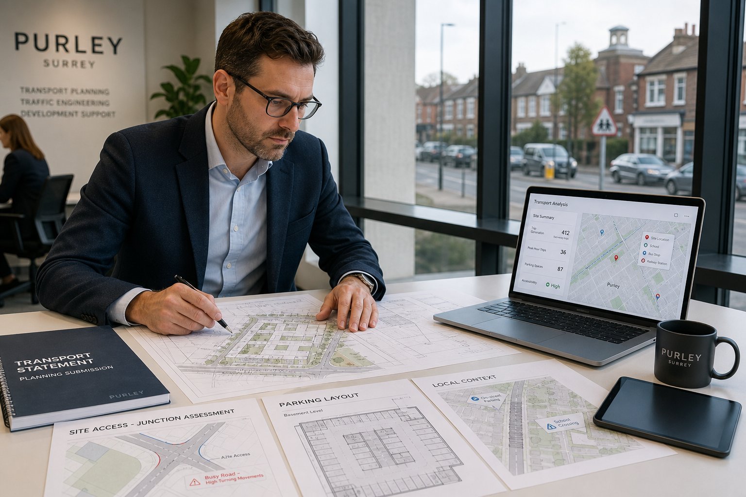
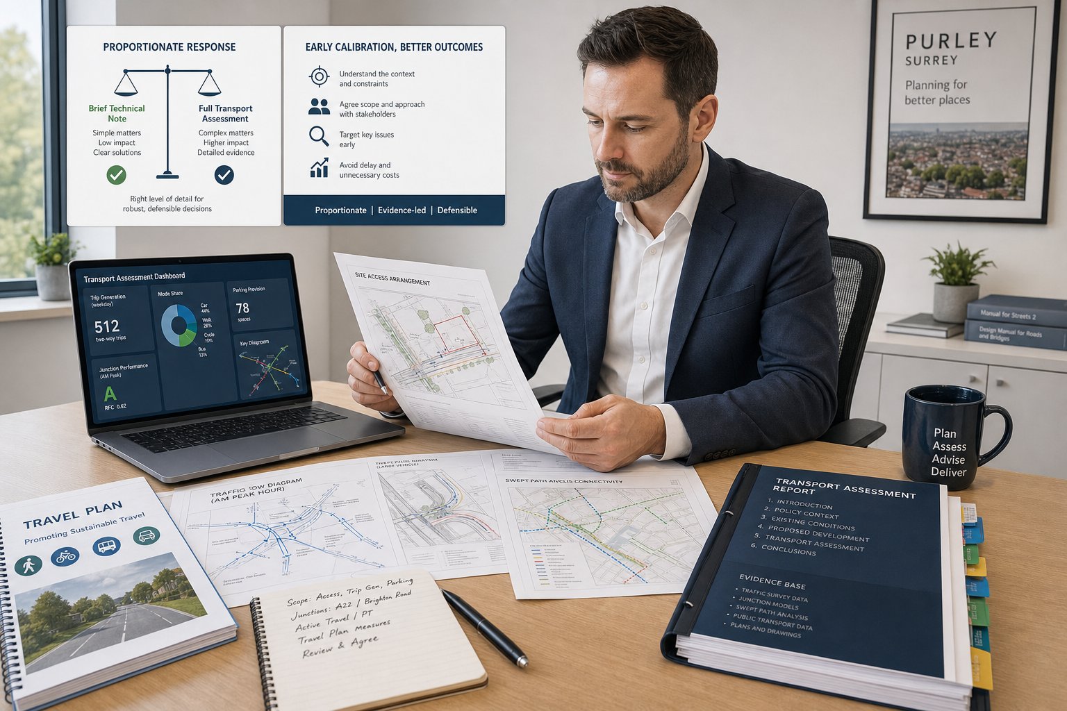
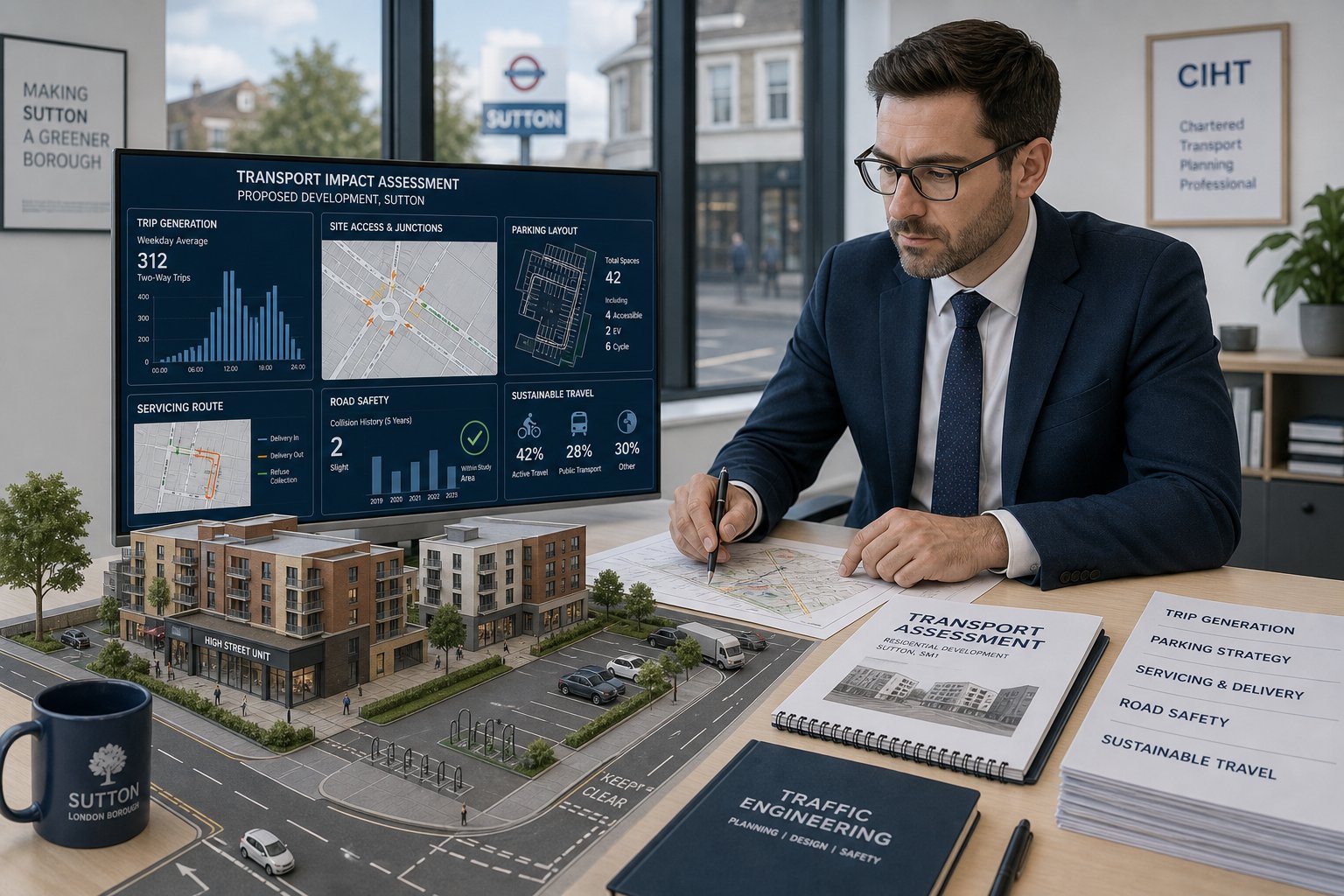
A Transport Statement (TS) is usually the proportionate response for a smaller or less traffic-intensive proposal. It sets out the site context, existing accessibility, access arrangements, parking, servicing, likely trip generation and whether the impact is expected to be material. A good TS is concise, but not superficial. It still needs to address the questions officers will ask.
A Transport Assessment (TA) is more detailed and is generally required where trip generation, network impact or site complexity is greater. A TA may include surveyed baseline conditions, industry database comparisons, trip assignment, junction modelling, capacity assessments, safety review and mitigation proposals. If objections are likely on congestion or operation, the TA is often the critical evidence document.
A Travel Plan (TP) is different again. Rather than focusing only on impact, it sets out how sustainable travel will be encouraged and monitored. That can include cycle parking, welcome packs, public transport information, car club membership, shower facilities, delivery management, incentives, targets and monitoring mechanisms.
In Ealing, the right document depends on scale, use, location and sensitivity of the surrounding network. We often find that developers underestimate the value of a well-pitched report. Too little information creates delay: too much, if unfocused, can obscure the key planning points. For commercial schemes, the balance discussed in Commercial Traffic Engineering is especially relevant.
When A Development In Ealing Is Likely To Need A Transport Report
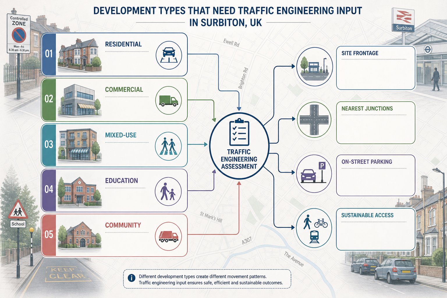
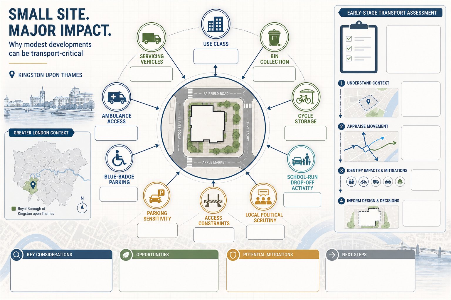
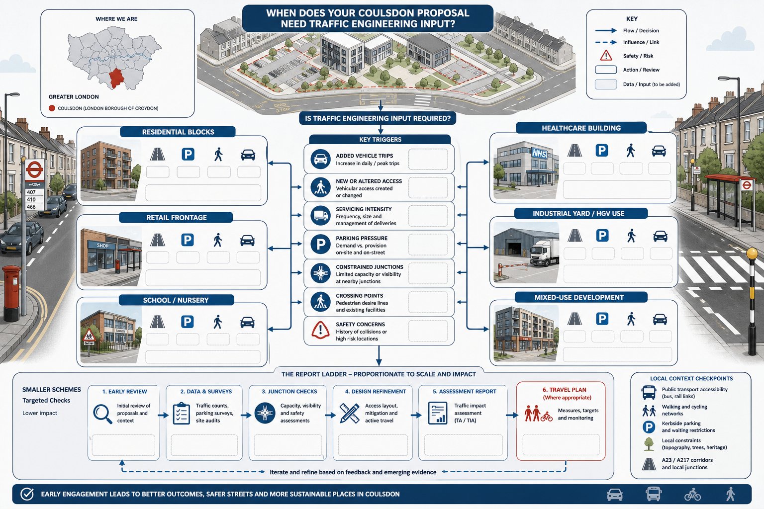
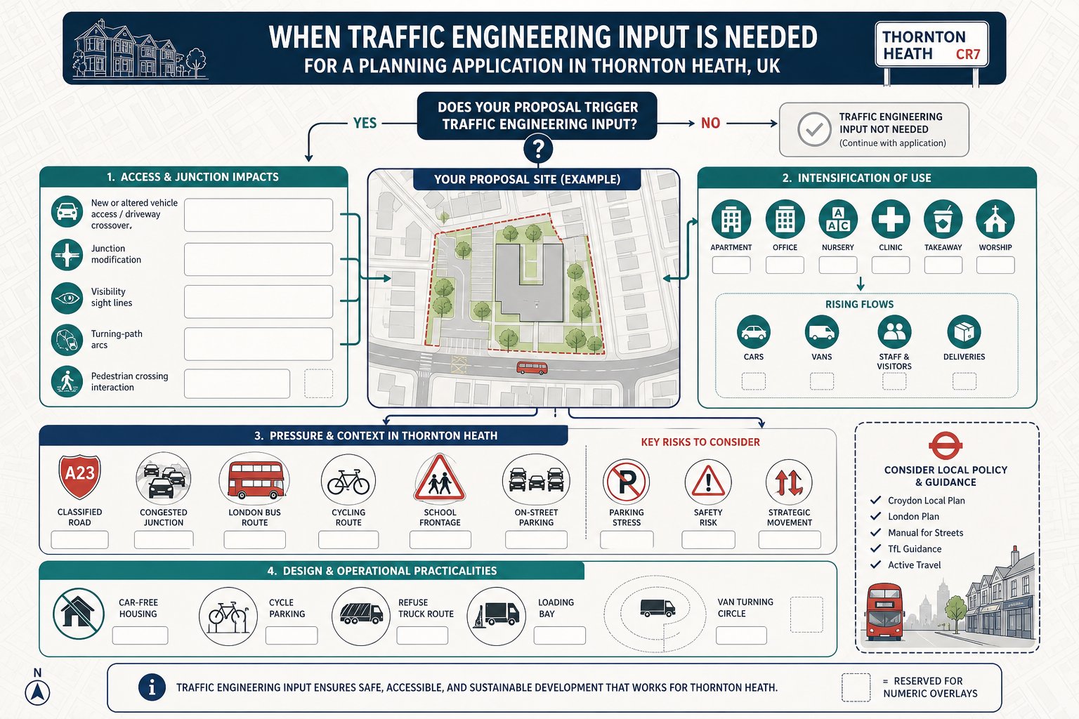
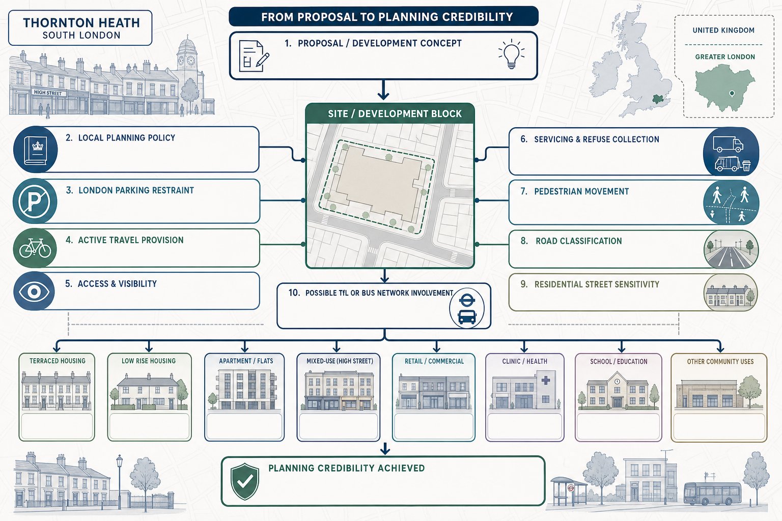
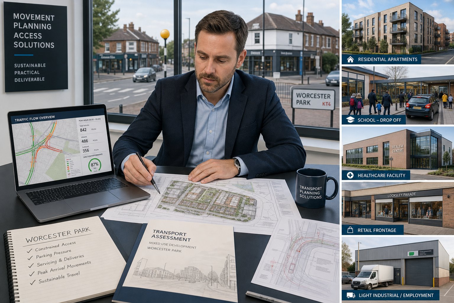
Not every application in Ealing requires a lengthy transport submission, but many do require some form of evidence. The most obvious cases are major residential, retail, education, employment, healthcare and mixed-use developments. If a scheme creates a noticeable number of person trips, changes access arrangements, alters parking supply, introduces servicing demand or affects a sensitive corridor, a report is likely to be expected.
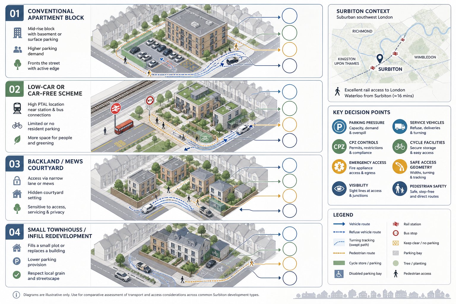
Smaller schemes can also trigger transport scrutiny. A modest infill development on a narrow residential road might raise concerns about refuse collection, emergency access or overspill parking. A change of use in a town centre can create delivery patterns or peak-hour activity that matter more than the floor area suggests. Sites near schools, stations, bus routes or known pressure points often attract closer review as well.
We also watch for less obvious indicators: proposals within controlled parking zones, sites reliant on substandard visibility, basements with ramp access, schemes removing established loading space, and developments in high-PTAL locations where car-free or car-lite expectations apply. In those cases, the transport response may need to explain not just what the impact is, but why the scheme’s travel assumptions are realistic.
This is where local judgement counts. A generic threshold approach can miss the actual planning risk. In our experience, a Traffic Engineer in Ealing adds most value when we identify early whether transport is likely to be a major issue, a moderate issue, or simply something that needs clean and proportionate justification.
Key Local Factors That Influence Transport Planning In Ealing
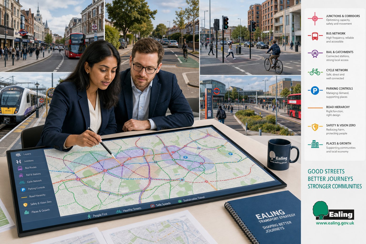
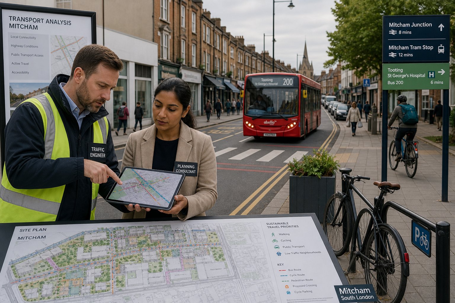
Transport planning in Ealing is shaped by the borough’s geography, network constraints and policy context. There’s no single “typical” site. A proposal in Acton, for example, raises a different mix of issues from one in Southall, Ealing Broadway, Greenford or Northolt. Yet some themes recur: constrained junctions, strategic movement corridors, strong public transport accessibility in some locations, suburban car dependence in others, and increasing emphasis on healthy streets and road safety.
That local variation matters because transport evidence needs to reflect how people actually move through the area. Station catchments, bus reliability, school travel patterns, town centre servicing windows, parking controls and local road function all influence what is considered acceptable. A broad Traffic Engineer In London: perspective helps, but borough-level detail is what often decides whether a transport case feels credible.
Town Centre, Residential, And Mixed-Use Site Considerations
Town centre sites in Ealing often come with the most competing demands. Pedestrian flows are high, bus movement is important, cycle routes may be present or planned, and kerbside space is already contested by loading, taxis, blue badge parking and general turnover. Even where public transport access is excellent, the question isn’t simply “can people arrive without a car?” It’s also “can the site operate day to day without undermining the street around it?”
Residential schemes raise a different set of tensions. In high-PTAL locations, policy may support car-free or car-lite approaches, but surrounding residents will still worry about overspill parking. Family housing can generate school trips and more varied daily travel patterns than a student or later-living scheme. Visitor parking, refuse collection, cycle storage and emergency access all need to work together.
Mixed-use sites are often the most intricate because trip patterns overlap rather than simply add up. Uses may share parking demand, peak at different times or create servicing conflicts. Retail units at ground floor with homes above sound straightforward until deliveries, bin movements and pedestrian priority all need resolving on a tight frontage. That’s why a joined-up transport strategy matters more than isolated calculations.
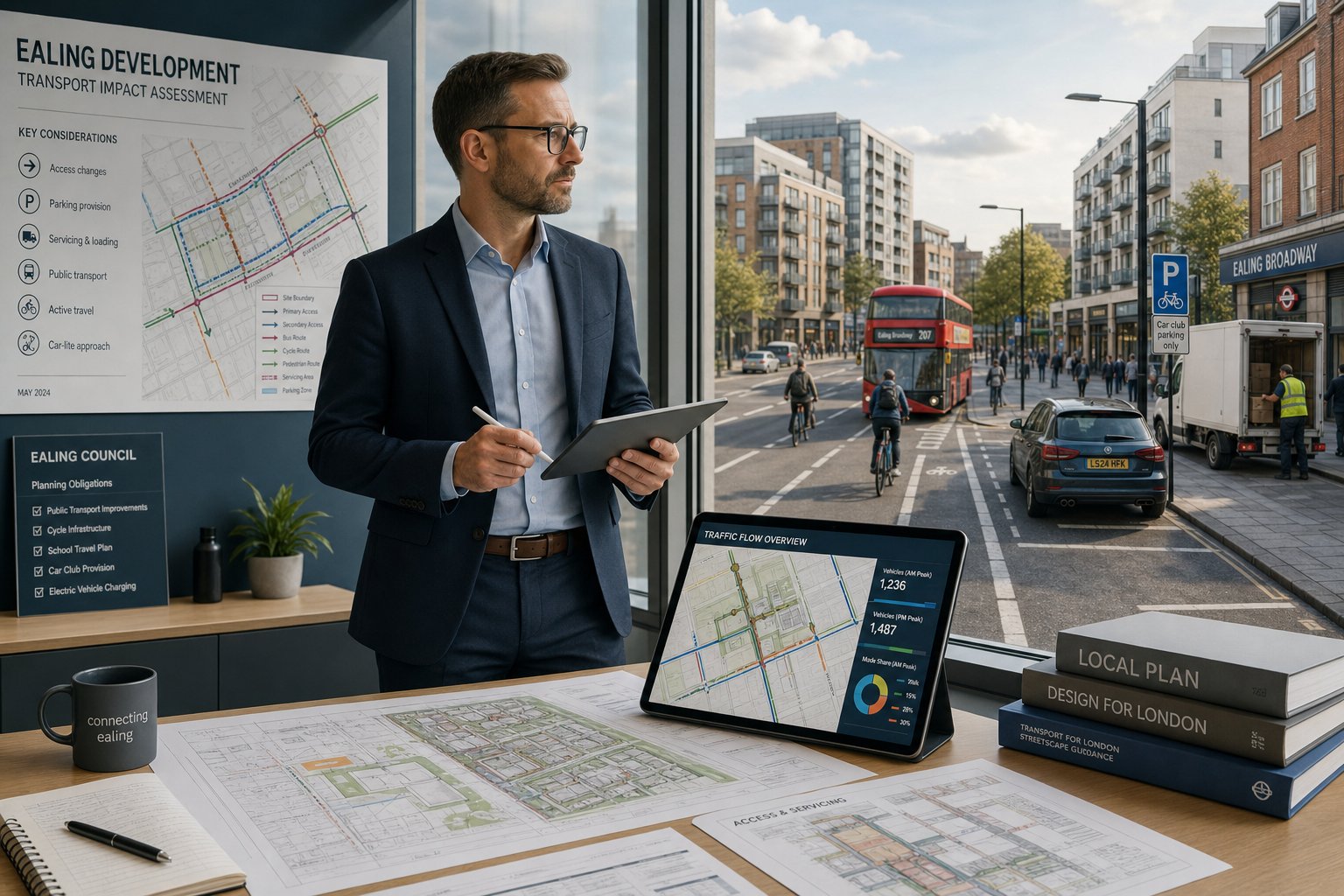
Parking, Servicing, And Access Constraints
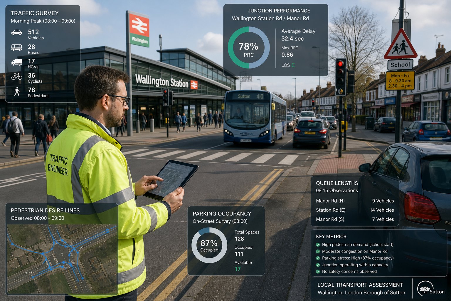
Parking in Ealing is rarely just about counting spaces. The planning discussion usually turns on stress, displacement, local controls and behaviour. A development may technically provide enough parking for policy purposes but still raise concern if nearby streets are already under pressure. That’s why parking beat surveys, controlled parking zone analysis and a realistic understanding of likely car ownership are so important.
Servicing is another common stumbling block. Town centre and mixed-use sites may have little kerb frontage, while residential streets may be too narrow for convenient delivery activity without conflict. Refuse collection, parcel deliveries, supermarket vans, maintenance access and occasional larger vehicles all need to be considered. If servicing relies on awkward reversing, blocking footways or informal stopping, objections become predictable.
Access itself can be equally sensitive. Width, gradient, visibility, gate set-back, pedestrian priority and interaction with cyclists can all affect acceptability. Practical design guidance on access design highway and parking strategy traffic is often useful here, because many planning disputes come down to whether access and parking arrangements work in everyday operation, not just on a drawing.
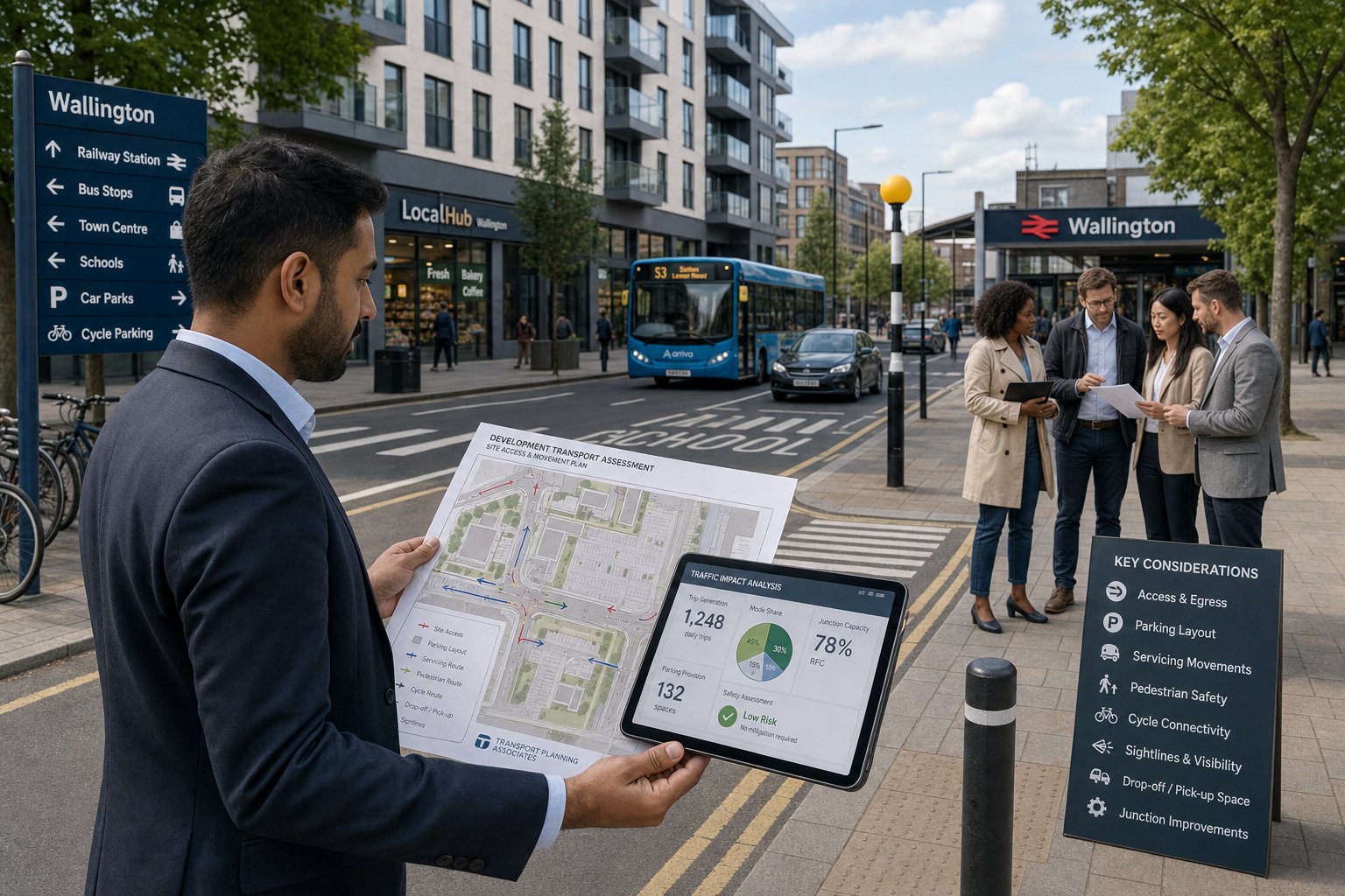
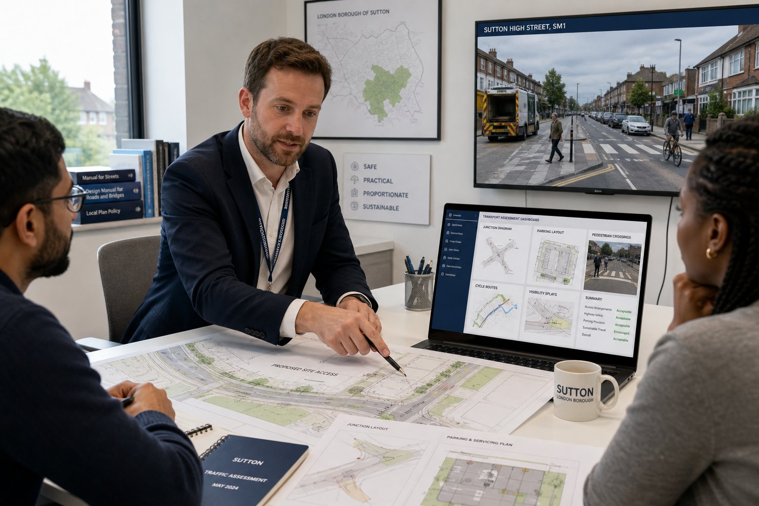
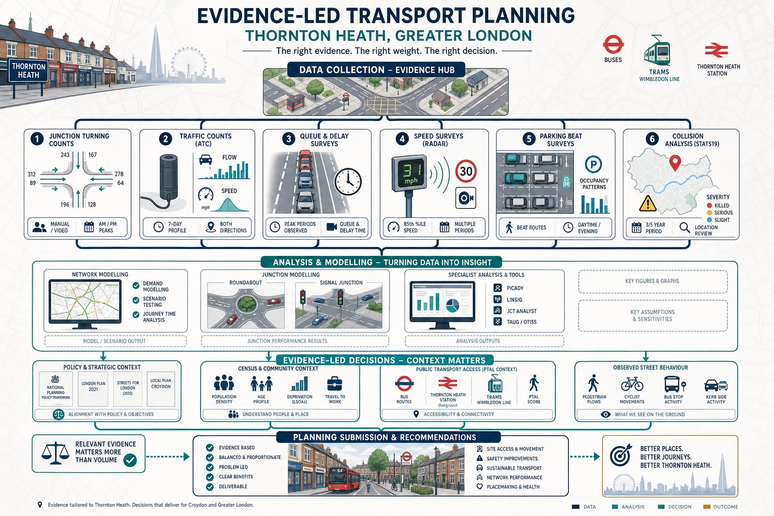
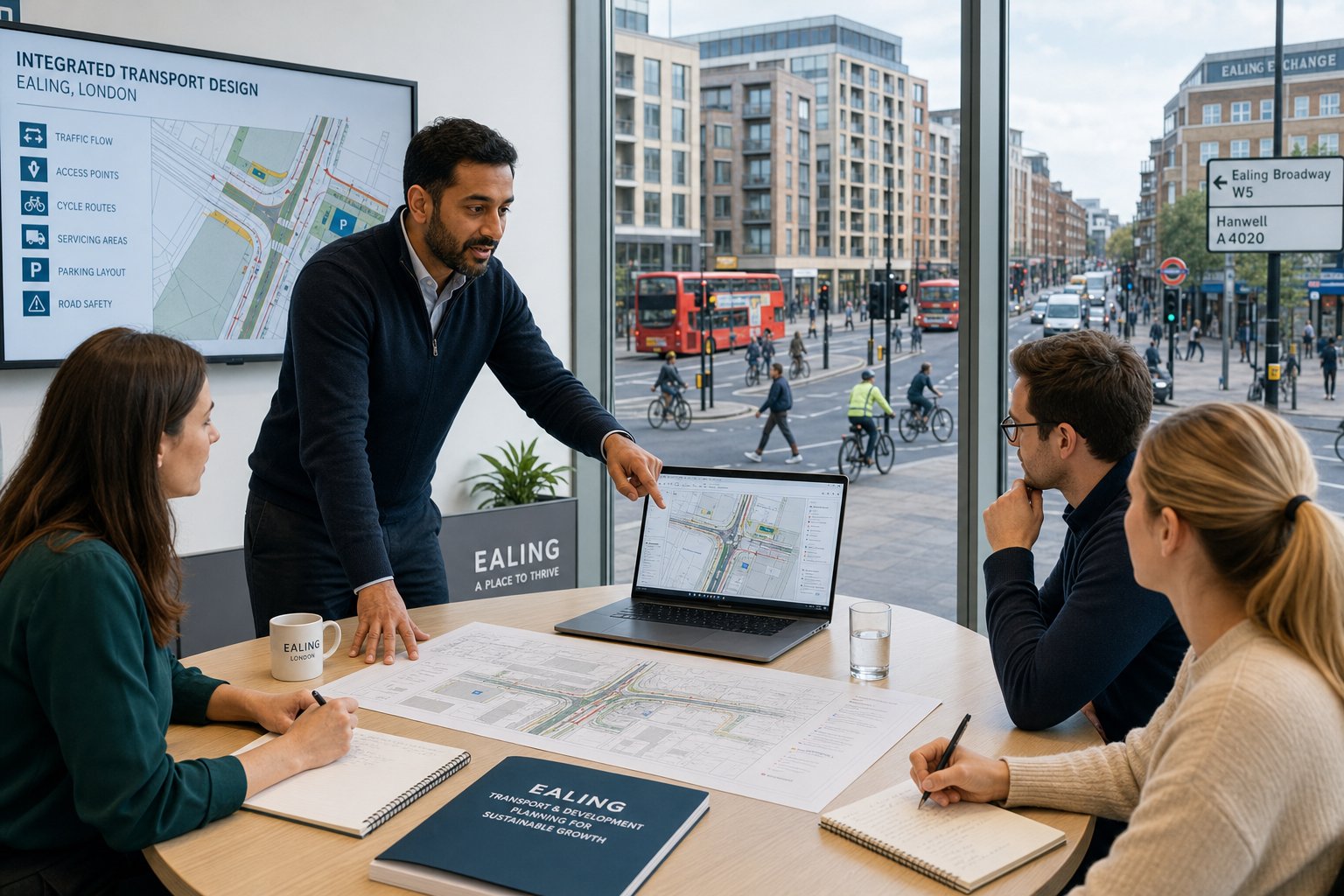
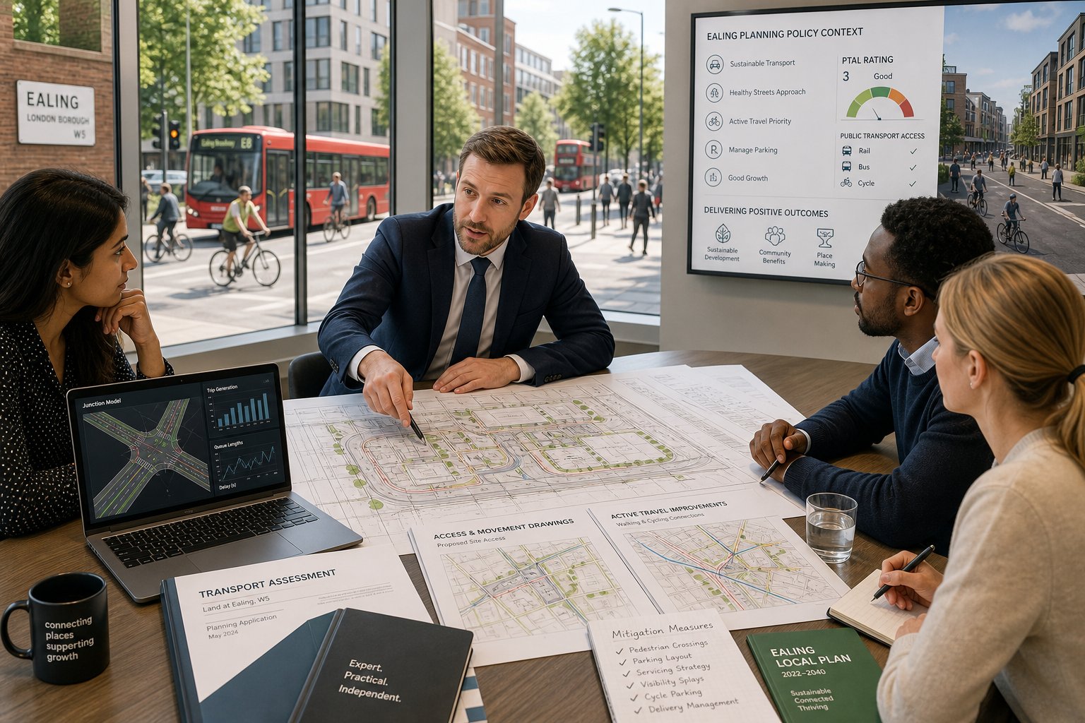
What A Traffic Engineer Will Assess For An Ealing Scheme
For most Ealing schemes, the assessment starts with the site itself and then expands outward. We look at the proposed land use, intensity, frontage conditions, surrounding road hierarchy, public transport accessibility, walking and cycling connections, collision history, parking controls and likely local sensitivities. Then we test how the proposal will function in reality.
That usually includes access suitability, servicing practicality, parking provision, refuse and emergency movements, disabled access, visibility, internal circulation and the relationship between the development and nearby streets. We also review whether the scheme aligns with borough and London policy expectations, particularly around mode share, active travel and road safety.
A key point for planning teams is that this isn’t only about proving acceptability after the design is fixed. Often, the engineering review improves the design before submission. A small tweak to a crossover, cycle store location, loading arrangement or pedestrian route can remove an objection that would otherwise dominate the application. In that sense, traffic engineering is as much a design discipline as an assessment one.
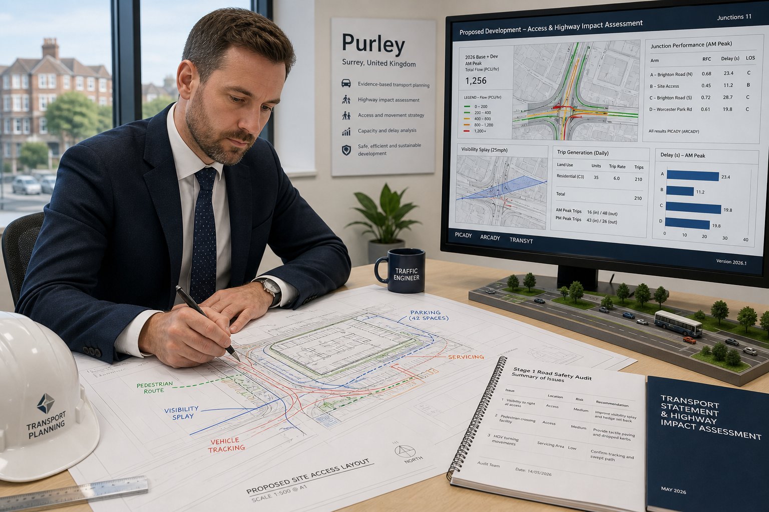
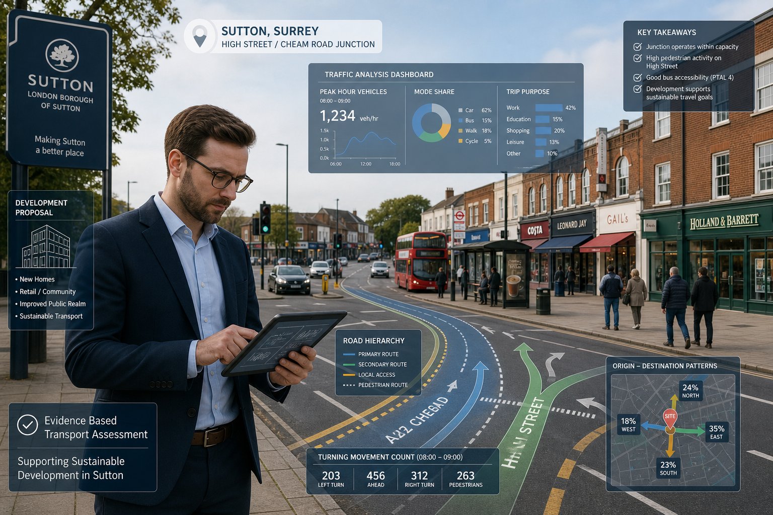
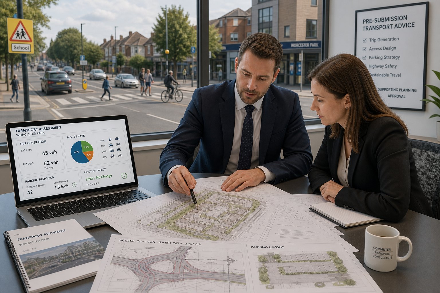
Trip Generation, Distribution, And Junction Impact
Trip Generation, Distribution, And Junction Impact
One of the core tasks is estimating how many trips a development is likely to generate, by all relevant modes. We typically use comparable site evidence, national databases, census and travel behaviour data, and local context to build a robust forecast. The numbers matter, but the interpretation matters just as much. A scheme near strong public transport links may generate fewer car trips than a suburban comparator, while a logistics-heavy use may require more detailed servicing analysis than standard trip rates suggest.
Once trips are estimated, we assign them across the local network to understand where pressure is likely to fall. That may involve considering existing turning patterns, strategic routes, rat-running sensitivities, town centre circulation and known local pinch points. Where necessary, we carry out junction modelling using recognised software to assess capacity, queueing and delay.
The aim isn’t to pretend every impact can be reduced to zero. It’s to determine whether the development effect is material, whether the network can accommodate it, and whether mitigation is needed. Sometimes the answer is a signal adjustment or crossing upgrade: sometimes it’s a revised access strategy: sometimes the evidence shows the effect is genuinely modest. Either way, quantified and transparent analysis tends to carry far more weight than broad assertion.
Walking, Cycling, Public Transport, And Highway Safety
Walking, Cycling, Public Transport, And Highway Safety
In Ealing, sustainable and safe movement is often at the centre of transport decision-making. So we assess more than the carriageway. We review footway continuity, crossing opportunities, dropped kerbs, step-free routes where relevant, pedestrian desire lines, links to schools and local centres, and the comfort of the route rather than just its existence.
Cycling assessment covers route quality, permeability, cycle parking quantity and specification, access to stores, and how the site connects to borough and London networks. For larger schemes, the detail matters: awkward ramps, tight doors, poor surveillance or conflict with refuse movement can undermine an otherwise policy-compliant provision.
Public transport analysis usually considers rail, Underground, Elizabeth line and bus accessibility, service frequency, walking distance to stops, and whether local stop or interchange conditions affect the real attractiveness of non-car travel. In high-PTAL areas, this often underpins reduced parking and stronger mode shift assumptions.
Highway safety is the final pillar. We examine collision records, site visibility, turning conflicts, vulnerable road user risk and whether the proposal could worsen existing hazards. Mitigation may involve geometry changes, improved crossings, speed management, waiting restrictions or clearer servicing arrangements. Safety concerns, if left vague, can stall an application: if addressed properly, they can often be managed.
Common Planning Challenges In Ealing And How To Address Them
The most common challenge is congestion concern, especially near already-busy junctions or corridors. Residents and consultees may assume any extra trips are unacceptable, even where the actual increase is modest. The best response is usually evidence-led: realistic trip generation, transparent assignment, proportionate modelling and a clear explanation of network effects. If mitigation is needed, it should be specific and credible rather than aspirational.
Parking objections are just as frequent. In high-demand areas, even low-parking schemes can provoke strong resistance. Robust survey work, realistic car ownership assumptions, CPZ context and a coherent car-lite strategy are essential. We’ve found that vague statements about “good public transport” rarely satisfy objectors on their own: the parking case needs to be grounded in local evidence.
Safety issues form the third recurring theme, particularly near schools, on rat-run corridors, or where access is constrained. Here, small design changes can have outsized planning value, revised visibility splays, tighter servicing controls, a better crossing point, improved internal tracking, or reduced conflict between cyclists and turning vehicles.
And then there’s coordination. Planning applications often struggle not because the transport issue is impossible, but because highways, architecture, servicing and landscape proposals don’t align. The strongest submissions present one coherent story: this is how the site will be accessed, this is how it will operate, and this is why that arrangement is safe, policy-compliant and manageable.
Choosing The Right Traffic Engineer For An Ealing Project
Not all transport consultants are equal, and in Ealing that difference shows up quickly. The right adviser should understand London planning policy, local authority expectations, TfL influence where relevant, and the practical issues that repeatedly arise on constrained urban sites. Experience with Transport Statements, Transport Assessments, Travel Plans, junction modelling, parking surveys and access design is important, but so is judgement.
We’d suggest looking for three things. First, technical range: can the consultant prepare the report, test the assumptions and propose workable mitigation? Second, local credibility: do they understand how borough-specific issues such as PTAL, CPZ pressure, town centre servicing and active travel priorities affect the submission? Third, communication: can they explain the case clearly to planners, clients, architects, committees or, if needed, at appeal?
Speed matters too. Planning programmes are rarely generous, and transport work often lands late in the process. A consultant with established systems and real experience can move quickly without producing generic material. That’s one reason specialist firms such as ML Traffic emphasise concise, accurate reporting shaped by local thresholds and planning context.
Eventually, choosing a Traffic Engineer in Ealing is about reducing uncertainty. A good consultant doesn’t just write a compliant document: they help the whole team understand what the transport risk really is, and how to manage it before it turns into delay.
Conclusion
In Ealing, transport evidence is rarely peripheral to planning. It affects layout, access, parking, servicing, policy compliance, neighbour concerns and, often, the overall credibility of the application. The stronger the scheme, the more important it is that transport work supports it rather than lags behind it.
A capable traffic engineer helps turn uncertainty into a clear strategy. That means identifying likely issues early, choosing the right level of reporting, testing impacts properly, and shaping practical mitigation where it’s needed. For architects, planners, developers, surveyors, lawyers and public sector teams, that kind of input can save time, protect viability and improve the chances of a smoother planning journey.
In 2026, with Ealing continuing to balance growth, safety and sustainable travel, transport engineering remains one of the key disciplines in getting development right, both on paper and on the ground.
Frequently Asked Questions About Traffic Engineering in Ealing
What role does a traffic engineer play in planning developments in Ealing?
A traffic engineer in Ealing assesses access, trip generation, parking, and highway impacts to ensure safe, efficient movement aligns with borough and London policies, helping to de-risk planning applications and support sustainable, workable developments.
When is a Transport Statement, Transport Assessment, or Travel Plan required for an Ealing development?
Smaller or less complex projects typically need a Transport Statement, while larger or more impactful schemes require a Transport Assessment. Travel Plans focus on promoting sustainable travel and monitoring. The choice depends on factors like scale, trip generation, and local network sensitivity.
How do local factors in Ealing influence traffic engineering assessments?
Ealing’s busy corridors, constrained junctions, high public transport accessibility areas, and policies towards active travel create site-specific challenges. Traffic engineers tailor assessments to local conditions such as parking stress, pedestrian safety, and public transport quality for credible planning evidence.
What are common traffic-related challenges in Ealing planning applications and how can they be addressed?
Frequently, congestion, parking pressure, and safety near schools or narrow streets arise. Evidence-led traffic modelling, robust parking surveys, careful design, and targeted mitigation like crossings or traffic calming help address these concerns effectively.
How can developers choose the right traffic engineer for projects in Ealing?
Select consultants with proven experience in London and preferably Ealing, strong technical skills in assessments and modelling, understanding of local policies, and the ability to communicate clearly with planning authorities, ensuring timely and credible transport evidence.
What aspects of parking and servicing does a traffic engineer assess for Ealing developments?
They evaluate parking supply versus local demand, controlled parking zone effects, on-street parking stress, servicing access without compromising pedestrian or cycle safety, and internal layout for deliveries, ensuring compliance with both policy and real-world operational needs.