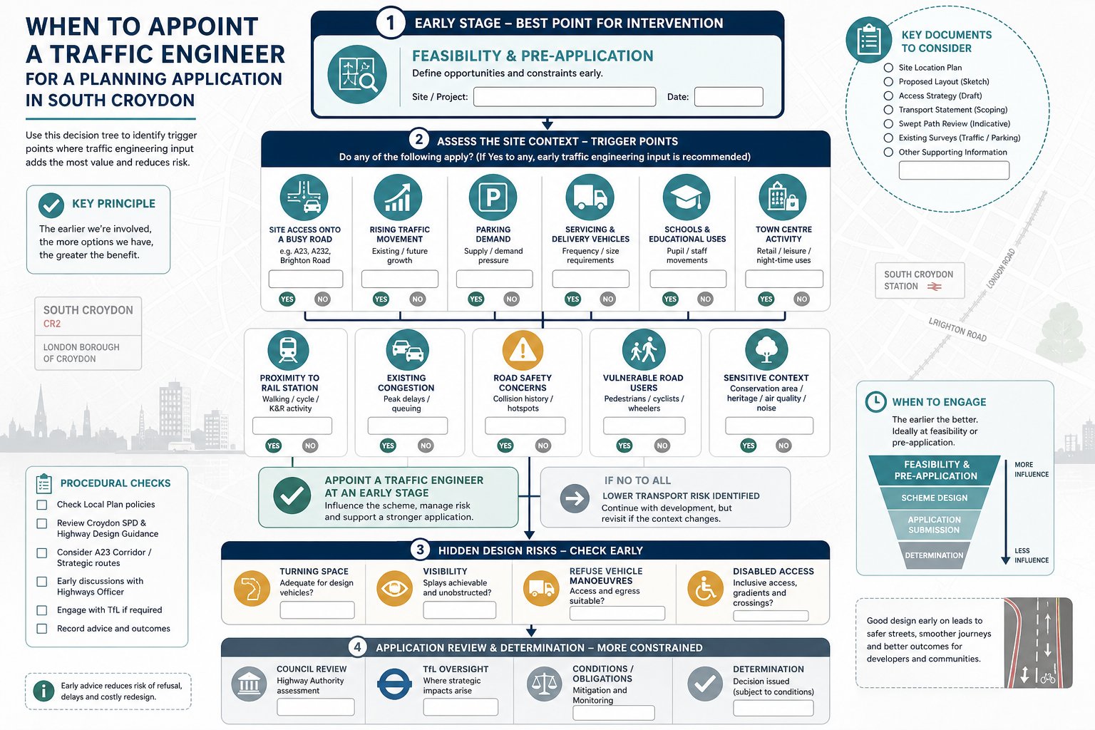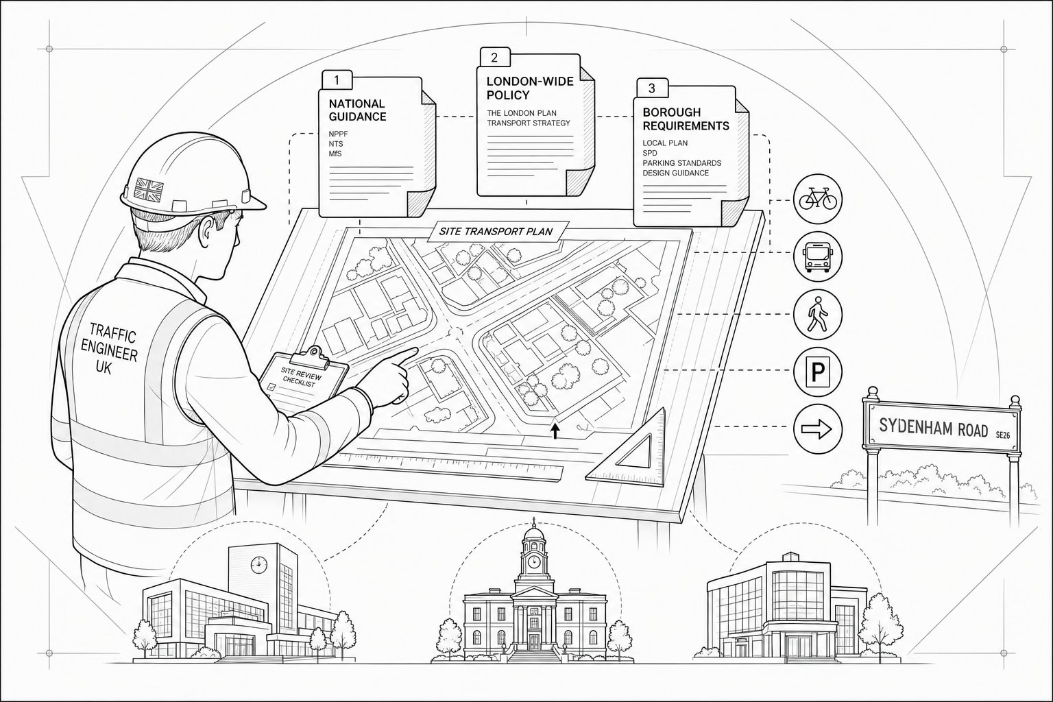
A planning scheme can look excellent on paper and still stall once transport questions start landing. In Kenley, that happens more often than many teams expect. A site may appear straightforward, but access geometry, parking pressure, school traffic, bus movements, visibility limits, or concerns about local rat-running can quickly become the issue that slows everything down.
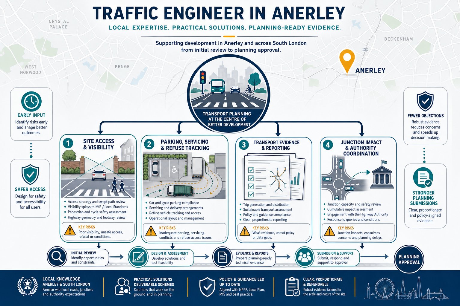
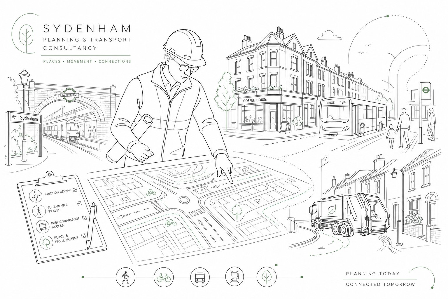
That is where a Traffic Engineer in Kenley becomes valuable. We help turn transport risk into evidence-led planning support. For architects, planners, developers, surveyors, legal teams, and local authorities, the aim is not simply to produce another report. It is to understand how a proposal will function on the ground, anticipate what Croydon Council and, where relevant, TfL are likely to focus on, and provide a proportionate response that keeps the application credible.
In practice, that can mean testing trip generation, reviewing junction capacity, checking whether servicing works without awkward reversing, assessing parking and cycle provision, or redesigning an access before a highways objection appears. Early input usually saves time later.
In this text, we set out what a traffic engineer does for Kenley developments, when transport input is usually needed, which reports commonly support planning submissions, and how to choose the right consultant for the job. If you are trying to move a scheme from concept to consent with fewer surprises, this is the part of the planning process worth getting right early.
Key Takeaways
- Engaging a Traffic Engineer in Kenley early in the planning process helps identify and mitigate transport risks, smoothing the path to planning consent.
- Traffic Engineers assess various factors including trip generation, junction capacity, parking, access geometry, and servicing to ensure developments integrate safely and efficiently with local transport networks.
- Proportionate transport reports—such as Transport Statements, Transport Assessments, or Travel Plans—are essential depending on the scale and impact of the project to satisfy Croydon Council and TfL requirements.
- Local constraints like narrow roads, high parking demand, and proximity to schools in Kenley must be carefully considered to create workable, policy-compliant proposals.
- Choosing a Traffic Engineer experienced with Kenley’s planning context and capable of clear, concise reporting improves communication with authorities and reduces delays.
- Proper preparation before instructing a Traffic Engineer accelerates project delivery by clarifying the scope and preventing late-stage redesigns or objections.
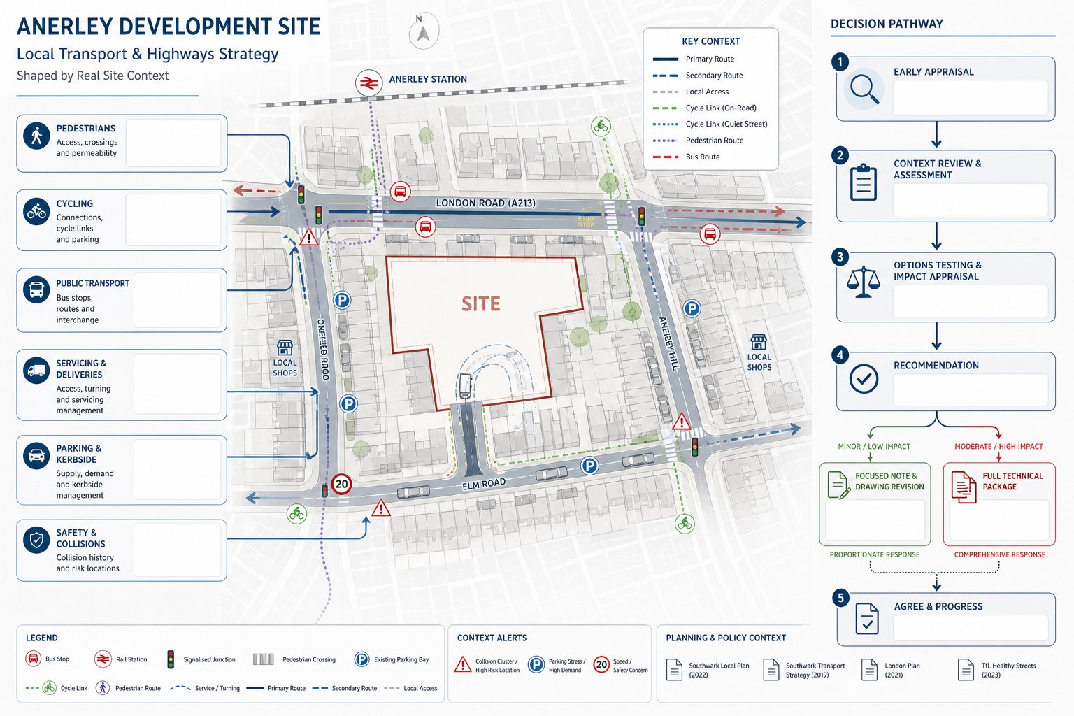
What A Traffic Engineer In Kenley Does For Planning And Development Projects
A traffic engineer working on a Kenley site looks at one central question: how will this proposal interact with the surrounding transport network, and will that interaction be acceptable to the decision-makers?
That sounds simple. It rarely is.
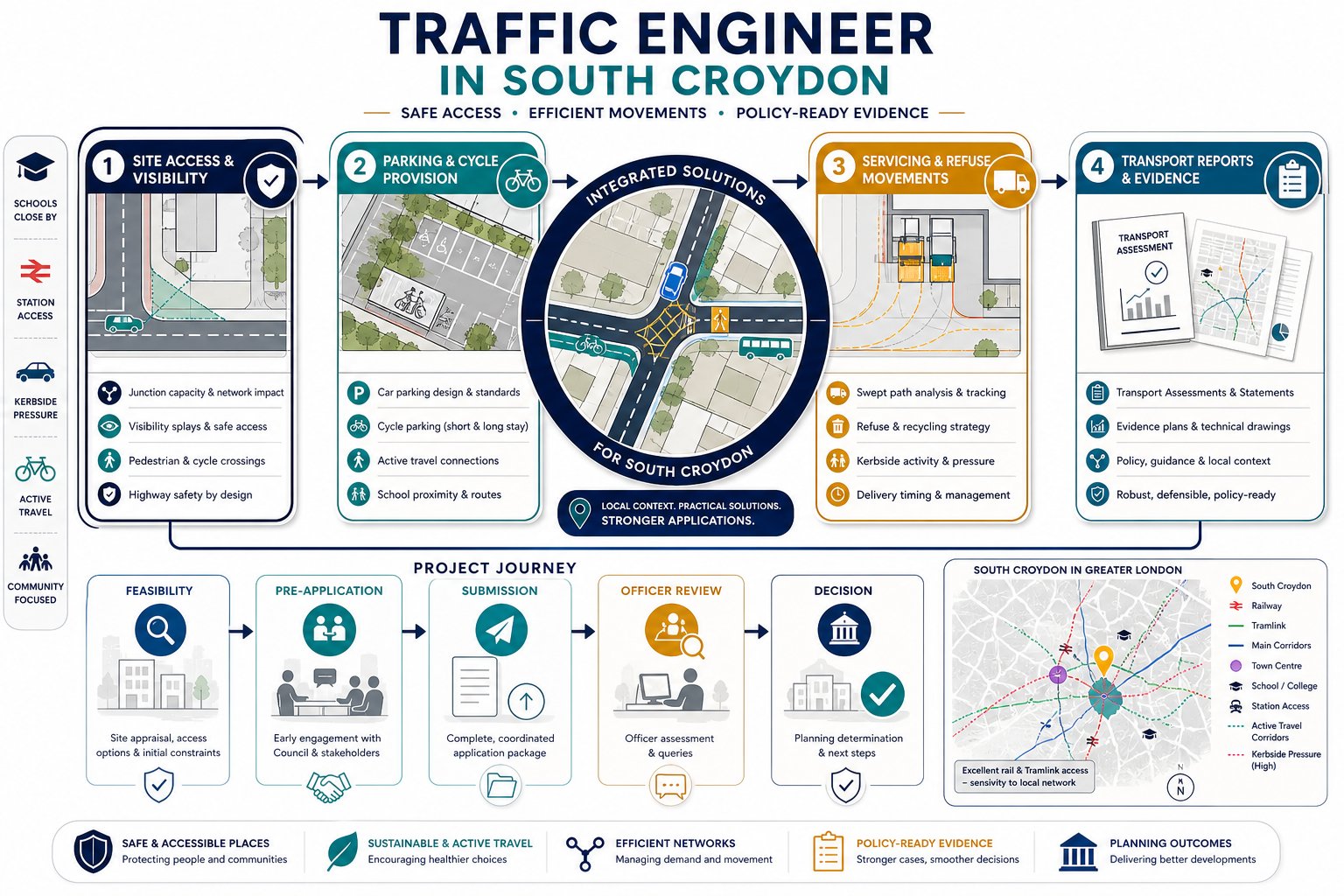
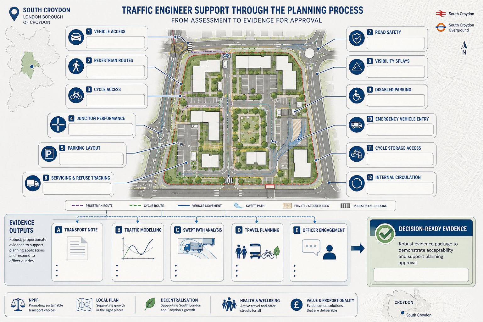
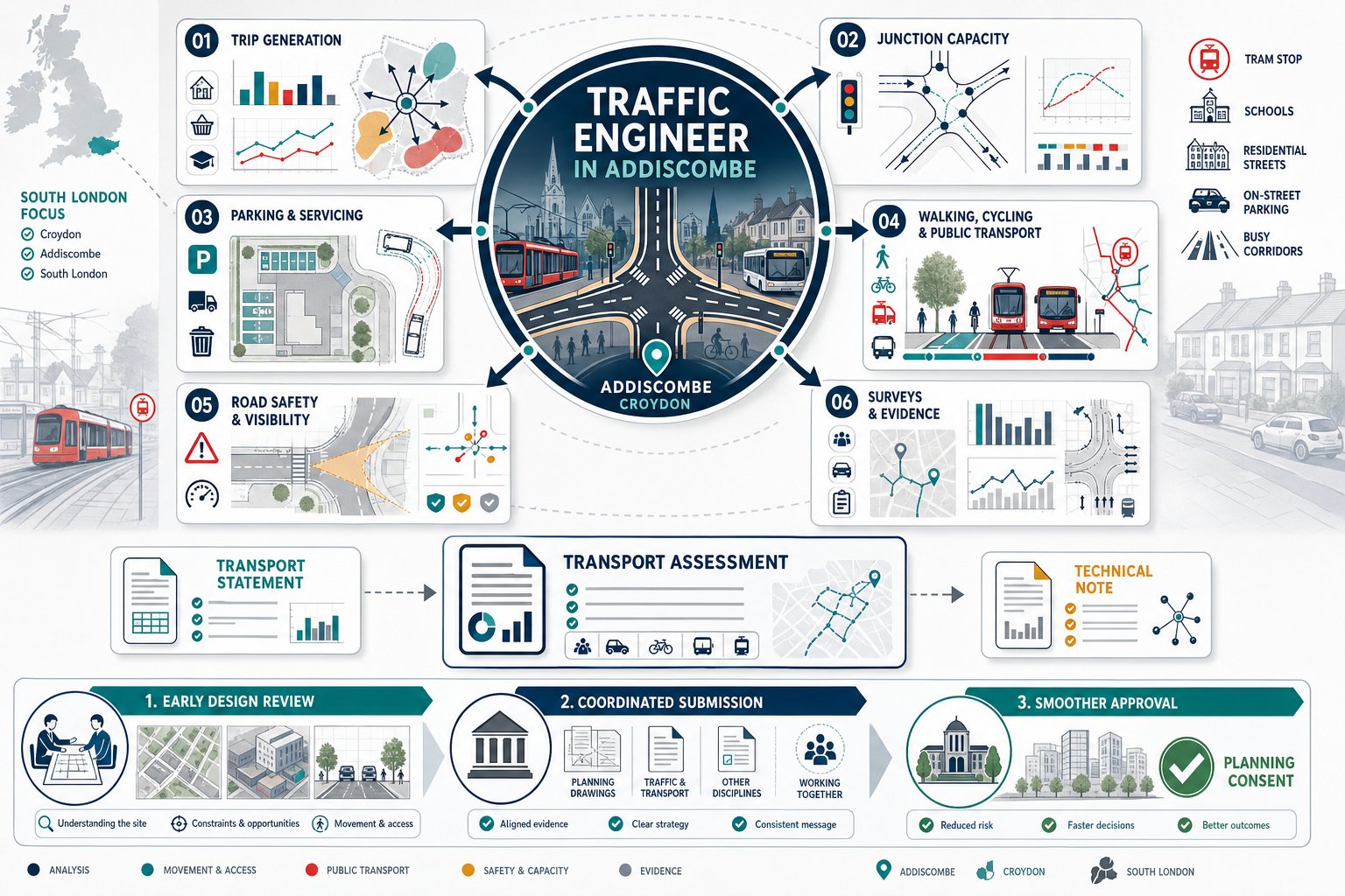
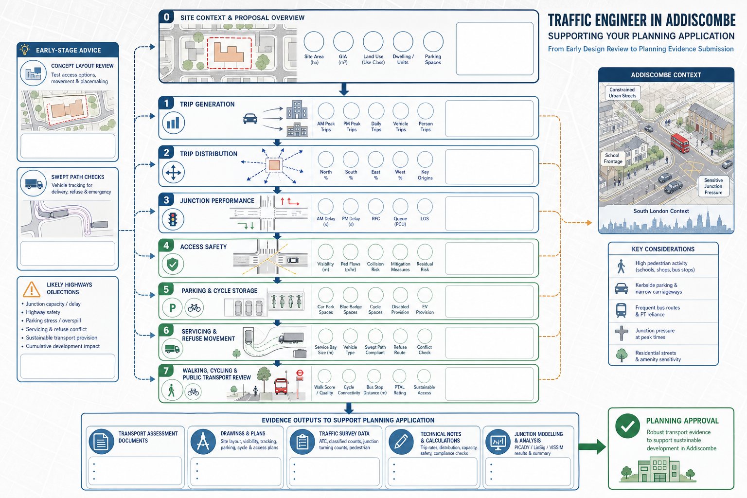
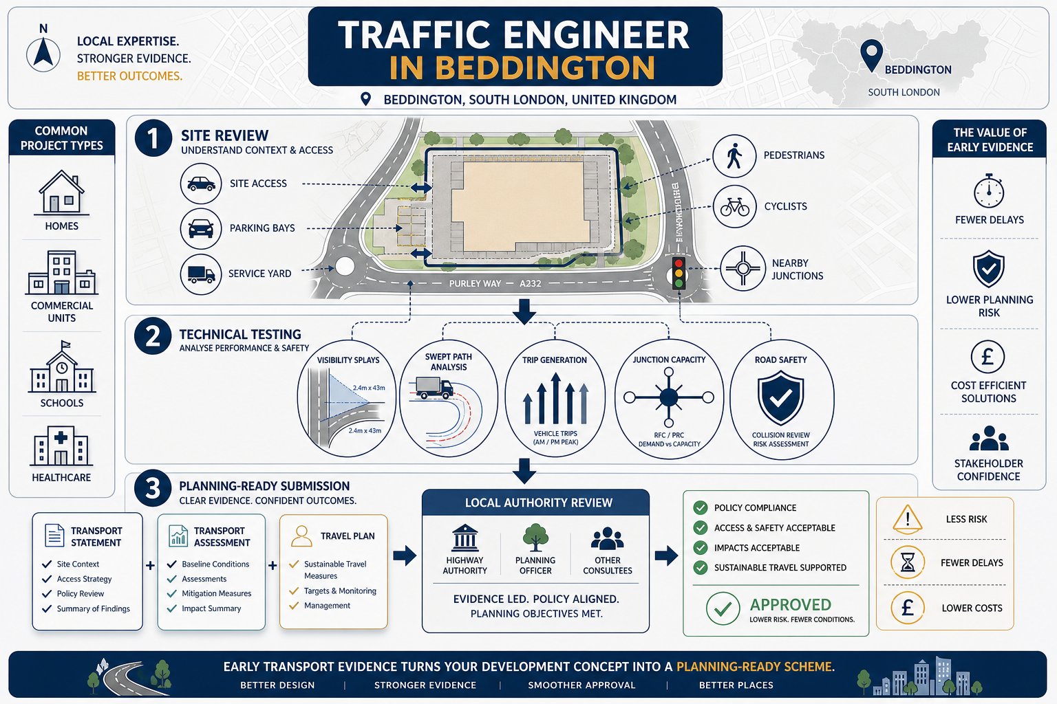
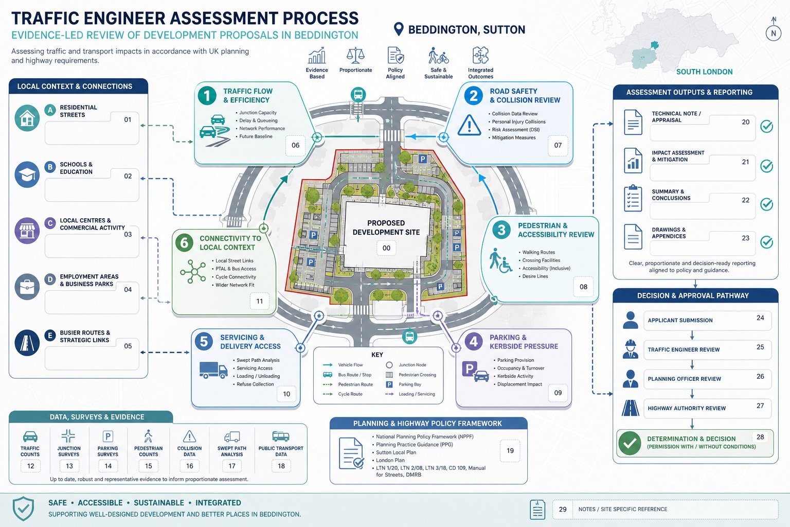
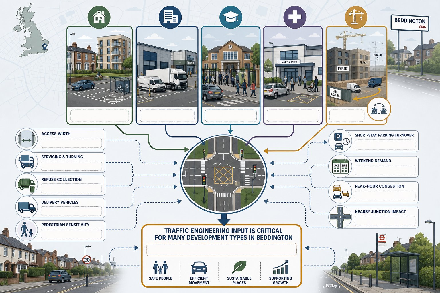
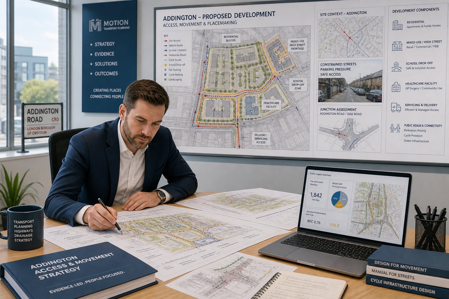
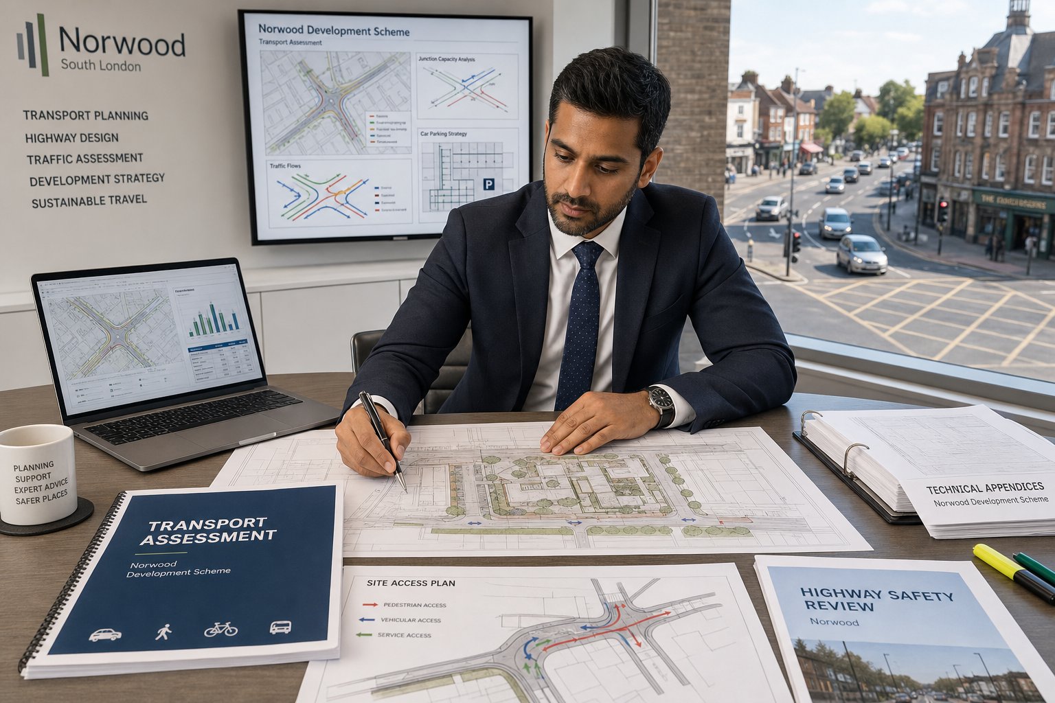
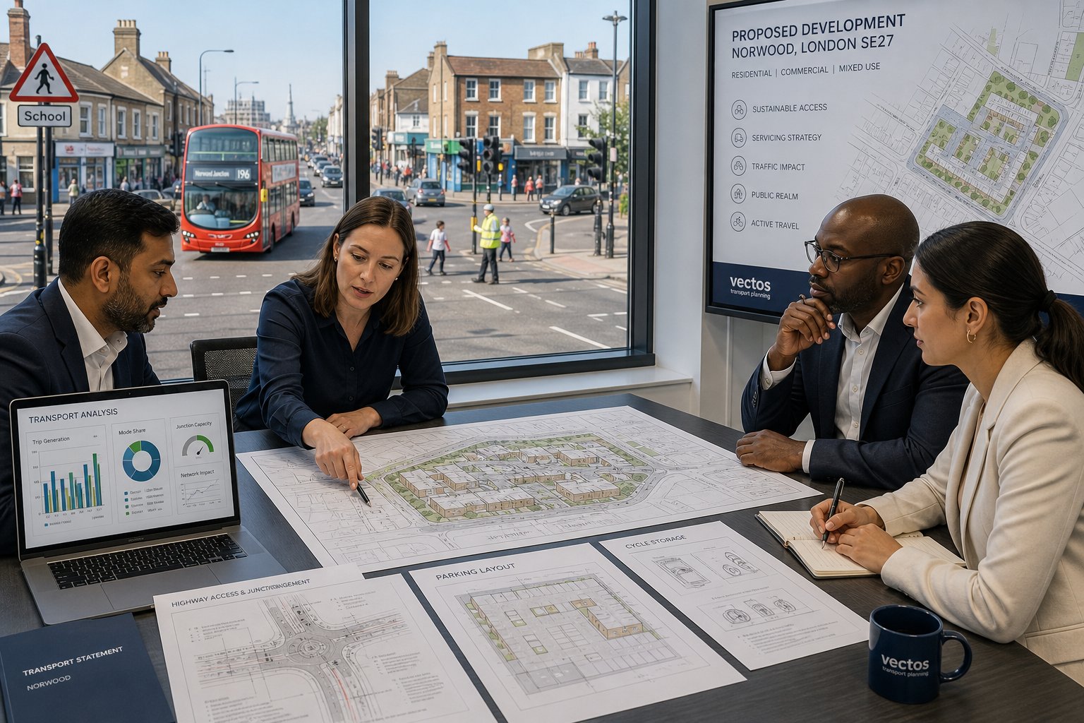
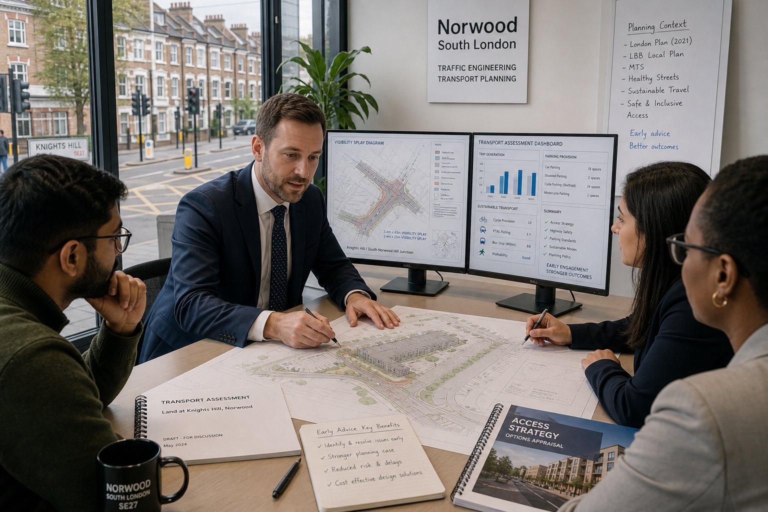
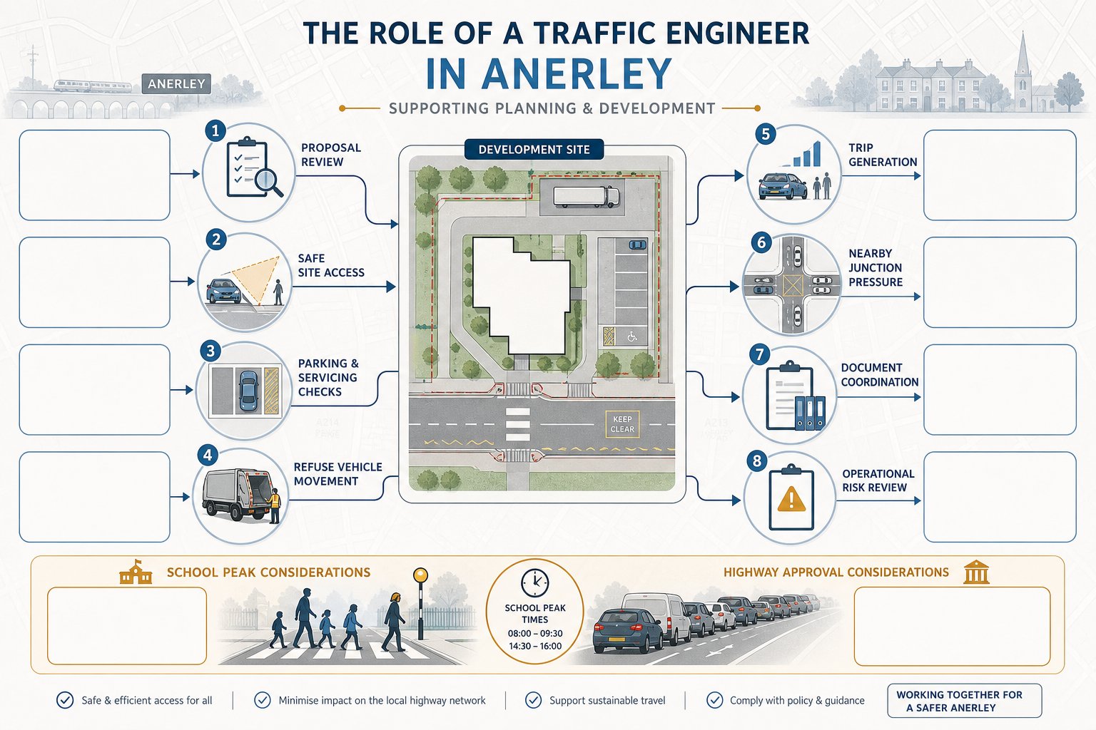
For development planning, our role usually starts with reviewing the scale and nature of the proposal against the local road context. We assess existing conditions, estimate future trip generation, consider likely vehicle routing, and examine whether nearby junctions can accommodate the change. We also look beyond cars. Walking routes, cycle access, public transport connectivity, road safety history, servicing movements, refuse collection, emergency access, and parking demand all matter.
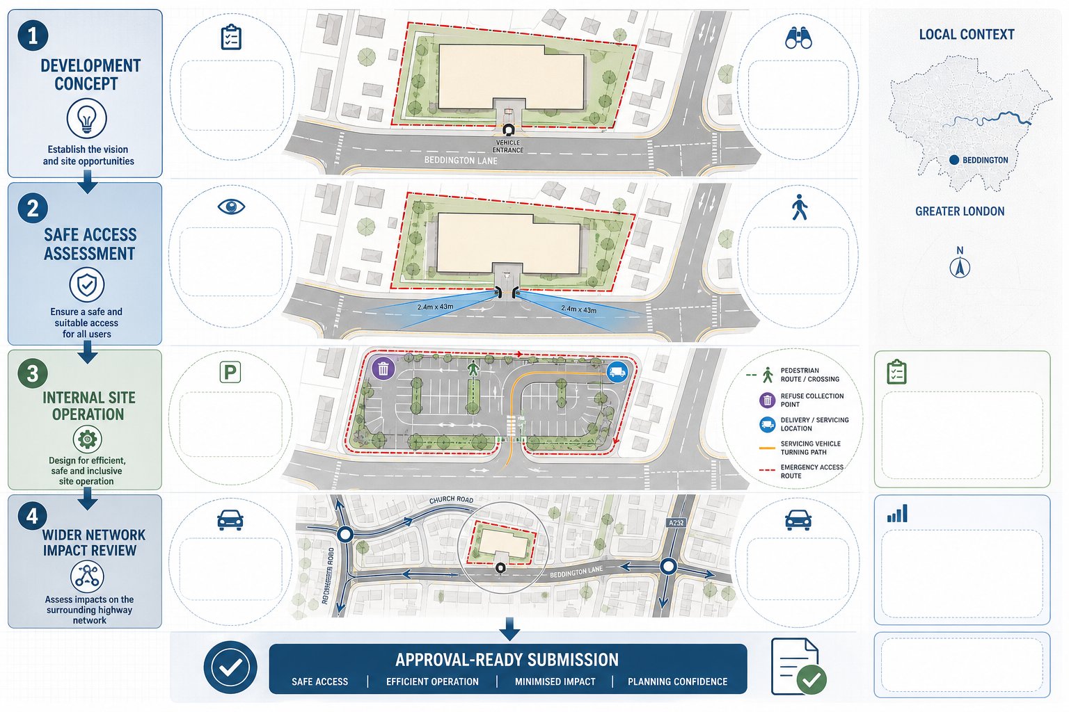
On many schemes, we are also involved in the physical design side. That can include new or amended vehicle accesses, internal layouts, turning areas, visibility splays, and the relationship between buildings and highway boundaries. If a site needs mitigation, we help define what is realistic and proportionate, whether that means improved crossing provision, lining and signing, parking controls, travel planning measures, or revised access arrangements.
In planning terms, transport support is strongest when it is tied closely to the application strategy. That is why many teams use broader Traffic Engineering and Transportation input at concept stage rather than waiting until drawings are fixed. The same principle sits behind effective Highway And Traffic Engineering advice: identify friction early, then design around it.
For Kenley projects, that often makes the difference between a transport report that merely exists and one that actually helps secure permission.
When You May Need Traffic Engineering Input In Kenley
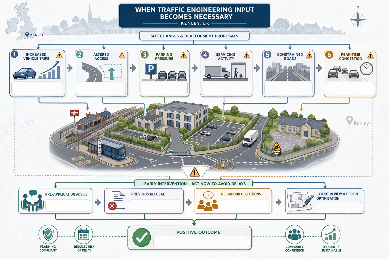
Not every project needs a full transport package. But many schemes in Kenley benefit from traffic engineering input much earlier than applicants first assume.
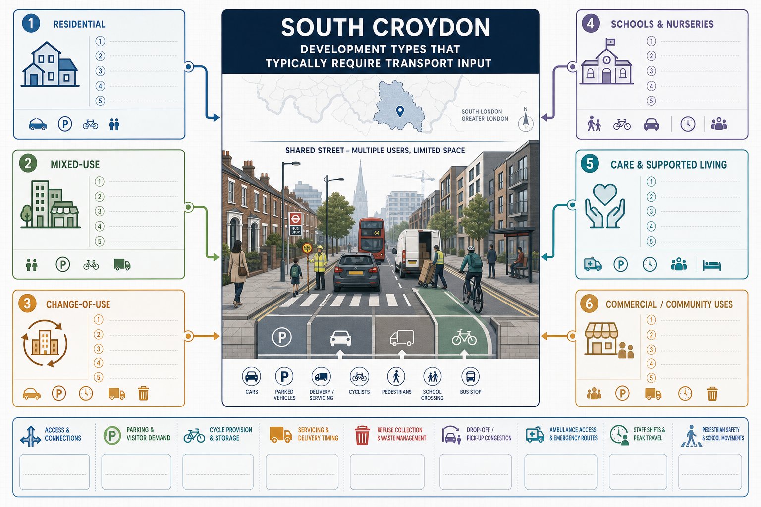
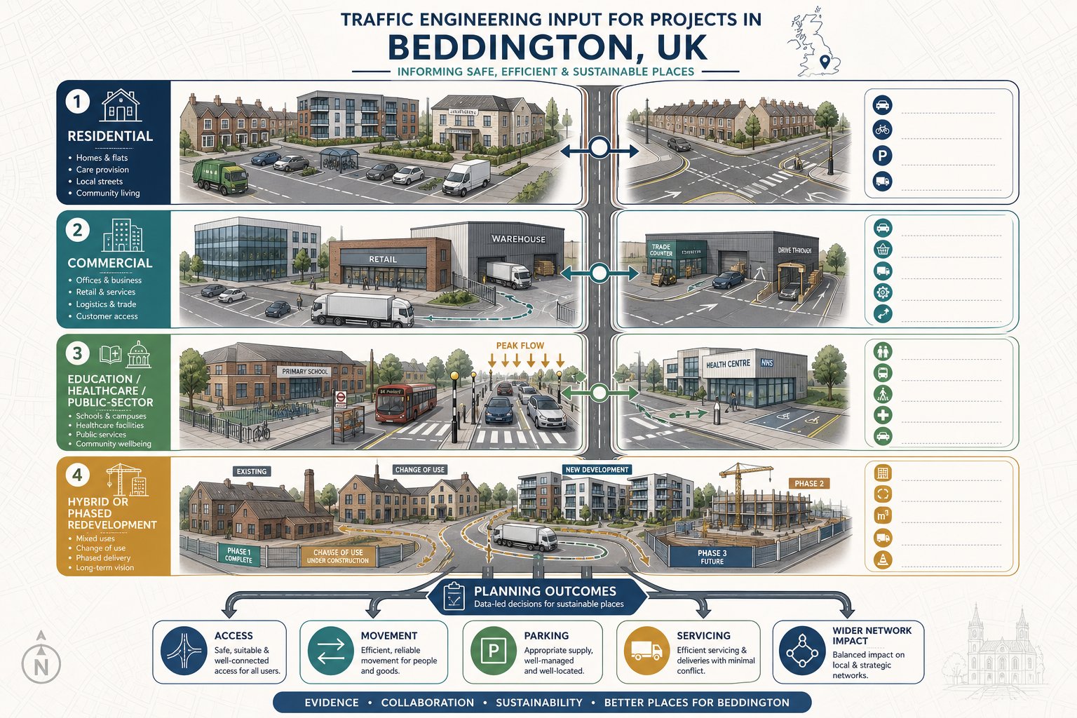
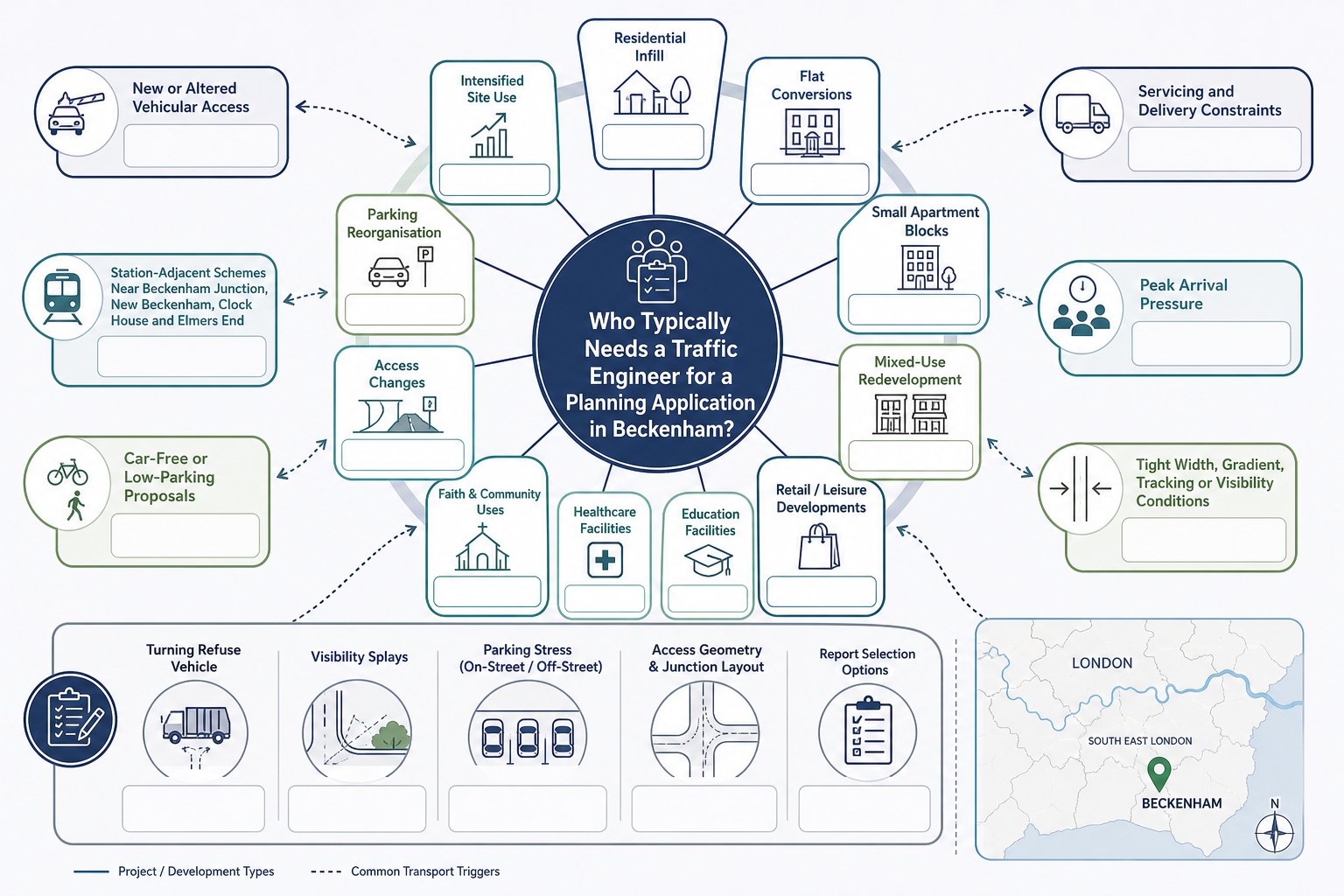
A useful rule of thumb is this: if a proposal will create noticeable extra trips, alter access arrangements, affect parking demand, introduce servicing activity, or sit on a constrained road, transport input is probably sensible. That includes residential schemes beyond minor domestic works, mixed-use redevelopment, retail premises, health uses, education sites, gyms, care facilities, and employment floorspace.
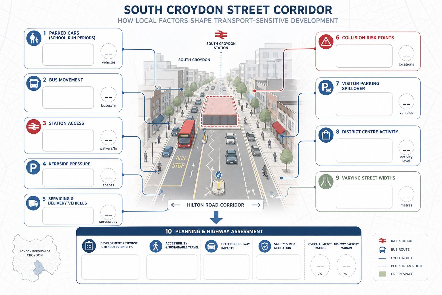
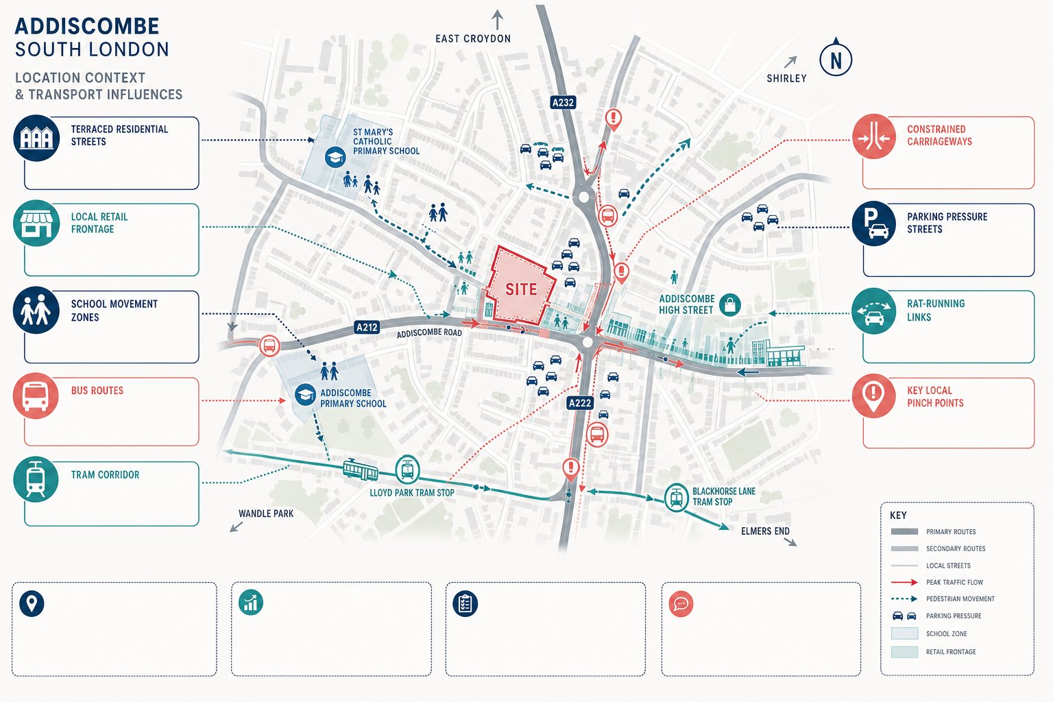
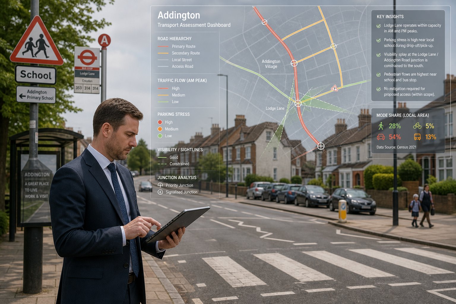
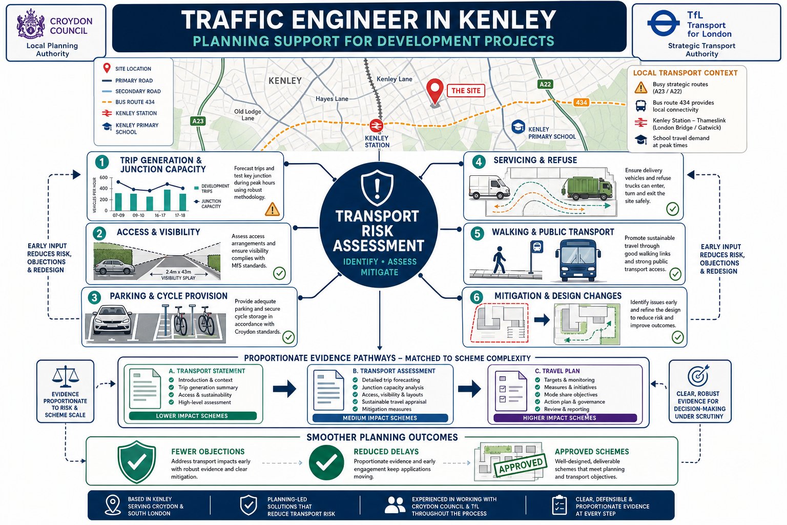
We are often instructed where a site fronts an A-road, lies close to a bus route, sits near a station catchment, or is affected by school traffic patterns. Kenley has locations where peak-period conditions can already feel tight. Add a new access, more turning movements, or delivery activity and suddenly an issue that looked manageable becomes central to the planning debate.
Timing matters too. If there has been pre-application advice flagging highways concerns, a previous refusal linked to parking or access, or strong neighbour objections about safety and congestion, it makes sense to bring in a specialist before the application is submitted. Early review can prevent a weak layout from becoming an expensive problem.
For clients operating across the capital, our experience mirrors what we discuss in Traffic Engineer In London: thresholds and sensitivities vary by authority, but transport objections tend to arise from the same core issues: impact, safety, access, servicing, and sustainable travel.
A Traffic Engineer in Kenley is most useful not when things have already gone wrong, but when the team wants to stop that happening.
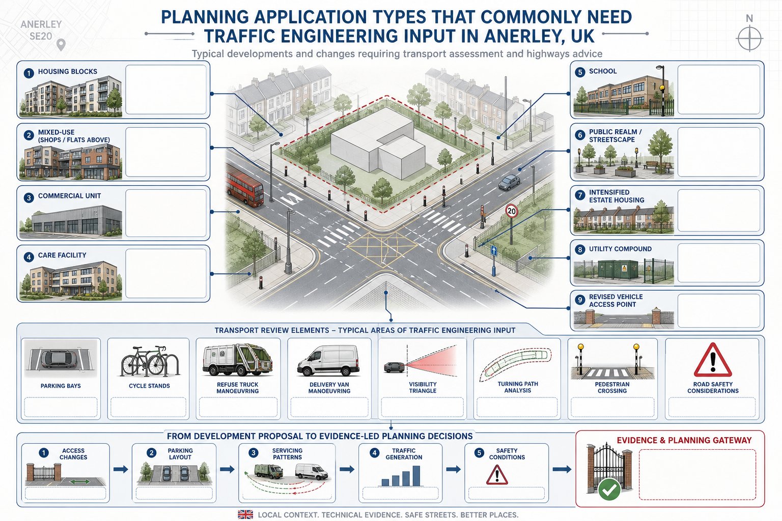
Planning Applications That Commonly Require Transport Evidence
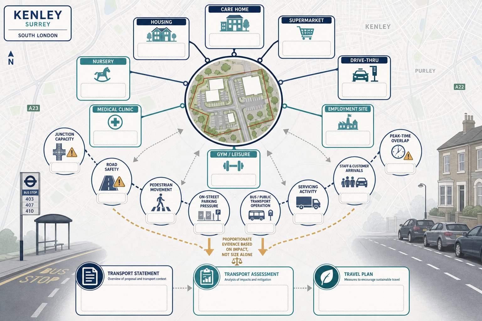
Some application types almost always trigger transport questions, even where the scheme itself is not especially large.
Larger housing developments are the obvious example, particularly where they intensify use on a previously quieter site or replace a lower-trip land use. But in Kenley, formal transport evidence is also commonly needed for care homes, supermarkets, drive-thrus, schools, nurseries, medical uses, gyms, and employment sites. Why? Because the trip profile matters as much as the floor area. A modest site with sharp peaks, high servicing demand, or difficult access can require more analysis than a bigger but simpler scheme.
Local planning and highway officers typically want evidence where the proposal may affect junction performance, road safety, pedestrian movement, on-street parking stress, or public transport operation. If an application is likely to generate representations from neighbours on traffic grounds, formal transport material becomes even more important. It gives the planning team an evidence base instead of relying on assumptions.
This is especially true in commercial schemes, where delivery patterns, staff travel, customer arrivals, and peak-time overlap can become contentious. Our approach is usually aligned with the practical priorities discussed in Commercial Traffic Engineering: understand the real-world operation of the site, then present the implications clearly.
In short, if transport effects could influence planning judgment, a proportionate statement, assessment, or travel plan is often not optional in practice, even if the validation checklist looks less explicit at first glance.
How Local Highway And Planning Constraints Can Affect Kenley Sites
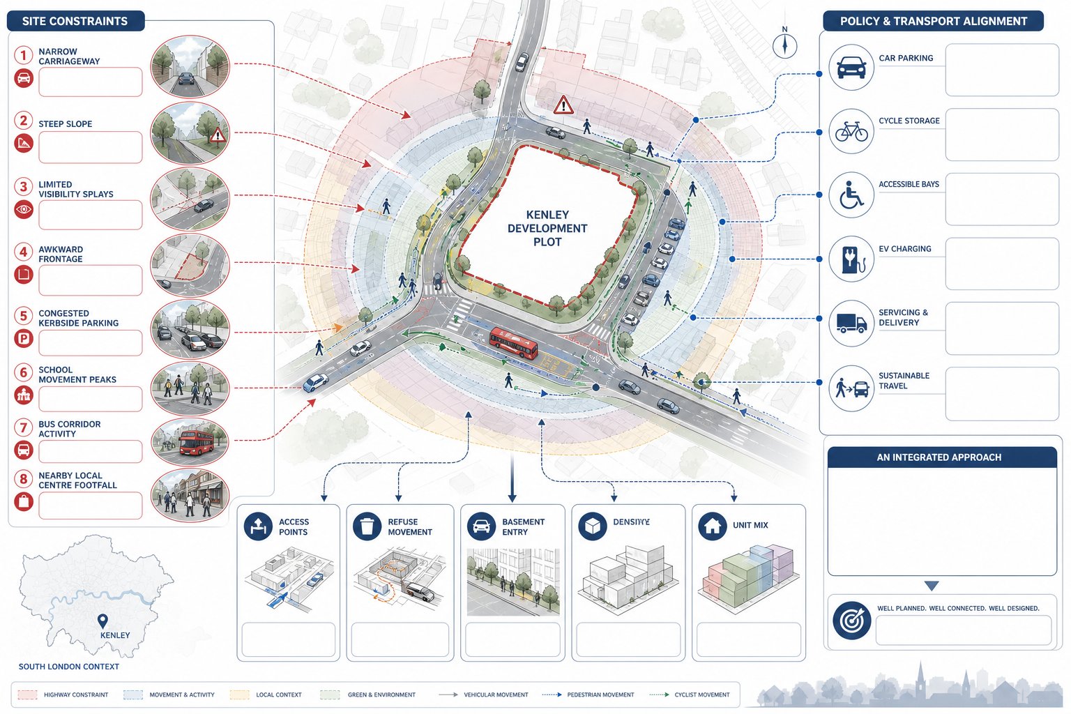
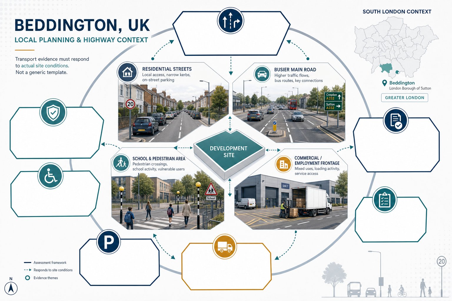
Kenley sites can be shaped quite heavily by local physical constraints. That is one reason generic transport advice often falls short.
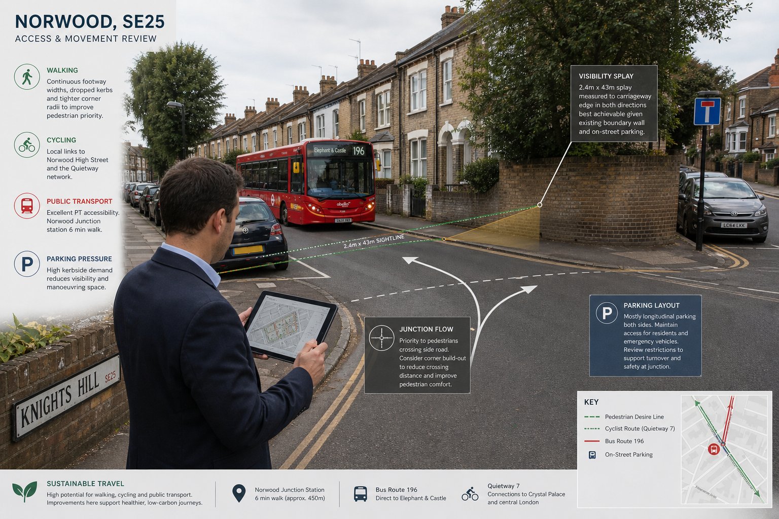
Some plots are affected by narrow carriageways, steep gradients, awkward frontage conditions, or limited visibility at the point where vehicles enter and leave. Others sit in areas where on-street parking demand is already high, so even a modest shortfall in on-site provision can become a planning concern. Proximity to schools, bus corridors, or local centres can also intensify scrutiny, particularly where pedestrian movement and crossing demand are strong at specific times of day.
Then there is policy context. London Plan expectations on car parking, cycle parking, disabled provision, electric vehicle charging, servicing, and sustainable travel are not background noise: they directly influence what is likely to be considered acceptable. Depending on the site, TfL input may also be relevant, especially where the road hierarchy or bus operations are affected.
This means the transport case cannot be developed in isolation from the architecture. Density, unit mix, access points, refuse strategy, basement arrangements, and frontage treatment can all be affected by highway realities. Occasionally the right answer is not a thicker report but a revised scheme.
That broader judgement is part of what experienced Traffic Engineering Consultants: bring to a project. We are not only measuring impact: we are testing whether the site plan aligns with the street it sits on. In Kenley, that local fit often decides whether a proposal feels workable to officers and reviewers.
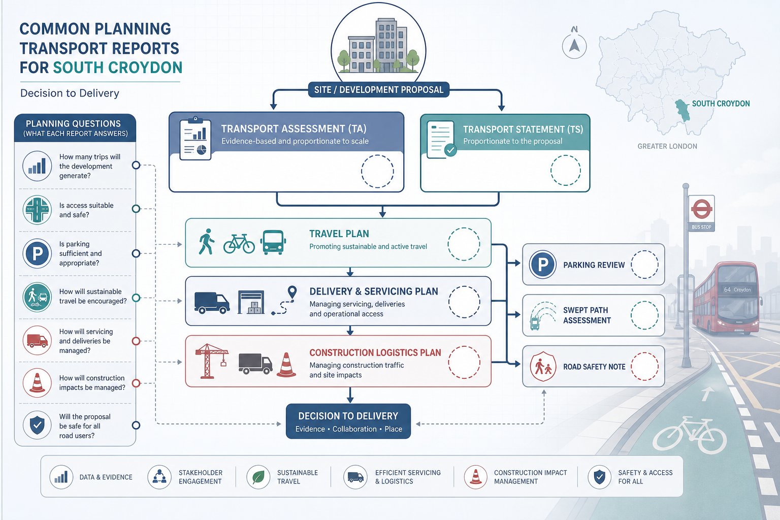
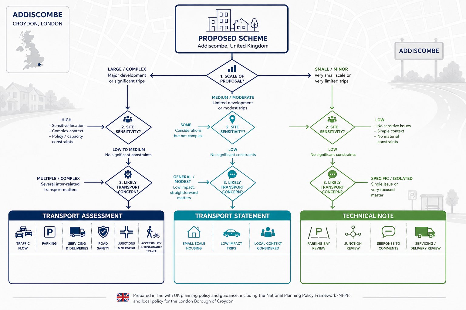
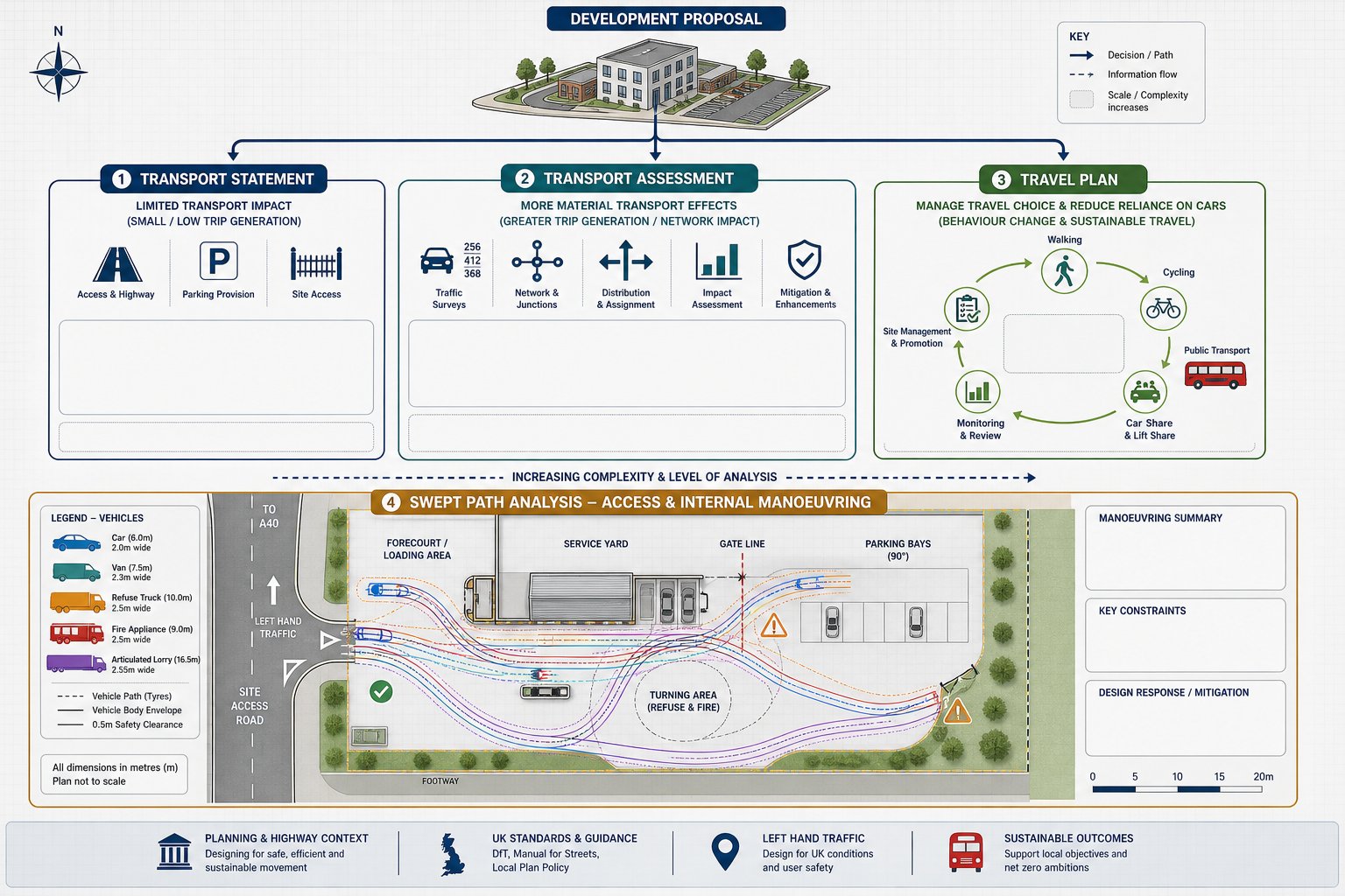
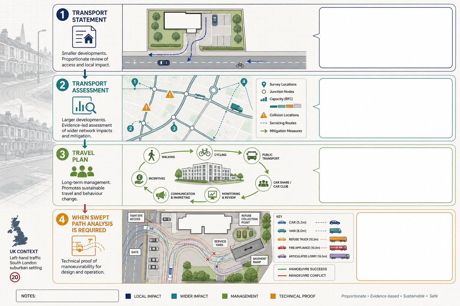
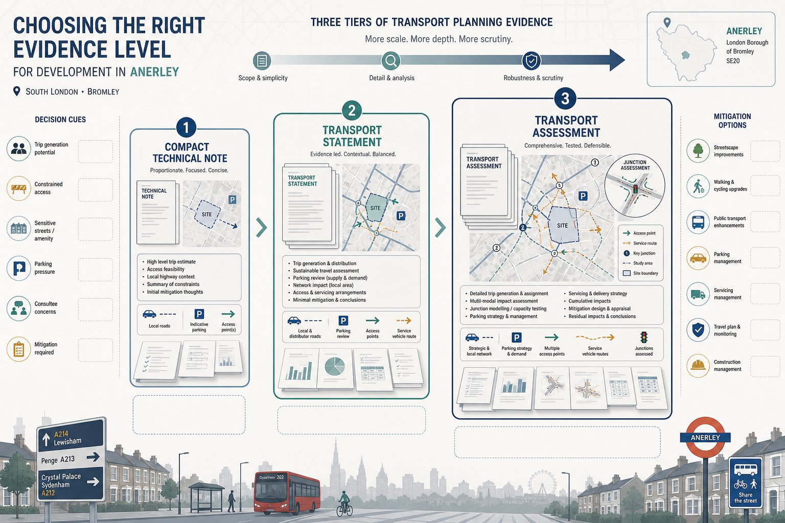
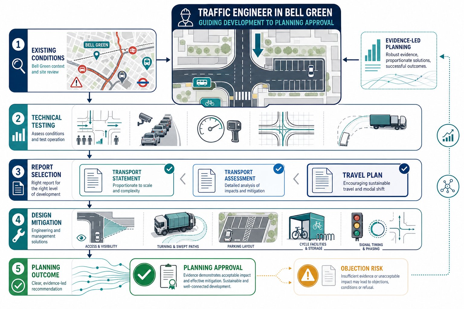
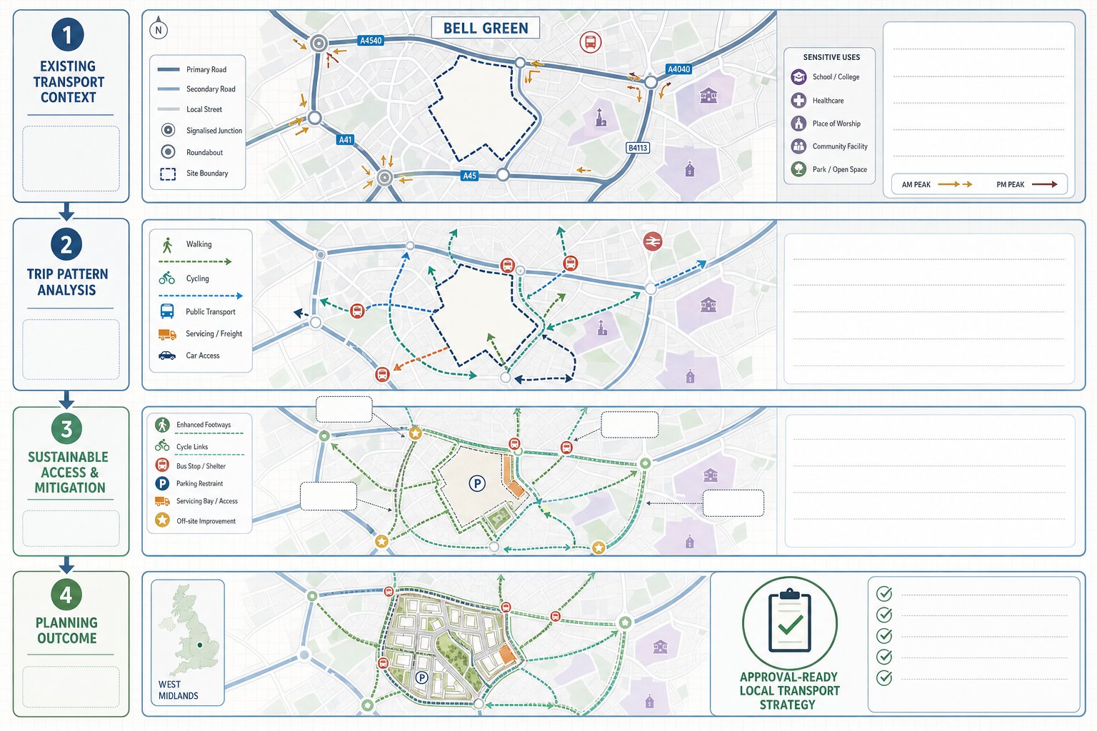
Key Traffic And Transport Reports For Kenley Developments
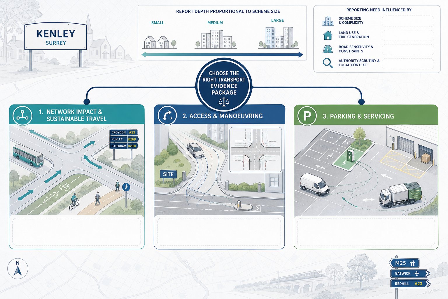
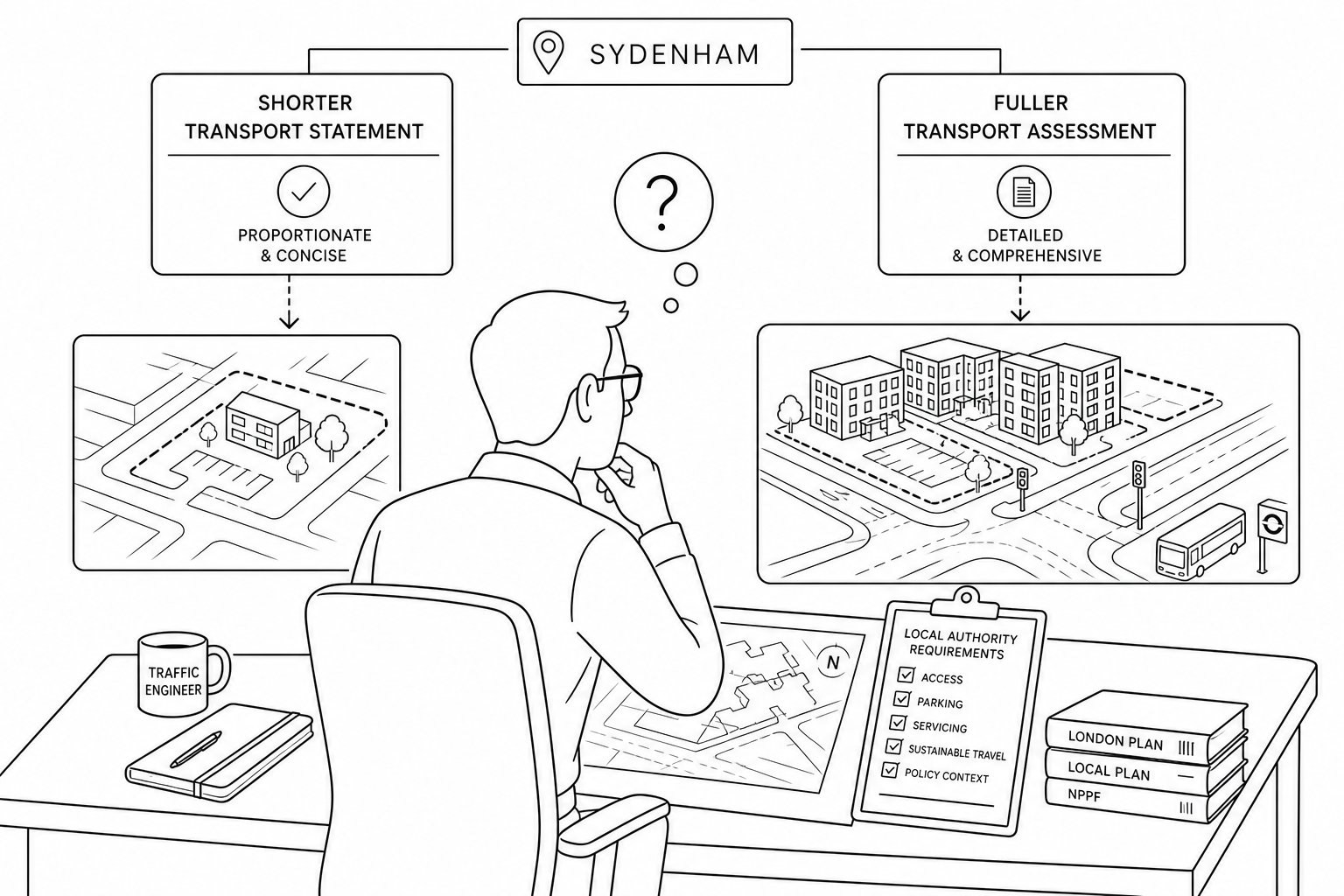
Most Kenley planning projects do not need every possible transport document. They do, but, need the right one.
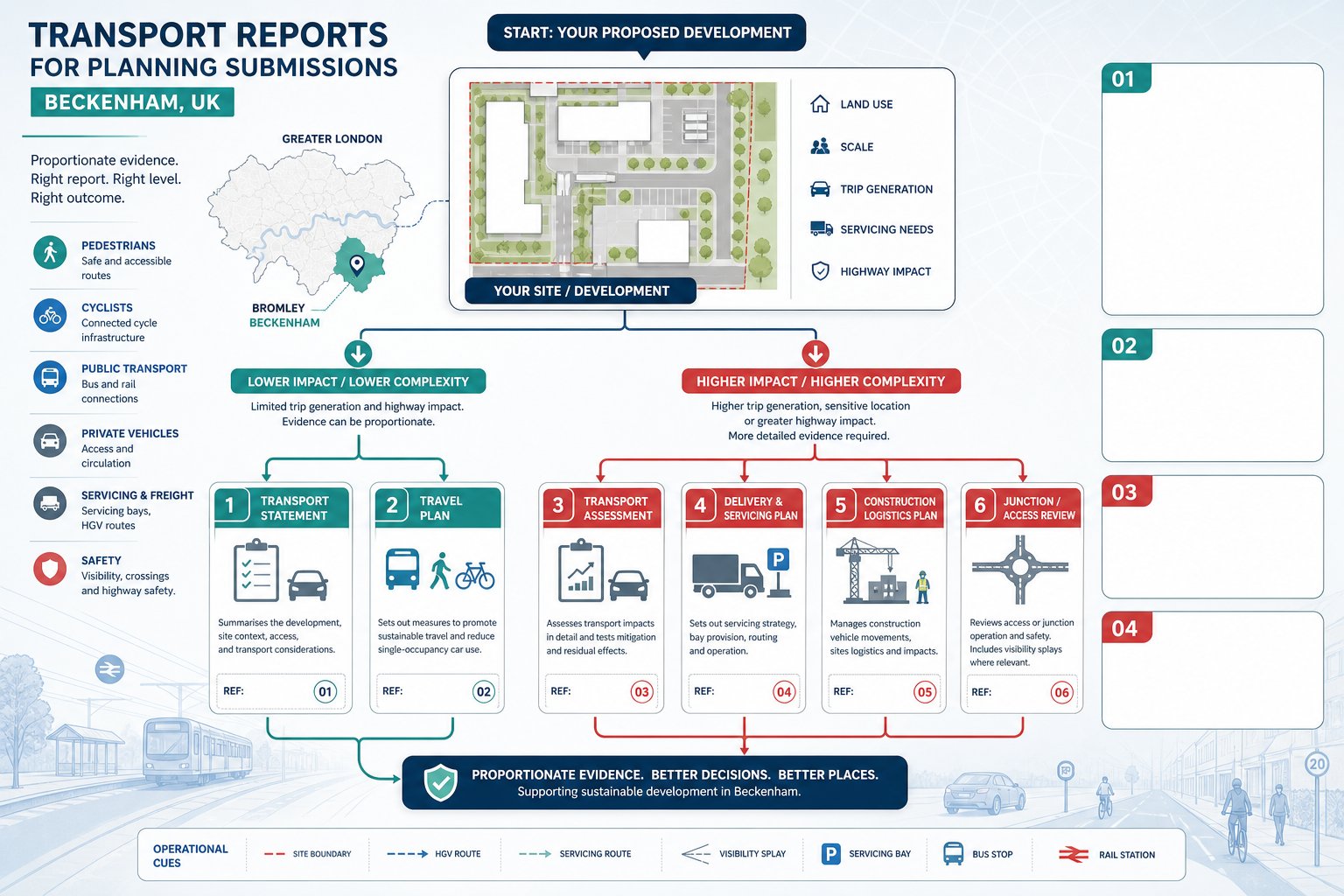
The choice of report depends on scale, land use, highway sensitivity, and the concerns likely to arise during determination. For smaller or lower-impact proposals, a concise evidence document may be enough. For larger developments, schemes on constrained roads, or proposals likely to attract scrutiny from Croydon Council or TfL, a fuller package is usually necessary.
In general, the core reports fall into three groups: network impact and sustainable travel reporting, access and manoeuvring analysis, and parking or servicing reviews. The strongest submissions link those strands together rather than treating them as separate technical exercises.
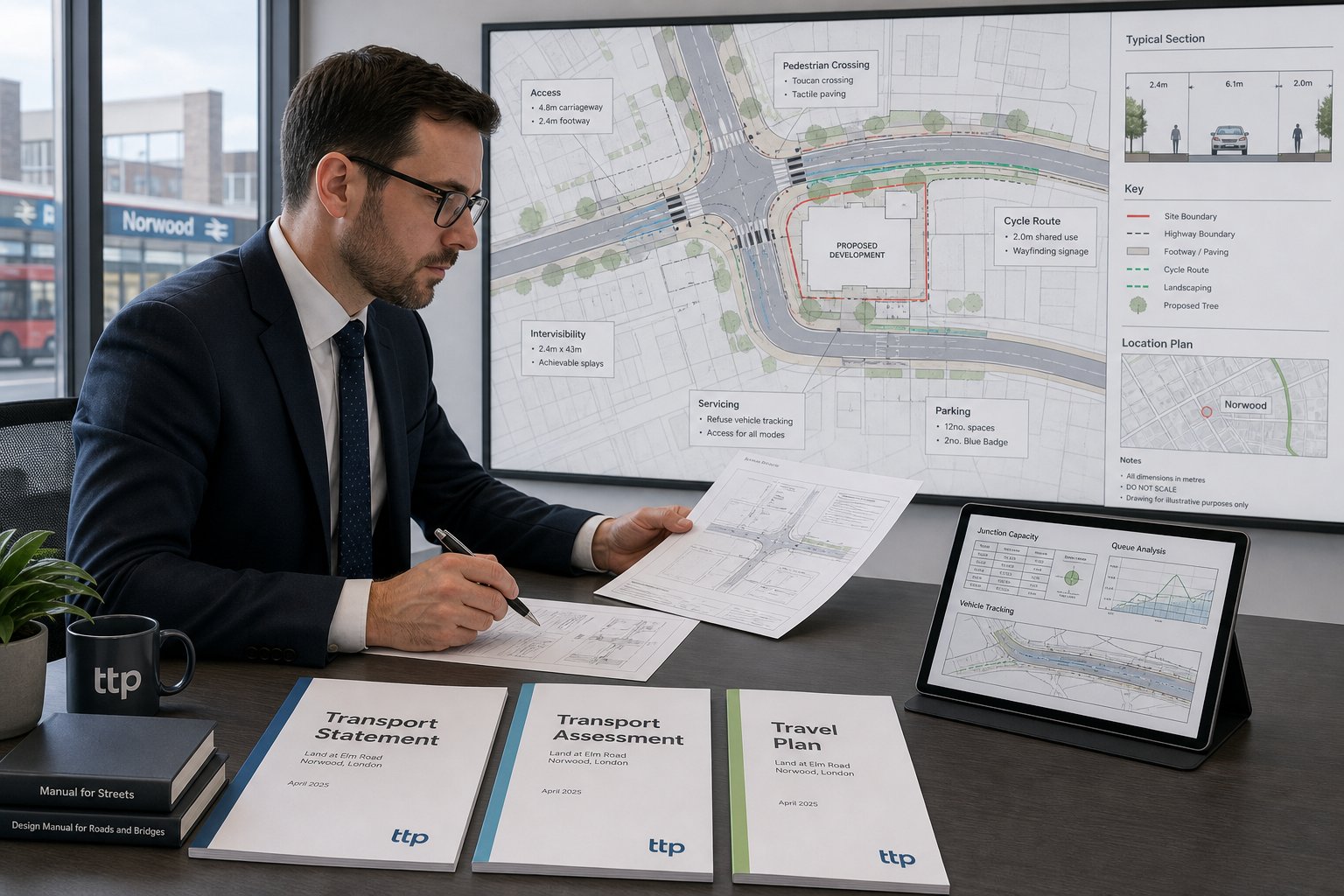
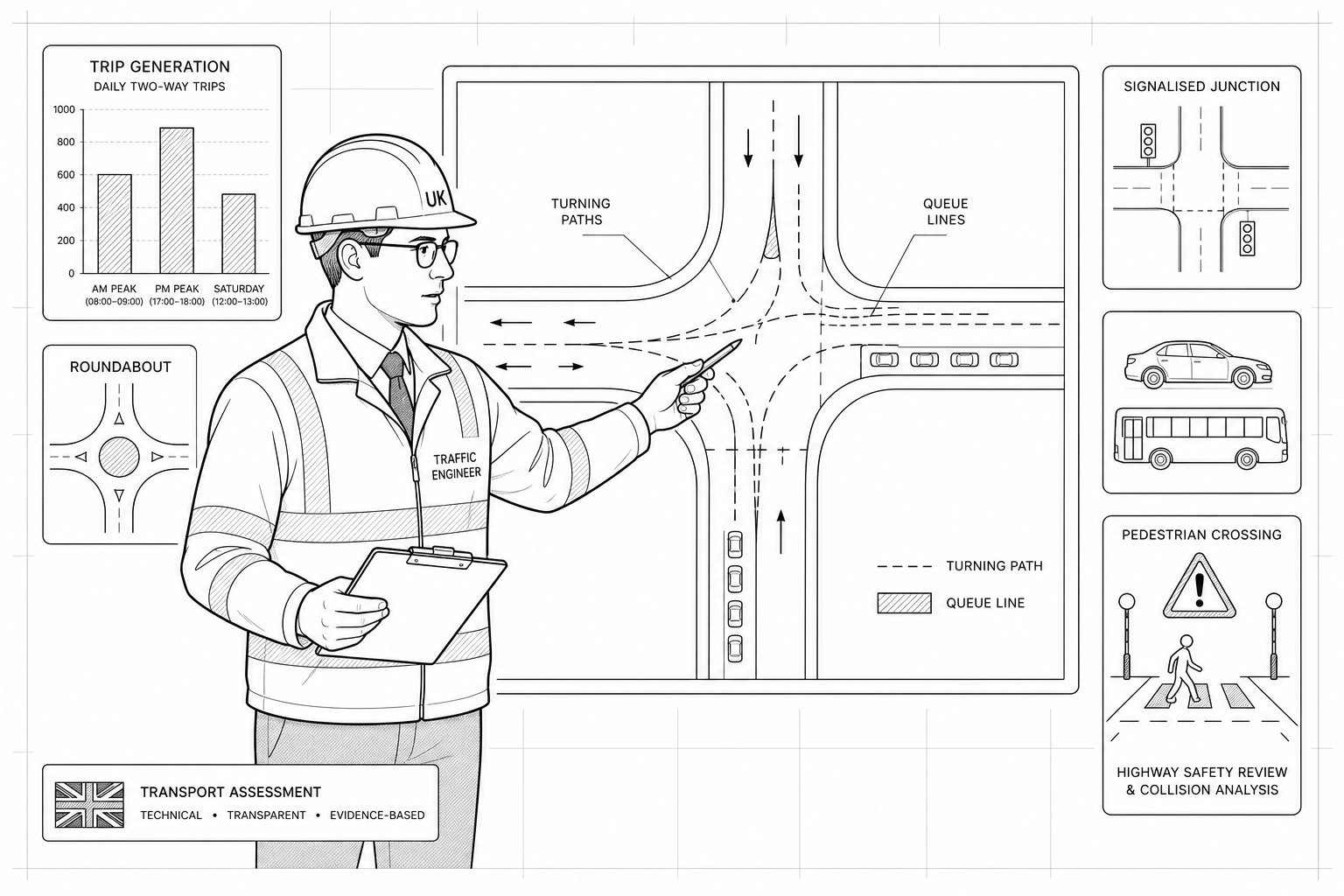
A transport report should answer practical planning questions. How many trips will the proposal generate? Where will they go? Will nearby junctions still operate acceptably? Can vehicles enter, turn, and leave safely? Is there enough parking, and is it policy-compliant? Can servicing and refuse collection happen without conflict? Are walking, cycling, and public transport realistically supported?
Good reporting is proportionate. Overstating the need can waste time and fees. Understating it can invite objections and delays. That balance is a big part of our role as a Traffic Engineer in Kenley, especially where programme pressure is real and the planning team needs documents that are concise, accurate, and aligned with local expectations.
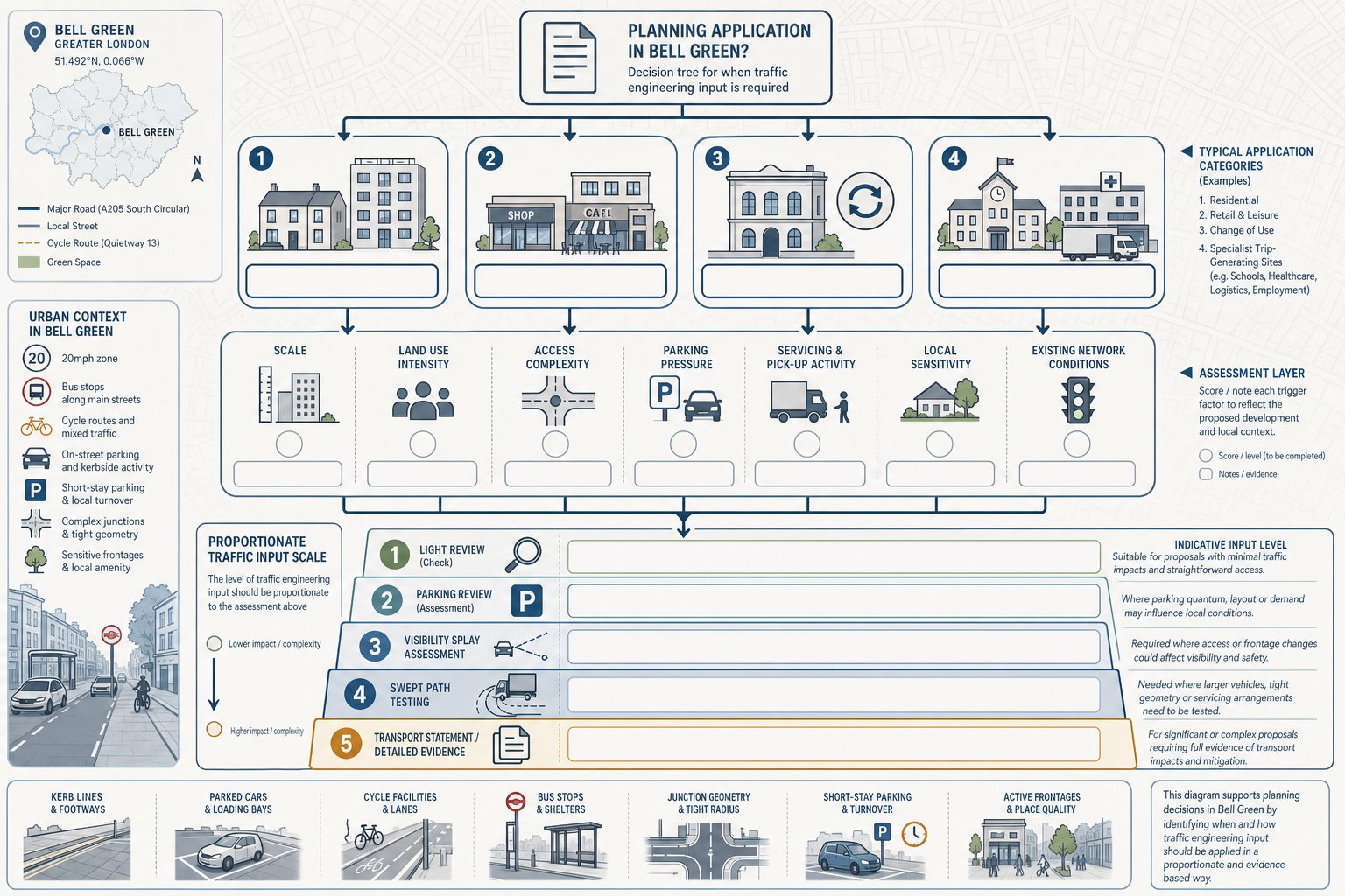
Transport Statements, Transport Assessments, And Travel Plans
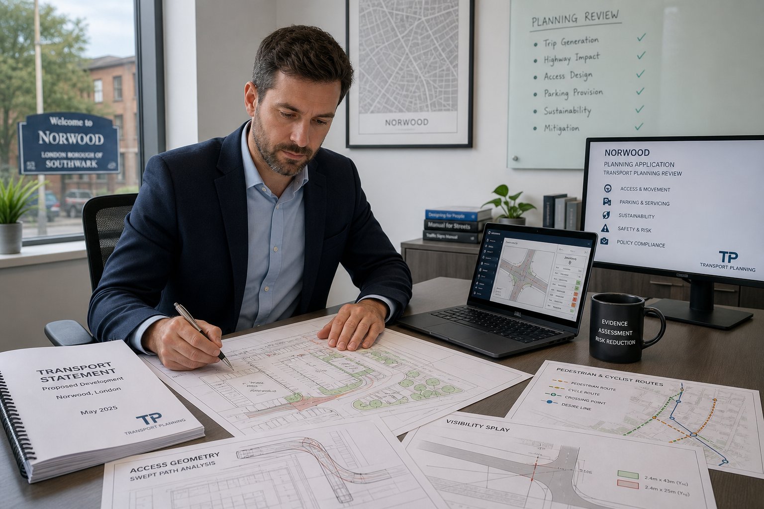
A Transport Statement (TS) is typically used for smaller to medium schemes where transport effects are expected to be limited and can be explained without extensive modelling. It usually covers the site context, accessibility, existing conditions, trip generation, parking, servicing, and a reasoned statement on likely impact. For many modest developments, a TS is the right level of evidence.
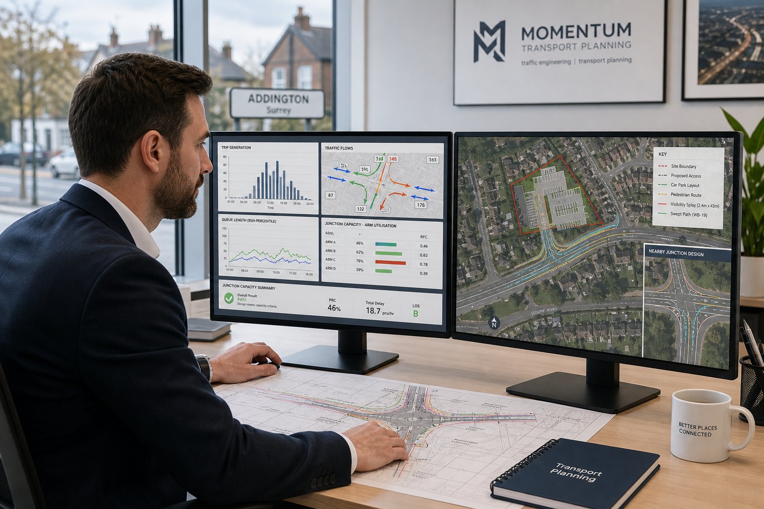
A Transport Assessment (TA) goes further. It is generally needed where a scheme is larger, more sensitive, or likely to create material network effects. A TA may include detailed trip generation analysis, distribution and assignment, junction capacity modelling, road safety review, and mitigation proposals. Where officers need to understand cumulative or peak-period impact in more depth, a TA is normally the more credible route.
A Travel Plan (TP) sits alongside either document where sustainable travel measures are important. This can be framework or full, depending on the scheme. It sets out mode-share targets, management responsibilities, practical measures such as cycle facilities or travel information, and monitoring arrangements over time.
The challenge is not just knowing the labels, but choosing the proportionate level of work. That is a recurring theme in Traffic Engineering: Your planning advice generally, and it matters particularly in outer-London locations where site context can vary sharply from one road to the next.
In Kenley, the right TS, TA, or TP often gives officers confidence that transport issues have been dealt with properly rather than parked for later.
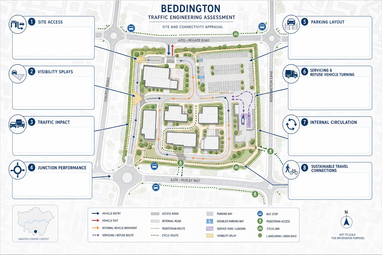
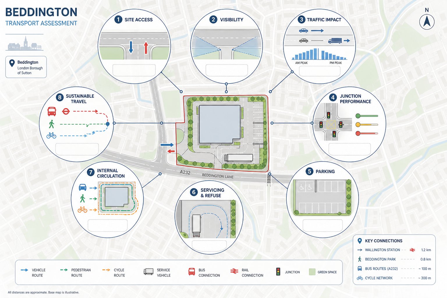
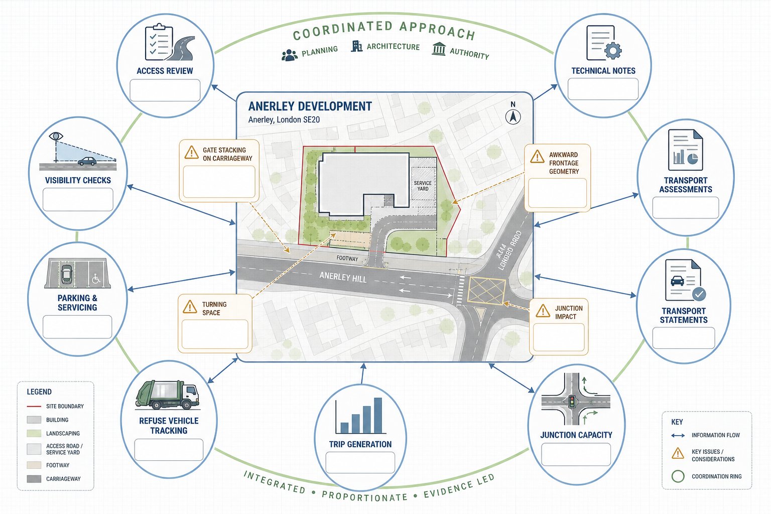
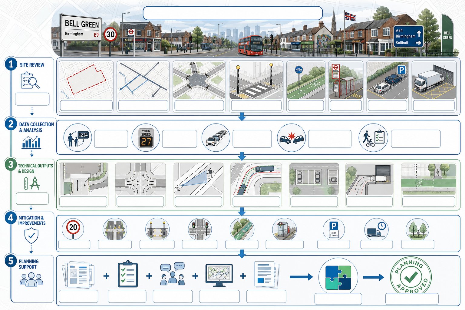
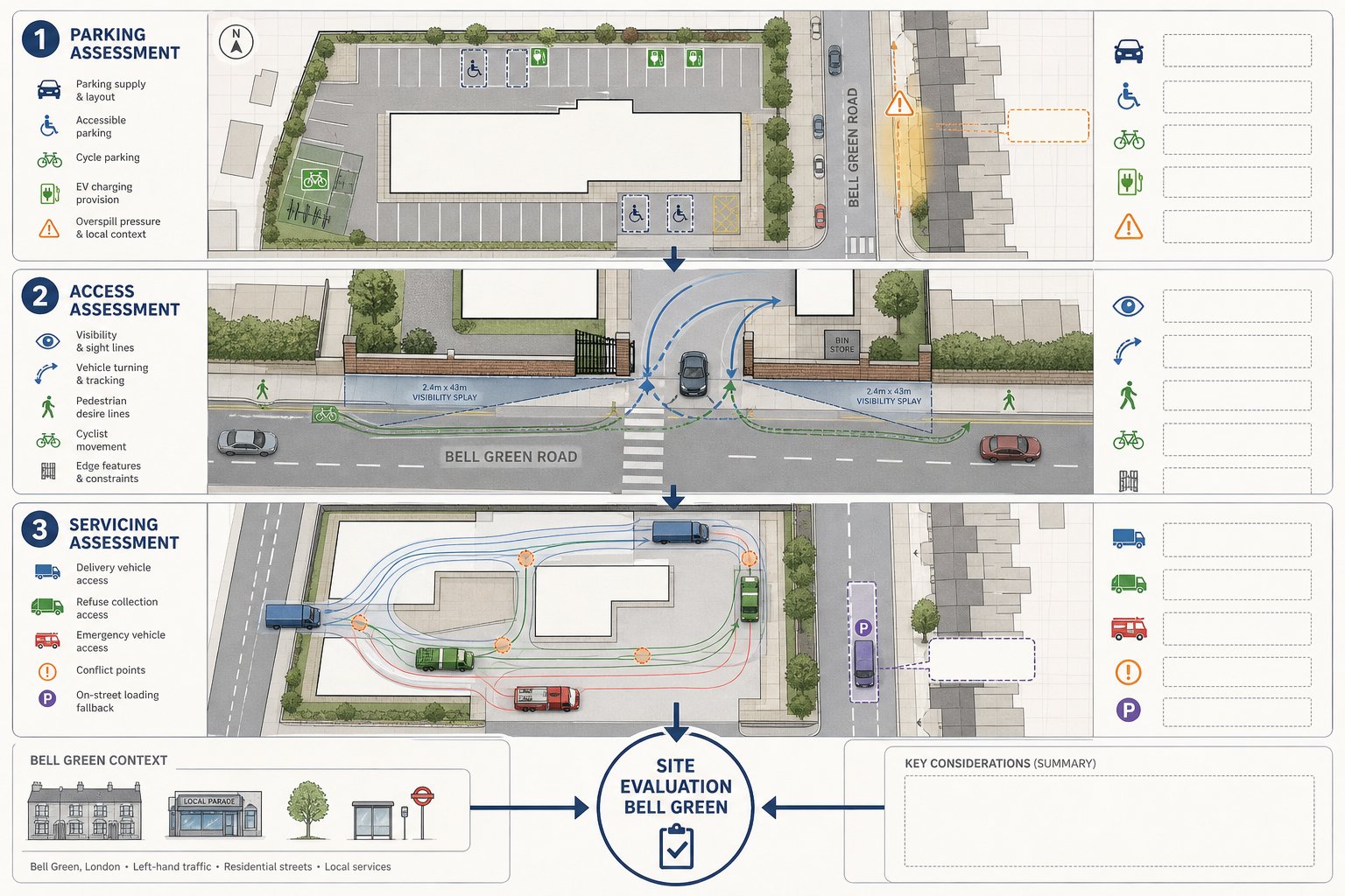
Highway Access, Swept Path, And Visibility Assessments
Access is one of the fastest ways for a planning application to run into trouble.
A site may have adequate land use justification and decent architecture, but if vehicles cannot enter and leave safely, or larger vehicles cannot manoeuvre without conflict, highways concerns can dominate the response. That is why access reviews need to be practical, not theoretical.
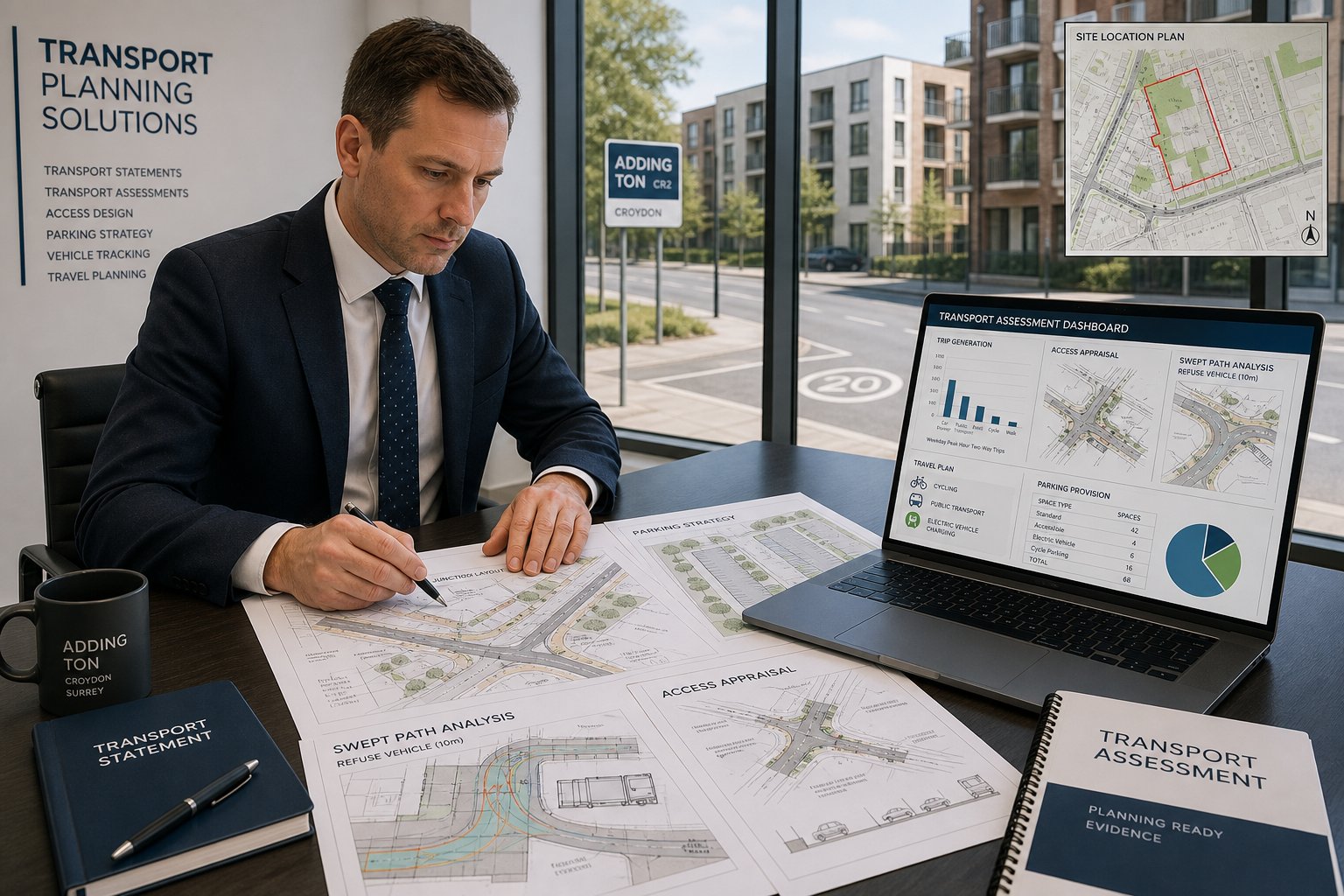
We typically assess whether an access point has suitable geometry, whether drivers can achieve the required visibility splays, and whether stopping sight distance is appropriate for the road environment. The benchmark can depend on the context, but Manual for Streets principles, visibility standards, and accepted highway design guidance all come into play. On some sites, a small wall, hedge, bin store, or parking bay is enough to undermine an otherwise workable layout.
Swept path analysis is equally important. Using vehicle tracking software, we test whether cars, delivery vehicles, refuse lorries, and emergency vehicles can enter, turn, load, and exit without mounting kerbs, overrunning footways, or reversing in a way that creates avoidable risk. These checks often reveal design tensions that are much easier to solve before submission than during a re-consultation.
Where technical disputes arise later, especially around causation, safety, or highway operation, experience overlapping with Expert Witness Traffic matters can also sharpen the quality of evidence. The underlying principle is the same: drawings need to work in the real world, not just on a screen.
Parking, Servicing, And Refuse Vehicle Reviews
Parking is one of those planning topics that looks straightforward until it is not.
In Kenley, on-site parking provision has to be considered alongside local stress, public transport accessibility, London Plan standards, blue badge needs, electric vehicle charging, cycle storage, and the actual behaviour the development is likely to generate. A scheme with technically compliant numbers can still face criticism if the layout is awkward, if bays are unusable, or if overspill risk has not been addressed convincingly.
We review car and cycle parking in practical terms: quantity, dimensions, accessibility, turning movements, and management. For residential proposals, that includes visitor needs and whether parking arrangements undermine amenity or road safety. For commercial schemes, shift patterns, customer dwell times, and loading demands often matter just as much as the headline bay count.
Servicing and refuse strategy is equally important. Officers will want to know how deliveries happen, where vehicles wait, whether refuse collection can occur within the site or from the highway, and whether reversing movements are acceptable. A tidy site plan can conceal a poor operational strategy if these details are not tested.
In many cases, modest design changes solve the problem: relocating stores, widening aisles, changing bay orientation, or adjusting management plans. But without that review, objections can arrive late and feel surprisingly difficult to unwind. Parking and servicing are rarely glamorous topics, though they are often where planning applications quietly succeed or fail.
How A Traffic Engineer Supports A Smoother Planning Process
The best transport input does more than write a report. It helps make the planning process less combative.
We usually start by identifying likely transport risks before the application is locked down. If the access is weak, parking is under pressure, or servicing looks awkward, we flag it early and work with the wider team on options. That can mean refining the layout, reducing conflict points, improving cycle parking, changing unit mix, or preparing mitigation that officers are more likely to accept.
Once the strategy is clearer, we prepare evidence in the format planners and highways officers expect. That matters. A concise, well-reasoned document tends to travel better through consultation than something bloated, generic, or disconnected from the site. We also respond to comments, clarify assumptions, and support negotiation where mitigation or conditions are being discussed.
This planning-led approach is central to our work and reflects the same discipline we bring to projects discussed in Traffic Engineer In Leeds other authorities: local detail changes, but smoother outcomes usually come from early risk spotting, proportionate reporting, and steady engagement.
For teams managing deadlines, that support has a practical benefit. It reduces the chance of late redesign, repeated highways queries, and avoidable committee anxiety. In other words, a Traffic Engineer in Kenley can help the application move forward with fewer surprises and a stronger technical footing.
What To Prepare Before Instructing A Traffic Engineer In Kenley
The faster we understand the scheme, the faster we can advise on what level of transport input is actually needed.
At minimum, it helps to provide the red line boundary, site address, existing and proposed land uses, proposed unit numbers or floorspace, and any available plans showing access, parking, servicing, and cycle provision. Even an early sketch layout is useful. Waiting for a perfect drawing set usually slows things down for no real gain.
Pre-application advice, previous refusal notices, appeal decisions, and any highways comments from earlier submissions are especially valuable. They tell us what has already worried the authority. The same goes for local sensitivities raised by neighbours or councillors, whether that is rat-running, school drop-off pressure, visibility, speeding, parking overspill, or pedestrian safety.
If surveys or supporting consultant information already exist, we should see those too. Topographical surveys, tracking drawings, delivery schedules, refuse strategies, and transport-related planning conditions from prior permissions can all shape the scope of work. And if a scheme is programme-sensitive, tell us that upfront. Scope, sequencing, and coordination matter.
The point is not to create bureaucracy before appointment. It is to give the traffic engineer enough context to make an early judgement: do you need a brief statement, a detailed assessment, access redesign, swept path checks, a travel plan, or some combination of the lot? Good preparation shortens that path considerably.
Choosing The Right Traffic Engineer For Kenley Projects
Not all transport consultants are equally suited to planning work. Some are strong on highway design, others on modelling, others on forensic analysis. For Kenley development projects, you usually need a consultant who understands the planning system as well as the engineering.
We would look first for relevant qualifications and experience: chartered or otherwise appropriately qualified professionals, a solid track record in development planning, familiarity with London and outer-London policy context, and the ability to scale work proportionately. The best consultant for a ten-unit residential scheme may not be the same one you would choose for a major mixed-use site, but both should be able to explain scope clearly and defend their methodology.
Local awareness matters too. A consultant does not need to sit around the corner to understand Kenley, but they do need to appreciate borough expectations, common transport objections, and where TfL involvement may arise. That practical planning judgement is often more valuable than raw technical volume.
Ask sensible questions. Have they supported similar schemes? Can they provide transport statements, assessments, travel plans, access reviews, and swept path analysis in-house? Are they used to working with architects and planners under real deadlines? Can they keep reports concise without losing credibility?
For many project teams, the right appointment is the one that combines technical strength with commercial realism: quick turnarounds, clear advice, and reports tailored to what the authority actually needs rather than what a template happens to contain.
Traffic Engineer In Kenley: Conclusion
For many Kenley developments, transport is not a side issue to be tidied up at the end. It is one of the factors that shapes whether a proposal feels workable, policy-compliant, and safe from a highways perspective.
A well-judged Traffic Engineer in Kenley helps at the point where planning risk is still manageable. That means spotting access and parking issues early, matching the report type to the scheme, and giving Croydon Council or TfL evidence that is proportionate, clear, and technically sound. In practice, that often leads to faster applications, fewer avoidable objections, and layouts that function better once built.
For architects, planners, developers, lawyers, surveyors, and councils, the value is straightforward: stronger technical backing, better coordination, and a more resilient planning case. And in 2026, with scrutiny around transport, safety, and sustainable travel only getting tighter, early specialist input is usually one of the smartest moves a project team can make.
Frequently Asked Questions about Traffic Engineering in Kenley
What services does a traffic engineer in Kenley provide for development projects?
A traffic engineer in Kenley assesses how proposals affect local transport, including traffic flows, junction capacity, parking, and sustainable travel. They design or review access points, servicing areas, and recommend mitigations like crossings or traffic calming to ensure planning compliance and safety.
When should I seek traffic engineering input for a project in Kenley?
Traffic engineering input is advisable for proposals generating noticeable extra trips or affecting access, parking, or servicing on constrained roads, such as new residential developments, mixed-use sites, schools, or near busy bus routes and A-roads. Early input helps avoid delays.
What types of planning applications in Kenley typically require transport evidence?
Larger housing schemes, care homes, supermarkets, drive-thrus, schools, nurseries, gyms, and employment sites usually need formal Transport Statements or Transport Assessments due to potential impacts on junctions, parking, road safety, and public transport.
How do local highway constraints affect development proposals in Kenley?
Kenley sites often have narrow streets, steep gradients, high parking stress, or limited visibility, especially near schools or bus corridors. These factors influence density, access design, and require compliance with TfL and London Plan standards for safety and sustainable travel.
What is the difference between a Transport Statement and a Transport Assessment in Kenley?
A Transport Statement is a concise summary suitable for small to medium schemes with modest impact, explaining site context and trip generation without detailed modelling. A Transport Assessment offers in-depth analysis, including multi-junction modelling and mitigation for larger or sensitive developments.
How can hiring the right traffic engineer in Kenley improve planning outcomes?
Choosing a qualified, experienced traffic engineer familiar with Kenley and local authority expectations ensures proportionate, credible transport reports. Early risk identification and tailored mitigation help prevent objections, speed up approvals, and create developments aligned with road and planning policy.