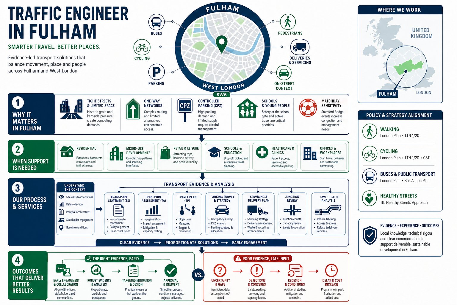
Hammersmith rarely gives development teams an easy ride. Between the gyratory, the A4 corridor, busy bus movements, Controlled Parking Zones, dense residential streets and a town centre that has to serve shoppers, deliveries, cyclists and through-traffic all at once, transport evidence can make or break a planning application. That is exactly why appointing a Traffic Engineer in Hammersmith early tends to save time later.
For architects, planners, lawyers, surveyors, developers and councils, the challenge is not simply producing a report with the right title. It is proving that a scheme can function on a constrained urban network, align with borough and London policy, and respond credibly to local issues such as servicing, parking stress, pedestrian safety and mode shift. In practice, that means clear forecasting, sensible assumptions, robust survey data and recommendations that can withstand scrutiny from planning officers, highways teams and often TfL as well.
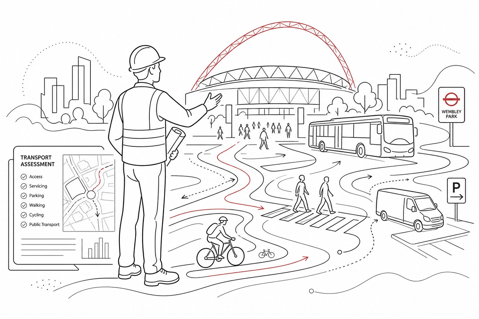
We approach Hammersmith schemes with that reality in mind. With more than 30 years of transport planning experience, we know that concise reporting is useful only if it is also technically accurate and locally grounded. In the sections below, we set out why traffic engineering matters here, which projects typically need support, what documents are usually required, and how surveys and authority expectations shape a faster, stronger planning submission.
Key Takeaways
- Appointing a Traffic Engineer in Hammersmith early streamlines planning by addressing the area’s complex transport challenges upfront.
- Effective traffic engineering in Hammersmith requires robust surveys and site-specific data to demonstrate developments’ impacts accurately and credibly.
- Traffic reports must align with local borough policies, the London Plan, and consider sustainable travel, pedestrian safety, and servicing practicality.
- Developments need tailored transport assessments proportionate to scale and context, often including Transport Statements, Travel Plans, and access appraisals.
- Kerbside management, parking stress, and multi-modal access including cycling, walking, and bus links are critical focus areas in Hammersmith traffic engineering.
- A well-prepared transport case reduces delays by providing practical, locally grounded evidence that satisfies planning officers and TfL scrutiny.
Why Traffic Engineering Matters For Development In Hammersmith
Hammersmith is one of those locations where transport planning cannot be treated as a late-stage add-on. The district sits within an intensely used part of west London, with major radial routes, a strategic role for buses, Underground connections, heavy pedestrian flows and a street network that is already working hard for multiple users. Even relatively modest development can raise questions about trip generation, servicing practicality, kerbside competition and road safety.
That matters because planning decisions are no longer based on vehicle impact alone. Officers will usually want to know whether a proposal supports sustainable travel, whether access works safely for all users, and whether loading, refuse and disabled access have been properly resolved. In Hammersmith, those questions can become detailed very quickly because street conditions are constrained and policy expectations are high.
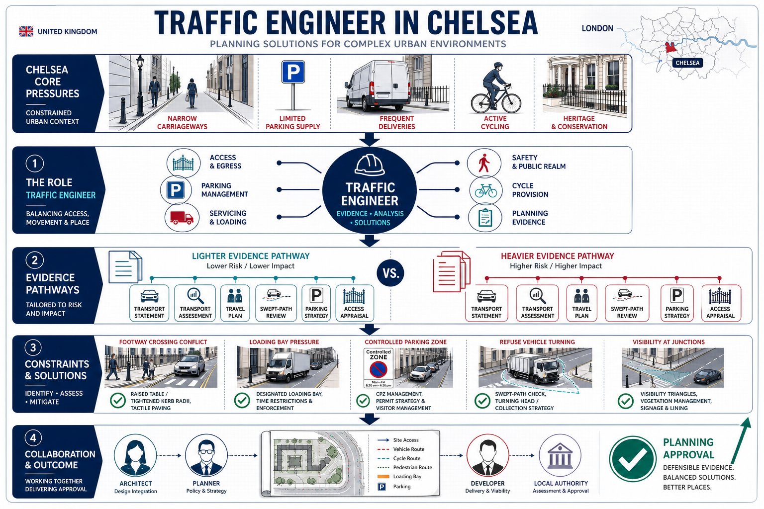
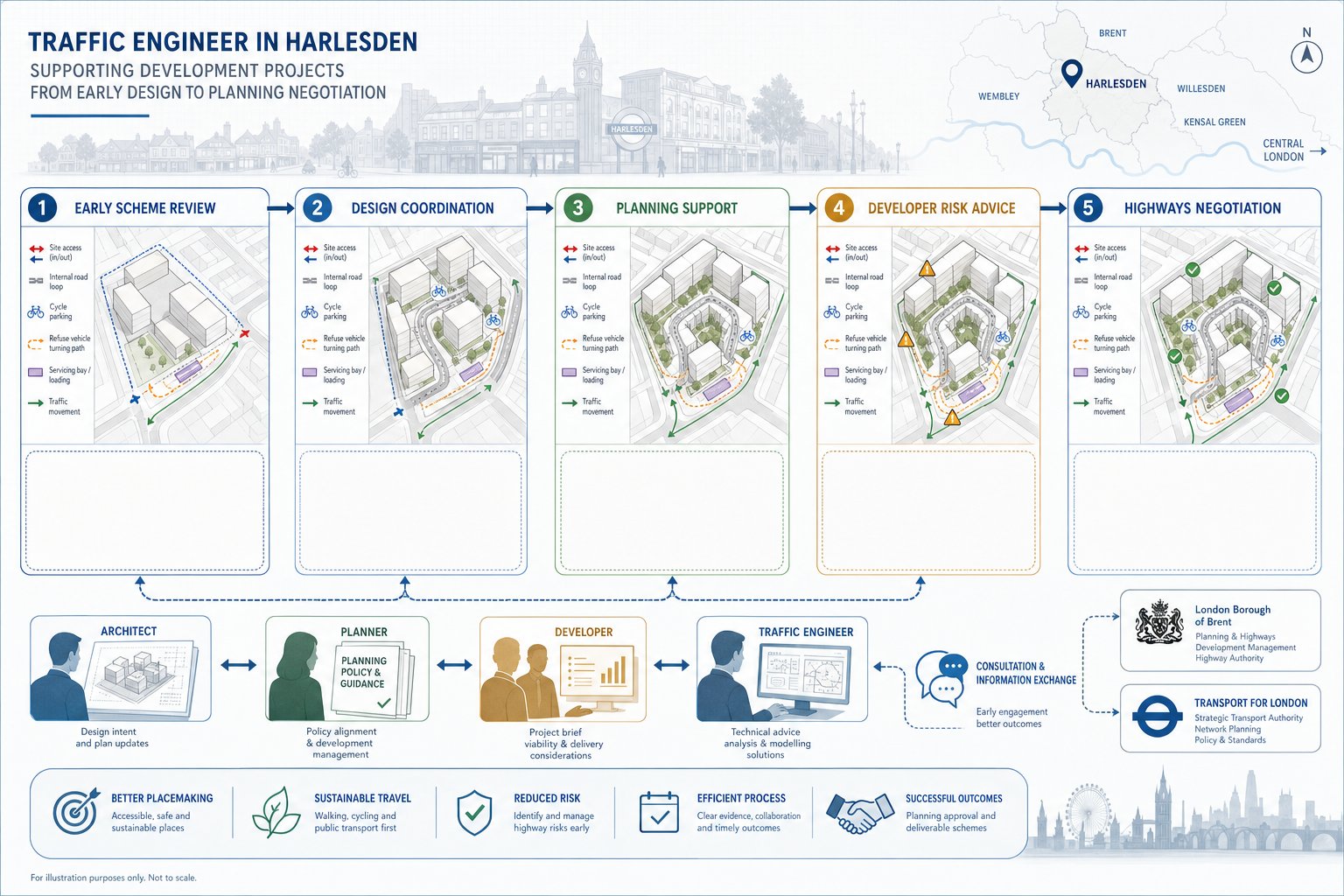
A good traffic engineer does two things at once. First, we quantify impact in a way that is proportionate to the scheme: existing conditions, forecast trips, likely distribution, junction effects, parking implications and servicing needs. Second, we translate those findings into planning language that aligns with borough requirements, the London Plan, Healthy Streets principles and Vision Zero thinking. That combination is often what turns a transport document from a basic appendix into something decision-makers can actually rely on.
For applicants, the value is practical. Early transport advice helps avoid redesigns, reduces surprises during validation or consultation, and gives the wider team a clearer basis for negotiations. In a place like Hammersmith, where one awkward access arrangement or weak parking assumption can stall progress, that local insight is not a luxury. It is part of getting permission.
Typical Projects That Need A Traffic Engineer In Hammersmith
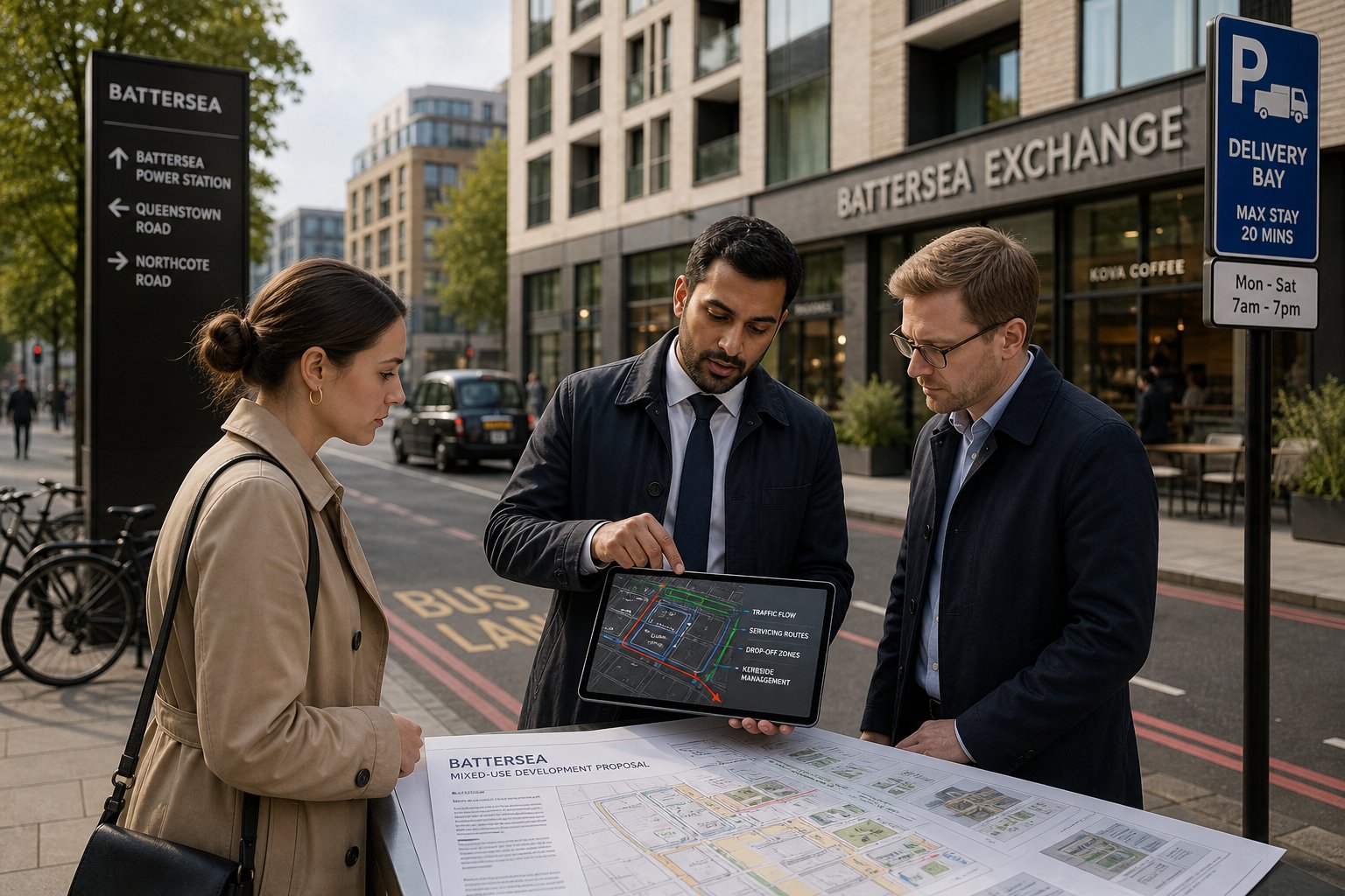
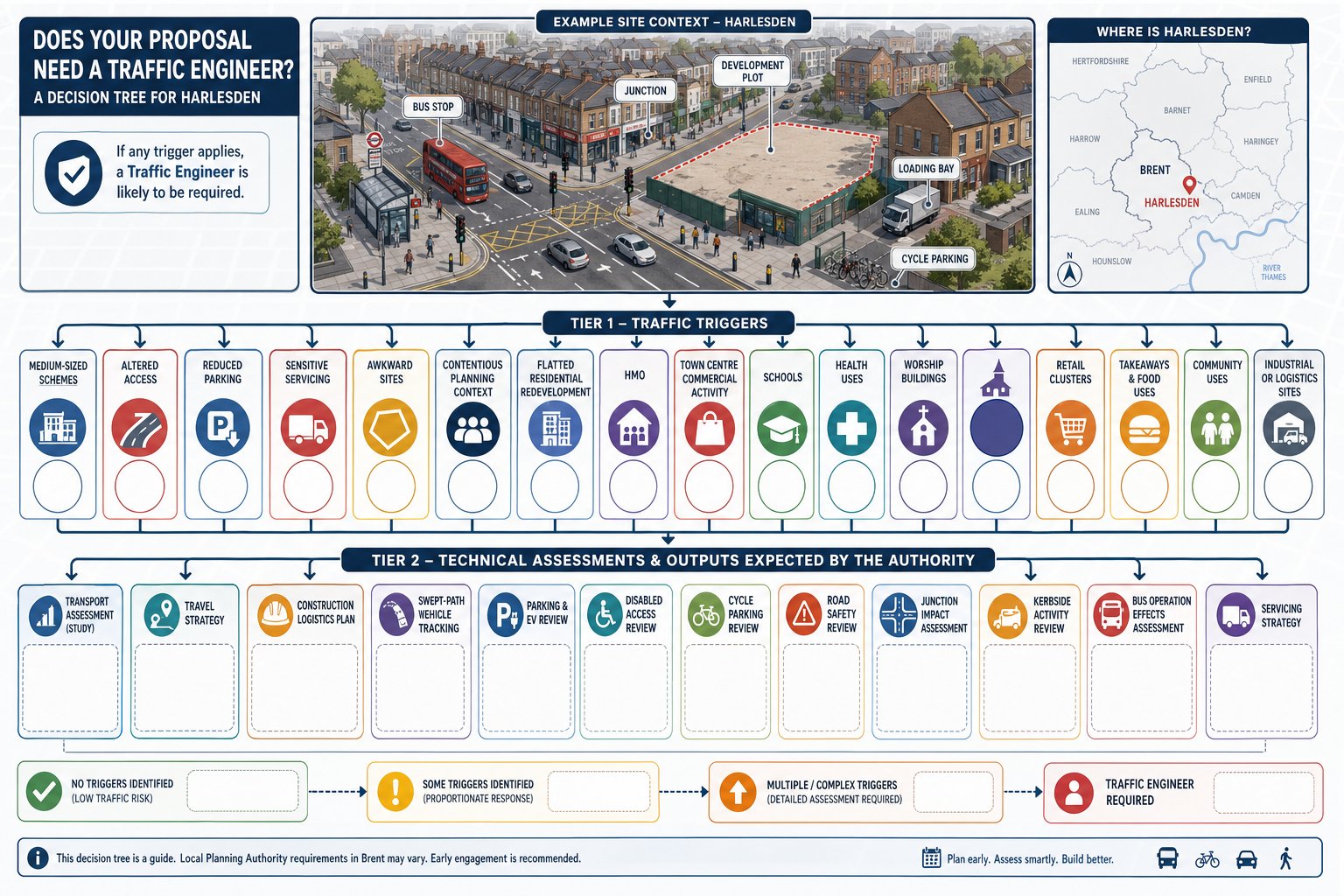
Not every scheme needs a full-scale modelling exercise, but many developments in Hammersmith do need transport input of some kind. The trigger is often not just size. It is context. A project on a constrained street, close to a junction, within a Controlled Parking Zone, or dependent on regular servicing may need careful evidence even where floorspace changes look modest on paper.
We are often brought in where the planning team needs a clear view on whether a Transport Statement is enough, whether a fuller assessment is likely, what surveys will be expected, and how to frame a realistic mitigation package. That early scoping is particularly useful where the borough, TfL interface or local sensitivity suggests transport comments are likely.
On broader strategy, our work sits alongside the principles covered in Traffic Engineering Consultants: and the more network-focused role described by Highway And Traffic Engineering. In Hammersmith, those disciplines overlap constantly because planning, access and local highway constraints are rarely separable.
Residential, Mixed-Use, And Commercial Schemes
Residential-led schemes are a common example. New-build flats, estate renewal, student accommodation and co-living proposals all raise familiar questions: how many person trips will the scheme generate, how many of those are likely to be by car, what cycle parking is needed, where do deliveries happen, and can refuse vehicles and emergency services operate safely? In Hammersmith, those answers depend heavily on public transport accessibility, surrounding parking controls and the realities of local kerbside demand.
Mixed-use and commercial schemes can be even more transport-sensitive. Offices, hotels, retail units, leisure uses and healthcare space create different peaks, different servicing profiles and, often, more pressure on short-stay parking and loading. A town-centre office refurbishment might not add many vehicle trips but could still create difficult questions about courier activity, blue-badge access or cycle parking shortfall. A hotel may generate relatively little commuter traffic yet attract taxis, coaches, servicing and guest pick-up patterns that need careful management.
That is why a Traffic Engineer in Hammersmith usually works beyond simple traffic counts. We look at how a site actually functions day to day, whether its operational assumptions are credible, and whether the proposal fits the street around it. For developer teams, that often means producing evidence that is proportionate but still detailed enough to reassure officers that the scheme will not create severe impacts.
Commercial applicants in particular benefit from a planning-led approach like the one outlined in Commercial Traffic Engineering, especially where servicing and employee travel patterns are under close review.
Change Of Use, Refurbishment, And Estate Optimisation
A lot of Hammersmith development is not clean-sheet redevelopment. It is change of use, retrofit, intensification or estate optimisation within existing urban blocks. Those projects can look straightforward at first glance. Then the awkward details emerge: a basement that no longer works for servicing, a rear access route with poor geometry, a reconfigured layout that shifts refuse collection to the street, or a former office building becoming residential in a location with already-stretched parking controls.
Change-of-use cases often need fresh transport evidence precisely because the use profile changes. A building may generate fewer peak-hour vehicle trips after conversion, but more home deliveries, more cycle demand or a different pattern of taxi and visitor activity. Equally, a refurbishment may retain the same lawful use while intensifying occupation enough to prompt questions about transport effects.
Estate optimisation projects bring their own complexity. Developers and housing providers may be consolidating parking, reorganising access roads, introducing secure cycle storage, or improving public realm while preserving service access. Small layout decisions can have big operational consequences. If a swept path fails, if emergency access is compromised, or if a loading arrangement blocks pedestrian desire lines, planning concerns follow quickly.
For these schemes, we tend to focus on evidence that is both site-specific and practical: parking accumulation, servicing frequency, access geometry, vehicle tracking and realistic travel plan measures. Broader context can also help, and our overview of Traffic Engineering and Transportation reflects how these issues connect to planning strategy rather than sitting in a silo.
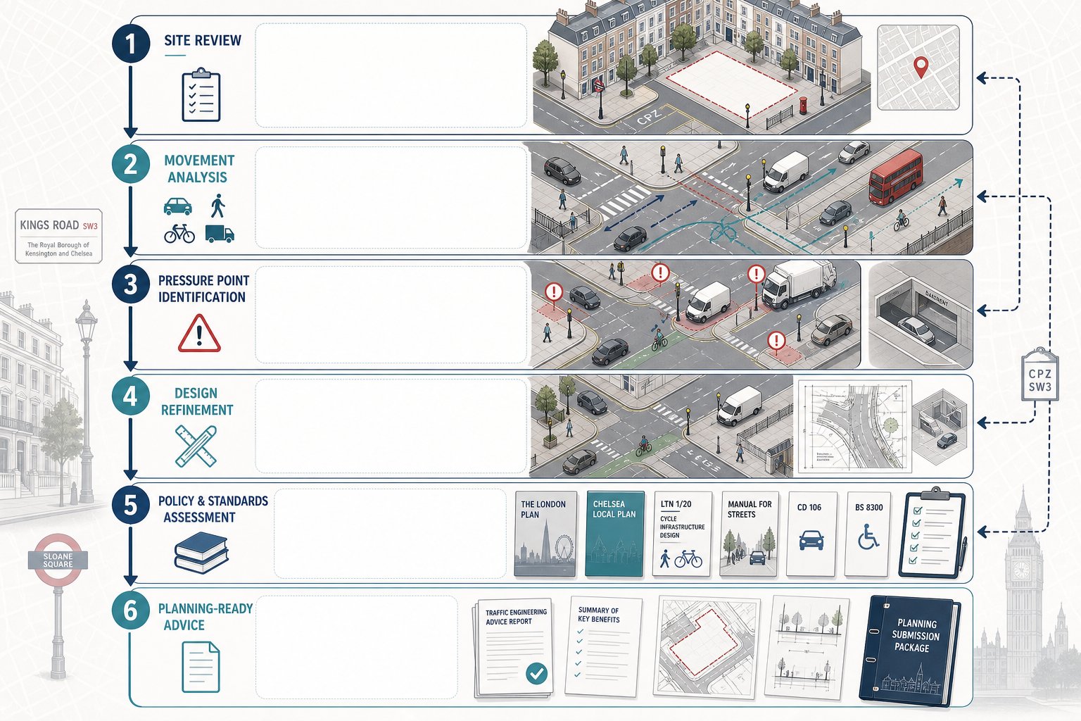
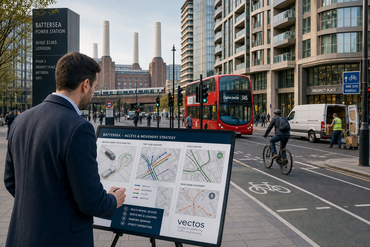
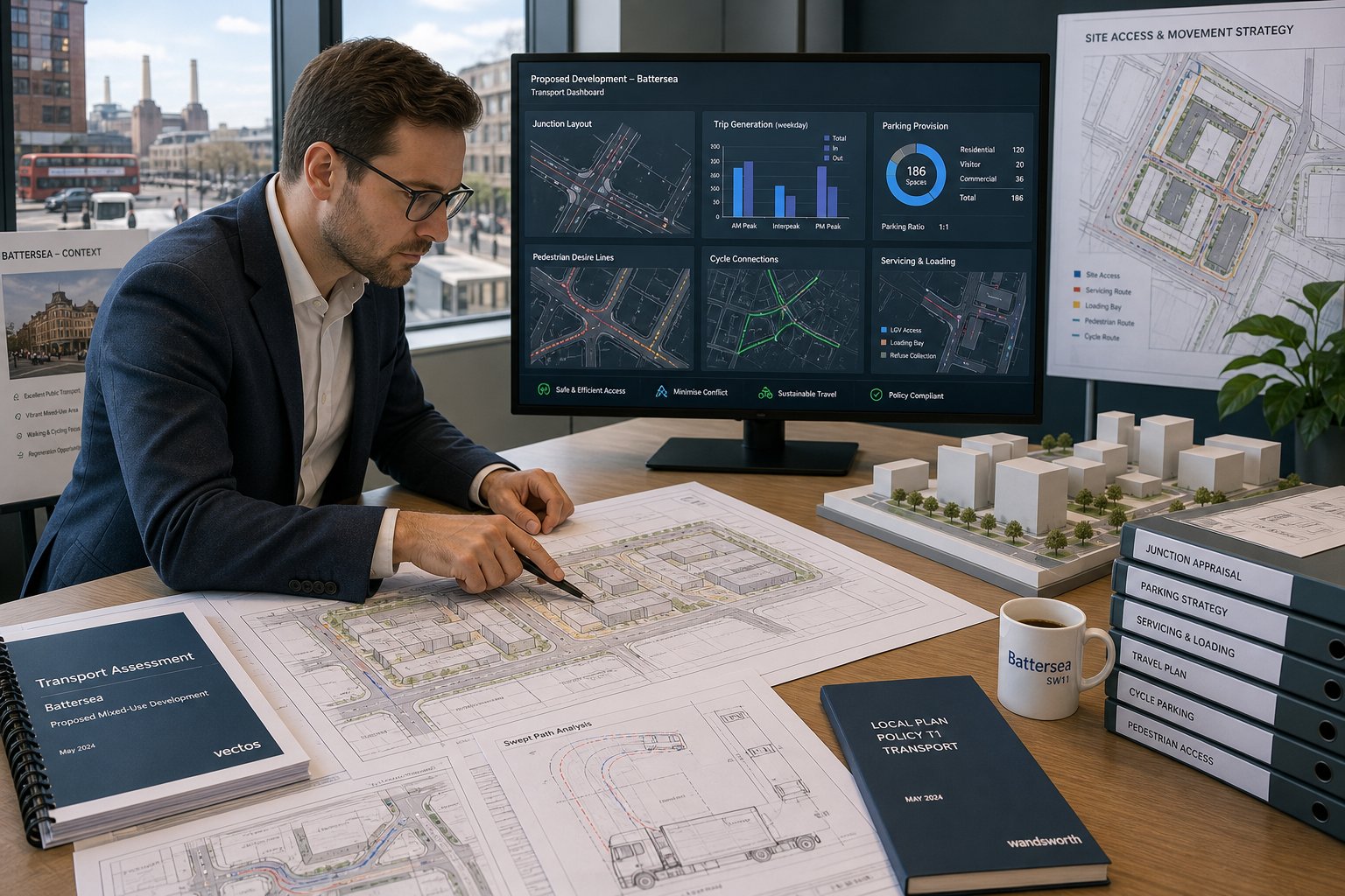
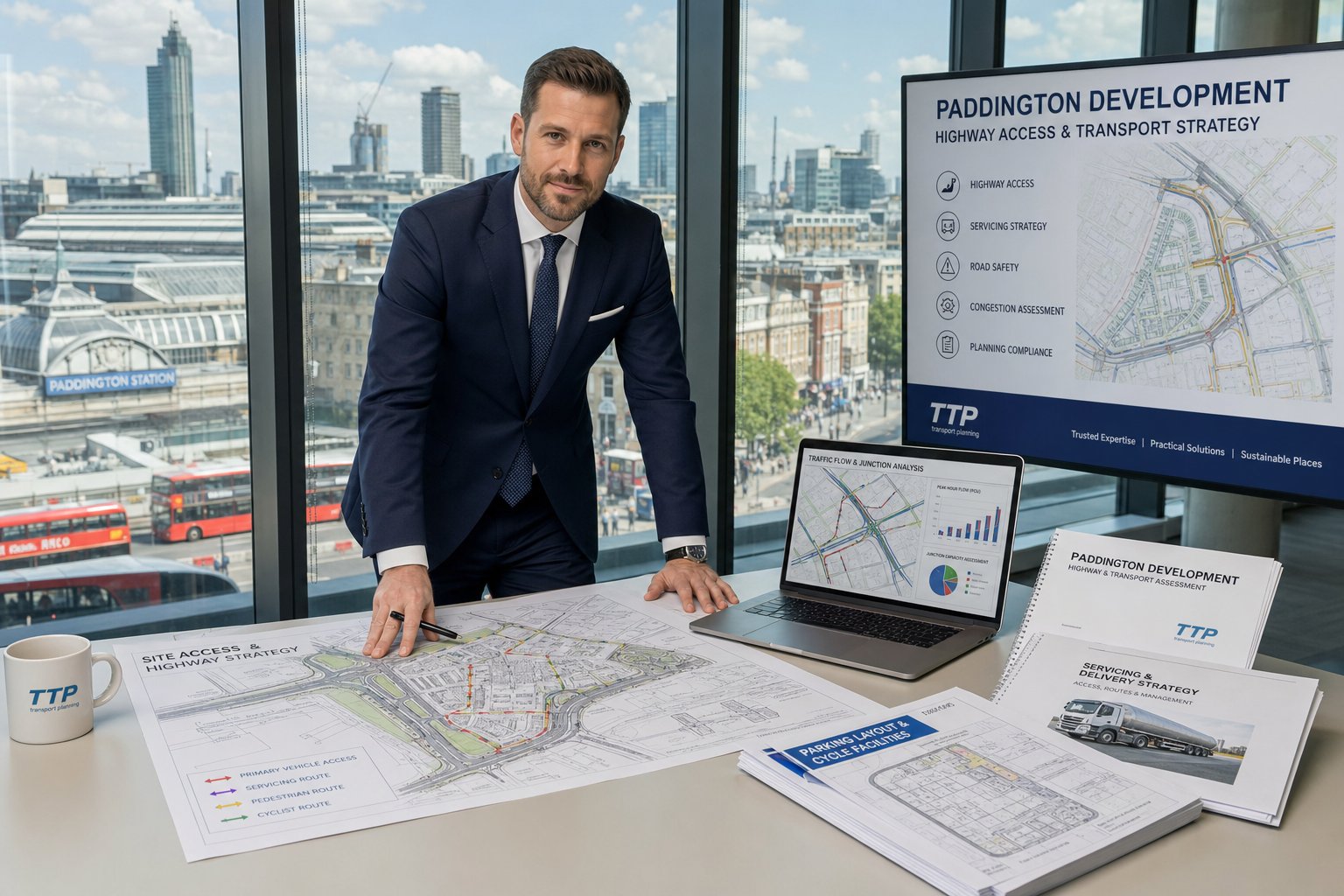
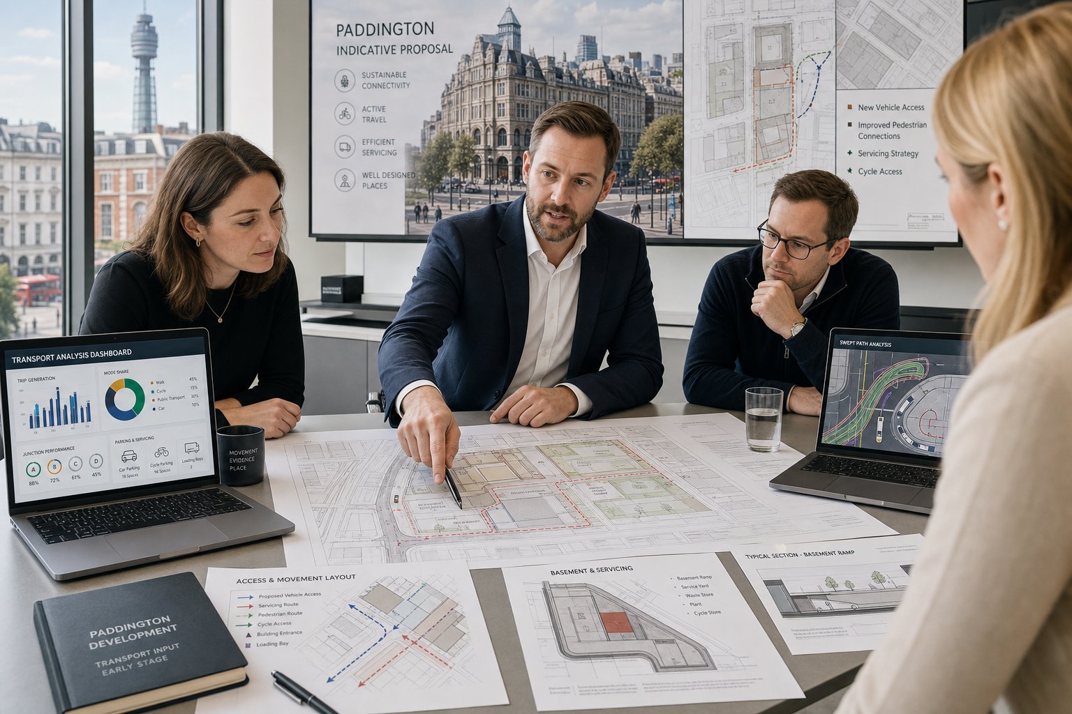
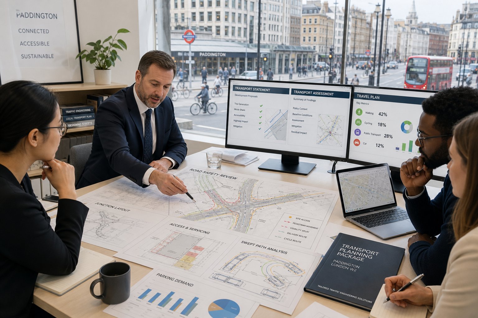
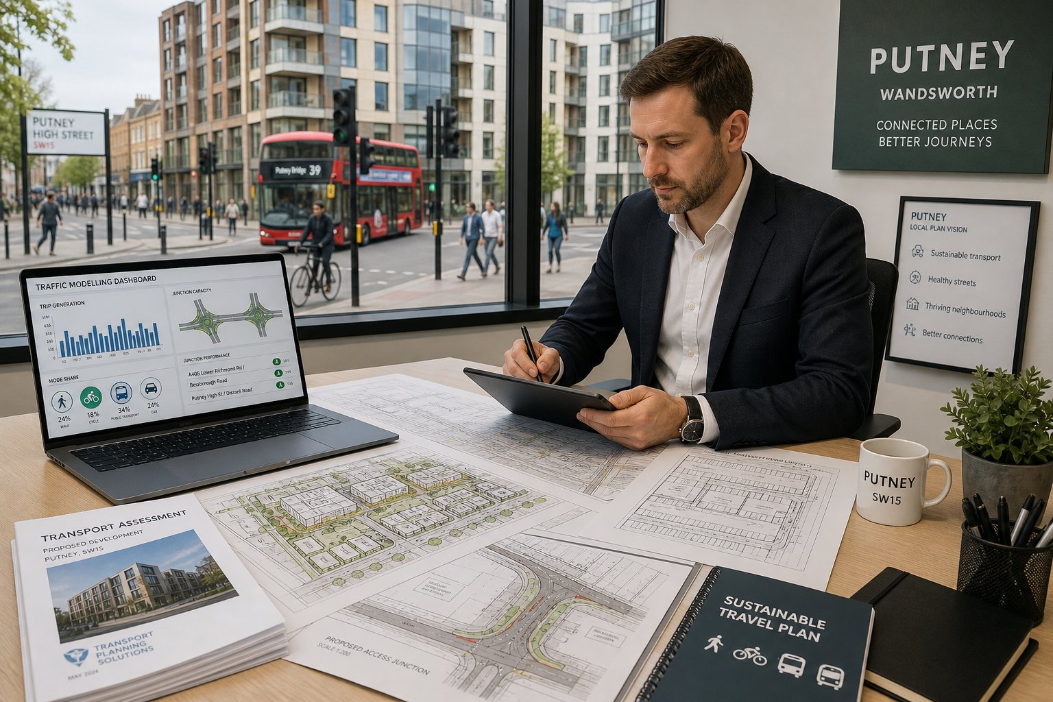
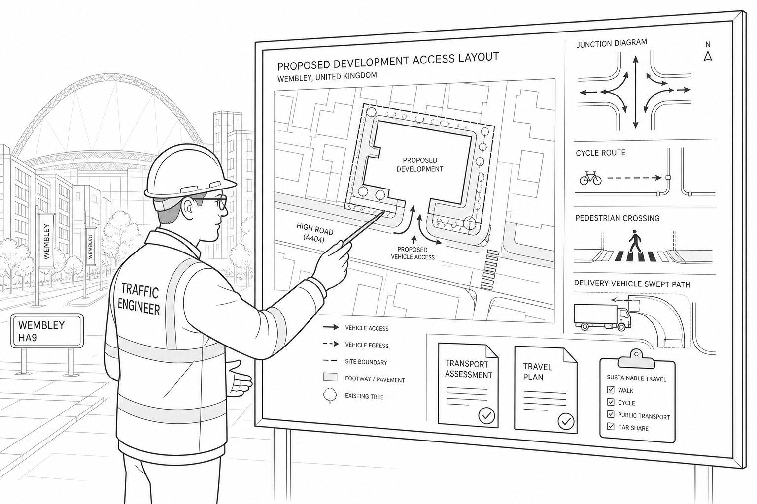
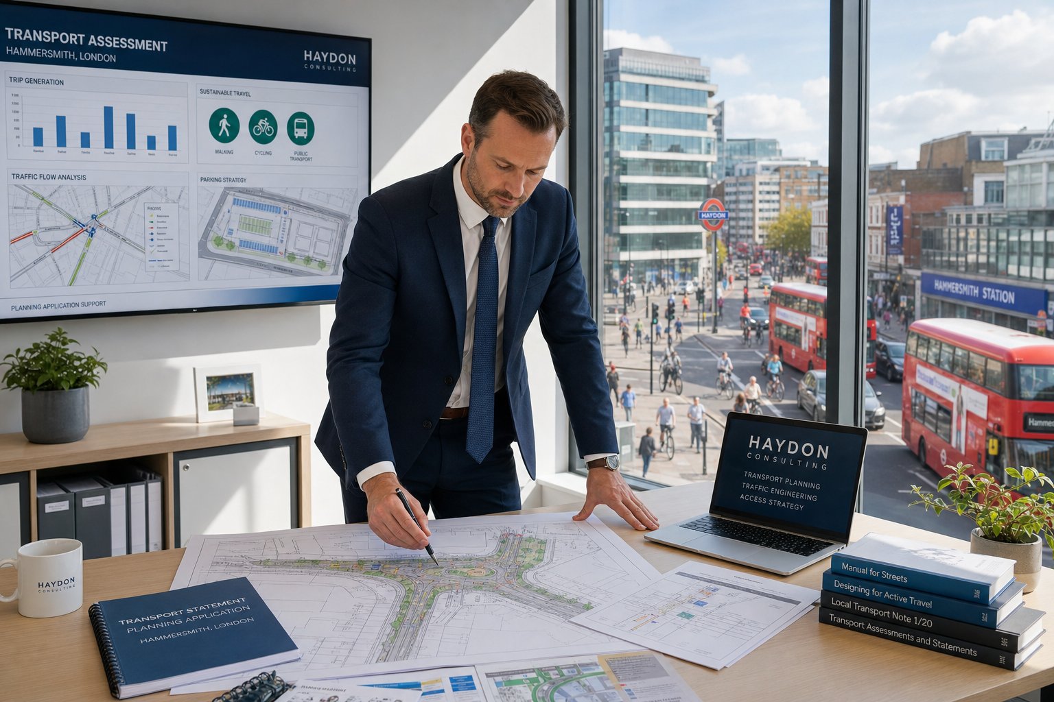
What A Traffic Engineer Can Prepare For A Planning Application
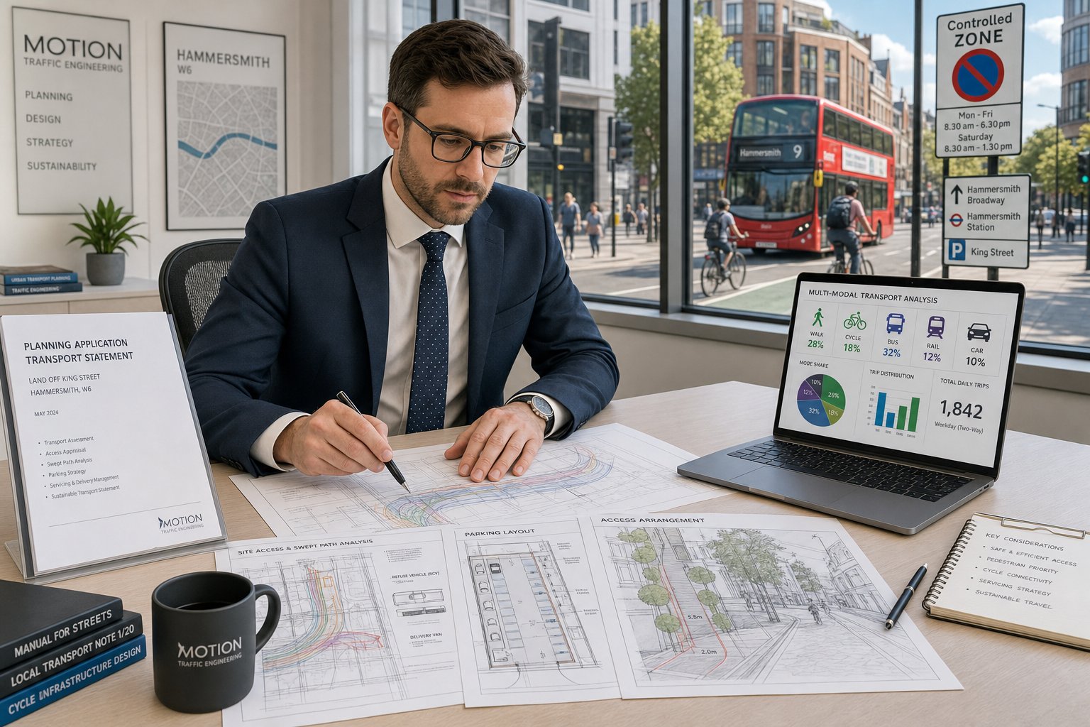
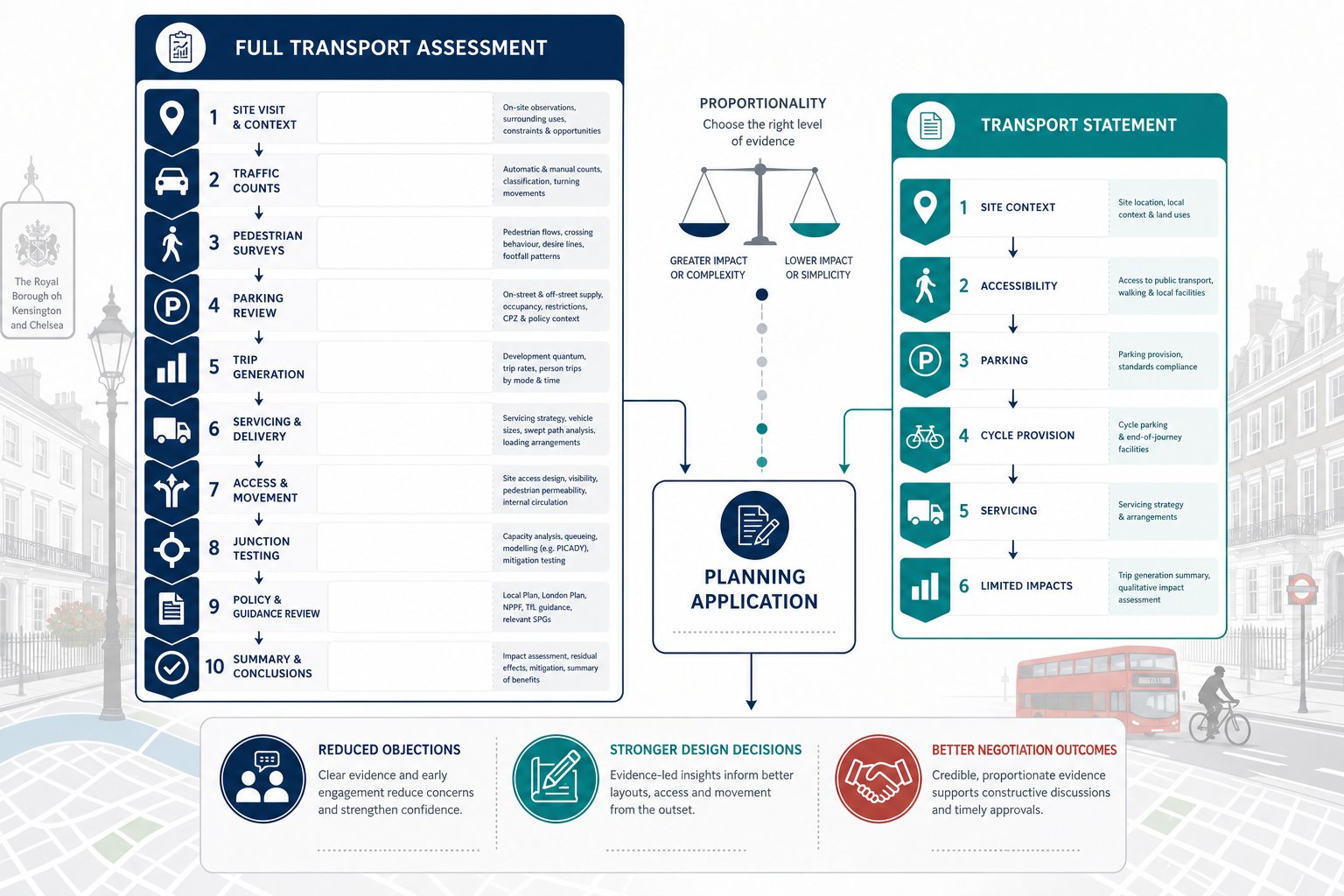
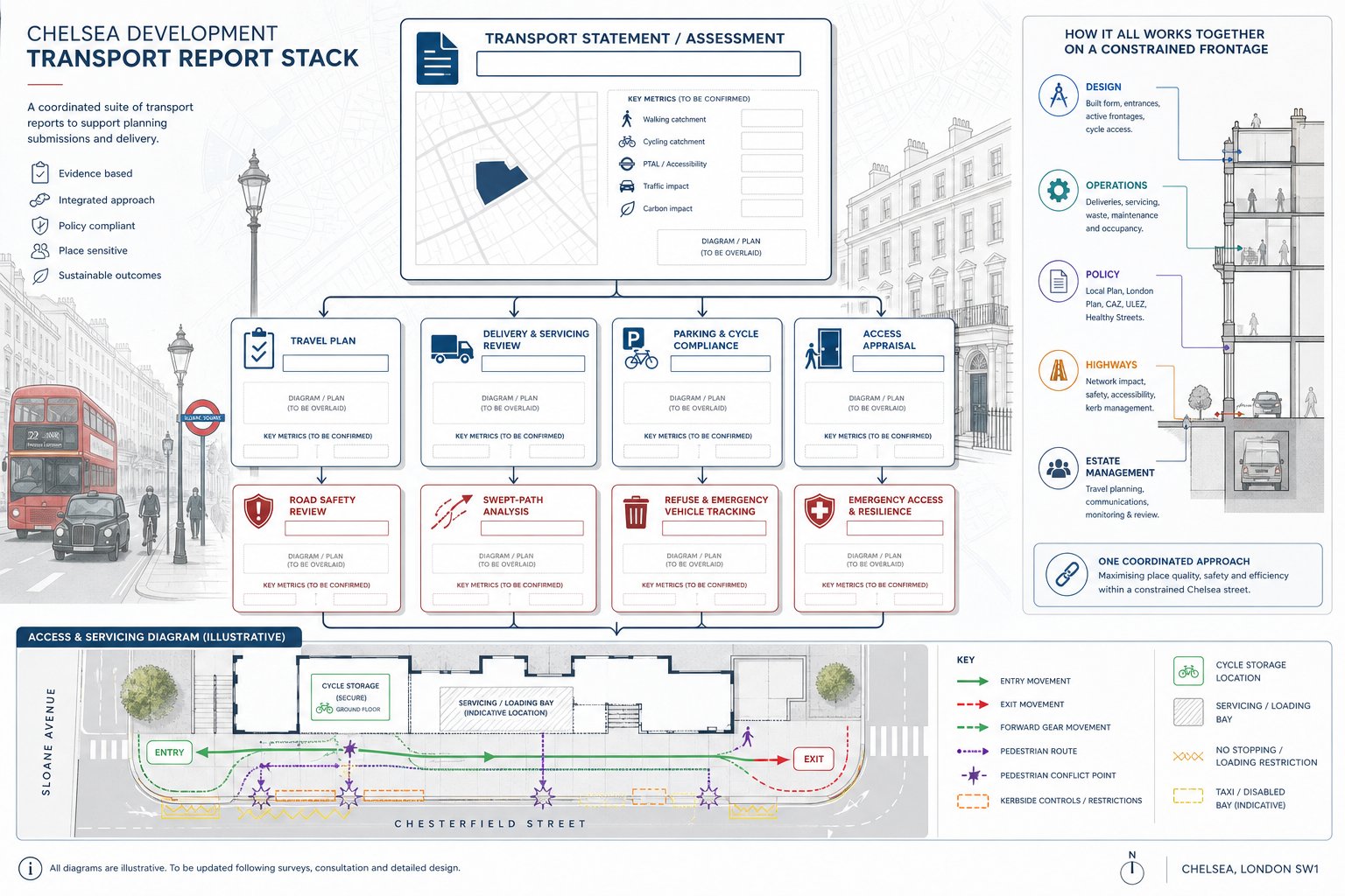
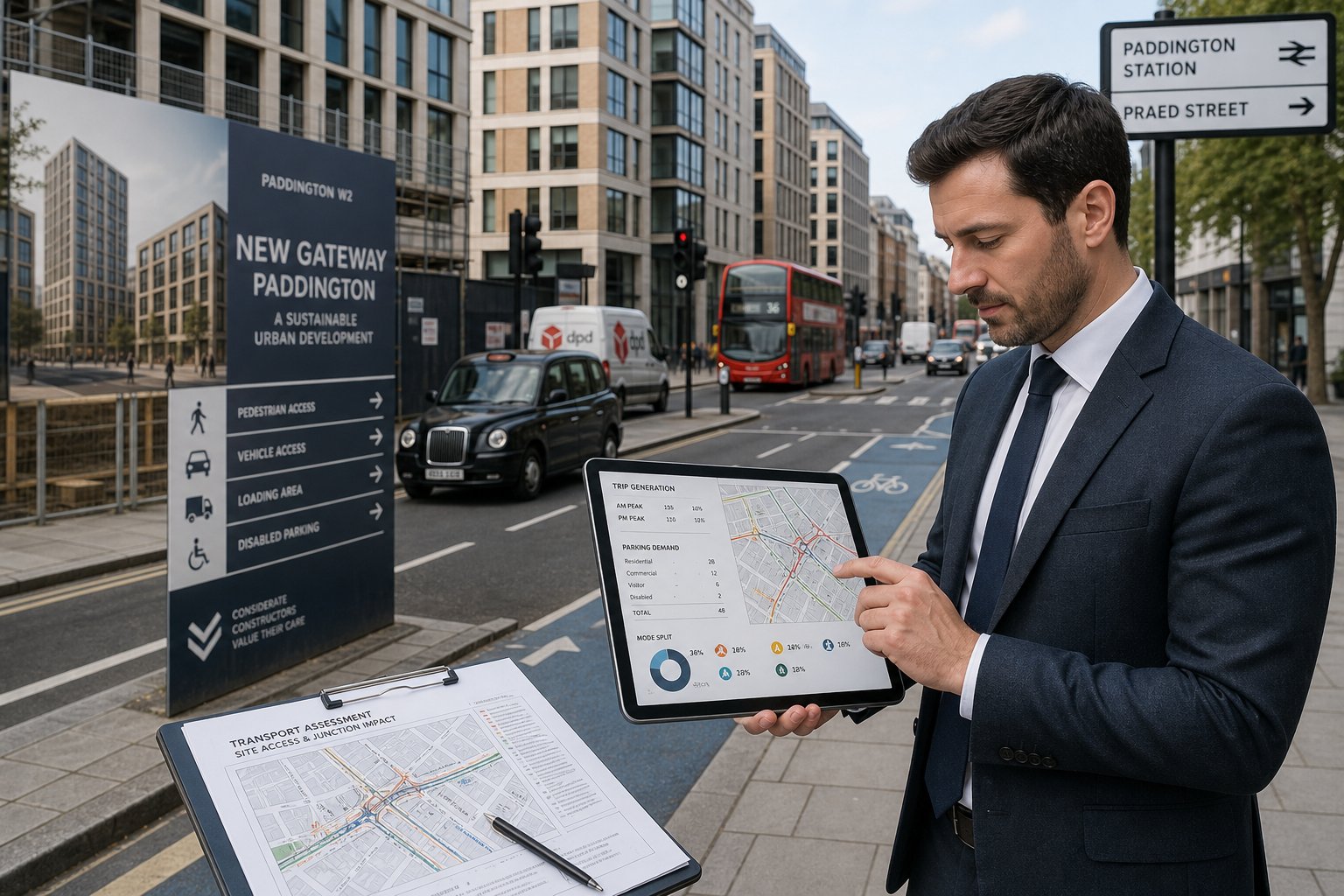
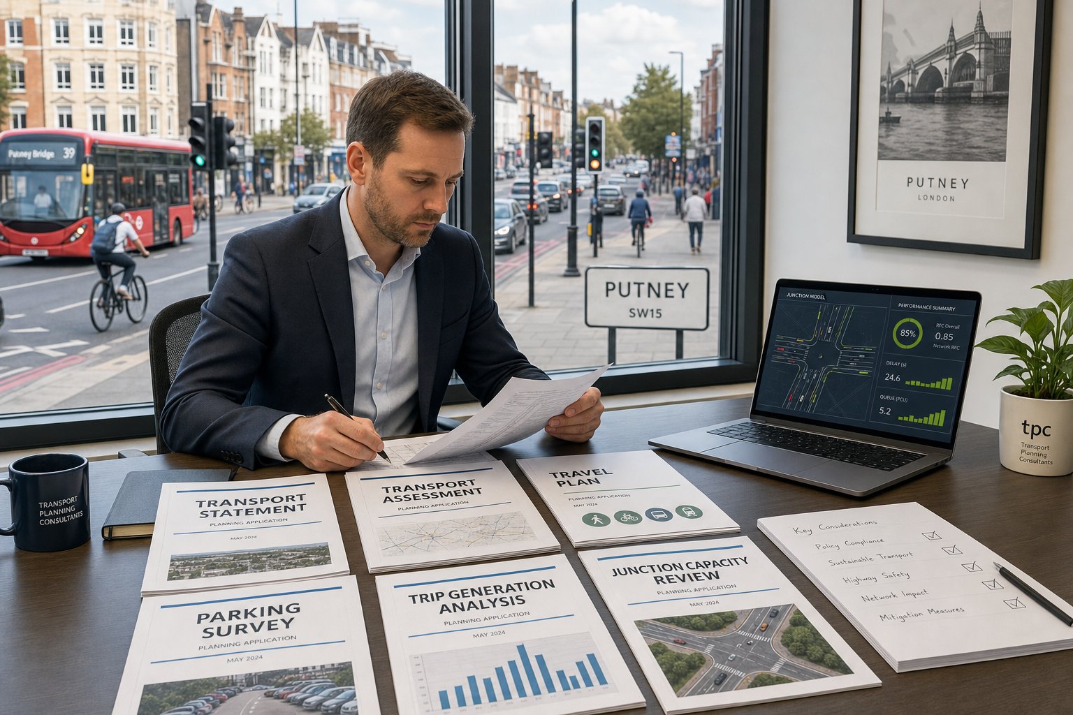
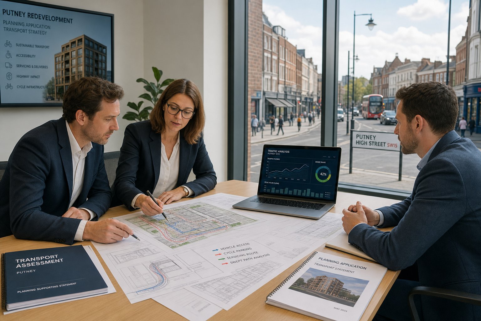
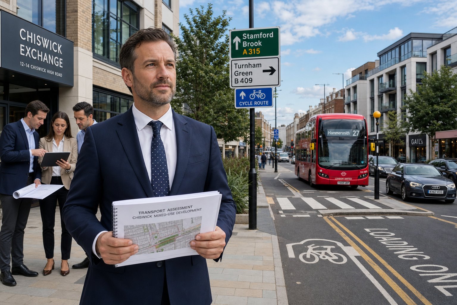
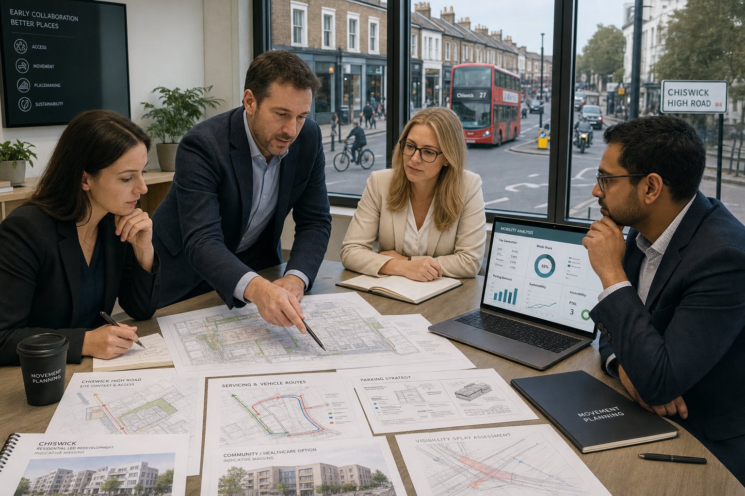
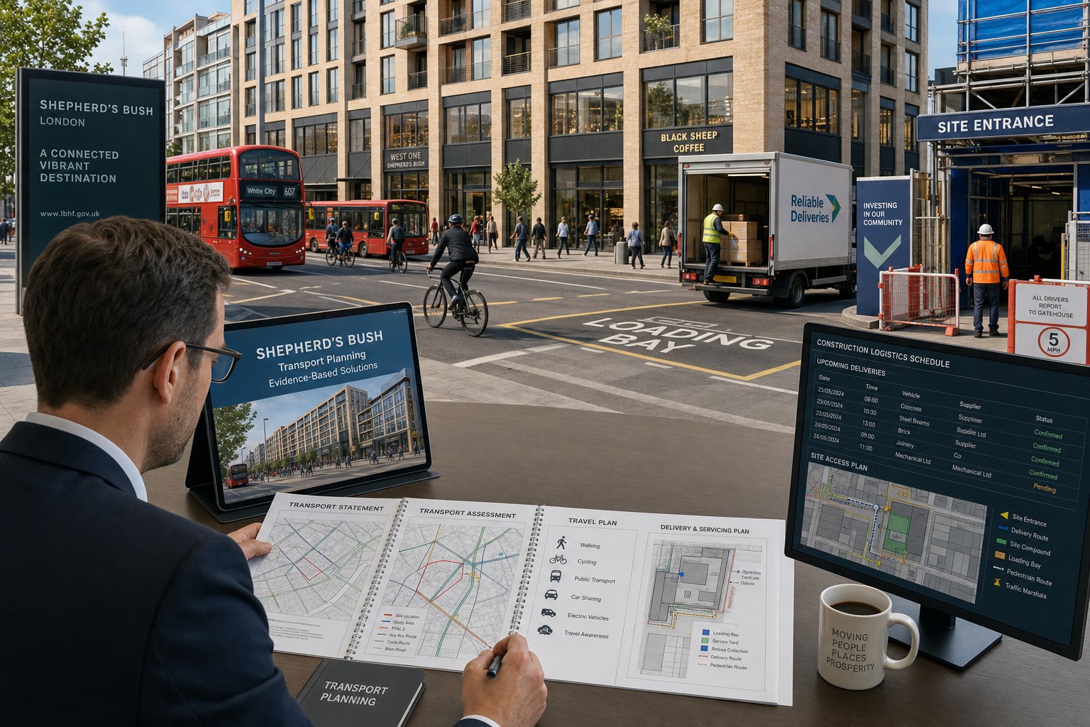
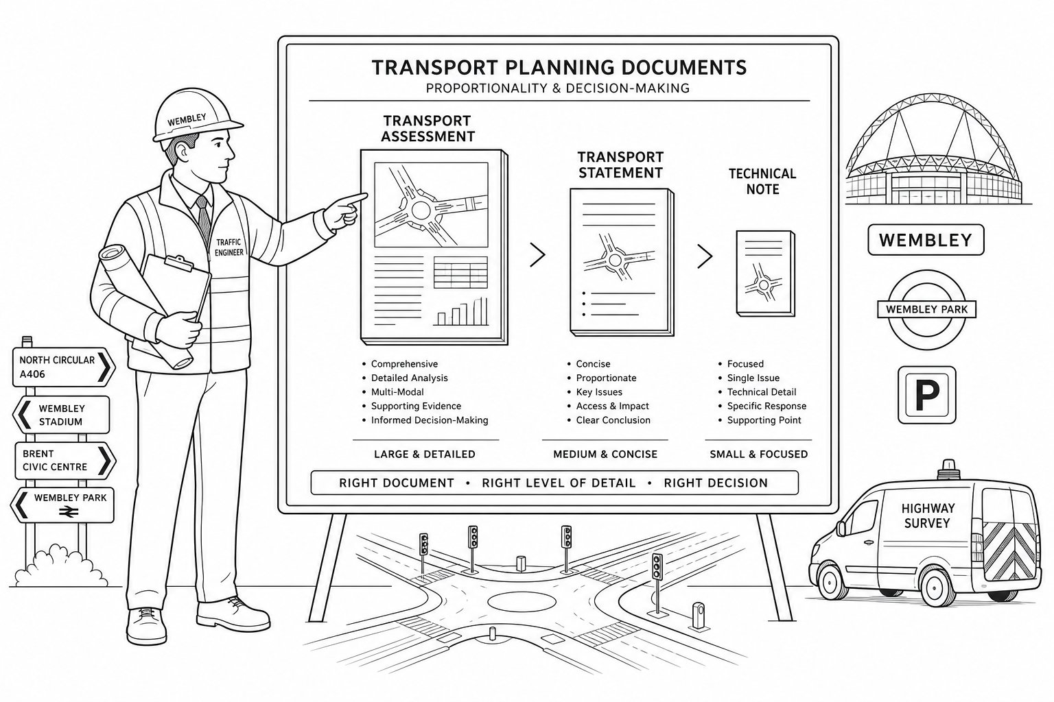
Planning transport work in Hammersmith is rarely one document and done. The right package depends on scale, use, access arrangements, local authority expectations and whether TfL has an interest. Some schemes need a concise Transport Statement and Framework Travel Plan. Others require a more detailed Transport Assessment, parking survey work, delivery strategy, swept-path drawings and input into Construction Logistics or servicing discussions.
The key is proportionality with enough depth to answer the real questions. Authorities tend to respond well when a report is focused, technically robust and directly relevant to the site. They respond rather less well to generic text pasted from another borough.
Where teams need wider context on report types and thresholds, our Traffic Engineer In London: perspective is useful because Hammersmith sits within that larger policy and operational framework, even though its local constraints are very specific.
Transport Statements, Transport Assessments, And Travel Plans
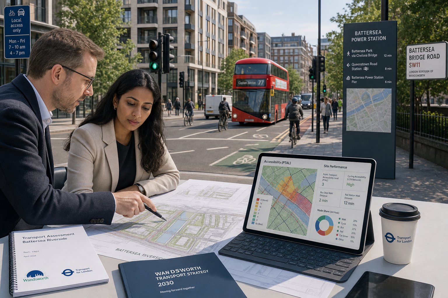
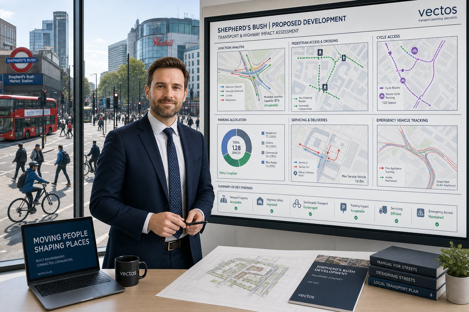
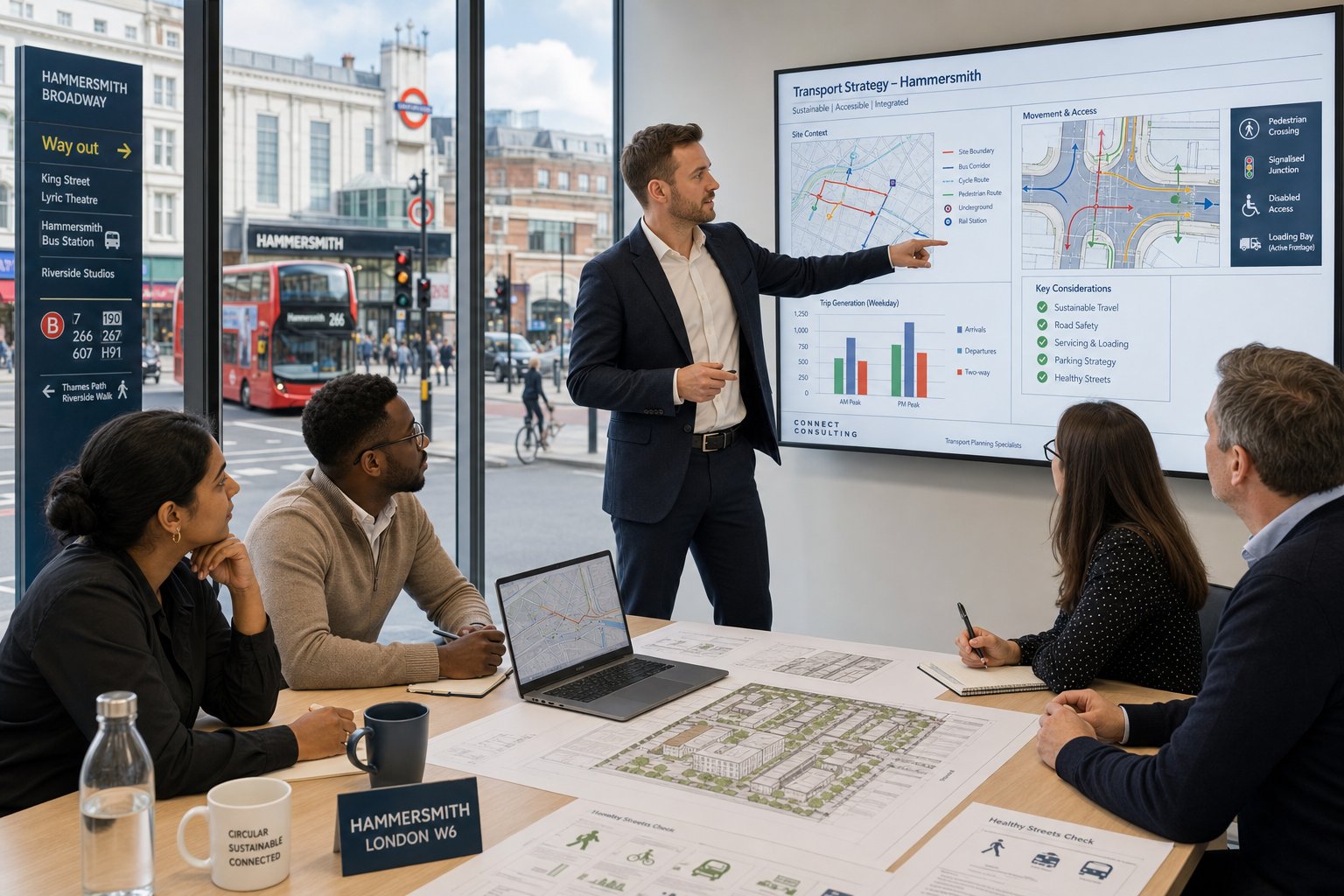
A Transport Statement is usually appropriate where impacts are expected to be limited, but the authority still needs clear evidence on access, mode choice and operational effects. A Transport Assessment is typically more detailed, covering baseline conditions, trip generation, trip distribution, assignment, junction effects and sometimes public transport capacity or safety considerations. In Hammersmith, deciding which route is right depends not just on scale, but also on site sensitivity.
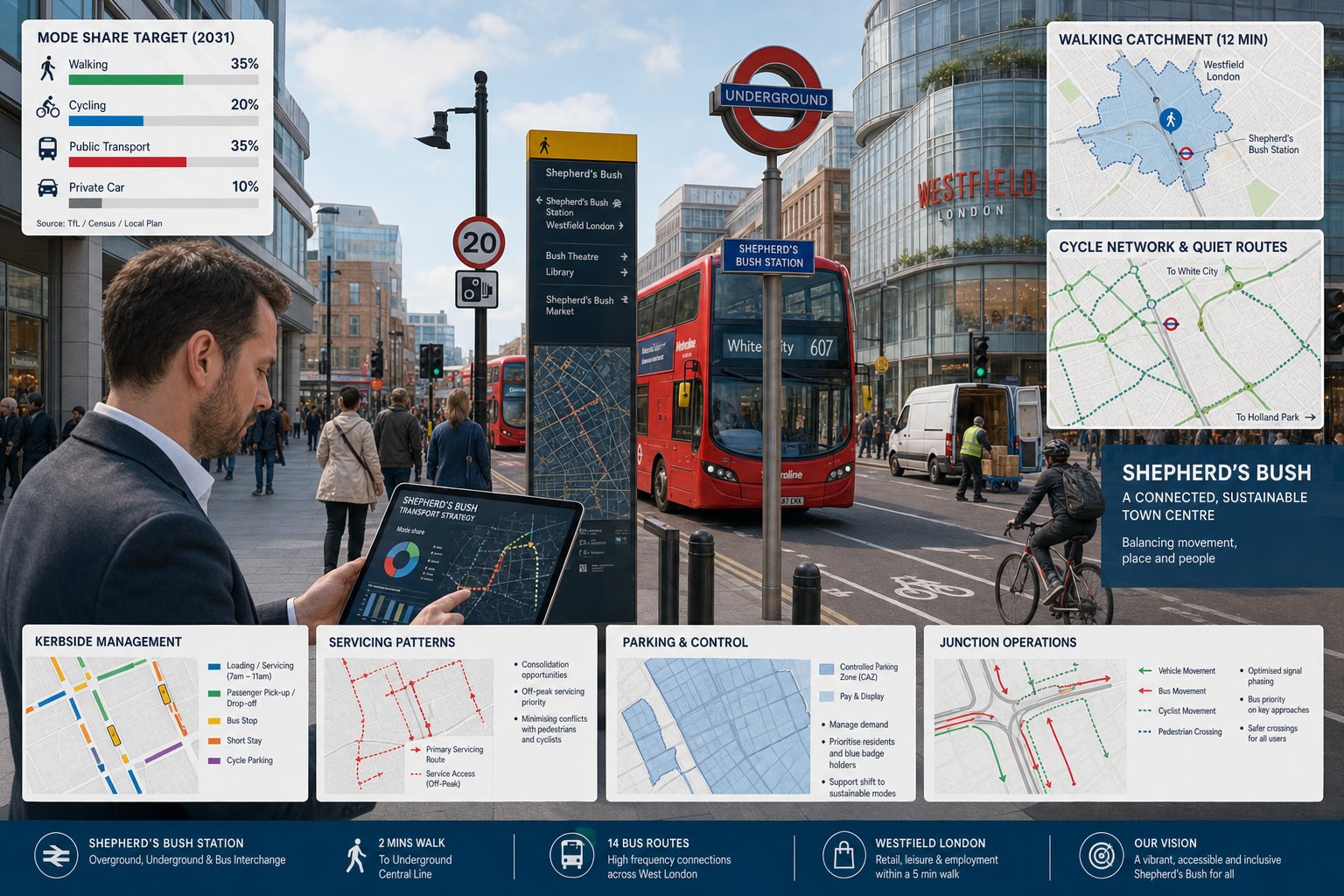
For either document, we usually examine existing transport conditions around the site, estimate future person and vehicle trips, and assess whether the local network can accommodate those trips without unacceptable impact. In an area with strong public transport and high walking rates, the analysis has to be genuinely multi-modal. A purely car-based picture will miss how Hammersmith actually works.
Travel Plans are often central rather than decorative. Boroughs and TfL expect applicants to show how sustainable travel will be encouraged through practical measures: cycle facilities, welcome packs, public transport information, car club membership, monitoring, targets and named responsibilities. A weak Travel Plan can undermine an otherwise competent submission because it suggests the applicant has not thought seriously about mode shift.
We hence prepare these documents with a clear planning purpose: not only to describe trips, but to explain why the development can operate acceptably and support local policy aims. That is where an experienced Traffic Engineer in Hammersmith adds real value, by matching technical method to local scrutiny instead of overcomplicating the report or, just as risky, undercooking it.
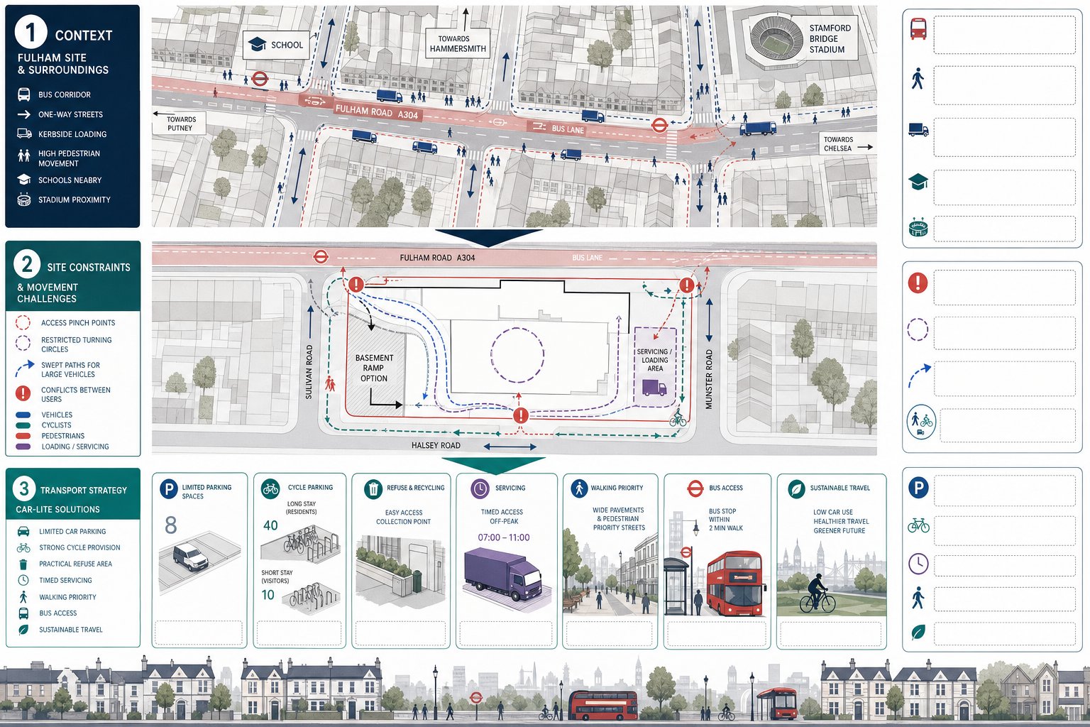
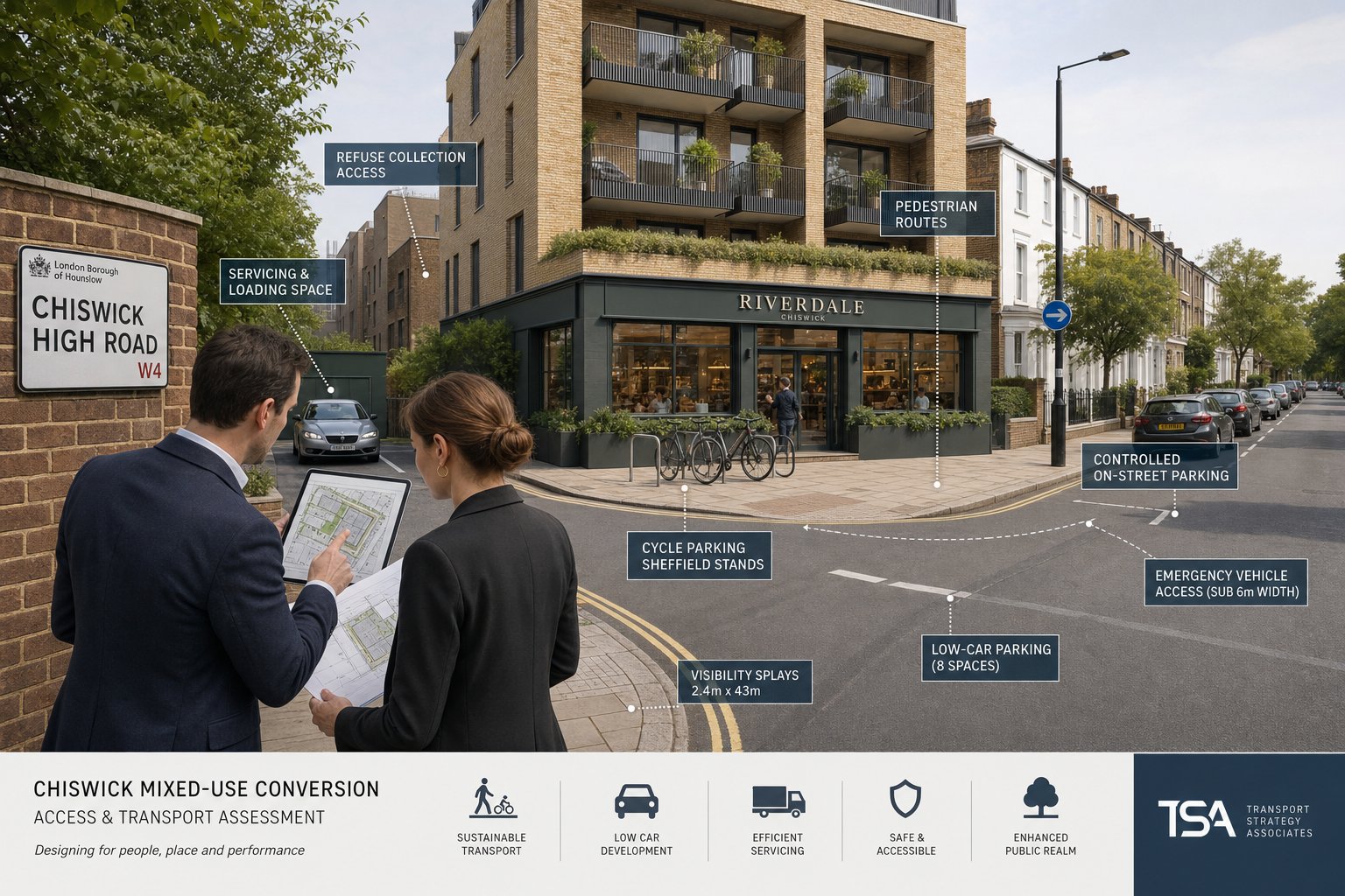
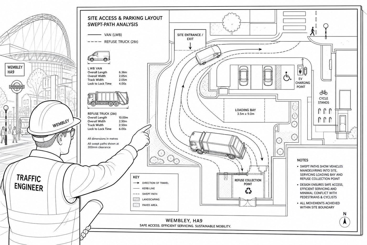
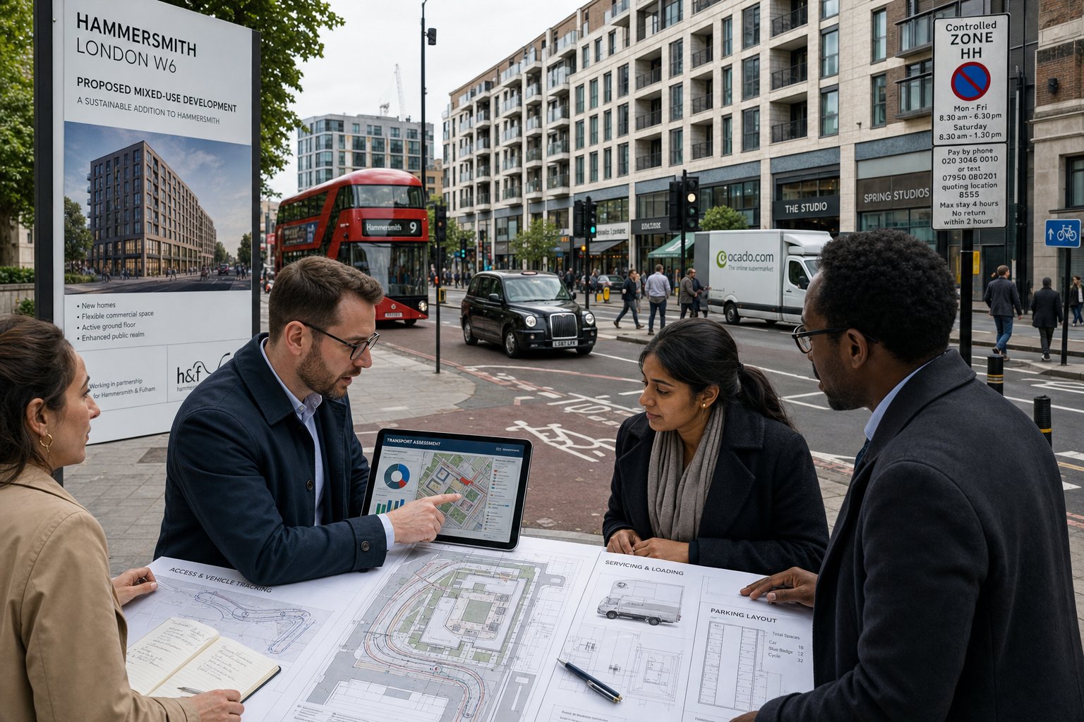
Delivery, Servicing, Parking, And Access Appraisals
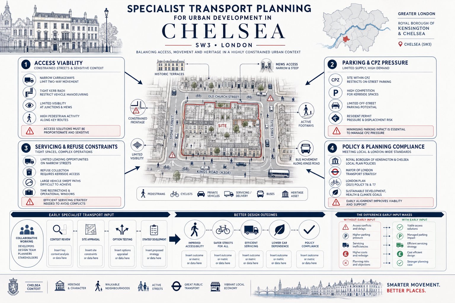
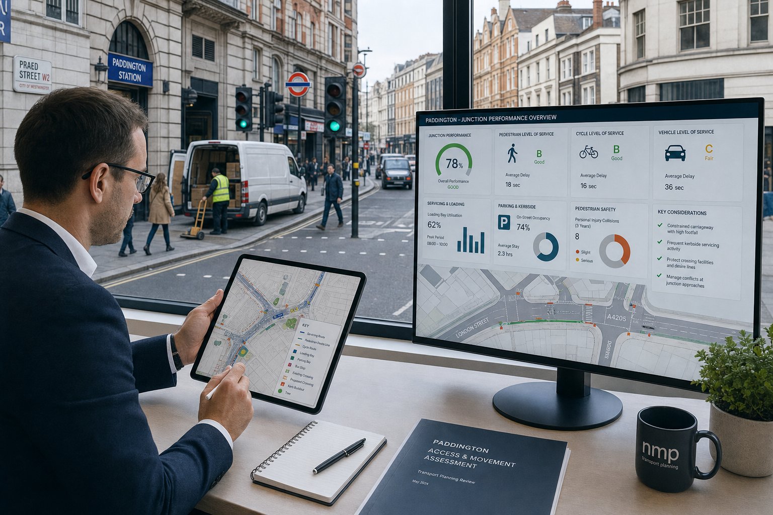
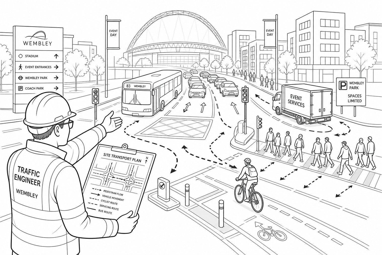
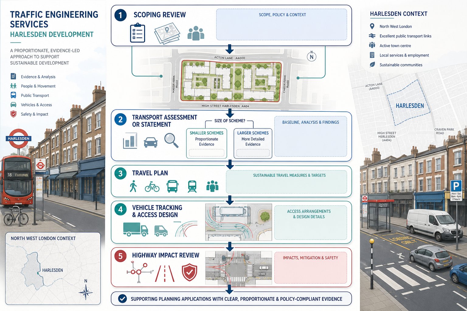
In Hammersmith, servicing and access often become the decisive issue. Plenty of schemes can show acceptable trip rates, yet still struggle because the loading strategy is unrealistic or the access design does not reflect street constraints. Can a refuse vehicle enter and leave in forward gear? Will delivery vans stop on-street and block a bus lane? Is there enough headroom, width and turning space? Those are the questions that tend to matter.
Parking appraisals are equally important. In Controlled Parking Zone areas, even low-car developments may face scrutiny over overspill risk, blue-badge provision, visitor arrangements and the relationship between disabled parking, servicing and public realm. Cycle parking also needs proper thought: quantity, location, security, accessibility and whether larger cycles or adapted cycles have been considered.
Access design work usually includes visibility, geometry, vehicle tracking and review of conflict points with pedestrians and cyclists. For constrained sites, very small adjustments to gate lines, radii or internal layout can make the difference between a workable arrangement and one that attracts an objection. That practical side of transport planning is often under-estimated by non-specialists.
Our approach follows the same principles discussed in access design highway and the broader safety-led perspective in Traffic Engineering: Your. The point is simple: reports need to be tied to operation on the ground. Otherwise, they read neatly but solve very little.
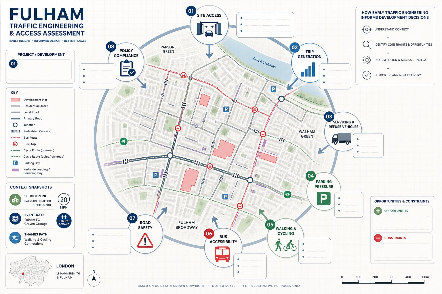
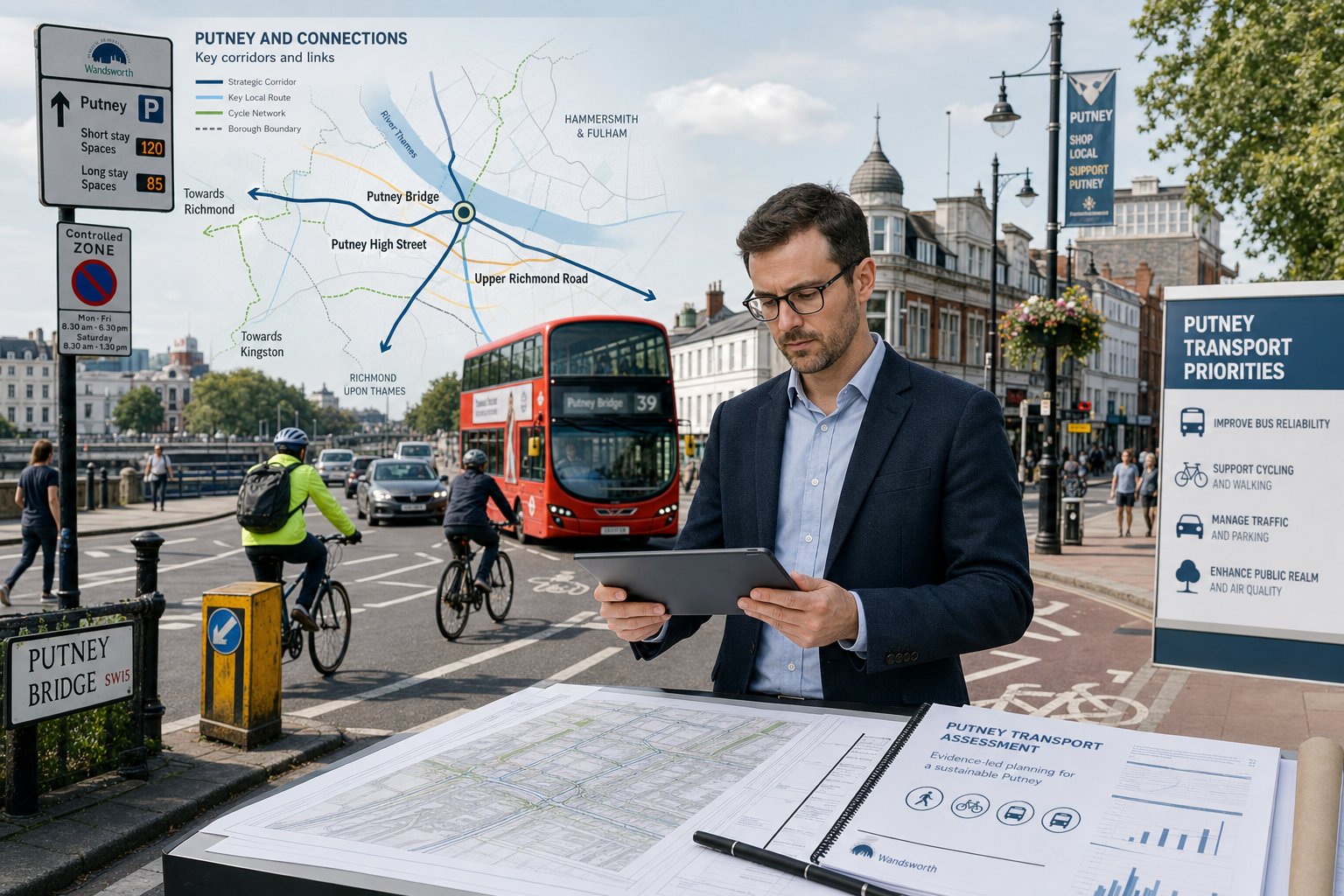
Key Transport Planning Issues In Hammersmith
Hammersmith has its own transport personality. It is not just “busy west London”. It is a place where strategic movement and local place-making sit in constant tension. Development teams hence need to address the issues that authorities, neighbours and transport officers are most likely to focus on, rather than relying on standard assumptions borrowed from other parts of London.
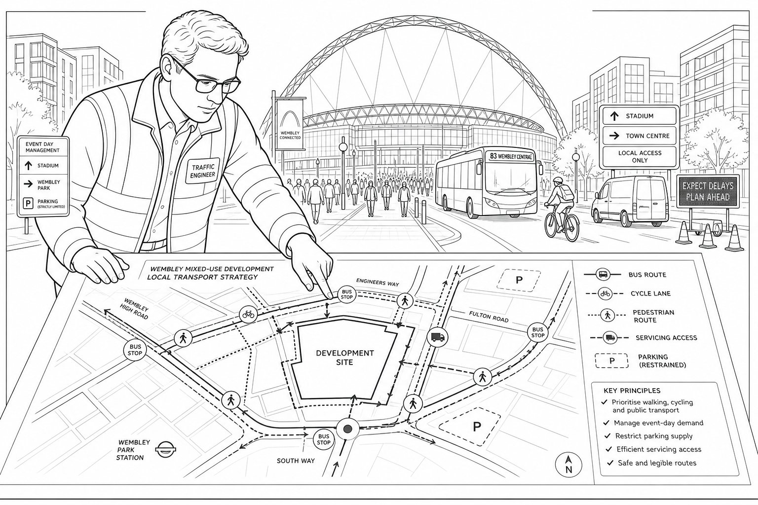
Town Centre Streets, Controlled Parking, And Kerbside Pressure
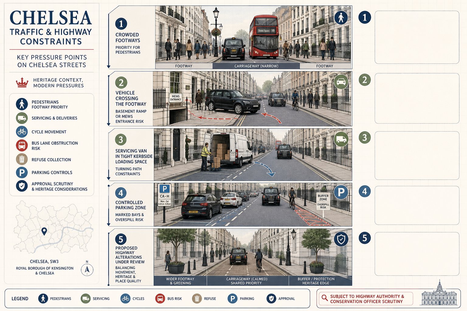
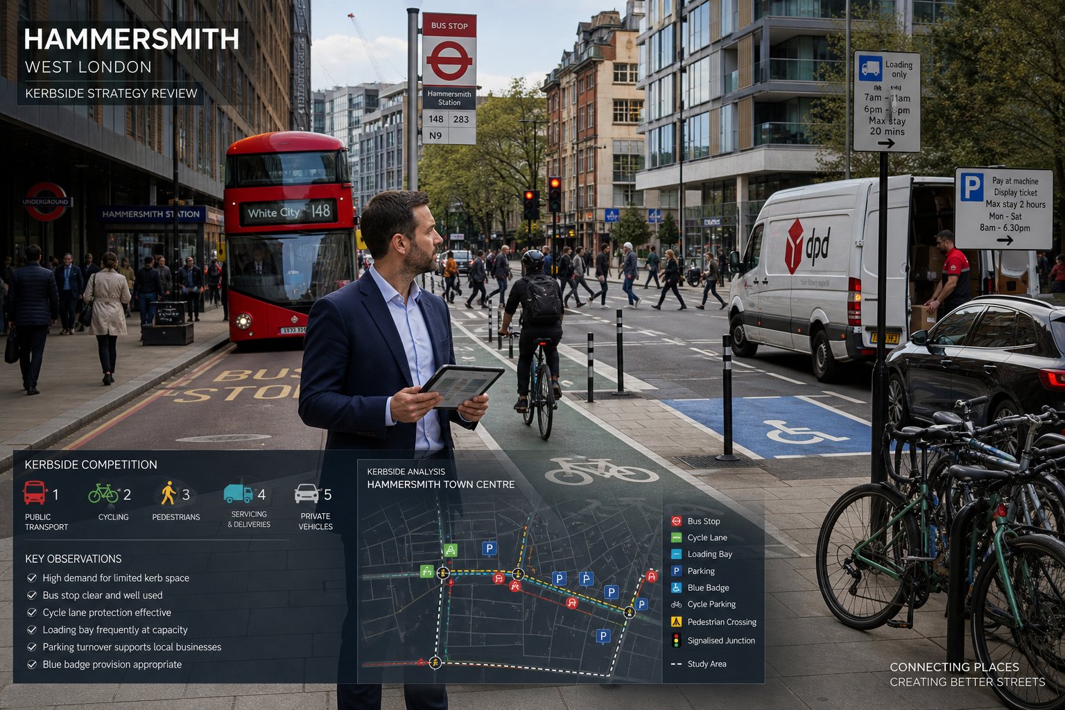
Kerbside pressure is one of the defining constraints. Residents need parking. Shops and restaurants need deliveries. Buses need reliable movement. Taxis and private hire vehicles need stopping opportunities. Blue-badge users need convenient access. Then add cycle parking, dockless micromobility management, car clubs and refuse activity. On many Hammersmith streets, everyone wants the same few metres of kerb.
That means even small developments can trigger big questions about operational realism. If a scheme assumes all servicing will happen within a tiny on-site bay that cannot comfortably take the expected vehicles, officers will notice. If visitor parking is omitted without explaining how the site will function in practice, that can create doubt. If blue-badge provision is tokenistic, or if loading conflicts with pedestrian movement, objections become more likely.
Controlled Parking Zones heighten that sensitivity. Authorities will often want evidence that a proposal will not worsen existing parking stress or create unmanaged overspill. Parking beat surveys, permit controls, allocation strategy and car-free or permit-free measures may all come into play. But policy language alone is not enough. The underlying question is always practical: what happens at 8.30am, at 1pm, at 7pm, on the actual street outside the site?
A well-prepared Traffic Engineer in Hammersmith addresses kerbside competition directly. We map how the street works, identify pressure points, and test whether the proposed parking and servicing arrangements are credible rather than merely policy-compliant on paper.
Walking, Cycling, Bus Links, And Highway Safety Considerations
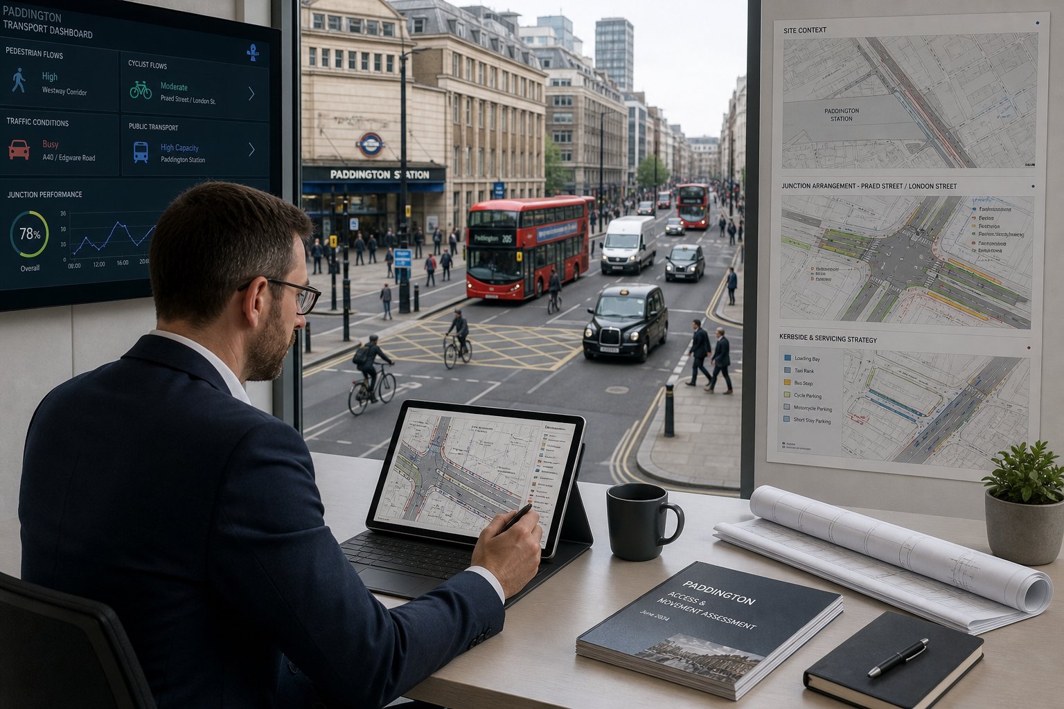
Hammersmith is a high-footfall, bus-oriented environment. For many developments, the main transport impact is not an increase in car trips but a change in pedestrian movement, crossing demand, cycle parking needs or interactions with bus stops and bus lanes. That is one reason transport reports here need a genuinely urban perspective.
Walking routes matter because town-centre developments often sit within a few minutes of stations, bus interchanges and busy retail frontages. A site may look well connected in a map-based accessibility summary, yet still perform poorly if key crossings feel unsafe, if footways are narrow, or if delivery activity obstructs pedestrian desire lines. The same applies to cycling. It is not enough to count stands: the route in and out of the site, the likely conflict points and the quality of local links all influence whether cycle provision will actually be used.
Bus access is another recurring issue. Changes to kerbside layout, servicing patterns or site accesses can affect bus reliability, stop operation or general corridor performance. Around major roads and junctions, highway safety also takes on extra significance. Collision records, vulnerable road user risk, school movements and turning conflicts may all shape the level of assessment required.
That is why we tie transport planning back to safety and network function, not just trip totals. A scheme may be low in traffic terms but still need design changes because of pedestrian conflict, visibility, crossing demand or servicing manoeuvres near a cycle route. Those are exactly the details that can influence an officer’s recommendation.
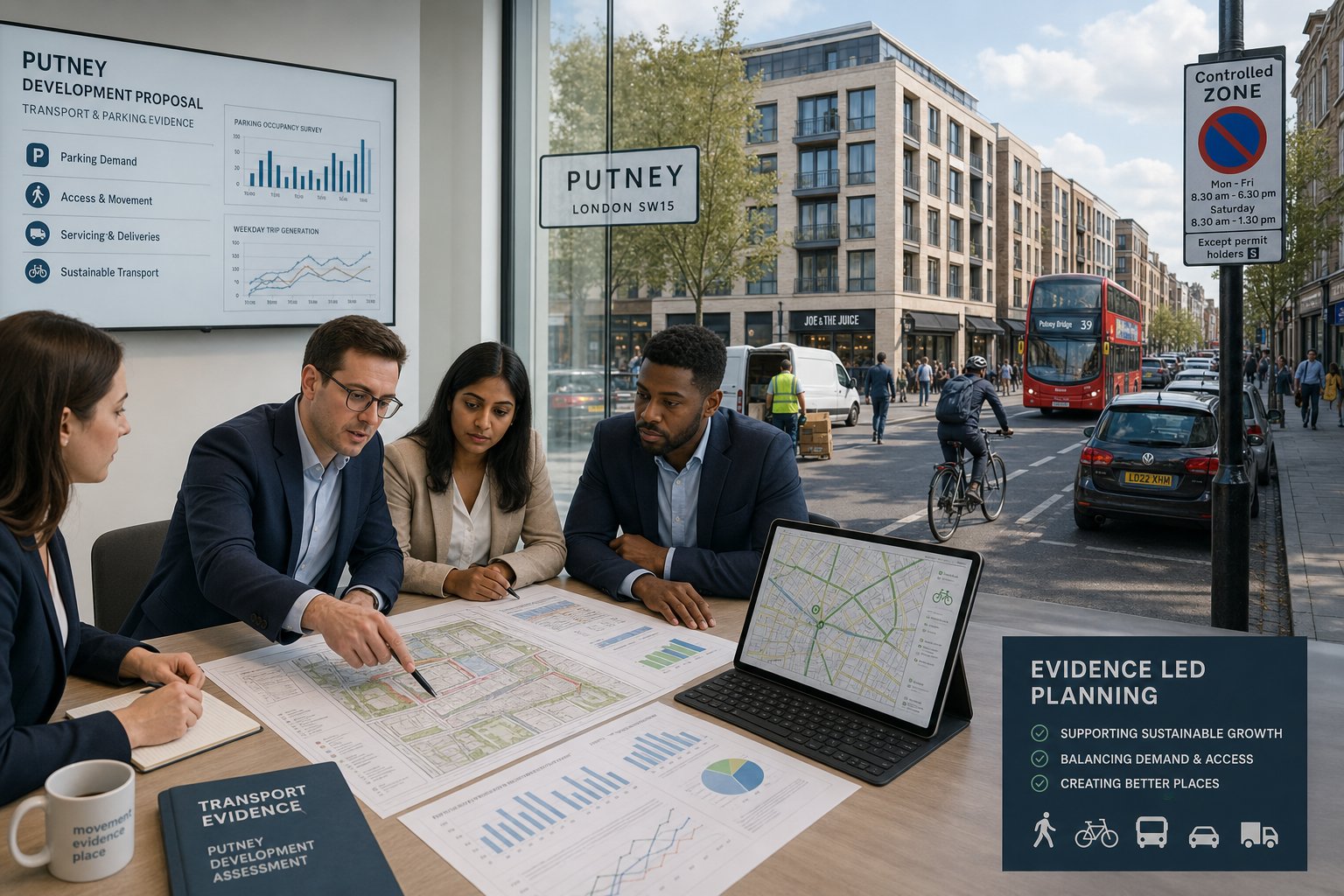
How Traffic Surveys And Local Authority Requirements Shape Reports
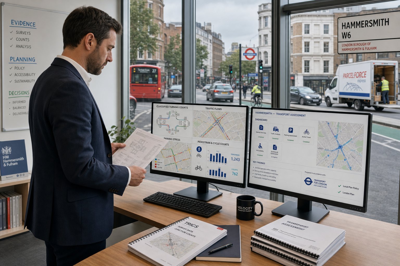
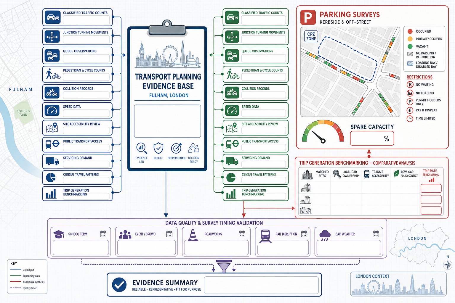
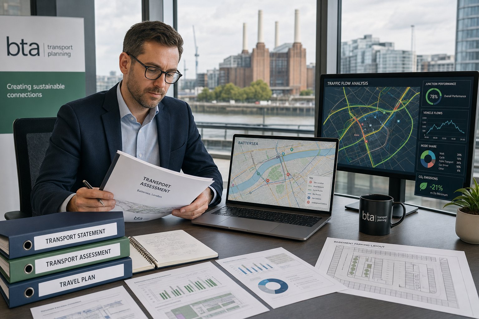
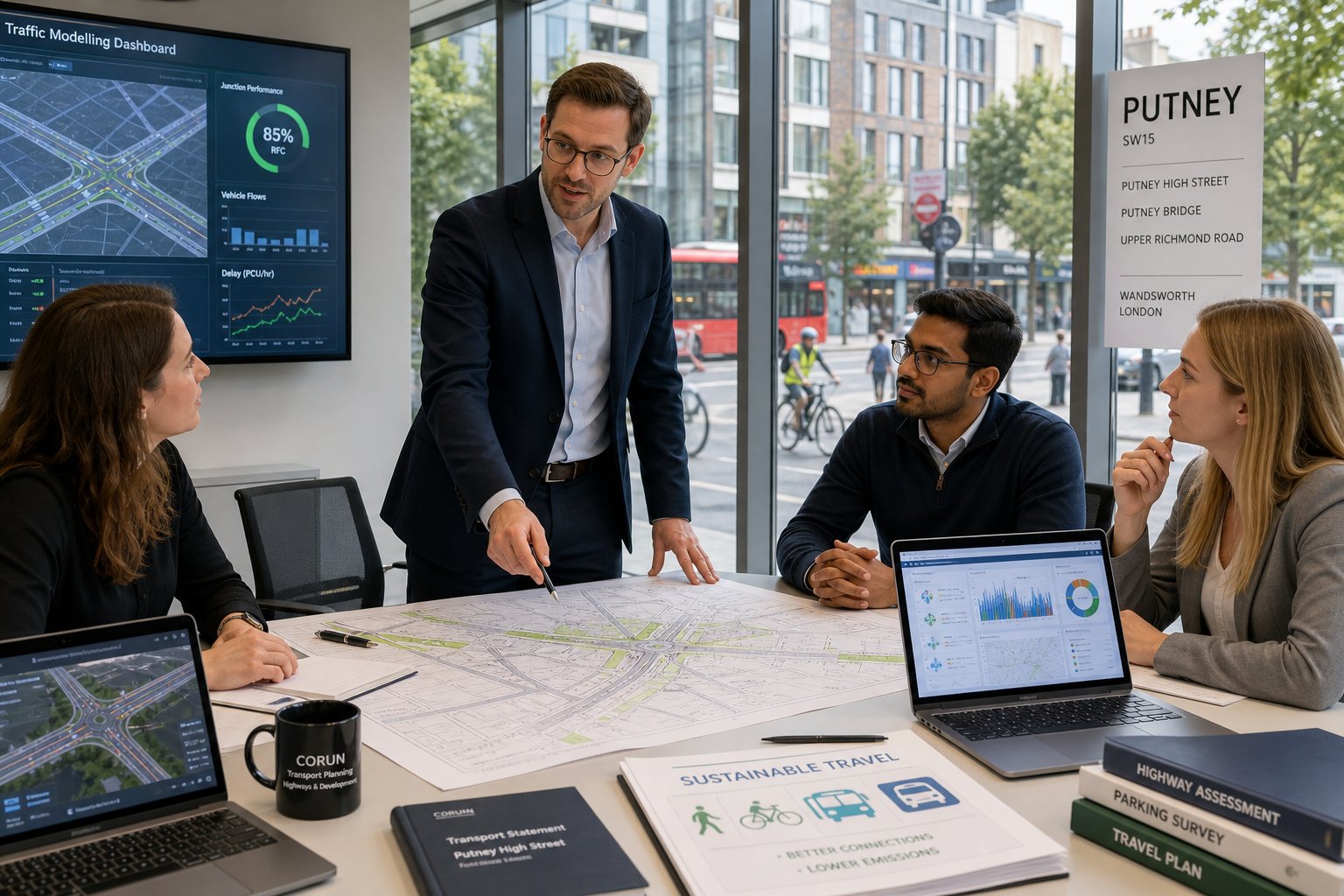
Good transport reporting starts with good evidence. In Hammersmith, that often means surveys are not a formality: they are the foundation of the planning case. The right survey programme depends on the site and the questions likely to be asked, but common inputs include classified turning counts at nearby junctions, automatic traffic counts, parking beat surveys, loading observations, pedestrian and cycle counts, and sometimes public transport or bus stop observations.
Why does that matter? Because assumptions are quickly exposed when a scheme is tested against local reality. If parking stress is being debated, survey data needs to capture the right streets, the right time periods and a representative day. If servicing is under scrutiny, broad statements about “low delivery demand” will not carry much weight without operational evidence. If junction effects are relevant, turning count quality and forecasting assumptions become central to credibility.
In our experience, Hammersmith reports work best when survey design is tied to the planning question from the outset. We do not simply gather data because transport reports usually contain data. We gather the evidence needed to address the likely concerns of case officers, highways teams and, where relevant, TfL. That keeps reports concise while still robust.
Local authority requirements shape the process just as much as the raw numbers. Validation expectations, borough transport policies, London Plan requirements and TfL guidance influence the scope, methodology and mitigation strategy. One scheme may only need a proportionate statement with parking and servicing analysis. Another may require a broader assessment package because of scale, location or strategic road implications. Knowing that distinction early can save weeks.
This is where experience helps. Over the years, we have found that faster reporting does not come from cutting corners: it comes from scoping correctly, commissioning the right surveys first time, and writing with the authority’s decision-making framework in mind. For applicants, that means fewer rounds of avoidable clarification and a smoother route through the planning process.
And while every borough has its own nuances, the discipline is consistent: survey-backed analysis, policy-aware reporting and practical mitigation. That is the combination most likely to move a Hammersmith application forward.
Conclusion
In Hammersmith, transport planning has to do more than fill a validation checklist. It has to show, with evidence, that a development can operate safely, fit within a constrained network and support broader policy goals around sustainable movement, street quality and reduced road danger.
That is why the role of a Traffic Engineer in Hammersmith is so important. We help development teams quantify impacts, resolve access and servicing issues, shape parking strategy, support walking and cycling objectives, and prepare reports that stand up to borough and TfL scrutiny. For architects, planners, lawyers, surveyors, builders, developers and councils, the real benefit is not just technical compliance. It is confidence that the transport case reflects how Hammersmith actually works.
When that happens, planning submissions tend to move more efficiently. The evidence is clearer, the design is more credible, and the conversation with the authority becomes much more productive.
Frequently Asked Questions About Traffic Engineers in Hammersmith
Why is appointing a Traffic Engineer important for developments in Hammersmith?
A Traffic Engineer in Hammersmith ensures new developments operate safely and align with local and London transport policies by addressing impacts on congestion, kerbside pressure, pedestrian safety, and sustainable travel. Early appointment helps avoid delays and redesigns during planning.
What types of projects in Hammersmith typically require a Traffic Engineer’s input?
Projects needing traffic engineering include residential, mixed-use, and commercial developments, as well as change of use, refurbishments, and estate optimisations. Even modest schemes near junctions or within Controlled Parking Zones may require transport assessments linked to local network constraints.
What transport documents can a Traffic Engineer prepare for a Hammersmith planning application?
Traffic Engineers prepare Transport Statements and Assessments covering trip generation and network impacts, Travel Plans promoting sustainable travel, and detailed delivery, servicing, parking, and access appraisals tailored to site conditions and local authority expectations.
How do Traffic Engineers address parking and servicing challenges in Hammersmith?
They analyse kerbside competition, conduct parking beat surveys, and design servicing strategies including swept-path vehicle tracking. This ensures realistic loading arrangements and parking solutions that meet strict Controlled Parking Zone rules and minimise conflicts with buses and pedestrians.
How do walking, cycling, and bus links influence traffic engineering in Hammersmith?
Given Hammersmith’s high pedestrian and bus use, Traffic Engineers assess safe crossing points, cycle parking quality, and impacts on bus stop operation. They ensure developments support Healthy Streets principles and maintain safety around high-footfall areas and key junctions.
What role do traffic surveys play in supporting planning submissions in Hammersmith?
Surveys like classified turning counts, pedestrian and cycle counts, and parking observations provide essential evidence to reflect real local conditions. This data helps tailor reports to address borough and TfL requirements, ensuring credible and efficient planning approvals.