Planning risk in London rarely comes from one big mistake. More often, it comes from a string of smaller issues that should have been dealt with early: an access that doesn’t quite work, parking assumptions that don’t fit the local CPZ, servicing that hasn’t been tracked properly, or a transport statement that looks generic rather than site-specific. In Willesden, those details matter.
A traffic engineer in Willesden helps development teams turn transport from a potential objection into a properly evidenced part of the planning case. That means reviewing access, parking, servicing, road safety, trip generation, sustainable travel opportunities, and the likely effect on nearby streets and junctions. It also means understanding Brent’s planning context, the London Plan, and the day-to-day realities of local movement patterns.
For architects, planners, surveyors, lawyers, developers and local authority teams, the value is practical. Strong transport input can shape a scheme before drawings are fixed, reduce back-and-forth during validation and consultation, and give officers confidence that impacts have been tested proportionately. Weak input tends to do the opposite.
In this guide, we set out what a traffic engineer in Willesden actually does, which planning applications usually need transport evidence, how reports are prepared, and what Brent is likely to expect in 2026. The aim is simple: clearer decisions, fewer surprises, and better-prepared applications.
Key Takeaways
- A traffic engineer in Willesden ensures transport considerations support planning applications by providing site-specific, evidence-based input on access, parking, servicing, and road safety.
- Early engagement with a traffic engineer reduces planning risks by identifying transport issues before submission, saving time and avoiding objections.
- Transport reports in Willesden must reflect local policies including Brent’s Local Plan and the London Plan, emphasising sustainable travel, road safety, and inclusive access.
- Common planning applications needing traffic engineering evidence include residential, mixed-use, retail, education, and healthcare developments, especially those affecting local transport networks.
- Accurate survey data, realistic trip generation, and clear, coordinated reporting aligned with local expectations are critical to avoid delays or challenges to transport assessments.
- Choosing a traffic engineer with local authority experience, strong technical skills, and clear communication is essential for successful Willesden planning applications.
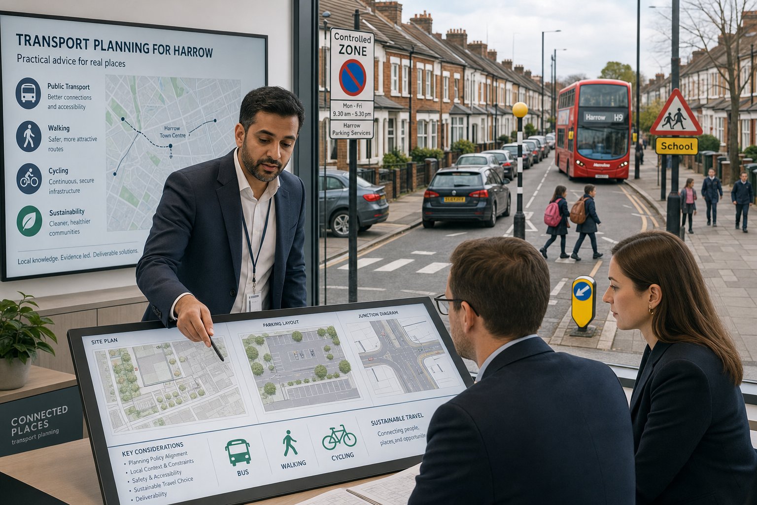
What A Traffic Engineer In Willesden Does For Development Projects
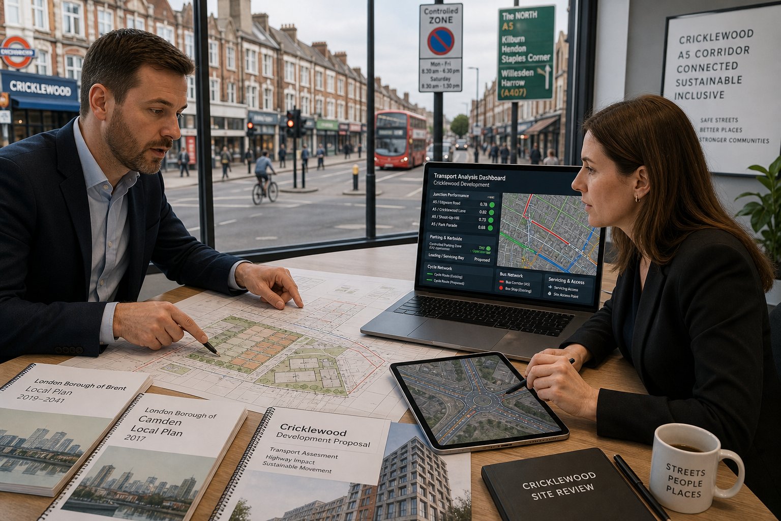
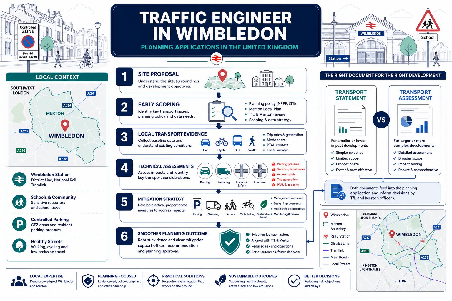
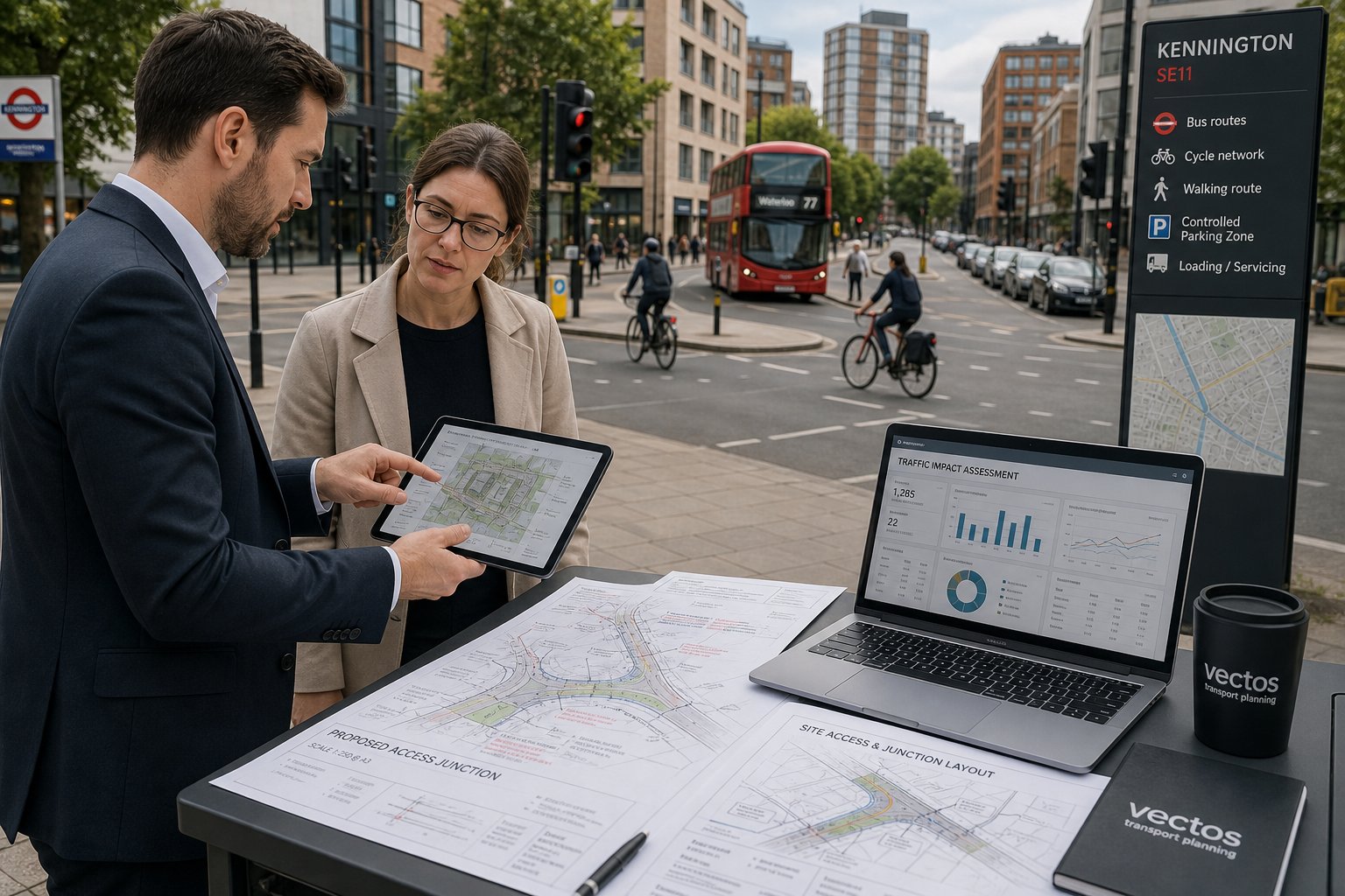
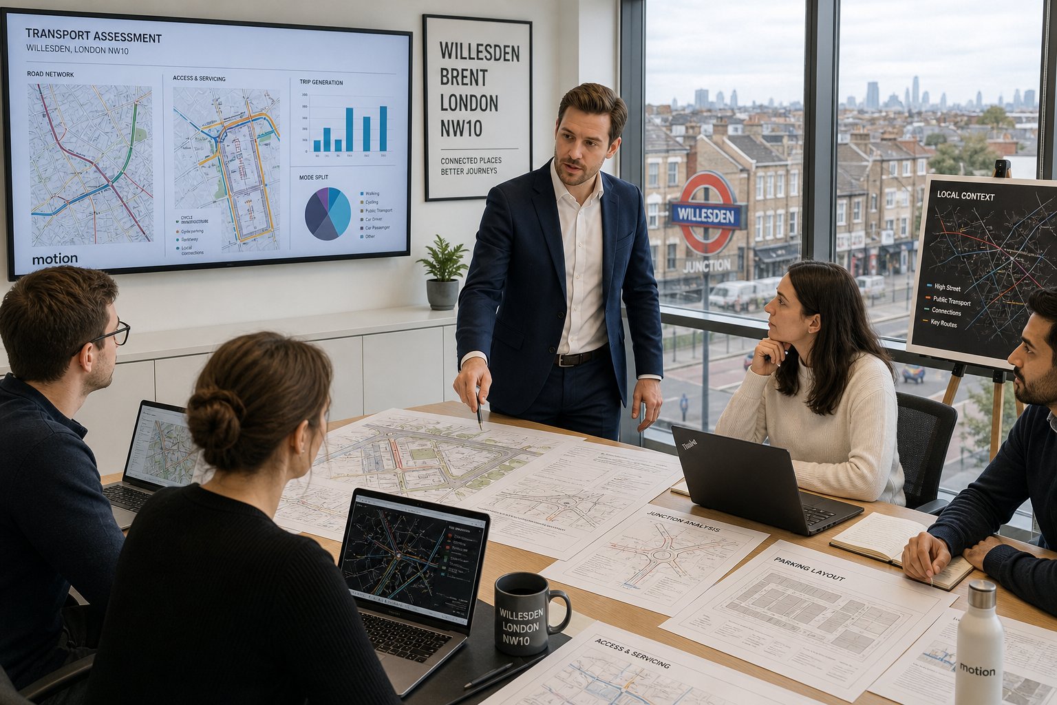
A traffic engineer in Willesden supports the planning process from the first feasibility review through to submission, consultation, and sometimes appeal. Our role is part technical, part strategic. We test whether a proposal can function safely and lawfully on the transport side, then present that case in a form the local authority can rely on.
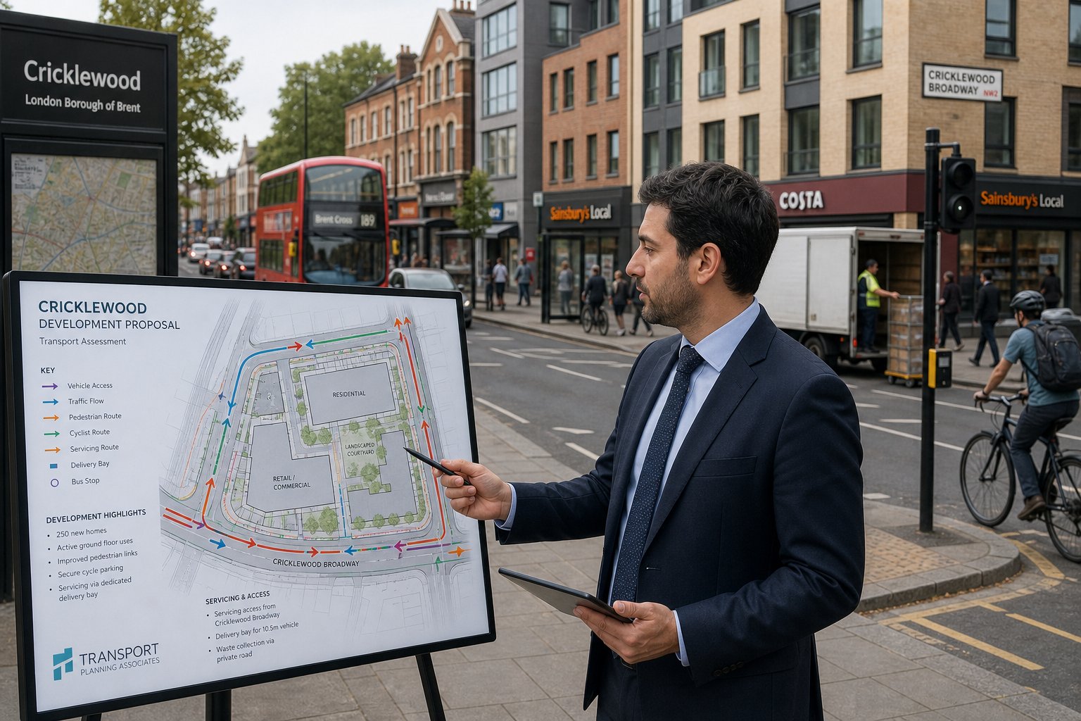
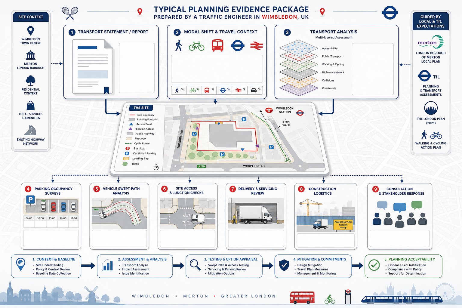
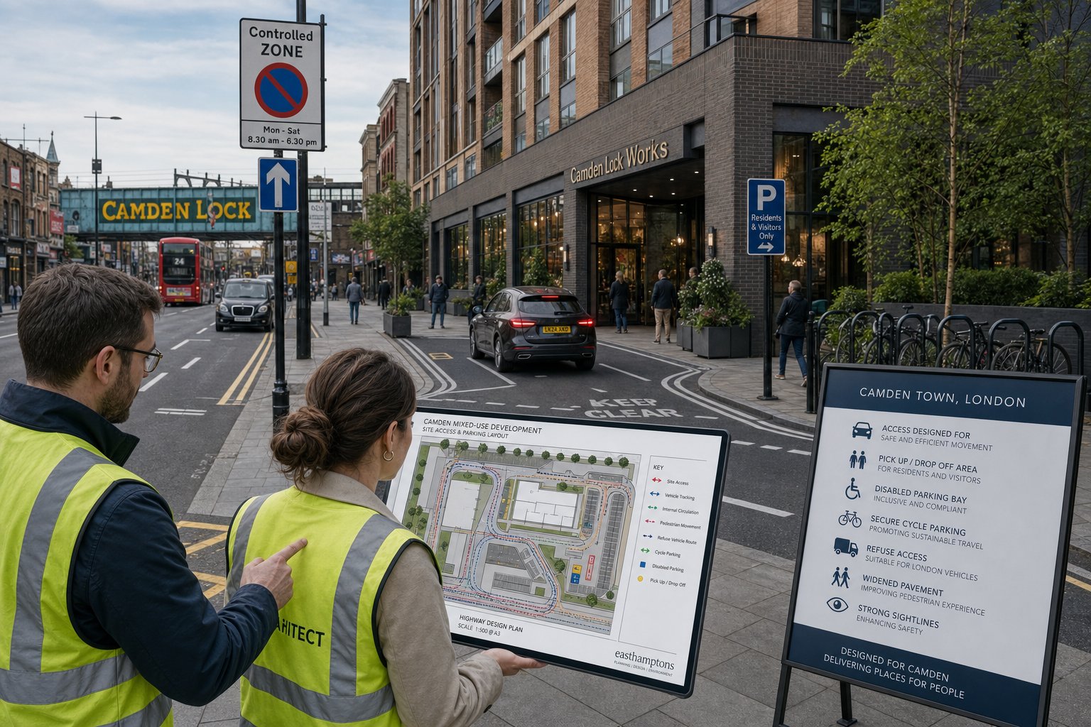
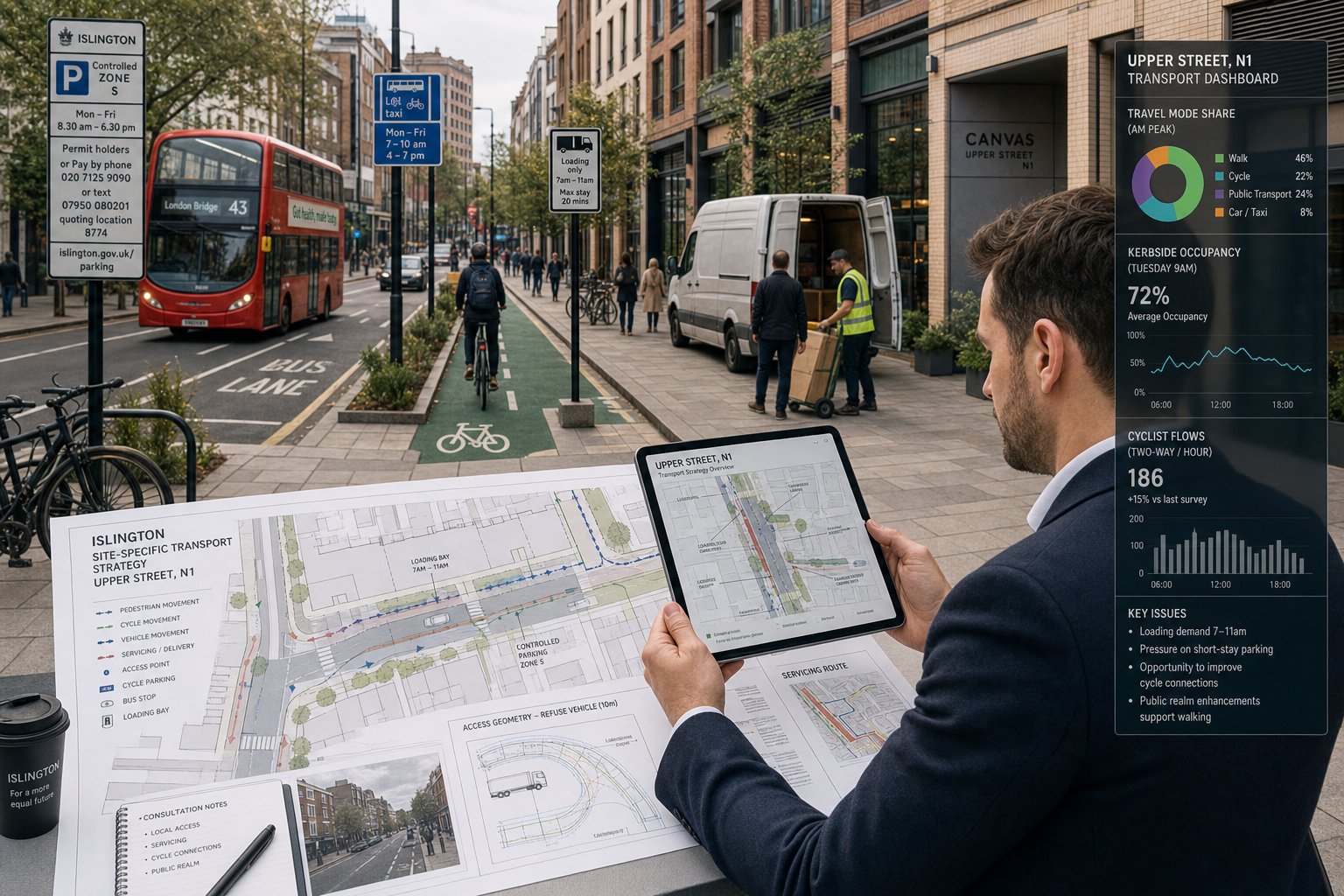
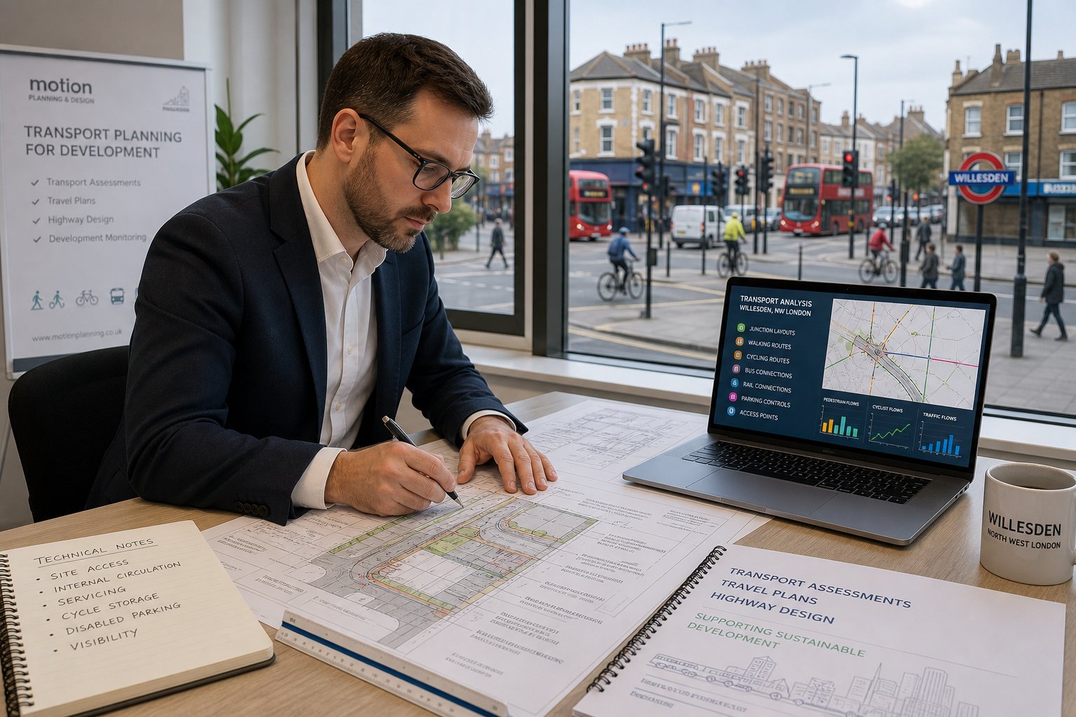
In practice, that starts with the site itself. We review the surrounding highway network, nearby junctions, walking and cycling routes, bus and rail access, local parking controls, servicing opportunities, and any obvious safety constraints. We then look at the proposed layout: access points, internal circulation, refuse collection, cycle storage, disabled parking, delivery arrangements, and visibility. If something is likely to cause concern later, we’d rather identify it early.
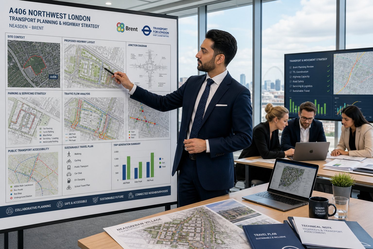
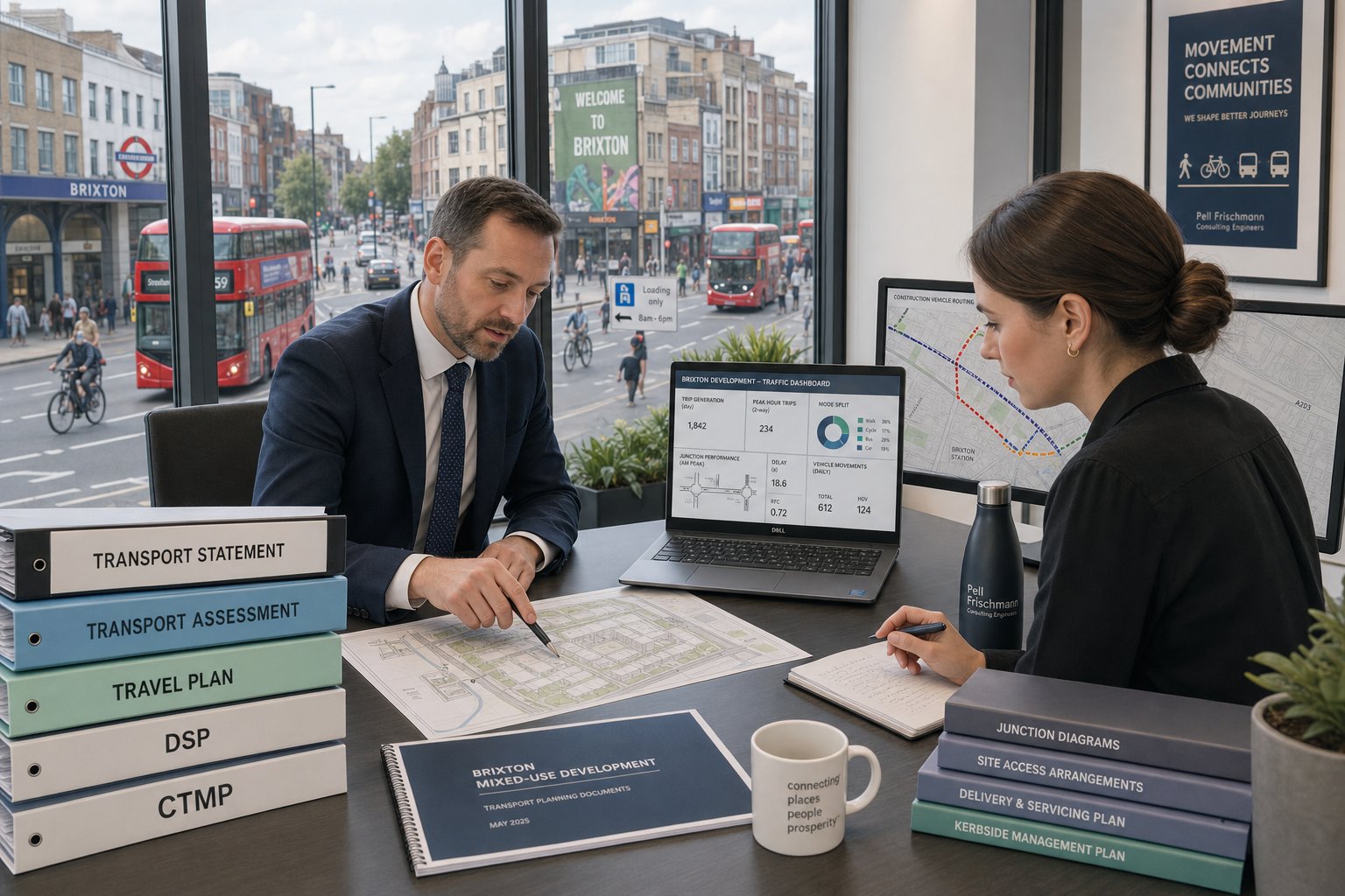
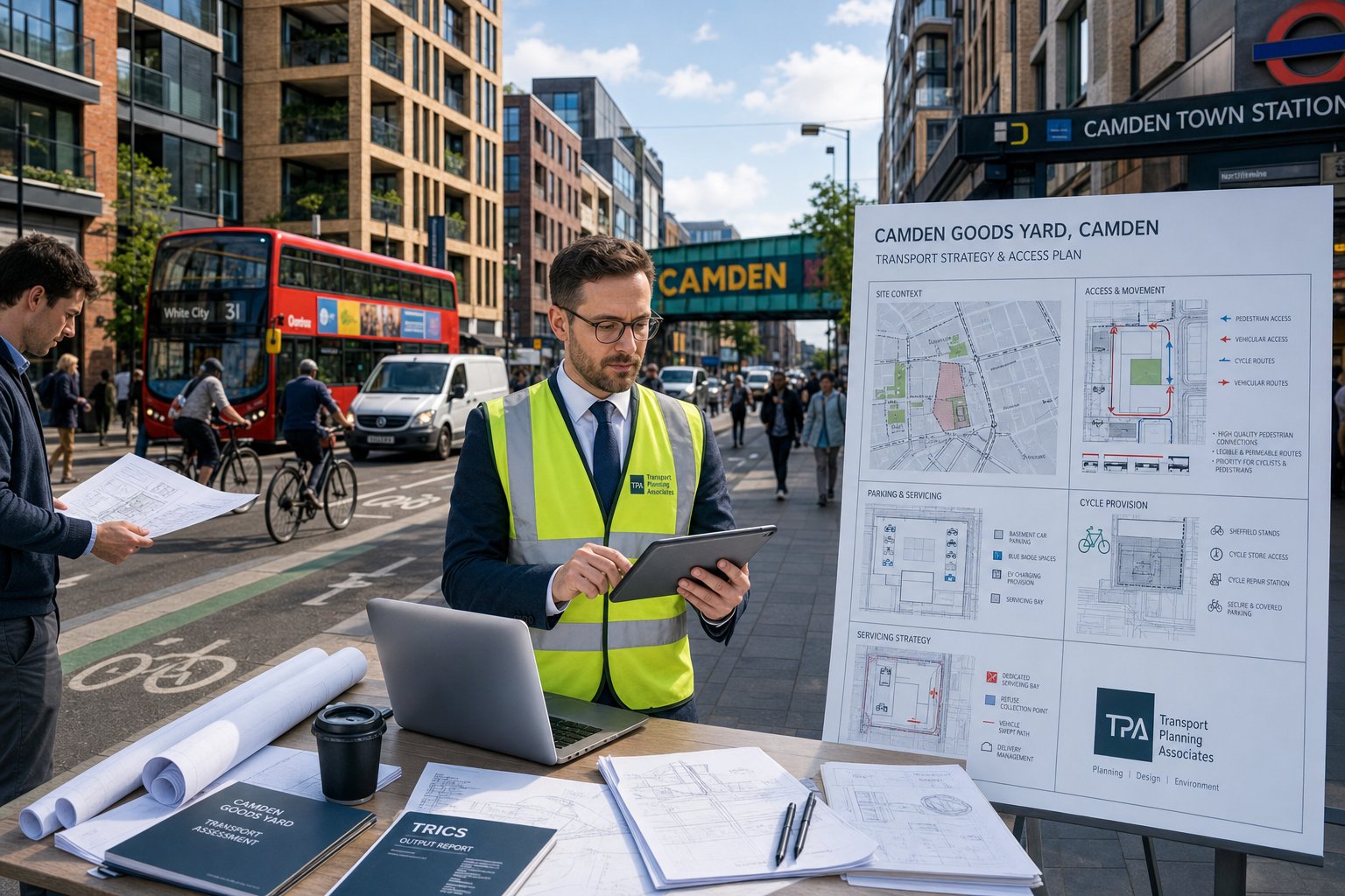
The reporting side is just as important. Depending on the scale and sensitivity of the scheme, we may prepare a Transport Assessment, Transport Statement, Travel Plan, Delivery and Servicing Plan, or supporting technical notes. On some projects, that extends into highway design work and support for Section 278 or Section 38 matters. Broader Traffic Engineering: Your principles sit behind all of this, but the key is always proportionality.
For development teams, good traffic input is not just about “producing a report”. It is about reducing uncertainty. A transport issue discovered after submission is expensive. One resolved during design is usually manageable.
Why Willesden Developments Need Local Transport Planning Input
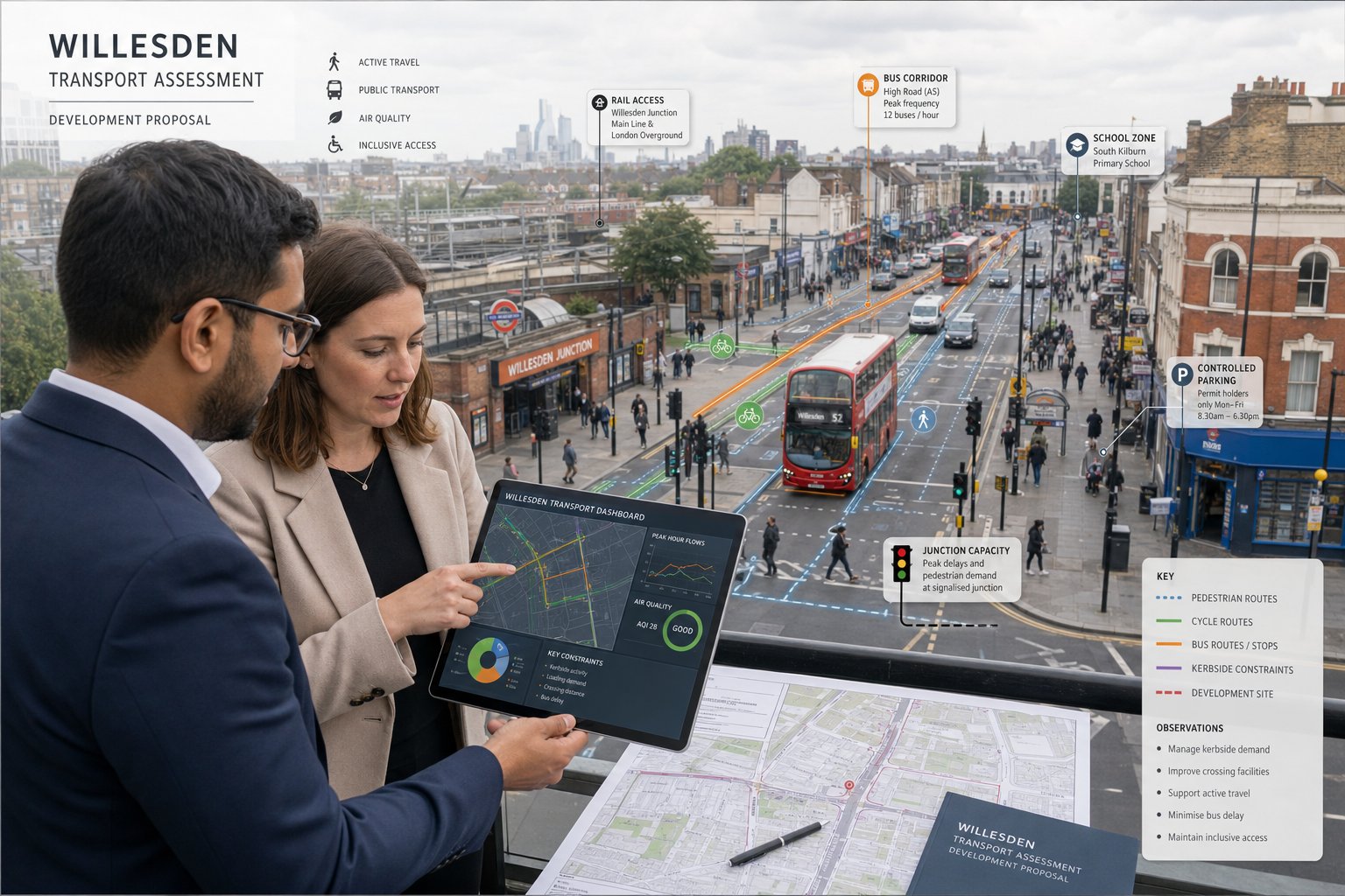
Willesden is not a place where generic assumptions travel well. The area sits within a dense and varied part of Brent, with a mix of town centre activity, residential streets, bus corridors, rail access, controlled parking zones, schools, and roads that are already under pressure at peak times. A report that might pass in a less constrained location can feel thin very quickly here.
Local transport planning input matters because planning decisions are made in a local context, even when the policy framework is regional or national. Brent officers will want to know how a scheme fits the London Plan, the Brent Local Plan, local parking conditions, and wider objectives around active travel, road danger reduction, air quality, and inclusive access. That takes more than standard wording.
It also helps to understand where the real pressure points are. Some sites look straightforward on a plan but are affected by school drop-off activity, constrained kerbside space, awkward servicing movements, or nearby junctions that are already sensitive. A localised review can highlight where surveys should focus and whether mitigation needs to be built in from the outset.
We often find that teams benefit from this early filter. It keeps transport advice realistic and avoids over- or under-scoping. For projects that sit within a wider London development pattern, experience from a Traffic Engineer In London: context is useful, but Willesden still needs its own evidence base.
Planning Applications That Commonly Require Traffic Engineering Evidence
Not every planning application needs a full transport package, but many more require technical transport input than applicants first assume. The trigger is not only size. Sensitivity, location, and operational change matter just as much.
Larger residential proposals are a common example: flatted schemes, HMOs, purpose-built rental, student-style accommodation, and estate infill can all raise questions around parking demand, servicing, cycle provision, and access design. Mixed-use schemes add another layer because residential, commercial, and servicing patterns don’t always sit comfortably together.
Retail, leisure, education, healthcare, industrial and employment uses also frequently need traffic engineering evidence. A modest floorspace increase can still generate noticeable delivery activity or change peak demand patterns. Schools and healthcare projects, in particular, tend to attract scrutiny because pick-up, drop-off, taxi use, and accessible parking all need careful thought.
Then there are proposals that look small but alter something fundamental: a new access onto a classified road, loss of turning space, basement parking served by a tight ramp, or a change that affects a known collision location. In those cases, Brent may reasonably ask for evidence even where floor area alone would not suggest it.
Many clients first speak to us through wider Traffic Engineering Consultants: support, then narrow the scope once the planning route becomes clear. That tends to save time compared with waiting for objections.
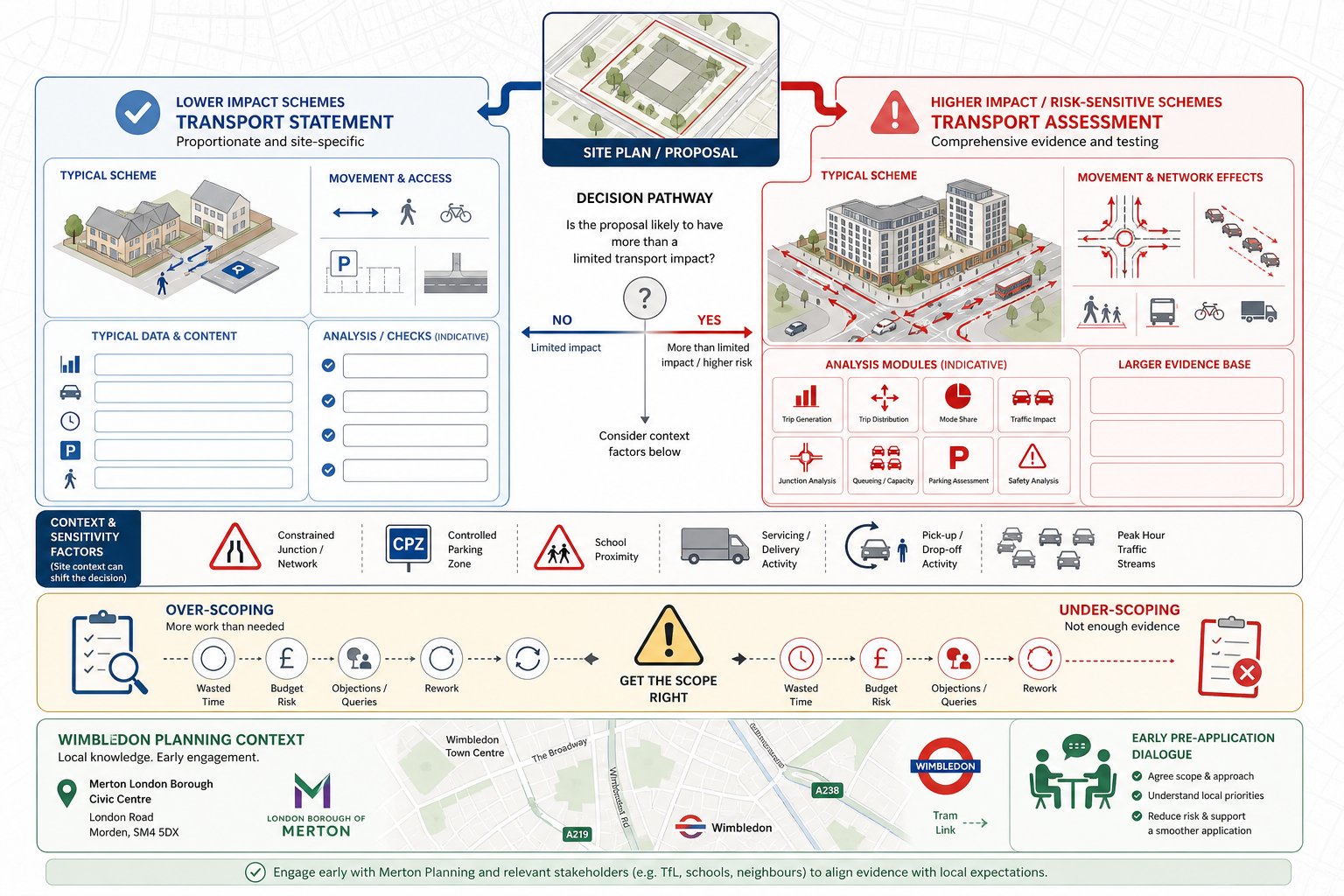
Transport Assessments, Transport Statements, And Travel Plans Explained
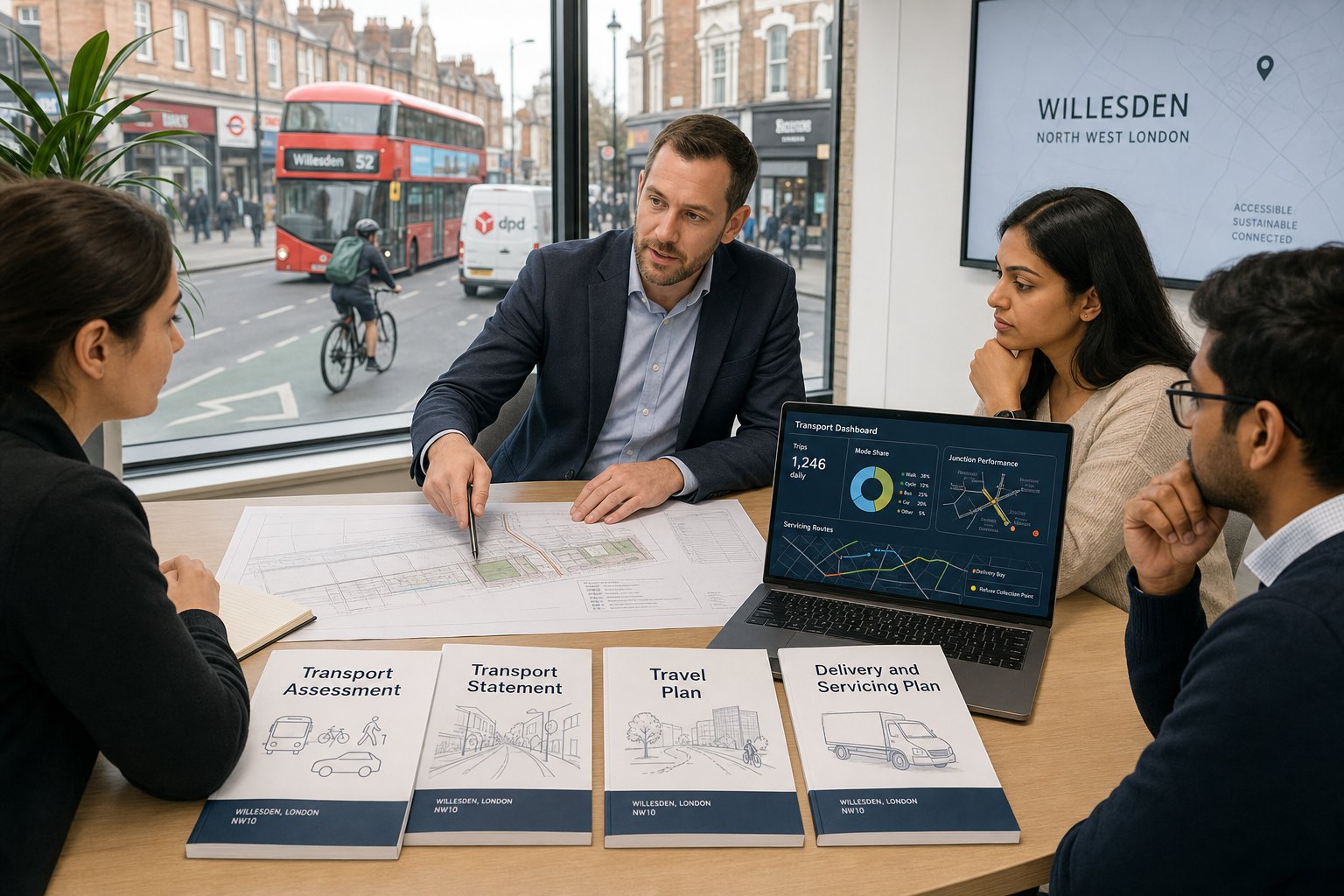
These documents are often mentioned together, but they serve different functions.
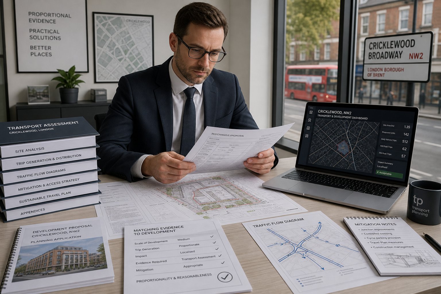
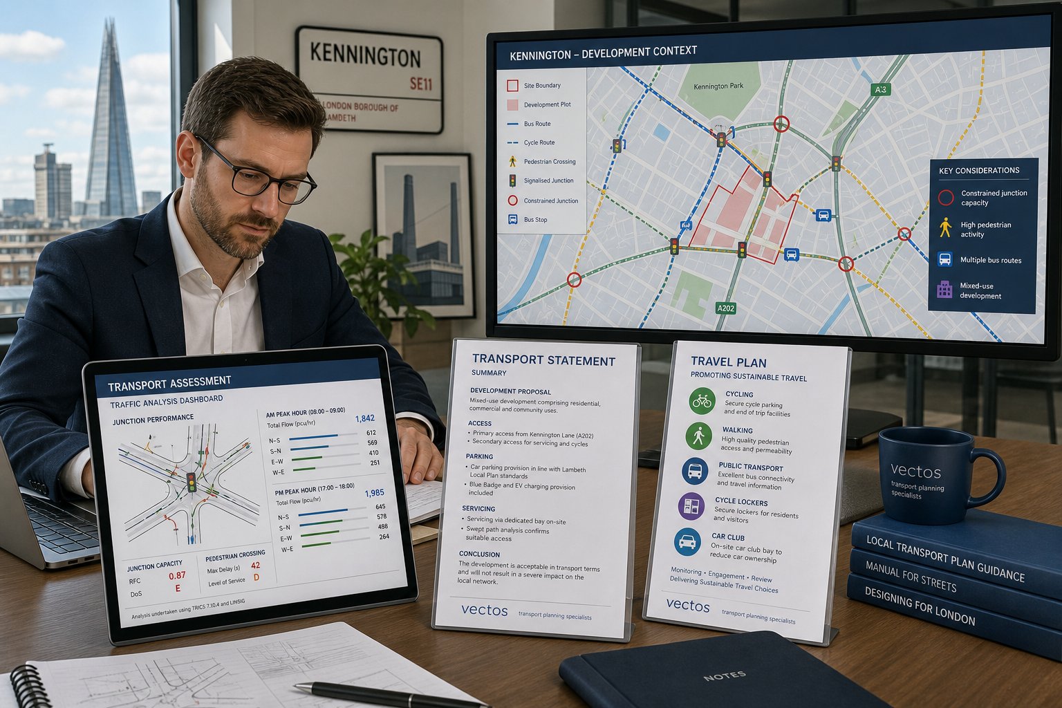
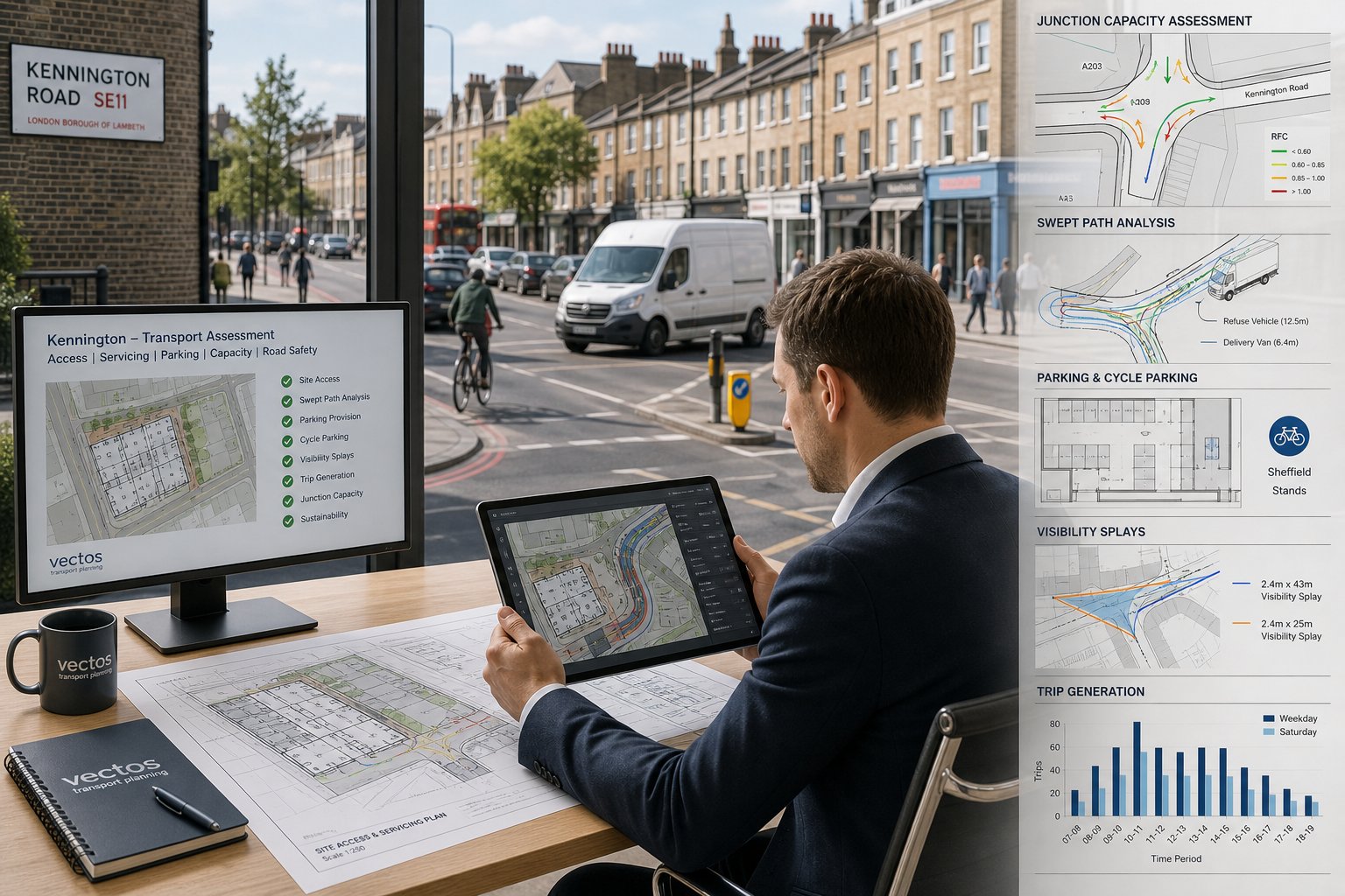
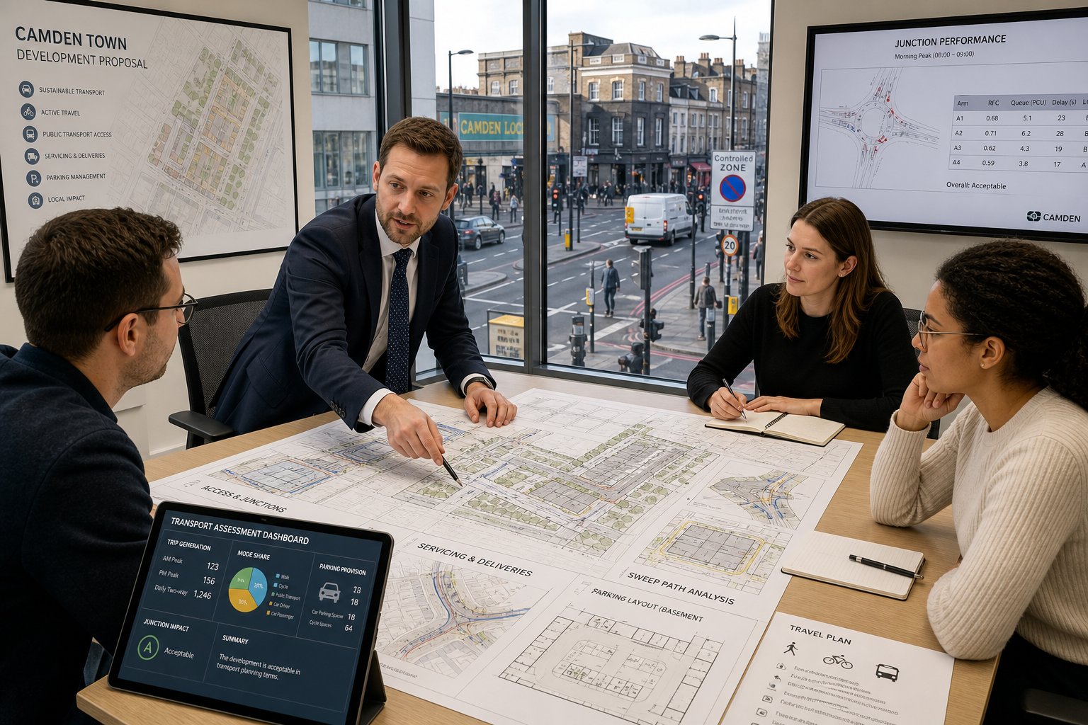
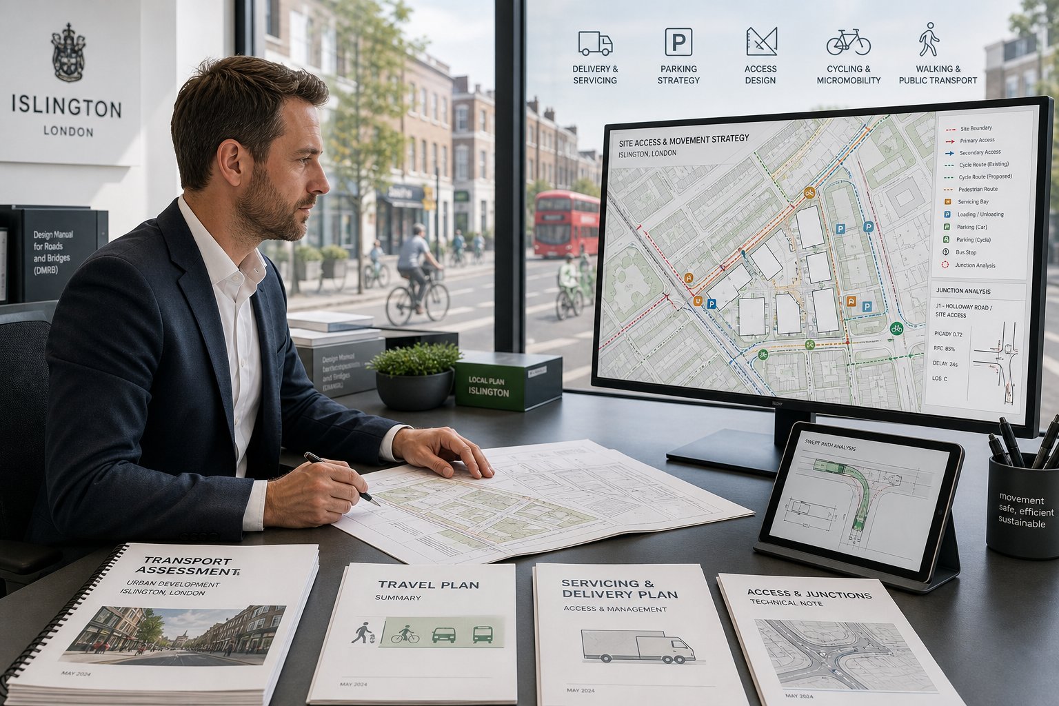
A Transport Assessment (TA) is the more detailed option. It is typically used for larger schemes, more complex sites, or proposals that may have a material impact on the surrounding transport network. A TA considers existing conditions, likely trip generation, mode share, accessibility, parking, servicing, road safety, and junction or network effects. It usually includes survey data and, where appropriate, modelling.
A Transport Statement (TS) is shorter and more proportionate. It is still technical, but it suits smaller or less impactful proposals where a full TA would be unnecessary. A strong TS is not a watered-down TA: it is a focused explanation of why impacts are limited and manageable.
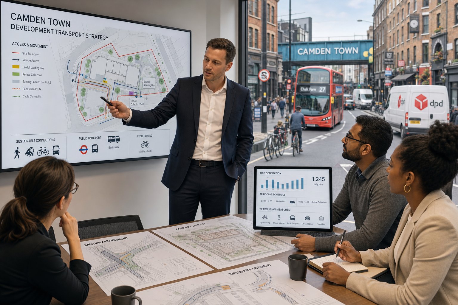
A Travel Plan (TP) is different again. It is a strategy document designed to influence how people travel to and from a site. On residential projects, that may involve cycle provision, public transport information, car club membership, welcome packs, and monitoring measures. On commercial schemes, it may also cover staff travel, coordinator roles, targets, and review mechanisms. In Brent, Travel Plans are often tied to conditions or legal agreements where mode shift is important.
For development teams working across sectors, the same logic appears in Commercial Traffic Engineering: match the evidence to the scale of impact, not just the name of the scheme.
When A Delivery And Servicing Plan May Also Be Needed
A Delivery and Servicing Plan becomes important when a development generates regular freight, refuse, courier, maintenance, or management vehicle activity. Mixed-use blocks, offices, supermarkets, student housing, and dense residential schemes are common examples.
The purpose is straightforward: to show that deliveries and servicing can happen without unsafe reversing, blocked footways, unreliable kerbside arrangements, or conflict with general traffic and vulnerable road users. A good plan identifies likely vehicle types, arrival patterns, loading locations, management controls, and any off-site assumptions that need to be justified.
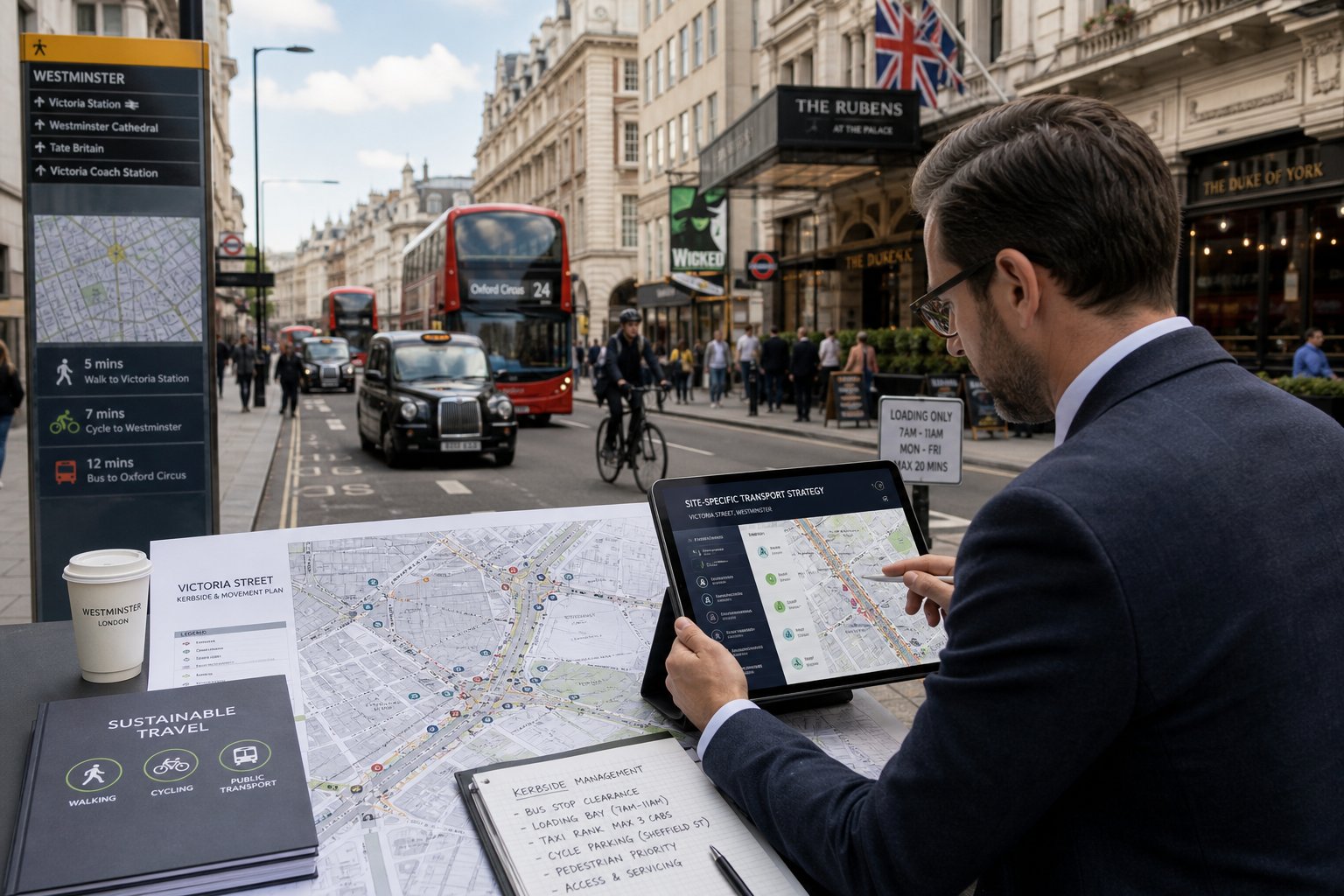
This is often where applications fall down. Teams may spend weeks refining parking numbers and then give servicing two paragraphs. But on constrained streets in Willesden, servicing can be the issue officers and neighbours focus on first.
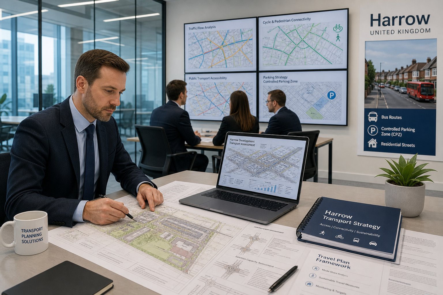
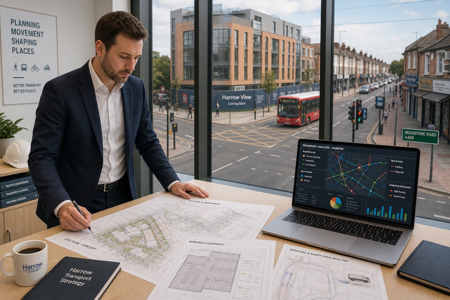
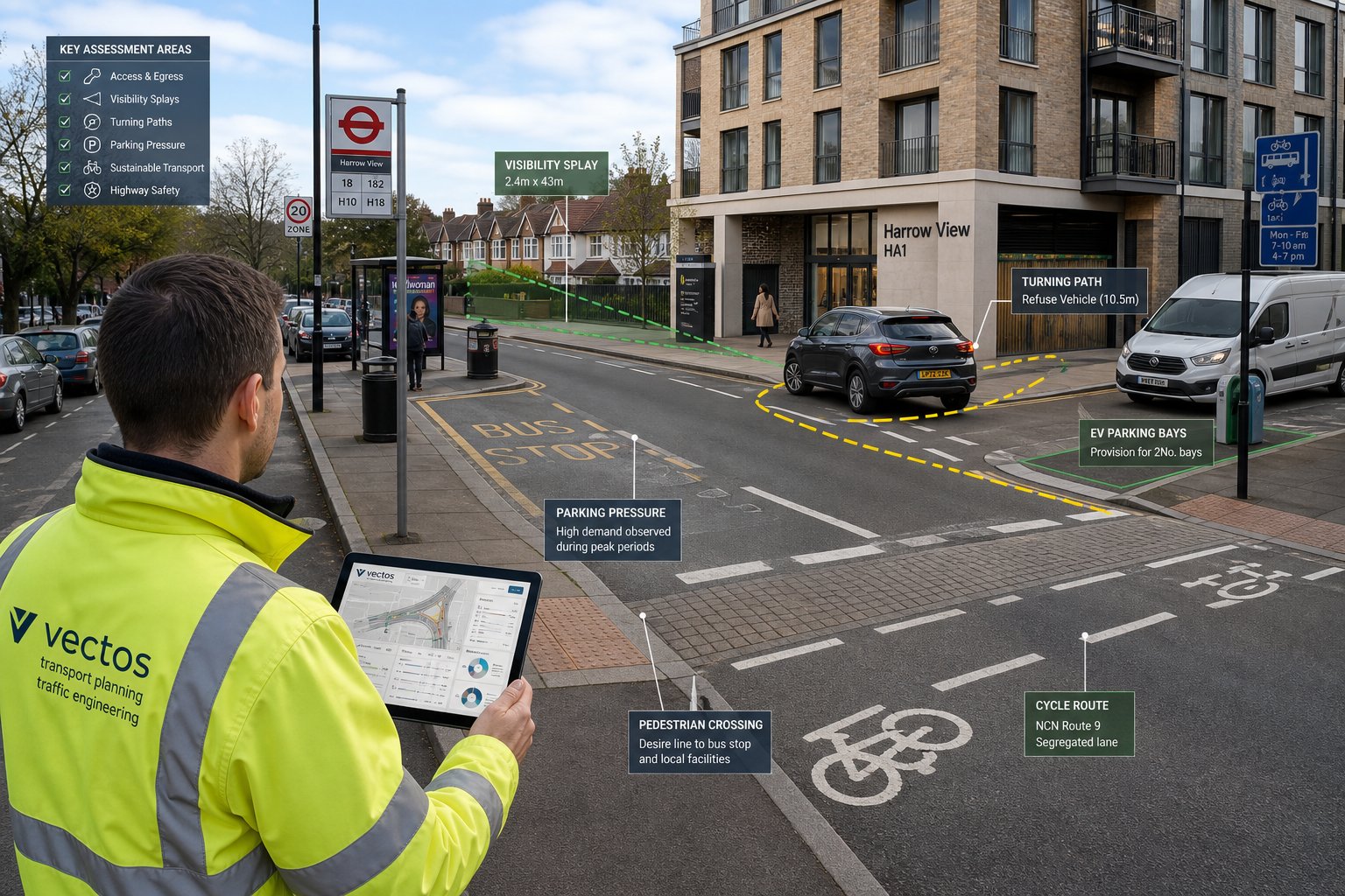
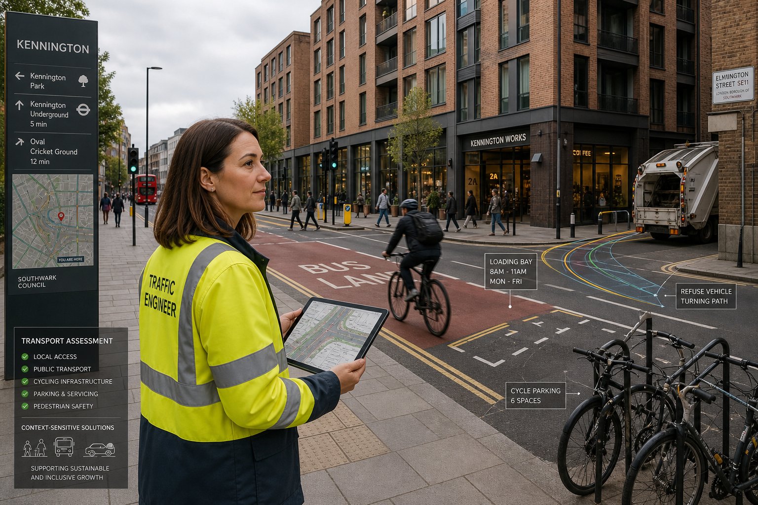
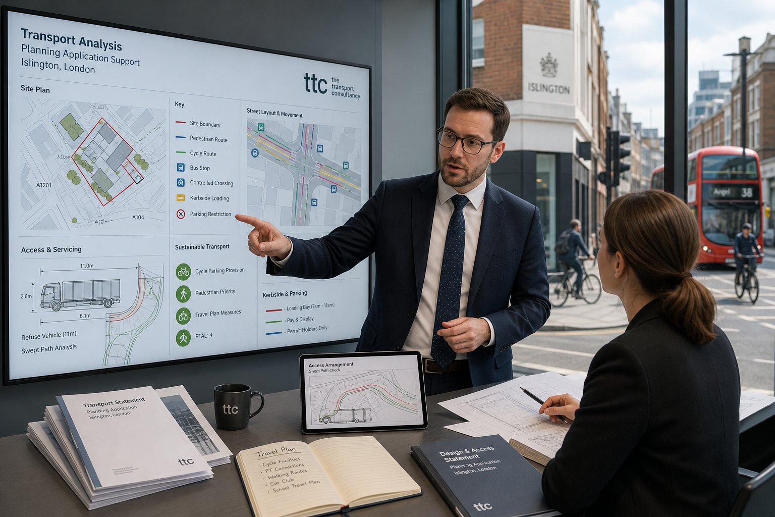
How Parking, Access, And Highway Safety Are Assessed
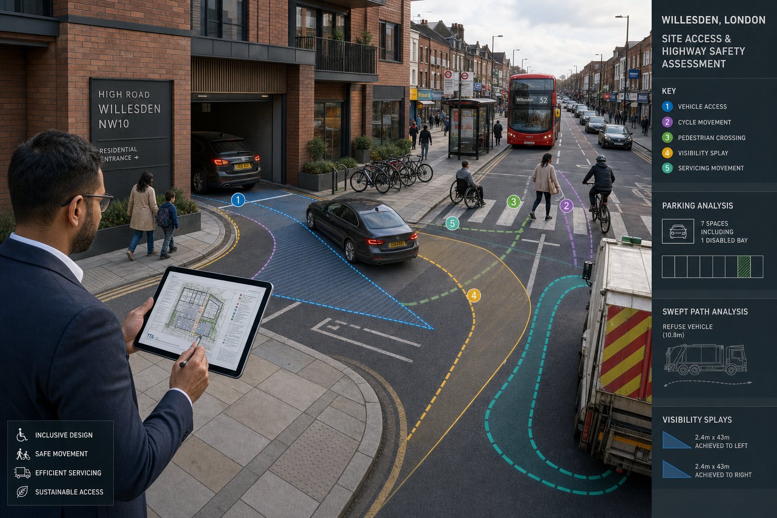
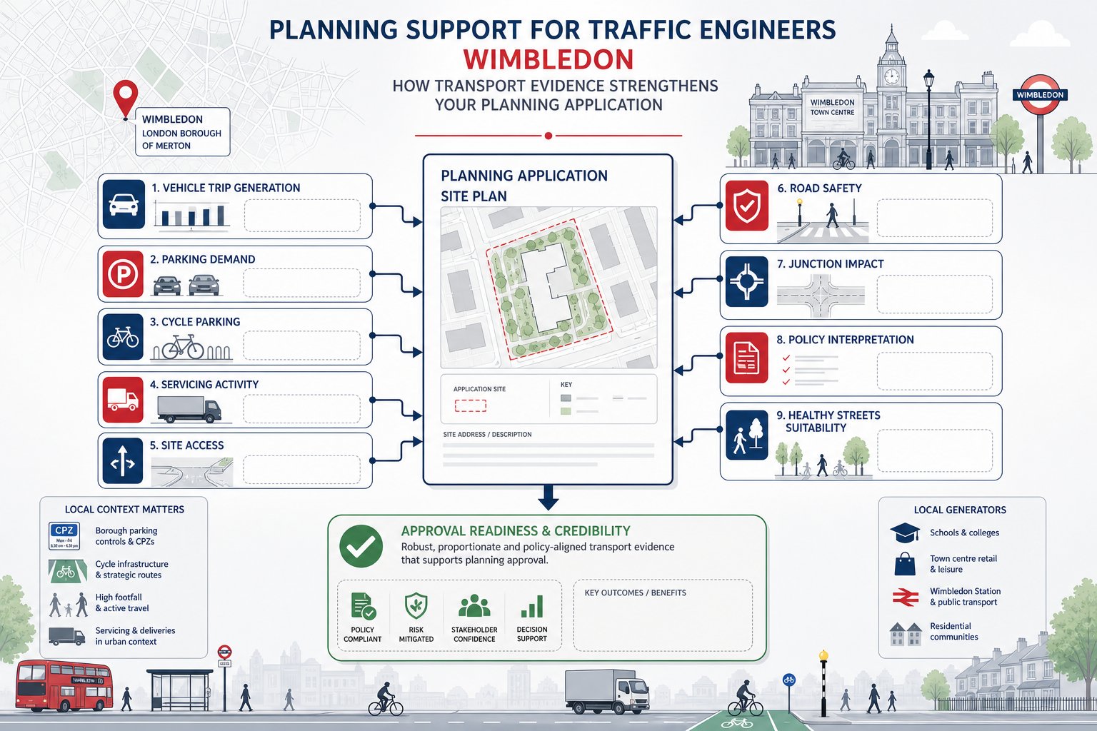
Parking, access, and highway safety are rarely standalone topics. In practice, they overlap. A parking layout that technically fits but creates awkward manoeuvres, poor visibility, or conflict with pedestrians is not a good planning outcome. The assessment has to look at how the whole arrangement operates in real life.
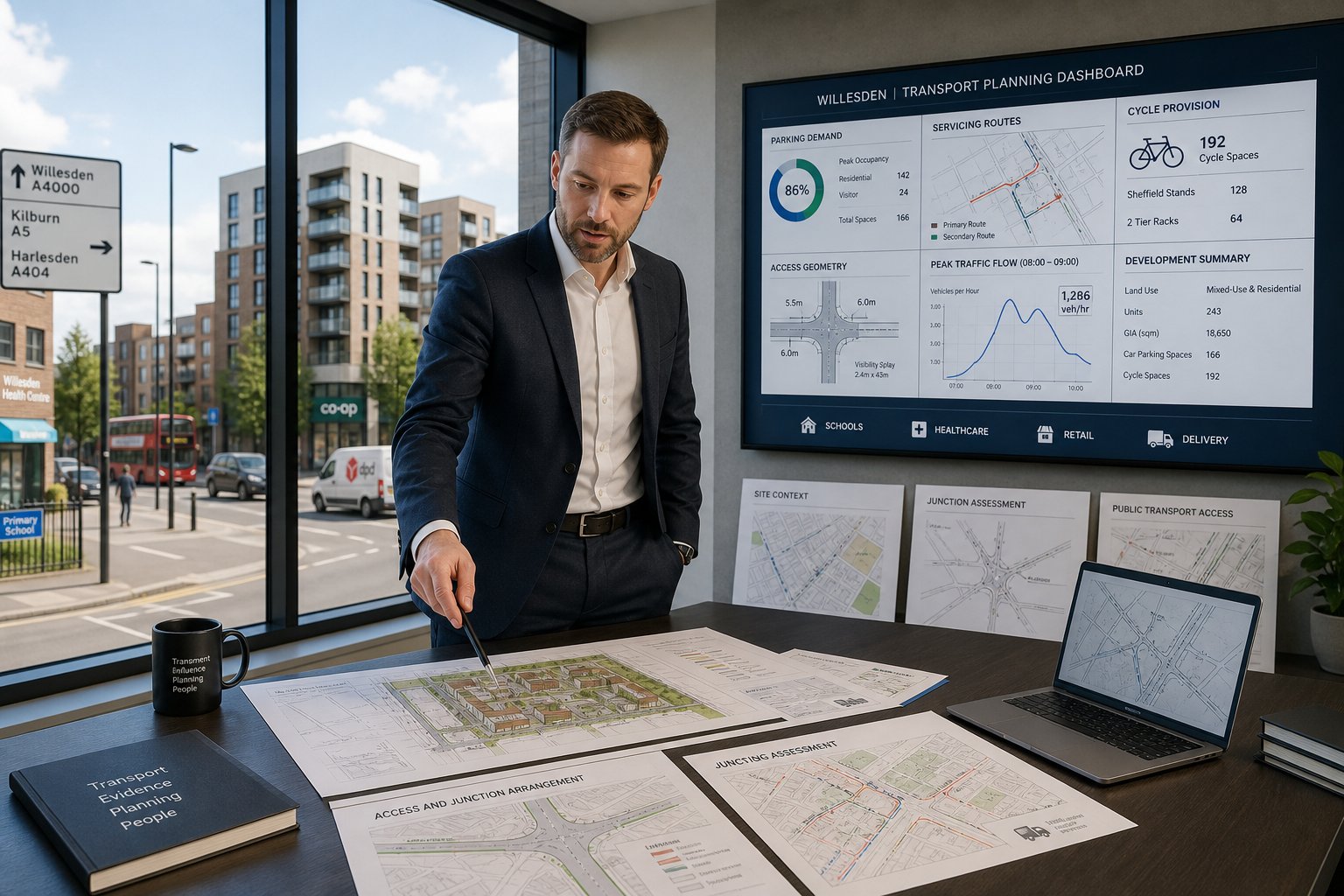
We usually begin with policy and context: London Plan parking standards, Brent’s local position, PTAL, nearby CPZ controls, blue badge demand, cycle parking expectations, and the likely level of car ownership for the proposed use. But standards are only the start. Existing stress on surrounding streets matters, especially where overspill parking could become a live issue.
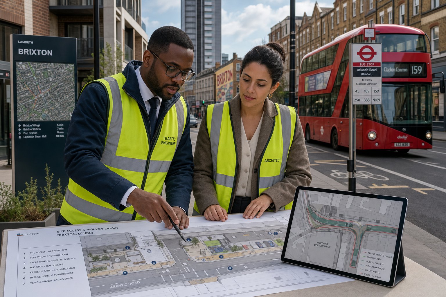
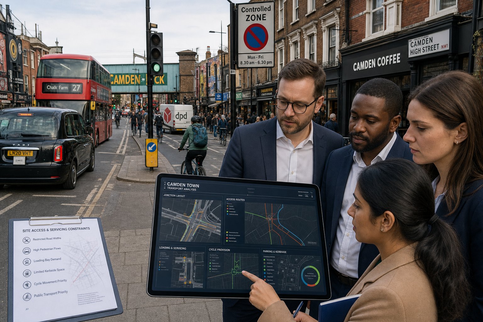
Access is then tested in geometric and operational terms. Can vehicles enter and leave safely? Are visibility splays acceptable? Is the gradient workable? Is there sufficient space for turning so that vehicles do not reverse onto the public highway? For servicing and refuse, swept path analysis often becomes essential.
Highway safety adds another evidence layer. We review collision records, road layout, pedestrian crossing desire lines, cycling conditions, frontage activity, and whether the proposal changes risk exposure. That can involve looking at school routes, bus stop interactions, and the experience of disabled users, not just private cars.
And this is where experienced scheme coordination matters. A Traffic Engineer In Manchester: or other city-based framework may use similar methods, but Willesden’s kerbside conditions and urban constraints often make the detail more decisive than the headline numbers.
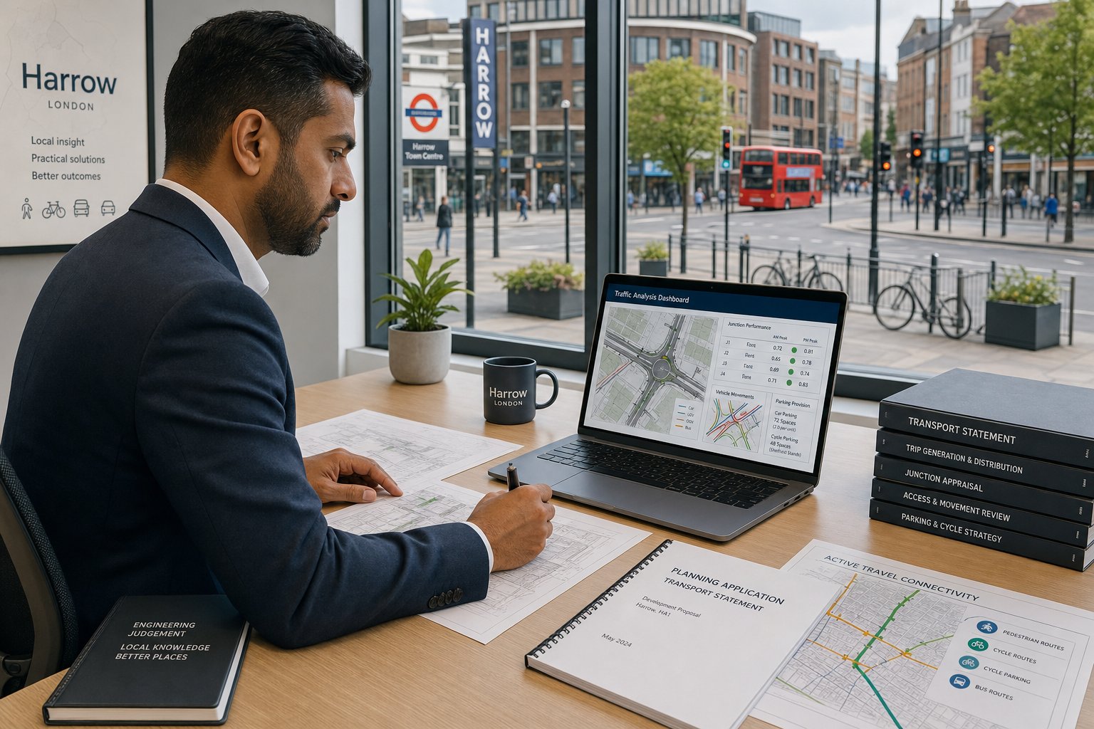
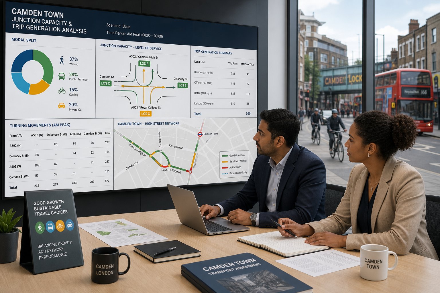
Junction Capacity, Trip Generation, And Traffic Impact Analysis
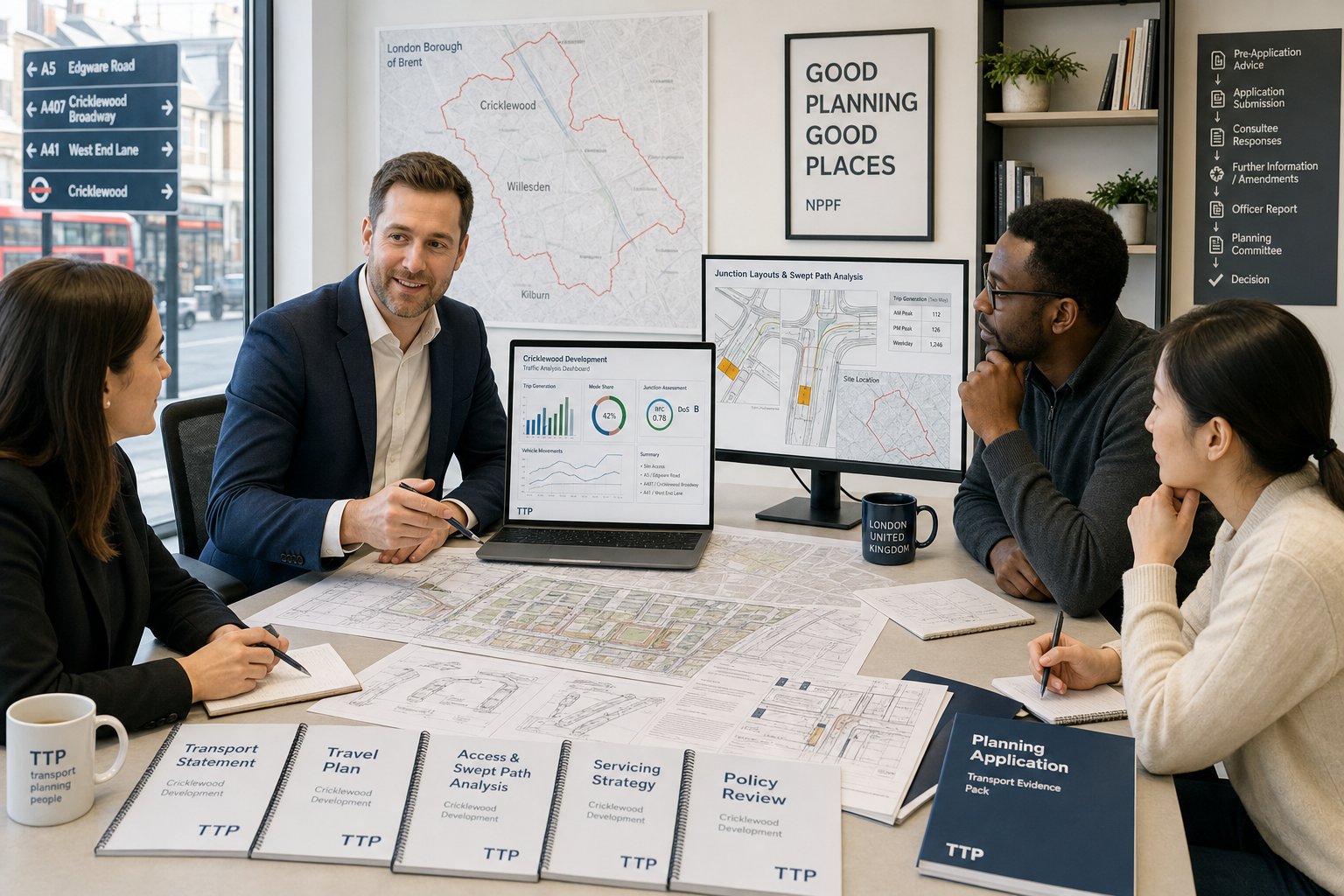
This is the part many project teams think of first when they hear “traffic engineering”, and for obvious reasons. If a proposal is expected to add vehicle trips, the authority will want to know how many, when they occur, where they go, and whether nearby junctions can absorb them.
Trip generation is normally derived from TRICS data or robust comparisons with similar sites, then adjusted for local circumstances. In Willesden, that means considering PTAL, accessibility to stations and buses, car ownership patterns, the nature of the proposed use, and whether a car-lite or car-free approach is realistic. A residential block beside strong public transport and controlled parking will not be assessed in the same way as an out-of-centre industrial site.
Distribution and assignment follow. We estimate where trips are likely to travel based on network structure, observed conditions, and local attractors. Then we test key junctions or access points using appropriate software and engineering judgment. Depending on the layout, that may involve Junctions, LinSig, SYNCHRO, SIDRA, VISSIM, HCS, or a simpler priority analysis.
But the software is not the whole story. Officers often look hard at assumptions: survey dates, base year conditions, committed development, cumulative impact, and peak periods. A model can be technically correct and still unpersuasive if it ignores how the street actually functions.
The better reports explain not only the numbers, but why those numbers make sense.
Local Authority Expectations And Planning Considerations In Willesden
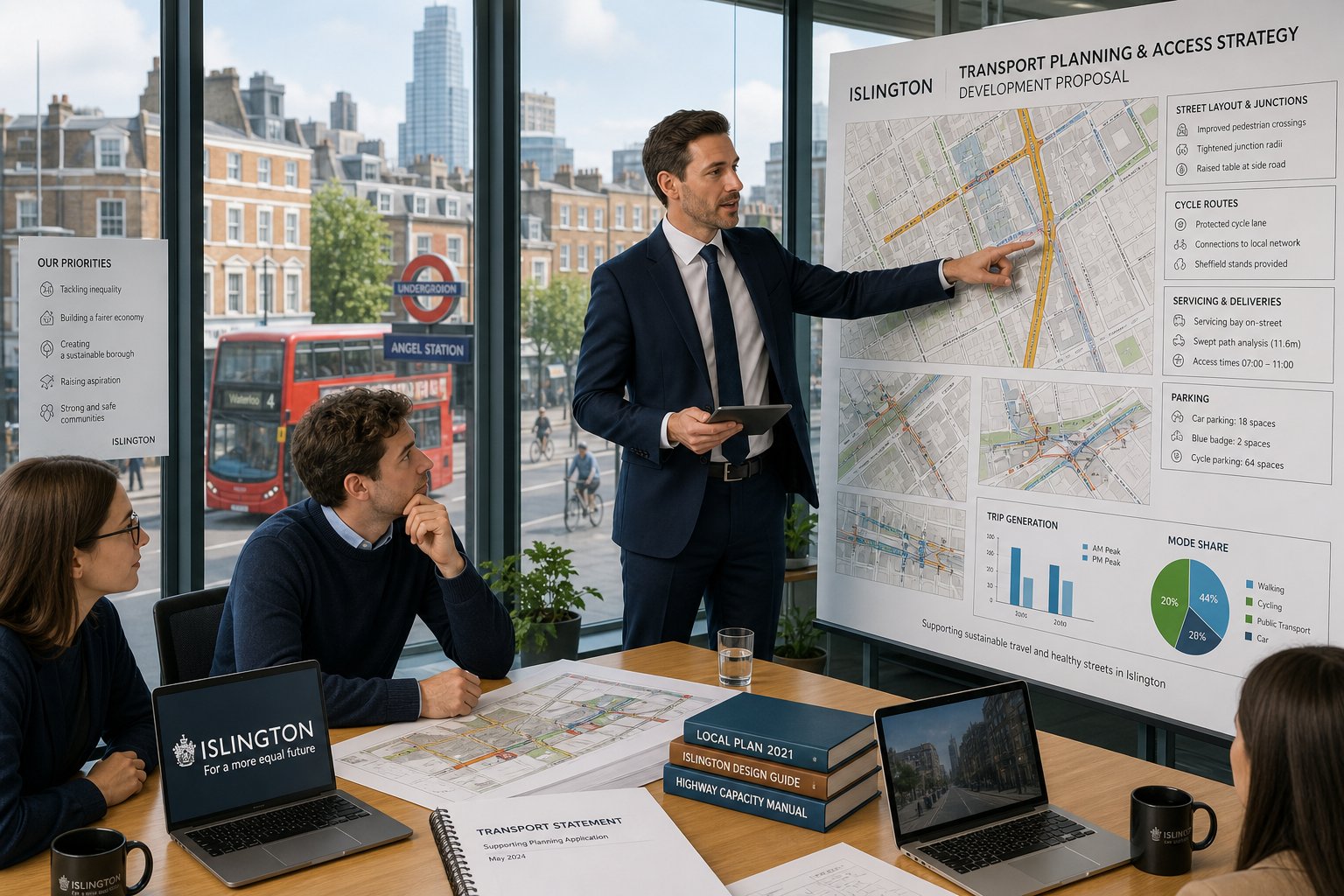
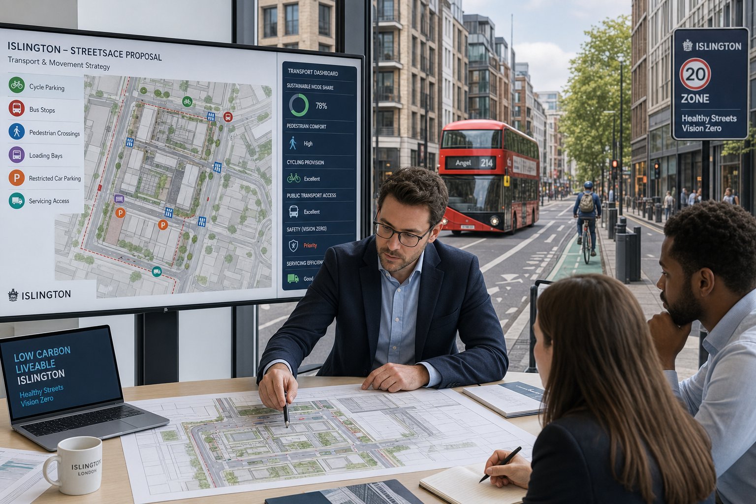
In Willesden, transport evidence has to align with more than one policy layer. Brent will consider the London Plan, the Brent Local Plan, local implementation priorities, and detailed design guidance such as Manual for Streets, with DMRB-style methods brought in where relevant to the road context. In 2026, that policy environment still places strong emphasis on sustainable travel, road danger reduction, and inclusive design.
That has practical consequences. Officers are likely to examine whether a scheme supports walking, cycling and public transport rather than simply accommodating traffic. They will look at cycle parking quality, blue badge provision, EV charging where required, car club arrangements, servicing realism, refuse collection strategy, and whether the development leans toward a car-lite or car-free model where justified.
Vision Zero thinking also affects the tone of review. The question is not just “does this comply numerically?” but “does this make the street safer and more legible for people using it?” That can influence access design, crossing provision, footway treatment, and the tolerance for awkward vehicle manoeuvres.
Early engagement helps. Even a short scoping discussion can clarify whether Brent expects a TA or TS, whether junction modelling is necessary, and what survey package is proportionate. On complex urban schemes, local expectations often matter as much as formal thresholds. Similar lessons show up in a Traffic Engineer In Bristol: context too, though Brent’s policy emphasis remains distinctly London-focused.
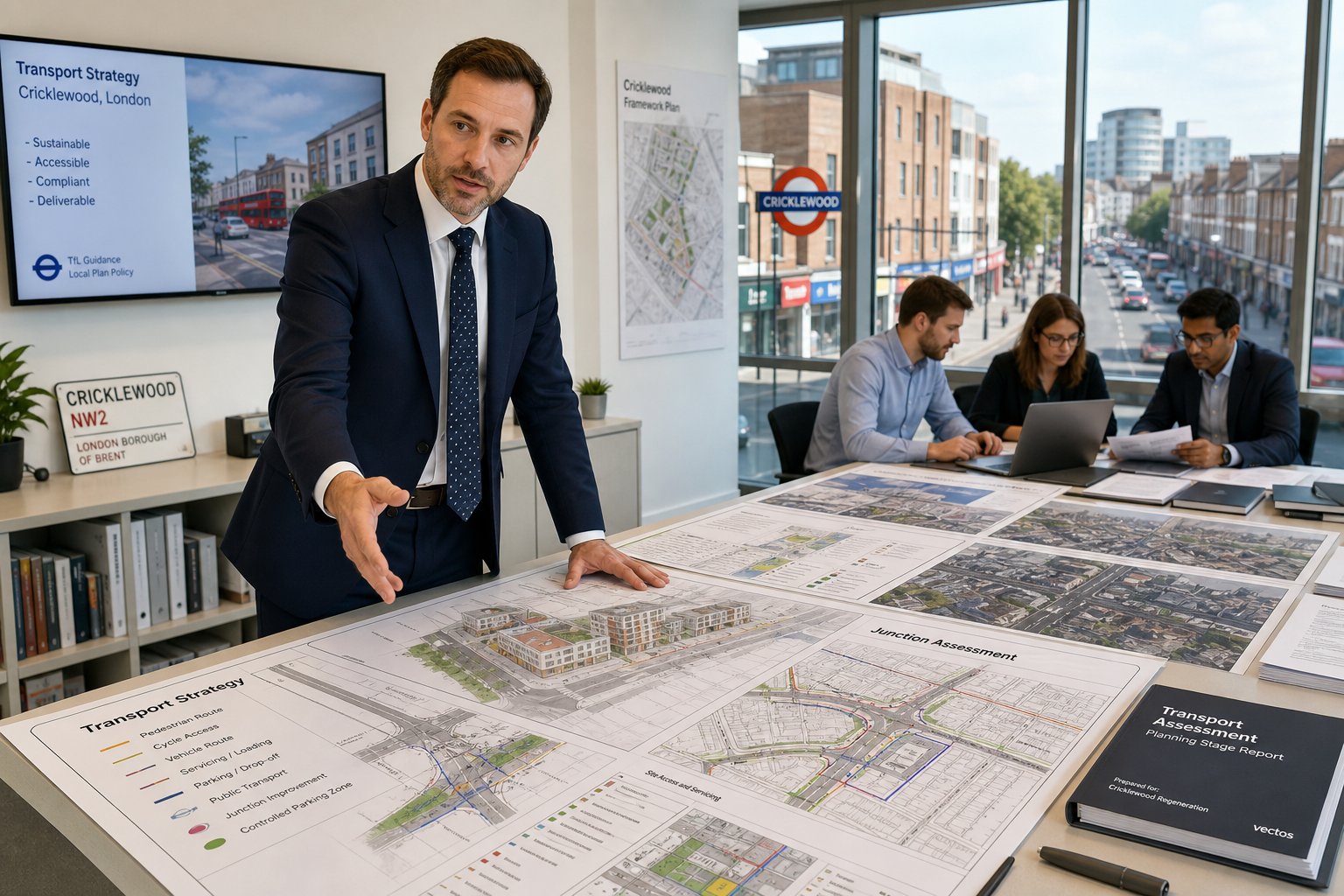
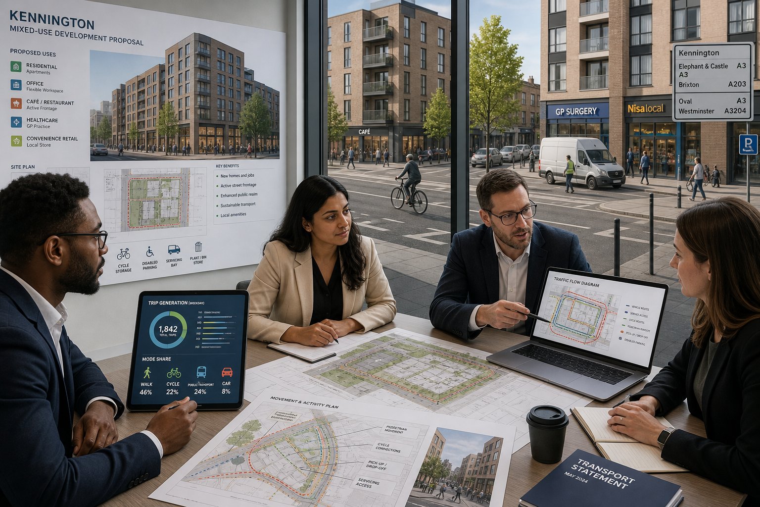
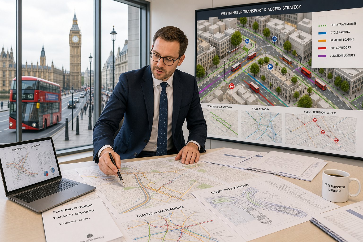
Working With Architects, Planners, Surveyors, And Developers
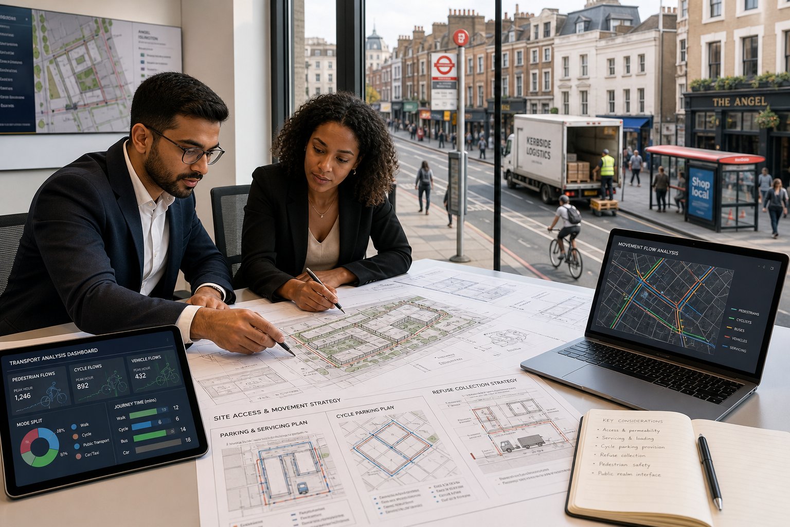
Transport engineering works best when it is embedded in the design team, not bolted on at the end. We usually start talking to architects about access geometry, parking ratios, cycle storage, refuse strategy, and servicing routes while plans are still moving. That is the point where a small layout change can solve what would otherwise become a major planning objection.
With planning consultants, the coordination is slightly different. The transport narrative needs to support the wider policy case. If the application relies on sustainable location, reduced parking, or active travel benefits, the technical reports should reinforce that argument with evidence rather than merely repeating it. Consistency matters.
Surveyors and project managers often bring in another layer: highway land ownership, stopping-up issues, potential Section 278 works, crossover amendments, and site delivery constraints. Those topics can affect viability and programme as much as planning strategy. Lawyers may also need clear transport evidence where obligations, conditions, or appeal statements are being drafted.
Developers tend to value straight answers. Can the scheme work? What will Brent likely challenge? Is the proposed servicing arrangement credible? What surveys are actually needed? That is where concise advice matters most.
On multi-disciplinary projects, our role is often to translate technical transport points into decisions the wider team can act on quickly. Good collaboration keeps the report aligned with the drawings, and that alone removes a surprising number of planning problems.
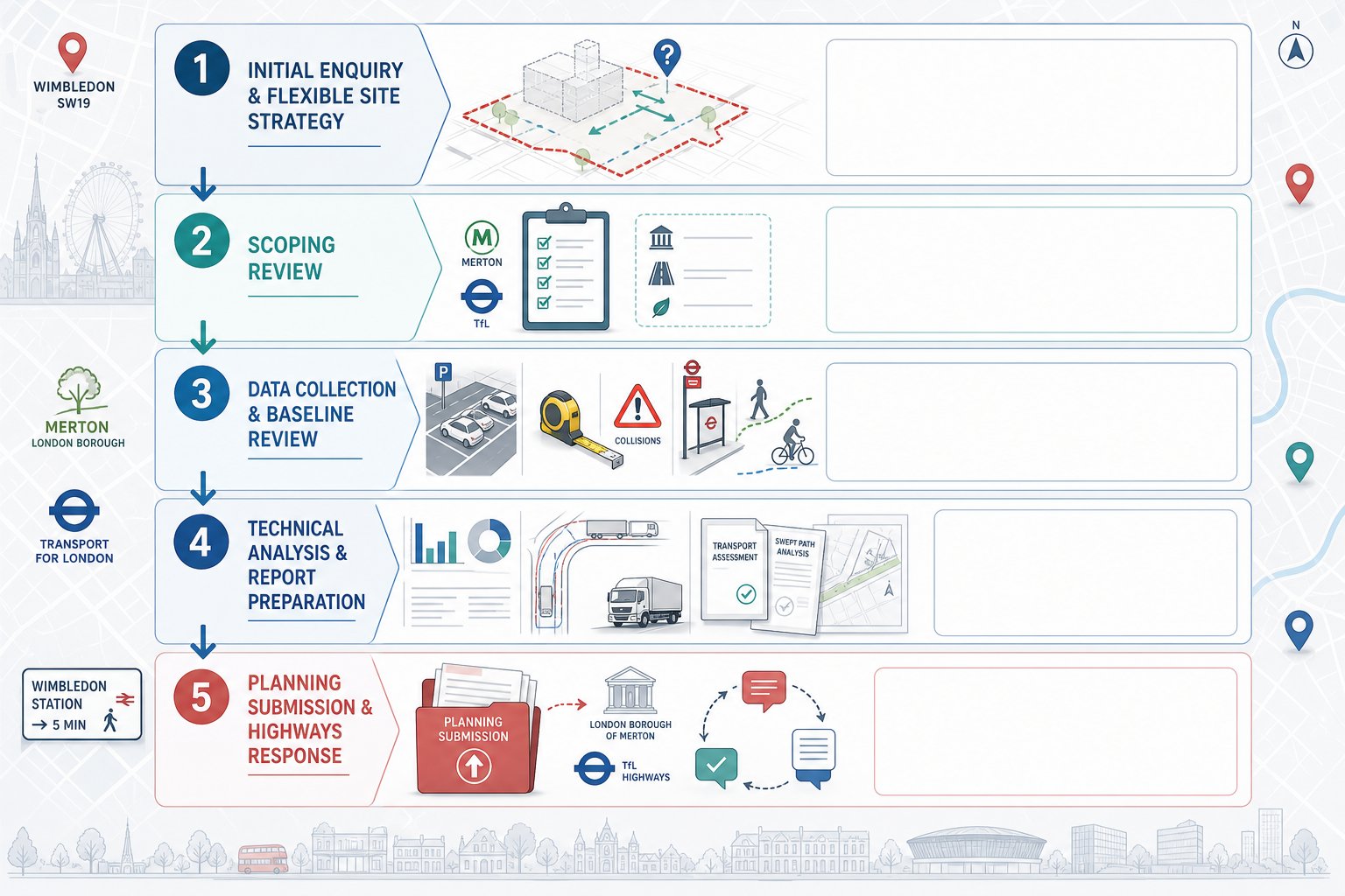
The Typical Process From Initial Review To Planning Submission
Most transport work for planning follows a recognisable sequence, even though the details vary from project to project.
First comes the initial feasibility review. We look at the site, planning history, access arrangement, public transport accessibility, parking constraints, likely policy position, and whether transport is likely to be a key planning risk. At this stage, the goal is not to overproduce. It is to identify what genuinely needs testing.
Second is scoping. Where appropriate, we discuss the likely report type and survey needs with the design team and, in some cases, Brent officers. Agreeing the scope early avoids a lot of wasted work.
Third is data collection. That may include traffic counts, queue observations, speed surveys, parking beat surveys, pedestrian and cycle counts, collision records, public transport accessibility review, and site observations on servicing behaviour.
Fourth comes analysis and design development. Trip generation is calculated, access and parking are tested, swept path analysis is undertaken, junctions are assessed where needed, and mitigation is considered.
Fifth is report drafting and coordination. The transport documents are aligned with architecture, landscape, waste strategy, and planning statements. This is where detail matters: mismatched drawings and reports invite questions.
Finally, the package is submitted with the planning application, followed by responses to officer comments or requests for clarification. Teams familiar with Traffic Engineer In city-centre work will recognise the process, but local review standards still shape the final content.
Common Reasons Transport Reports Are Delayed Or Challenged
Most challenged transport reports are not rejected because the idea is impossible. They are challenged because the evidence is incomplete, inconsistent, or unconvincing.
Outdated or weak survey data is one of the biggest causes. Counts collected on unusual dates, during school holidays, in poor weather, or without enough coverage around the site can undermine an otherwise decent assessment. Parking surveys are another common problem, especially where they do not reflect controlled hours or local stress patterns properly.
Trip generation assumptions can also cause trouble. If a mode split looks optimistic, or a low-car scenario is asserted without clear justification, officers may ask for revisions. The same applies to servicing: many reports underestimate delivery frequency or fail to show where vehicles will actually wait and manoeuvre.
Another issue is failing to follow agreed scoping. If Brent asked for a Travel Plan, collision review, or swept path analysis and it is absent, the report will likely come back. Likewise, if the report references drawings that have since changed, confidence drops fast.
And then there is simple clarity. Dense text, vague conclusions, and diagrams that do not match the site layout waste everyone’s time. A transport report should make technical matters easier to understand, not harder.
This is why concise, planning-led preparation matters so much. Experience from Traffic Engineer In other urban authorities helps, but local evidence quality remains the deciding factor.
Choosing A Traffic Engineer For A Willesden Planning Application
Choosing the right consultant is not just about credentials, although those matter. You need someone who understands development control in London, can judge what level of reporting is proportionate, and knows how to turn technical analysis into something planning officers can work with.
We would look for three things first. Relevant planning experience: not general highway design alone, but recent work on planning applications, transport statements, assessments, Travel Plans, and servicing evidence. Local authority awareness: familiarity with Brent’s approach, London Plan policy, TfL-related expectations, and the practical implications of CPZs, PTAL, and car-lite development. Technical range: confidence with TRICS, parking analysis, road safety review, swept path work, and junction modelling where required.
Professional standing still counts. Qualifications such as CEng, MICE, or MIHE are useful indicators, as is a track record of supporting schemes through committee or appeal when necessary. But communication is just as important. If advice arrives late, reads like a template, or ignores the scheme’s commercial reality, it will not help much.
We also think speed matters, provided it does not come at the expense of accuracy. On many applications, the best consultant is the one who gives a clear early view, scopes the work properly, and produces evidence that is concise enough to be read and robust enough to withstand challenge.
That combination is usually what moves a project forward.
Conclusion
For planning applications in Brent, transport is rarely a side issue. It affects layout, policy compliance, neighbour impact, officer confidence, and often the overall timetable. A capable traffic engineer in Willesden helps development teams deal with those questions before they harden into objections.
The real benefit is not just producing a Transport Assessment or Statement. It is shaping a scheme that works on the ground: safe access, realistic servicing, defendable parking, proportionate trip analysis, and a planning narrative that matches local expectations. That takes technical skill, yes, but also judgment about what Brent is likely to focus on.
When transport input is brought in early, the process is usually smoother and the evidence stronger. And in a place like Willesden, where local conditions and policy priorities can quickly expose weak assumptions, that early, experienced input often makes the difference between a report that merely exists and one that actually supports permission.
Traffic Engineer in Willesden: Frequently Asked Questions
What roles does a traffic engineer in Willesden perform in development projects?
A traffic engineer in Willesden assesses site access, parking, servicing, and highway safety, preparing reports like Transport Assessments and Delivery & Servicing Plans, and supports the planning application process to ensure transport compliance with local policies.
Why is local transport planning input crucial for developments in Willesden?
Local input is vital due to Willesden’s complex transport network, CPZs, congestion, and Brent Council’s requirements under the London Plan, ensuring assessments account for local conditions, sustainable travel, and safety priorities.
Which planning applications commonly require traffic engineering evidence in Willesden?
Applications involving larger residential schemes, mixed-use developments, retail, healthcare, education, or any changes affecting access, parking, servicing, or sensitive junctions typically need robust traffic engineering evidence.
What are the main differences between a Transport Assessment, Transport Statement, and Travel Plan?
A Transport Assessment provides a full analysis for larger schemes, a Transport Statement is a proportionate, shorter report for smaller proposals, and a Travel Plan outlines strategies to promote sustainable travel and reduce car use, often secured by conditions.
How are parking, access, and highway safety evaluated in Willesden transport reports?
Evaluations consider London Plan parking standards, local CPZs, visibility splays, vehicle manoeuvrability, collision data, and pedestrian/cyclist safety to ensure proposals offer safe, practical access and parking in line with local policies.
How can early involvement of a traffic engineer in Willesden benefit a planning application?
Early engagement helps identify and resolve transport issues during design, reducing planning objections, ensuring reports meet Brent’s expectations, and aligning technical input with the wider development team for smoother application processes.