Category: High Frequency Posts

  • Junctions 11 Software In 2026: A Practical Guide For Transport Assessments And Planning Applications

    Junctions 11 Software In 2026: A Practical Guide For Transport Assessments And Planning Applications

    If a planning application turns on whether a junction can cope, the discussion usually gets technical very quickly. Local authorities want evidence, not guesswork. Developers want clarity on risk, cost and mitigation. And everyone involved, planners, architects, transport consultants, solicitors and councils, needs outputs that are defensible when a scheme is scrutinised.

    That is where Junctions 11 software comes in. In UK transport planning, it remains one of the standard tools for testing how priority junctions, roundabouts and simple signalised junctions are likely to perform under existing and future traffic conditions. Used properly, it helps us estimate capacity, delay, queues and operational stress in a way that can be clearly presented within a transport assessment or supporting planning submission.

    In practice, though, the value of a Junctions 11 model depends less on pressing “run” and more on everything around it: traffic surveys, coding accuracy, realistic assumptions, careful checking and clear reporting. A neat output table means very little if the geometry is wrong or the turning counts have been misread.

    In this guide, we set out how Junctions 11 fits into planning work in 2026, what it can model, what data it needs, how to build and check a robust model, and how to present results so they actually help a planning case rather than confuse it.

    What Junctions 11 Software Is And When It Is Used
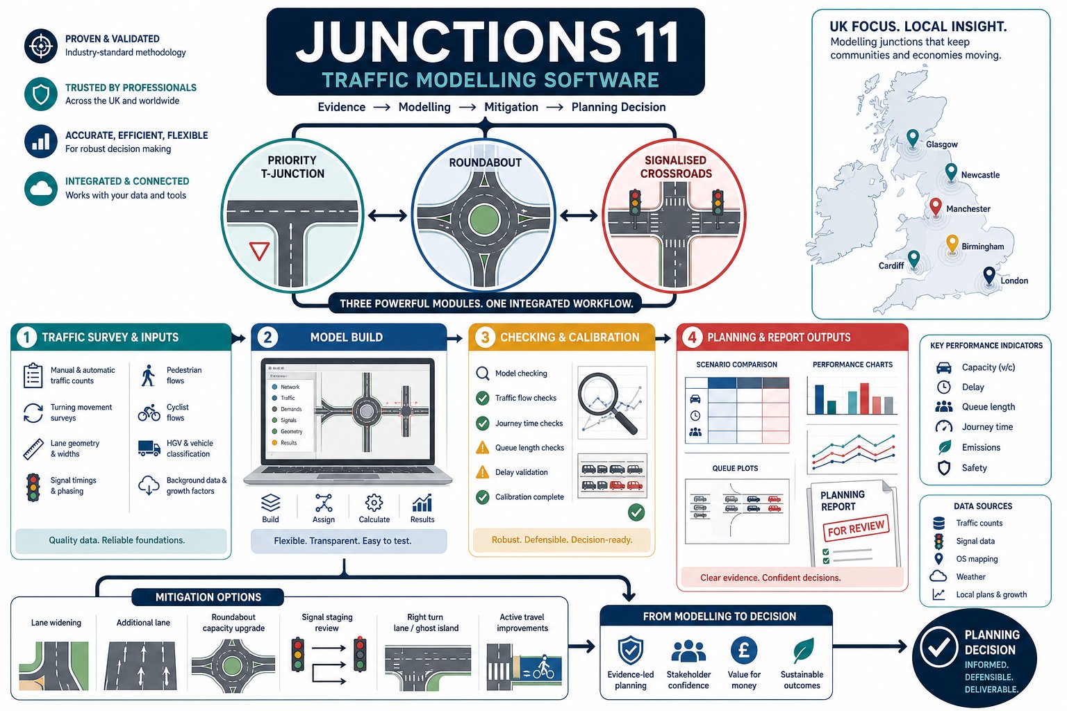
    Infographic of Junctions 11 software modules and planning assessment stages.

    Junctions 11 software is TRL Software’s established package for modelling the performance of individual junctions and small groups of closely related junctions. In day-to-day transport work, it is widely used to assess whether a junction arrangement is likely to operate within acceptable limits once existing traffic, background growth and development traffic are taken into account.

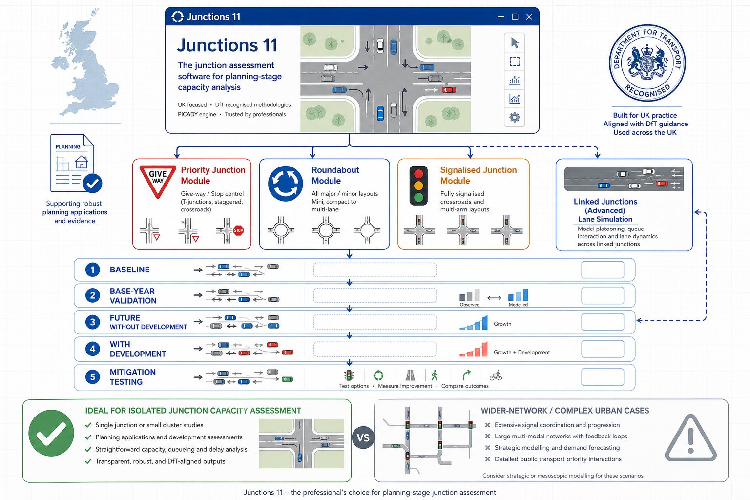
    The software brings together the core modules many practitioners already know by name: PICADY for priority junctions, ARCADY for roundabouts and OSCADY for isolated signalised junctions. It can also represent certain linked situations through lane simulation where spacing is tight enough for one junction to influence another.

    We typically use it at several points in the planning process:

    • to test an existing baseline using surveyed traffic flows
    • to assess a base year or validation case
    • to forecast future year without-development conditions
    • to test with-development scenarios
    • to compare mitigation options, such as lane widening, altered priorities or revised signal staging

    That makes it especially relevant for transport assessments, transport statements, access appraisals and technical notes submitted with planning applications.

    It is not a catch-all model for every highway question. If a site has a large urban network, complex signal coordination or wider route assignment issues, other tools may be more appropriate. But for isolated junction capacity work, which is still a large proportion of planning-related transport analysis in the UK, Junctions 11 remains the workhorse. And, frankly, planning officers and highway authorities are very used to seeing it.

    How Junctions 11 Fits Into Transport Assessments And Planning Submissions
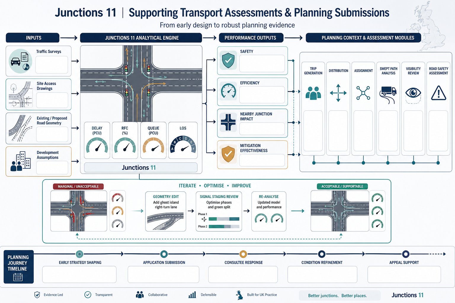
    Flowchart of Junctions 11 supporting UK transport planning and junction design decisions.

    Within a planning submission, Junctions 11 usually sits at the point where design intent meets operational proof. A proposed access may look tidy on a drawing, but the authority will still want to know whether it works in traffic terms, both on opening and in the agreed future assessment year.

    We use the software to turn survey data and design assumptions into measurable outputs that support a planning narrative. Those outputs often inform some of the most important questions in a transport assessment:

    • Can the proposed site access operate safely and efficiently?
    • Will the development materially worsen conditions at nearby junctions?
    • Is mitigation required, and if so, does it solve the identified issue?
    • Are residual impacts likely to be severe in planning terms?

    That link to planning policy matters. Junction modelling is rarely presented in isolation: it supports a wider argument around access, highway capacity, sustainability and acceptability. The model results are hence usually paired with trip generation, distribution, assignment, swept path work, visibility analysis and sometimes road safety review.

    For planning teams, timing is everything. Early modelling can shape the access strategy before an application is fixed. Later, the same modelling may be used to refine conditions, respond to consultee comments or support an appeal statement.

    On live projects, we often find the most useful role of Junctions 11 is not just proving a final answer. It helps us iterate. A modest geometry change, a ghost island right-turn lane, or a revised signal stage can shift a junction from marginal to acceptable. Used that way, it becomes less of a reporting tool and more of a design tool, which is where much of its real value lies.

    The Main Junction Types You Can Model In Junctions 11
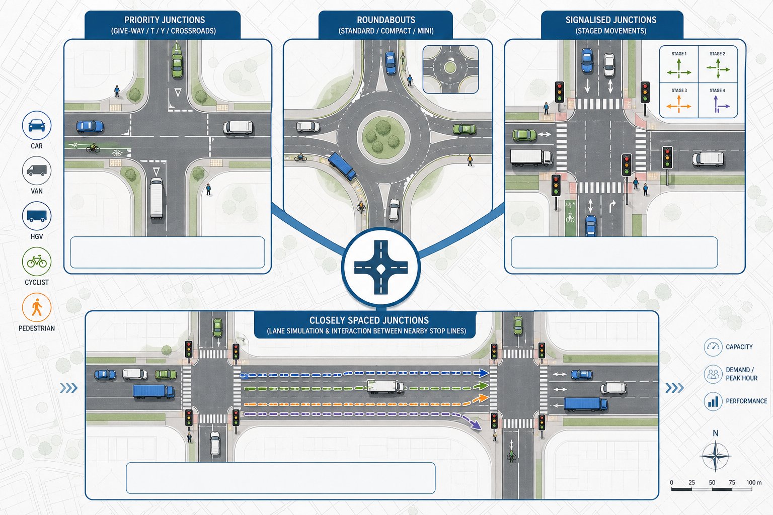
    Diagram of Junctions 11 junction types including priority, roundabout, signals, and linked layouts.

    Junctions 11 is designed around the junction forms most commonly encountered in UK development work. That makes it practical for planning applications, because the software aligns with the kinds of access points and nearby highway nodes that authorities expect to see assessed.

    At a high level, it covers priority junctions, roundabouts and simple signalised junctions, with additional scope for linked behaviour in certain closely spaced arrangements. The right choice of module matters, because each is based on a different operational logic and set of inputs.

    For development work, this usually means we select the module that best reflects the real control type, then build scenarios around existing operation, forecast demand and any physical mitigation. If the wrong modelling approach is chosen at the outset, every output that follows becomes harder to defend.

    Priority, Roundabout, And Signalised Junction Capabilities

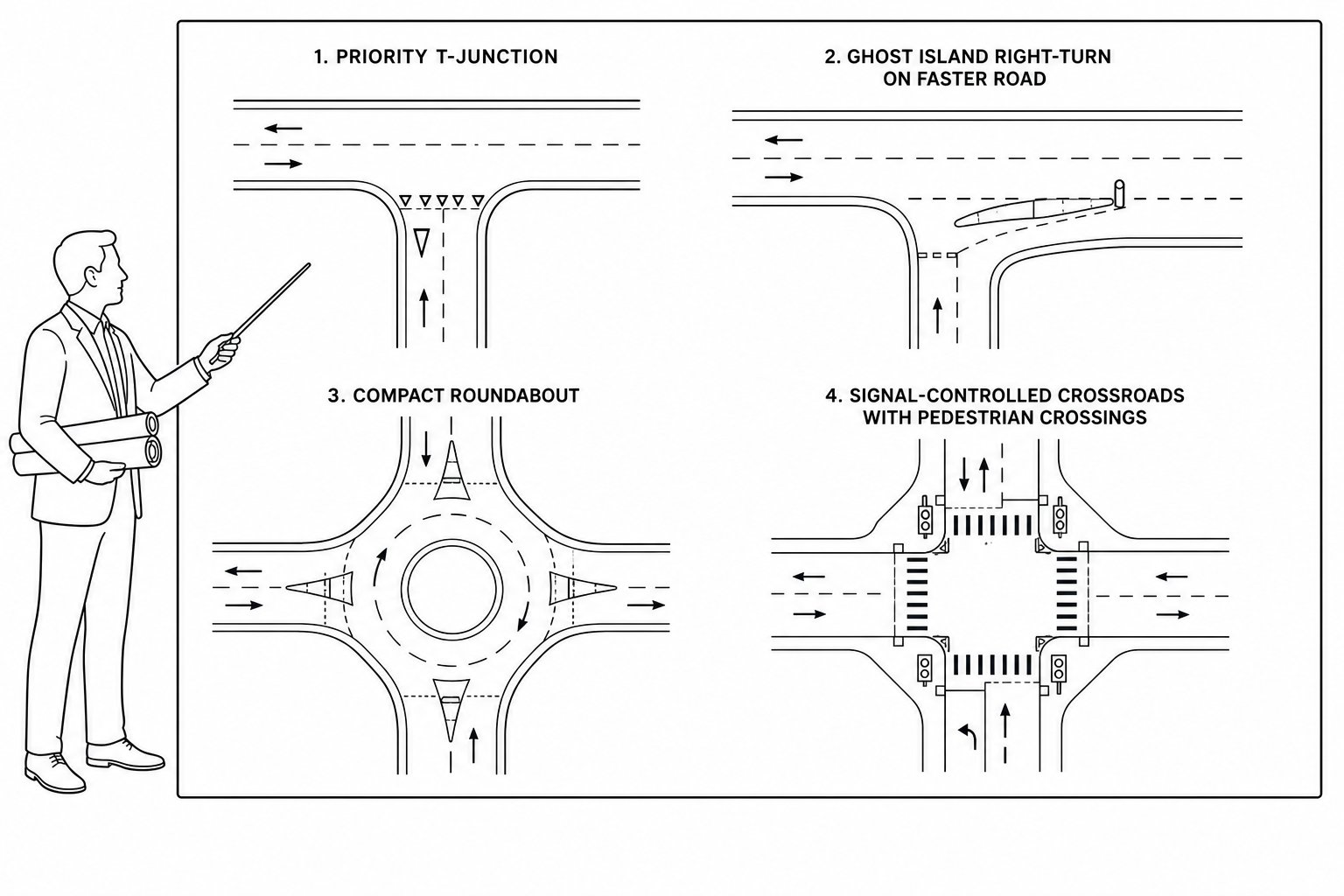
    For priority junctions, the PICADY module is commonly used for T-junctions, Y-junctions and crossroads where minor-arm traffic gives way to a major road. It can account for features such as right-turn lanes and other layout characteristics that materially affect capacity.

    For roundabouts, ARCADY covers conventional roundabouts, compact forms and mini-roundabouts, along with some non-standard arrangements. That makes it highly relevant for residential, mixed-use and roadside development where roundabout access remains common.

    For signalised junctions, OSCADY is used for isolated traffic signals with multiple stages and phases. It can represent pedestrian stages and straightforward adaptive-style arrangements where appropriate.

    Where junctions sit close together, Lane Simulation Mode can be used to capture interaction between them. This is useful when queueing at one stop line affects another nearby movement, something a simple isolated model can miss.

    Pedestrian, Cycle, And Multi-Modal Considerations

    Although Junctions 11 is primarily a junction capacity tool for vehicular operation, it is not blind to non-car movements. Pedestrian crossings can be coded on approaches, which is important because crossing demands and signal stages can reduce effective green time or otherwise influence junction performance.

    Cyclists are a more nuanced issue. In practice, cycle flows are often represented in a way that reflects their operational effect where they materially influence capacity, particularly at give-way conditions or signals. The exact treatment depends on the site, the volume of movements and the purpose of the assessment.

    Vehicle composition also matters. The software allows for different vehicle classes, including HGVs, which is often crucial on commercial, industrial or roadside schemes. A junction serving vans and articulated vehicles will not behave quite like one serving mainly commuter cars.

    So while Junctions 11 is not a full multimodal microsimulation package, it can still support a realistic planning assessment where pedestrians, cyclists and heavier vehicles have a meaningful bearing on how the junction performs.

    The Input Data You Need Before Building A Model
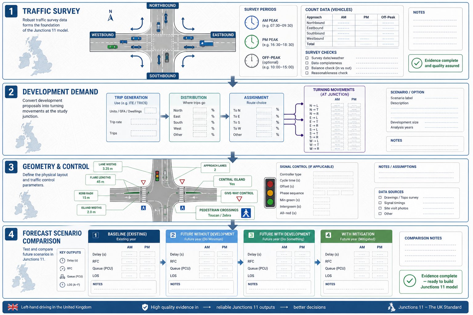
    Infographic of key inputs needed before building a junction traffic model.

    Good junction modelling starts long before the software opens. The quality of a Junctions 11 assessment depends on whether the inputs genuinely reflect what is happening on the ground and what is likely to happen once a development is built.

    In planning work, the most defensible models are usually the ones built from a disciplined evidence base: current traffic surveys, reliable geometry, agreed forecast assumptions and a clear record of how each scenario has been assembled. Skip that discipline and the model may still produce numbers, just not numbers anyone should rely on.

    Traffic Counts, Turning Movements, And Peak Hours

    The core traffic input is normally a turning-movement count for each arm and each movement through the modelled junction. In most planning assessments, we use the AM and PM peak hours, and sometimes an inter-peak or Saturday peak where the land use demands it.

    This sounds straightforward, but it is where many problems begin. We need to confirm:

    • survey dates and whether they are representative
    • whether flows are recorded in suitable time slices
    • whether all turning totals reconcile properly
    • whether unusual conditions affected the count, such as roadworks, school holidays or severe weather

    For some sites, a single peak hour is not enough. Retail, leisure, roadside and education schemes can generate patterns that differ from standard commuter peaks. In those cases, the model should reflect the operational period that genuinely matters, not just the easiest period to analyse.

    We also need development traffic in a usable form: trip generation, distribution and assignment translated into turning flows by scenario. If that handoff is sloppy, the junction model inherits the error immediately.

    Geometry, Control Data, And Forecast Scenarios

    Beyond traffic, geometry is the backbone of the model. We need accurate details for entry widths, flare lengths, lane allocations, radii, island dimensions, gradients and other physical features relevant to the junction type. A seemingly minor coding error, half a metre of width missed, a flare omitted, a lane misallocated, can noticeably change the reported capacity.

    Control data matters just as much. For priority junctions, that includes give-way relationships and lane use. For signalised junctions, it includes stage structure, phase timings, cycle times, intergreens, pedestrian stages and, where relevant, offsets.

    Then come the forecast scenarios. A planning assessment usually requires a clear set of cases, such as:

    • existing baseline
    • future year without development
    • future year with development
    • future year with development plus mitigation

    Those scenarios should be internally consistent. Background growth factors, committed development assumptions and proposed layout changes need to be applied transparently and in the same way across the comparison set. If the forecast structure is messy, the final reporting becomes messy too.

    How To Build, Check, And Calibrate A Junctions 11 Model
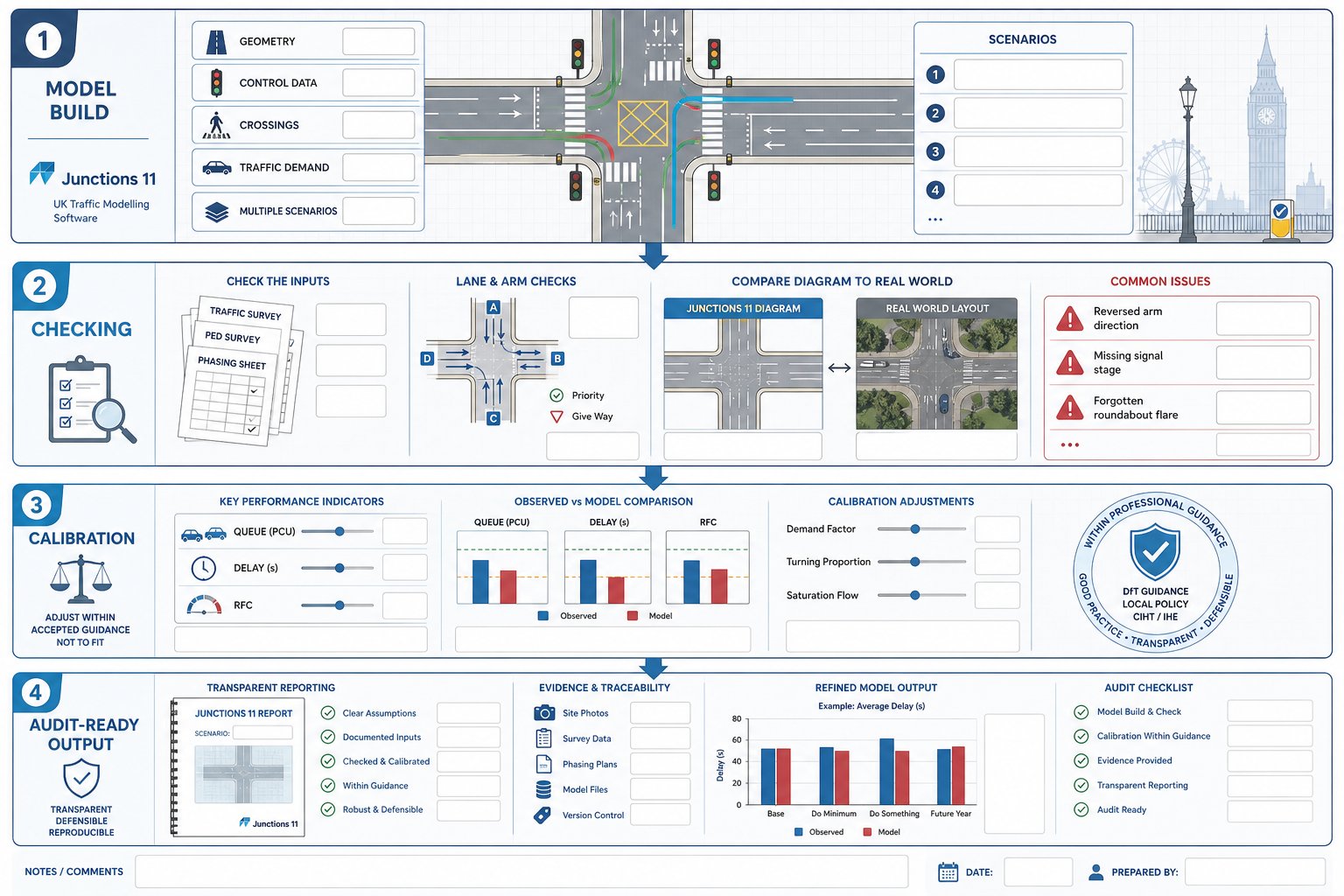
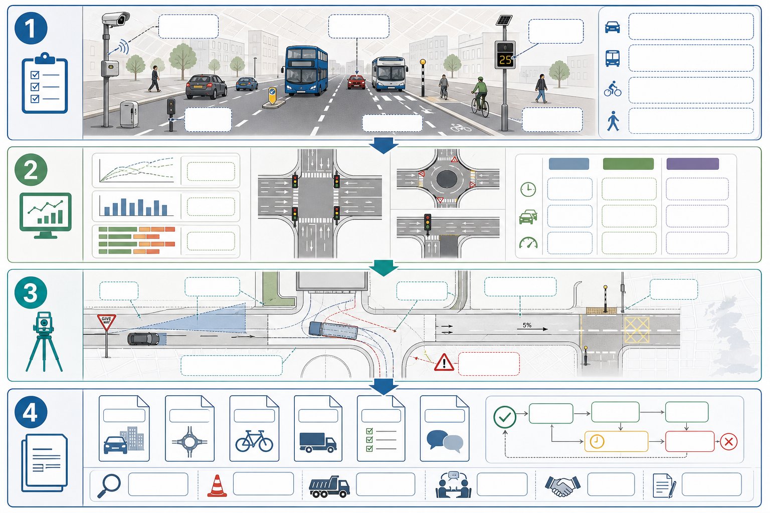
    Infographic of building, checking, and calibrating a UK junction traffic model.

    Once the evidence base is ready, the actual build process is fairly methodical. We define the correct junction type, code the geometry and control data, enter pedestrian or crossing information where relevant, add traffic demand and then run the model for each scenario.

    But building the model is the easy part. The real professional work lies in checking and, where justified, calibrating it.

    A robust checking process usually includes:

    • confirming arm labels match the drawing and report tables
    • checking movement flows against survey sheets and assignment outputs
    • reviewing lane allocations and priority relationships
    • ensuring scenario naming is consistent and unambiguous
    • sense-checking whether outputs look plausible in relation to observed conditions

    We have all seen models that are technically complete but obviously wrong on inspection: an arm coded in the wrong direction, a signal stage omitted, a roundabout flare forgotten. Those mistakes often survive because nobody stops to compare the software diagram with the actual junction layout.

    Calibration is more delicate. Where observed queueing, delays or known operational behaviour exist, it may be reasonable to adjust certain model parameters within accepted guidance so the model better reflects local reality. The key phrase there is within accepted guidance. Calibration should not become a way of forcing the software to produce a politically convenient answer.

    Any adjustment should be justified, proportionate and recorded clearly in the report. What was changed? Why? What evidence supported it? Could the same conclusion be reached without the adjustment? Highway authorities are usually far more comfortable with a modest, transparent calibration than with a model that appears to have been “massaged” in the dark.

    In practical planning work, we find the best models are not the most complicated. They are the clearest, best checked and easiest to audit.

    Understanding Key Outputs Such As RFC, Delay, Queue, And LOS

    Junctions 11 produces a lot of numbers, but planning decisions usually turn on a handful of headline outputs. If those are misunderstood, the reporting can become either alarmist or oddly complacent.

    The most commonly cited measure is RFC, Ratio of Flow to Capacity. In simple terms, it shows how hard a movement or arm is working relative to its theoretical capacity. As RFC rises towards 1.00, the junction is operating under greater stress. In many UK assessments, values above about 0.85 to 0.90 trigger closer scrutiny because they suggest limited spare capacity and a greater risk of unstable operation.

    Delay is the average delay experienced by vehicles, usually presented in seconds per vehicle. For planners and clients, delay is often easier to grasp than RFC because it translates operational stress into something tangible: how long people are likely to wait.

    Queue is equally important, especially where storage lengths, blocking back or interaction with nearby accesses are relevant. Mean queues can be useful, but maximum or percentile-style interpretations often matter more in design conversations because they help answer the obvious question: will the queue physically fit?

    LOS, Level of Service, provides a qualitative shorthand derived from delay bands. It can be helpful in summaries, but we should treat it as a supporting label, not the analysis itself.

    The key is context. A slightly elevated RFC at one arm may be acceptable if queues remain contained and impacts are minor. Equally, a tolerable average delay can still conceal a problematic peak queue. Good reporting reads these outputs together rather than relying on a single metric to tell the whole story.

    Common Errors That Can Undermine Results

    Most weak junction assessments do not fail because the software is incapable. They fail because the inputs, assumptions or reporting chain contain avoidable errors.

    One of the most common issues is incorrect turning data. Totals may not reconcile, movements may be assigned to the wrong arm, or development traffic may be added twice. A close second is mis-coded geometry: wrong entry widths, missing flares, incorrect lane use or an oversimplified layout that does not match the drawing.

    Signal models introduce their own risks. If stage sequences, intergreens, pedestrian stages or cycle times are entered incorrectly, the outputs can look polished while being fundamentally misleading.

    Another recurring problem is inconsistent scenarios. We sometimes see a future-year baseline built using one growth assumption, then a with-development case built using another, or a mitigation case that quietly changes more than the proposed layout. That kind of inconsistency makes comparison unreliable and can quickly undermine confidence with the local highway authority.

    There is also a softer error, but an important one: over-claiming certainty. Junctions 11 is a powerful tool, not an oracle. It is based on assumptions, observed data and model structure. When a report presents outputs as if they are exact predictions rather than informed estimates, readers with experience tend to spot the overreach immediately.

    The cure is not glamorous. Check the surveys. Check the drawings. Check the scenario logic. Then have someone else check them again. In transport planning, a careful second review often saves far more time than a fast first submission.

    How To Present Junctions 11 Results Clearly In A Planning Report

    Even a sound model can lose its value if the reporting is hard to follow. Planning reports need to be clear enough for technical consultees, but also readable for case officers, applicants and, sometimes, inquiry participants who are not transport specialists.

    The best approach is usually simple and structured.

    Start with a plan of each modelled junction showing arm labels that match the software outputs exactly. If the drawing calls an approach “Arm B” but the table calls it “Eastbound Minor Arm”, confusion is almost guaranteed.

    Next, explain the methodology briefly but properly: survey dates, peak periods assessed, forecast years, background growth, committed development assumptions, development traffic, and any calibration or capacity adjustments. This is the part that makes the results auditable.

    Then present the outputs in tables that allow direct comparison across scenarios. For each relevant arm or junction, it is usually helpful to include:

    • RFC
    • average delay in seconds
    • queue length in vehicles or PCUs
    • LOS, where used

    Highlight the metrics that matter, but do not bury awkward results. A transparent note explaining that one arm is forecast to operate near capacity, and that a mitigation drawing addresses it, is far more credible than a table designed to distract.

    Including extracts from the Junctions 11 summary reports can also help, especially where the authority expects to see the source output. But raw appendices should support the narrative, not replace it.

    From our perspective at ML Traffic, the strongest planning reports are concise, traceable and honest about the operational picture. They answer the authority’s likely questions before those questions are asked. That, more than page count, is what tends to move an application along.

    Conclusion

    Junctions 11 software remains a central tool for UK transport assessments because it does something planning work badly needs: it turns junction design and traffic evidence into testable, reportable outcomes. Used well, it helps us assess baseline performance, future stress, and the practical value of mitigation in a way local authorities can review with confidence.

    But software alone is never the whole story. Reliable results depend on representative traffic data, accurate coding, sensible forecast assumptions, disciplined checking and reporting that is clear enough to withstand scrutiny.

    For architects, planners, developers, councils and legal teams, the takeaway is fairly straightforward. A Junctions 11 model is most useful when it is treated as part of a wider planning evidence base, not as a standalone technical appendix wheeled in at the end.

    If the modelling is proportionate, transparent and tied closely to the design and planning case, it can make the difference between a junction debate that drags on for months and one that is resolved on the evidence.

    Frequently Asked Questions about Junctions 11 Software

    What is Junctions 11 software used for in UK transport planning?

    Junctions 11 is TRL Software’s standard tool for modelling priority junctions, roundabouts, and simple signalised junctions to assess capacity, queues, and delays, supporting planning applications and transport assessments with robust traffic performance data.

    Which junction types can Junctions 11 model effectively?

    Junctions 11 models priority junctions using PICADY, roundabouts via ARCADY, and isolated signalised junctions through OSCADY. It also can simulate linked junctions closely spaced using Lane Simulation Mode, covering most UK development junction scenarios.

    What input data is necessary to build a reliable Junctions 11 model?

    A reliable model requires accurate traffic surveys with turning movements for peak hours, detailed geometry including entry widths and lane allocations, control data like priorities or signal timings, plus consistent forecast scenarios reflecting development and background growth.

    How does Junctions 11 incorporate pedestrian and cycle considerations?

    The software includes pedestrian crossings in its capacity calculations by coding crossings on approaches, affecting green time. Cycle flows are represented if they materially impact junction capacity, often coded as vehicles, supporting a realistic multimodal assessment.

    What key outputs does Junctions 11 provide and how are they used?

    Key outputs include RFC (Ratio of Flow to Capacity) indicating saturation, average delay per vehicle, queue lengths, and LOS (Level of Service). These inform whether junctions operate within acceptable limits and help support planning decisions and mitigation design.

    How should Junctions 11 results be presented in planning reports?

    Results should be presented clearly with junction plans that match model arm labels, tables showing RFC, delay, queue, and LOS for each scenario and arm, with transparent methodology, calibration details, and summary report extracts to ensure auditability and clarity for planning authorities.
  • Traffic Flow Management Consultants: What They Do, When You Need One, And How They Support Planning Success In 2026

    Traffic Flow Management Consultants: What They Do, When You Need One, And How They Support Planning Success In 2026

    A planning application can look perfectly sensible on paper and still stall the moment transport questions start landing. Will the junction cope? Is the access safe? Can service vehicles turn without conflict? Will pedestrians, cyclists and buses be properly considered? Those are the points that often decide whether a scheme moves forward smoothly or gets dragged into rounds of objection, redesign and delay.

    That’s where traffic flow management consultants come in. We use transport evidence to test how a development will function in the real world, not just on a site plan. For architects, developers, planning consultants, solicitors, surveyors and local authorities, that input is rarely a box-ticking exercise. Done well, it shapes layout, supports planning strategy, answers highway authority concerns and reduces risk early.

    In 2026, expectations are sharper than ever. Planning and highway authorities want clear methodology, locally relevant analysis and mitigation that is practical, proportionate and policy-led. They also expect transport reports to speak plainly. A weak note full of assumptions won’t carry much weight.

    In this guide, we explain what traffic flow management consultants actually do, when projects need transport input, which reports are usually required, and how the right consultant helps turn transport from a planning problem into a planning solution.

    What Traffic Flow Management Consultants Do

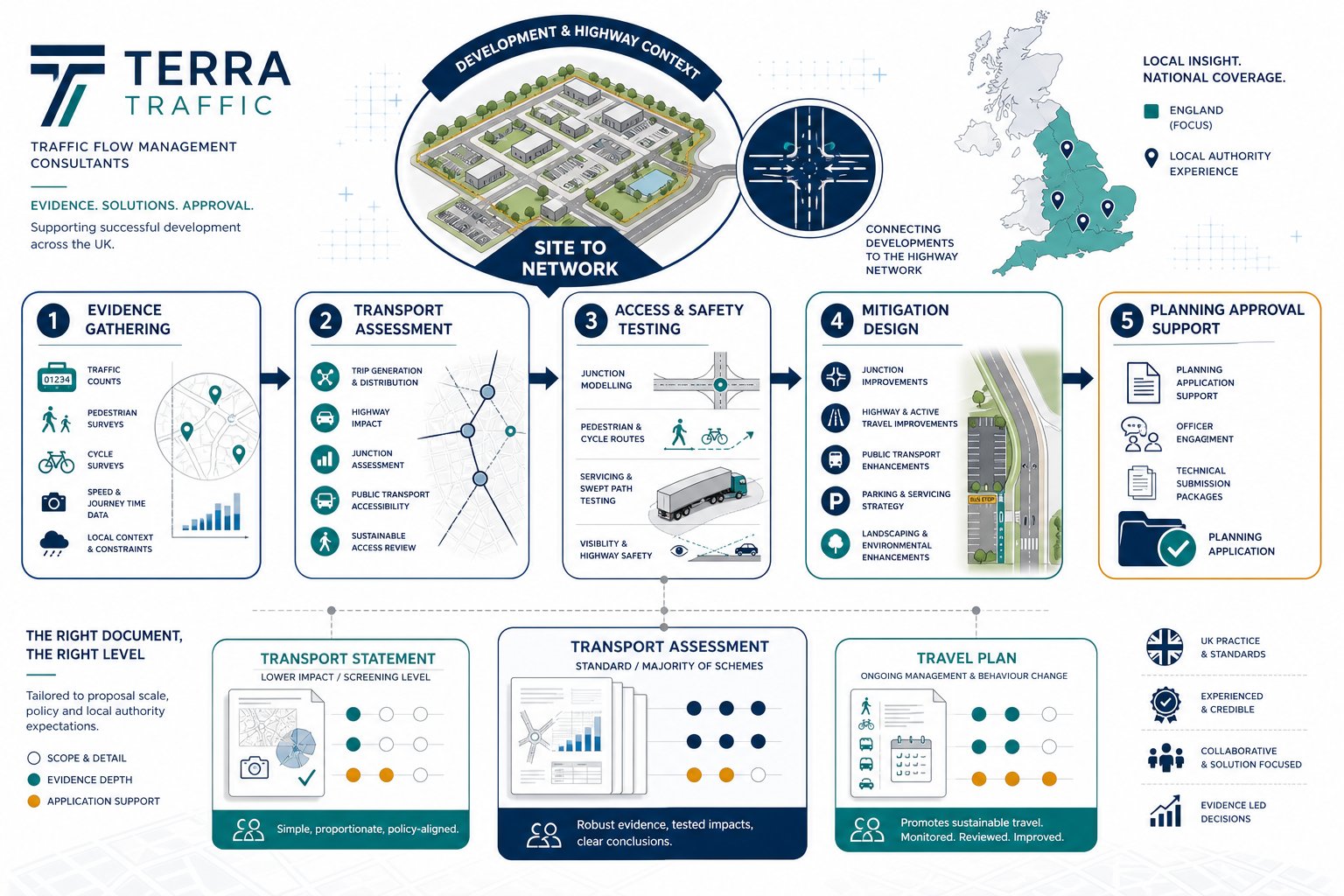
    Infographic of site access, traffic analysis, and pedestrian flow assessment.
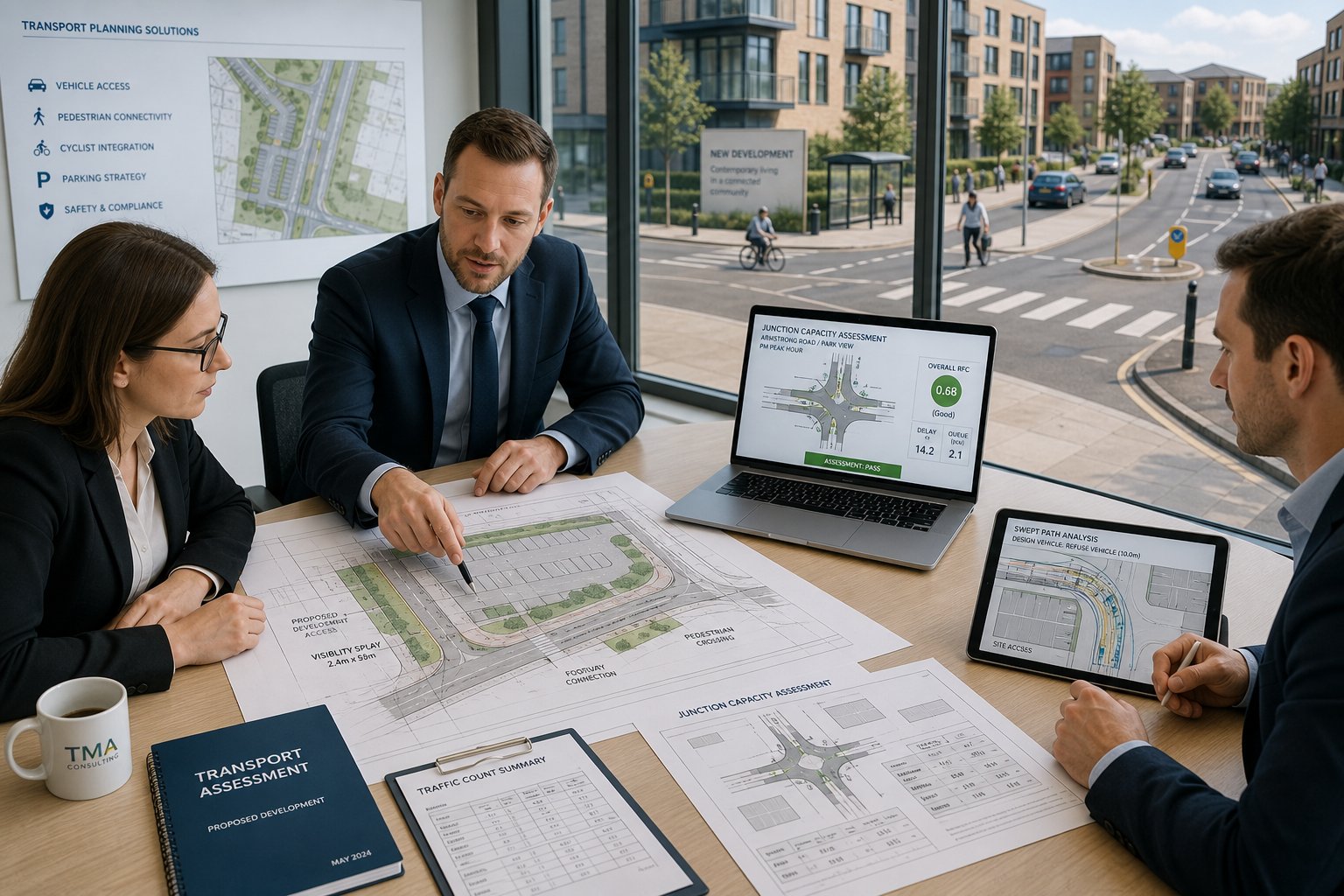
    Transport consultants reviewing site access and traffic plans in a modern office.

    Traffic flow management consultants are specialist transport planners who assess how people and vehicles move around a site and through the surrounding network. Our job is to show whether a proposal can be accessed safely and operate efficiently, and if not, what needs to change.

    That usually means far more than counting cars. We review existing highway conditions, trip generation, junction performance, parking demand, walking and cycling links, public transport accessibility, servicing arrangements and the practical design of access points. For planning applications, we turn that technical analysis into evidence that planning officers and highway authorities can use.

    Early input matters. On many schemes, transport problems are not really report problems: they are design problems discovered too late. A development might have enough floorspace and the right land use, but the access geometry is too tight, visibility is compromised, or the internal layout forces awkward servicing movements. Bringing in transport advice at concept stage often prevents expensive redesign after submission.

    In practice, we also work across disciplines. Transport advice feeds into site layout, viability, drainage interfaces, frontage design, townscape decisions and planning strategy. That’s why the role often overlaps with wider Traffic Engineering and Transportation input, especially where movement, access and highway design are tightly linked.

    How They Assess Vehicle, Pedestrian, And Site Access Impacts

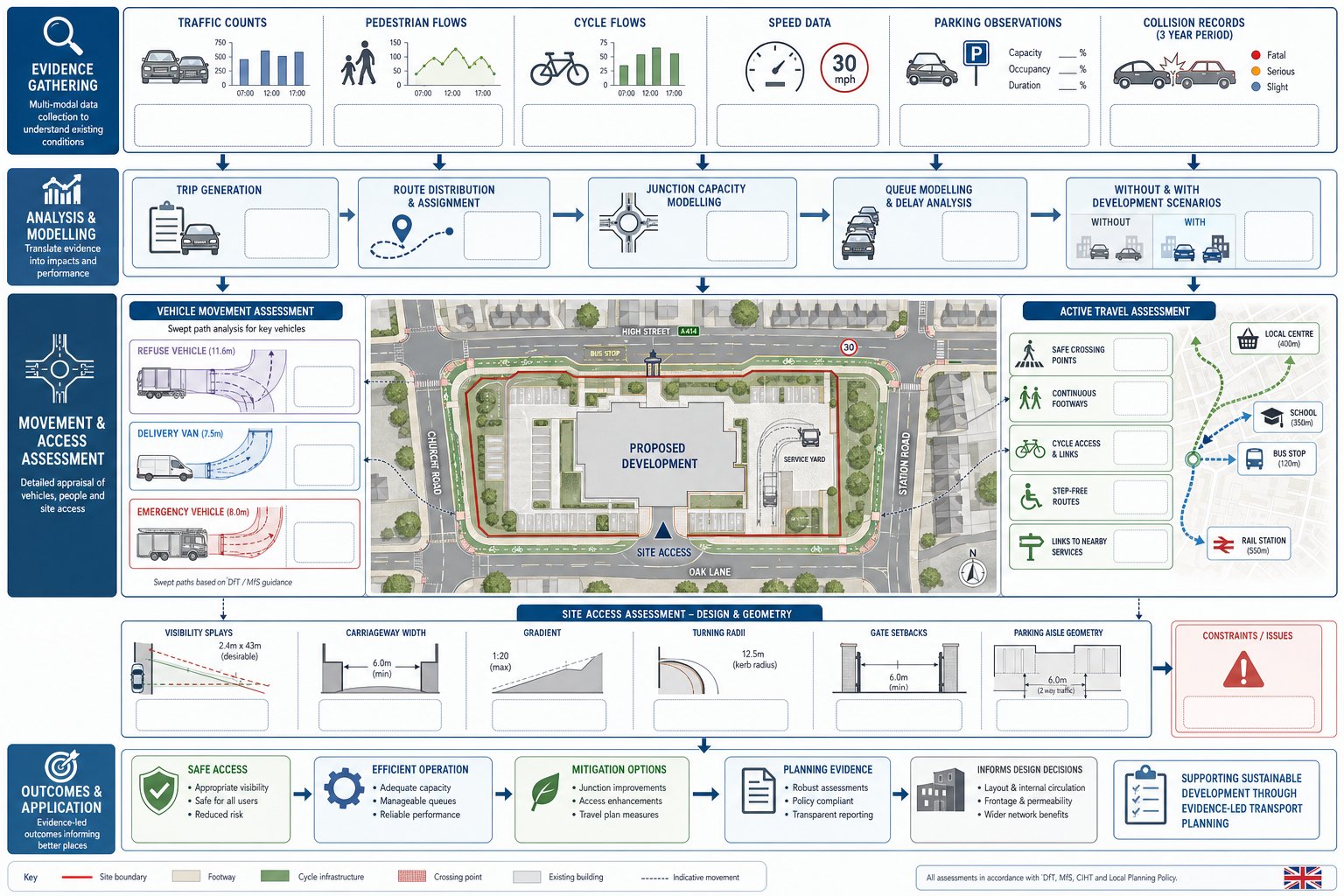
    The assessment process typically starts with evidence. We gather traffic counts, pedestrian and cycle movement data, speed information, parking observations and collision records where relevant. We then examine how the site currently works and how the proposed development is likely to change conditions.

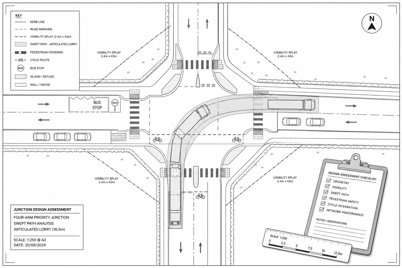
    For vehicles, that may include trip generation forecasts, distribution and assignment, queue analysis and junction capacity modelling. We test scenarios such as with-development versus without-development, peak-hour operation and the effect of mitigation. If the scheme includes larger vehicles, we often use swept-path analysis to confirm that refuse lorries, delivery vehicles and emergency appliances can enter, turn and leave safely.

    Pedestrian and cycle assessment is just as important. Authorities increasingly expect clear evidence on crossing opportunities, footway continuity, cycle access, step-free routes and connections to local services. A scheme can be acceptable in traffic terms but still draw criticism if active travel access is poor.

    Site access work focuses on the details that often decide an application: visibility splays, carriageway width, gradients, radii, gate set-backs, parking aisle dimensions and interaction with nearby junctions. On more sensitive sites, we may also review safety, accessibility and placemaking against local policy and guidance. The aim is simple: prove that movement around the site will be workable, safe and proportionate to the development proposed.

    When A Project Needs Traffic Flow Management Input

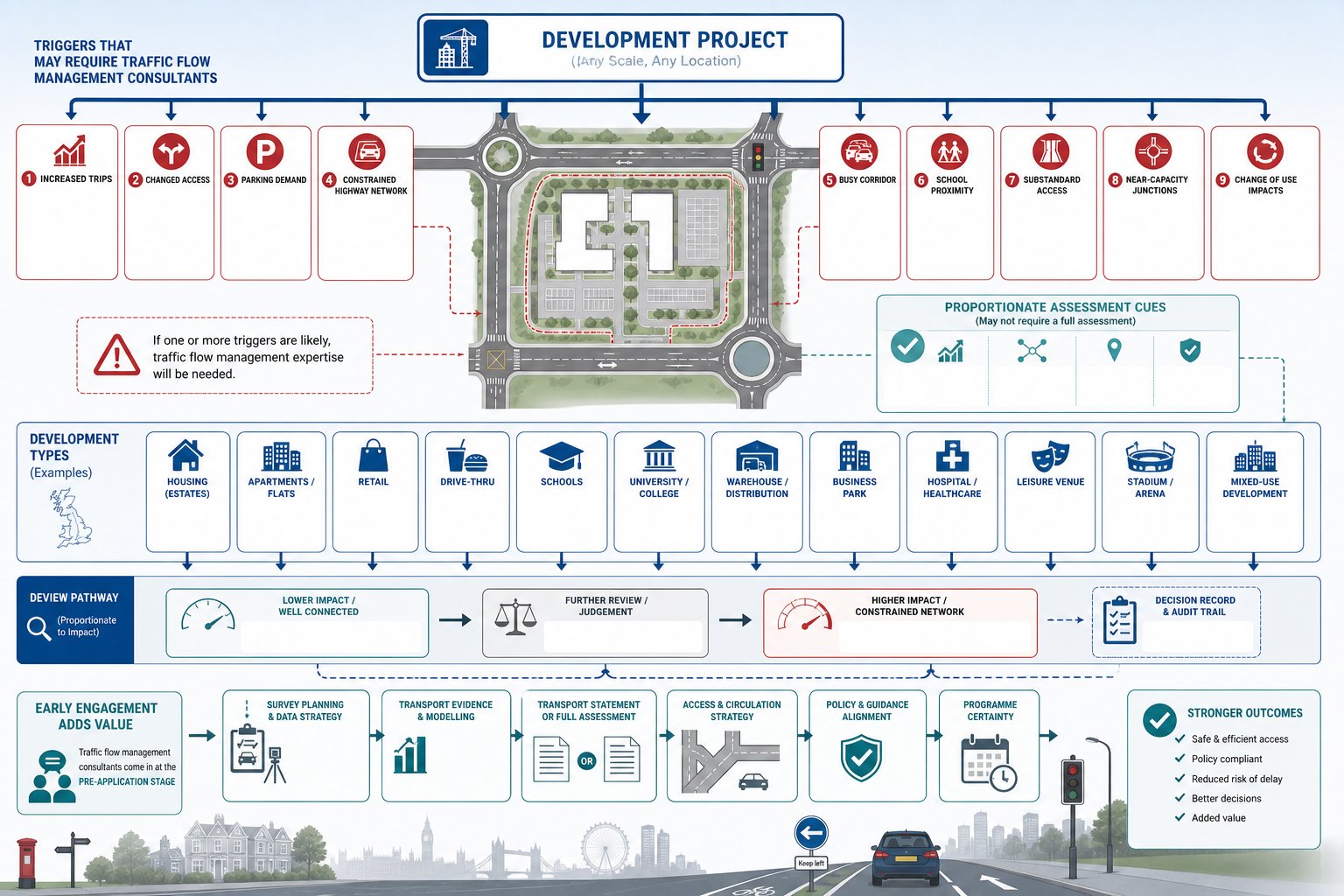
    Infographic showing when UK developments need traffic flow management review.
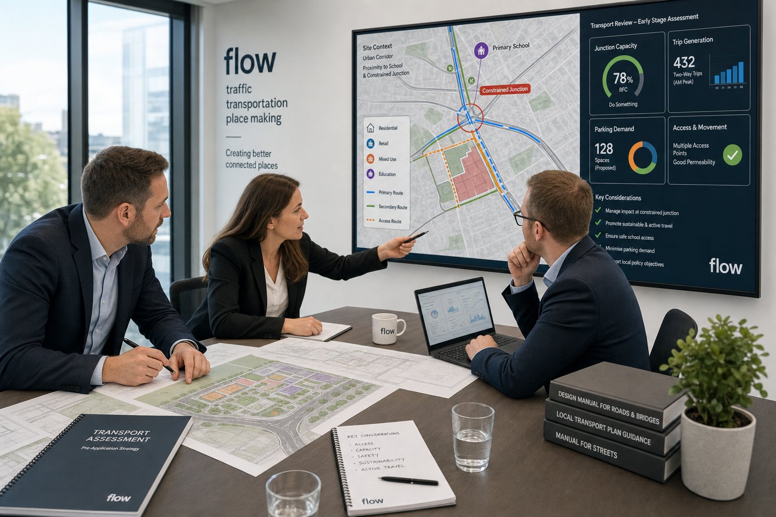
    UK consultants reviewing traffic plans for a development project in an office.

    Not every proposal needs a lengthy transport report. But any development that materially changes trips, alters access, affects parking demand or interacts with a constrained part of the highway network should usually have traffic flow management input. The key question is not just size. It is transport effect.

    A relatively modest scheme can trigger scrutiny if it sits on a busy corridor, uses a substandard access, sits near a school, or relies on a junction already operating close to capacity. Equally, a larger development in a well-connected location may only need proportionate evidence if its impacts are limited and well managed.

    Pre-application is often the right point to bring consultants in. We can scope likely requirements, advise whether a Transport Statement or full assessment is more appropriate, identify survey needs and help the project team avoid committing to an awkward access strategy too early. That can be especially valuable where local thresholds are nuanced rather than absolute.

    For development teams trying to keep planning on programme, early transport advice reduces uncertainty. It also helps align the planning narrative with policy, access design and likely consultee concerns. That broader role is one reason many clients pair traffic input with Transport Planning Consultants: advice when schemes move from feasibility into formal application work.

    Typical Developments That Trigger Transport Review

    The most common triggers are residential, retail, employment, education, healthcare, leisure and mixed-use schemes. Housing estates, apartment blocks and student accommodation often need review because of trip generation, parking demand, access geometry and pedestrian connectivity. Retail parks, supermarkets and drive-thrus are closely examined because peaks can be sharp and junction effects can spread beyond the site frontage.

    Schools, colleges and universities frequently require detailed thought because arrivals and departures are concentrated, kerbside management matters, and walking, cycling and coach arrangements are often contentious. Warehouses, business parks and industrial developments raise servicing, HGV routing and junction capacity issues. Hospitals, event venues and stadium-related development can be even more sensitive due to surges in demand and operational complexity.

    Change-of-use schemes also get overlooked. A building may remain physically similar while generating a very different movement pattern. A former office becoming a gym, medical use or food-led destination can alter peaks, parking and servicing dramatically.

    As a rule, if a proposal changes how people arrive, where they stop, how vehicles enter and leave, or how the surrounding network performs, a transport review is sensible. Whether the final output is short or detailed depends on scale and context, but the need for informed judgement is often there from the start.

    How Traffic Evidence Supports Planning Applications

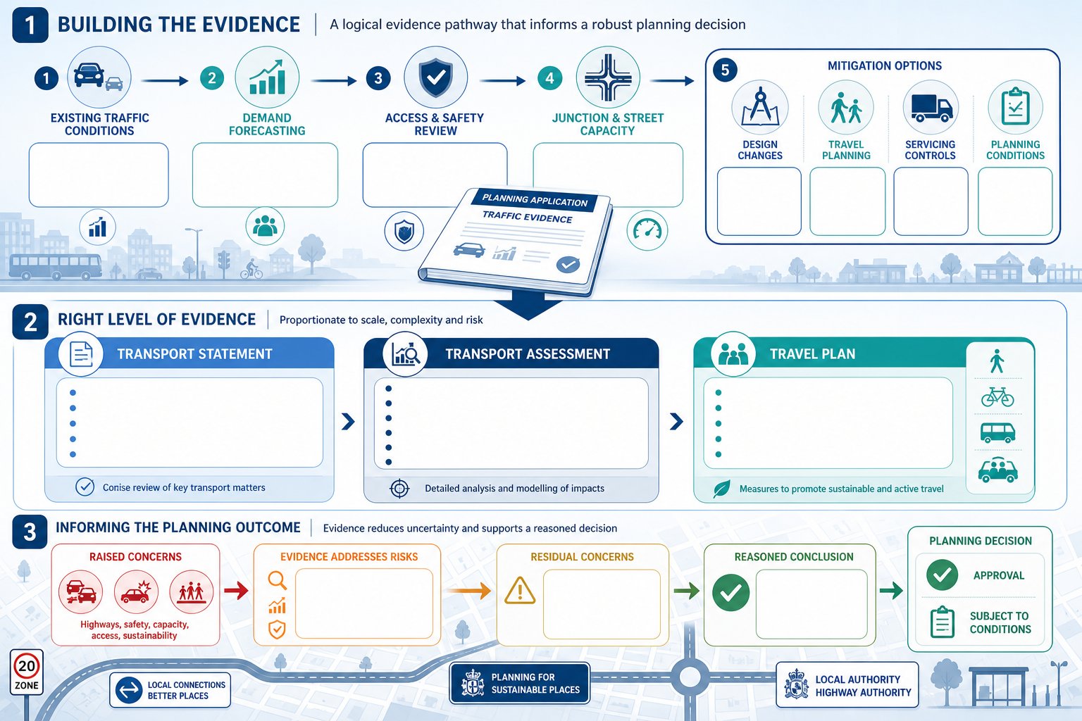
    Infographic comparing UK transport planning documents and traffic evidence process.
    Transport consultants reviewing planning and traffic evidence in a modern UK office.

    Strong traffic evidence does two jobs at once. First, it demonstrates whether the development is acceptable in transport terms. Second, it shows that the applicant has understood the site, tested impacts properly and proposed realistic mitigation where needed. That matters because planning decisions are rarely made on assertion alone.

    A good transport submission gives decision-makers confidence. It explains existing conditions, forecasts likely demand, assesses access and safety, and sets out whether nearby junctions and streets can accommodate the proposal. If constraints exist, it shows how they can be addressed through design changes, physical mitigation, travel planning measures, servicing controls or planning conditions.

    This is particularly important where transport concerns might otherwise become a reason for refusal. Clear evidence can narrow disputes, frame consultee comments more usefully and prevent broad, untested objections from dominating the process. It also helps legal and planning teams by creating a robust, traceable basis for the application’s transport case.

    Policy context sits behind all of this. National and local policy generally support development that enables safe and suitable access for all users and avoids severe residual cumulative impacts. But the phrase everyone remembers is “severe”, and that threshold still needs evidence. On some schemes, a focused traffic impact assessment is what turns a vague concern into a reasoned conclusion.

    The Difference Between Transport Statements, Transport Assessments, And Travel Plans

    These documents are related, but they are not interchangeable.

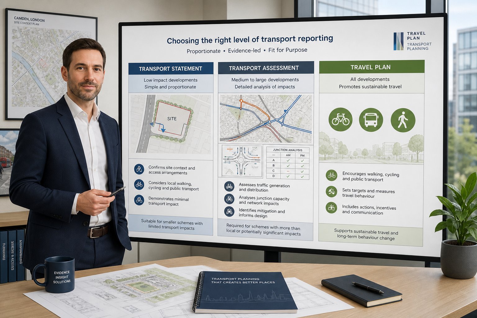
    A Transport Statement (TS) is normally used for smaller or lower-impact developments. It provides a concise review of existing transport conditions, site access, likely trips and any relevant constraints. A TS may include basic junction review or parking analysis, but it is generally proportionate rather than exhaustive.

    A Transport Assessment (TA) is more detailed. It is usually required where development scale, sensitivity or likely impact is greater. A TA can include surveys, trip forecasting, distribution, junction modelling, active travel review, servicing analysis, parking strategy and mitigation proposals. It is the main evidence document for larger or more complex schemes.

    A Travel Plan (TP) is different again. It does not primarily test highway impact. Instead, it sets out measures to encourage walking, cycling, public transport use, car sharing and smarter travel behaviour. Authorities often seek Travel Plans alongside TSs or TAs, especially for workplaces, schools, residential schemes and mixed-use development.

    The right choice depends on local thresholds, site context and officer expectations. We usually advise clients not to guess. A short scoping discussion with the authority can save weeks of wasted work, or avoid under-scoping a submission that later needs to be redone.

    Key Traffic Flow Studies And Reports Consultants Prepare

    Infographic of UK traffic surveys, junction modelling, access review and planning reports.
    Transport consultants reviewing traffic data and junction plans in a modern office.

    The report list varies by project, but most traffic flow management consultants prepare a core group of planning and technical documents. These often include transport scoping notes, Transport Statements, Transport Assessments, Travel Plans, access appraisals, parking and servicing strategies, delivery and servicing plans, and technical responses to consultee comments.

    On some schemes, we also coordinate specialist inputs such as Road Safety Audits, stage-by-stage highway design review, construction traffic management advice or support for Section 278 and Section 38 discussions. Audits themselves are often undertaken by independent accredited teams, but the transport consultant usually helps make sure the design package is ready for that process.

    The value of these documents is not just that they exist. It is that they are proportionate, evidence-led and tailored to the local authority’s validation and policy expectations. A generic report lifted from another site tends to unravel quickly once officers compare assumptions with actual site conditions.

    That is one area where experienced firms stand out. Teams with long planning-led transport experience, including those producing concise reports for varying authority thresholds such as Birmingham Transport Consultant: Planning-Led, usually focus on the question behind the report: what exactly needs proving here?

    Traffic Surveys, Junction Capacity Modelling, And Access Appraisals

    Traffic surveys provide the raw evidence. Depending on the scheme, that may include automatic traffic counts, turning counts, queue length surveys, journey time surveys, speed data, vehicle classification counts, parking beat surveys and pedestrian or cycle counts. Timing matters. Surveys need to reflect representative conditions, and school holidays, abnormal roadworks or seasonal distortion can weaken the dataset.

    Junction capacity modelling is then used to test performance. In the UK, consultants commonly use recognised software and standard methodologies to assess priority junctions, roundabouts and signalised junctions. The core exercise is usually to compare existing and future baseline scenarios with a development case, then test whether queues, delays or reserve capacity remain acceptable. Mitigation options can then be modelled before any design commitment is made.

    Access appraisals are more geometric and practical. We review visibility splays, widths, gradients, corner radii, stopping behaviour, swept paths, pedestrian crossing points and how the access relates to nearby junctions or frontage activity. In some cases, the issue is not whether the network can absorb additional traffic but whether vehicles can use the site entrance safely and comfortably at all.

    These studies often overlap with highway design consultants work, especially where mitigation involves new bellmouths, frontage changes, TRO implications or adoptable highway details.

    How Consultants Work With Architects, Planners, And Developers

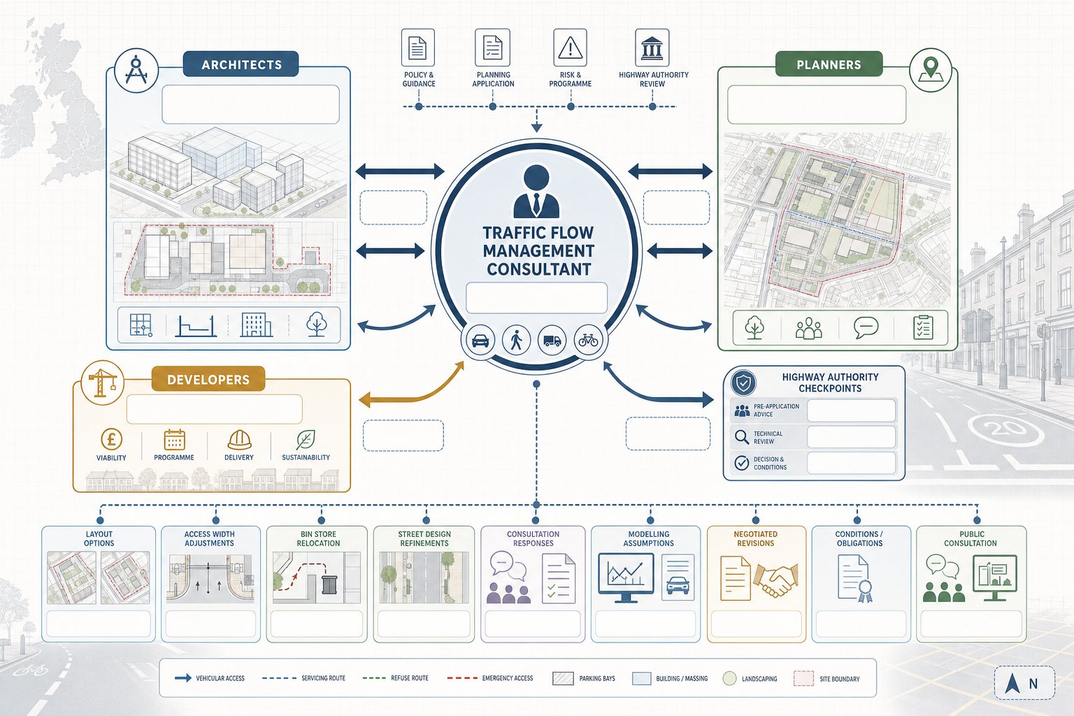
    Infographic of consultants coordinating traffic planning with architects, planners, and developers.
    Consultants, planners, and architects reviewing transport plans in a modern office.

    The best transport work is collaborative, not bolted on at the end. We usually start by understanding the scheme’s planning aims, site constraints, commercial drivers and likely authority sensitivities. From there, transport advice feeds into layout options, access location, parking strategy, servicing routes, street design and the overall planning narrative.

    With architects, we often comment on internal circulation, refuse strategy, emergency access, tracking, frontage treatment and the small design moves that stop a scheme becoming awkward operationally. With planning consultants, we align transport evidence with policy wording, application strategy and pre-app discussions. With developers and land teams, we help test site capacity and programme risk before too much money is committed.

    This matters because transport can quietly reshape a scheme. A few metres of access width, a different bin store position, or a revised servicing route can resolve issues that would otherwise trigger objections. On constrained urban sites, those changes can be the difference between a workable application and a redesign after submission.

    Consultants also play a practical role during consultation and determination. We respond to highway authority comments, explain modelling assumptions, agree revisions and support negotiations over conditions or obligations. Where community concern is likely, transport evidence can also feed into broader public consultation transport exercises so that movement issues are addressed with facts rather than speculation.

    In short, our role is not just to write the report. It is to help the whole project team make decisions that stand up technically and politically.

    Common Planning And Highway Issues They Help Resolve

    Most planning transport disputes come back to a familiar set of issues. Junction capacity is high on the list: will extra trips cause unacceptable delay or queuing, especially at nearby priority junctions, roundabouts or signalised nodes? Then there is safety, not only recorded collisions, but also visibility, speed environment, turning conflict, crossing demand and whether vulnerable users are properly catered for.

    Parking is another recurring pressure point. Authorities may question whether parking is overprovided, underprovided or poorly laid out. Residential schemes often face tension between policy aspirations for sustainable travel and market expectations for car ownership. Commercial sites bring their own problems: delivery activity, staff parking, disabled spaces, EV charging, cycle parking and kerbside management all need coherent treatment.

    Servicing is frequently underestimated. Refuse collection, delivery vehicles and emergency access have a way of exposing weak layouts. If a vehicle cannot enter and exit in forward gear, or has to reverse excessively in a shared environment, objections follow quickly. Construction traffic creates a separate layer of concern, especially on tight urban sites where temporary traffic management, routing and loading arrangements must be controlled.

    Consultants help resolve these matters by testing options, refining layouts and translating technical constraints into realistic mitigation. Sometimes the answer is physical improvement. Sometimes it is operational control, such as delivery timing, car park management or a Construction Traffic Management Plan. And sometimes the real value lies in framing a proportionate response that addresses the authority’s concern without over-engineering the scheme.

    That blend of technical evidence and policy judgement is why transport advice often overlaps with Transport Policy Review work on more complex or contentious applications.

    What Local Planning Authorities And Highway Authorities Expect

    Authorities expect transport submissions to be proportionate, evidence-based and clearly tied to policy. They do not want a heavily technical document that dodges the real issue, and they do not want a short report that makes sweeping claims without data. The standard is simpler than that: explain the site, use robust methods, assess the right scenarios and set out defensible conclusions.

    In UK practice, that usually means alignment with national guidance, local plan policy, parking standards, highway design principles and recognised transport assessment methods. Guidance such as Manual for Streets remains influential, but local policy often shapes the details: survey scope, peak periods, trip rate assumptions, modelling years, mitigation triggers and whether a Travel Plan is expected.

    Highway authorities also care about transparency. They want to understand where survey data came from, why certain junctions were included, how development traffic was distributed and what assumptions sit behind the model. If sensitivity tests are needed, they should be there. If a mitigation package is proposed, it should be practical, cost-aware and capable of being secured by condition or obligation.

    We find that early scoping can make a major difference. Agreeing methodology up front reduces argument later and helps everyone focus on genuine planning issues rather than process disputes. It also improves the chances that reports are concise without being thin, a balance many applicants want, especially when trying to maintain programme certainty.

    Above all, authorities expect transport documents to help decision-making. If a report answers the key questions plainly and backs them with sound analysis, it stands a much better chance of moving the application forward.

    How To Choose The Right Traffic Flow Management Consultant

    Choosing the right consultant is partly about technical competence and partly about judgement. Plenty of people can produce a model or compile a report. Fewer can identify the real planning risk early, scope the work proportionately and communicate with officers in a way that keeps the application moving.

    We’d start with experience in UK development planning, not just general traffic engineering. The consultant should understand how local planning authorities and highway authorities review submissions, how thresholds vary, and what level of evidence is usually needed for the type of scheme you are promoting. A strong track record with residential, retail, education, employment or mixed-use applications similar to yours is a practical sign.

    Then look at method and communication. Do they use recognised survey and modelling tools? Can they explain, in plain language, why a TS may be enough instead of a TA, or why a Travel Plan should be framed in a certain way? Are their reports concise, readable and tailored to place? That matters. Dense technical writing can be just as unhelpful as thin reporting.

    Local knowledge is useful too, especially on schemes involving sensitive junctions, constrained urban access or authority-specific expectations. But local knowledge on its own is not enough. You want a consultant who can challenge assumptions, coordinate with the wider design team and respond quickly when comments arrive.

    Finally, look for evidence of planning success rather than promises. A consultant with a history of producing clear, authority-aware submissions, including practical guidance around traffic flow management consultants and related planning-led transport work, is usually better placed to add value than one who simply offers generic analysis.

    Conclusion

    Traffic flow management consultants do much more than measure traffic. We provide the evidence, design input and negotiation support that help show a development can be accessed safely, function efficiently and comply with planning and transport policy.

    For architects, planners, developers, surveyors, lawyers and local authorities, the practical benefit is straightforward: fewer surprises, stronger submissions and a clearer route through transport risk. The right advice at the right stage can shape site layout, support pre-application strategy, answer highway objections and keep a planning application from drifting into avoidable delay.

    In 2026, that role is only becoming more important. Authorities expect robust data, proportionate reporting and mitigation that genuinely works on the ground. When transport evidence is well prepared and properly integrated with the wider scheme, it does not just defend an application. It helps unlock it.

    Frequently Asked Questions about Traffic Flow Management Consultants

    What roles do traffic flow management consultants play in planning applications?

    Traffic flow management consultants assess vehicle, pedestrian and cyclist movement to ensure safe, efficient access for developments. They provide evidence-based transport reports, design input and mitigation proposals that support planning approvals and address highway authority concerns.

    When is it necessary to involve traffic flow management consultants in a development project?

    Any development likely to increase trips, alter access or impact sensitive junctions typically needs traffic input. This includes larger residential, retail, educational, employment and mixed-use schemes, particularly at the pre-application stage to avoid delays.

    How do traffic flow management consultants assess vehicle and pedestrian impacts?

    They conduct traffic counts, pedestrian and cycle surveys, junction capacity modelling, and swept-path analysis for larger vehicles. They also appraise site access issues like visibility splays, carriageway widths and safety audits to ensure functionality and compliance.

    What is the difference between a Transport Statement, Transport Assessment and Travel Plan?

    A Transport Statement is a concise review for low-impact schemes. A Transport Assessment is a comprehensive report with detailed modelling for larger developments. A Travel Plan focuses on managing travel behaviour, promoting walking, cycling and public transport to reduce car dependency.

    How do traffic flow management consultants collaborate with architects and planners?

    Consultants work closely with architects and planners to inform site layout, access design, parking and servicing strategies. Their input during early design stages helps avoid costly redesigns and ensures the transport aspects support a smoother planning process.

    What are common transport issues these consultants help resolve during planning?

    They address junction capacity, safety concerns such as visibility and pedestrian provision, parking adequacy and design, servicing access, and construction traffic management. Their solutions balance technical analysis with local policy to mitigate objection risks effectively.

  • Traffic Engineering Consultants: What They Do, When You Need One, And How They Support Planning Success In 2026

    Traffic Engineering Consultants: What They Do, When You Need One, And How They Support Planning Success In 2026

    Planning risk rarely starts with the glossy parts of a scheme. More often, it starts at the site access, the nearby junction, the parking layout, or a local highway officer asking a deceptively simple question: will this development work safely on the ground? That is where traffic engineering consultants come in.

    For architects, planners, developers, surveyors, solicitors and local authorities, transport evidence can make the difference between a smooth planning process and months of avoidable delay. A well-prepared report does more than satisfy a validation checklist. It shows how vehicles, cyclists and pedestrians will move, whether junctions can cope, whether visibility is acceptable, and what mitigation is needed to support approval.

    In our experience, the best outcomes come when traffic engineering is brought in early rather than treated as a late-stage add-on. At that point, we can help shape site layout, access strategy, parking provision and technical scope before positions harden. That matters even more in 2026, when local planning authorities and highway teams are under pressure to assess schemes quickly but still expect robust, policy-aligned evidence.

    Below, we break down what traffic engineering consultants do, when their input is needed, what services they provide, and how to choose the right specialist for a planning application.

    What Traffic Engineering Consultants Do And Why Their Input Matters

    Traffic consultants reviewing UK road access plans in a modern office.

    Traffic engineering consultants focus on the way streets and development accesses actually operate. We assess how traffic moves now, how it is likely to move once a scheme is built, and whether the surrounding network can continue to function safely and efficiently. That means looking at flows, queues, delay, lane use, turning movements, conflict points, pedestrian desire lines, servicing movements, cycle interaction and road safety performance.

    On a live planning project, that work often turns into practical decisions very quickly. Should the access be priority-controlled or signalised? Is a ghost island right turn lane needed? Can refuse vehicles turn on-site? Will parking overspill create highway stress on nearby residential streets? Does the proposed visibility achieve an acceptable standard? These are not side issues. They are often the issues that determine whether a local authority is comfortable recommending approval.

    Strong technical input also helps frame mitigation properly. Instead of vague assurances, a consultant can quantify likely effects and set out targeted responses, whether that is revised access geometry, improved footways, junction upgrades, lining changes, a Travel Plan or a contribution package. Broader context matters too, and good teams understand how traffic evidence fits alongside policy, masterplanning and delivery, as discussed in Transport Planning Consultants.

    How Traffic Engineering Differs From Transport Planning And Highway Design

    Traffic engineering sits between strategy and construction. Transport planning tends to look at the wider picture: travel demand, trip generation, sustainable mode share, land use patterns and policy compliance. Highway design, by contrast, is more concerned with the physical design and construction of roads, levels, drainage interfaces, pavements, structures and detailed engineering delivery.

    Traffic engineering is more operational. We look at how the network performs day to day and how specific design choices affect safety and capacity. Signals, junction geometry, visibility, swept paths, parking layout, lane discipline, queue interaction and network management all sit firmly in this space.

    There is overlap, of course. On many projects, one consultant team may contribute to transport planning, traffic engineering and elements of highway design. But the distinction still matters. If a site’s key risk is whether a constrained access can safely serve a mixed-use development, or whether a nearby junction can absorb extra turning traffic, that is traffic engineering territory. Getting the right discipline involved early usually saves redesign later.

    When To Appoint A Traffic Engineering Consultant For A Planning Application

    Traffic consultants reviewing site access plans in a modern UK office.

    The short answer is earlier than most teams think.

    We are often instructed after a layout has been fixed, a red line boundary agreed and a pre-app date booked. That can still work, but it is rarely ideal. If access is marginal, parking is tight, or a sensitive junction sits nearby, early technical review can change the direction of the scheme before money is spent on drawings that later need to be revisited.

    At feasibility stage, traffic engineering consultants can test whether a site is likely to be developable in highway terms. That is particularly useful for option appraisals, acquisitions and conditional contracts. We can advise on likely survey needs, local thresholds for a Transport Statement or Transport Assessment, and whether the authority is likely to scrutinise access, capacity, servicing or sustainable travel measures most closely.

    Pre-application is another key point. A concise technical note can sharpen discussions with the highway authority and reduce the chance of broad, open-ended information requests later. For developers and planning teams working across multiple regions, local insight also matters: authority expectations in one area are not always mirrored in another, which is why project-specific support such as a Traffic Engineer In Manchester: or other location-led adviser can be valuable.

    Once a formal scope is requested, consultant input becomes less optional and more essential.

    Typical Triggers For Consultant Input

    Some planning applications can proceed with relatively light transport evidence. Others trigger immediate technical scrutiny. Common examples include:

    • developments exceeding local thresholds for a Transport Statement or Transport Assessment
    • new or altered accesses onto classified roads
    • sites close to congested junctions, schools or high street frontages
    • constrained urban plots with parking, servicing or turning challenges
    • schemes with poor visibility splays or unusual topography
    • proposals likely to attract highway objections from neighbours or consultees
    • applications where a planning appeal is possible if consent is refused

    We would also add one trigger that is easy to miss: uncertainty. If the project team is not sure whether the transport case is straightforward, it usually isn’t. A quick early review often exposes the real risks.

    And there is a commercial point here. A modest upfront instruction is usually cheaper than redesigning access geometry, commissioning rushed surveys, or answering several rounds of highway queries under deadline pressure.

    Core Services Traffic Engineering Consultants Provide

    UK traffic consultants reviewing transport plans and junction analysis in a modern office.

    Most people associate traffic engineering with a Transport Assessment, but the scope is wider than that. Depending on the scheme, we may collect and interpret traffic survey data, review collision records, undertake junction capacity modelling, prepare swept path analysis, advise on parking and servicing, develop access options, assess visibility, support Road Safety Audit processes, and respond to consultation comments during determination or appeal.

    The value is not just in producing drawings or calculations. It is in joining the dots. A parking issue may actually be a servicing issue. A junction concern may be solvable through layout changes on site rather than off-site highway works. A local authority objection may stem from poor scoping rather than a fundamentally flawed scheme.

    For many development teams, speed matters too. At ML Traffic, the emphasis is on concise and accurate reporting shaped around local authority thresholds, and that reflects what clients usually need: documents that are technically robust without becoming bloated. Practical guidance on the wider discipline appears in Highway and Traffic Engineering Consultants, but in planning terms the core service offer tends to fall into a few recognisable categories.

    Transport Statements, Transport Assessments, And Travel Plans

    A Transport Statement is generally used for smaller schemes where impacts are expected to be limited. It sets out the development proposals, local transport context, access arrangements, parking provision and a proportionate view of likely traffic effects. The best ones are concise, not flimsy.

    A Transport Assessment goes further. It usually includes trip generation, distribution and assignment, baseline network conditions, capacity modelling, sustainable accessibility, servicing review, and mitigation where needed. For larger or more sensitive developments, it becomes one of the central pieces of planning evidence.

    Travel Plans sit alongside those reports. Their purpose is demand management: reducing single-occupancy car use, promoting active travel, supporting public transport uptake and embedding monitoring measures that the authority can rely on post-consent. A weak Travel Plan feels generic. A good one is tied to the site, users and local travel opportunities.

    Junction Capacity, Access, Parking, And Visibility Reviews

    These are often the decisive technical workstreams.

    Junction capacity modelling tests how a priority junction, roundabout or signal-controlled junction is expected to operate with and without development traffic. We use recognised tools to understand queues, delay, reserve capacity and practical stress points. Numbers matter, but interpretation matters just as much. A model can show an issue: an experienced engineer explains whether it is material and what can realistically be done about it.

    Access reviews focus on geometry, width, radii, vehicle tracking, pedestrian crossing points and conflict with existing movements. Parking and servicing reviews consider quantity, policy compliance, bay dimensions, turning areas, delivery arrangements and usability in the real world. Visibility assessments check whether drivers can see and react in line with accepted standards and local expectations.

    Where authorities are especially sensitive to congestion or operational performance, related support from Traffic Flow Management specialists can also feed into the case.

    How Traffic Engineering Evidence Supports Planning Decisions

    Traffic consultants presenting planning evidence in a modern UK meeting room.

    Planning officers and committee members rarely need every technical detail, but they do need confidence that the transport case is sound. Good traffic engineering evidence provides that confidence by translating technical analysis into clear planning conclusions.

    In practical terms, the evidence answers a set of recurring questions. Is the site accessible? Can vehicles enter and leave safely? Will nearby junctions operate within an acceptable range? Is parking adequate and usable? Are pedestrians and cyclists properly considered? Is there likely to be severe impact, to use the language that often shapes highway decisions? And if there is an impact, can it be mitigated in a proportionate way?

    That evidence also anchors negotiations. Without quantified assessment, discussions become subjective very quickly. One consultee says queues will be intolerable: another says the impact will be negligible. A properly scoped report, supported by survey data and accepted assessment methods, gives everyone a shared technical base.

    It is also important at appeal. Inspectors tend to respond well to clear, transparent transport evidence that distinguishes between genuine harm and generalised concern. Loose claims do not travel far. Measured analysis does.

    For local authorities, this kind of work helps balance competing objectives: enabling growth, protecting safety, supporting sustainable movement and managing pressure on existing infrastructure. For applicants, it reduces uncertainty. That is why transport evidence is rarely just a supporting note. On many schemes, it is one of the pillars holding the application up.

    Working With Architects, Planners, Developers, And Local Authorities

    Professionals reviewing traffic plans in a modern UK office meeting.

    Traffic engineering works best when it is integrated, not bolted on. We spend a large part of any project coordinating with other disciplines because transport issues are almost never isolated from the rest of the design.

    With architects, the conversation often starts with layout. A small shift in building line can improve visibility. Moving a bin store can unlock vehicle tracking. Reconfiguring active frontage can create a safer pedestrian route from the public highway. These are design moves, but they are informed by traffic engineering logic.

    With planning consultants and town planners, the focus is usually strategy and wording. We help align technical evidence with local policy, committee risk, likely consultee objections and the application narrative. For lawyers and land teams, we may provide input at due diligence stage, particularly where access rights, adoptability or off-site mitigation could affect viability.

    Developers want clarity on programme and risk. Local authorities want evidence that is proportionate, policy-compliant and easy to review. The consultant’s job is to bridge those priorities. In major urban areas, that often means understanding how different councils interpret similar standards, whether through a Traffic Engineer In London: perspective on constrained city sites or experience on regional projects such as those led by a Traffic Engineer In Leeds:.

    The relationship with highway officers matters as well. The best outcomes usually come from constructive, early dialogue, backed by drawings and evidence that answer the authority’s actual concerns rather than a generic checklist.

    What Makes A Good Traffic Engineering Report

    A good report is not simply long, heavily modelled or packed with appendices. In fact, some of the least effective transport reports are the ones that bury the key point under fifty pages of technical noise.

    A strong traffic engineering report starts with the right scope. That sounds obvious, but many weak submissions begin with assumptions that were never agreed with the authority. Survey extents, assessment years, junction selection, committed development assumptions and modelling scenarios all need to be proportionate and defensible.

    From there, quality comes down to transparency. The data source should be clear. The methodology should be recognisable. Any assumptions on trip rates, distribution patterns or growth factors should be explained rather than smuggled in. If modelling has been undertaken, the report should state what software was used, how the network was coded and what the outputs mean in practical terms.

    Structure matters too. We generally want to see a clean line from baseline conditions to proposed development, then assessment, mitigation and conclusion. Plans should match the text. Vehicle tracking should reflect the layout actually submitted. Parking counts should be internally consistent. These details sound mundane, but inconsistencies are exactly the sort of thing consultees latch onto.

    Most of all, a good report is readable. Technical appendices can do the heavy lifting. The main narrative should explain the findings in plain English, because planning decisions are made by people, not just by models.

    Common Issues That Delay Planning Approval

    The same transport problems come up again and again, and most are avoidable.

    First, poor survey data. If counts are out of date, collected in abnormal conditions, or too limited in geographic scope, the authority may reject the whole evidence base. Since traffic patterns shifted noticeably in the past few years across many towns and city centres, relying on old assumptions is a risky move.

    Second, incomplete assessment. A report may mention a junction concern but provide no modelling. Or it may refer to parking compliance without testing whether vehicles can actually manoeuvre. These gaps create easy reasons for objection.

    Third, design conflict between disciplines. We have seen planning layouts where landscaping blocks visibility, cycle stores interfere with turning paths, or servicing relies on manoeuvres no operator would accept in real life. None of those issues is fatal on its own, but each can stall determination while revisions are prepared.

    Fourth, mitigation arriving too late. Travel Plans, highway works drawings, swept paths or safety responses are sometimes submitted only after objections have been raised. That slows trust as much as it slows programme.

    Finally, there is the simple problem of local fit. A technically competent report can still underperform if it does not reflect how the relevant authority reads thresholds and standards. Regional familiarity helps here, whether the scheme sits within the patch of a Traffic Engineer In Liverpool: or a Traffic Engineer In Birmingham: team.

    How To Choose The Right Traffic Engineering Consultant

    Choosing a consultant is partly about qualifications, but not only that. Technical competence is the baseline. What clients usually need beyond that is judgement.

    We would start with relevant experience. Has the consultant worked on similar development types: residential, logistics, roadside, mixed-use, education, care, urban infill? Have they dealt with the local authority involved, or at least authorities with similar highway expectations? Experience shortens the learning curve and reduces avoidable missteps.

    Professional standards matter as well. Familiarity with UK guidance such as DMRB, Manual for Streets and TSRGD is essential, as is comfort with survey interpretation, modelling tools, access design and planning-stage reporting. Chartered status can be a useful indicator, though it is not the only one. You also want to know who will actually do the work. A polished proposal means little if the project is then handed to someone inexperienced without oversight.

    Ask for examples. Not just glossy covers, but anonymised reports or extracts that show how clearly the consultant writes, how they justify assumptions and how they respond to difficult sites. If appeals, committee support or negotiations are likely, communication skills count every bit as much as technical software skills.

    And then there is responsiveness. Planning programmes rarely move in a straight line. You need a team that can turn comments around quickly, advise candidly and keep the transport strategy aligned with the wider application as it evolves.

    Conclusion

    Traffic engineering consultants sit at a practical but influential point in the planning process. We translate movement, safety and network performance into evidence that planning officers, highway authorities and project teams can act on. When that work is done early and done well, it reduces uncertainty, improves design quality and gives applications a far better chance of progressing without transport-related delay.

    For architects, planners, developers, solicitors and councils, the takeaway is fairly simple: do not wait for a highway objection before testing the transport case. Early review of access, junctions, parking, visibility and mitigation is usually cheaper, faster and far less painful than fixing problems late.

    In 2026, with planning timescales tight and scrutiny still high, the right consultant does more than write a report. They help make a scheme workable, defensible and ready for decision.

    Frequently Asked Questions about Traffic Engineering Consultants

    What role do traffic engineering consultants play in the planning process?

    Traffic engineering consultants assess how vehicles, cyclists, and pedestrians will move safely and efficiently within a development site and its surroundings. They provide technical evidence on access, junction performance, parking, and safety, which supports smooth planning approvals and reduces delays.

    How is traffic engineering different from transport planning and highway design?

    Traffic engineering focuses on the day-to-day operation and control of traffic flow, including signals, junction geometry, and safety. In contrast, transport planning addresses broader travel demand and sustainable mode use, while highway design concerns the physical construction and geometry of roads.

    When should a traffic engineering consultant be appointed for a planning application?

    It is best to involve traffic engineering consultants early, ideally during site feasibility or before pre-application meetings. Early input on access, parking, and local junctions can prevent costly redesigns and ensure compliance with highway authority requirements.

    What are the typical services provided by traffic engineering consultants?

    Services include traffic surveys and data analysis, junction capacity modelling, swept path and visibility assessments, parking and servicing design, road safety audits, and preparation of Transport Assessments, Transport Statements, and Travel Plans aligned with planning policies.

    How does traffic engineering evidence support planning decisions?

    It provides quantified data on traffic flows, safety, and junction performance, helping planners assess accessibility, parking adequacy, and road safety. This evidence facilitates informed decision-making, negotiation on mitigation measures, and strengthens appeals by distinguishing genuine impacts from general concerns.

    What should be considered when choosing a traffic engineering consultant?

    Consider relevant experience with similar development types and local authorities, professional qualifications including chartered status, familiarity with UK standards, quality of previous reports, communication skills, responsiveness, and ability to integrate with planning teams to deliver clear, robust, and compliant evidence.

  • Highway Engineering Consultants For Planning Applications: What They Do, When You Need One, And How To Choose In 2026

    Highway Engineering Consultants For Planning Applications: What They Do, When You Need One, And How To Choose In 2026

    A planning application can look perfectly sound on paper and still run into trouble the moment highways comments land. We’ve seen it happen with schemes that had strong design intent, clear commercial logic, and local support, but weak transport evidence, a questionable access arrangement, or parking assumptions that didn’t survive scrutiny.

    That’s where highway engineering consultants come in. Their role isn’t just to produce a report for the planning portal. Done properly, highway input shapes a proposal early, tests whether access is safe and workable, checks likely traffic effects, and helps a development line up with local policy before problems harden into objections.

    For architects, planners, surveyors, developers, legal teams and councils, that matters more than ever in 2026. Local highway authorities are under pressure, validation standards are closely applied, and even modest schemes can stall if transport issues are left too late. A simple access amendment can trigger visibility checks, junction review, tracking, parking analysis and sometimes a fuller transport case than the applicant expected.

    In this guide, we’ll break down what highway engineering consultants actually do in the planning process, when their input becomes necessary, which reports they prepare, how they assess access and safety, and what separates a useful consultancy from one that simply adds paperwork. The aim is practical: helping you make better planning decisions earlier, with fewer surprises later on.

    What Highway Engineering Consultants Do In The Planning Process

    Highway consultants reviewing UK planning and road access plans in an office.

    Highway engineering consultants provide the technical bridge between a development idea and the realities of the public highway. In practice, that means we assess whether a proposal can be accessed safely, whether the surrounding network can reasonably accommodate the trips it will generate, and whether parking, servicing, turning and sustainable travel arrangements are likely to satisfy planning and highway officers.

    Their input often sits alongside architecture, planning and drainage, but it has a habit of becoming critical very quickly. A site may look developable until a visibility splay crosses third-party land, a refuse vehicle can’t turn, or a local junction is already operating close to capacity at peak times. Good advice catches those issues early enough to redesign rather than defend the indefensible.

    For planning applications, the work usually covers feasibility advice, access strategy, trip generation, highway safety review, parking provision, servicing, and the preparation of supporting transport documents. On more involved schemes, consultants may also coordinate traffic surveys, junction modelling, swept path analysis and mitigation proposals.

    The best highway advice is planning-focused rather than purely theoretical. It balances standards, evidence and local authority expectations with commercial reality. That’s why teams looking at wider transport planning support often bring highway input in at the same time instead of treating it as a final-box exercise.

    How They Support Planning Applications From Early Feasibility To Determination

    At feasibility stage, we normally start with risk. Is there a realistic point of access? Are local roads suitable in geometry and character? Will the likely use create transport issues that push the scheme into a Transport Statement or full Transport Assessment? These are simple questions, but they can save months.

    As a design develops, highway engineering consultants help shape the site layout. That may involve repositioning an access, refining internal tracking, checking parking ratios against local standards, or ensuring emergency, service and delivery vehicles can operate without awkward reversals onto the highway. Sometimes the most valuable output is not a report at all, but a change to the drawing before the application is lodged.

    At submission stage, consultants produce the technical evidence needed for validation and determination. Depending on scale, that might be a concise note or a detailed package of transport documents, plans and appendices. During consultation, we respond to officer queries, clarify assumptions, and where needed negotiate mitigation, conditions or highway works.

    And after submission, the job often continues. A strong team will stay engaged through objections, amendments and committee deadlines, much like experienced Traffic Engineering Consultants do when a project needs both technical depth and quick, practical responses.

    When A Development Needs Highway Engineering Input

    Highway engineering consultants reviewing access, traffic, and parking plans in a UK office.

    Not every proposal needs a lengthy transport package, but many developments need some level of highway engineering input far earlier than applicants assume. The trigger is rarely just size. Small schemes can create complex access or parking problems, while larger sites sometimes sit in locations where transport impacts are straightforward and well understood.

    As a rule, we advise getting highway input whenever a scheme interacts materially with the public highway or relies on an access arrangement that could be challenged. That includes residential, commercial, education, healthcare and mixed-use schemes. Change-of-use applications are easy to underestimate here: a building may remain the same physically, yet its trip profile, servicing pattern or parking demand can change enough to raise objections.

    Highway input is also sensible where a planning application sits in a constrained urban environment. Historic streets, high pedestrian activity, school frontages, hospitals, one-way systems and roads with existing congestion all increase the value of early technical review. Local context matters as much as headline floorspace or unit numbers.

    For developers working across regions, this is where local knowledge earns its keep. Thresholds and officer expectations vary. The level of detail accepted in one authority may be rejected in another. That’s especially true on projects needing a tailored access solution or coordinated highway infrastructure design response.

    Common Triggers Including Access Changes, Traffic Impact, And Parking Pressure

    The most obvious trigger is a new or altered point of access. If a development needs a fresh vehicular access, a widened bellmouth, a relocated entrance, or revised priority arrangement, highway engineering consultants are usually required. Even seemingly modest changes can lead to questions on visibility, geometry, pedestrian conflict, drainage tie-in and adoptable standards.

    Traffic impact is another common trigger. Where a development is likely to generate noticeable additional trips, or where local junctions are already sensitive, officers may expect a Transport Statement or Transport Assessment. This is not just about raw trip numbers. Peak spreading, servicing activity, school pick-up patterns, HGV movements and cumulative nearby development can all become material.

    Parking pressure is frequently underestimated. Councils will look closely at whether on-site parking is policy compliant, whether overspill is likely, and whether disabled bays, cycle parking and servicing arrangements are credible. In town centres and suburban streets alike, parking can become the issue neighbours understand most viscerally, so weak evidence here invites resistance.

    Other triggers include intensification of use, operational changes, sensitive receptors, collision history nearby, constrained visibility, and third-party land affecting splay delivery. If a site sits on a route with existing safety concerns, or close to a school gate where behaviour is already messy at 8.30am, highway review stops being optional and starts being essential.

    Core Reports Highway Engineering Consultants Prepare

    Highway engineering consultants reviewing transport planning reports in a modern UK office.

    Planning decisions rarely turn on a single drawing. They turn on evidence, and in transport terms that evidence usually comes in the form of proportionate reports. Highway engineering consultants prepare the documents that explain how a development will function, what its impacts are likely to be, and why the proposal should be considered acceptable in policy and operational terms.

    The right document depends on scale, context and authority requirements. One of the most common mistakes we see is the assumption that a standard template will do. It won’t. Reports need to reflect local thresholds, the character of the network, the nature of the development and the specific concerns likely to come from consultees.

    Some projects need only a concise technical note. Others require a coordinated suite of assessments covering traffic generation, capacity, parking, servicing, access design and sustainable travel measures. The consultancy’s role is to scope that package properly at the outset, so the application is neither under-evidenced nor buried under unnecessary paperwork.

    This is also where speed matters. For time-sensitive planning programmes, concise and accurate reporting can make a material difference. Teams used to preparing planning transport reports around validation requirements tend to reduce back-and-forth later because the right questions are answered first time.

    Transport Statements, Transport Assessments, Travel Plans, And Technical Notes

    A Transport Statement (TS) is usually prepared for smaller developments with limited transport impacts. It sets out baseline conditions, access arrangements, anticipated trip generation, parking and servicing, and explains why the proposal is unlikely to create severe impacts. The key word is proportionate. A good TS is concise but still evidence-based.

    A Transport Assessment (TA) goes further. This is the detailed document used for larger or more sensitive schemes where traffic impact, junction performance, safety or mitigation require fuller analysis. A TA may include survey data, distribution and assignment, capacity modelling, accident review, sustainable travel opportunities and mitigation proposals. If the scheme is likely to be scrutinised heavily by the highway authority, the TA becomes central to the planning case.

    A Travel Plan (TP) supports sustainable transport objectives. It sets out measures to encourage walking, cycling, public transport use, car sharing and active travel management. Some authorities require Travel Plans routinely above certain thresholds: others expect them where there is a clear opportunity to influence mode share.

    Then there are technical notes, often the unsung heroes of a planning application. These focused documents answer specific questions on matters such as parking accumulation, swept path analysis, access geometry, visibility, or a single junction concern. For many developments, a sharp technical note can resolve a consultee issue faster than a bloated report.

    On commercial and employment schemes, the transport package often overlaps directly with commercial access planning, where servicing, delivery yards and larger vehicle movements carry as much weight as staff travel patterns.

    How Highway Engineering Consultants Assess Site Access And Highway Safety

    Highway consultants reviewing safe site access on a UK urban roadside.

    Access is where highway engineering becomes tangible. But polished the architecture, a planning application still needs to show that people and vehicles can get in and out safely, legally and without creating unacceptable effects on the surrounding road network. That assessment is part standards-based, part contextual judgement.

    We normally start with the site frontage and surrounding network: road hierarchy, speed environment, existing restrictions, pedestrian activity, nearby junctions, bus stops, street trees, utilities and level differences. Access isn’t just a line on a plan. It’s an operational interface between a development and the public realm.

    Safety review then broadens beyond geometry. We consider how drivers approach and leave the site, whether visibility is available and deliverable, whether pedestrians and cyclists are protected, and whether the proposed arrangement introduces conflict points. Collision records can help identify patterns, but they’re only one part of the picture. A low-collision location can still be awkward by design.

    For schemes in busy urban areas, consultants may also review the cumulative effect of loading activity, taxi movements, school-run behaviour or informal parking habits. In city contexts, this often sits alongside more detailed highway design advice because the layout has to work not just technically, but realistically.

    Junction Design, Visibility Splays, Swept Path Analysis, And Safety Considerations

    Junction design is assessed against relevant guidance such as DMRB, Manual for Streets and local authority standards. The right design depends on road type, expected traffic, user mix and place function. A rural access onto a faster road demands a different response from an urban side street with heavy pedestrian movement.

    Visibility splays are a recurring issue in planning applications. Consultants assess whether drivers can see and be seen over the necessary distances, taking account of speed, alignment, street furniture, vegetation and boundary constraints. Crucially, it’s not enough to draw a splay: the land often has to be controlled, maintainable and free from future obstruction.

    Swept path analysis uses vehicle-tracking software to test whether refuse vehicles, fire appliances, delivery vans or articulated HGVs can manoeuvre safely. This matters for both access points and internal layouts. A development that technically fits cars but cannot accommodate a standard refuse collection pattern is likely to face challenge.

    Beyond those headline checks, strong highway engineering consultants look at pedestrian crossings, cycle access, kerb radii, gradients, inter-visibility, parking bay usability, emergency access and roadside activity. They also flag what can’t be solved easily. Sometimes the honest answer is that an access is possible only with off-site works, land dedication, or a redesign of the scheme itself. It’s better to know that before determination than in a refusal notice.

    Working With Local Highway Authorities And Planning Officers

    Highway consultants meeting planning officers over transport reports and road plans.

    One of the least visible but most important parts of the job is managing the relationship between technical evidence and the expectations of consultees. A report can be technically sound and still miss the mark if it ignores local policy wording, validation requirements, or the authority’s preferred approach to assessment.

    Highway engineering consultants hence spend a lot of time aligning scope. That may involve pre-application discussions, agreeing survey periods, confirming whether a TS or TA is appropriate, clarifying accident data extents, or checking what parking standards and trip-rate assumptions are likely to be accepted. These conversations don’t guarantee agreement, but they reduce avoidable dispute.

    Planning officers and local highway authorities also read reports differently. Planning officers want a clear explanation of risk, policy compliance and planning balance. Highway officers want robust technical evidence and a design that works. Good consultants write for both audiences at once: technically credible, but still understandable.

    That balance is particularly valuable on region-specific projects, where knowing how an authority tends to respond can save a lot of churn. On schemes requiring local precedent and authority-specific judgement, experience in places such as Manchester highway engineering can make the reporting noticeably more targeted.

    How Local Standards, Thresholds, And Validation Requirements Shape Reports

    Local standards shape everything from parking provision to access geometry, cycle storage, refuse tracking and threshold triggers for transport documents. National policy provides the framework, but local guidance often determines what level of detail is expected. That’s why “we used this report on another project” is not much comfort.

    Validation is the first gate. If an authority expects a Transport Statement, Travel Plan or tracking plan and the application omits it, the process can stall before substantive review even starts. We’ve seen perfectly viable schemes lose weeks simply because the submission package didn’t match the local list.

    Thresholds also matter. One council may ask for a TS at a relatively modest scale: another may focus more on context than unit count. Parking stress, school proximity, conservation constraints or an awkward access history can all push a scheme into needing more evidence than its floorspace alone would suggest.

    Good reports are hence shaped backward from decision-making needs. They answer the authority’s likely questions, reference the right standards, and explain where departures are justified. And if departures are proposed, they need to be defended clearly, not hidden in an appendix and hoped over. That’s the difference between a report that merely exists and one that actually helps secure permission.

    What To Expect From A Strong Highway Engineering Consultancy

    Not all consultancies add the same value. Some will produce a competent report if the brief is obvious and the site is straightforward. Fewer will identify hidden risks early, speak plainly about what is and isn’t defensible, and keep the work tied to the realities of planning timetables and authority expectations.

    A strong highway engineering consultancy should bring three things at once: technical competence, planning judgement and responsiveness. You need the calculations to be right, obviously. But you also need advice that helps the design team make decisions. There’s no benefit in receiving a 40-page note that explains a problem beautifully after the planning drawings are frozen.

    We’d also expect genuine familiarity with similar development types and local authority areas. Residential, roadside, education, industrial and mixed-use schemes each carry different transport issues. A consultant who understands those patterns can scope work more accurately and avoid both under-reporting and gold-plating.

    For clients balancing cost and programme, practical turnaround matters too. At ML Traffic, our own focus is on concise, accurate reporting shaped around local thresholds and planning context, because most project teams don’t need theatre, they need dependable advice quickly.

    Experience, Turnaround Times, Clear Advice, And Planning-Focused Recommendations

    Experience should show up in the right way. Not as vague claims, but in the ability to spot recurring problems: marginal visibility on a suburban frontage, an internal aisle too tight for refuse turning, a parking ratio likely to trigger objections, or a modelling request that can be challenged as disproportionate.

    Turnaround times should be clear from the outset. Ask what information is needed, what surveys may be required, how long drafting and QA will take, and whether the consultancy can support responses during determination. Fast is useful: realistic is better. Missed deadlines erode trust very quickly.

    Clear advice is non-negotiable. The best consultants tell you, in plain English, whether the proposal is low, medium or high risk from a highways perspective and what should change before submission. That may involve amending the access, reducing parking conflict, strengthening sustainable travel measures, or preparing a more detailed TA than originally planned.

    Finally, recommendations should be planning-focused. A good consultancy doesn’t just point to standards: it explains what officers are likely to care about, which issues can be mitigated by condition, and which may threaten the principle of development. That kind of advice is often what separates a manageable negotiation from a refusal defended on technical grounds.

    Common Problems That Delay Transport And Highway Approvals

    Delays usually don’t happen because highways is complicated in the abstract. They happen because a critical issue was missed, under-scoped or left too late. In most cases, the pattern is depressingly familiar.

    First, the application is submitted without the right transport documents. A required TS, TA, TP or tracking plan is absent, incomplete or too generic to satisfy validation. Weeks go by before that gap is closed. Then the highway authority raises further questions because the eventual report doesn’t align with local standards or doesn’t properly justify its assumptions.

    Second, data disputes drag projects out. Trip rates, survey dates, growth factors, junction scenarios or parking accumulation methods can all become points of friction. If the methodology wasn’t discussed early, consultants may end up debating scope after submission when the programme is already under pressure.

    Third, access and safety issues emerge late. Perhaps a visibility splay crosses land outside the applicant’s control. Perhaps the tracking shows a refuse vehicle overrunning parking bays. Perhaps the local junction needs mitigation no one budgeted for. These are not minor technicalities: they go to deliverability.

    Parking is another repeat offender. Underprovided spaces, awkward disabled bay placement, poor cycle parking, unworkable servicing and likely overspill onto nearby streets all create objections from both officers and neighbours. On constrained sites, these problems often connect back to layout decisions made too early and tested too late.

    Finally, there’s the human factor. Slow responses to consultee comments, unclear revisions, and consultants who disappear after submission can turn a manageable highways query into a prolonged planning issue. The smoother approvals tend to come from teams that scope early, engage locally, and respond with evidence rather than irritation.

    If there’s one practical takeaway, it’s this: bring highway engineering consultants in before the application package is fixed. Most delays are easier to prevent than to argue away.

    Frequently Asked Questions about Highway Engineering Consultants

    What role do highway engineering consultants play in planning applications?

    Highway engineering consultants provide essential technical input to ensure safe access, manage traffic impacts, and plan parking for developments. Their advice shapes proposals early on to comply with local policies and avoid objections during the planning process.

    When is it necessary to involve highway engineering consultants in a development project?

    Consultants should be involved when a scheme affects public highway access, involves new or altered entrances, creates traffic impacts, changes parking demand, or is located near sensitive sites like schools or hospitals. Early input helps address these complexities effectively.

    What types of reports do highway engineering consultants prepare for planning?

    They prepare proportionate transport evidence including Transport Statements for smaller projects, detailed Transport Assessments for larger or sensitive schemes, Travel Plans promoting sustainable travel, and focused technical notes addressing specific issues like junctions or parking.

    How do consultants assess site access and highway safety?

    They evaluate junction design per standards, visibility splays considering road speed, and perform swept path analysis to ensure vehicles manoeuvre safely. They also review collision history, pedestrian and cycling safety, and the operational fit of the access within the local highway environment.

    How do highway engineering consultants work with local highway authorities and planning officers?

    Consultants liaise early to align on scope, data requirements, and assessment methods. They ensure reports meet local validation standards and address the concerns of both technical highway officers and planning staff with clear, policy-focused evidence.

    What common problems delay transport and highway approvals in planning applications?

    Delays often arise from missing or inadequate transport reports at validation, disputes over traffic data, late discovery of access or safety issues, failure to meet local standards for parking or geometry, and poor communication responding to authority queries during the process.

  • Transport Assessment Consultants: How To Choose The Right Planning Partner For Faster, Stronger Applications In 2026

    Transport Assessment Consultants: How To Choose The Right Planning Partner For Faster, Stronger Applications In 2026

    A planning application can look well prepared on paper and still unravel the moment transport questions land. Will the junction cope? Is access safe? Are parking levels defendable? Has anyone actually agreed the scope with the local highway authority? Those are the points that slow schemes down, trigger objections, or lead to costly redesign late in the process.

    That is where transport assessment consultants matter. For architects, planners, developers, surveyors, lawyers and councils, the right consultant does far more than produce a report to tick a box. We help translate a development proposal into transport evidence that a case officer and highway officer can scrutinise, challenge and, ideally, accept. Done properly, that evidence can de-risk a scheme, support negotiations, and make planning submissions much more resilient.

    In 2026, expectations are not getting lighter. Local planning authorities want proportionate but robust analysis, sustainable travel measures, credible modelling assumptions and reports aligned with local standards. And because every authority applies policy through its own lens, speed comes from getting the approach right early, not from rushing a weak document out the door.

    In this guide, we set out what transport assessment consultants do, when you need one, what a strong assessment should contain, and how to choose a planning partner who can move quickly without cutting corners.

    What Transport Assessment Consultants Do And When You Need One

    Transport consultant reviewing traffic plans with a planning team in a modern office.

    Transport assessment consultants are specialist transport planners and traffic engineers who examine how a proposed development will interact with the surrounding network. In practical terms, we assess likely trip generation, test junction performance, review access arrangements, consider parking demand, check servicing movements and examine safety issues such as visibility, collision history and conflict points.

    But the job is broader than analysis. We also shape mitigation. That may include revised access geometry, off-site highway works, parking strategy changes, servicing controls, pedestrian links, cycle facilities or a travel plan package aimed at reducing car dependence. A good consultant is not simply identifying problems: we are building a planning case around workable solutions.

    You usually need one when a scheme is likely to create significant vehicle movements or where transport is clearly sensitive, even if the development is not huge. That can mean a busy urban infill site, constrained access onto a classified road, a school near peak-time congestion, or a town-centre regeneration site where mode share and servicing are under close scrutiny.

    For planning teams, the real value is early judgement. On many schemes, a proportionate strategy starts with deciding whether a full TA is necessary or whether a lighter study will satisfy the authority. A useful overview of that wider role sits in Transport Planning Consultants: What, particularly for multidisciplinary teams trying to align planning, design and highways inputs from the outset.

    How Transport Assessments Support Planning Applications

    Transport consultants reviewing planning and traffic documents in a modern office.

    A transport assessment supports a planning application by turning transport risk into evidence. It explains whether the site is accessible by different modes, whether the development’s traffic effects are acceptable, and whether mitigation is needed to keep impacts within policy and operational limits.

    For applicants, that matters because transport objections tend to be highly technical and, once raised, can be hard to neutralise quickly. An unsupported claim that “the network will cope” is not enough. Highway authorities normally want to understand baseline conditions, forecast trips, assignment assumptions, peak-hour effects, parking logic, servicing operation and any mitigation relied upon. The TA becomes the structured answer to those questions.

    It also supports design choices. Access widths, internal layout, parking quantum, cycle parking, refuse collection routes and emergency access often need transport input before the final drawing set is fixed. If we leave those questions too late, the report ends up trying to defend a layout that was never transport-tested in the first place.

    For larger or more sensitive sites, the TA often sits alongside a wider transport assessment for strategy covering phasing, mitigation and negotiation points. That is especially helpful where planning officers, highway officers and applicants all need a common evidence base for conditions, obligations or amendments.

    Transport Assessment Vs Transport Statement Vs Travel Plan

    Consultants comparing transport assessment, statement, and travel plan documents.

    These documents are related, but they are not interchangeable.

    A Transport Assessment (TA) is the fullest option. It is normally used for larger or higher-impact schemes, or where the site context is sensitive enough to justify detailed evidence. A TA usually includes surveys, forecast trip generation, distribution and assignment, capacity testing, sustainable travel review, parking and servicing analysis, and mitigation proposals.

    A Transport Statement (TS) is shorter and more proportionate. It is typically prepared where impacts are expected to be limited and a full modelling exercise would be excessive. A TS may still include traffic surveys, policy review, access analysis and parking review, but the level of detail is scaled to the development.

    A Travel Plan (TP) is different again. It focuses on influencing how people travel to and from a site. That means targets, measures, incentives, monitoring and review mechanisms intended to encourage walking, cycling, public transport, car sharing or staggered travel behaviour.

    In many real projects, the correct answer is not one or the other but a combination: a TS with a Travel Plan, or a TA supported by a Framework Travel Plan. Teams working on more scheme-specific impacts sometimes also compare this work with a traffic impact assessment, especially where the authority’s terminology varies.

    What Triggers The Need For A Transport Assessment

    Transport consultants reviewing development traffic plans in a modern UK office.

    The trigger for a transport assessment is rarely just one number. Yes, many local authorities use floor area, unit count or use-class thresholds, and national guidance still points decision-makers toward developments that are likely to generate significant movement. But in practice, context often drives the requirement as much as scale.

    A modest scheme can still need a TA if it sits on a constrained access, near a poor accident record, beside a saturated junction, or within an area where parking stress is politically and operationally sensitive. Equally, a larger scheme in a highly accessible location may still require detailed evidence, but the emphasis may shift toward sustainable mode share, trip suppression and servicing management rather than pure highway capacity.

    We usually advise clients to ask three early questions:

    • Is the development likely to generate noticeable peak-hour demand?
    • Is the site in a location where highway or access conditions are already delicate?
    • Does the local authority have explicit validation or threshold guidance that points toward a TA or TS?

    If the answer to any of those is yes, bringing in transport assessment consultants early is sensible. Local knowledge matters too. A city-centre authority may focus heavily on mode split and servicing, while a suburban or edge-of-settlement authority may focus on junction operation, visibility and school-run effects.

    Typical Development Types And Planning Scenarios

    Typical schemes that trigger a TA include residential estates, apartment developments, supermarkets, retail parks, logistics units, offices, hospitals, schools, colleges, universities and mixed-use regeneration proposals. Urban extensions are another obvious category because they can affect multiple junctions, internal streets and phased delivery of sustainable transport infrastructure.

    Some sectors are especially transport-sensitive. Schools can generate short, intense peaks and difficult kerbside conditions. Logistics sites raise HGV routing, servicing and access geometry questions. Retail schemes often face scrutiny on parking turnover and weekend peaks. Residential proposals may look straightforward, yet access visibility, parking stress and cumulative traffic growth frequently become the main battleground.

    For housing-led schemes, a Residential Development Transport Assessment: framework is often useful because the arguments around trip rates, internal layout, active travel links and parking standards tend to repeat across authorities, albeit with local nuance.

    How Consultants Scope A Transport Assessment

    UK transport consultants reviewing traffic plans and survey data in a meeting.

    Scoping is where strong transport work begins. Before surveys are commissioned or models are built, we need agreement on the fundamentals: what development is being tested, which years are relevant, what study area applies, which junctions need assessment, what baseline data is acceptable, and whether committed developments or background growth should be included.

    The best approach is usually early discussion with the local highway authority. That can happen through pre-application meetings, written scoping notes or direct technical liaison where the planning team already has a live timetable. The objective is not to ask the authority to design the report for us, but to reduce the chance of later disputes about missing evidence.

    A sound scope also ties transport work to the actual planning strategy. If the architect is still refining the access point, if the planner expects phased delivery, or if legal teams are already considering obligations, the TA must reflect that. We have seen schemes delayed not because the traffic work was weak, but because it answered a slightly different project brief from the one submitted.

    Consultants with broad Traffic Engineering Consultants: experience are often better placed here, because scoping is as much about design realism and authority expectations as it is about transport theory.

    Key Data, Surveys, And Modelling Inputs

    Most transport assessments rely on a familiar toolkit, but the exact mix should be proportionate to the scheme.

    Common inputs include:

    • Manual classified counts and automatic traffic counts
    • Junction turning counts, queue surveys and journey time observations
    • Personal injury collision data and, where relevant, speed surveys
    • Public transport service information and walking/cycling catchment review
    • Trip generation drawn from established databases such as TRICS-type evidence
    • Distribution and assignment assumptions based on census, network logic and local patterns
    • Junction capacity modelling and, on larger sites, network or microsimulation modelling
    • Parking accumulation, servicing demand and swept path analysis

    Data quality matters more than volume. Outdated surveys, poorly justified trip selections or a study area that ducks the obvious pressure points will quickly attract challenge. A concise, accurate evidence base is usually stronger than a bloated appendix that avoids the real issues.

    What A High-Quality Transport Assessment Should Include

    A high-quality transport assessment should read like a coherent planning document, not a stack of unrelated calculations. The best reports start with policy and site context, describe the development clearly, explain the access strategy, and then move logically through baseline conditions, forecast impacts, sustainable travel opportunities and mitigation.

    At minimum, we would expect a strong TA to include:

    • A description of the site, development proposals and relevant planning status
    • Review of national and local policy, standards and guidance
    • Existing transport conditions, including network characteristics and survey findings
    • Accessibility by walking, cycling and public transport
    • Trip generation, distribution and assignment methodology
    • Capacity analysis of relevant junctions or links
    • Parking, servicing and internal operation review
    • Collision and highway safety review
    • Mitigation measures and, where relevant, travel plan commitments
    • A clear conclusion on acceptability

    What separates a merely compliant report from a persuasive one is judgement. Does it explain why a trip rate was chosen? Does it acknowledge sensitive assumptions rather than hiding them? Does it align with the drawings? Does it anticipate likely objections before the authority raises them?

    That planning-led clarity is often what clients need most. Firms offering Developer Transport Consultants: support tend to be most effective when they can combine technical robustness with concise reporting that planners, design teams and highway officers can all follow.

    Access, Parking, Servicing, And Highway Safety Considerations

    This is the part of a TA that often decides whether a scheme feels workable in the real world. Capacity results matter, of course, but planning authorities also want to know whether the development can function day to day without creating obvious conflict or safety problems.

    Access starts with geometry and visibility. Can vehicles enter and leave safely? Is the proposed access too close to an existing junction? How will pedestrians cross? Does the design accommodate refuse vehicles, fire appliances and delivery vehicles without awkward manoeuvres?

    Parking is rarely just a numbers exercise. We need to test whether the parking quantum matches local standards and likely demand, whether disabled bays are appropriately located, whether EV charging is properly integrated, and whether cycle parking is secure and convenient. Under-provision can generate overspill and political resistance: over-provision can undermine sustainability arguments.

    Servicing is another classic pain point. Delivery patterns, refuse collection, loading locations and swept paths need to make operational sense. A beautifully drafted site plan can still fail once the first rigid vehicle tries to reverse across a pedestrian route.

    Highway safety draws together design and evidence. Collision records, observed behaviour, visibility standards and user conflict all matter. On constrained urban sites, the issue is often not a dramatic design failure but a series of small frictions that, together, make officers uneasy.

    For place-specific advice, regional knowledge can help. On schemes in the West Midlands, for example, a Birmingham Transport Consultant: perspective can be useful where local standards and authority expectations shape what is considered acceptable.

    How Transport Consultants Work With Architects, Planners, And Local Authorities

    Transport work is most effective when it is integrated, not bolted on. Architects need early input on access points, internal geometry, active travel connections and servicing space. Planning consultants need transport evidence that supports policy arguments and submission strategy. Lawyers may need clarity on what could become a condition or planning obligation. And local authorities need a technical narrative they can test without reconstructing the project from scratch.

    That means we often sit in the middle of competing pressures. The architect wants design freedom. The developer wants certainty and speed. The planner wants a submission that is robust but proportionate. The highway authority wants confidence that hidden problems are not being pushed into the post-permission stage.

    Good consultants translate between those worlds. We review layouts before they harden, flag likely authority concerns, draft scoping notes, respond to technical comments and help refine mitigation so that it is both defendable and deliverable. In appeals, our role becomes even more forensic: assumptions, survey validity and design standards can all be examined closely.

    Local familiarity is a practical advantage here. A consultant who understands how specific authorities interpret policy, what their transport officers typically focus on, and how they treat thresholds can shorten negotiations materially. On northern schemes, for instance, input from a Traffic Engineer In the region may help bridge technical work with authority expectations more smoothly.

    Common Reasons Transport Reports Are Delayed Or Challenged

    Most challenged transport reports do not fail because the maths is impossible. They fail because the groundwork was shaky.

    One common issue is poor scoping. If the highway authority expected a wider study area, different peak periods or additional survey work, that disagreement can surface late and stall determination. Another is outdated or seasonally weak data. Surveys collected at the wrong time, or too far in advance of submission, invite obvious questions.

    Assumptions are another pressure point. Trip rates chosen without proper comparables, unrealistic pass-by or linked-trip allowances, or overly convenient distribution patterns can all undermine credibility. Authorities may not object to every assumption, but they will object to assumptions that consistently minimise impact without explanation.

    Layout mismatch is equally common. The TA may describe one access arrangement while the architect’s latest drawing shows another. Parking numbers change. Servicing routes disappear. A swept path works in an appendix but not on the submitted plan. Those inconsistencies make reviewers doubt the entire package.

    And then there is policy fit. A technically competent report can still be challenged if it ignores local validation requirements, parking standards, road safety concerns or active travel expectations. In 2026, proportionate does not mean generic. Reports need to feel written for the authority receiving them, not recycled from another borough, district or city.

    How To Choose Transport Assessment Consultants For Your Project

    Choosing between transport assessment consultants is not just a question of price or turnaround. The better question is: who is most likely to get your scheme through scrutiny with the least friction?

    We would usually assess a consultant against six factors.

    1. Relevant project experience. Have they worked on your type of scheme before: residential, logistics, education, retail, mixed-use, urban infill? Sector familiarity sharpens judgement on trip rates, parking logic and likely authority objections.

    2. Local authority understanding. Do they know the council’s thresholds, standards and review style? This is often the difference between a report that is technically fine and one that is strategically persuasive.

    3. Scoping discipline. Ask how they handle pre-app engagement, study areas, survey specifications and assessment years. Weak scoping creates expensive rework.

    4. Technical capability. Can they manage surveys, capacity modelling, access design and servicing analysis in-house or through reliable partners? If not, programme risk rises.

    5. Reporting quality. Read a sample if you can. The document should be clear, concise and planning-focused, not padded with jargon.

    6. Responsiveness under pressure. Planning timetables move. Authorities ask questions. Drawings change. You want a consultant who can adapt without losing technical coherence.

    That is one reason many teams look for firms with long-form transport assessment consultants experience and fast reporting habits. For example, a practice such as ML Traffic positions itself around concise, accurate transport engineering advice delivered quickly, backed by decades of experience and tailored to local authority thresholds. In our view, that combination, speed plus judgement, is exactly what planning teams should be testing in consultant selection.

    Conclusion

    Transport evidence can make or break a planning application, especially where access, parking, safety or network impact are already sensitive. The right consultant will not just produce a report: they will help shape the scheme, agree a sensible scope, test assumptions honestly and present a case the local authority can work with.

    For architects, planners, developers, lawyers, surveyors and councils, the practical lesson is simple: bring transport input in early enough to influence the design, not merely defend it. That early coordination usually saves time, reduces avoidable objections and leads to stronger, more credible submissions.

    In 2026, the strongest planning outcomes tend to come from proportionate evidence, local awareness and clear technical judgement. Choose transport assessment consultants on that basis, and your application stands a far better chance of moving forward without unnecessary turbulence.

    Frequently Asked Questions About Transport Assessment Consultants

    What do transport assessment consultants do in development projects?

    Transport assessment consultants analyse how proposed developments affect traffic, parking, access, and safety. They assess trip generation, junction operation, and propose mitigation like sustainable travel measures and highway works to support planning approvals.

    When is a transport assessment needed for a planning application?

    A transport assessment is typically required when a development is expected to generate significant vehicle movements, occurs in sensitive locations with access or safety concerns, or meets local authority size thresholds, ensuring transport impacts are thoroughly evaluated.

    How does a transport assessment support planning applications?

    It provides robust transport evidence demonstrating accessibility, acceptable traffic impacts, and necessary mitigation. This helps address technical objections, informs design decisions like access and parking, and aligns with local highway authority requirements for smoother planning approval.

    What is the difference between a Transport Assessment, Transport Statement, and Travel Plan?

    A Transport Assessment is a detailed analysis for large or sensitive schemes; a Transport Statement is a shorter, proportionate report for smaller impacts; and a Travel Plan focuses on strategies to encourage sustainable travel modes and reduce car dependence.

    How should I choose the right transport assessment consultant for my project?

    Select consultants with relevant project experience, strong local authority knowledge, disciplined scoping processes, technical capability for surveys and modelling, clear reporting skills, and responsiveness to planning timetable pressures to minimise delays and objections.

    What common issues cause delays or challenges in transport reports?

    Delays often stem from inadequate scoping with authorities, outdated or insufficient surveys, unrealistic assumptions about trip generation, inconsistencies between transport reports and site layouts, and failure to address local policy or safety standards effectively.

  • Transport Statement Consultants In 2026: How To Choose The Right Expert For A Smoother Planning Application

    Transport Statement Consultants In 2026: How To Choose The Right Expert For A Smoother Planning Application

    Planning delays often start with something that looks small on paper. A modest residential scheme, a light industrial unit, a school extension, none of them may seem large enough to trigger a heavyweight transport exercise. Yet one awkward access point, a few disputed trip rates, or parking that jars with local standards can slow an application down fast. That is exactly where transport statement consultants earn their keep.

    In practice, a good consultant does far more than write a report to tick a validation box. We use transport evidence to explain how a proposed development will work on the ground: how vehicles enter and leave, whether pedestrians can move safely, what parking and servicing look like, and whether the local highway network can accommodate the proposal without material harm. For architects, planners, solicitors, surveyors, developers and council teams, that proportionate evidence can make the difference between a straightforward approval and a long chain of technical queries.

    In 2026, expectations are a bit sharper too. Local planning authorities are paying closer attention to active travel, site-specific constraints and whether a report genuinely reflects the scheme submitted. So choosing the right advisor matters. In this guide, we set out what transport statement consultants do, when a Transport Statement is needed, why councils challenge them, and how to choose an expert who helps keep the planning process moving.

    What A Transport Statement Consultant Does And When You Need One

    Transport consultant reviewing development plans with a planning team in a modern office.

    A transport statement consultant is a transport planning specialist who assesses the likely movement effects of a development and turns that analysis into a concise planning report. The key word is proportionate. A Transport Statement is usually prepared for schemes where transport impacts are real enough to matter, but not so extensive that they justify a full Transport Assessment with detailed junction modelling.

    In practical terms, we review how a site will function day to day. That means forecasting likely vehicle, pedestrian and cycle trips: checking access geometry and visibility: reviewing parking and servicing: and considering whether people can realistically reach the site by walking, cycling or public transport. If there are issues, we identify sensible mitigation early rather than leaving them to become objections later.

    You typically need one when a planning application sits in that middle ground: too significant to submit with no transport evidence, but below the threshold for a more detailed assessment. Small housing developments, changes of use, infill sites, nursery or school expansions, local retail units and modest commercial schemes often fall into this category.

    The consultant’s role also extends beyond writing. We often help define the scope, advise the design team on access and layout, and respond to comments from the local highway authority. That wider planning input is why many teams value early advice from Transport Planning Consultants: What before a scheme is fixed. And where a proposal starts to edge beyond TS territory, the distinction with transport assessment for larger schemes becomes important.

    How A Transport Statement Differs From A Transport Assessment And A Travel Plan

    Transport consultant comparing statement, assessment and travel plan in a modern office.

    These three documents are related, but they are not interchangeable.

    A Transport Statement (TS) is a concise, evidence-based review used where a development is expected to generate relatively low levels of movement and no complex network modelling is needed. It explains existing conditions, likely trips, access arrangements, parking, servicing and sustainable travel options. The emphasis is on proportionality.

    A Transport Assessment (TA) goes further. It is normally required for larger, more traffic-intensive or more sensitive developments. A TA may include traffic surveys, junction capacity assessments, distribution and assignment work, accident analysis in more depth, and a fuller package of mitigation. If a scheme could materially affect the operation of nearby junctions or strategic routes, a TA is often the right tool rather than a TS. That broader comparison is covered well in discussions around Transport Assessment Consultants: for more complex planning applications.

    A Travel Plan, by contrast, is a management strategy rather than an impact report. It sets out how a site will encourage sustainable travel over time, for example through cycle parking, staff travel information, public transport incentives or monitoring commitments. A Travel Plan may accompany either a TS or a TA.

    The mistake we still see is treating the smallest document as the safest option. It isn’t. If a scheme really needs a TA, a thin TS can create delay because the council will simply ask for more. The right approach is to match the reporting level to the scale, context and sensitivity of the development.

    Which Developments Commonly Require A Transport Statement

    Consultants reviewing transport plans for a small UK development site.

    Many schemes that need transport input are not headline-grabbing developments. They are ordinary projects in constrained places.

    Common examples include small residential developments, infill plots, apartment conversions, mixed-use refurbishments, modest office or retail units, care uses, community buildings, medical facilities, school extensions and light industrial proposals. In each case, the likely movement impact may be limited in absolute terms, but still important enough for the planning authority to want clear evidence.

    Location often matters as much as size. A ten-unit housing scheme on a quiet road with good visibility may need only brief transport input. The same scheme near a school, on-street parking pressure or a difficult junction can trigger more detailed scrutiny. Likewise, a small commercial unit may still need a TS if servicing is awkward or local parking standards are already stretched.

    From a development management perspective, the TS acts as the bridge between concept drawings and real-world operation. It explains how deliveries occur, where cars turn, whether emergency access is practical, and whether the surrounding road environment is suitable.

    For applicants handling several moving parts at once, that wider coordination is often part of an end to end planning strategy rather than a stand-alone report.

    Typical Local Authority Triggers And Validation Expectations

    There is no single national trigger that works for every authority. Councils usually rely on local validation checklists, local plan policies and county or unitary highway guidance to decide whether a TS or TA is required.

    Typical triggers include developments below TA thresholds but above a level where transport effects are considered material: proposals in sensitive locations: sites with constrained access: schemes that exceed parking standards: and developments near schools, town centres or busy junctions. A change in use can trigger a TS even where no new building is proposed, simply because trip patterns or peak demand are expected to change.

    Validation expectations are fairly consistent. Most authorities expect the TS to address existing site context, access arrangements, visibility, walking and cycling links, public transport availability, trip generation, parking provision, servicing and refuse collection. If there is a safety concern, they may also expect collision data or a road safety review.

    What catches applicants out is assuming that a national threshold is enough. It rarely is. Local nuance matters, and so does policy wording. That is why an early Transport Policy Review can be useful when a site sits near the boundary between a simple TS and something more involved.

    What A Consultant Reviews Before Preparing The Report

    Transport consultant reviewing site access and traffic plans in a modern office.

    Before drafting starts, a competent consultant should test the site and scheme from several angles. Writing first and checking later is how weak reports happen.

    We normally begin with planning policy, local highway guidance and the council’s validation requirements. Then we look at the development itself: floor area, land use, unit mix, parking quantum, servicing needs, access proposals and likely build-out assumptions. Even a small mismatch between the architect’s drawings and the transport description can trigger unnecessary questions.

    Existing site context comes next. That includes nearby roads, junctions, speed environment, pedestrian routes, cycle links, public transport accessibility and any physical constraints such as narrow frontages, retaining walls or poor inter-visibility. We also review available traffic data, road safety records and whether surveys are needed.

    The purpose of this early review is simple: identify the issues that matter and ignore the noise. A concise report should still be technically robust.

    Site Access, Highway Conditions And Visibility

    Access is usually the first thing a highway officer looks at, and for good reason. If vehicles cannot enter and leave safely, the rest of the report becomes academic.

    A consultant should assess access position, width, geometry, gradient and relationship to neighbouring junctions or crossings. Visibility splays need to be checked against the prevailing speed environment and the relevant design standards. On constrained urban sites, that can involve some judgement, especially where existing front boundaries, parked vehicles or street furniture affect sightlines.

    We also review the condition of the adjacent highway. Are footways continuous? Are there safe crossing opportunities? Does the proposal rely on reversing manoeuvres onto the public road? Can refuse, delivery and emergency vehicles enter, turn and exit in a practical way? Sometimes a swept path exercise is enough to resolve what would otherwise become a planning objection.

    Where access is marginal, honest advice early on is invaluable. Moving a gate, widening a bellmouth or altering internal layout at concept stage is usually much cheaper than defending a poor arrangement after submission.

    Trip Generation, Parking, Servicing And Sustainable Travel

    Trip generation is where proportion matters most. A TS does not usually require highly complex modelling, but it still needs credible evidence. Consultants often use recognised databases, survey data, census information, local observations and comparable sites to forecast likely arrivals and departures by mode and by peak period.

    Parking is not just a numbers exercise either. We assess whether provision aligns with local standards, whether disabled spaces and cycle parking are properly integrated, and whether overspill risk is likely. Too little parking can concern neighbours and officers. Too much can also be problematic, especially in accessible urban areas where policy encourages restraint.

    Servicing deserves more attention than it sometimes gets. A small café with awkward delivery patterns, for instance, may create more operational concern than a slightly larger office. Turning space, loading position and refuse collection arrangements need to work in reality, not just on paper.

    And then there is sustainable travel. Even modest schemes should explain nearby bus services, walkable destinations, cycle links and any measures that support non-car trips. For some developments, early community-facing work through public consultation transport can also help identify practical access concerns before they harden into objections.

    How Transport Statement Consultants Support The Planning Process

    Transport consultants reviewing planning and site documents in a modern UK office.

    The report itself is only one part of the consultant’s value. Good transport statement consultants support the planning process from early feasibility to post-submission negotiation.

    At pre-application stage, we help teams understand whether a TS is likely to be required, what scope is sensible, and which design issues should be resolved before plans are fixed. That can be especially useful for architects and planning consultants working to tight programmes. A short technical note at the right moment can prevent a much longer delay later.

    During preparation, we coordinate with the wider design team so the transport evidence matches the submitted scheme. That sounds obvious, but inconsistencies between site layout, access drawings, parking schedules and planning forms are a surprisingly common source of technical queries.

    After submission, the consultant often becomes the point of contact for highways comments. We answer officer questions, clarify assumptions, provide supplementary analysis where justified and help negotiate conditions or minor mitigation measures. In some cases, that may mean refining a visibility drawing: in others, it may involve additional parking justification, servicing detail or a lightweight Travel Plan.

    For developers and planning teams managing broader technical packages, the input often overlaps with the work of Developer Transport Consultants: who support planning strategy more generally. And where local junction sensitivity is part of the discussion, experience in Traffic Flow Management can strengthen the response.

    Key Inputs That Improve Accuracy And Reduce Delays

    Most transport delays are not caused by exotic technical problems. They are caused by missing basics.

    The quality of a Transport Statement depends heavily on the information the consultant receives at the right time. Accurate floor areas, unit numbers, land-use descriptions and dwelling mix are essential because they affect trip rates, parking demand and servicing assumptions. If those numbers change late in the process, the report may need rewriting.

    Access drawings matter just as much. We need a confirmed or near-confirmed layout showing junction geometry, visibility, internal turning, parking spaces, cycle parking and refuse strategy. A TS based on a sketch that later changes materially can undermine confidence in the whole application.

    Survey data is another common pinch point. Not every TS needs fresh traffic counts, but where local conditions are sensitive, observed turning patterns, parking stress or speed data may be necessary. Using old or irrelevant evidence is rarely worth the risk.

    Early engagement with the highway authority can save weeks. If officers agree the scope up front, there is less room for procedural dispute later. That is particularly helpful where the site sits close to TS/TA thresholds or has unusual operational characteristics.

    The best outcomes usually come from concise collaboration: planner, architect, transport consultant and client making sure the scheme description, drawings and technical evidence all tell the same story.

    Common Reasons Transport Statements Are Challenged By Councils

    Councils do not usually challenge a Transport Statement because it is too short. They challenge it because it feels incomplete, optimistic or disconnected from the scheme.

    One frequent issue is underestimated trip generation. If peak periods are chosen selectively, if comparable sites are weak, or if local characteristics are ignored, the highway officer may conclude the report understates impact. That does not always mean the development is unacceptable, only that the evidence is not persuasive enough.

    Access problems are another obvious trigger. Sub-standard visibility, awkward manoeuvring, reliance on reversing movements, conflict with pedestrians or insufficient space for service vehicles can all lead to objections. On constrained sites, trying to explain away a poor arrangement without redesign is rarely convincing.

    Parking often causes friction too. Some reports simply state compliance with standards without addressing actual demand or local context. Others underprovide or overprovide spaces without policy justification. Either way, councils tend to ask for more explanation.

    We also see challenges where the TS ignores collision history, nearby school activity, bus stop accessibility, or the quality of walking and cycling routes. In 2026, sustainable travel is no longer a token paragraph. Authorities expect a realistic appraisal of non-car access, even for modest schemes.

    Finally, reports are vulnerable when they are generic. A recycled template may mention the right headings, but if it does not reflect the local street network, policy wording and operational reality of the proposal, officers spot that quickly.

    How To Choose A Transport Statement Consultant

    Choosing the right consultant is partly about credentials and partly about judgement.

    Start with relevant experience. You want a transport planner who regularly works on planning applications of similar scale and complexity, not someone who only really focuses on major infrastructure or, at the other end, produces generic reports with little strategic thought behind them. Chartered status or equivalent professional standing can be a useful signal, but recent comparable work matters more.

    Local authority familiarity is another big factor. A consultant who understands how a particular council or county highway team interprets thresholds, parking standards and access expectations can often scope the work more efficiently and avoid predictable pitfalls. That is especially valuable on edge cases where the question is not just what guidance says, but how it is applied in practice.

    We would also look at communication style. Can they explain transport issues clearly to non-specialists? Will they challenge a weak access arrangement before submission? Are they responsive when planners, solicitors or architects need quick answers? Technical ability is vital, but planning work is collaborative, and a consultant who cannot communicate tends to create drag.

    For many clients, speed matters as well. Fast turnaround is helpful only if the report is still accurate, concise and tailored to the authority. That combination of pace and technical rigour is one reason firms with long practical experience, such as ML Traffic’s planning-focused approach, are often preferred for smaller schemes.

    Finally, ask what happens after submission. Some consultants disappear once the PDF is issued. Better ones stay involved, answer queries and help close out conditions or amendments. That support can be the difference between a smooth determination and weeks of avoidable back-and-forth.

    Conclusion

    A strong Transport Statement does not try to make a scheme look bigger than it is, or smaller than it is. It gives the planning authority a proportionate, credible account of how the development will function and whether any transport concerns can be managed.

    That is why choosing the right consultant matters. The best transport statement consultants combine technical accuracy with planning judgement: they understand thresholds, local expectations, access design, trip generation, parking, servicing and sustainable travel, and they know how to present that evidence clearly enough to keep an application moving.

    For architects, planners, developers, solicitors and council teams, the real benefit is not just a report. It is fewer surprises, faster responses and a lower risk of avoidable delay on transport grounds. In a planning system that rarely rewards vagueness, proportionate expertise still goes a long way.

    Frequently Asked Questions About Transport Statement Consultants

    What is the role of a transport statement consultant in planning applications?

    A transport statement consultant assesses how a modest-scale development affects local transport, including vehicle, pedestrian, and cycle movements. They prepare a concise Transport Statement to support planning applications, ensuring access, parking, and sustainable travel measures are appropriate.

    When is a Transport Statement needed instead of a Transport Assessment?

    A Transport Statement is required for small to medium developments with material but lower traffic impacts that do not justify detailed junction modelling. Larger or more traffic-intensive projects typically need a full Transport Assessment with extensive analysis.

    How do transport statement consultants help reduce planning delays?

    By providing accurate, proportionate transport evidence early, consultants identify potential access, parking, or trip generation issues, advise on mitigation, and coordinate with local authorities to avoid objections or technical queries that can delay approvals.

    What key factors do consultants assess before preparing a Transport Statement?

    Consultants review local planning policies, existing traffic and safety data, site layout and access options, nearby public transport, walking and cycling links, and parking and servicing arrangements to produce a robust and tailored report.

    Why do councils often challenge Transport Statements and how can these issues be avoided?

    Challenges usually arise from underestimated trip rates, inadequate access or visibility, non-compliant parking, ignoring road safety, or insufficient sustainable travel considerations. Early engagement with authorities and thorough site-specific analysis help prevent these problems.

    What should be considered when choosing a transport statement consultant?

    Select experienced, chartered transport planners familiar with local authority practices who can communicate clearly, provide evidence-based advice, manage engagements efficiently, and support the planning process from pre-application to post-submission.

  • Traffic Impact Assessments In 2026: What Developers And Planning Teams Need To Know

    Traffic Impact Assessments In 2026: What Developers And Planning Teams Need To Know

    A planning application can look solid on paper and still come unstuck on one awkward question: what happens on the road network once the scheme is built? That’s where traffic impact assessments matter. In 2026, they’re not just a technical appendix for major sites. They’re often one of the key pieces of evidence that decides whether a proposal moves forward smoothly, gets delayed by objections, or ends up stuck in rounds of transport queries.

    For developers, architects, planners, solicitors, surveyors and local authorities, the challenge is usually the same. We need a proportionate, defensible assessment that reflects local thresholds, existing network conditions and the real operational effect of a scheme. Too little detail and the application can be challenged. Too much of the wrong detail and time is wasted without answering the authority’s core concerns.

    A good Traffic Impact Assessment, or TIA, does more than count vehicles. It explains whether a development will materially affect capacity, queues, delay, safety and access, and it sets out mitigation in a way decision-makers can actually use. With local planning authorities taking a closer look at cumulative growth, constrained junctions and road safety evidence, getting the scope right early is now half the battle.

    In this guide, we’ll break down what traffic impact assessments are, when they’re required, how they differ from related transport documents, and what makes one robust enough to support planning success.

    What A Traffic Impact Assessment Is And When It Is Required

    Infographic showing when a traffic impact assessment is needed in the UK.

    A Traffic Impact Assessment is a structured study of how a proposed development is likely to affect the operation, safety and efficiency of the surrounding highway and transport network. In practical terms, it asks a simple question: if this scheme goes ahead, what changes on nearby roads, junctions and access points, and are those changes acceptable?

    The answer usually turns on evidence. A TIA quantifies likely vehicle movements, tests network performance under different scenarios, reviews safety conditions and, where necessary, proposes mitigation. It is more detailed than a short supporting note and more traffic-focused than a broad multi-modal transport appraisal.

    In the UK planning context, a TIA is commonly required where development may generate a material increase in trips, alter turning patterns, affect a sensitive junction, or introduce safety risks at the site access. A rough rule of thumb often used in practice is around 100 or more peak-hour vehicle trips, but that is not a universal legal trigger. Local planning authorities work to their own thresholds and local validation requirements.

    That means a scheme with fewer trips can still need a TIA if it sits on a constrained corridor, near a school, beside a known collision cluster, or within an area already under cumulative pressure from committed development. Equally, some schemes may only need a lighter-touch document if impacts are clearly limited. In many cases, early traffic impact assessments scoping avoids expensive course-correction later.

    How A Traffic Impact Assessment Differs From A Transport Statement And Transport Assessment

    Comparison infographic of Transport Statement, Transport Assessment, and Traffic Impact Assessment.

    These three documents are often mentioned together, and sometimes used loosely in conversation, but they are not interchangeable.

    A Transport Statement is the lightest-touch option. It is generally prepared for smaller, lower-impact proposals where the anticipated transport effects are limited and relatively straightforward. It usually summarises existing access conditions, likely trip levels and any modest operational issues, but it does not normally involve the same depth of modelling or junction testing as a full TIA.

    A Transport Assessment is broader in scope. It looks at how people will travel to and from a development across all modes, not just private cars. That can include walking, cycling, bus access, parking strategy, servicing, accessibility and travel planning, alongside traffic effects. For many medium and larger developments, this wider appraisal is what authorities want because it supports policy compliance on sustainable transport as well as highway operation. The distinction is important when deciding whether a scheme needs a focused TIA, a broader transport assessment for developments, or both.

    A Traffic Impact Assessment is narrower but deeper. Its emphasis is on network performance: traffic generation, routing, junction capacity, queueing, delay, access design and traffic-related safety. If officers are worried about a roundabout operating over capacity, rat-running on local streets, or turning movements at a priority junction, a TIA is usually the right tool.

    In real projects, the boundaries overlap. A residential scheme may require a Transport Assessment with a substantial TIA chapter. A logistics site may need a heavily traffic-led package with supporting sustainable travel measures. The key is proportionality, not labels.

    Which Developments Typically Trigger A Traffic Impact Assessment

    Infographic of development types and local factors triggering traffic impact assessments.

    Some development types come up again and again in TIA work because their traffic effects are obvious, concentrated or politically sensitive.

    Large housing developments are a common trigger, particularly where a site adds substantial peak-hour commuting traffic onto already stressed local junctions. Apartment schemes in town centres can also require detailed review where parking restraint, servicing activity or nearby signalised junctions create pressure. Retail parks, supermarkets and roadside food-led uses often generate sharp peaks, complex turning movements and weekend demand patterns that need testing rather than assumption.

    Employment uses are another major category. Business parks, industrial estates, warehouses and logistics schemes can produce substantial two-way movements, including HGV traffic, at very specific times of day. Education, healthcare and leisure developments can be just as demanding, especially when arrivals and departures are highly concentrated or linked to school-run conditions.

    Authorities also look closely at phased sites, regeneration areas and significant rezoning proposals. Even if one phase appears manageable in isolation, cumulative growth across the masterplan may justify a full assessment from the outset. That is particularly true where access is taken from a constrained network or where neighbouring allocated sites are expected to come forward within the assessment period.

    In practice, the trigger is not only the land use but the local context: surrounding road hierarchy, existing congestion, collision record, public objection risk and whether the development changes how traffic interacts with the wider network.

    How Local Planning Authorities Decide Whether A Full Assessment Is Needed

    UK planning flowchart for deciding if a traffic assessment is needed.

    Local planning authorities typically start with thresholds, but they rarely stop there. Floorspace, dwelling numbers, parking provision and estimated peak-hour trips all help officers decide whether a proposal should be screened into a full assessment. Some councils publish local validation guidance: others rely more heavily on case-by-case judgement from transport officers or highway authorities.
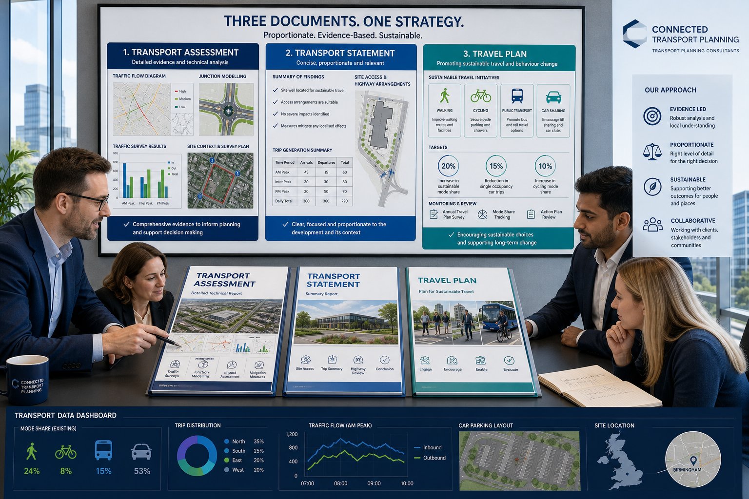
    Professional judgement matters because transport impact is rarely captured by one headline number. A site generating fewer than 100 peak-hour trips might still require detailed analysis if it connects to a difficult right-turn access, affects a school route, or sits close to a junction already operating with little spare capacity. Likewise, a modest development in a lightly trafficked location may justify a more proportionate response.

    Authorities will usually look at several things together:

    • sensitivity of nearby junctions and corridors
    • recent collision patterns and road safety concerns
    • cumulative impact from committed or allocated development
    • access geometry, visibility and servicing demands
    • whether the proposal is likely to attract objections on traffic grounds

    This is why early scoping is so valuable. Agreeing the study scope with officers at pre-application stage can prevent the familiar planning delay: a report is submitted, transport comments return, extra junctions are requested, surveys have to be repeated, and the timetable slips by weeks. A concise agreed brief up front is often worth far more than a longer report later.

    The Core Objectives Of A Traffic Impact Assessment

    Infographic showing four main goals of a traffic impact assessment.

    At its heart, a TIA is designed to give decision-makers enough confidence to judge whether transport impacts are acceptable and, if not, what should be done about them.

    The first objective is to quantify the trips generated by the development. That includes identifying how many movements are likely to occur, when they happen, what vehicles are involved and where they are expected to go. For mixed-use or phased schemes, that can get quite nuanced quite quickly.

    The second objective is to test performance on the surrounding network. We usually need to understand whether key links and junctions can accommodate the added demand in existing conditions, future baseline conditions and future conditions with the development in place. Capacity, queueing, delay, practical reserve capacity, volume-to-capacity ratios and level of service all come into play depending on the network type and the assessment tools used.

    A third objective is safety. A scheme may appear acceptable on pure capacity terms and still raise concerns because of collision history, substandard geometry, pedestrian conflict or HGV manoeuvring. A robust TIA hence considers how traffic operation and road safety interact.

    Finally, a TIA should identify mitigation that is reasonable, proportionate and deliverable. That might include access amendments, signal optimisation, localised widening, visibility improvements, travel measures, pedestrian facilities or phasing controls. On some projects, the TIA also sits alongside a wider environmental impact assessment where traffic effects feed into noise, air quality or environmental topics.

    If a report does those four things well, it becomes a planning tool rather than just a technical obligation.

    Key Stages In The Traffic Impact Assessment Process

    Although every site has its own quirks, most traffic impact assessments follow a recognisable process.

    First comes scoping. We define the development parameters, understand the local highway context, identify likely concerns and agree an assessment framework with the authority where possible. This part is often underestimated, but it is where the eventual credibility of the report is set.

    Second comes data collection. That may include classified turning counts, automatic traffic counts, queue observations, speed data, parking stress review, collision records and review of committed development. If survey data is weak or out of date, the entire assessment becomes vulnerable.

    Third is forecasting demand. We estimate trip generation, then distribute and assign those trips across the network using observed patterns, census or mobile data, gravity-style methods, or accepted reference sources. That creates the basis for modelling future flows.

    Fourth is operational analysis. We test links and junctions under existing, future baseline and future with-development scenarios. Depending on the site, that might involve priority junction software, roundabout modelling, signal modelling, corridor review or microsimulation.

    Fifth is mitigation. If impacts are material, we develop and test measures to address them. The best mitigation is usually practical, targeted and aligned with what can actually be delivered through planning conditions or obligations.

    Finally, we report the evidence clearly enough for officers, consultees and committee members to follow. Dense technical work is fine: opaque technical work is not.

    Scoping The Study Area, Assessment Years And Junctions To Be Tested

    Scoping is where a TIA either becomes proportionate and persuasive, or drifts into argument later.

    The study area should cover the roads and junctions that are genuinely likely to experience material development traffic. That usually means the site access, immediate frontage, main approach routes and any junctions where assigned traffic creates a meaningful percentage uplift or where existing sensitivity is already known. We do not need to test every junction in a district, but we do need to avoid obvious omissions.

    Assessment years matter just as much. In most cases, we consider an existing or base year, an opening year and a future design year. We also compare a future baseline scenario without the development against a future scenario with the development. That distinction is crucial because planning decisions are not based on today’s traffic alone: they are based on the network conditions likely to exist when the scheme operates.

    Committed development should also be included where appropriate. Ignoring nearby consented sites is one of the fastest ways to invite objections from the highway authority.

    The choice of junctions to test should be evidence-led. If traffic assignment shows only trivial change at a location, extensive modelling may not be justified. But if a roundabout is already close to capacity, even a modest increase can become significant. We’ve found that careful, locally informed scoping, especially where authority thresholds differ from standard assumptions, saves both clients and councils a lot of needless back-and-forth.

    What Data Is Needed For A Reliable Assessment

    A reliable TIA depends on data that is current, relevant and transparent. When reports fall apart under scrutiny, it is often because the underlying evidence is patchy rather than because the calculations are especially controversial.

    At minimum, we usually need a clear description of the development proposals: land use mix, gross floorspace, unit numbers, access strategy, servicing arrangements, parking provision and likely phasing. Without that, trip forecasts are built on sand.

    Existing network data is equally important. That normally includes traffic counts on surrounding roads, turning movement surveys at key junctions, observed queue and delay conditions, speed environment, collision history and, where relevant, pedestrian or cycle flows. On constrained urban sites, kerbside activity, loading behaviour and parking stress can also matter more than headline link volumes.

    Future-year inputs also need care. Background growth factors, committed developments, local plan allocations and planned highway changes all influence the baseline against which the scheme is judged. If these are omitted, the authority may reasonably argue that the model understates future pressure.

    Data quality is not just about age: it is about representativeness. Holiday periods, abnormal roadworks, school closures or weather disruption can all distort survey results. And if a site sits in a fast-changing area, survey data from even a year ago may already need checking against present conditions. Strong analysis starts with honest inputs.

    Traffic Surveys, Trip Generation And Distribution Methods

    Survey choice should reflect the questions the TIA is trying to answer. Automatic traffic counts are useful for understanding daily profiles and road volumes over several days. Classified turning counts give the detail needed to test individual junctions in the weekday AM and PM peaks, and sometimes Saturday peaks for retail or leisure schemes. Queue surveys and journey time observations add context where operational stress is already evident.

    Trip generation then converts the development proposal into forecast movements. That may rely on comparable sites, recognised databases, local surveys or accepted reference material such as ITE-based evidence where appropriate, though UK planning work usually demands careful local adjustment rather than blind transfer. Land use, location, parking restraint, public transport accessibility and internalisation all influence the final rates.

    Distribution and assignment are where professional judgement becomes especially visible. We need to explain not just how many trips are generated, but where they are likely to travel and which routes they will use. That can be informed by observed turning patterns, census journey-to-work data, origin-destination information, gravity-style modelling and route logic based on the network itself.

    Weak TIAs often stumble here. Unsupported trip rates, optimistic mode assumptions or implausible routing can undermine an otherwise well-presented report. Sound methods, clearly explained, make it easier for officers to agree conclusions and focus discussion on mitigation rather than methodology.

    How Junction Capacity, Safety And Network Effects Are Assessed

    Once flows have been established, the next step is to test what they mean in operation.

    At junction level, we assess capacity and performance under several scenarios: existing conditions, future baseline without the development, and future with the development. Depending on junction type, that may involve priority junction assessment, roundabout modelling, signal analysis or more strategic corridor tools. The headline outputs often include queue lengths, delay, reserve capacity, degree of saturation and practical stress points during peak periods.

    But capacity is only part of the picture. Safety assessment matters too. We review collision records, site access geometry, visibility, turning paths, crossing demand and compliance with relevant design principles. A junction with spare capacity can still be problematic if a proposed access creates poor manoeuvres or conflict with vulnerable road users.

    Network effects can extend beyond one junction. Added traffic may influence rat-running, route choice, bus reliability, servicing interaction or performance at a linked set of signals. On larger schemes, cumulative effects across a corridor may be more important than a single arm’s model output.

    This is also where local knowledge counts. Someone familiar with how a town centre actually operates in the school peak, or how a logistics route behaves under nearby motorway pressure, will often spot issues a spreadsheet misses. On regionally sensitive schemes, input from a specialist Traffic Engineer In the relevant authority area can make the assessment both sharper and more defensible.

    Common Issues That Delay Planning Applications

    Most planning delays linked to transport are not caused by exotic modelling disputes. They come from ordinary avoidable weaknesses.

    The first is poor scoping. If the submitted report ignores an obviously sensitive junction, omits school-time conditions, or uses assessment years the authority does not accept, the review clock effectively resets. Officers ask for more work, the applicant commissions more surveys, and everyone loses time.

    The second is stale or incomplete data. Surveys carried out during abnormal network conditions, with too short a count duration, or long before submission often attract justified challenge. The same goes for missing collision analysis or a failure to account for nearby committed schemes.

    Third, trip generation and distribution can be under-evidenced. Authorities quickly spot rates that look too low, mode shares that feel aspirational rather than proven, or routing patterns that conveniently avoid constrained junctions. A polished report does not rescue weak assumptions.

    Fourth, mitigation is often undercooked. Drawings may be too vague, swept paths unresolved, visibility unproven or highway works not coordinated with the land available for delivery. In that situation, even if officers accept there is a solution in principle, they may still hold back support.

    And finally, there is plain readability. If the document is hard to follow, inconsistent between text and appendices, or overloaded with unexplained outputs, it creates uncertainty. In planning, uncertainty tends to slow everything down.

    How To Prepare A Strong Traffic Impact Assessment For Planning Success

    The strongest TIAs are rarely the longest. They are the ones that answer the authority’s actual questions with current evidence, proportionate testing and practical mitigation.

    Start early. Pre-application engagement is not glamorous, but agreeing the study area, survey scope, peak periods, committed developments and modelling approach before submission can remove a surprising amount of later friction. Where a scheme sits in a complex planning context, that early alignment is often the difference between one transport consultation round and three.

    Use robust data and explain assumptions plainly. If trip rates are adjusted, show why. If a junction is excluded, justify it. If mode share is expected to improve, link that expectation to site location, accessibility and credible measures rather than hope.

    Compare scenarios clearly. Decision-makers should be able to track the story from existing conditions to future baseline and then to future with-development conditions without hunting through appendices. Well-labelled figures, concise summary tables and consistent scenario naming help more than people think.

    Mitigation should be specific, deliverable and proportionate. Costly overdesign can be just as unhelpful as thin mitigation, especially where modest access changes, signal tweaks or travel planning can address the actual issue. For developers juggling wider planning documents, it also helps when the traffic case aligns neatly with related traffic impact assessments and broader transport assessment for work, rather than contradicting them.

    In short, planning success usually follows from a report that is technically sound, locally aware and easy to interrogate.

    Conclusion

    Traffic impact assessments are, at their best, decision-making tools. They help us move the conversation away from vague concerns about congestion and towards evidence: how much traffic is likely to be generated, where it will go, what it will do at key junctions, whether safety is affected, and what mitigation is genuinely needed.

    In 2026, that clarity matters more than ever. Local authorities are balancing growth, network resilience, road safety and cumulative development pressure, and they expect supporting transport evidence to be proportionate but rigorous. For applicants, the message is fairly simple: scope early, use current data, test the right locations, and make the report readable enough for non-technical decision-makers as well as highway officers.

    When we get those basics right, a TIA becomes far more than a planning requirement. It becomes one of the clearest ways to show that a development is workable, responsible and ready to progress.

    Frequently Asked Questions about Traffic Impact Assessments

    What is a Traffic Impact Assessment (TIA) and why is it important for planning applications?

    A Traffic Impact Assessment is a detailed study evaluating how a proposed development will affect the surrounding road network’s operation, safety, and efficiency. It is vital for planning as it provides evidence on traffic generation, network capacity, and safety, influencing whether a development proceeds or faces delays.

    When is a Traffic Impact Assessment typically required?

    TIAs are usually needed when a development generates around 100 or more peak-hour vehicle trips, exceeds certain size or floorspace thresholds, or is located in sensitive or constrained areas. Local planning authorities also consider site context, such as nearby schools, collision clusters, and cumulative traffic pressures.

    How does a Traffic Impact Assessment differ from a Transport Statement or Transport Assessment?

    A Transport Statement provides a brief overview for smaller developments with limited transport effects. A Transport Assessment covers all travel modes and broader accessibility issues typically for larger schemes. In contrast, a TIA focuses specifically on detailed traffic effects on junctions, capacity, delays, and safety concerns.

    What are the core objectives and stages involved in preparing a Traffic Impact Assessment?

    The core objectives include quantifying additional traffic, assessing network capacity and safety, and identifying proportionate mitigation measures. Key stages involve scoping the study area and years, collecting data, forecasting trips, analysing junction capacity and safety, proposing mitigation, and compiling a clear report.

    Which types of developments often trigger the requirement for a Traffic Impact Assessment?

    Large housing estates, apartment complexes, retail parks, supermarkets, business and logistics parks, education, healthcare, leisure facilities, and significant rezoning or phased masterplans commonly require TIAs due to their substantial or complex traffic impacts.

    How can developers ensure a successful Traffic Impact Assessment to support planning approval?

    Developers should engage early with local authorities to agree on scope and methods, use current and robust data, clearly compare traffic scenarios, and propose feasible, deliverable mitigation. Early scoping and a well-structured, readable TIA help prevent application delays and objections.

  • Speed Reduction Measures Design: A Practical Guide For Safer, Policy-Compliant Streets In 2026

    Speed Reduction Measures Design: A Practical Guide For Safer, Policy-Compliant Streets In 2026

    Getting vehicle speeds down is rarely about putting up another sign and hoping for the best. In practice, the most successful speed reduction measures design creates streets that feel slower to drive on, function better for the people using them, and stand up to scrutiny in planning, adoption, and detailed design reviews.

    That matters for our audience. Whether we’re preparing a transport assessment for a planning application, advising on an estate road for adoption, or reviewing a retrofit scheme near schools and shops, speed management has to work on several levels at once. It needs to reduce operating speeds, cut collision risk, support pedestrians and cyclists, and still accommodate buses, servicing, refuse vehicles, and emergency access.

    In the UK, local authorities increasingly expect a clear line between street function, target speed, and physical layout. A residential street designed as if it were a distributor road will invite the wrong behaviour. Equally, an over-engineered calming package on a key bus route can create accessibility, noise, and maintenance problems of its own.

    In this guide, we set out a practical framework for speed reduction measures design in 2026: what these schemes are meant to achieve, how to assess the existing road environment, which traffic calming tools are commonly used in UK schemes, and where teams often go wrong. Drawing on the kind of planning and transport engineering work we support at ML Traffic, the aim is simple: help us choose measures that are safer, proportionate, and policy-compliant.

    What Speed Reduction Measures Design Aims To Achieve

    infographic showing how street design lowers speeds and balances safety, access, and movement

    At its core, speed reduction measures design is about changing real driving behaviour, not just the posted limit. The target is usually a lower mean speed and lower 85th percentile speed, because those figures tell us far more about how a street actually operates than the number on a signpost.

    When speeds fall, both the likelihood and severity of collisions tend to fall as well. That is especially important on local and mixed-use streets where pedestrians, cyclists, school children, older people, and turning vehicles are all interacting in relatively tight space. A small reduction in average speed can make a disproportionate difference to stopping distance and injury outcome.

    But safety is not the only objective. Well-designed measures can also discourage rat-running, reduce the dominance of through traffic, and make residential streets feel liveable again. On newer developments, they help streets operate as intended from day one rather than needing retrofitted fixes later.

    The best schemes are self-enforcing. In other words, the geometry, frontage activity, priority arrangement, and overall character of the street encourage appropriate speeds naturally. Drivers should not feel that the road says “40” while a terminal sign says “20”. If there is that mismatch, the layout usually loses.

    How Vehicle Speed, Street Function, And Risk Interact

    Vehicle speed affects risk in two linked ways: it alters both the chance of a collision occurring and the consequences if one does. The physics is straightforward. As speed rises, kinetic energy rises sharply, and the margin for driver reaction shrinks. A street that tolerates high approach speeds hence carries a very different risk profile from one that signals caution and lower speed through its design.

    Street function matters just as much. A strategic or primary route may need to prioritise movement and network resilience, even in an urban setting. A residential street, by contrast, is fundamentally about access, frontage, crossing, parking, and social activity. We should not expect the same geometry to suit both.

    This is where design controls become powerful. Carriageway width, forward visibility, junction spacing, alignment, crossing points, and priority arrangements all influence operating speed. Wide, straight corridors with generous radii invite acceleration. Narrower lanes, vertical shifts, frequent junction activity, and visible pedestrian demand tend to moderate it.

    So when we assess speed reduction options, we are really asking a broader question: what kind of street is this, and what sort of driver behaviour does its current form reward?

    Why Design Must Balance Safety, Access, And Movement

    Reducing speed is not an excuse to ignore how a route actually functions. A scheme that slows private cars but creates unacceptable delay for buses, obstructs emergency access, or introduces barriers for disabled users is not a successful scheme, it is just a different problem.

    That balance is particularly important on streets with overlapping roles. A town-centre street may need to support loading, bus movements, pedestrian crossing, short-stay parking, and cycle access at the same time. A suburban distributor may need calmer speeds near schools without losing its wider network role.

    In practice, we are balancing three things:

    • Safety: lower speeds, better crossing conditions, fewer severe collisions
    • Access and inclusion: usable layouts for residents, deliveries, wheelchair users, visually impaired pedestrians, cyclists, and public transport
    • Movement: keeping the network legible and functional for its intended traffic role

    That is why one-size-fits-all traffic calming rarely performs well. We need measures matched to place. Sometimes that means raised tables and tighter geometry. Sometimes it means visual narrowing, refuge islands, or route management instead of aggressive vertical features. The right answer is usually the one that fits the street’s hierarchy and user mix, not the one with the strongest headline effect in isolation.

    Assessing The Existing Road Environment Before Choosing Measures

    Infographic of assessing a UK road before choosing speed reduction measures.

    Before selecting any device, we need a clear diagnosis of the road environment. Too many schemes begin with a preferred measure, humps, cushions, build-outs, before the underlying problem has been properly defined. That is how costly, awkward layouts get approved and then underperform.

    A robust assessment typically starts with evidence:

    • Speed data: mean speeds, 85th percentile speeds, and where feasible speed profiles by time of day
    • Traffic volumes and composition: including HGV content, bus movements, and school-run peaks
    • Collision history: not only total incidents, but pattern, severity, contributory factors, and location
    • Vulnerable road user activity: pedestrian desire lines, cycle flows, mobility scooter use, school access, and frontage crossings

    Then we step back and look at the route’s role in the wider network. Is it a residential access street, a bus corridor, a freight route, an emergency response route, or some uncomfortable hybrid? A measure that is highly effective on a cul-de-sac may be wholly unsuitable on a key link road.

    Physical context matters too. Width, alignment, gradient, drainage constraints, parking behaviour, trees, existing signing, junction spacing, and frontage activity all influence what can be delivered. Schools, local shops, community facilities, and high pedestrian turnover often justify stronger place-led interventions.

    For development proposals, this assessment should feed directly into the transport statement, transport assessment, or technical note supporting the planning application. At ML Traffic, for example, the value often lies in tailoring recommendations to the exact thresholds, local standards, and policy language that a particular authority expects. That saves time later.

    The point is simple: if we do not understand current conditions properly, we are not designing a speed reduction scheme. We are guessing.

    Traffic Calming Features Commonly Used In UK Schemes

    UK infographic of vertical, horizontal, and visual traffic calming measures.

    UK traffic calming schemes usually draw from three broad families of intervention: vertical deflection, horizontal deflection and priority features, and visual or psychological techniques. Some schemes also include closures, modal filters, or movement restrictions, but the principle is similar: alter the street environment so the desired speed feels natural.

    The strongest results often come from combining measures rather than relying on one device. A raised table at a crossing may work better when reinforced by tighter kerb geometry, active frontage, and gateway treatments. Likewise, a chicane can lose much of its effect if the surrounding corridor remains visually over-wide and straight.

    Choice depends on street type, traffic composition, available width, network role, maintenance implications, and user comfort. Councils and designers also need to account for local authority supplements to national guidance such as Manual for Streets, traffic signs requirements, and where relevant DMRB principles for higher-order roads.

    What follows is not a universal recipe. It is a practical overview of the tools most commonly used in UK-style schemes, and the design considerations that tend to determine whether they succeed or become a source of complaints.

    Vertical Deflection Measures

    Vertical deflection measures physically interrupt a driver’s path and are often among the most reliable ways to reduce speed on local streets. They are particularly common where a 20 mph environment is the aim and where through movement is less important than frontage access and pedestrian safety.

    Typical examples include:

    • Speed humps: rounded or sinusoidal profiles, often used in a series so drivers cannot simply accelerate between them
    • Speed cushions: narrower features that some emergency vehicles and buses may straddle, subject to track width
    • Speed tables and raised junctions: flat-topped features that combine speed control with improved pedestrian crossing conditions
    • Raised entry treatments: ramped side-road entries that slow turning traffic and clarify pedestrian priority

    These measures can be highly effective, but they are not plug-and-play. Ramp gradients, heights, spacing, and transitions all affect comfort, noise, and compliance. If humps are spaced too far apart, speeds rebound between features. Too close together, and complaints about noise, vibration, and discomfort tend to follow.

    Drainage is another recurring issue. Raised features can create ponding if channels, kerb upstands, and crossfall are not handled carefully. And on bus routes or emergency corridors, vertical measures often require explicit agreement because the operational impacts can be significant.

    Horizontal Deflection And Priority Features

    Horizontal measures work by disrupting the straight, forgiving alignment that encourages speed. They ask drivers to steer, negotiate, or yield, which introduces just enough friction to change behaviour.

    Common options include:

    • Chicanes using alternating build-outs or parking bays
    • Lane shifts through kerbing, islands, or markings
    • Chokers and pinchpoints that narrow the carriageway locally, sometimes with priority control
    • Mini-roundabouts or small traffic circles at junctions
    • Central islands and medians that visually narrow lanes and can provide crossing refuge

    These features can be very effective where full vertical calming is undesirable, for example on bus routes or streets where ride quality is a concern. They also have placemaking benefits, especially when paired with crossing improvements or planting.

    But they are less forgiving of sloppy geometry. If the lateral shift is too gentle, drivers barely react. If it is too tight, larger vehicles overrun kerbs or conflict with opposing traffic. Pinchpoints are a particular risk for cyclists if bypass space or adequate lane width is not provided. Swept-path analysis is hence essential where buses, refuse vehicles, or HGVs use the route.

    Visibility and priority control also need attention. A one-lane narrowing that is legible in daylight can become ambiguous at night if signs, markings, or lighting are weak.

    Visual And Psychological Speed Reduction Techniques

    Not every successful intervention needs a jolt or a hard steering input. Visual and psychological measures rely on perception: if the road feels narrower, busier, more enclosed, or more pedestrian-oriented, many drivers instinctively moderate speed.

    This family of measures includes:

    • Lane narrowing or road diets that reallocate excess width
    • On-street parking that reduces the effective running corridor
    • Street trees and planting that create enclosure
    • Active frontages and tighter building lines in new developments
    • Coloured surfacing or high-friction materials at gateways and crossings
    • Speed feedback signs showing live driver speed

    These measures are especially valuable on higher-order urban streets where aggressive vertical calming would be inappropriate. They can also help new developments avoid the classic problem of over-wide, under-enclosed estate roads that invite speeding from day one.

    Used alone, their effect may be modest. Used well, in combination with crossings, kerb build-outs, or raised features, they can be the difference between a street that merely posts a lower limit and one that genuinely supports it. We should think of them as part of the language of self-enforcing design, not decorative extras.

    Selecting The Right Measure For Different Street Types

    Infographic comparing traffic calming measures for different UK street types.

    The right measure depends less on fashion and more on context. A device that works well on a short residential street may be entirely wrong for a high street, a distributor road, or a strategic corridor. That is why speed reduction measures design should always begin with street type and network role.

    For strategic, trunk, or primary urban roads, typical speed aims may still sit in the 30–50 mph range. Here, designers usually lean towards visual narrowing, medians, signal timing strategy, roundabouts, and targeted crossing treatments rather than humps or cushions. Heavy traffic, buses, and HGVs make severe vertical deflection hard to justify.

    For distributor roads and bus routes, 20–30 mph may be appropriate depending on context. Speed cushions, raised tables at crossings, refuge islands, lane shifts, and carefully designed chicanes can work, but only if they respect bus operation, passenger comfort, and emergency access.

    For local residential streets, especially where 20 mph is the aim, a broader toolkit is available: humps, cushions, mini-roundabouts, chicanes, closures, and route filters. These streets usually place access and place function ahead of movement, so stronger calming is often justified.

    For high streets and mixed-use centres, lower design speeds, sometimes 10–20 mph, are often desirable. Raised crossings, tables, narrow effective carriageways, active kerbside use, and strong visual cues tend to outperform harsh vertical features that disrupt buses and cycling.

    Across all street types, we still need to test the same constraints: emergency response routes, freight access, cycle desire lines, school travel patterns, and inclusive design needs. Good selection is really a matching exercise between speed aim, street function, and technical reality.

    Design Standards, Visibility, Drainage, And Accessibility Checks

    Road safety design infographic showing geometry, visibility, drainage, accessibility, and noise checks.

    Once a preferred approach has been identified, detailed design discipline matters. Plenty of schemes fail not because the concept was wrong, but because the technical checks were weak.

    Geometric design comes first. Vertical features need suitable ramp gradients, heights, and spacing. Horizontal features need enough deflection to influence speed, but not so much that larger vehicles cannot pass safely. Lane widths should align with the target speed and route role rather than defaulting to overly generous dimensions.

    Visibility is another non-negotiable. Drivers need adequate stopping sight distance to any feature, crossing, priority arrangement, or abrupt alignment change. Hidden humps, poorly signed build-outs, and late-visible priority pinchpoints are an invitation to braking events and side-swipe risk.

    Drainage deserves more attention than it usually gets. Raised tables, side-road entries, and kerb build-outs can trap water if crossfall continuity and drainage paths are interrupted. Ponding is not only a maintenance issue: it can create slip risk, winter icing, and accessibility problems at crossing points.

    Accessibility checks should run through the whole design, not be added at the end. That means considering tactile paving, crossing gradients, wheelchair and mobility scooter movement, bus boarding conditions, and the experience of visually impaired pedestrians. Cyclist comfort matters too. Narrowings that force riders into conflict with overtaking traffic are a common design fault.

    And then there is noise and vibration, especially with vertical features near housing. Residents tend to notice repeated braking, acceleration, body slap from poorly designed humps, and loose utility covers very quickly. A scheme that is technically compliant but operationally unpleasant will struggle in the real world.

    In UK practice, these checks usually sit within national guidance, local standards, and road safety audit requirements. We ignore any one of them at our peril.

    Planning, Adoption, And Coordination With Local Authorities

    For planning-led schemes, the technical design is only half the job. The other half is navigating authority expectations, adoption requirements, and the practical coordination needed to get a scheme approved and built.

    The process works best when we engage early and define the problem clearly. Local highway authorities are far more likely to support a proposal when it is backed by speed data, traffic counts, collision records, frontage context, and a reasoned explanation of why the chosen measures suit the street. Vague claims about “traffic calming if required” rarely survive detailed review.

    Coordination normally extends beyond the authority itself. Bus operators, emergency services, refuse teams, schools, local members, and frontagers may all have legitimate concerns. A raised table that improves crossing safety, for instance, might also affect bus ride quality or drainage over a utility corridor. Better to surface those issues early than discover them at technical approval stage.

    Some interventions require statutory processes, including Traffic Regulation Orders for speed limits, waiting restrictions, one-way working, or movement restrictions. Temporary or trial layouts can be useful where behaviour is uncertain, particularly in town centres or low-traffic neighbourhood contexts.

    For new developments, speed reduction measures often need to be baked into the planning application and agreed before reserved matters or technical approval. If roads are intended for adoption, local standards, construction quality, road safety audits, and as-built compliance all become critical.

    This is where experienced reporting helps. On projects where deadlines are tight, concise and authority-aware technical work, the sort of service ML Traffic provides, can make the difference between a clean planning response and weeks of avoidable queries.

    Post-implementation monitoring should also be planned from the outset. We should know how success will be measured: speeds, traffic redistribution, collisions, compliance, or public feedback. Otherwise the scheme finishes the day construction ends, which is rarely enough.

    Common Design Mistakes And How To Avoid Them

    Most disappointing schemes do not fail because speed management is ineffective as a concept. They fail because the measures are mismatched, isolated, or under-designed.

    One of the most common mistakes is relying on a single isolated feature. A lone hump, refuge, or table may slow drivers at one point and nowhere else. If the wider route still feels open and fast, overall operating speed may barely shift. Whole-route thinking is usually more effective than point solutions.

    Another frequent problem is poor spacing of vertical measures. Too far apart, and drivers accelerate between them. Too close together, and the result can be noise, discomfort, and backlash from residents and bus users. The spacing has to reflect both target speed and local context.

    Designers also sometimes choose measures that are incompatible with route function. Severe humps on a primary bus route, for example, are asking for objections. In those situations, cushions, raised crossings, visual narrowing, or horizontal deflection may achieve more with fewer side effects.

    A subtler issue is insufficient deflection or narrowing. Some build-outs and chicanes look impressive on plan but are so forgiving on site that drivers barely change line or speed. If we are not creating a meaningful behavioural cue, we are mostly building expensive kerbs.

    Then there are the technical misses: ignored drainage causing ponding, cyclist pinchpoints at narrowings, weak signing or lighting, and no follow-up monitoring. None is glamorous. All are common.

    The fix is not complicated, though it does require discipline:

    • diagnose the problem with data
    • design at route level, not just point level
    • match measures to street function
    • test vehicles, drainage, visibility, and accessibility properly
    • review the scheme with a multidisciplinary team
    • monitor outcomes and adjust if needed

    That combination avoids a lot of regret, and a fair number of angry emails.

    Conclusion

    Good speed reduction measures design is not about choosing the harshest traffic calming feature available. It is about creating a street that naturally supports the right speed for its function.

    In practice, that means starting with evidence, understanding how the route works, and then combining vertical, horizontal, and visual measures in a way that balances safety, access, and movement. A local residential street, a bus corridor, and a high street will not need the same answer, and they should not look as if they do.

    For architects, planners, surveyors, developers, and councils, the real challenge is joining policy, design detail, and deliverability. If we get that right, speed management becomes easier to justify at planning stage, easier to approve with the highway authority, and more likely to perform once built.

    And that is really the standard to aim for in 2026: schemes that are not only compliant on paper, but calmer, safer, and more legible in everyday use.

    Frequently Asked Questions about Speed Reduction Measures Design

    What are the main objectives of speed reduction measures design in UK streets?

    Speed reduction measures design aims to lower actual vehicle speeds, reduce collision likelihood and severity, discourage cut-through traffic, improve street liveability, and create self-enforcing environments that naturally encourage appropriate speeds based on street function.

    How does street function influence the choice of speed reduction measures?

    Street function determines appropriate target speeds and suitable measures. Residential streets prioritise low speeds and access, using vertical deflection like humps, while primary or strategic roads prioritise movement, favouring visual narrowing, medians, or signal timing to manage speed without disrupting traffic flow.

    What types of traffic calming features are commonly used in UK speed reduction schemes?

    Common UK features include vertical deflection devices (speed humps, cushions, raised tables), horizontal deflection and priority features (chicanes, lane shifts, mini-roundabouts), and visual or psychological measures (lane narrowing, street trees, coloured surfacing) often combined to reinforce lower speeds.

    Why is it important to assess the existing road environment before choosing speed reduction measures?

    A thorough assessment of speeds, traffic volumes, collision history, street type, geometry, drainage, and vulnerable user activity ensures measures address the real problems and fit the street’s function, preventing ineffective or problematic designs and improving scheme success and compliance.

    How do designers balance safety, access, and movement when planning speed reduction measures?

    Designers ensure speed reduction does not compromise emergency access, bus operations, freight deliveries, or disabled user accessibility by selecting suitable measures that lower speeds safely while maintaining the street’s intended traffic function and accommodating all users inclusively.

    What are common design mistakes in speed reduction schemes and how can they be avoided?

    Mistakes include relying on isolated features, poor spacing of vertical measures, incompatible devices for the street function, insufficient deflection, ignoring drainage and accessibility, and lacking monitoring. Avoiding these requires robust diagnostics, route-level design, adherence to standards, and multidisciplinary reviews.

  • Sustainable Transport Consultants In 2026: How Expert Advice Strengthens Planning Applications And Future-Proofs Development

    Sustainable Transport Consultants In 2026: How Expert Advice Strengthens Planning Applications And Future-Proofs Development

    Planning risk rarely announces itself politely. More often, it appears halfway through a scheme as a late highways objection, a weak accessibility case, an awkward parking dispute, or a Travel Plan that says all the right words but convinces nobody. By that point, redesigns are expensive, programme dates start slipping, and what looked straightforward on a site plan becomes much harder to justify in policy terms.

    That is exactly where sustainable transport consultants add value. We help development teams show not only that a proposal can function on the network, but that it is genuinely accessible by walking, cycling and public transport, aligned with current planning policy, and realistic about how people will actually travel. In 2026, that matters more than ever. Local authorities are under pressure to support growth while meeting net-zero commitments, reducing car dependence where appropriate, and improving air quality, safety and place quality.

    For architects, planners, developers, surveyors, legal teams and councils, the strongest transport advice now goes well beyond traffic counts and junction capacity. It shapes layouts, informs site selection, supports negotiation, and reduces the chance of transport becoming the reason a promising application stalls. In this guide, we set out what sustainable transport consultants do, when to involve them, the services that matter most, and what to look for if you want evidence that stands up under scrutiny.

    What Sustainable Transport Consultants Do In The Planning Process

    Transport consultants reviewing a development plan in a modern UK office.

    Sustainable transport consultants sit at the point where design ambition meets planning reality. Our job is to test whether a development is accessible, policy-compliant and operationally credible, then turn that analysis into evidence a planning authority can rely on.

    In practice, that means estimating trip generation, understanding likely mode share, reviewing the surrounding street and movement network, and identifying whether a scheme can support more journeys on foot, by cycle and by public transport. We also look at the basics that frequently become contentious: site access, servicing, parking levels, drop-off arrangements, and the relationship between the proposal and nearby junctions or routes.

    Just as importantly, we help explain why the scheme is acceptable. A good planning submission does more than append transport documents: it presents a coherent story. If the site is in a town-centre location with strong bus links and walkable catchments, that should shape the strategy from the start. If constraints exist, they need to be acknowledged early and addressed with realistic mitigation.

    This is why many teams treat transport input as part of a wider planning narrative rather than a stand-alone technical exercise. On complex schemes, the role overlaps with broader Transport Planning Consultants: work, especially where masterplanning, phasing and authority negotiation all interact. For applicants, the real value is simple: fewer assumptions, better evidence, and a stronger basis for approval.

    How Sustainable Transport Supports Planning Policy And Development Goals

    Consultants reviewing sustainable transport plans for a UK development project.

    Transport is no longer a side note in planning policy. It is central to how authorities judge sustainability, placemaking and long-term resilience. That shift has been building for years, but in 2026 it is much sharper: schemes are expected to reduce unnecessary car dependence, support active travel, respond to climate obligations and make efficient use of existing infrastructure.

    Sustainable transport consultants help translate those policy expectations into practical development decisions. We assess how a proposal aligns with national guidance, local plan policies, parking standards, active travel strategies and, where relevant, town-centre regeneration or public health objectives. That policy fit matters because even a modest scheme can struggle if its transport case feels disconnected from the authority’s wider goals.

    There is also a commercial dimension. A development that is easier to reach by multiple modes is often more adaptable over time. Residential schemes benefit from wider travel choice: employment and education sites are less exposed to parking pressure: mixed-use places tend to function better when walking routes, cycle links and public transport integration are designed in early.

    The strongest advice often combines technical evidence with policy interpretation. That is why policy-led analysis, including work similar to Transport Policy Review, can be so useful where objections are likely. And on larger sites, a vision led transport approach helps teams move beyond “how many cars?” towards “what kind of place are we trying to create?”

    When A Development Should Involve A Sustainable Transport Consultant

    Transport consultants reviewing sustainable development plans in a modern UK office.

    The short answer? Earlier than most teams think.

    If transport is brought in only after the layout is fixed and the planning statement is drafted, options narrow quickly. By contrast, early input can influence site selection, access strategy, density assumptions, frontage design, parking distribution and the case for sustainable mode share. It can also prevent a familiar problem: a scheme that looks acceptable in broad terms but starts to unravel once someone asks how people will actually get there.

    We usually advise involving sustainable transport consultants at three points. First, during feasibility, when a site’s strengths and constraints are still being weighed. Second, before or during pre-application discussions, so transport issues are framed properly with the authority. Third, whenever a proposal is likely to generate material traffic effects, raise parking concerns, or rely on a strong sustainability argument to secure support.

    This is particularly important where thresholds for a Transport Statement or Assessment may be close, local policy is tight, or the surrounding network is already sensitive. Teams working on phased or multi-party sites also benefit from joined-up, end to end advice rather than isolated report writing.

    A useful rule of thumb: if transport could influence viability, programme, design quality or planning risk, bring it in early.

    Typical Projects That Benefit From Sustainable Transport Input

    The obvious candidates are residential, mixed-use and commercial schemes, but the range is wider than that. Retail parks, roadside foodstores, logistics sites, schools, colleges, healthcare facilities, leisure venues and stadiums all generate transport issues that can make or break an application.

    Town-centre regeneration projects often need especially careful handling. They may involve constrained street networks, competing demands for servicing and public realm, reduced parking expectations, and a policy push toward active travel. Strategic land promotion and masterplanning also benefit from transport input because movement assumptions made early tend to shape everything that follows.

    Even relatively small schemes can justify expert advice where local sensitivities are high. A few dozen dwellings on a constrained rural edge-of-settlement site may attract more transport scrutiny than a larger urban infill proposal with excellent bus access. Context matters more than headline scale.

    In our experience, any project that depends on demonstrating accessibility rather than simply accommodating traffic will benefit from specialist input. That includes schemes where decision-makers are likely to ask hard questions about mode choice, parking restraint, highway safety or cumulative impact.

    Core Services Provided By Sustainable Transport Consultants

    Transport consultants reviewing sustainable site plans in a modern UK office.

    The core offer is broader than many clients expect. Yes, sustainable transport consultants prepare planning documents, but the better work starts earlier and reaches further. We review site opportunities, advise on design responses, test assumptions, develop mitigation, and support discussions with local authorities and highway officers.

    For planning teams, that breadth is useful because transport issues rarely arrive in neat silos. A parking question may actually be an accessibility problem. A highways objection may stem from weak trip assumptions. A request for mitigation may point back to a layout that missed a pedestrian desire line or failed to integrate a bus stop properly.

    Strong consultants hence combine technical assessment with judgement. They know when a concise statement is enough and when a more detailed evidence base is needed. They can also connect transport with related disciplines, including drainage, environmental effects, townscape and masterplanning.

    On schemes with potentially wider impacts, transport work may overlap with environmental impact assessment requirements, especially where cumulative effects, air quality or strategic mitigation need careful framing. The service is not just about compliance: it is about helping a scheme function well, read credibly, and stand up to scrutiny.

    Transport Statements, Transport Assessments, And Travel Plans

    These are the documents most clients recognise, but each serves a different purpose.

    A Transport Statement is usually proportionate to smaller or less complex schemes. It explains the existing context, estimates likely trips, reviews access and parking, and demonstrates that impacts are acceptable without extensive modelling.

    A Transport Assessment goes further. It is used where impacts are likely to be more material or more contested. That can involve junction analysis, baseline surveys, distribution and assignment assumptions, committed development review, mitigation testing and a more robust treatment of accessibility and mode share.

    A Travel Plan focuses on behaviour. It sets out practical measures to encourage walking, cycling, public transport use, car sharing and sometimes EV support or mobility hubs, with targets, management actions and monitoring. Weak Travel Plans are easy to spot: they promise modal shift without clear ownership or follow-through.

    For teams deciding what level of reporting is appropriate, the distinction between statements and assessments is often the key issue, which is why guidance from Transport Statement Consultants and transport assessment for schemes can be so relevant at the outset.

    Site Appraisals, Accessibility Reviews, And Mitigation Strategies

    The desk-based picture only tells part of the story. Good consultants visit sites, walk routes, review gradients, crossing points, lighting, surveillance, bus stop quality, cycle permeability and the small details that mapping can miss. A route may look short on plan and still feel unusable in reality.

    Accessibility reviews test whether key destinations are realistically reachable by sustainable modes, not just theoretically within a catchment buffer. That distinction matters in committee reports and appeals, where credibility often turns on practical, on-the-ground conditions.

    Mitigation strategy then bridges evidence and action. Depending on the scheme, that might include new pedestrian crossings, footway links, cycle access improvements, junction upgrades, wayfinding, bus stop enhancements, parking management, servicing controls or phased Travel Plan measures. The best mitigation is proportionate, deliverable and tied clearly to identified issues.

    And one point worth stressing: authorities are much more receptive when mitigation is specific. “Encourage cycling” is not a strategy. A funded crossing, secure cycle parking, a direct route to nearby services and a monitored Travel Plan coordinator role, that starts to look real.

    How Consultants Assess Accessibility And Travel Behaviour

    Transport consultants reviewing accessibility and travel data in a modern UK office.

    Assessing accessibility is part data exercise, part professional judgement. We typically start with location, land use and network context: where the site sits relative to homes, jobs, schools, centres and transport corridors. Then we test actual travel options, not idealised ones.

    The evidence base can include TRICS-style trip-rate benchmarks, traffic counts, junction surveys, census travel-to-work data, local mode share evidence, public transport timetables, National Travel Survey patterns, and origin-destination information where available. On larger or more sensitive schemes, scenario testing helps us understand not only expected demand but also how different design or mitigation choices could affect it.

    But numbers alone are not enough. Travel behaviour is influenced by convenience, safety, cost, habit and perception. A five-minute walk to a bus stop sounds positive: less so if the route involves poor crossings, no lighting and an uninviting frontage. Likewise, a cycle connection may exist on paper but fail if it is indirect, hostile or fragmented.

    This is where frameworks such as Avoid–Shift–Improve are helpful. First, avoid unnecessary trips through land-use planning and digital access. Then shift trips to cleaner, more space-efficient modes. Finally, improve the performance of the remaining trips. It is a simple lens, but a powerful one. It keeps transport strategy focused on outcomes rather than just vehicle throughput.

    Done well, accessibility assessment does something valuable for planning teams: it turns “sustainable location” from a slogan into evidence.

    The Role Of Sustainable Transport In Reducing Planning Risk

    Transport problems are expensive mainly because they emerge late. A missed access issue can trigger redesign. A weak trip generation case can lead to prolonged highways queries. An over-optimistic Travel Plan can leave conditions that are difficult, or impossible, to discharge. Sustainable transport input reduces those risks by identifying them before they harden into objections.

    That risk reduction operates at several levels. Technically, it strengthens the evidence base. Policy-wise, it aligns the proposal with how authorities now assess sustainable development. Strategically, it gives applicants a more realistic sense of what can be supported, what needs mitigation, and what may be hard to defend.

    This matters not just at application stage but at appeal, condition discharge and reserved matters too. Reports need to be internally consistent, proportionate and robust enough to withstand scrutiny from planning officers, highway authorities, objectors and sometimes barristers. The better the transport case, the less room there is for avoidable ambiguity.

    For many clients, the practical gain is programme certainty. Faster responses, clearer scoping and concise reporting all help. That is also where experienced firms such as ML Traffic position their service: accurate technical work, quickly delivered, with a strong understanding of local authority thresholds and planning context. When transport advice arrives early and is properly integrated, it stops being a reactive fix and becomes a genuine risk-management tool.

    Working With Architects, Planners, Developers, And Local Councils

    The best outcomes usually come from collaboration, not handovers. Sustainable transport consultants work most effectively when we are part of the design team early enough to influence decisions rather than simply document them afterwards.

    With architects, that often means testing street hierarchy, block structure, access geometry, parking placement, servicing strategy and how frontages support walkability. With planners and planning lawyers, it means building a transport narrative that aligns with policy, committee concerns and likely conditions. With developers and land promoters, it often centres on feasibility, phasing, deliverability and negotiation strategy.

    Local councils and highway authorities are a crucial part of this picture. Their concerns may range from junction capacity and safety to parking overspill, bus service viability or the realism of active travel claims. Early, constructive engagement can narrow issues before they become formal objections. It also helps define scope: whether a statement will suffice, what survey data is needed, and how mitigation should be framed.

    On larger projects, transport operators, education bodies, estate teams and neighbouring land interests may also need to be involved. Coordination matters because transport sits across disciplines and ownership boundaries in a way few other planning topics do.

    When this collaboration works, the result is usually obvious. The transport strategy feels native to the scheme, not stapled on at the end.

    What To Look For When Choosing A Sustainable Transport Consultant

    Not all consultants bring the same mix of planning judgement, technical capability and local authority credibility. If an application is likely to face scrutiny, those differences matter.

    Start with relevant experience. Has the consultant handled similar land uses, scales and planning contexts? A town-centre mixed-use site, a suburban care home and a logistics scheme may all require transport input, but the issues are very different. Past work with the relevant authority, or with comparable authorities, can also be valuable because thresholds, expectations and preferred methodologies vary.

    Next, look at capability. Can they provide proportionate advice on statements, assessments, Travel Plans, accessibility and mitigation? Do they understand active travel design, not just traffic modelling? Can they engage confidently in pre-apps, committee support or appeal preparation? Broader expertise often leads to cleaner, more consistent advice.

    Communication is another differentiator. Good consultants explain risk clearly, scope work sensibly and avoid unnecessary technical theatre. They tell you when an issue is manageable and when it is not.

    If you are comparing options, it is worth reviewing how they approach Transport Assessment Consultants: work and whether they can support wider planning strategy rather than only produce a report. In short: choose a consultant who can think, negotiate and write, not just calculate.

    Common Mistakes That Delay Sustainable Transport Approval

    The most common mistake is timing. Transport is often commissioned after key design decisions are already fixed, which leaves little room to solve problems elegantly. At that point, consultants can still help, but the work becomes more defensive and less strategic.

    Another frequent issue is underestimating demand. Trip generation, servicing needs and parking pressure are sometimes presented too optimistically, especially where applicants worry that realistic assumptions may trigger mitigation. In reality, weak assumptions usually create bigger delays because they invite challenge.

    Accessibility is another blind spot. Teams may point to nearby bus stops or cycle routes without checking whether they are attractive, safe or useful in practice. Planning officers notice that quickly. So do objectors.

    Mitigation can also be vague to the point of being ineffective. If proposals are unfunded, uncosted, dependent on third parties with no delivery route, or disconnected from the actual impact identified, authorities are unlikely to be reassured. The same goes for generic Travel Plans with no targets, monitoring, incentives or named responsibility.

    Finally, some applications fail to connect transport evidence with the wider planning case. A technically competent report can still feel weak if it does not support the scheme’s sustainability narrative. The avoidable delay, then, is not just bad analysis. It is bad integration.

    Conclusion

    In 2026, sustainable transport is not a box to tick near the end of an application. It is a core part of how development is judged: on accessibility, policy fit, placemaking, climate response and everyday practicality.

    That is why sustainable transport consultants matter most when they are involved early. We can test assumptions before they become liabilities, shape schemes around real movement patterns, and provide evidence that planning officers and highway authorities can trust. For developers, designers, planners and councils, that usually means fewer surprises, more credible mitigation, and a better chance of securing consent without avoidable delay.

    The strongest schemes are not simply the ones that generate acceptable traffic. They are the ones that function well for people, fit the policy direction of travel, and remain resilient as standards and expectations keep moving. Expert transport advice helps get them there.

    Frequently Asked Questions About Sustainable Transport Consultants

    What role do sustainable transport consultants play in the planning process?

    Sustainable transport consultants assess trip generation, mode share, site access, and parking to ensure developments are accessible by walking, cycling, and public transport, providing evidence that meets planning policy and reduces risks in approval.

    When should developers involve sustainable transport consultants in their projects?

    Engage sustainable transport consultants early during site selection, feasibility, or pre-application stages to influence layout, access, and transport strategy, preventing costly redesigns and addressing planning risks effectively.

    How do sustainable transport consultants support planning policy and development goals?

    They align proposals with national and local policies on net zero, active travel, and air quality, promoting low-car reliance and sustainable infrastructure investment to meet modern climate and accessibility standards.

    What typical projects benefit most from sustainable transport consultancy?

    Residential, mixed-use, retail parks, logistics sites, education, healthcare, stadiums, and town-centre regeneration projects commonly require sustainable transport input due to their complex transport and policy implications.

    What are the differences between Transport Statements, Transport Assessments, and Travel Plans?

    Transport Statements suit smaller schemes with basic trip and impact summaries; Transport Assessments offer detailed junction and traffic modelling for complex sites; Travel Plans focus on behavioural measures to encourage sustainable travel modes through targets and monitoring.

    How do sustainable transport consultants reduce planning risk?

    They provide robust, policy-compliant evidence early on, identify transport issues before objections arise, and create credible mitigation strategies, helping schemes avoid delays, redesigns, and hard-to-discharge conditions.

  • Junction Design Consultants: How Expert Input Strengthens Planning Approval And Highway Performance In 2026

    Junction Design Consultants: How Expert Input Strengthens Planning Approval And Highway Performance In 2026

    A junction can look deceptively simple on a drawing. A kerb line here, a ghost island there, a roundabout in the middle and everyone moves on. In practice, though, junction design is where planning ambition meets highway reality. If the layout is wrong, the consequences show up quickly: safety concerns from the highway authority, capacity objections, awkward servicing movements, redraws to the site layout, and planning delays nobody priced into the programme.

    That is why junction design consultants matter. We’re not simply drawing road features: we’re testing whether an access will work for the vehicles that need to use it, fit the standards that apply, and perform acceptably within the surrounding network. For architects, planners, developers, surveyors and local authorities, that input often becomes the difference between a scheme that progresses smoothly and one that gets stuck in technical negotiation.

    In 2026, that scrutiny is only getting sharper. Authorities expect a clearer evidence base, stronger justification for access strategy, and more visible consideration of safety, active travel and local design guidance. So, whether the project is a residential site, a commercial redevelopment or a highway improvement scheme, understanding how junction design consultants support planning is no longer a nice-to-have. It’s part of getting viable development over the line.

    What Junction Design Consultants Do And When Their Input Is Needed

    Engineer reviewing a UK road junction plan with access options.

    Junction design consultants are specialist traffic and highway engineers who plan, test and refine the way roads meet. That can involve a brand-new site access, a modification to an existing priority junction, a mini-roundabout, a signal-controlled layout, or a more complex package of off-site highway works tied to development.

    Our role usually starts earlier than many teams expect. We may be asked to advise at feasibility stage, when land constraints, visibility, traffic generation and likely highway authority expectations are still being explored. From there, the work can continue through concept design, capacity testing, swept path analysis, planning support, technical approval, road safety input and sometimes detailed delivery drawings.

    The trigger for junction design input is generally straightforward: if a proposal changes how vehicles, cyclists or pedestrians interact with the highway, junction design is likely to be relevant. That includes schemes creating a new access, intensifying use of an existing one, altering junction geometry, or affecting nearby network performance.

    In planning terms, this often sits alongside transport assessments, transport statements and access strategy. On more involved schemes, the junction work becomes the technical backbone of the planning case, particularly where the acceptability of the development depends on safe and efficient access. In that wider context, Traffic Engineering Consultants: What often frame junction design as one part of a broader package of highway evidence.

    Projects That Commonly Require Junction Design Support

    The most common projects are residential, retail, commercial and mixed-use developments, especially where new trips will materially alter local turning movements. But the list is broader than many assume.

    We regularly see junction design needed for:

    • new housing accesses onto local or classified roads
    • employment and logistics schemes with servicing demands
    • care homes, schools and roadside uses with peak-hour sensitivity
    • redevelopment sites where existing access is substandard
    • highway improvement schemes and safety-led alterations
    • active travel projects that change junction priority or geometry
    • traffic-calming works affecting movement through side roads

    Sometimes the issue is obvious, such as a proposed roundabout to serve a strategic allocation. Sometimes it is much smaller: a single altered access that now needs to accommodate refuse vehicles without overrunning footways. Either way, the consultant’s value lies in identifying whether the proposed form is suitable before assumptions harden into expensive design commitments.

    How Junction Design Fits Into The Planning Application Process

    Consultant reviewing a site plan with road junction access design.

    Junction design is rarely a standalone exercise. It feeds directly into planning strategy, site layout, viability and the transport evidence submitted with an application.

    At concept or masterplanning stage, we usually help define what form of access is realistic. That early view influences frontage design, internal road alignment, building placement, parking layout and servicing strategy. If a site can only achieve policy-compliant access from one point, the whole development framework may need to pivot around that fact.

    Pre-application engagement is often where junction design earns its keep. Highway authorities want confidence that the applicant understands the likely technical issues before formal submission. A sensible preliminary design, backed by visibility checks, vehicle tracking and proportionate capacity analysis, gives those discussions substance. It also helps identify whether the authority is likely to accept a simple priority junction, prefer a ghost island right-turn lane, or expect something more robust.

    When the planning application is prepared, junction design material commonly appears in several places: the transport statement or assessment, access drawings, engineering appendices, road safety commentary and design rationale. The package needs to show not just what is proposed, but why it is appropriate for the scale and type of development.

    This is also where coordination matters. Access design should align with drainage, levels, utilities, land ownership and visibility controls. We often find that strong Junction And Access Design work reduces planning queries because the submission feels coherent rather than stitched together from separate disciplines.

    Done properly, junction design supports planning by making the highway case legible: safe access, suitable geometry, acceptable operation and compliance with the standards the decision-maker will rely on.

    Why Early Design Advice Reduces Delays, Objections And Redesign Costs

    consultant reviewing a road junction plan to avoid delays and redesigns

    Early advice saves time partly because it prevents false starts. Teams sometimes develop a layout around an assumed access point, only to discover later that visibility is constrained by land outside the red line, the junction sits too close to another arm, or the turning demand would push the authority towards a different form of control. By then, changing course is expensive.

    Councils and highway officers generally expect the broad junction strategy to be established at concept stage. They may accept detail being refined later, but they are far less tolerant of applicants arriving with unresolved fundamentals. If the access arrangement is uncertain, they tend to question whether the wider scheme is actually ready for determination.

    Early junction input reduces three common sources of delay:

    1. Technical objections based on safety, geometry or capacity.
    2. Late redesign caused by poor coordination with architecture and site planning.
    3. Programme drift when additional surveys, modelling or land checks are requested after submission.

    There is a commercial angle too. Revising internal roads, parking courts, servicing yards or boundary treatments after highway comments can ripple through the whole consultant team. A modest early design commission often avoids much larger downstream redesign fees.

    We see this especially on constrained sites, where one technical oversight can trigger several others. A tighter, earlier review usually exposes the awkward bits when they are still manageable. And because local authority expectations vary, practical experience matters as much as textbook knowledge. Teams looking at wider access implications often benefit from input similar to that provided by highway design consultants, particularly where planning success depends on balancing standards with local judgement.

    In short, early advice does not just make designs better. It makes projects more predictable.

    Core Elements Of A Junction Design Assessment

    Line drawing of a junction plan with lorry turning path and crossings.

    A proper junction design assessment is more than a drawing exercise. It pulls together geometry, safety, operational performance and policy fit into one technical narrative. The exact scope depends on the site, but several core elements appear again and again.

    We begin by asking practical questions. Can drivers see and be seen? Can the intended vehicles turn without conflict? Is the spacing to nearby accesses acceptable? Will queues interfere with other movements? Does the proposal create undue risk for pedestrians and cyclists? And, crucially, will the highway authority view the evidence as proportionate and credible?

    Most assessments combine desk-based review, site observation, geometric design and analytical testing. On some schemes that means straightforward visibility checks and swept paths. On others it expands into capacity modelling, traffic surveys, personal injury collision review, speed data analysis or more detailed design development.

    What matters is that the assessment matches the decision being made. A low-intensity access onto a lightly trafficked road should not be overloaded with unnecessary analysis. But a larger site near an already stressed junction plainly requires more robust evidence. Good consultants know the difference.

    Visibility, Geometry And Vehicle Tracking Requirements

    Visibility is usually the first make-or-break issue. If the required splays cannot be achieved, either because of alignment, boundary constraints, vegetation, walls or third-party land, the proposed access may be unacceptable regardless of what the capacity results later show.

    Geometry then shapes how comfortably and safely users move through the junction. Entry widths, kerb radii, lane allocation, crossing provision, gradients and spacing to adjacent features all matter. The right answer is rarely just “make it bigger”. Oversized geometry can increase vehicle speeds, lengthen crossing distances and undermine placemaking.

    Vehicle tracking is the reality check. It tests whether the design works for the largest vehicles reasonably expected to use it, such as refuse vehicles, articulated HGVs, buses or delivery vans. A junction that works nicely for a car but forces a fire appliance across opposing lanes or over a footway is not a workable design.

    This is where detail catches people out. A gate set back too shallow, a central island that clips trailer paths, or an internal bend that prevents a clean exit movement can all become planning problems. Careful tracking and geometric review flush out those issues early.

    Capacity, Safety And Network Performance Considerations

    Capacity analysis asks whether the junction can operate acceptably under forecast conditions. Depending on the form of junction, that may involve modelling delays, queue lengths, reserve capacity or signal performance in future assessment years. The purpose is not to chase theoretical perfection: it is to establish whether the development impact remains acceptable in planning terms.

    Safety is broader than collision history alone. We look at conflict points, driver expectation, visibility, speed environment, pedestrian crossing desire lines, cycling provision and the clarity of priority. Some layouts are mathematically capacious but intuitively poor. Highway officers notice that quickly.

    Network performance matters as well. A junction can appear acceptable in isolation yet create knock-on effects at nearby nodes, block back into existing accesses or weaken bus movement and active travel conditions. In 2026, authorities increasingly expect applicants to show awareness of all modes, not just private cars.

    That means assessing whether the design fits within the surrounding street function. On urban sites, a technically workable junction may still need refinement to support walking routes, side-road crossing safety or cycle continuity. Strong assessment balances all of that rather than treating the carriageway as the only thing that counts.

    Types Of Junctions Consultants Commonly Design

    Consultant presenting four common road junction designs on a planning board.

    The best junction type is the one that suits the traffic demand, speed environment, road hierarchy, site constraints and policy context. There is no universal “preferred” layout, even though how often project teams hope for one.

    In practice, consultants work across a broad spectrum. Some schemes need a simple priority access with modest widening and visibility improvements. Others require a right-turn ghost island because through traffic speeds are higher or turning demand is more concentrated. Larger developments may justify a roundabout or signals, especially where multiple turning movements, pedestrian demands or network integration issues are involved.

    What matters is choosing a form the authority can reasonably support and then designing it properly. That sounds obvious, but many planning delays come from selecting a junction type too early for commercial reasons, then trying to force the evidence to catch up.

    Priority, Ghost Island, Roundabout And Signal-Controlled Layouts

    Priority junctions remain common for smaller and medium-scale sites. They can be efficient, economical and straightforward to deliver where traffic flows are moderate and visibility is suitable. But they are not a default answer. Poor right-turn conditions or unbalanced flows can quickly make them unsuitable.

    Ghost island junctions are often used where a dedicated right-turn lane improves safety and operation on a faster road. They can provide a sensible middle ground between a simple priority arrangement and a more intervention-heavy solution, though they need adequate width, taper length and visibility.

    Roundabouts range from mini-roundabouts in urban settings to compact or full roundabouts on larger sites and distributor roads. They can help with speed reduction and balanced operation, but they are land-hungry and can create design tension where walking and cycling routes need to remain direct and legible.

    Signal-controlled junctions are typically considered where turning movements are heavy, crossing demand is significant, coordination with nearby signals is needed, or network control is a priority. They can handle complexity well, but they bring issues around staging, queue management, maintenance and cost.

    In some cases, more innovative or less standard arrangements may be explored. Those usually require especially clear justification, because local authorities will want confidence that the layout is understandable, auditable and maintainable.

    How Junction Design Consultants Work With Architects, Planners And Developers

    Junction design works best when it is integrated, not bolted on after the site layout is nearly finished. Architects, planners and developers each shape decisions that directly affect access design, and the junction engineer needs those conversations early.

    With architects, the key interfaces are usually frontage treatment, building set-back, internal road alignment, parking layout, servicing and pedestrian routes. A small shift in building line can unlock visibility. A different bin collection strategy can change the required turning head. These are not marginal design tweaks: they can determine whether the highway solution is elegant or compromised.

    With planners and planning consultants, the focus is often strategy and evidence. We help align the proposed access with policy language, pre-app feedback, transport documentation and committee risk. If a local authority is likely to be sensitive about pedestrian crossing distance, junction spacing or rat-running concerns, the planning narrative needs to address that directly.

    Developers bring programme, cost and land realities. They need to know what is essential, what is negotiable and what might trigger off-site works or third-party agreements. Good junction advice is commercially aware without becoming technically soft.

    That joined-up approach is central to how we think about planning support at ML Traffic. With over 30 years of transport engineering experience, our focus is on concise, accurate reporting that reflects local authority thresholds and real planning contexts rather than generic templates. The result is usually a stronger submission and fewer unpleasant surprises once comments start arriving.
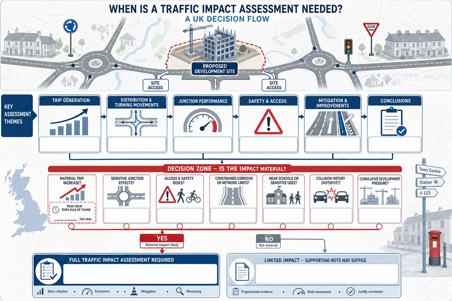
    In day-to-day terms, the consultant often becomes the translator between design ambition and highway acceptability. That is a useful role because those two things do not naturally speak the same language.

    Standards, Guidance And Local Authority Expectations That Shape Design

    Junction design in the UK is shaped by a mix of national standards, local guidance and professional judgement. That blend is important because planning outcomes rarely hinge on one document alone.

    At national level, consultants frequently work with frameworks such as DMRB for trunk-road related contexts and Manual for Streets or Manual for Streets 2 for more urban, development-led environments. Depending on the project, other guidance on cycling, accessibility, road safety and traffic modelling may also come into play.
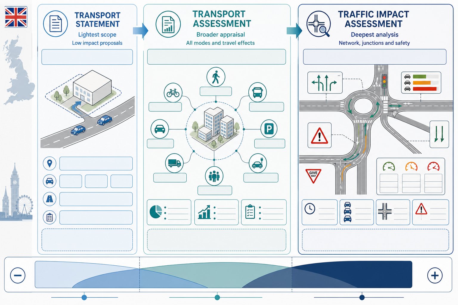
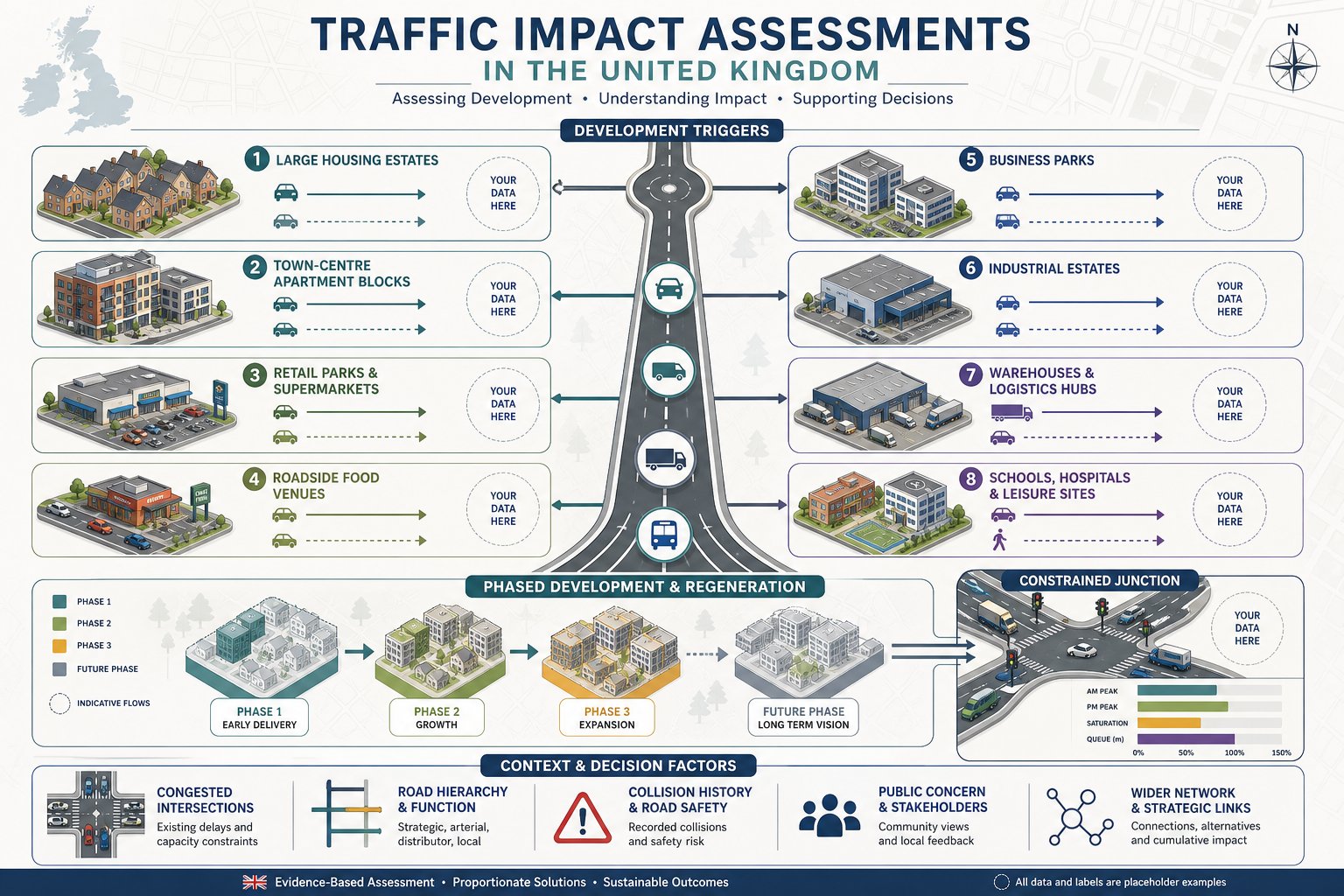
    But local authority expectations often carry equal weight in planning. Many councils and highway authorities publish their own design guides, access standards, parking guidance and validation expectations. These can influence preferred junction types, visibility standards, adoption requirements, footway widths, tracking assumptions and thresholds for more detailed assessment.

    That is why local knowledge matters. Two authorities may both refer to the same national guidance yet apply it differently in practice, especially on constrained sites. One may be open to context-sensitive departures backed by clear reasoning: another may expect a more literal standard-led approach.

    For applicants, the practical lesson is simple: compliant design is not just about quoting guidance. It is about understanding which standards are likely to drive officer comments on that specific site. The strongest submissions explain the design logic clearly, reference the relevant standards accurately and acknowledge local expectations rather than pretending they do not exist.

    In 2026, that clarity is increasingly valuable. Authorities are under pressure, review time is limited, and ambiguous highway submissions tend to attract more questions, not fewer.

    What To Prepare Before Appointing A Junction Design Consultant

    A consultant can start with limited information, but better inputs usually mean faster and sharper advice. If the aim is to assess feasibility quickly, there are a few items worth gathering before appointment.

    At minimum, prepare:

    • a site location plan and red line boundary
    • topographical survey information, if available
    • outline development proposals, including land use and quantum
    • any draft site layout or masterplan material
    • previous planning or highway correspondence
    • traffic survey data, speed surveys or collision information, if already commissioned
    • notes on known constraints such as third-party land, trees, utilities or level changes

    The reason this matters is simple: junction design is highly context-driven. Without a decent understanding of the site and its intended use, advice becomes too generic to be useful. A consultant may still flag obvious issues, but the real value comes from tailoring the solution to likely vehicle movements, authority expectations and development objectives.

    It also helps to be clear on the programme. Do you need a quick feasibility steer for land negotiations, a pre-app drawing package, or planning-ready assessment work? Those are different tasks with different levels of detail.

    Where possible, share what has already been said by the council or county highway team. Previous objections, officer emails or committee concerns can save time and stop the project team from repeating the same weak assumptions. A well-briefed consultant is far more likely to give targeted advice than a cold-start technical review.

    How To Choose The Right Junction Design Consultant For Your Project

    Not all transport consultants offer the same depth of junction design capability, and that matters more than the brochure usually suggests. For planning-led projects, you need a team that can move comfortably between concept design, standards interpretation, capacity analysis and practical negotiation with highway officers.

    Start with core technical competence. The consultant should be able to demonstrate experience in geometric design, visibility review, vehicle tracking, junction capacity assessment and planning support. If the project may evolve into detailed delivery, it also helps if they understand the route from concept through to technical approval and implementation.

    Then look at relevance, not just reputation. A consultant who has handled schemes of similar scale, land constraints and local authority context is often a better fit than a larger practice with less directly comparable work. Ask how they approach pre-app discussions, what software and design checks they use, and how they typically coordinate with architects and planners.

    Communication style matters as well. A good junction consultant should be able to explain risk plainly: what is likely to be acceptable, what is marginal, what evidence is still needed, and where costs may escalate. If every answer sounds overconfident, that is not always reassuring.

    We would also look for speed and clarity in reporting. In planning, a concise and accurate technical note can be more valuable than a bulky report that leaves officers hunting for the point. That is one reason many project teams prioritise consultants with established planning experience, not just highway design credentials.

    Eventually, the right choice is the team that can protect both technical quality and planning momentum. Those two things are inseparable, even if procurement processes sometimes treat them as separate lines on a spreadsheet.

    A strong appointment at the right moment usually pays for itself. When junction strategy is handled well, the planning application reads more confidently, the authority has fewer reasons to object, and the development team can spend less time firefighting basic access issues and more time moving the project forward.

    Frequently Asked Questions About Junction Design Consultants

    What do junction design consultants specialise in?

    Junction design consultants are specialist traffic and highway engineers who plan and assess how roads meet, ensuring safe, efficient, and policy-compliant access for new developments and road schemes.

    When should I involve junction design consultants in a development project?

    Consultants should be involved early, ideally at feasibility or concept design stages, whenever a project changes traffic flow, creates a new access, or alters an existing junction. Early input helps avoid planning delays and costly redesigns.

    How do junction design consultants support planning applications?

    They provide appropriate junction forms at masterplanning, assist pre-application discussions with highway authorities, and supply capacity assessments, vehicle tracking, safety analysis, and access drawings that underpin a robust planning submission.

    What types of projects typically require junction design consultation?

    Most commonly, residential, retail, commercial, and mixed-use developments need junction design support, as well as highway improvements, traffic calming, and active travel schemes that materially affect road junctions or accesses.

    Why is early advice from junction design consultants important?

    Early advice prevents false starts by resolving visibility, geometry, and safety issues before formal submissions, reducing objections, redesign costs, and programme delays associated with late technical challenges.

    How do junction design consultants work with architects and planners?

    They integrate access design with architectural site layout, parking, and servicing plans, align proposals with local highway design guides, and translate technical highway requirements into planning strategy that meets authority expectations.